With the widespread availability of COVID vaccines in the US starting in April and the dramatic and steady increase in vaccinations by June, we were feeling bullish once again about travel this summer. Most importantly, about resurrecting our ill-fated South of France road trip planned for Labor Day 2020. This discarded trip was sadly documented in the last “trip planning and itineraries” post here, as well as on our subsequent post on the consolation to the consolation prize that took its place. Last year sucked.
So, this past June – full of vaccinated confidence and excitement – we booked three sets of flights to reassert our road trip through Languedoc, Provence, and beyond.
Then, of course:

The f’ing Delta variant is screwing everything up.
So, here’s where things stand as of this morning:
- France has opened their borders to Americans if you’re vaccinated. No worries here. We are, so we’re good.
- We have a non-stop, round-trip flight on United from Dulles to Paris on Friday evening, August 27. We can upload images of our vaccination cards to United to meet the French entry requirement above, so, no worries – we’re still good there.
- We have a separately booked, one-way flight on Air France from Paris to Montpellier. Air France requires passengers to have the French passe sanitaire (health pass) to board. This is a QR code that gets screened in order to enter restaurants, museums, flights, etc. We do not have this. So, some worries – we’re not good here.
- But! France announced on August 9 that a new program has been established to issue health passes to non-EU travelers to France if you submit a completed application, photo of vaccination card, photo of passport, and photo of plane reservations. We did so on August 11.
- It’s now August 22 and we have not received anything. We still have time, but, as is attested by the previously planning posts, we (one of us, anyway) like all variables to be locked down before we travel. As a result, we’re consumed with this lack of a health pass. There’s a real possibility that we’ll get to Paris and not be able to board our internal flight south.
But all is not lost. The French government website for the health pass program for non-EU residents was updated this past Thursday to clarify that they’re only processing applications for travelers currently in the country or who will be arriving by today. Hopefully, the next processing window will include August 28.
In addition to potentially receiving French health passes in the next few days, we have the following backup plans:
- Take COVID tests 2 days before we leave, like we did for Turks and Aruba, and present the negative tests to a health care professional at Paris CDG airport to get health pass QR codes.
- Take COVID rapid antigen tests in the airport itself after landing in Paris to accomplish the same. These are available at CDG in the public area, so even if we don’t have tickets yet, we could access this. We have a 6-hour layover there because the only direct flight from Paris to Montpellier was in the early afternoon, so would be able to swing this, timewise.
- Present our vaccination cards to board instead of a QR pass and hope for the best. This has worked at restaurants and other venues, based on research on the interwebs, but not always. And the Air France web site cites the requirement for the passe sanitaire, not just proof of vaccination.
We like Option 2 and will likely exercise this if we don’t get a QR code before we leave. However, the ones you get from proof of a negative test are only valid for 72 hours, which would mean repeating the process every 3 days while we’re there. Def would rather get the permanent one now . . .
So, the trip. In brief, we’ll:
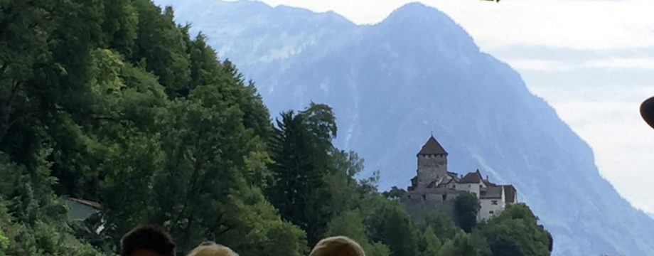
- Rent a car in Montpellier, on the Mediterranean coast, and drive all over the place in both the Languedoc and Provence regions of the South of France, a la the epic Micronations Road Trip,
- End up on the Atlantic coast in San Sebastian, Spain, for a few days,
- Drop the car off across the French border in Biaritz to avoid an even more mammoth drop fee than we’re already facing simply by dropping it at another location in the same country,
- Fly back to Paris, then fly back home.
As explained in our previous trip planning post, Google My Maps served a pivotal function in planning (and then replanning) this trip. The result was this useful mess:
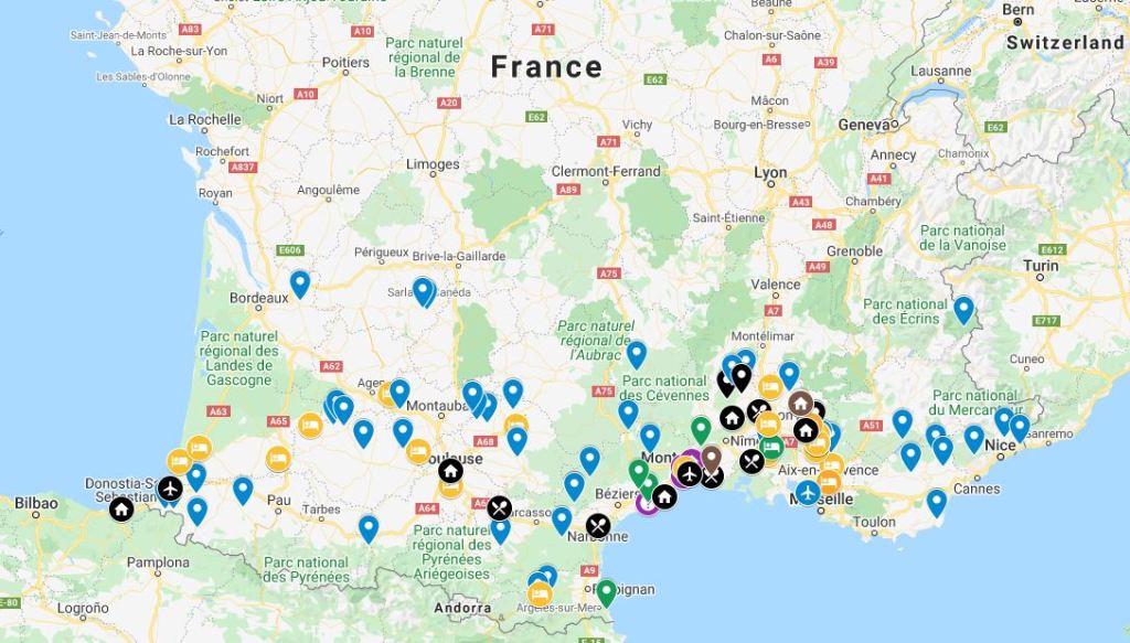
The previous post explained the the pin colors and icons used on the map. The end result, though, is the distilled-down itinerary for this here trip, which is represented by the black pins. If we blow up the South of France portion of the map, we can see these icons more clearly:
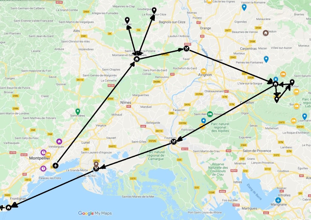
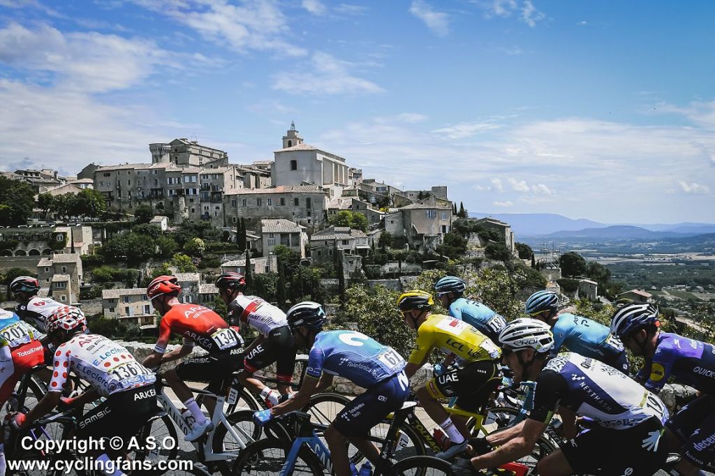
The little houses are towns we’re staying in (Uzes for 4 nights, Gordes for 3 nights, Sete for 2 nights, in that order). The plain black pins are other Les Plus Beaux Villages de France (“the most beautiful villages of France”) that we’ll day trip to from our base towns. If you watched the Tour de France this year, btw, you would have seen the peloton ride through both Uzes (Stage 12) and Gordes (Stage 11).
The little knife and fork guys are stopovers on the longer trips between base towns.
We chose to stay in Sete (extreme lower left) for a couple of days simply because one of us thought that, if we’re so freakin’ close to the Mediterranean, then we should at least spend some time there. So we are.
From Sete, we head northwest to Toulouse for the night (we booked this totally cool castle turret in the middle of town on Air B&B only to have this unceremoniously cancelled on us without explanation a couple of weeks later). We still haven’t booked a replacement; since the stop in Toulouse is just to break up a 7-hour drive from Sete, France, to San Sebastian, Spain, and because there don’t appear to be any particularly charming places to lock in (other than our ill-fated castle turret), we’ll just deal with this when we’re over there.
From Toulouse, we’ll drive the same distance as the day before, but to the southwest, to San Sebastian, just over the border in the Basque region of Spain. We’ll spend 4 days there – the center of gravity of the world’s gastronomic dining scene, where there’s higher density of Michelin-starred restaurants than anywhere else on Earth. There’s also pintxo, which holds an equal appeal for us.
An interactive version of the full itinerary-planning map is here:
To get back home, we’ll have to find another COVID testing station in Spain to secure the required negative test results to reenter the US. We assume that won’t be a problem, but then, there’s this recent article in the New York Times: “Blindsided Abroad: Vaccinated but Testing Positive on a Trip to Europe,” with anecdotes of travelers in our situation having to quarantine due to a positive result from a test taken to get back to the US.
Definitely some risks, but definitely still worth it. We’re looking forward to busting out of here.


