“WASHINGTON—A report released Wednesday by the United Nations revealed that the U.S. continues to lead the world with the highest per capita density of Kevins of any nation. ‘Ranked against the rest of the international community, the United States is far and away the global leader in Kevins, with upwards of 27 Kevins per square mile in most major American urban centers,’ said lead researcher Gilbert Dujarric, who added that when factoring in the nation’s Kevs, the density figure nearly doubles. ‘There are certainly areas of Australia, the U.K., and Canada where the concentration of Kevins is high, but they all fall well short of the United States’ Kevin population across all demographics. And when we look at the benchmark Kevin-to-John ratio, no country comes even remotely close to the staggering .205 figure the U.S. posted in 2013.’ The report’s authors noted with surprise, however, that the United States had surpassed Denmark and risen to second place in Jürgen density.”
A post this morning decidedly not about travel. Instead, a wildly entertaining one on words, albeit not one of our creation. In addition to our well-established reputation as cartography geeks (and our lesser-known, but related, verve for vexillology), we’re also word nerds. (For any in doubt, we would simply point to this finely curated collection here.)
“Opinion: How I wound up with a wound from heteronyms”
“The English language has something to confuse or annoy just about anyone — the mysteries of who and whom usage, the e.g. vs. i.e. standoff, the polarizing Oxford comma. I have a long-standing, personal problem with heteronyms — words that are spelled the same but don’t sound alike. Allow me to explain with a little story.
In order to graduate from the graduate program at my university, every student was required to take part in a group discussion of heteronyms. My group asked me to take the lead which, alas, went over like a lead balloon.
I now know that when trying to perfect one’s thinking for the perfect presentation on heteronyms, you must project confidence in your project and be content with the content. I was not.
Shy by nature, I do not live to give live presentations. Nor am I very articulate, so it’s always been difficult for me to articulate my points.
The teacher, as if able to intimate my most intimate fears, knew this. Like a food fighter at a buffet, he immediately began to buffet me with criticisms. He raised minute points every minute. I made a futile attempt to object to being made the object of his ridicule. I told the teacher his conduct was unacceptable and this was no way to conduct a class. He told me my arguments were invalid and I was being an emotional invalid.
As he continued to tear into me, I shed a tear.
I’m normally reluctant to attribute a negative attribute to anyone, but as I wicked away the moisture on my cheek with a tissue, I decided my teacher was a wicked man. There is no good excuse to excuse cruelty.
Meanwhile, the class took sides, and a row broke out in the back row.
Sensing I was sailing against the wind, I tried to wind up my presentation as quickly as possible.
Afterward, some classmates and I made a deliberate plan to meet so we could deliberate on what went wrong. They agreed that my big mistake was to just stand in front of the class and read what I had read. Technically, it isn’t plagiarism, but it also isn’t appropriate to appropriate others’ work.
They also agreed that my opening was poor, arguing I should have used my entrance to entrance my audience.
As this record indicates, and as history will record, my interest in heteronyms continues. But thanks to that cruel teacher, I wound up with a wound that remains to this day.”
As noted in the Post: “John Ficarra was the editor of Mad magazine from 1985 to 2018.” Indeed.
As anyone who follows this blog knows, we’re weirdly enthralled with all things cartographic in Europe. Plus, we have a comparable passion for Old Town Alexandria – the undisputed best small town in America – which includes our fair city’s retrocession from the District of Columbia in the 19th century. A local cartographic legacy that is still represented by extant boundary stones in Virginia delineating the original borders of the District.
Imagine our nerdy elation upon reading a news article in today’s New York Times that involves both!
Regarding boundary stones, recall this image from our Alexandria, DC, post celebrating the anniversary of our fair city’s retrocession:
Boundary stone Southwest 2 near Alexandria’s Union Station
Now, compare that image with this one of the 1819 boundary stone on the Franco-Belgian border from this morning’s article:
You can read the full New York Times article here, but the essence is captured by this paragraph:
“Apparently frustrated by a 200-year-old stone border marker, a Belgian farmer dug it out and moved it about seven feet into French territory, local officials told French news media, thus slightly enlarging his own land as well as the entire country of Belgium.”
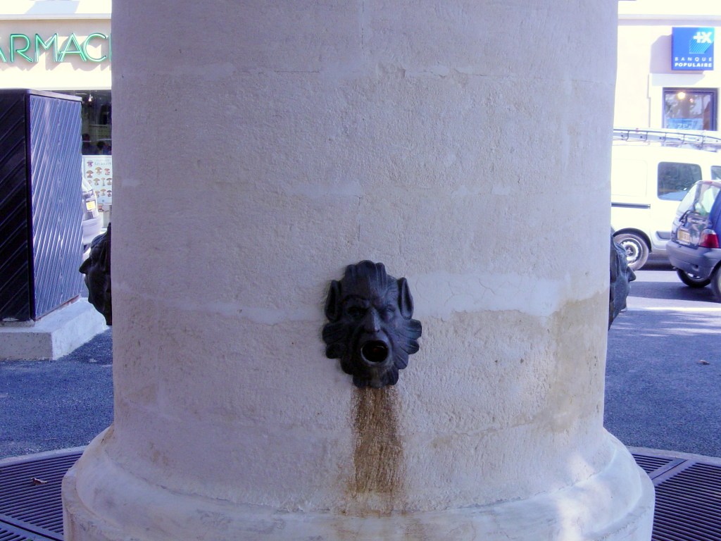
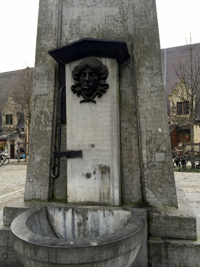
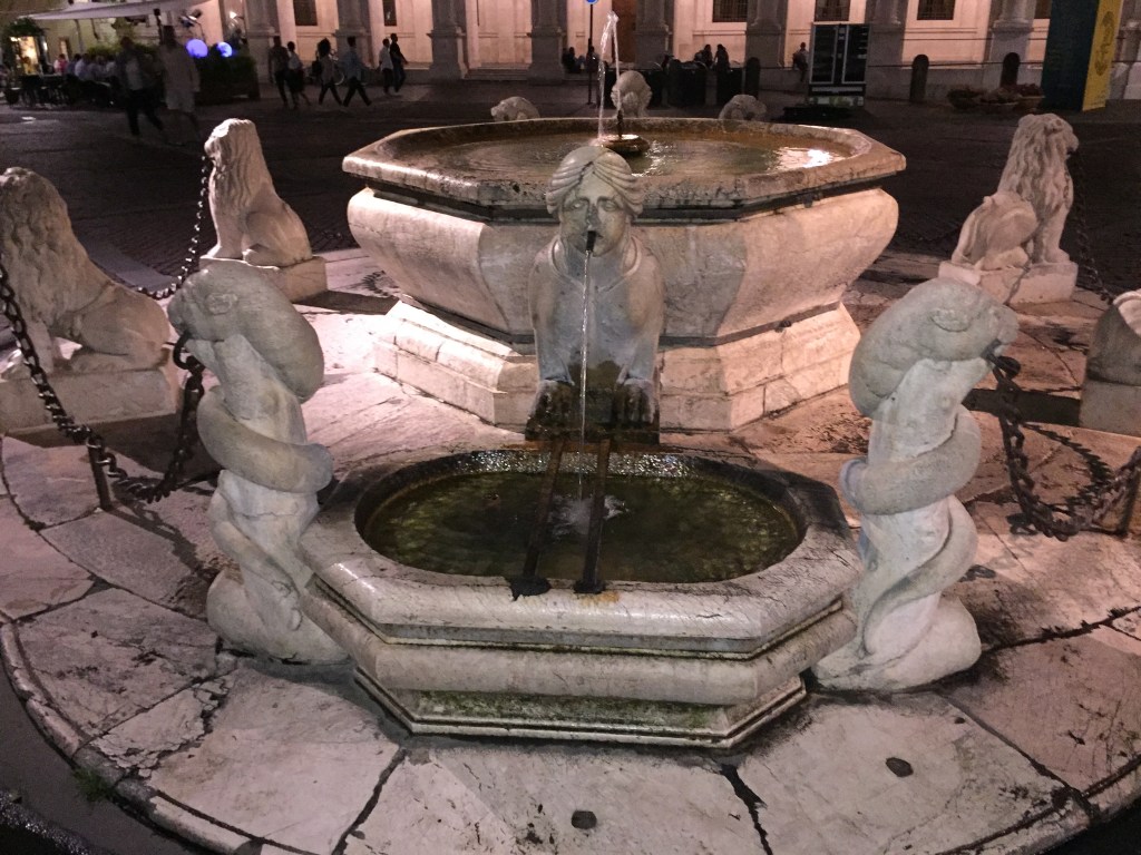
Can fountains be considered couth or uncouth? Maybe? Whatever. The ones that we’ve encountered are both cool and compelling, if not couth (and WolfeStreetTravel always likes a pun, no matter how tortured it may be).
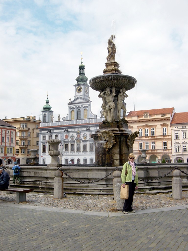
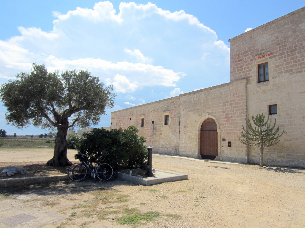
One of the common denominators to travel in Europe is the ubiquity of cool and compelling public fountains. Not decorative fountains serving as atmospheric – but nonfunctional – water features, like Trevi Fountain. We’re talking about fountains that serve as public drinking water sources in city and village squares all over the continent. We find them weirdly appealing and compelling (and sometimes gratifying, as was the case in the heat of the Southern Italy summer while biking through parched Puglia).
Because we don’t anticipate getting back into Europe for the next 6 months or more, we figured this would be a logical time to finally post the collection of cool-ass fountains that we’ve been aggregating by theme for several years into a single post. Again, weirdly appealing to us, with an emphasis on weird. What more can we say? So, we’re taking a quick break from posting on the Southeast Asia trip to finally put this one up on the site.
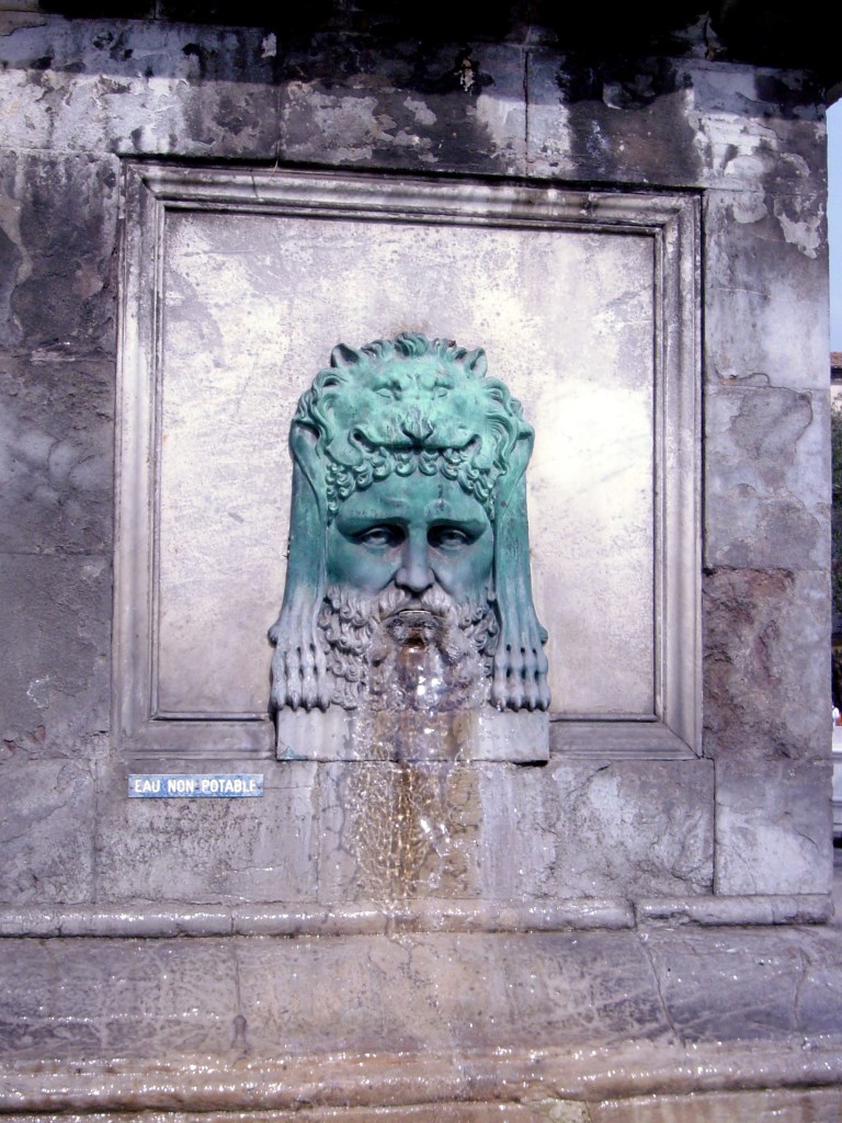
Thematically, you first got your stern- and angry-looking dude-with-additional-features-style public water fountains:
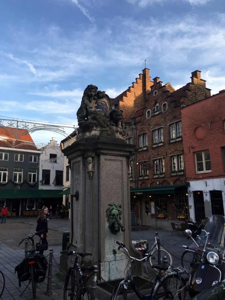
Cool fountain in Bruges, Belgium, from a Christmas trip in 2015.A disembodied head in Ljubljana, Slovenia, from a 2008 trip.An absolutely furious water dispenser in Belagio, Italy, in 2004.A withered, disembodied head fountain in Split, Croatia, from 2008. What a delight to have your drinking water dispensed by this guy. . .Dude at the Netherbow Wellhead in Edinburgh, ScotlandA brass, satyr-looking dude dispensing drinking water inside the Hamburg Rathaus from a Christmas trip in 2017.Our favorite fountain in the town square / Roman forum in the middle of Arles, Provence, France, from our trip to Europe in 2002 and our first bike trip, at that.
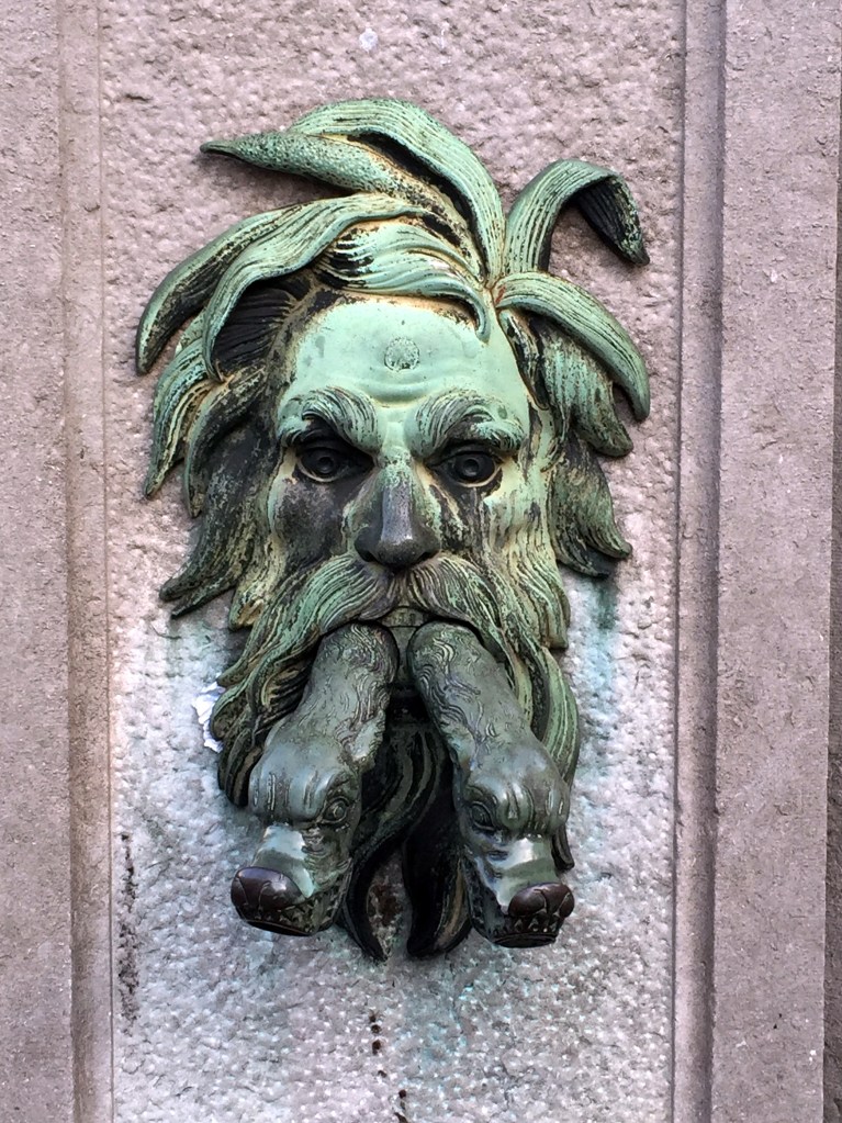
Closeup of the fountain face. This has become our avatar for WolfeStreetTravel for two reason: 1. It’s cool as shit and very Gaulish / Celtic 2. It’s an iconic image from our very first European trip
(We’ll acknowledge that this one isn’t actually a drinking water fountain, per se, considering the non-potable sign, but it’s absolutely included due to the reasons noted above.)
Cherubimic little fella in Dubrovnik, Croatia, in 2008.Cool fountain in Beaucaire, Provence, France, in 2002.Scallop-headed dude with fish from London in 2016.Hulking Samson’s fountain (Samsonova Kašna) in České Budějovice, Czech Republic, built in the 1720s. From a Central European bike and road trip in 2006. České Budějovice, btw, is hope to the original Budweiser beer, the source of legal battles over the decades.So, maybe this one isn’t actually a drinking water fountain . . .
Interesting iron fountain in Kotor, Montenegro, in 2008. Very cool fountain in Stockholm, Sweden, in 2016.A very similar, but smaller one in a different media, in Paris in 2008.
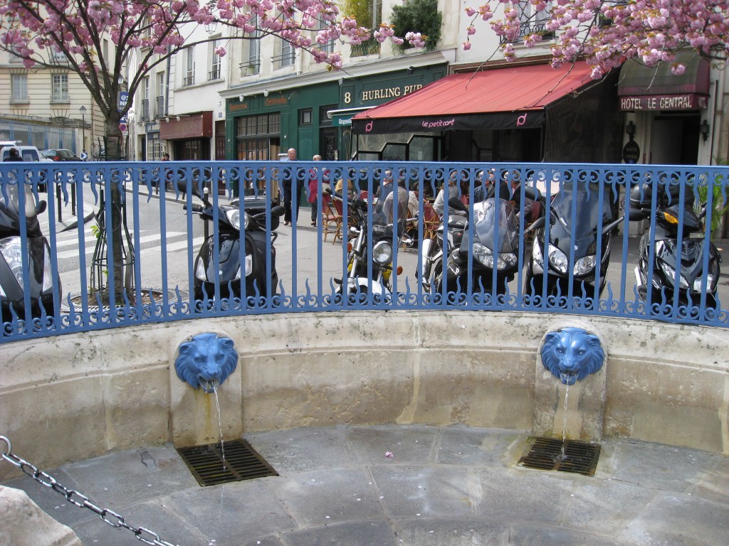
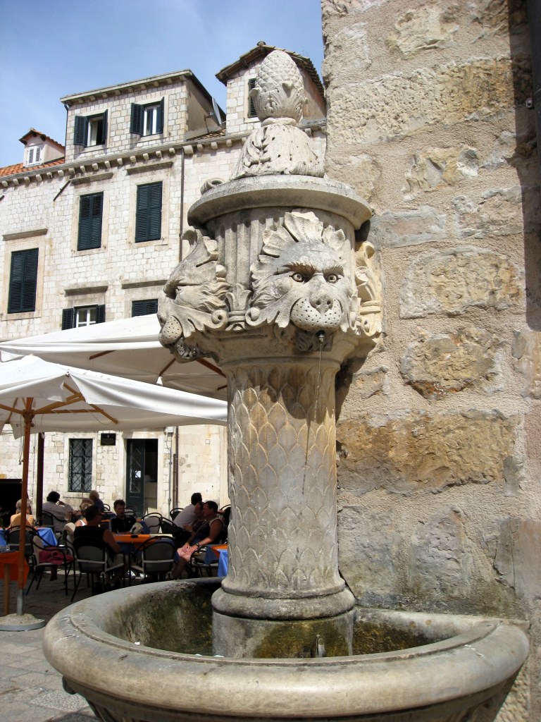
You got your always-popular lion fountains:
Located just down the street during the same trip to Paris, but in an adjoining arrondissement, are these stylish, royal blue lions.Paris, FranceA sad, confused, or constipated lion fountain in Dubrovnik, Croatia, from 2008.A lion fountain supplying a watering trough right outside the walled city gates in Carcassonne, France, on a stopover during the Great Micronations Road Trip of 2017.A pair o’ lions in Girona, Spain, the starting point for our bike trip through Catalonia in 2011.
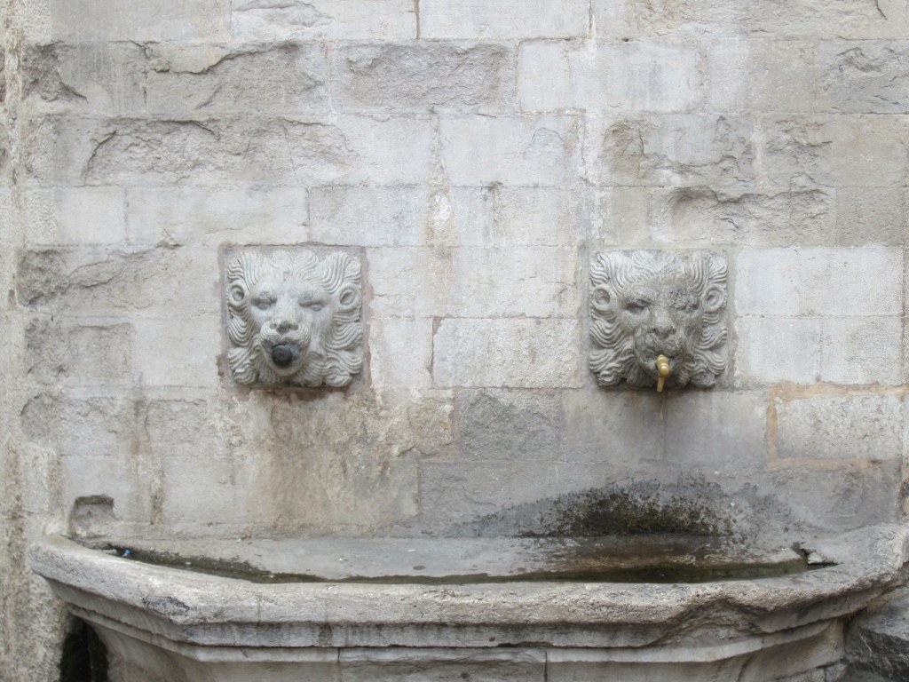
And, your lion / creature hybrid?
Another fountain in Dubrovnik, Croatia, from 2008.
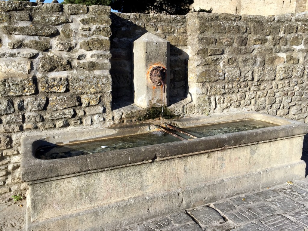
Finally, you got your truly utilitarian water fountains out in the country – in this case on rides in Italy and Spain.
Countryside fountain located while biking in Puglia – as long as it had a brass spout, it was potable, and the water from all of these was excellentOutside the village of Colmers in Catalonia while biking in 2011 (took this ’cause of the snails, not the design . . .).A perfectly located fountain at a masseria along one of our rides in Puglia in 2013.A formerly functional and now purely decorative fountain in Strasbourg, France, during Christmas 2017.
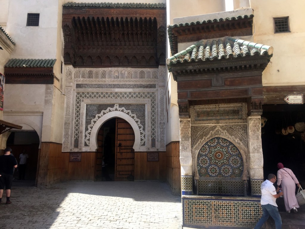
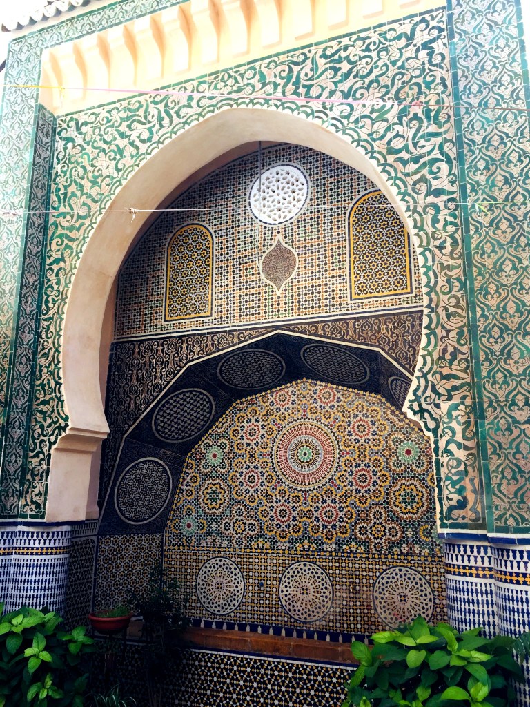
And now for something completely different: Moroccan public water fountains. We thought we’d expand the theme of awesome European water fountain sculptures to the same function, but different approach, in Morocco, home to the “I shipped my pants” advertising campaign. Here, the public water fountains are all about the mosaic tile.
Potable water fountain outside Fez‘ Museum of Wood in 2019. Yup. Museum of Wood.Another fountain in full use deep within Fez’ medina in 2019.
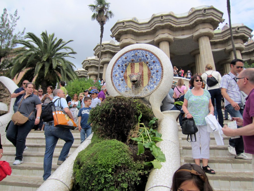
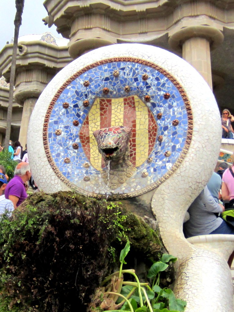
Further expanding the theme, here’s a couple of NON-potable water fountains, deviating from our original theme to a few decorative fountains. That are cool enough to qualify for the post: Antoni Gaudi’s tiled animal fountains, unique to Barcelona’s Parc Güell.
And finally, a further expansion to the drinking fountain theme – a stretch beyond which we really can’t expand further without diluting the original theme to oblivion.
Town cistern and multifaceted fountains down the street in Dubrovnik, Croatia, in 2008.Another in an unmarked, tiny town in Catalonia, Spain, while biking in 2011.
And finally, a contribution from home: the weirdest freakin’ fountain-type sculpture in the DC metro area, as far as we’re concerned:
There are a series of these creepy fish dudes along Ohio Drive Bridge downtown, otherwise known as the Tidal Basin Bridge:
What the hell? Not only does the dude have a fish body, but he’s definitely leering.
We’ve never known what they were, but whenever we bike or walk over this bridge, we’re always weirded out by them. Other than that awareness, though, we didn’t know anything else. But in posting this, we did find a Washington Post article that explains these, and why the dude’s a fish. “The bronze sculptures on the Ohio Drive SW bridge at the Tidal Basin were commissioned about 1987 in honor of Jack Fish’s forthcoming retirement from the Park Service. They are more correctly called grotesques, because they don’t have the rainspout that defines a gargoyle.” Jack Fish was director of the National Park Service’s National Capital Region until 1988.
So, they’re technically not the European city square drinking water fountains that we’re enamored with, but they’re thematically similar enough to include here.
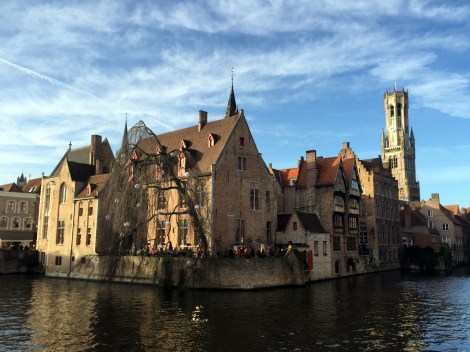
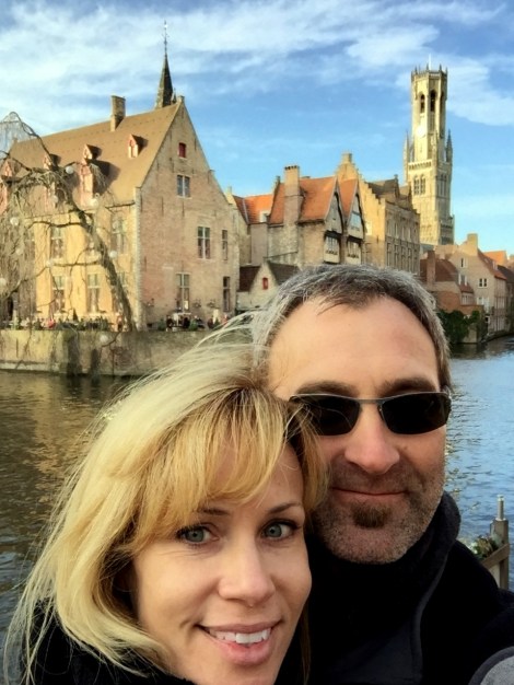
As some have observed, this blog maintains a low-grade obsession with cartography and European history. Although this story is a little light on the former, it’s equipped with some decent elements of the latter. Plus, it centers on Bruges, in Flanders, which we totally dug during a Christmas trip in 2015.
The opportunity for exploitation revolves around a charter granted in 1666 by Charles II of England to a bunch of fishermen in Bruges. Here’s a portion of an article in yesterday’s Telegraph that outlines the brilliant scheme:
“Belgium will invoke a 1666 Royal charter granting its fishermen the eternal right to fish British waters if there is a no deal Brexit.
Boris Johnson has threatened to quit negotiations with Brussels if a trade deal is not in sight by the October 15 EU summit. No deal will hit Belgian fisherman hard because they will face being shut out of British waters.
King Charles II granted 50 men of Bruges the right to fish UK waters for “eternity” after staying in the city during his 1656 to 1659 exile after the English Civil War that ended with the execution of his father.
The regional government of Dutch-speaking Flanders said it would use the ancient charter in the courts if necessary.
“Our goal is to reach a negotiated deal,” a spokesperson for Flemish Fisheries Minister Hilde Crevits told Belgian radio.
“But if we don’t reach a deal, we could invoke the charter. It dates back to 1666 but was confirmed by a UK lawyer in 1820.”
EU boats land about eight times more fish in UK waters than British fishermen do in EU waters. Three quarters of the fish sold in the Belgian port of Ostend are caught in British waters.
“One wonders if it is in Belgium’s, or anyone’s interests to start going back to such historic claims. A lot could get put back on the table,” a British source said.
Britain began fishing negotiations with the newly established Kingdom of Belgium in 1849. A treaty was signed but Belgium insisted at the time it was “without prejudice” to the 1666 “fishing privilege”.
The charter was rediscovered in Bruges city archives by alderman Victor Depaepe in 1963, who wrote to Queen Elizabeth pressing the claim.
Mr Depaepe, an accountant and owner of a fishing fleet, contrived to have himself arrested by the Royal Navy fishing off the coast of East Sussex.
British authorities never brought the case to court, which has fueled speculation prosecutors believed the charter could still be legally enforceable.”
Hello Peter, whatss happening? Ummm, I’m gonna need you to go ahead come in tomorrow. So if you could be here around 9 that would be great, mmm kay… oh oh! and I almost forgot ahh, I’m also gonna need you to go ahead and come in on Sunday too, kay? We, ahh, lost some people this week and ah, we sorta need to play catch up.
Thomas and Lumberg in person at Jackson Hole in 2010: