Alexandria History

Old Town’s Alley Houses

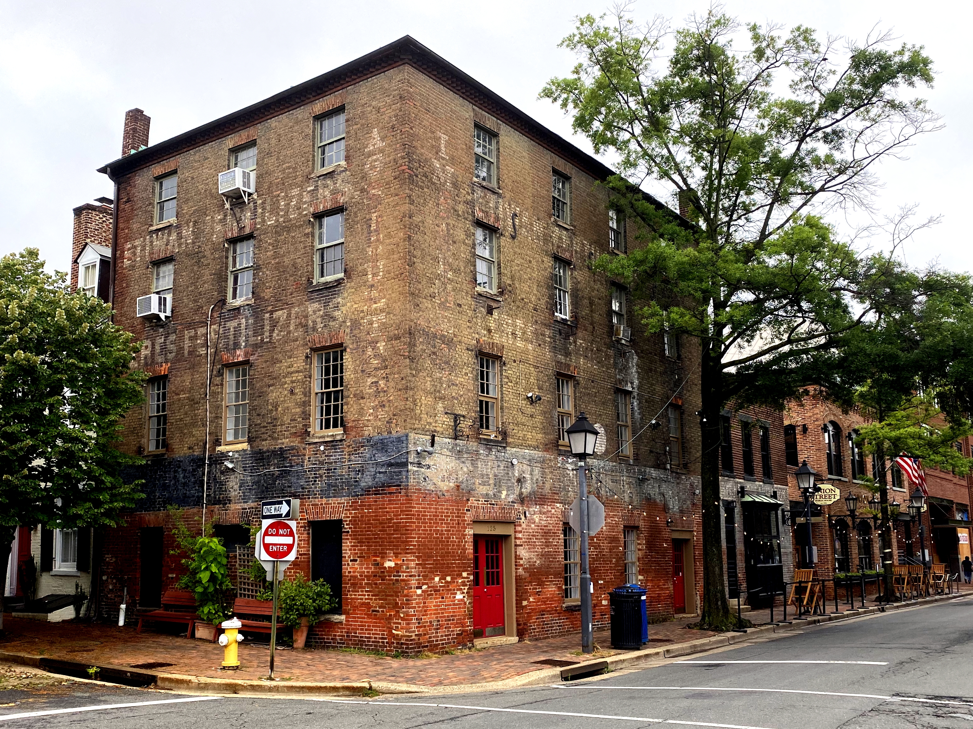
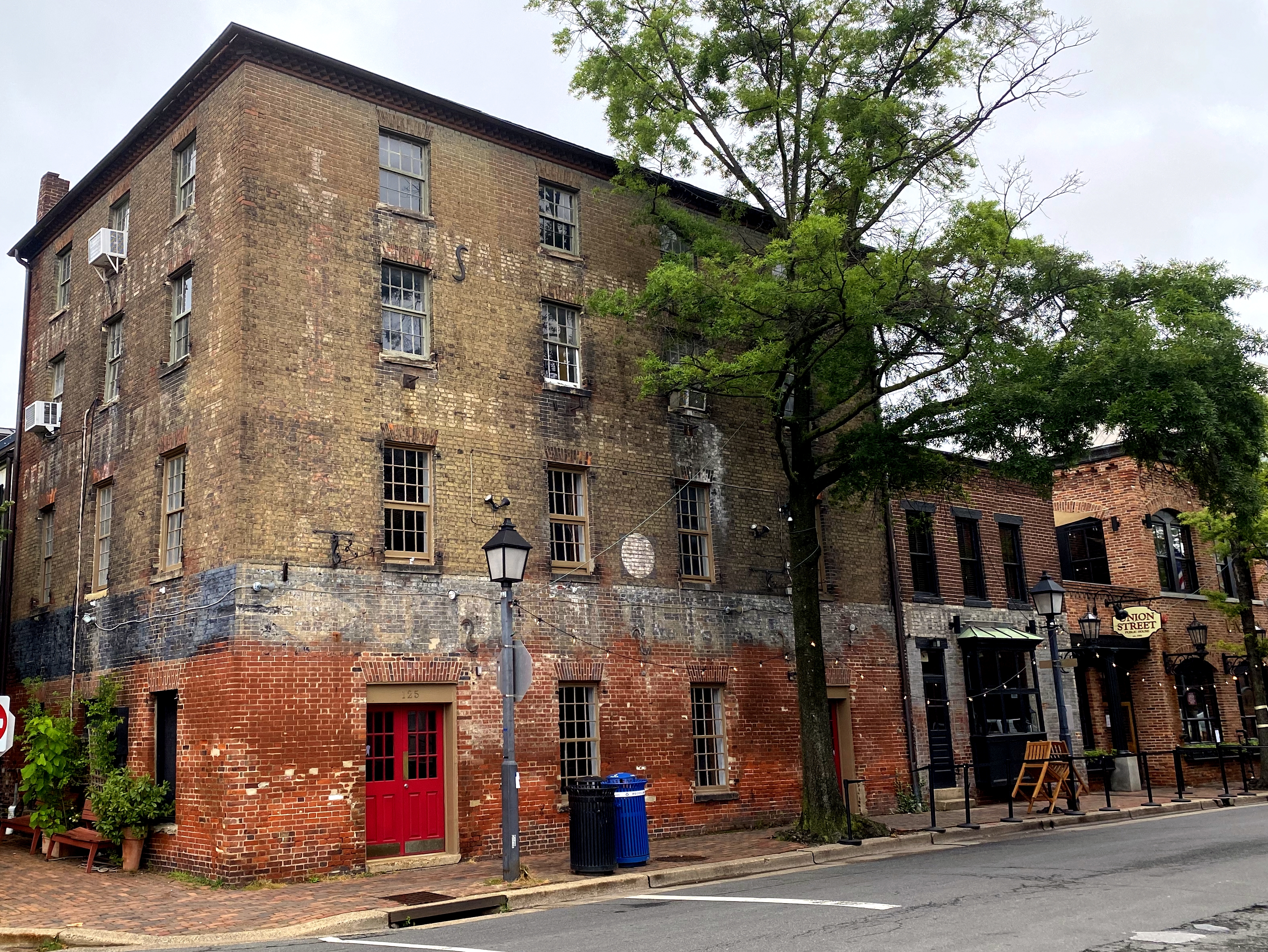
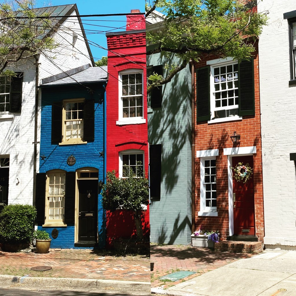
The narrowest house in Old Town (and reportedly the narrowest house in the country) is located on the 500 block of Queen Street and is known as the Spite House. It gets way too much attention, given a relatively unknown competitor three blocks away from us on Prince. (Nonetheless, it made it into one of our previous posts . . .)

The place even rated a story in the New York Times, from which we’ve quoted its origins: “The house, 7 feet wide, about 25 feet deep and a whopping 325 square feet in two stories, is a tiny landmark on Queen Street in the Old Town district in Alexandria, Va., just across the Potomac from Washington. Structurally, it’s more of an enclosed alley than a house — the brick walls of older houses on either side form the painted brick walls in the living room. It’s called the Spite House by some because John Hollensbury, the owner of one of the adjacent houses, built it in 1830 to keep horse-drawn wagons and loiterers out of his alley. Indeed, the brick walls of the living room have gouges from wagon-wheel hubs.”

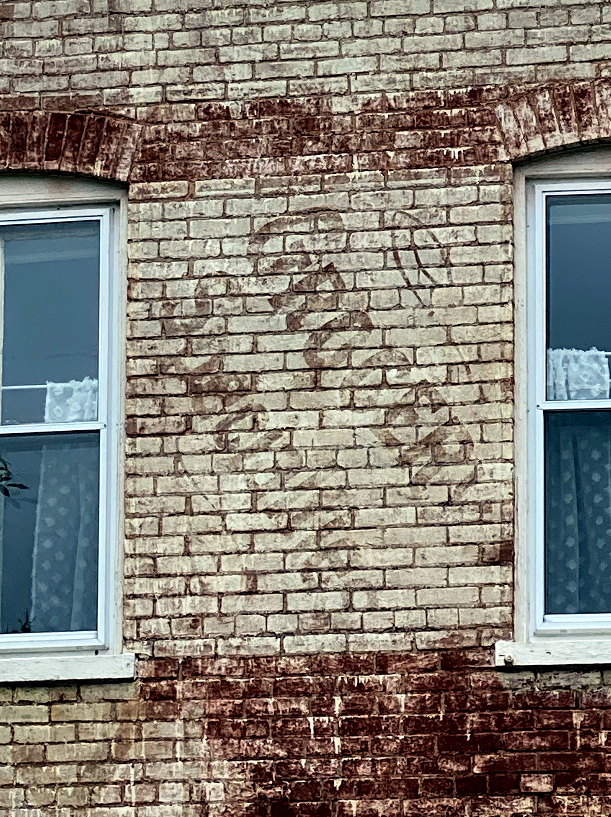
The article cites the Spite House’s 7-foot width. It’s actually wider than that. How do we know? We freakin’ walked over and measured it one day. It’s 7′ 6.5″ wide.

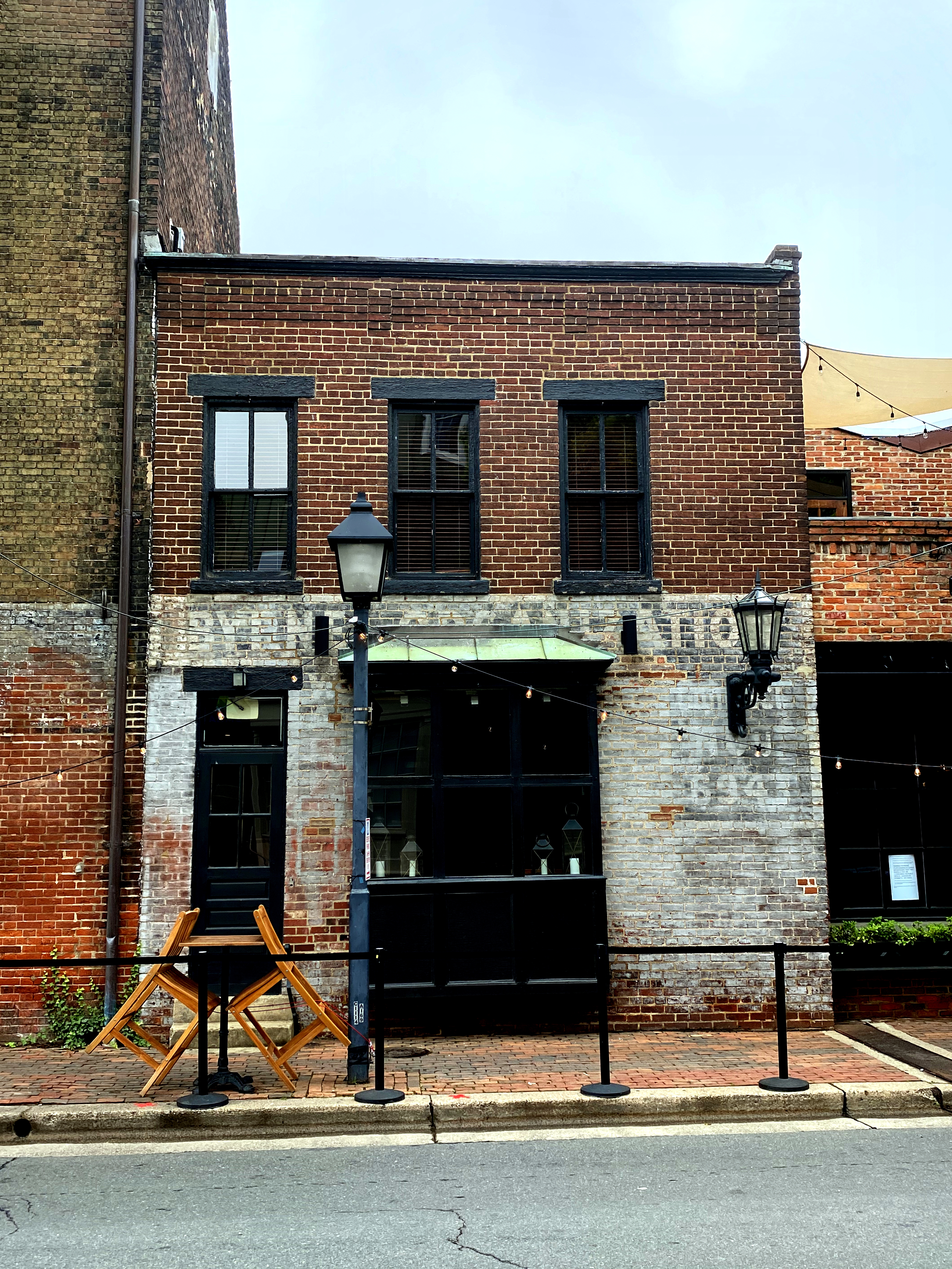
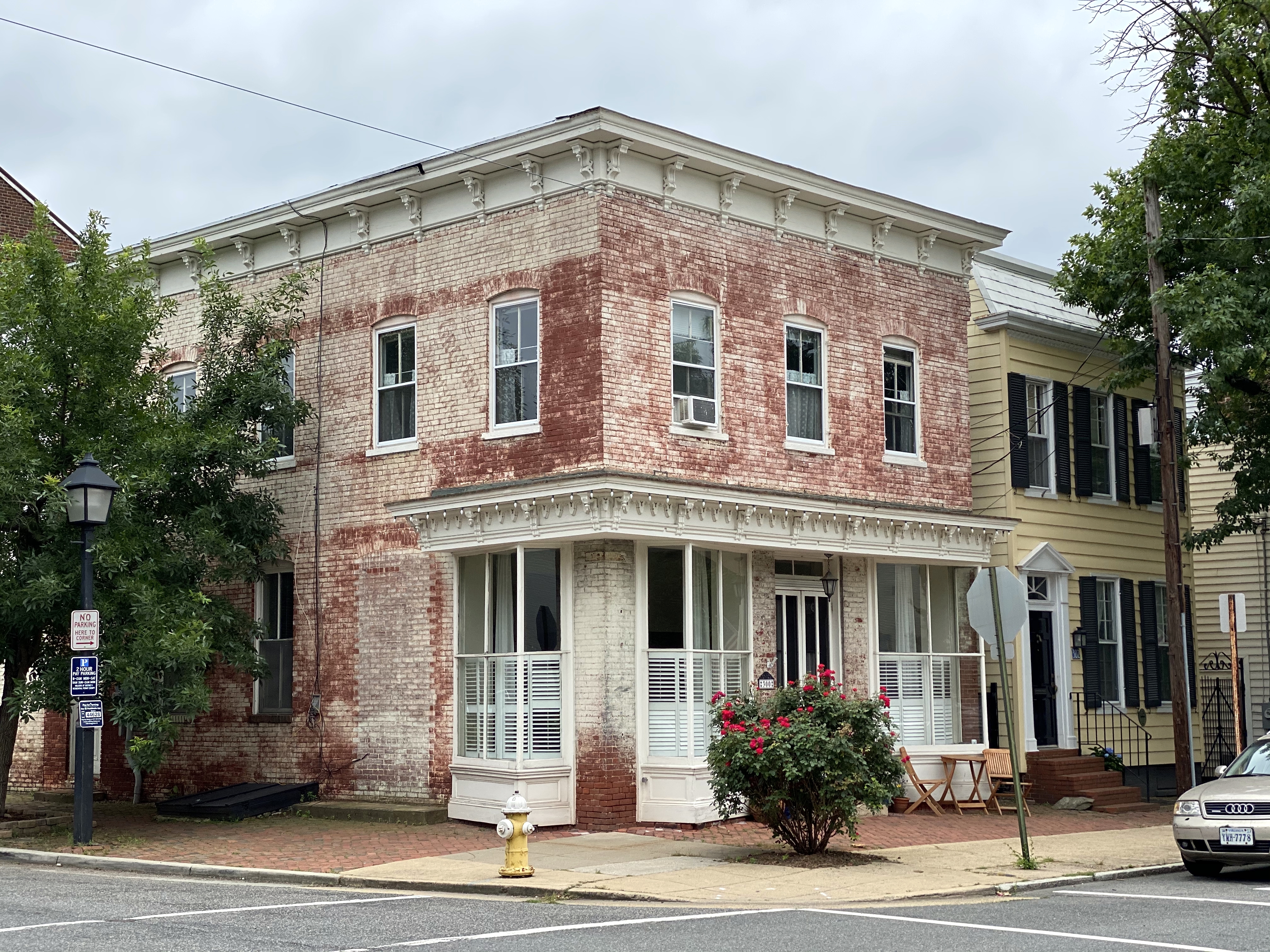
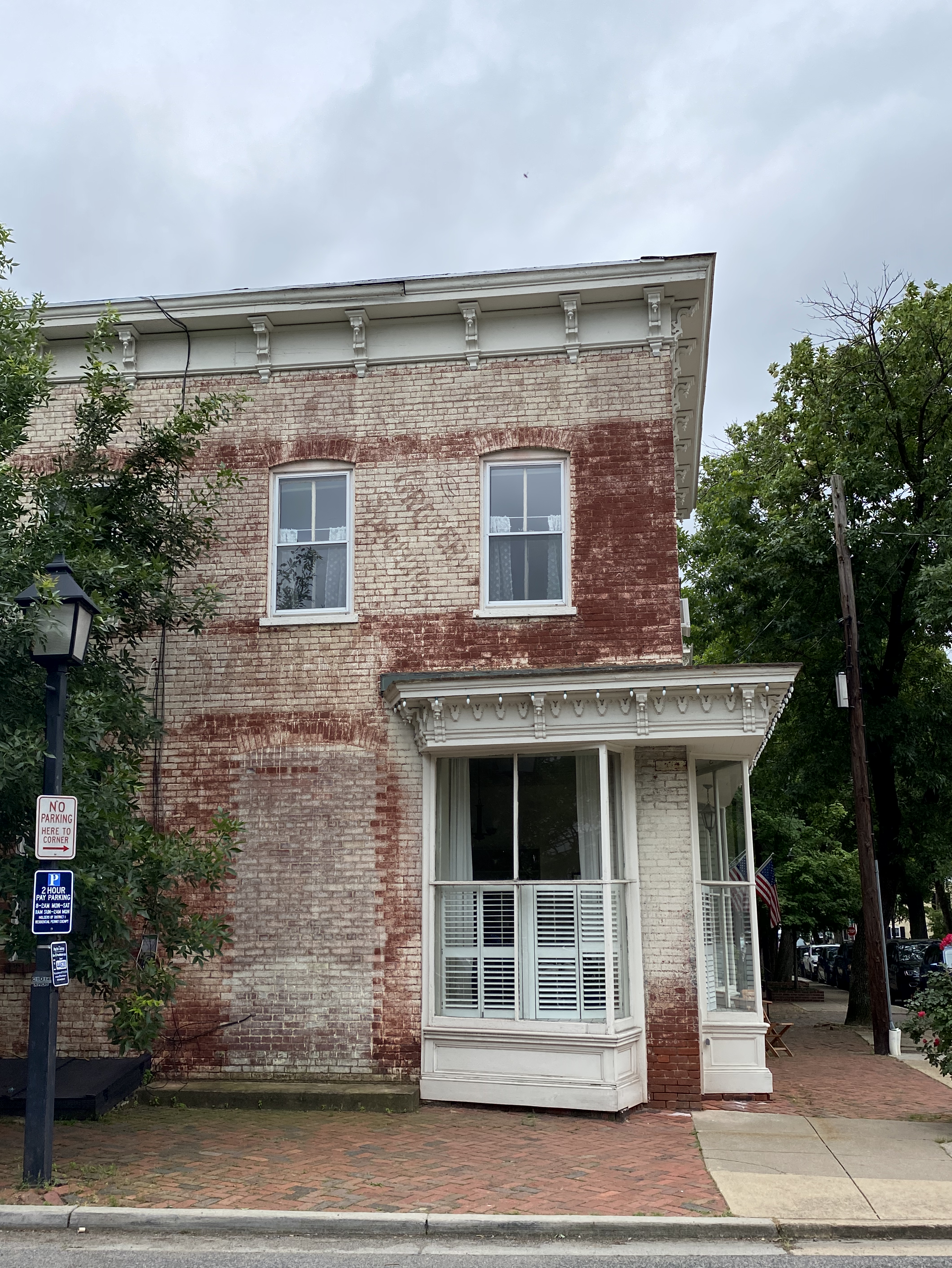
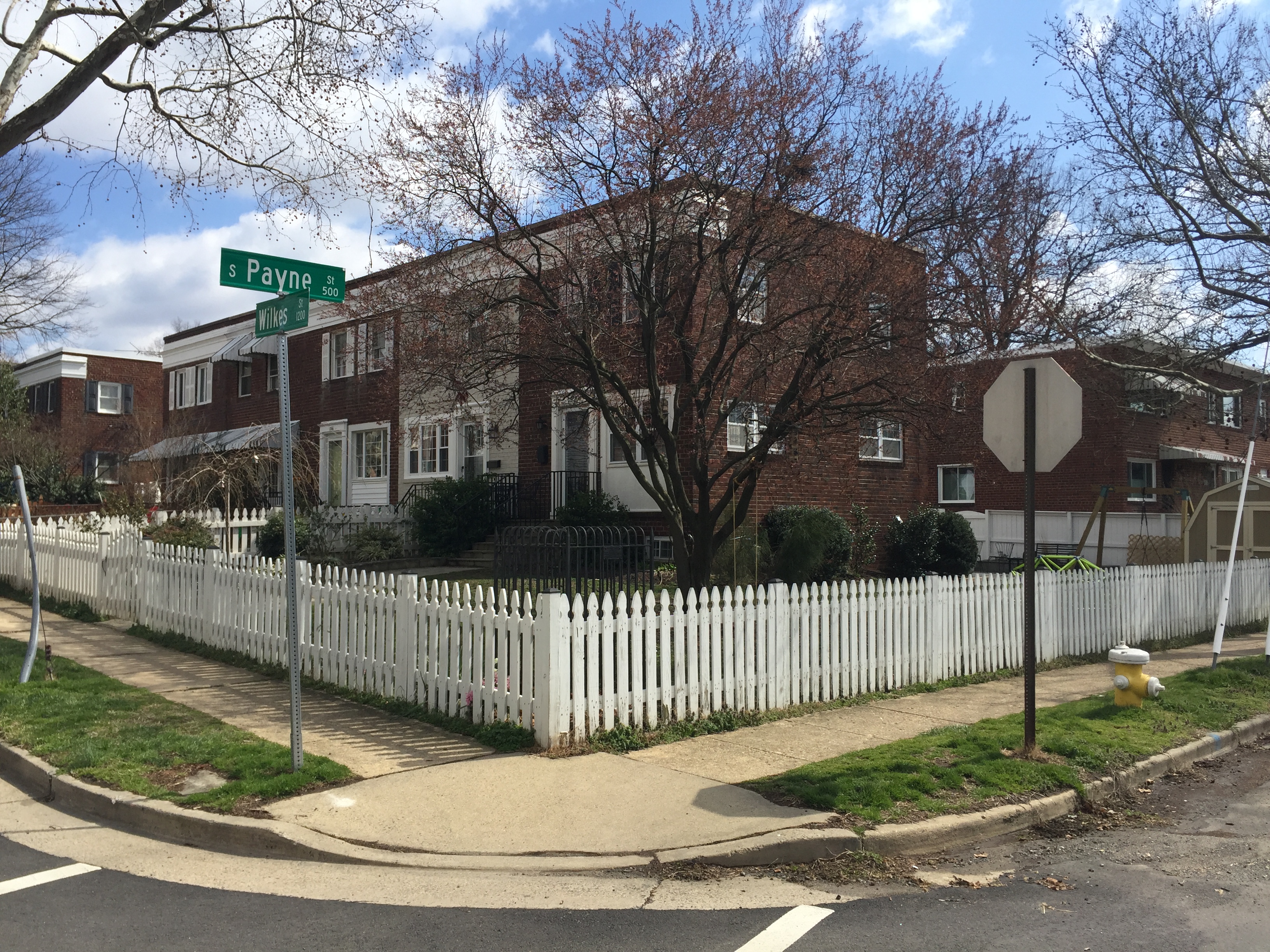
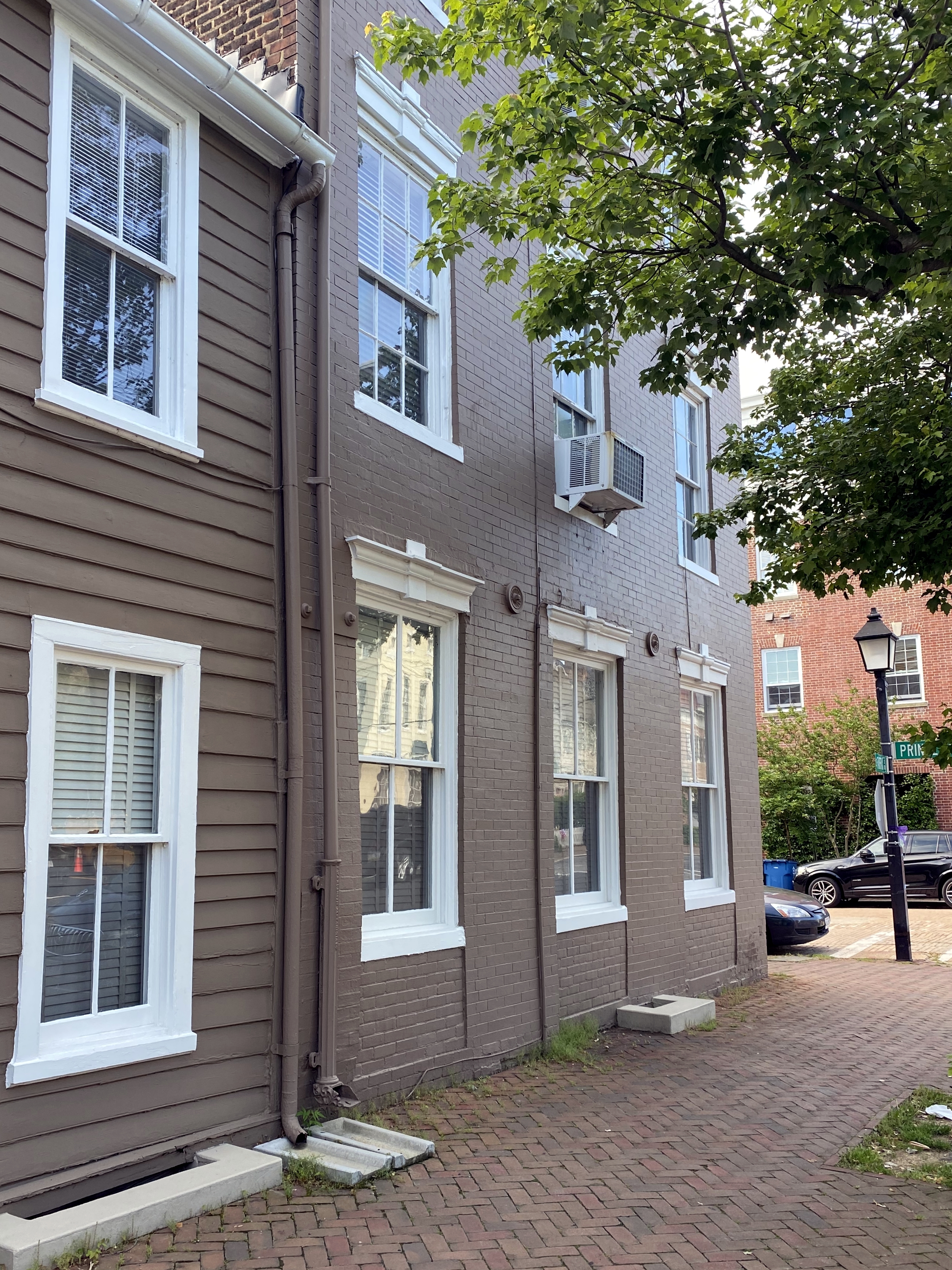
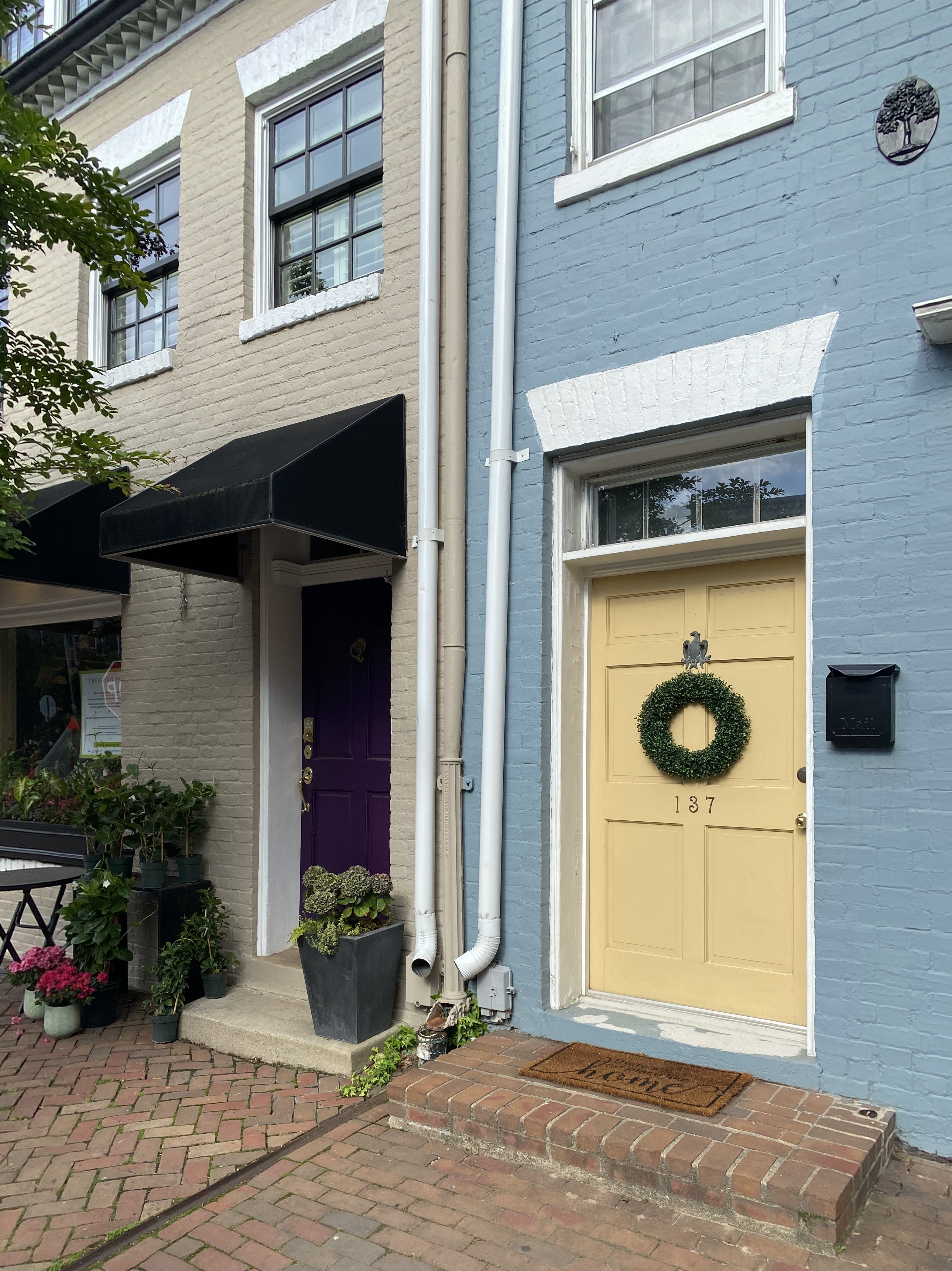
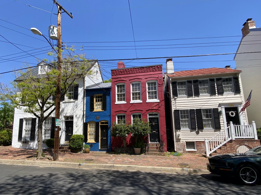
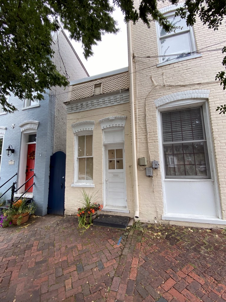
We measured it because we were convinced the tiny house closer to us on Prince Street was actually narrower and should be getting the spotlight that was always the freakin’ Spite House. Here’s the Prince Street house:

It clocks in at 8′ 1.5″ wide. Wider than Hollensbury’s house by 7 inches. We’re surprised and annoyed, but numbers don’t lie.

Here they are, side by side:

Unlike the Spite House, the house on Prince wasn’t built out of spite, but as a means to generate rent revenue. According to our copy of “Historic Alexandria Virginia Street by Street: A Survey of Existing Early Buildings” the house was “built before 1883, when Samuel H. Janney bequeathed to his son, Henry, the rents accruing from ‘the three-story brick house and the small two-story brick house adjoining thereto on the northwest corner of Prince and Royal.'”

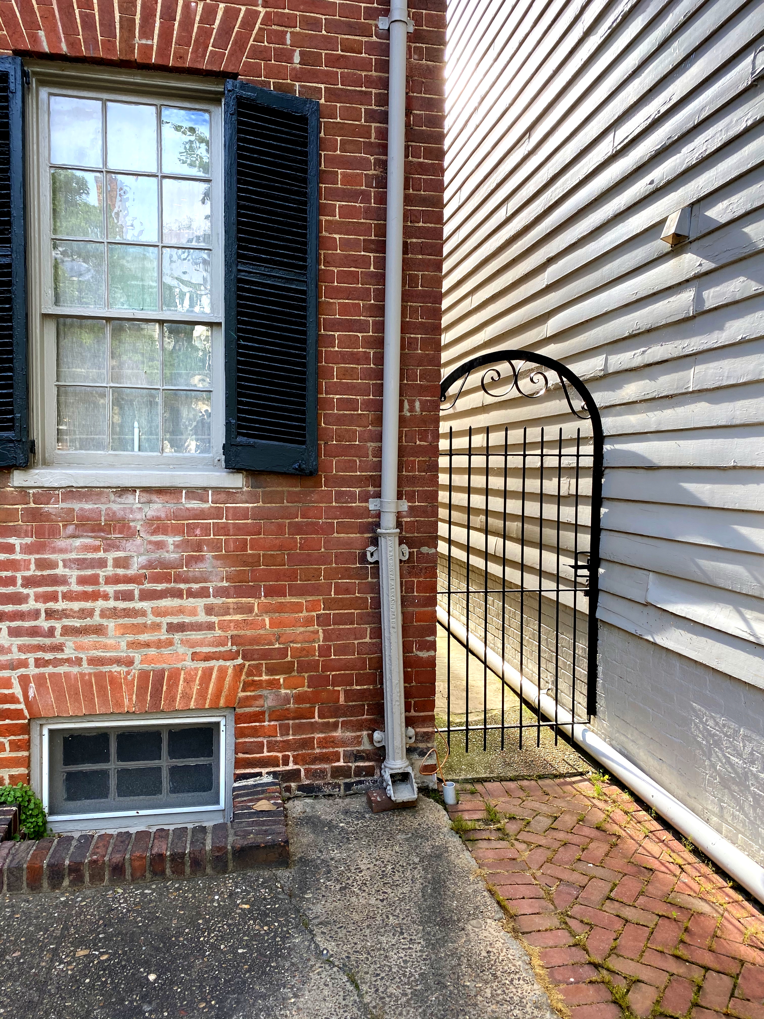
Although the little Prince (Street) wasn’t built out of spite, it does share an attribute with the Spite House that few other town houses in Old Town do – it’s an alley house. A house built in what previously was a narrow alley between two larger houses, and that may use one or both sides of the houses on either side of the alley, instead of having independent sides, separate from the other houses.

This was brought to our attention in this article last week by Sarah Dingman in Alexandria Living magazine, which identified this as one of only three other alley houses in Old Town, in addition to the Instagram favorite, the Spite House.

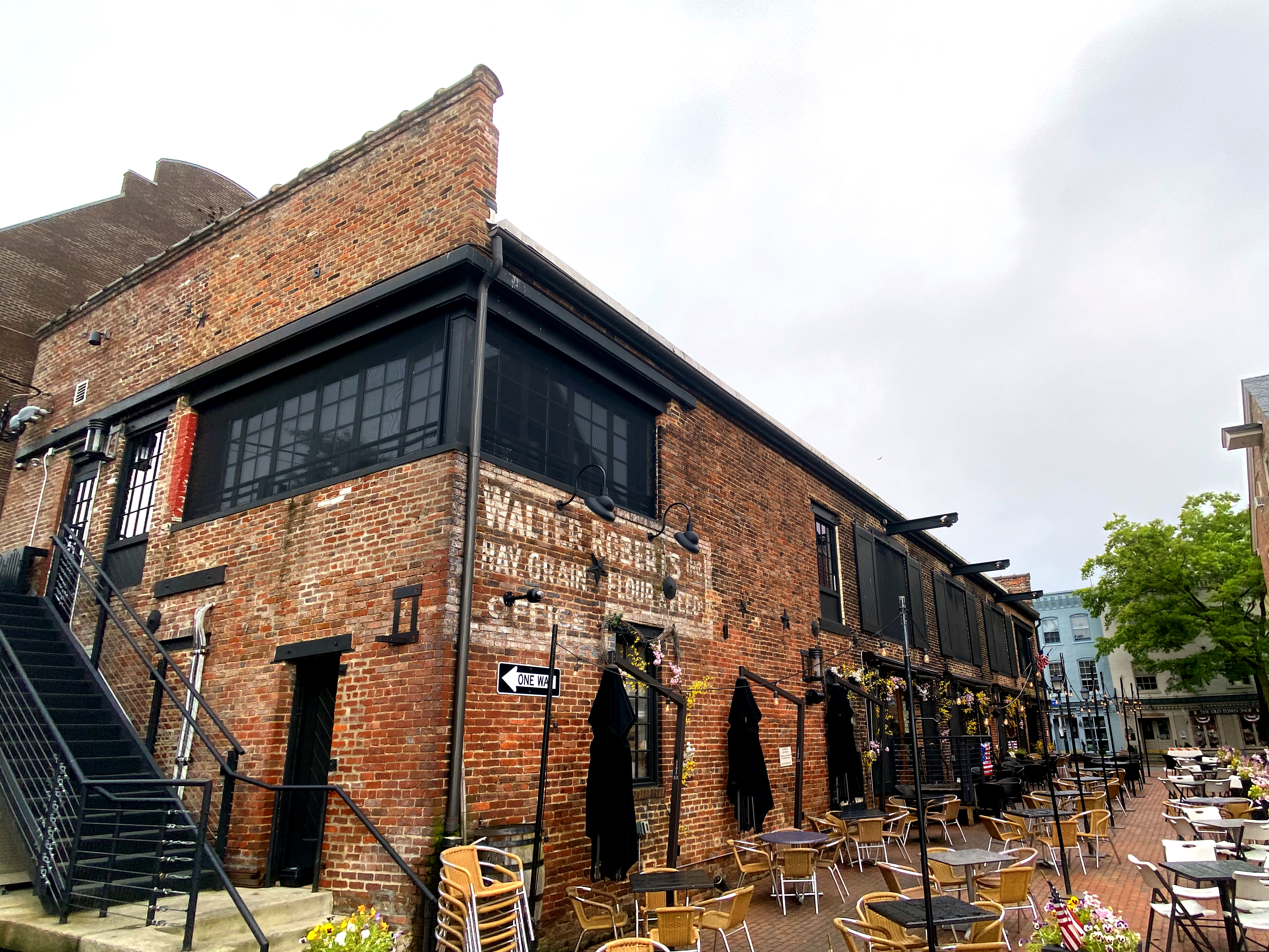
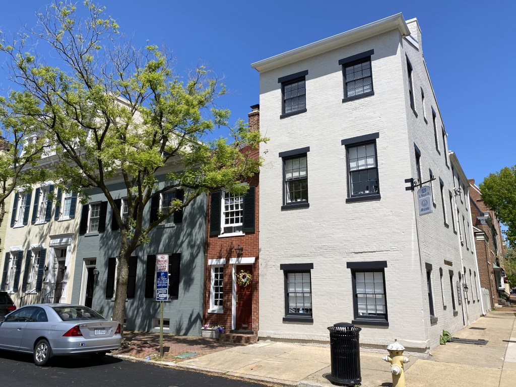
Another of the alley houses can be found 11 blocks west of the little guy above, on the 1400 block of Prince Street:

From the Alexandria Living article:

“It is unique from the other spite houses in that it is only one story tall. The home is a little more than 8-feet wide and has been incorporated into the home next to it. 

The same color as the building to the east — the rear of 131 S. West St., which houses Christ House — it almost blends in. It also looks like a miniature replica of the buildings to its left. Note in the photo below the similar framing above the front door and window.

This alley house is the youngest alley house, built between 1891 and 1895 according to Sanborn Fire Insurance maps.”

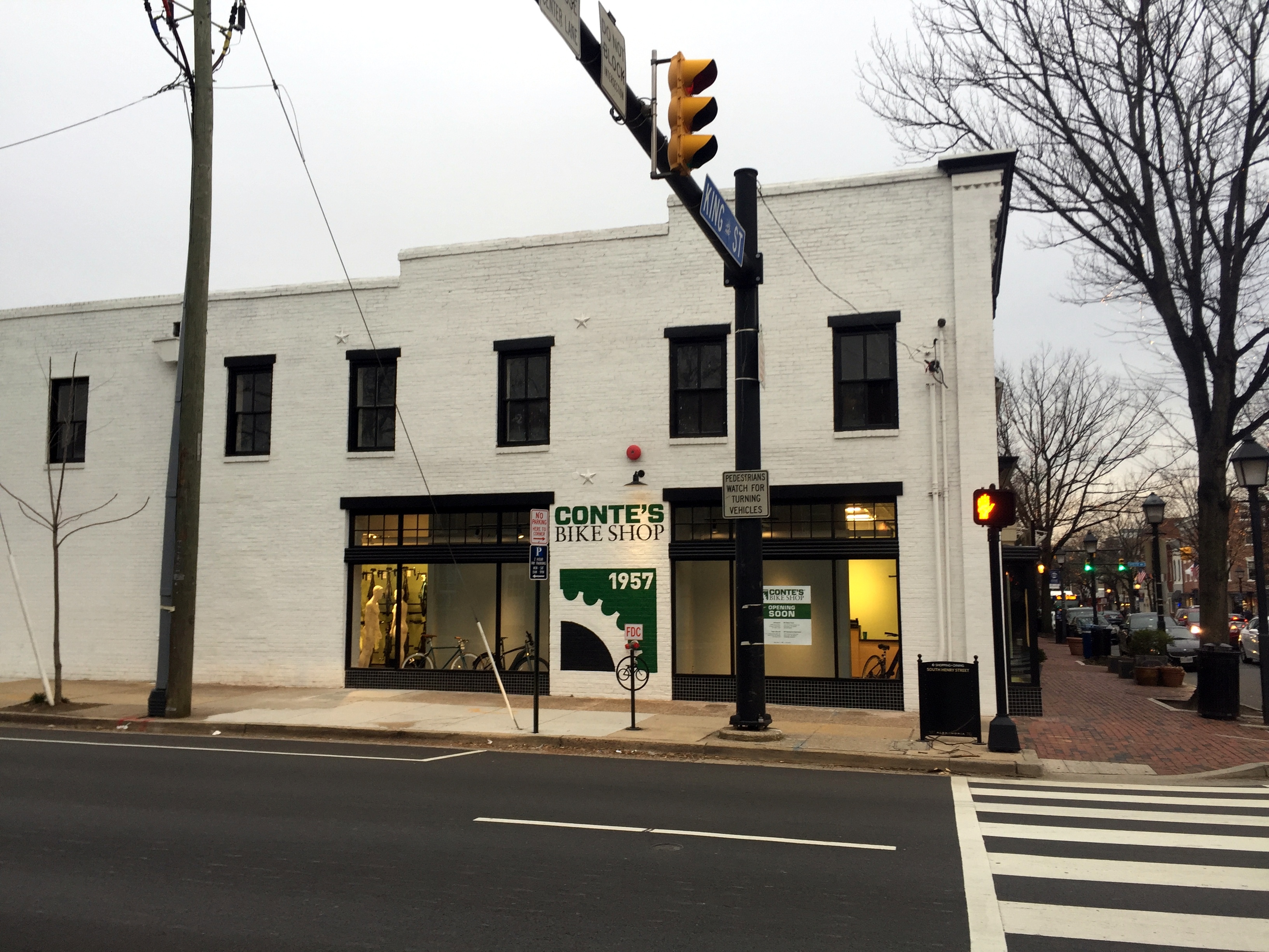
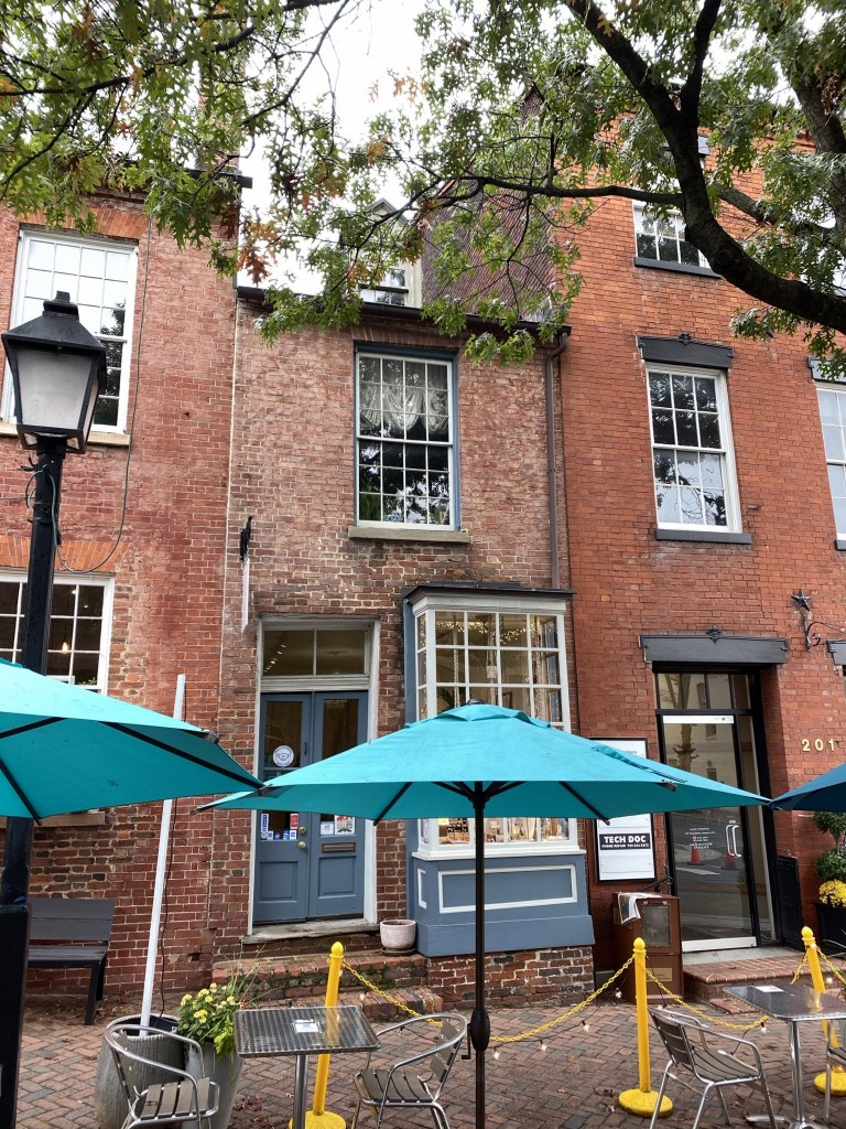
The final alley house is a boutique shop on the 200 block of King, right in the middle of the shopping and restaurant district:

More from the Alexandria Living article:

“Only a couple blocks up from the water, it is commonly passed by but not noticed as one of the alley houses. [We can vouch for this.]

This alley house is relatively wide, measuring 11 feet wide (as measured by Old Town Home blog). The house was built around 1812. 

In 1994 the residence, which was located above a then-Birkenstock shoe store, was a total of four rooms, including the bathroom and a kitchen, didn’t have space for a washing machine.”

Definitely puts our small house into perspective!

Categories: Alexandria History, Maps and Miscellany, WolfeStreetProject | Tags: , , , | Leave a comment

The Ghost Signs of OId Town

Alexandria’s history dates back to 1749, and the older, brick buildings in our town, particularly along Union Street, have been repurposed many times over the centuries. This included commercial uses where a little in situ advertising on their walls would have benefited sales of their goods. Although these buildings now generally house restaurants and more tourist-oriented shops, there are faded reminders of their previous lives still visible on their facades – ghost signs.

The most visible is likely this building on the corner of Prince and South Union:

Formerly the home to “ETIMAN FERTILIZER”  and “CERES FERTILIZER,” according to the ghost signs on both the south and east facades,

It was for a few decades the home of The Christmas Attic, but that business, too, has gone the way of Ceres Fertilizer, and is no longer there. We’ll see who moves in next.

Just north on an adjacent building is the former home to BYRNE ORGANIZATION:

We have no idea what this is, but would like to think that it was Alexandria’s Irish mob version of the Bada Bing in the Sopranos. Regardless, it’s now the whiskey room portion of Union Street Public House.

Across the street is Virtue Feed & Grain restaurant and bar:

At some point in the past, this was “WALTER ROBERT’S HAY, GRAIN, FLOUR & FEED.” The building also was home to the actual Virtue Feed & Grain store, and we thought there was a ghost sign for this that inspired the restaurant’s name, but it’s not visible now.

A ghost sign that we didn’t even realize was there until recently, despite walking or running by the place hundreds of times, can be found on the corner of Duke and Fairfax:

This was once a corner store, which, prior to the 1960s and the advent of the supermarket, occupied most corners in Old Town (including both ends of our block of Wolfe Street). The last of them – a deli on the corner of Fairfax and Franklin – succumbed to residential conversion about a decade ago.

As with many of the former corner stores, now residences, you can tell that they once served a commercial purpose – this one based on the store windows. The ghost sign can be found between the two windows on the second floor.

“GROCERY SPECIALTIES”

The most recently uncovered is undoubtedly the coolest – the Grape house on the corner of South St. Asaph and Gibbon:

The house was built in 1842, and for our entire residency in Old Town, this wall was painted. However, the house underwent a comprehensive renovation in 2015, including stripping the old paint from this wall, revealing a chewing tobacco advertisement. Wisely, the wall was left exposed. We assume that it actually added a premium to the house price, considering how prominently the Grape tobacco ad was featured in marketing for the house when it was sold.

All of these ghost signs are located in the southeast quadrant. There’s one in the southwest on the top floor of a brick building on King Street:

“Michelbach’s Furniture”

And perhaps a future ghost sign on the side of the new location for Conte’s Bike Shop:

And, lastly, a fake and hokey Oldey Timey sign that the developers of the Watermark condos put up on the Strand:

We have no doubt that this structure (which used to be the sales office for the Potomac River cruise ship The Dandy) was at one time the PHILIP B. HOOE WAREHOUSE for GRAIN, but the oldey timey font is a bit much.

The tables, btw, are overflow outdoor seating for Chadwick’s around the corner (a true Old Town institution). The city has permitted restaurants to spill out into the streets and alleys to accommodate outdoor dining during the current restrictions, which is absolutely awesome. If you haven’t been out to a restaurant since February and are hankering to dine out, come to Old Town!

Categories: Alexandria History, Maps and Miscellany, WolfeStreetProject | Tags: , , , , , , | 4 Comments

Ice, Ice, Baby

That’s right – Vanilla Ice knew his Old Town ice houses. There are exactly two ice ice houses in Alexandria, down from dozens across the city at the turn of the 20th century.

Neither are used for storing and selling ice anymore, but this summer, according to Alexandria Living Magazine, a company called Goodie’s Frozen Custard will be moving into the more iconic of Old Town’s two extant ice houses. After 30 years as a plumbing supply shop, and then being abandoned for more than a decade, that ice house will soon host a tenant worthy of the space.

Between 1900 and 1930, ice houses in Alexandria distributed hundreds of thousands of tons of ice annually to the city’s businesses and residents. The increased availability of electricity throughout the city after this period rendered the ice houses obsolete. Most were demo’d to allow the construction of new structures. But two remain standing, albeit used for other purposes.

The more well-known of the two (and the one for which its function is unambiguously broadcast), is located in the southwest quadrant, on the 200 block of Commerce Street (and visible from King):

When one of us was growing up, that ice house was abandoned, and painted a uniform, faded light blue. The “ICE” was visible only as relief on the facade. (BTW, we continue to look for a serigraph of the ice house in this condition by late, local Torpedo Factory artist Clay Huffman, but the search has been fruitless.) About 5 years ago, someone bought ICE house, began restoring it, and applied the new, improved paint scheme. This is the future home of the frozen custard purveyor, fittingly enough.

The other remaining ice house structure lies on the 100 block of South Lee Street:

We run or walk by this place multiple times a week, and only recently realized that it was an ice house. This was the home of the Mutual Ice Company from 1900 to 1937, when it closed due to widespread adoption of electricity for refrigerators and freezers. It’s now home to an architectural firm.

As with the first “ICE” house, the structure on Lee features a shelf on which to place ice blocks during a transaction:

And a pretty impressive, heavy wood insulated door to the ice freezer:

These more recent ice houses have nothing on the grand daddy of them all in Old Town, though – the 18th-century Gatsby’s Tavern ice well. (All of the quoted information below is verbatim from the city’s historical information site here.)

“The Alexandria Common Council granted Wise permission to build an icehouse underneath the corner of Royal and Cameron Streets in 1793 as part of his construction. For the previous four years, Wise had leased the Alexandria Inn and Coffee House at 201 N. Fairfax Street, which included an on-site icehouse. Perhaps this convenience in his earlier ventures convinced Wise of the importance to the hospitality industry of having a regular supply of ice. Wise saw into the future by including this important feature in his designs for Alexandria’s five-star hotel of the 18th century.”

Inscription on the bluestone at the center of the circle on the corner above:

“Ice harvesting was an expensive and time-consuming process. It was cut from the frozen Potomac River in the winter and hauled by cart to the City Tavern for storage.  Once in the well, the ice was formed into a solid mound and covered with straw to preserve it for use through the summer months.  Preserving ice was an on-going challenge in the late 18th century and an expensive venture. Therefore, ice was generally reserved for wealthy estate owners. George Washington records in his journals the trials and tribulations of trying to preserve ice. In Alexandria, many homes had interior ice pits to store small quantities of ice. Those lucky enough to have access to ice used it to chill beverages, preserve perishable foods, and even make a new popular dessert of the day: ice cream. This availability of ice at Gadsby’s Tavern helped to distinguish the establishment as one of the finest of its kind in the 18th century.”

Linked directly to the Tavern basement by a brick-walled and vaulted tunnel, the ice well was also accessed by the tavern staff through a small hatch at street level. The City Tavern’s well is much larger than most urban residential ice wells, measuring over 17 feet in diameter and over 11 feet deep at the lowest excavation point. The well could store as much as 68 tons of ice, enough to supply the tavern and even the citizens of Alexandria. In 1805, when John Gadsby was leasing the tavern from John Wise, Gadsby advertised the sale of ice from the well, “ICE FOR SALE, Persons may be supplied with ice, at eight cents per pound on application to John Gadsby.”

A view into the ice well:

“The ice well is an important and rare example of a commercial well in an urban environment.  Most ice wells have been lost to “progress” as they have succumbed to office buildings, parking lots, and housing.  Examples still exist at Monticello, Montpelier, and Mount Vernon, but these were created for private and not commercial use.  Gadsby’s ice well tells the larger story of commerce and the evolution of hospitality.  It is a reminder to modern day travelers and residents of something we take for granted today – a ready supply of ice.”

Stay cool, Old Town.

Categories: Alexandria History, Maps and Miscellany, WolfeStreetProject | Tags: , , , , | 2 Comments

Adieu, Appomattox

A Saturday morning quiz: spot the difference between these two pictures

We took the picture on the top a few weeks ago; we took the one on the bottom this past Tuesday.

In light of the ongoing protests throughout the country, the city worked with the United Daughters of the Confederacy on Tuesday morning to remove the Appomattox statue from its plinth at the intersection of Washington and Prince Streets. The city had voted several years ago to remove the statue, but were prevented from acting on this by a state law that reserved decisions on Confederate war memorials at the state level. The new legislature that was voted into Richmond during last year’s mid-term elections reversed this policy, enabling municipalities to take the actions they saw fit. In the case of Appomattox, this required working with the monument’s owner, since the statue and plinth are not owned by the city. (The circular patch in the intersection also may be owned by the UDC – we’ve heard this, but haven’t been able to verify it. The city’s GIS parcel viewer does show a little circle at this intersection, while there is none in the other intersections, but there’s not a parcel designation for the circle.)

We previously posted on Alexandria’s Appomattox monument in 2017 after the white supremacist jackassery in Charlottesville.

From this article in the Alexandria Gazette: “Although City Council voted unanimously in 2016 to move the statue to another location, prevailing law at the time required approval from the General Assembly for the relocation of the Appomattox Statue along with other war memorials throughout the state. A bill passed by the legislature and signed by Gov. Ralph Northam (D) earlier this year removed those protections, giving authority over memorials to local jurisdictions. That law goes into effect July 1. ‘We had already coordinated with the UDC and scheduled a date for removal in July,” [Alexandria City Mayor] Wilson said. “They approached the city last night with a request to remove the statue early. That is probably a testament to the moment we are in right now.'”

A closer look:

There was earlier consideration to move Appomattox to the city’s Lyceum museum located on the southwest corner. That no longer appears to be the case and it’s unclear where the statue (and plinth, we assume) will be relocated.

A plaque addressing Appomattox near the Lyceum:

Adieu, Appomattox.

Categories: Alexandria History, Maps and Miscellany, WolfeStreetProject | Tags: , , , , , , , | 5 Comments

The Plantation Ruins Hidden in National Airport’s Parking Garage

We’re still sorting through photos from Morocco, so in the meantime, a quick post closer to home about some nearby history hidden in plain sight.

Within the parking garage at Reagan National Airport just north of Old Town there lies the ruins of a colonial-era plantation connected to George Washington. The ruins are completely enveloped by the parking garage structure, but you can tell where the plantation ruins are as you’re driving by on the parkway by the looking for the trees that appear to grow out of the parking garage roof.

After seeing this for years, and as consummate history dorks, we checked it out.

Abingdon Plantation ruins’ green space within the garage from in a satellite view on Google Maps:

There are a few signs in the Reagan National Airport parking garage leading to the ruins of Abingdon plantation. However, considering that most people parking there need to catch a flight and don’t have time to wander around to see the landmark, we’re no sure how often the spot actually gets visitors.

However, since National Airport is a short bike ride away for us, we rode there on the way to a longer ride up the Capital Crescent Trail to Bethesda for lunch. There’s actually biking infrastructure involving a few paths, a tunnel, and the parking garage that connects National Airport to the Mt. Vernon bike trail next to the parkway. (We have a friend around the corner who used to tow one of his kids in a Burley and bike from Old Town to the National Airport terminal for lunch at Legal Seafoods, which is located outside security. Go figure.)

The first helpful sign in the ground level of the garage near the bike entrance:

Directions to the plantation ruins in the breezeway between the terminal and parking garage:

Entrance sign to the plantation ruins; Parking Garage B is to the right:

The ruins are just up a path:

Remains of the main house with the airport terminal in the background:

Context of the ruins within the airport from signage at the site:

Remains of the kitchen building with Parking Garage C behind it:

Lots o’ signage at the top of the mound, overlooking both the ruins and the terminal:

Layout of the ruins:

Pretty well done historical markers providing the history of the place:

Instead of trying to read the signs, here’s an easier approach – this article on Atlas Obscura (which is an absolutely phenomenal site, btw):

“Abingdon was built in 1695 by the Alexander family, whose name was later conveyed to the nearby port town that we know today as Alexandria. Years later, George Washington’s adopted stepson, John, purchased the house so that he could live closer to the Washingtons’ home at Mount Vernon.

The property later reverted to the Alexander descendants, named Hunter, up until the Civil War when the confederate sympathizers fled south. Like the nearby Custis Lee Mansion (today, Arlington National Cemetery), Union troops took the property over and made camp on the lawns. After the war, the Hunters returned and successfully sued the government for rights to Abingdon. The lawyer, incidentally, was James Garfield, the future president of the United States.”

“The mansion itself burned down under suspicious circumstances in 1930. It was possibly an act of arson—the RF&P Railroad wanted to build on the site, and had previously “invited employees to strip the house” in order to “save demolition costs,” according to the Washington Post.

The ruins of Abingdon then sat abandoned for 11 years until Washington National Airport was built on landfill just north of the site. The airport’s continued expansion over the years again threatened Abingdon. In 1990, the Washington Metropolitan Airports Authority proposed bulldozing the fenced-off site to make way for a new parking garage. A vigorous preservation campaign played out in the city’s newspapers, and the ruins of Abingdon reopened in 1998 as a little park.”

The George Washington connection: Abingdon is the birthplace of Eleanor “Nelly” Parke Custis Lewis, Martha Washington’s granddaughter:

Categories: Alexandria History, Maps and Miscellany, WolfeStreetProject | 2 Comments

Mount Vernon’s Hidden Entrance

Mount Vernon is located just south of us, right down the aptly named George Washington Parkway. Visitors to Mount Vernon pass through the main entrance, beyond which – and out of sight – lie the mansion, out buildings, and gardens.

There’s a great 30-mile-loop bike ride from Old Town we frequently use that passes by Mount Vernon as the route continues to the turnaround point in Yacht Haven, so we encounter the estate’s entrance several times a month.

However, the ride also passes by a different portal into the estate that tourists have no idea even exists: the overlooked West Gate.

Mount Vernon’s West Gate is located at the opposite end of the estate and off the parkway itself. The Google Earth image below shows the main entrance to Mount Vernon on the right (at the base of the roundabout) and the West Gate indicated by the red dot on the left.

The gate lies along an unassuming stretch of the appropriately monikered Old Mount Vernon Road at its intersection with Old Mill Road:

The trajectory of Old Mill Road would continue straight through to the mansion, if not for the gate:

Beyond which lies Mount Vernon itself,

From the mountvernon.org site regarding traveling to Mount Vernon when George and Martha still occupied the estate: “Since the wharf on the Potomac River was reserved almost exclusively for deliveries, most of George Washington’s visitors arrived overland, on roads and paths that meandered past the fields and pastures surrounding the Mansion Farm House. Washington places a premium on first impressions. Visitors first sighted the Mansion from what is now known as the west gate. From there, they were afforded a “visto”, or view, of the west face of the Mansion, in front of which were cleared land and rolling hills for about seven-tenths of a mile.”

This 18th-century “visto” still exists, under the radar, and unknown to the tourists piling out of buses and filing into the main entrance:

Brief information on the West Gate right inside the barrier:

Definitely worth a look the next time you’re riding (or driving) near Mount Vernon:

Categories: Alexandria History, Maps and Miscellany, WolfeStreetProject | Leave a comment

The Abandoned Rodman Guns of Fort Foote

So, we were supposed to be publishing posts from our Edinburgh trip this weekend (as well as a bunch of other backlogged posts), but it’s too much work right now.

However, after a ride today over the Woodrow Wilson Bridge into Prince Georges County, we thought this may be interesting to share instead. All of the quoted information below is from this helpful National Park Service site.

Fort Foote was one of 68 ring forts constructed during the Civil War to protect the capital city from Confederate attack. It’s still around, but is well and truly hidden. Seriously. We grew up in the area, are well aware of Fort Hunt on our side of the Potomac and the massive Fort Washington on the opposite shore, and had never heard of Fort Foote. It took the 2008 opening of the Woodrow Wilson Bridge replacement – with outstanding pedestrian and bike infrastructure to reach Prince Georges County – to make us aware of its existence. Even with this revelation, it’s still jarring to wander through the overgrown site, turn a corner, and stumble upon the massive abandoned Rodman guns.

Some background on Fort Foote from the Park Service:

“In 1862 the battle between the Monitor and Merrimac, at Hampton Roads, created panic in Washington. As the war progressed, many European countries seemed eager to join the fight on the side of the Confederacy. Fort Washington, on the Potomac River 16 miles below Washington was considered too far away to be adequately supported. Therefore the protection of the city from naval attack became a major concern and army engineers began building earthworks to resist naval bombardment.”

“In the words of General Barnard they were “in many respects, model works. Fort Foote was constructed for the purpose of defending, in connection with Battery Rogers, the water approach to the city.”

Battery Rodgers, as it happens, is just a few blocks away from us in Old Town – there’s a historical marker on the 800 block of South Lee Street, just a little west of where the battery stood during the Civil War.

“Fort Foote was situated six miles below Washington,on a commanding bluff of the Maryland shore, elevated 100 feet above the river. The fort was essentially completed in the fall of 1863, and was designed as a water battery of eight 200-pounder Parrott rifles and two 15-inch guns.”

Location of Fort Foote (and Battery Rodgers):

Location Satellite

The Saturday in May 2008 that the new bridge and bike lane opened, one of us headed across to explore, with Fort Washington as the destination for the ride. On the way, right on the curve of Fort Foote Road, was an unassuming sign in a field by an empty gravel parking lot.

There only signage in the park is a hundred yards into the woods, where there’s barely a trail to follow:

Even from this location, there was no fort or guns to be seen. Only a long berm, overgrown with bushes and saplings. This turned out to be the remains of one of the earthworks.

Beyond, lay one of the guns:

Some background on Fort Foote’s firepower during the Civil War from the Park Service site: “The first 15-inch gun arrived in the fall of 1863 and by April 1865 the fort boasted of two 15-inch Rodman Cannons, four 200 pounder Parrott Rifles and six 30 pounder Parrott Rifles. The work was declared complete on June 6, 1865. A large crowd of civilian and military observers gathered to watch the guns fire on February 27 and again on April 1, 1864. The 8-inch Parrott Rifles weighed over 8 tons and used 16 pounds of powder to fire its 200-pound projectile 2,000 yards down the river. But the fort’s main attraction was the 15-inch [Rodmans]. They weighed in at 25 tons and required 300 to 400 soldiers to move them up the bluff from the river. Forty pounds of powder could send a 440-pound round-shot over 5,000 yards.”

It’s difficult to convey how truly huge these mothers are without some perspective, even from a shot this close:

So, some perspective:

The guns are massive, and they’re basically just abandoned in the woods. “During the Civil War the 15-inch guns cost the government $9,000 each but they could do major damage to a wood sailing ship-of-war. At close range, even the iron clads were not safe from the massive weapons.”

“During our Civil War most European navies armed their vessels with 9-inch rifled guns. Other technologies such as the screw propeller, steam engine, rotating gun turret and iron-sided ships with watertight compartments were making our seacoast defenses obsolete. Our government could not afford an arms races so it was decided to wait and see how the gun versus ship race progressed before investing in changes. In 1870, the army started an extensive program to modify existing defenses. Inexpensive earthwork batteries were armed with existing smoothbore guns, primarily the 15-inch Rodman. A few guns were mounted but funds were withdrawn in 1875. The Chief of Engineers stated in his 1877 annual report, “Our largest guns, of which we have any number, is a 15-inch smooth-bore, and weighs over 25 ton. We have about 325 of them for our entire coast of 12,600 miles.”

The 15-inch gun was finally tested at Sandy Hook, NJ in 1883. It was found that 130 pounds of black-powder created 25,000 pounds of pressure in the chamber and at 20 degrees elevation the gun could send a 440-pound shell over 3 1/2 miles. At 1,000 yards the round-ball projectile could pierce 10 inches of iron. No warship, regardless of how well armored, could afford to trade shots with a 15-inch Rodman at close range.”

I’ve brought riding partners to the site when they join me for the ride east from Alexandria into PG County, and some have found more creative ways to provide the size context:

If you have 15 minutes to blow after a visit to National Harbor, Fort Foote is worth checking out. Unassuming, overgrown, and with two big ass Rodman guns sitting in a sylvan setting as incongruous reminders of the site’s power for a few years in the 1860s. The now-homely site even hosted some notables during the war:

“The first unit to garrison Fort Foote was four companies of the 9th New York Heavy Artillery that arrived on August 12, 1863. The post was commanded by lieutenant Colonel William H. Seward, Jr., the son of the Secretary of State. The secretary visited the post often while his son was in command and President Lincoln visited the fort on August 20, 1863 with the Secretary of War and number of high-ranking army officers.”

Categories: Alexandria History, Maps and Miscellany, WolfeStreetProject | 3 Comments

18th-Century Ship at the Foot of Wolfe

On Saturday, Alexandria left exposed for 4 hours the hull of an 18th-century ship uncovered during ongoing construction work on the block between Wolfe and Duke on Union. The ship is the largest of three undergoing excavations on the site and one of four discovered in a two-block area along the water; the fourth was encountered 18 months ago during construction of Hotel Indigo a block north.

IMG_7002

Visitors started to gather at noon for the 4-hour viewing period before tarps over the hull were replaced to protect it from degradation due to exposure.

The city’s Acting Archeologist told us during our visit that the ships were likely scuttled in 1798 as part of the city’s efforts to create more land on the waterfront to support warehouses of the port city.

IMG_7004

View of the hull facing north from Wolfe Street; the stone foundation of a 19th-century warehouse (that was buried by a 20th-century warehouse) can be seen at the top of the picture.

The ship is about 46′ by 25′ and had reinforced futtocks (curved timber pieces forming the lower part of a ship’s frame) suggesting that it could have been used to haul military cargo. A bunch of volunteers at the event wore “Save our Futtocks” buttons promoting funding preservation efforts for the ship.

IMG_7028

View of the hull facing west from the waterfront

In addition to scuttling the ships to extend the shoreline, the city also used cribbing – rough boxes created with logs and filled with anything on hand – for the same purpose.

IMG_7051

Exposed cribbing immediately west of the ship hull.

To be clear, this really wasn’t the most exciting find in the world and we were a little underwhelmed by the ship hull itself. That said, it’s great to see these historical remnants of the city’s early period exposed, interpreted, and open to the public during construction of a new development along the water and at the foot of Wolfe Street.

Save our Futtocks!


Categories: Alexandria History, Maps and Miscellany, WolfeStreetProject | 3 Comments

Is Alexandria’s Appomattox Statue the Next to Fall?

Old Town’s iconic Appomattox statue at the intersection of Washington Street and Prince Street currently is under police protection. Someone tried scaling the statue this morning.

We talked to the cops who were on all four corners of the intersection this morning. All they knew was that someone tried climbing the statue without authorization and were there to prevent further attempts. We assume this is fallout from the jackass alt right march in Charlottesville and the resulting authorized (in Baltimore, for example) and unauthorized (in Durham) removals of Confederate statues in several states.

The ladder used by the climber was still there when we walked by (we assume that’s what it is – when we asked the cops, they said, “All I know is that it’s not ours.”)

The confederate soldier on the monument faces south, his back to the north. A stone historic marker on the southwest corner of the intersection by the Lyceum reads:

“THE CONFEDERATE STATUE

The unarmed Confederate soldier standing in the intersection of Washington and Prince Streets marks the location where units from Alexandria left to join the Confederate Army on May 24, 1861. The soldier is facing the battlefields to the South where his comrades fell during the War Between the States. The names of those Alexandrians who died in service for the Confederacy are inscribed on the base of the statue. The title of the sculpture is “Appomattox” by M. Casper Buberl.

The statue was erected in 1889 by the Robert E. Lee Camp, United Confederate Veterans.”

The north side of the statue’s base reads, “They died in the consciousness of duty faithfully performed.” The south side reads, “Erected to the memory of Confederate dead of Alexandria, Va. by their Surviving Comrades, May 24th 1889.” The east and west sides bear the names of those from Alexandria who died during the Civil War.

In the wake of other recent violent racist events south of Virginia, Alexandria’s City Council voted unanimously last year to move the statue to the Lyceum. However, a Virginia law prohibits the relocation of war memorials, rendering the vote a purely symbolic gesture.

We hope it stays, and that Alexandria’s monument to an aspect of the city’s history doesn’t become yet more collateral damage from the actions of racist morons.

Categories: Alexandria History, Maps and Miscellany, WolfeStreetProject | 4 Comments

Mappy Hour: Alexandria, DC

On this day in 1846, Congress passed legislation to return Alexandria, which was then a part of the District of Columbia, to its rightful place in the Commonwealth of Virginia. (The legislation also returned Arlington, but that’s clearly of no interest.)

Reminders of Alexandria’s retrocession from DC can be found when running through Jones Point at the southern tip of the city – where the original borders of DC are now literally carved in stone – and just walking through Old Town, where often-overlooked relics of Alexandria’s past can be found if you know what you’re looking for, and where to look.

The District of Columbia’s borders were meant to create a perfect diamond, carved out of Maryland and Virginia and centered on the Potomac River:

Original Diamond Map of DC

Thanks to legislation passed in Congress 171 years ago today, DC’s borders took on a more familiar shape, courtesy of Alexandria’s Retrocession to the Commonwealth:

You can get the full details of this glorious return of Alexandria (and much less interesting Arlington) to the Commonwealth on Wikipedia, a really good WETA blog, or this site on DC’s boundary stones.

The short version is that the port city of Alexandria assumed that becoming part of the capital would result in an economic boom, including serving as the location of some government offices and other business activities in support of the new federal government. None of this happened. Not only did DC fail to invest in Alexandria, but construction of federal buildings for the new capital were restricted to the east side of the Potomac River. As an even greater affront to our bustling port town, shipping traffic was routed increasingly to DC’s Georgetown, to the detriment of Alexandria.

Alexandria wanted out. And, on this day in 1846, Congress agreed.

More than 170 years later, at least three traces of Alexandria’s legacy as a part of the original District still remain. Some from the 18th century, others from the 19th, and the last from just a few years ago.

Boundary stones. The oldest signs of the city’s past as part of the District can be found on Jones Point, then heading in a straight line due northwest from the light house. The boundary stones that originally delineated the border between DC and Virginia. From boundarystones.org: “Acting on instructions from Secretary of State Thomas Jefferson, Major Andrew Ellicott began his initial observations for a rough survey of the ten-mile square on Friday, February 11, 1791. Ellicott, a prominent professional surveyor, hired Benjamin Banneker, an astronomer and surveyor from Maryland, to make the astronomical observations and calculations necessary to establish the south corner of the square at Jones Point in Alexandria. . . On April 15, 1791, the Alexandria Masonic Lodge placed a small stone at the south corner at Jones Point in ceremonies attended by Ellicott, federal district commissioners Daniel Carroll and David Stuart, and other dignitaries. George Washington did not attend the ceremony, although he did visit the site the prior month. Newpapers around the country announced the story of the beginning of the new federal city. (In 1794, the ceremonial stone at Jones Point was replaced by a large stone, still in place today, with the inscription “The beginning of the Territory of Columbia” on one side.)”

Approaching Jones Point Light House from the pylons marking the old Virginia / District of Columbia border under the Woodrow Wilson Bridge (we’ll get to the pylons later):

Historical plaque outside of the lighthouse with more details:

Good stuff on the origin and retrocession:

And a new one to us – we didn’t know that L’Enfant had planned to do something on this side of the river:

Protective enclosure over the stone:

The original boundary stone from 1794 inside the light house sea wall:

Historical marker next to the boundary stone:

The boundary stone exposed during maintenance in March 2020. From boundarystone.org: “On April 15, 1791, the Alexandria Masonic Lodge placed a small stone at the south corner at Jones Point in ceremonies attended by Ellicott, federal district commissioners Daniel Carroll and David Stuart, and other dignitaries. George Washington did not attend the ceremony, although he did visit the site the prior month. Newpapers around the country announced the story of the beginning of the new federal city. (In 1794, the ceremonial stone at Jones Point was replaced by a large stone, still in place today, with the inscription “The beginning of the Territory of Columbia” on one side.)”

The 1794 stone actually sits so close to the shoreline that it gets flooded at very high tides. Amazing that it’s still there and intact, but it is.

In fact, most of the original boundary stones are still extant:

From boundarystones.org

The second boundary stone lies a mile to the northwest, at the edge of a picket-fenced yard at the corner of Wilkes and South Payne:

Another mile further, is the third boundary stone, on Russell Road, right off of King near the Masonic Temple:

From boundarystone.org: “This is neither the original stone nor the original location. Baker and Woodward reported the original stone to be missing as of the late 1800s, and DAR records show that the current stone was placed at this location in 1920. The original stone was located about 0.35 northwest of this replacement. According to Woodward, the original “stone was evidently placed on the east side, and very close to, [King Street], on the eastern side of Shuter’s Hill, in a subdivision” now called Rosemont.”

We’re sure boundarystones.org is correct, but this conflicts directly with the first word on the plaque affixed to the protective cage:

The third boundary stone is located a mile down King Street, in the parking lot of the First Baptist Church on King Street near TC Williams:

Downspouts. The absolute coolest of these leftovers are cast iron downspouts manufactured before 1846, which are embossed with “Alexandria, DC.” Part of the attraction is the legacy, in iron, of Alexandria’s past:

IMG_6498

The other part is the scavenger hunt aspect to spotting these artifacts. They only seem to be located in the southeast quadrant of town, and we’ve only located three. Two are located near the intersection of Prince and South Fairfax; the other is on the 300 block of South Lee.

Presumably after the retrocession, the same iron works, TW&RC Smith, continued fabrication of wrought iron downspouts of the same design, but just updated the “ALEXANDRIA, DC” to “ALEXANDRIA, VA.” An example of this later generation of downspout also can be found right across the street from a DC version, near the Prince and Fairfax intersection:

Border pylons. Thanks to frequent morning runs under the Woodrow Wilson Bridge and through Jones Point Park, the third legacy of Alexandria’s old DC borders are hard to miss. Jones Point is located at the southern tip of Alexandria and of what was, prior to retrocession, the District:

Jones Point

During construction of the new bridge and restoration and renewal activities at the park, the Park Service installed granite pylons marking the original borders of Alexandria, DC.

As a result, you get to run through the old borders, into what was once DC – and into Maryland. The border between Maryland and Virginia is the low-water mark of the Potomac River. Due to infill by Alexandria over the centuries, the river edge has moved gradually east, stranding the original Maryland / Virginia border at Jones Point on dry land.

Although the recently erected granite pylons at Jones Point are not original, the southernmost boundary stone entombed in the Jones Point Light House sea wall is. Happy 268th Birthday, Alexandria, and happy 171st Retrocession Day!

Categories: Alexandria History, Maps and Miscellany, WolfeStreetProject | 1 Comment

Blog at WordPress.com.