
This Thursday, Britain votes to remain in the European Union or to simply Brexit, stage left. In advance of Britain’s vote, which could reshape Europe once again, the Washington Post helpfully published today a very cool history of other amalgamations of European countries (or kingdoms, empires, grand duchies . . .) that resulted in past European unions.
The full article is here. Below are some blasts from the past that highlight previous combinations of territory that have shaped the political makeup of Europe. These selections include:
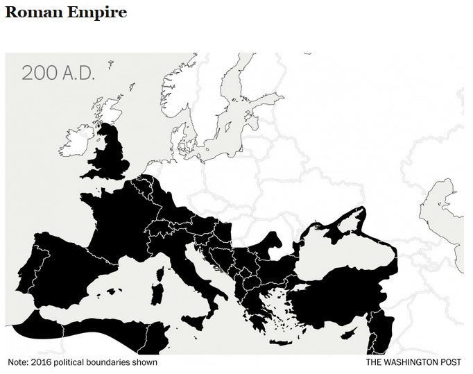
The predictable . . .

The combinations we learned in school, but immediately forgot . . .


And the obscure and charmingly insignificant . . .
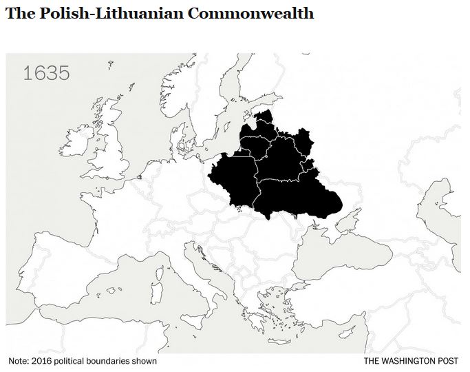

For the record, the Polish-Lithuanian Commonwealth apparently existed between the 14th and 18th centuries.
And it even included a Grand Duchy.
