
Edinburgh Castle dominates the upper end of the Royal Mile; Holyrood Palace, the royal family’s Edinburgh residence, anchors the lower end. More importantly, though, that end of the Royal Mile is the site of Arthur’s Seat, which we saw from the castle, and we wanted to start our morning with a hike up that hill and take in some great views of Edinburgh.
As it happened, the Edinburgh Marathon was held the same morning, and the stragglers were still on the Mile while we headed to our hill:

Later that evening, we hung out with one of the race participants in a pub on this end of the mile:

Also along the Royal Mile in this direction were a few odds and ends worth noticing. First – and we should have included this in our Upper Mile post – the Closes of Edinburgh:

Edinburgh’s multistory tenement buildings lining the Royal Mile effectively form a wall that’s not punctuated by very many roads. You’ll walk blocks without a road piercing the buildings on either side, so it feels a little like a canyon. What it IS punctuated with are dozens of narrow, cramped passages that lead from the street to behind the buildings. With that, here’s some more details from this Amusing Planet article:
“The Old Town of Edinburgh, Scotland, consisted originally of the main street, now known as the Royal Mile, and a large number of small alleyways that led off it to the north and south. Some of these lead to open courtyards and are therefore called ‘courts.’ Others are open thoroughfare wide enough for a horse and cart, and are called ‘wynds,’ a reference to the way they wind along. But most of these alleyways are called “closes,’ because they lead to private property and are hence gated and closed to the public. Back in medieval times, Royal Mile was lined with individual plots of land with paths to gain access to the land behind. As each plot became built up over time, these paths or closes developed into narrow lanes connecting courtyards and streets behind the Royal Mile. Tall buildings on both sides gave many closes a canyon-like appearance and atmosphere. Most closes slope steeply down from the Royal Mile. For anyone walking down the long flights of stairs, it creates the impression of walking into the underground.”
There’s a very cool detailed map of the Closes here which is worth a look to get an idea of what a hive of holes the closes form between buildings.
Back on our way down the road to Arthur’s Seat. Here’s another little item encountered on the way, of interest to one of us with some experience in water resources:

And, another cool fountain head to add to our collection (the best of which, from Arles, used to serve as our avatar on WolfeStreetTravel and continues to serve as such for our TripAdvisor profile):

A block further, there’s a plaque to Golfers Land from the 17th century and a crest featuring a fist grasping a golf club:


Here’s some explanation from this Atlas Obscura article: “It’s what’s left of a house owned by John Paterson, a cobbler by trade and a golfer by talent. Paterson’s swing was so well-known that the Duke of Albany at Holyroodhouse summoned him in 1681 to settle a dispute with two English noblemen who claimed that golf was an English game.
Though Scottish Parliamentary edicts dating to 1457 make mention of golf, there was only one true way to settle this. The good duke, who would later take his confrontational ways to the throne as James VII of Scotland / II of England, paired up with Paterson at Leith Links to take down the cocky Englishmen. The showdown is now known as the first international golf match (with the first recorded use of a caddy also, as the duke couldn’t be expected to carry his own clubs during such a round).
The royal skin in the game yielded a substantial winner’s purse, which the duke generously split with his cobbler ringer. Paterson promptly put his share into the house at 77 Canongate, calling it Golfer’s Land, and the duke had an escutcheon added to the outside with heraldic touches befitting the achievement. Its Latin inscription read:
‘In the year when Paterson won the prize in golfing, a game peculiar to the Scots (in which his ancestors had nine times won the same honor), he then raised this mansion, a victory more honorable than all the rest.'”
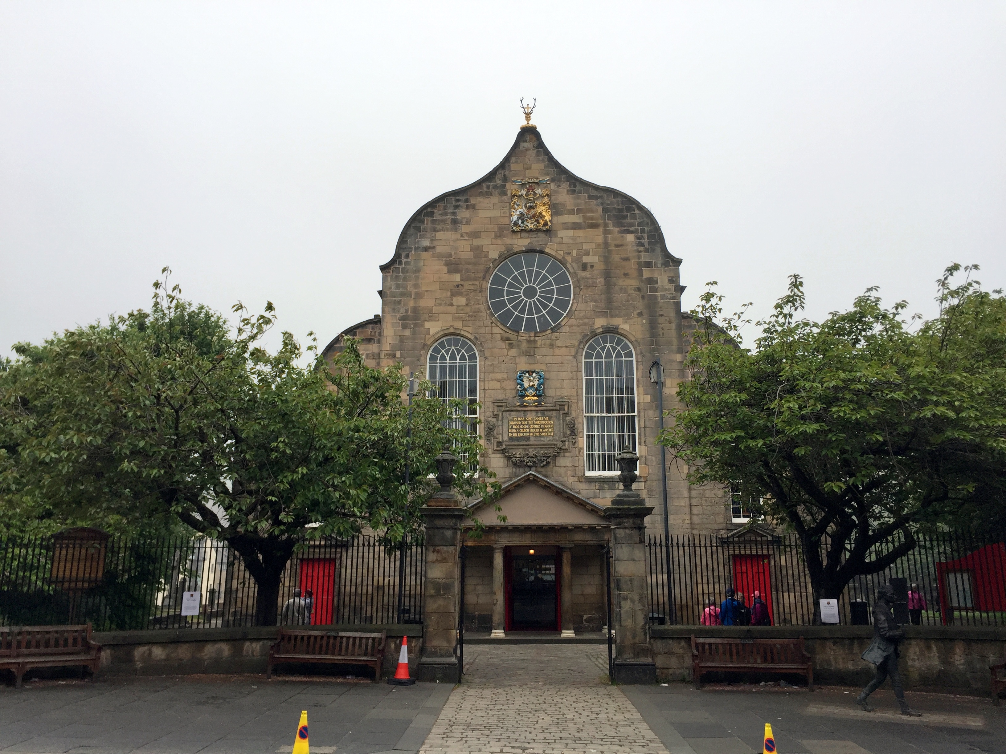
Still further down the Royal Mile toward is the Kirk of the Canongate, which serves as the church for Edinburgh’s Old Town and, more specifically, Holyrood Palace. As a result, this is the royal family’s church when they’re in residence. It’s topped by the same deer-with-a-cross-stuck-in-its-head bust as found later at the gates of Holyrood.
And in the graveyard next door lies Adam Smith’s grave site to accompany his monument up the Royal Mile next to Giles Cathedral:

Scotland’s new and very organic Parliament Building, designed to evoke the highlands (we don’t really see it):


At this point, we’re at the end of the Mile, but Arthur’s Seat was totally fogged in. Although Holyrood wasn’t high on our list to see, we figured we’d pop in and check it out while we waited for the sun to do its work and burn off the fog so we could benefit from a real view at the top of the hill. Holyrood Palace has been the Edinburgh residence of the royal family since the 16th century. The name originally applied to the adjoining Augustinian abbey, which predated the palace, and refers to a vision that King David I had while hunting, where he encountered a deer with a piece of the true cross jutting out of its head (as far as we could discern from our materials, but who knows?). Regardless, there’s a deer head with a cross topping the gate, so there’s that.


A magical unicorn on a nearby wall and the ubiquitous anatomically correct crest atop the entrance to Holyrood House:


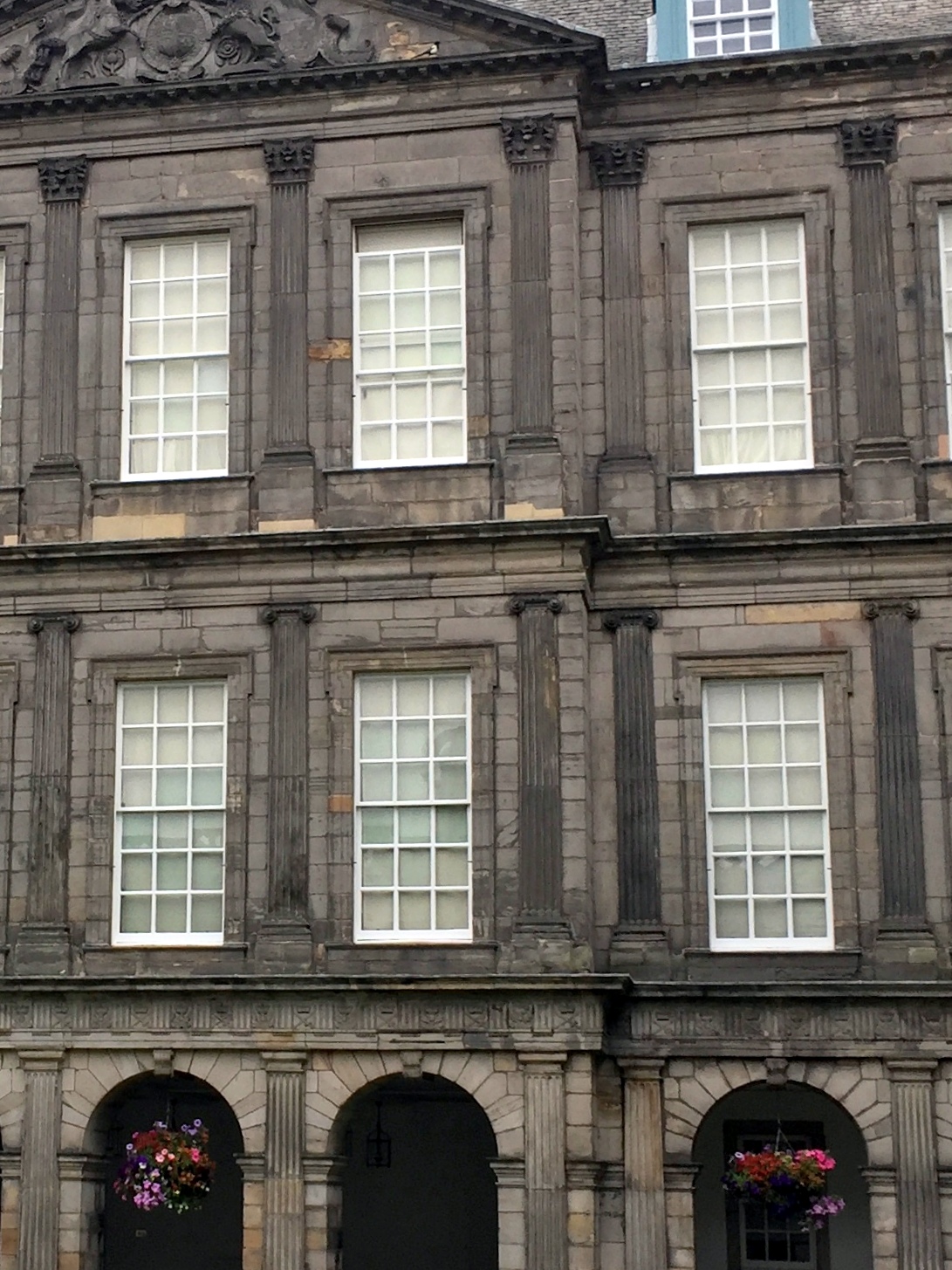
Cloister-like courtyard of Holyrood Palace, featuring what we thought was a pretty cool design element using the capitals of the columns.

As you move up from the ground floor to the third floor, the capitals increase in complexity according to the orders of Greek architecture. The first floor features Doric capitals, the second Ionic, and the third Corinthian.
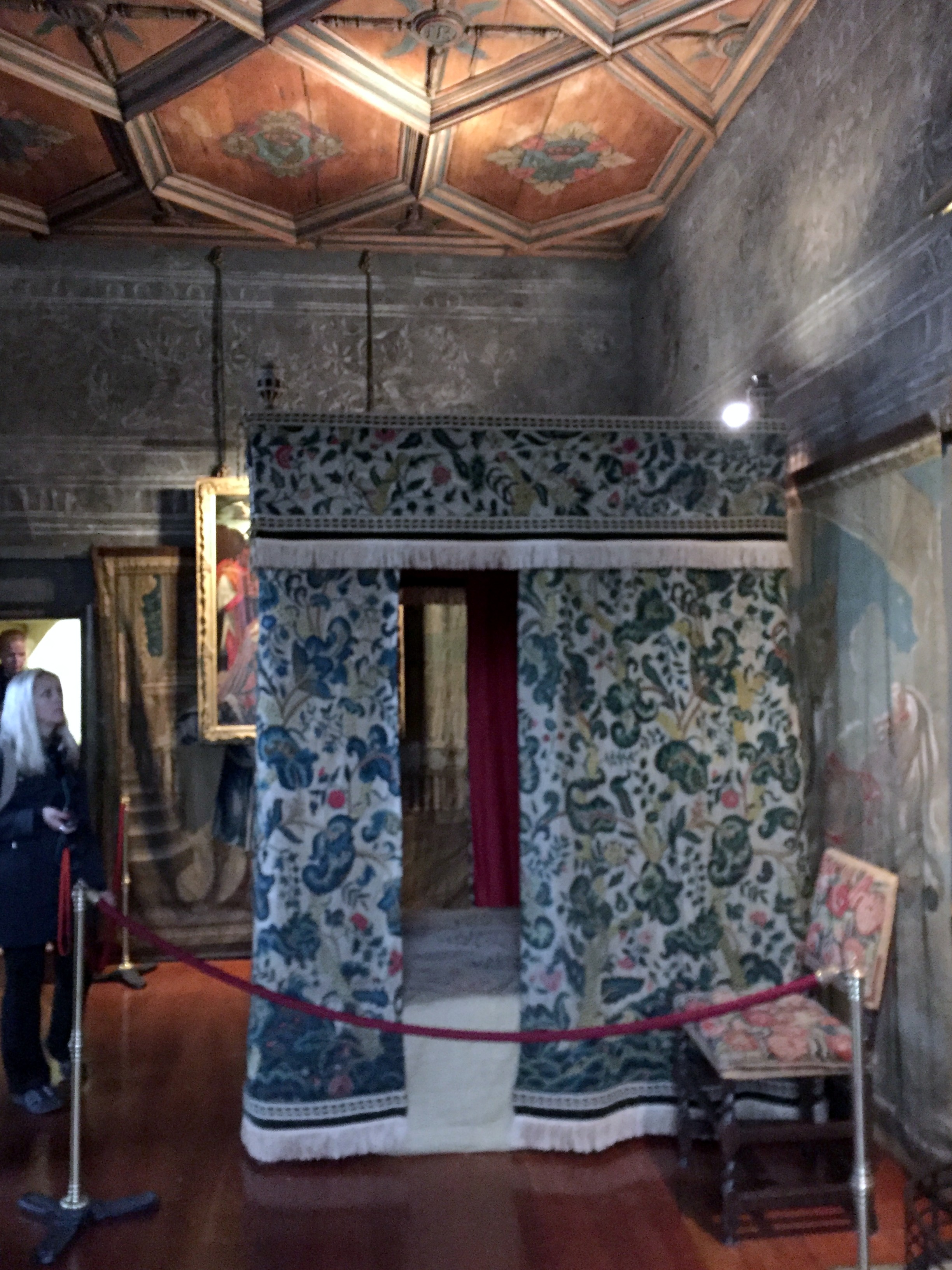
A surreptitiously taken picture of Mary Queen of Scot’s room, from which her advisor was dragged and stabbed to death by Elizibeth’s agents during Mary’s forced residence in the palace (also featured in Ken Follet’s “A Column of Fire,” the last book in the Kingsbridge trilogy (which is really great, if you haven’t read them)):
Adjacent to the palace is the ruined Holyrood Abbey, founded in 1128 by King David I and lying in ruins since the 18th century. Holyrood Abbey was the site of the coronations of James II in 1437, Margaret Tudor in 1504, Mary of Guise in 1540, Anne of Denmark in 1590, and Charles I in 1633.


We took the scenic route through the palace grounds back to the Royal Mile and the trailhead to Arthur’s Seat, and encountered this terrifying nugget of garden statuary:


Ghaa!
Escaping back to the palace courtyard, we ended our tour in front the north-west tower, the oldest section, dating to the 16th century.

We had anticipated that the fog would have burned off Arthur’s Seat after our tour of Holyrood. Nope.

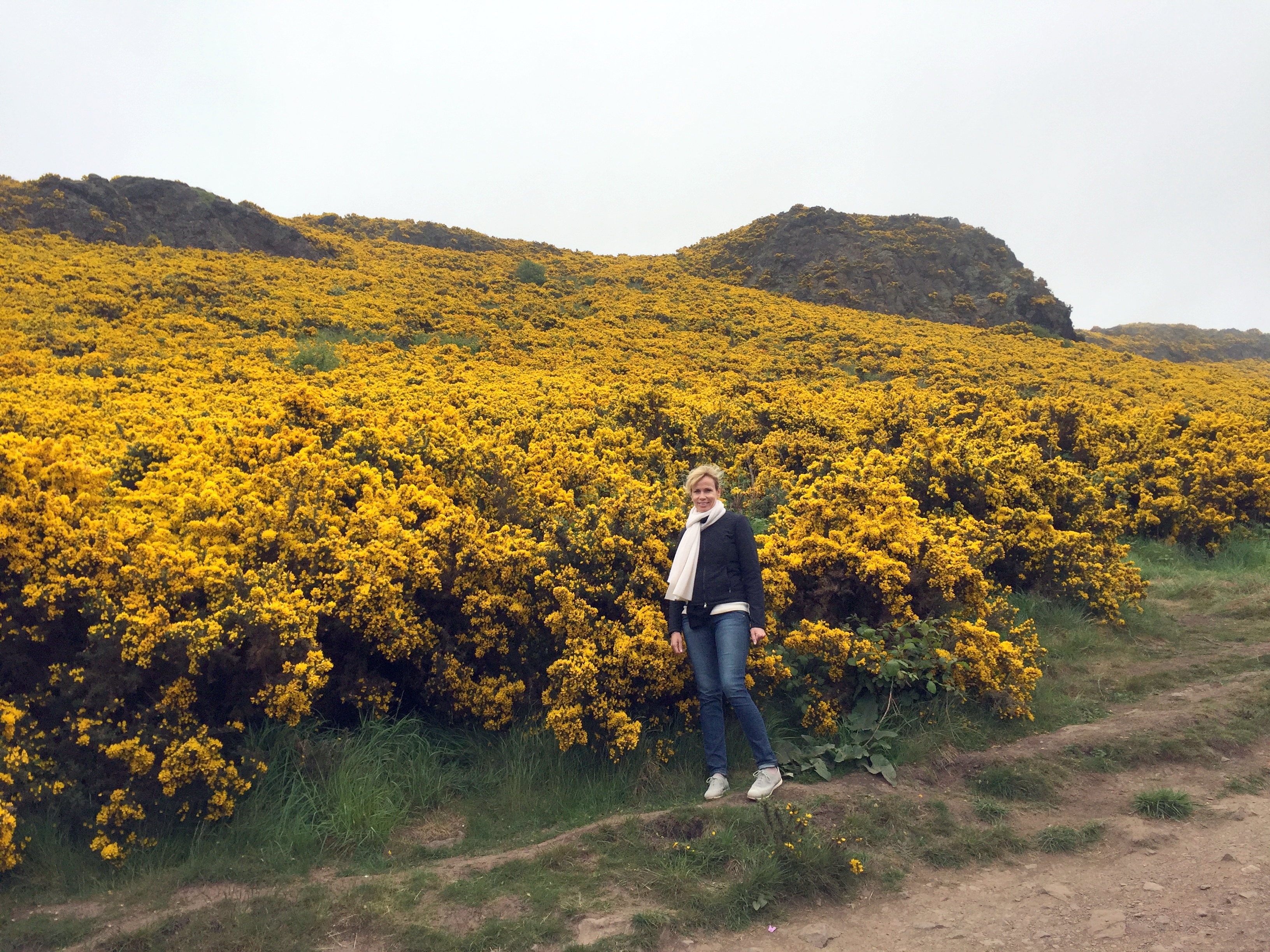
No matter. We began our climb up the extinct volcano with uncertain name origins (don’t assume it’s named after King Arthur, who was, after all, a Welsh or English concoction, not a Scottish one). We were still hoping that the late-morning sun would help us and we’d have our view at the top of Edinburgh. On the way up, we finally got to see what was creating the yellow carpet on the mountain that we saw from Edinburgh Castle – shrubby gorse in full bloom:
Here’s our view from the top:
Seriously! Zero visibility:


Fogged in all the way back down – and nice hair, as a result!


Kevin–you’ve GOT to publish…..
LikeLike
But we do! Right here!
LikeLike