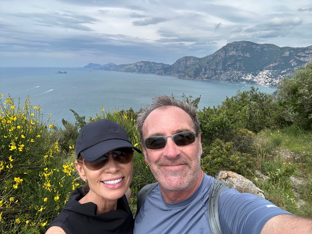
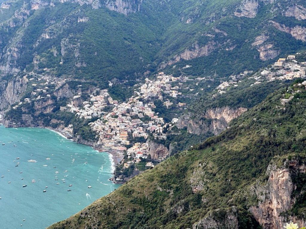
From Herculaneum (and Naples), we originally had planned to head next to Sorento on the Amalfi Coast, and then to Positano. A couple we met in Botswana on safari in 2018, who’s travel style is almost identical to ours, and who we keep in touch with, advised against this. They travel in Italy at least twice a year, and had a lot of insight into the Amalfi Coast, in particular. As far as Sorento went, they found this to be devoid of charm and recommended instead that we spend a few days just opposite that town, on the island of Capri. So we cancelled our Sorento reservations (this discussion occurred during our planning phase) and found a cool place on Capri instead, which is where we headed next. (We’ll cover the Positano issue in the next post.)
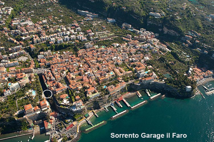
Our only experience with Sorento came from our parking and the ferry dock to Capri, since both took place there. Parking was a trip for one of us and deeply traumatic for the other. After careening down a series of urban switchbacks from the center of Sorento down towards the dock and passing a couple of parking lots on the way (that we sped on past because we had no idea how much further ahead the ferry dock actually was, and we had luggage), we passed a portal leading to a cave in the face of the high cliff that abutted the road we were on. In the cave resided a few piggyback car lifts – a garage! Of sorts. But from the cave portal, we could actually see the ferry dock down a hill. Perfect! Thought one of us. WTF?!? Responded the other when the first suggested we just park there. But park we did – kind of.
The WolfeStreetDriver left the car in neutral (it was a stick), got out, and ran over to talk to the cave people. But he didn’t turn the car off or apply the parking break. As a result, the rental car – with the WolfeStreetPassenger still in it, began to drift down the steep decline straight to the ferry dock and, uh, the ocean. This almost led to a coronary by the passenger at the time and definitely created some residual PTSD that remains to this day. The driver remedied the situation before the car drifted too far, and we successfully dropped the car off at the car cave and arranged to pick it up a few days later, when we thought we’d be back. Then strolled like 50 yards down to the ferry dock and caught the next ferry, which, conveniently, departed in just 20 minutes.
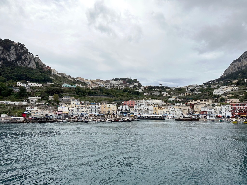
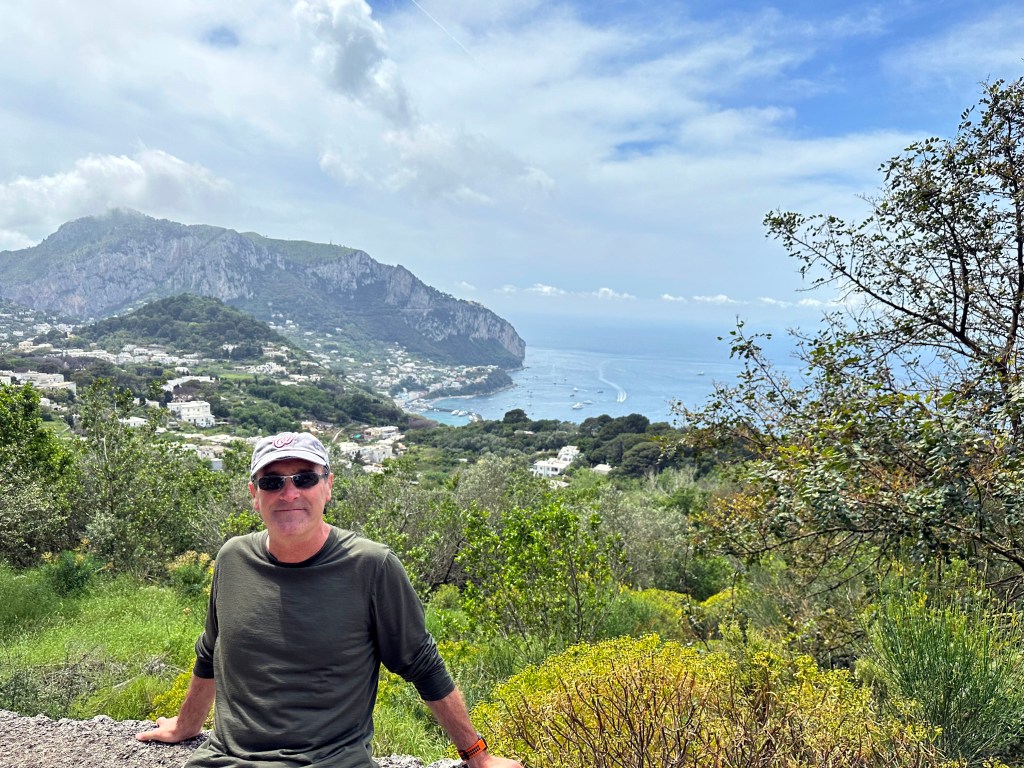
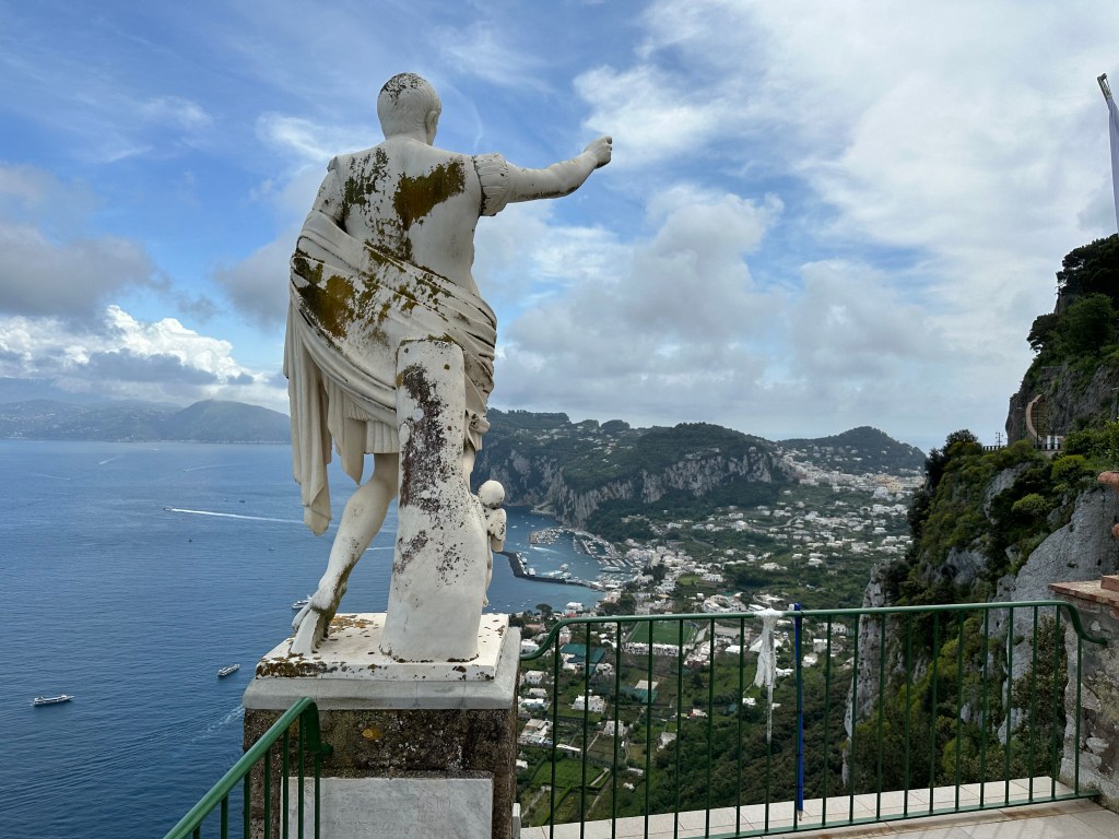
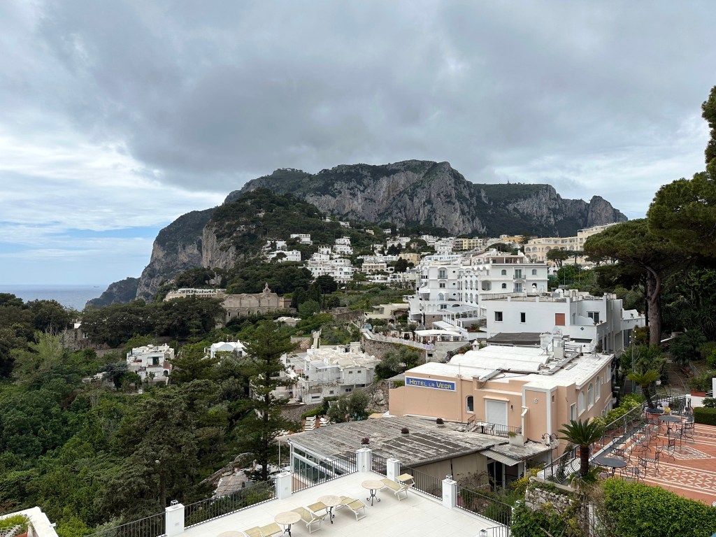
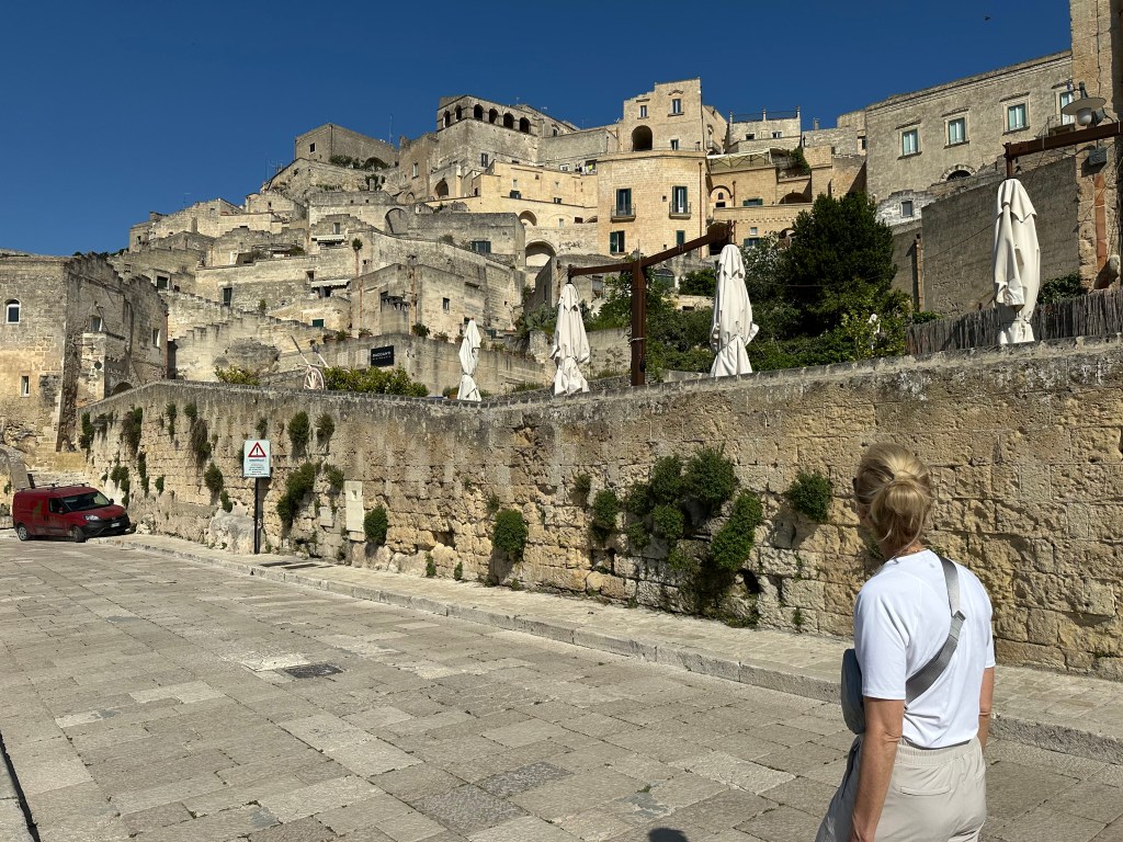
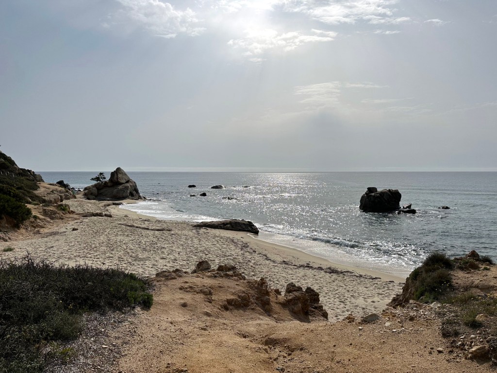
A view of the dock area on Capri. A little misleading, considering how mountainous the rest of Capri is.
To wit, a view from the Gardens of Augustus on the edge of Capri Town:
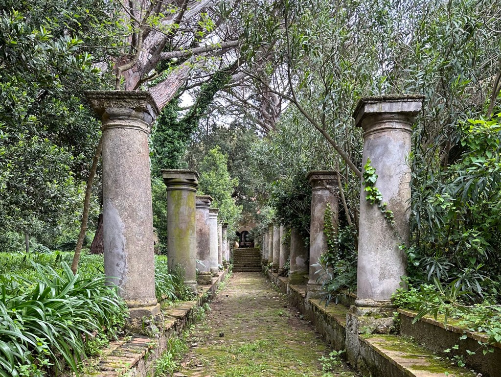
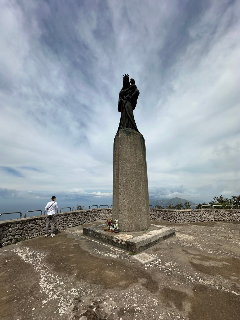
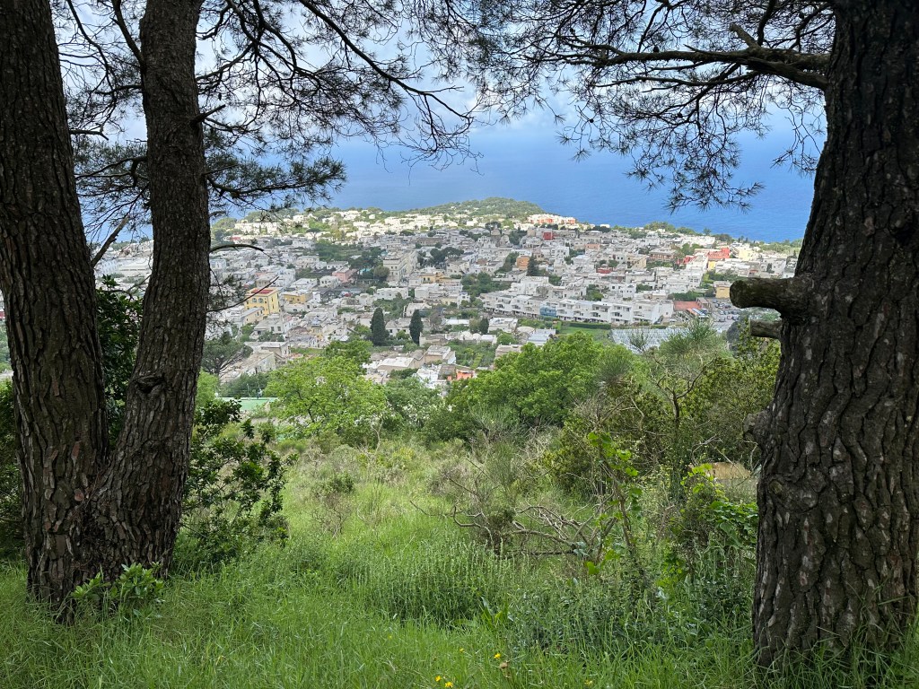
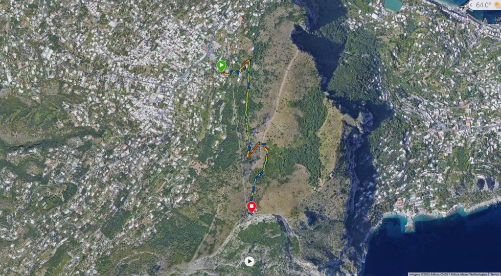
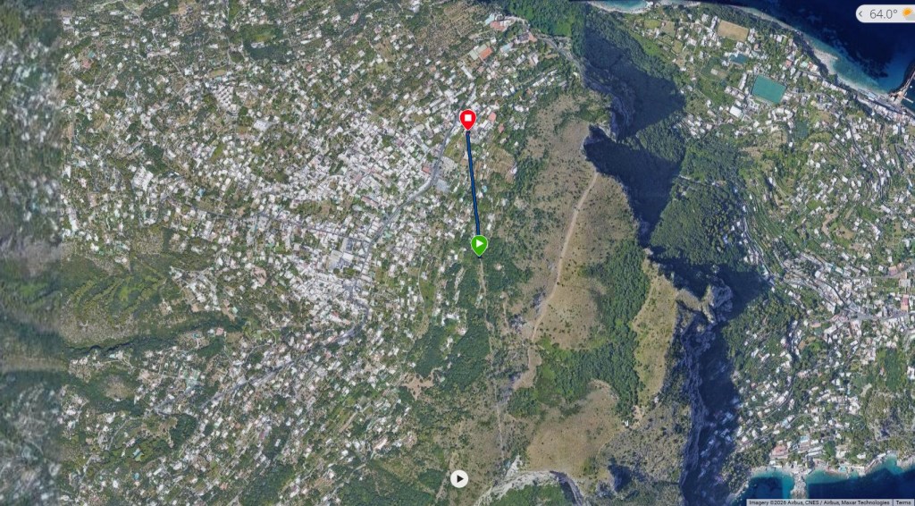
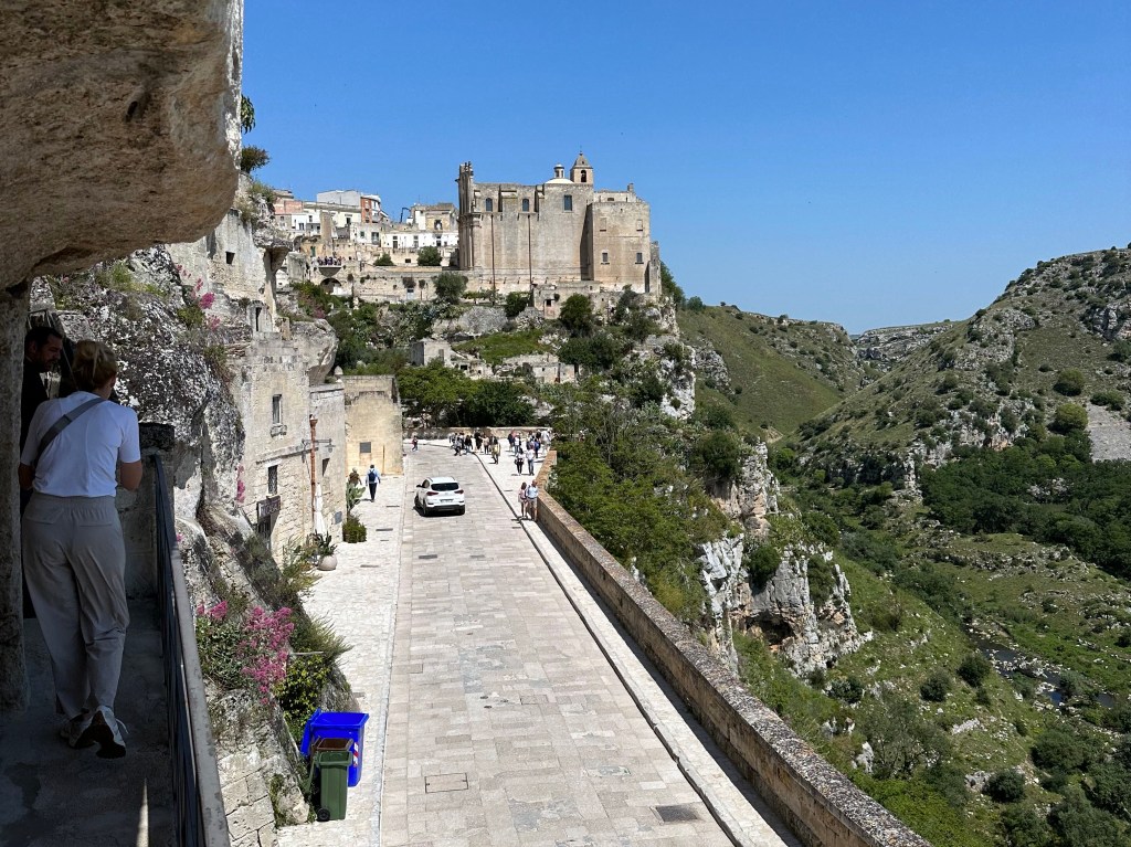
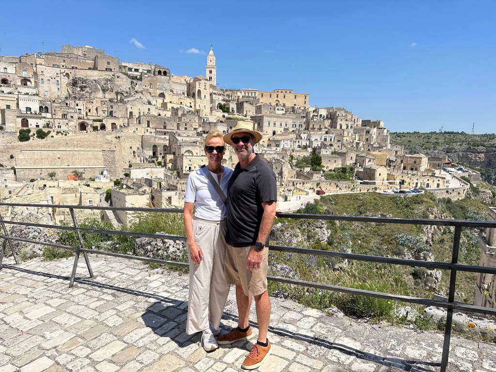
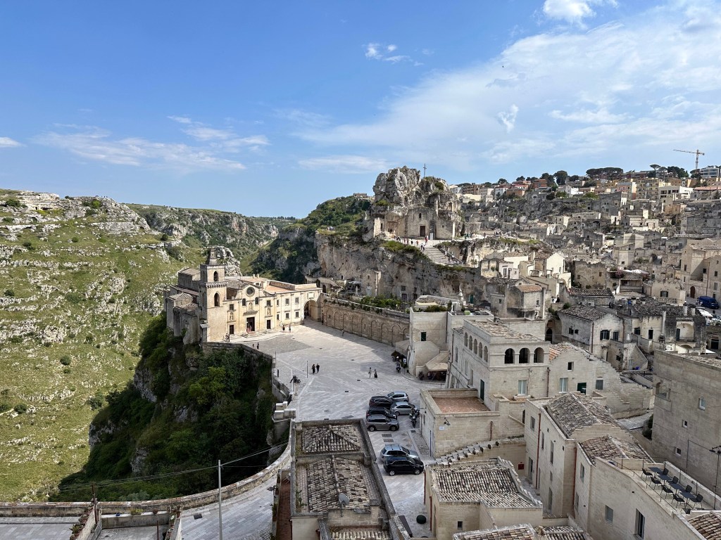
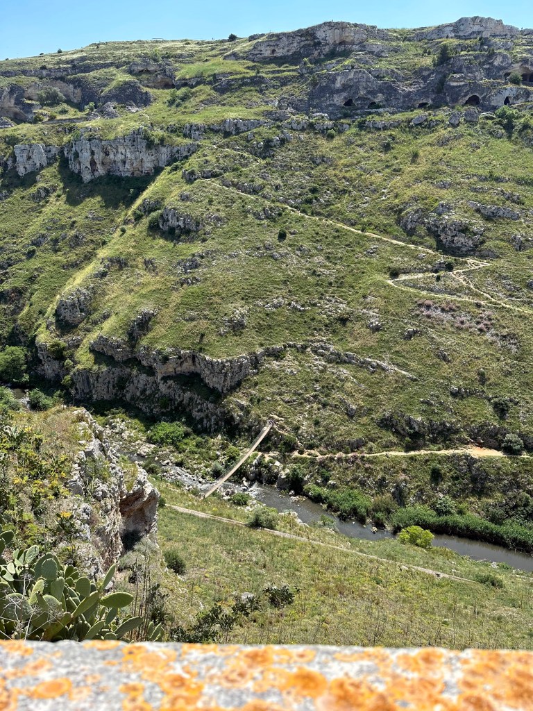
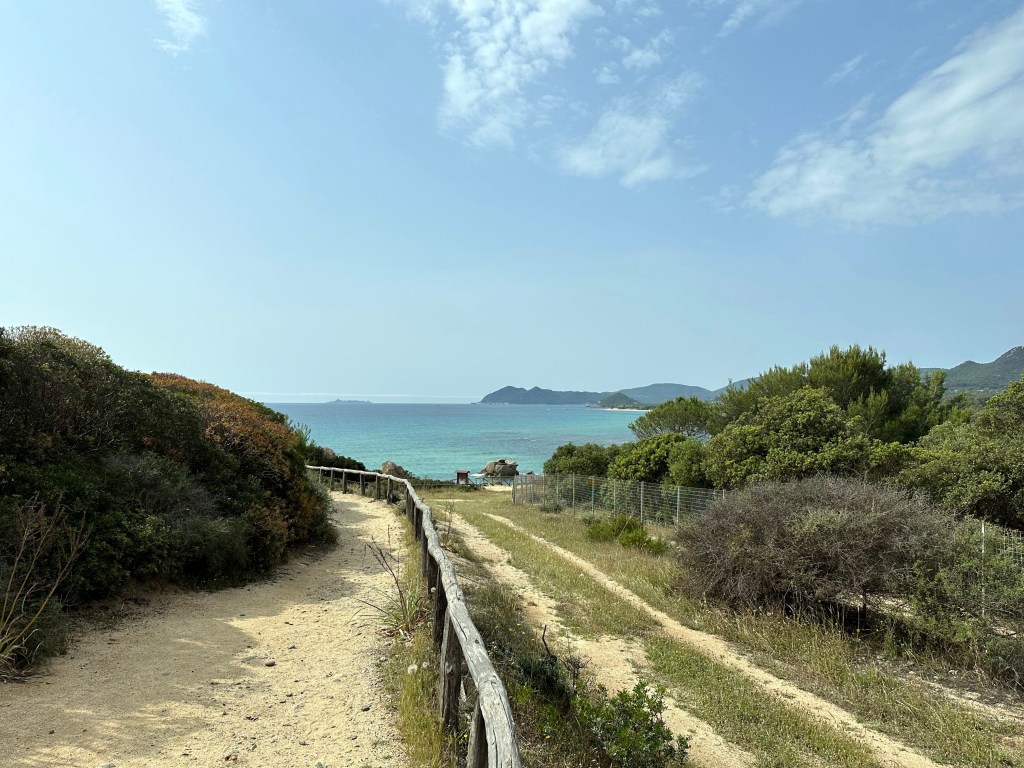
A nice hike from town to a historical location that we wanted to make sure we checked out: Villa Jovis.
Super cool entrance to a villa on the hike there:
Pretty great views along the way:
Another villa’s atmospheric entrance:
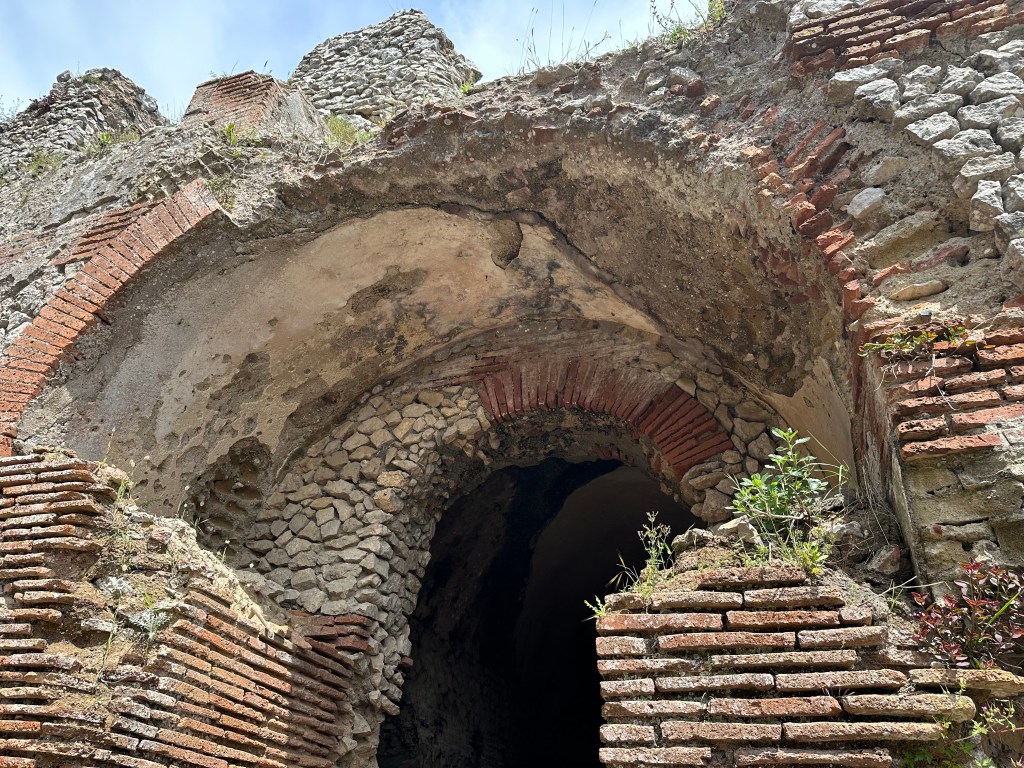
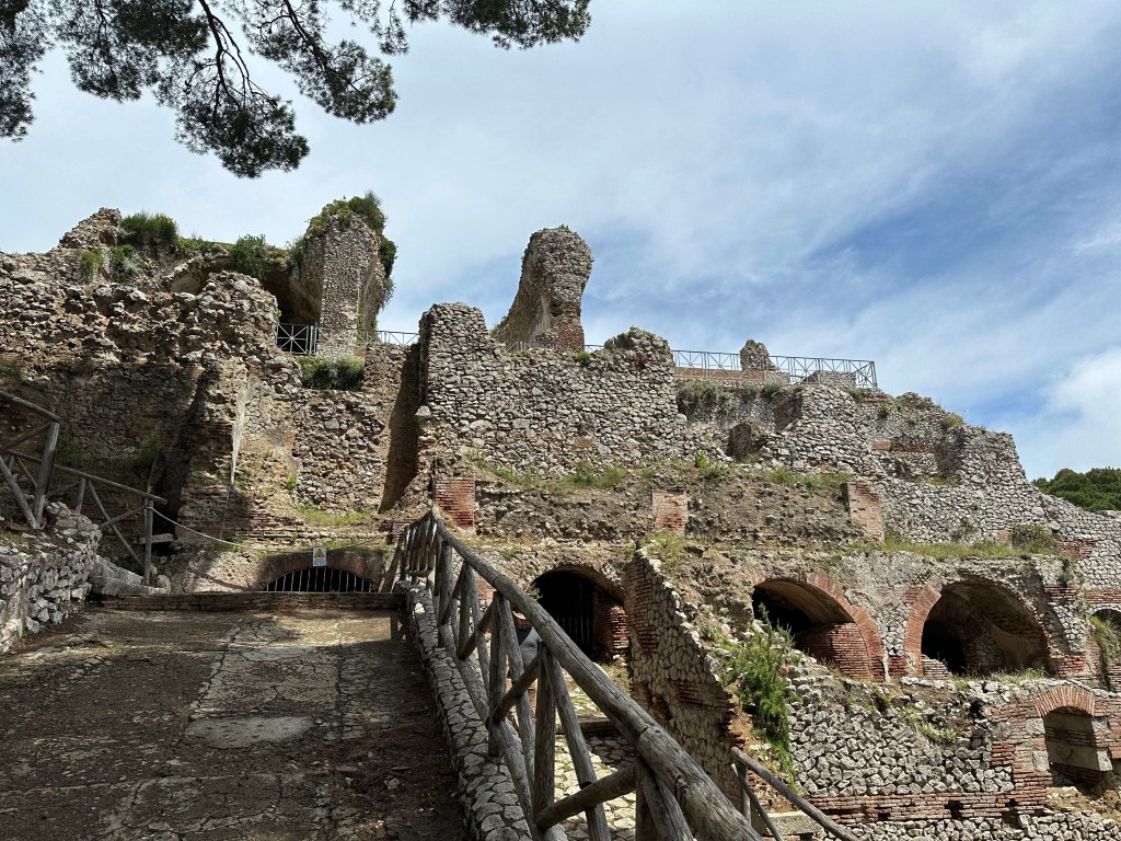
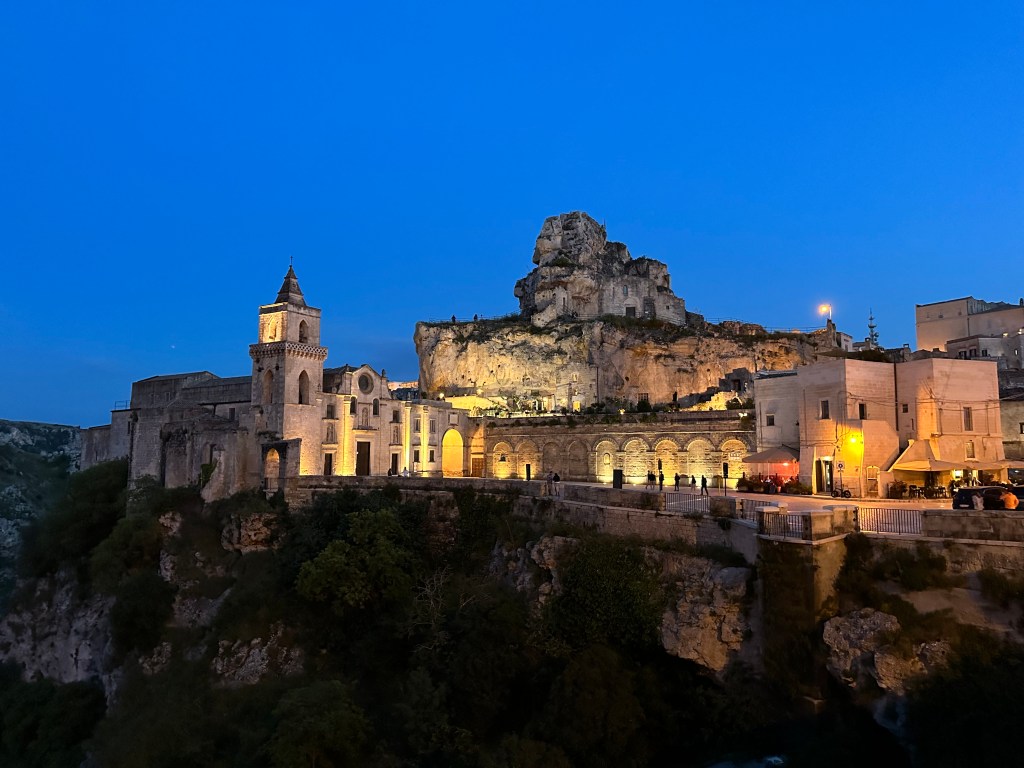
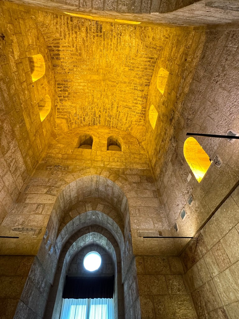
And THE villa! Villa Jovis, accessible only by foot:
Villa Jovis (what remains) holds the distinction as the largest of the 12 villas Roman Emperor Tiberius built on Capri.
Completed in 27 AD, Tiberius spent the last 10 years of his reign ruling from here, away from the bustle – and potential danger – of Rome.
“Apparently, the main motivations for Tiberius’s move from Rome to Capri were his wariness of the political maneuvering in Rome and a lingering fear of assassination. The villa is situated at a very secluded spot on the island and Tiberius’s quarters in the north and east of the palatial villa were particularly difficult to reach and heavily guarded.” (From here.)
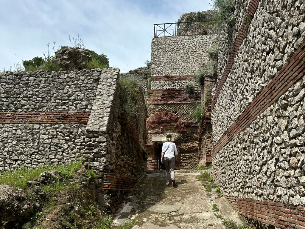
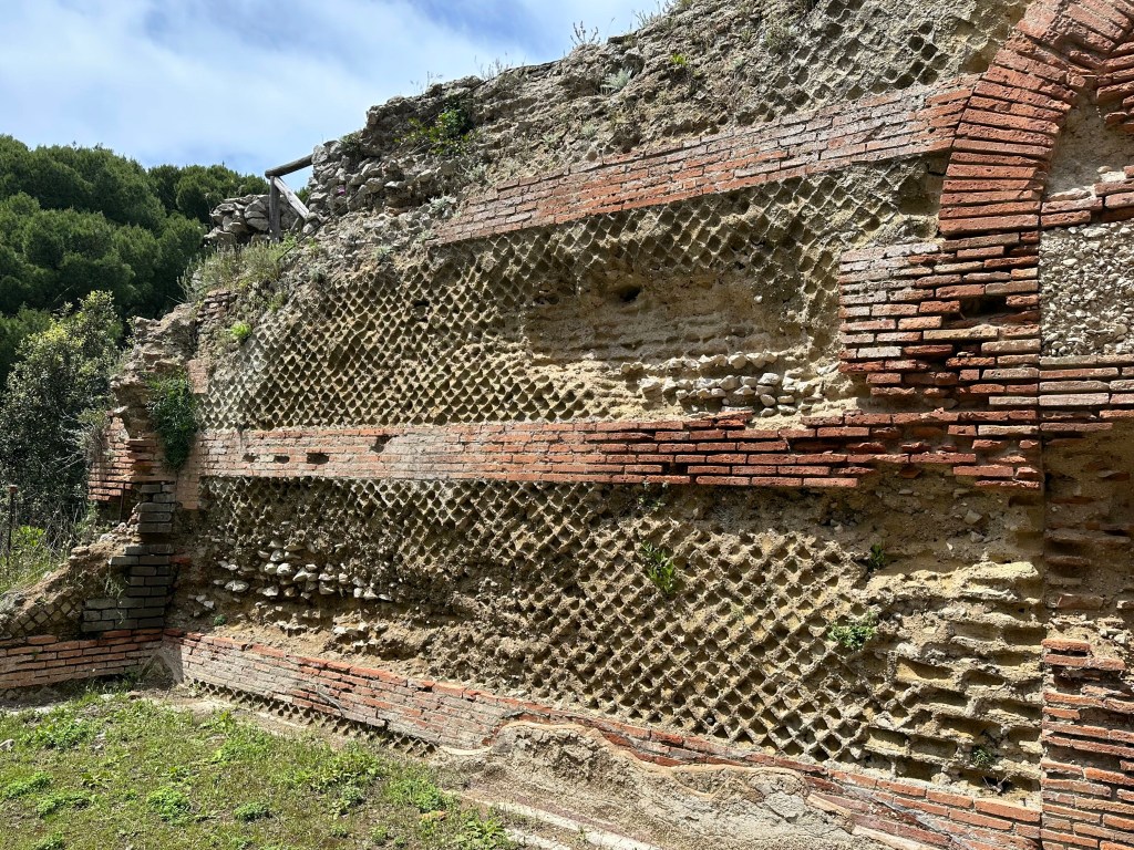
Roman engineering still holding up:
The original structure of the villa, which dates to Caesar Augustus, Tiberius’ predecessor, was restructured to meet the requirements of Tiberius when he chose the island as his headquarters from 27 AD to his death in 37 AD.
Villa Jovis continued to serve as the Imperial residence until the 2nd century AD. Subsequent modifications made in the middle ages. The villa was explored during Bourbon rule in the 19th century and excavated systematically by an Italian archeologist between 1932 and 1935.
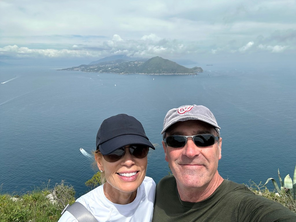
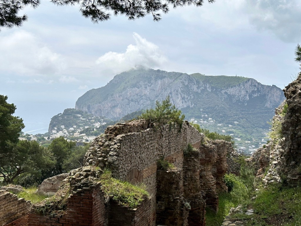
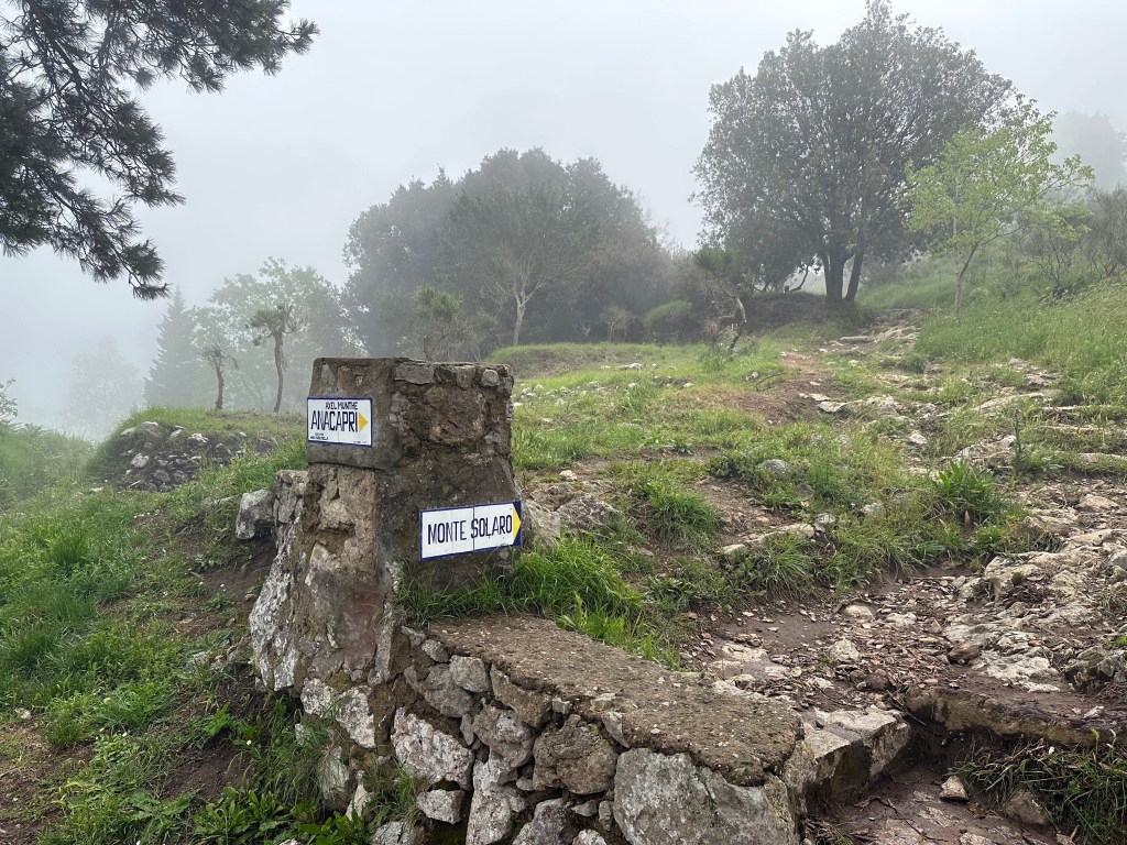
The villa is located atop Mount Tiberio, the second-highest peak of Capri after Monte Solaro (which we’ll get to, to be sure):
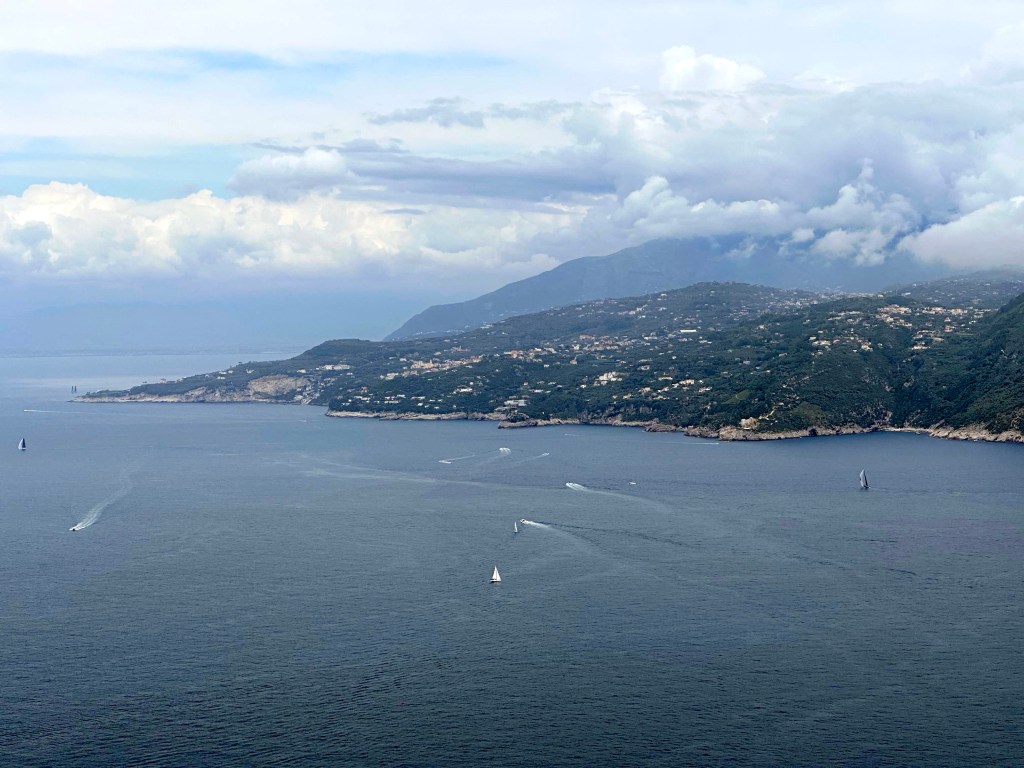
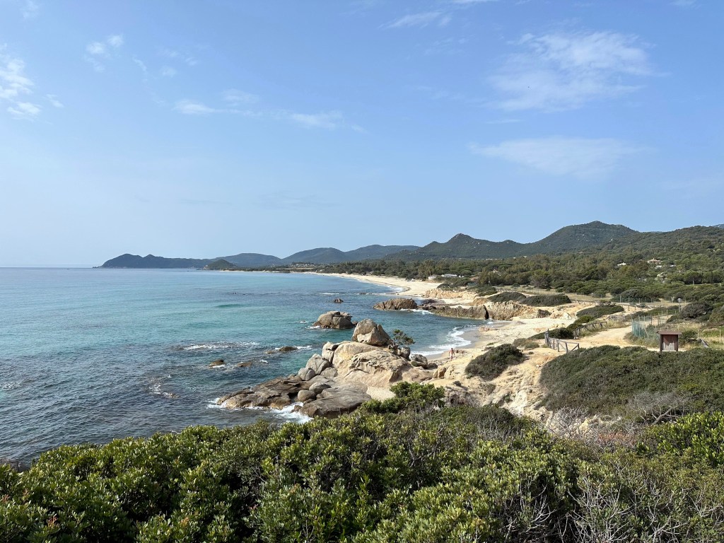
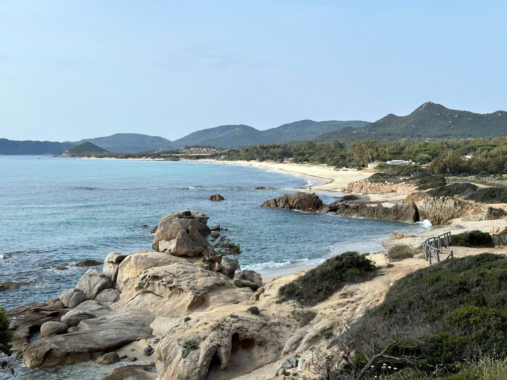
Pretty great views back to other areas of Capri:
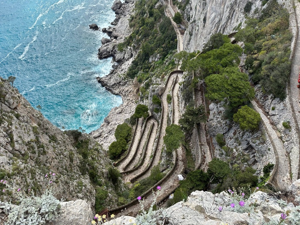
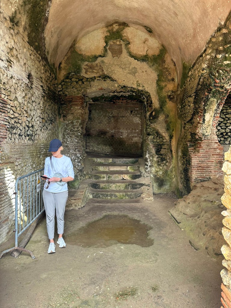
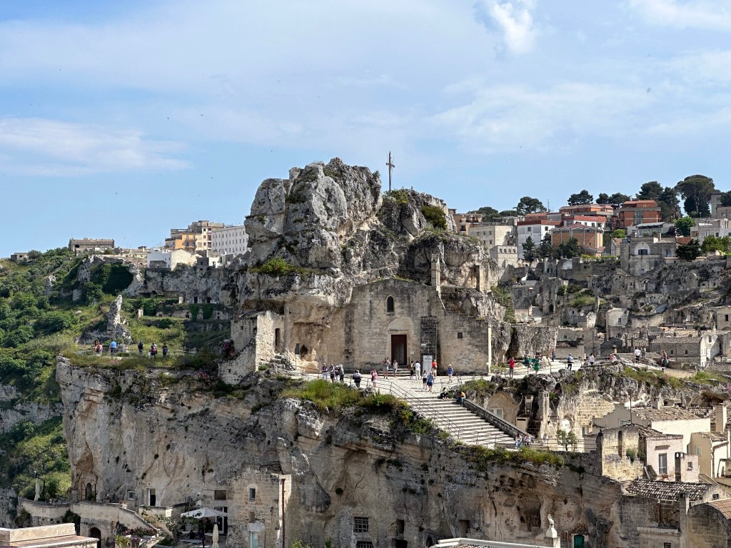
The remains of Villa Jovis’ watchtower (specula) from which messages would be exchanged with the mainland by fire or smoke:
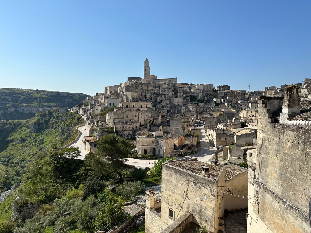
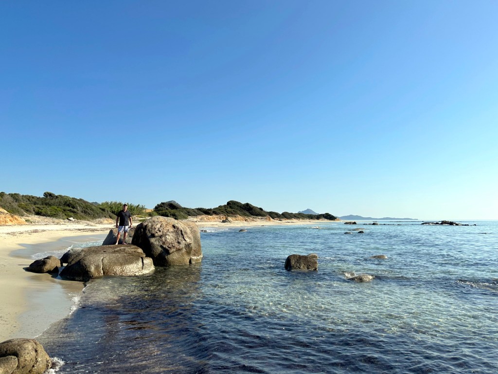
Views still pretty good on the hike back:
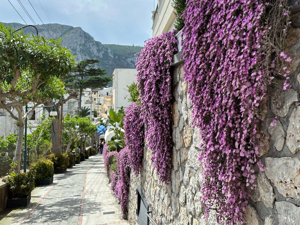
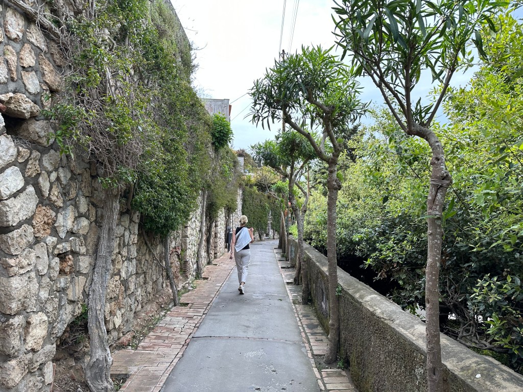
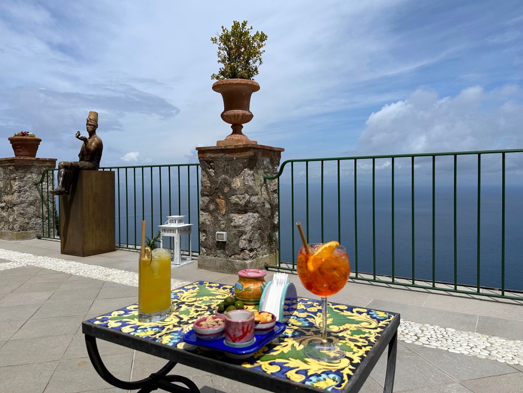
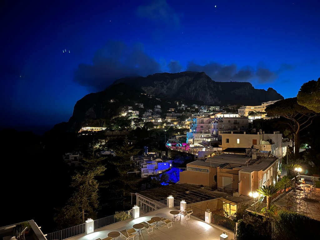
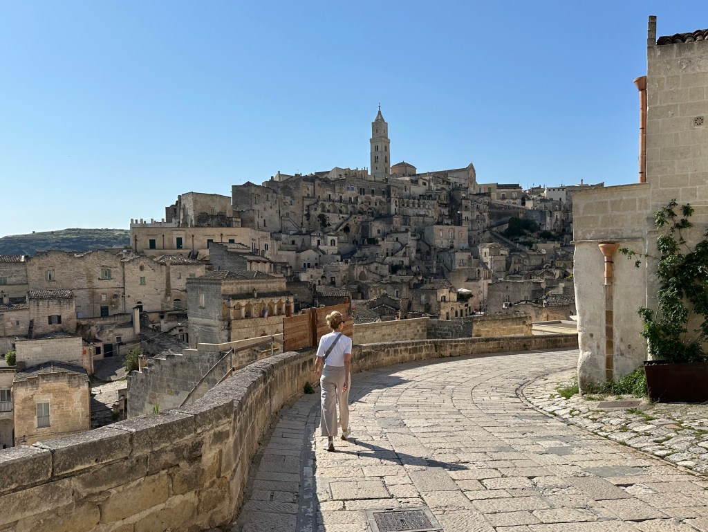
Pretty nice walk into town. One regret is not taking pictures while enjoying aperitivos from Capri Town’s piazetta, where we’d hang out each late afternoon people watching. Pretty great, frankly.
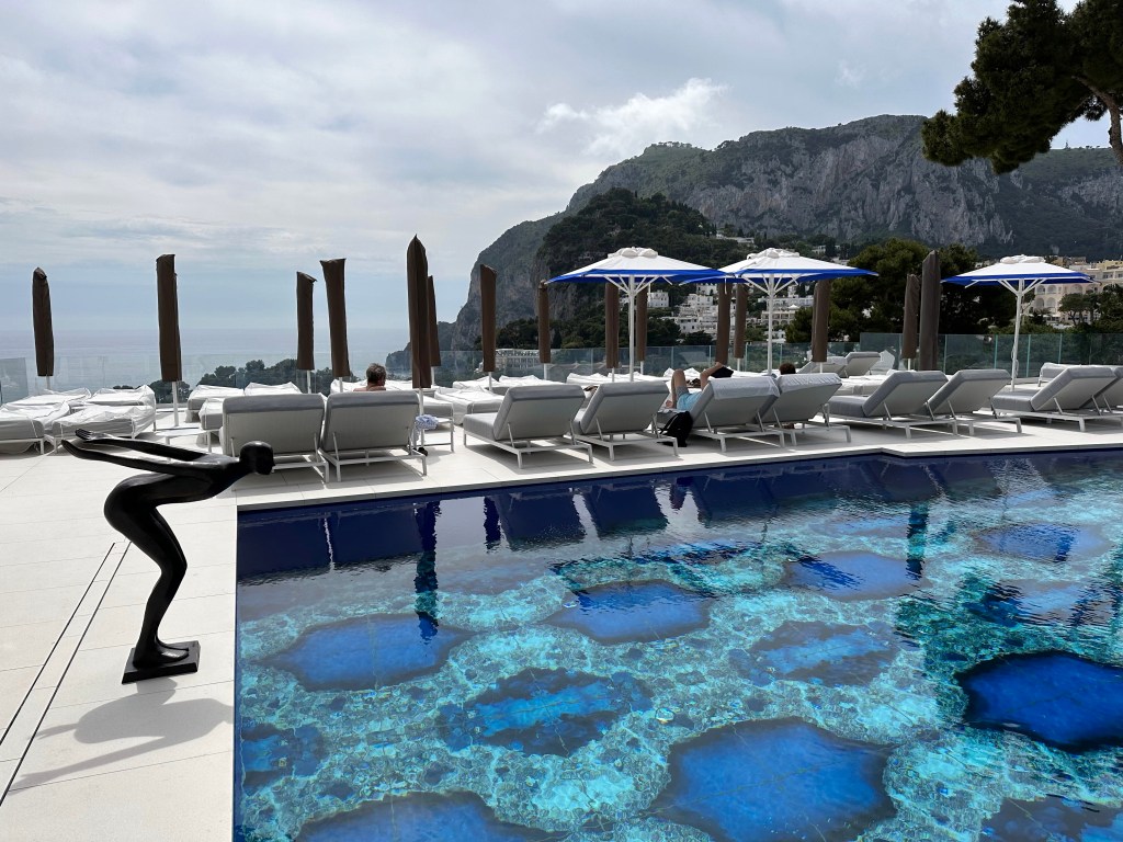
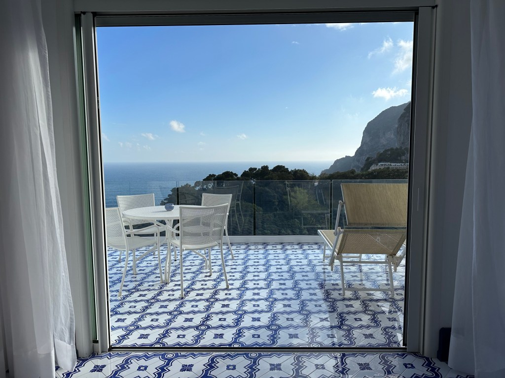
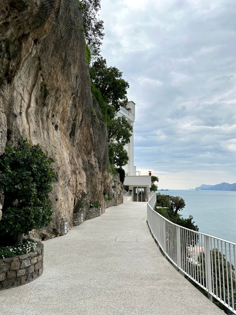
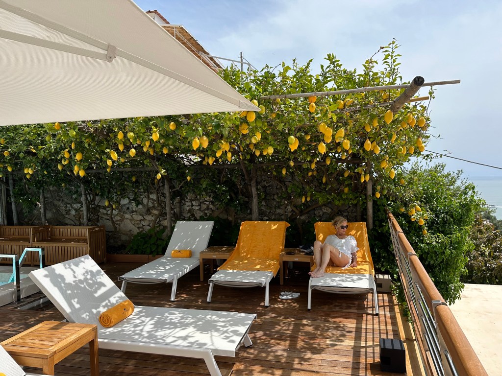
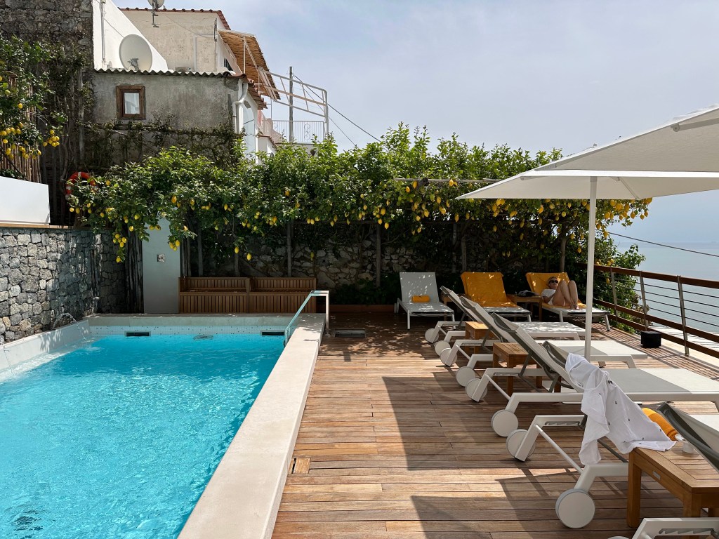
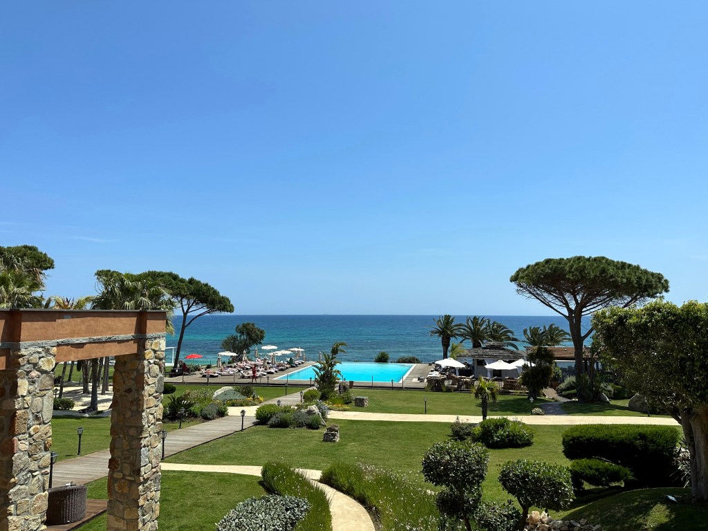
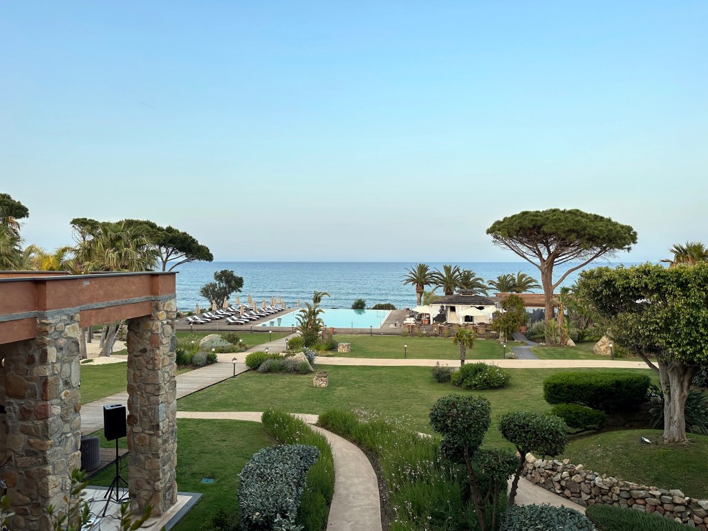
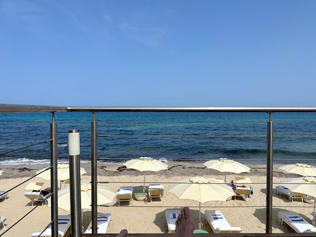
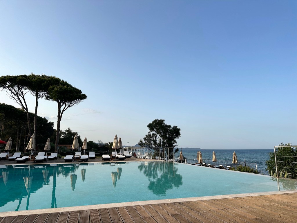
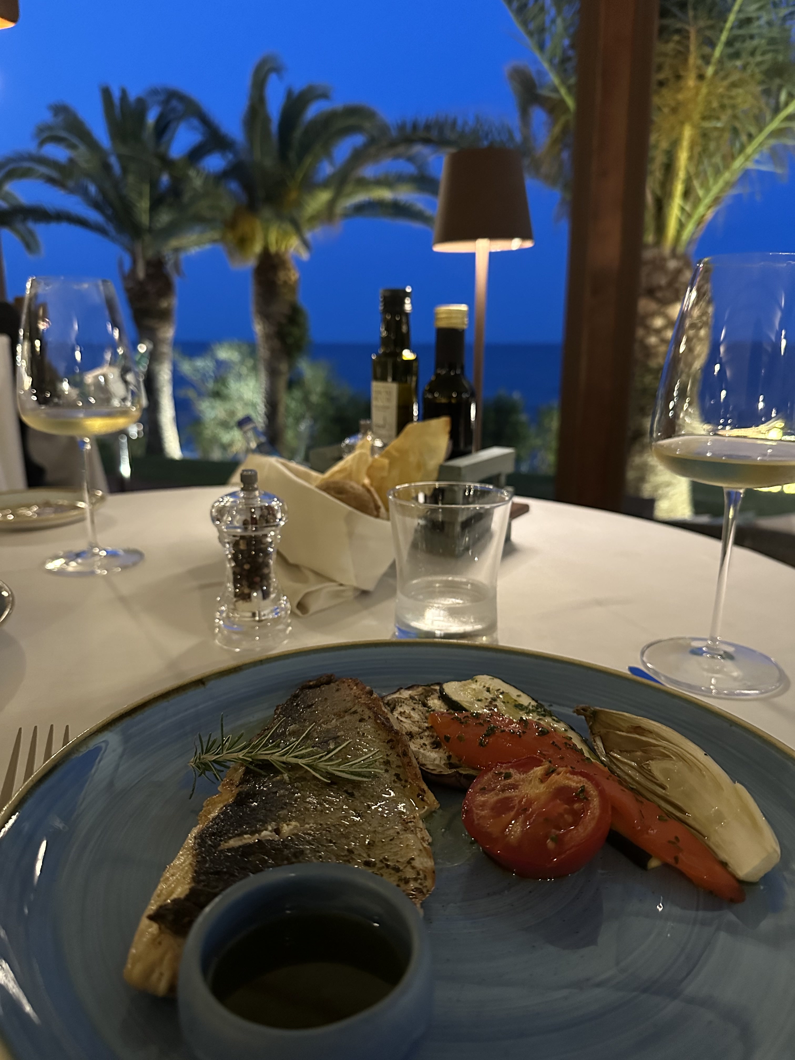
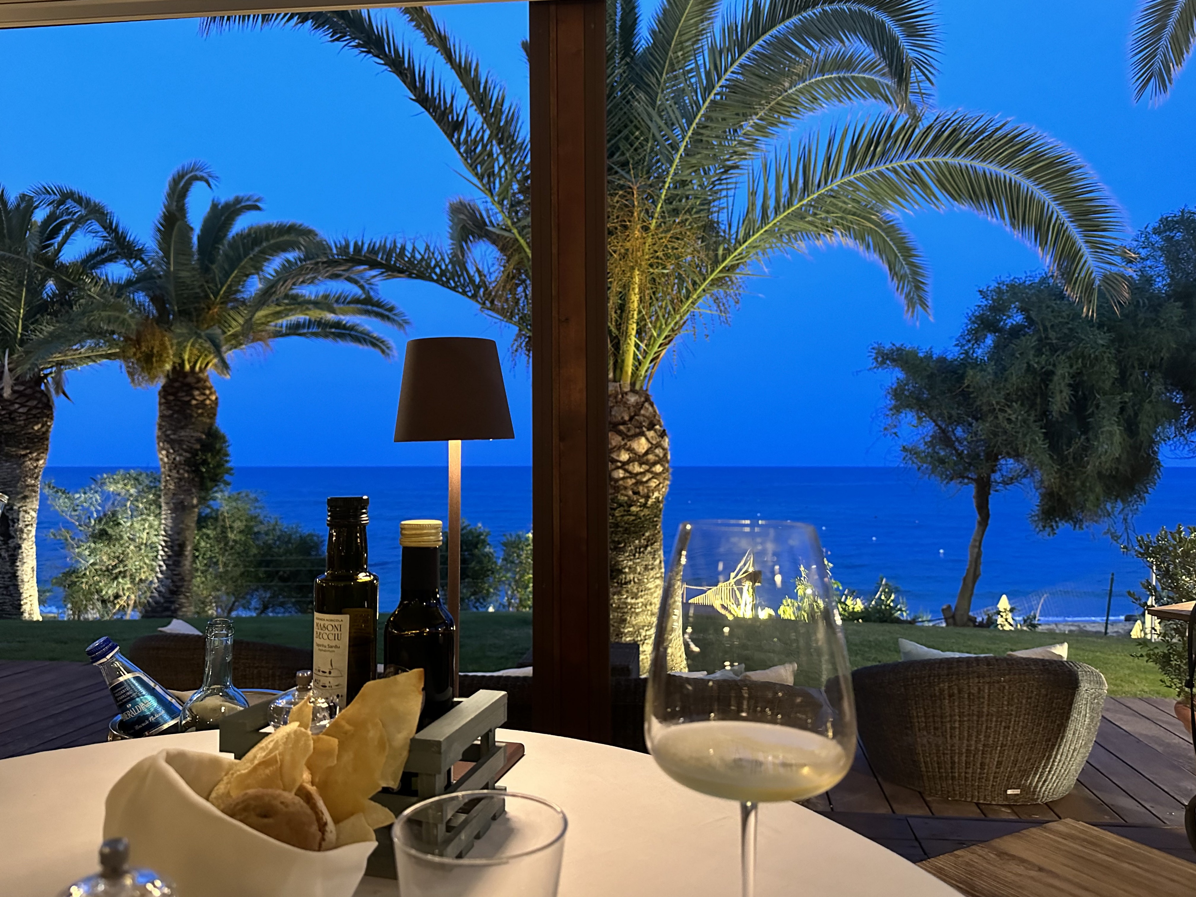
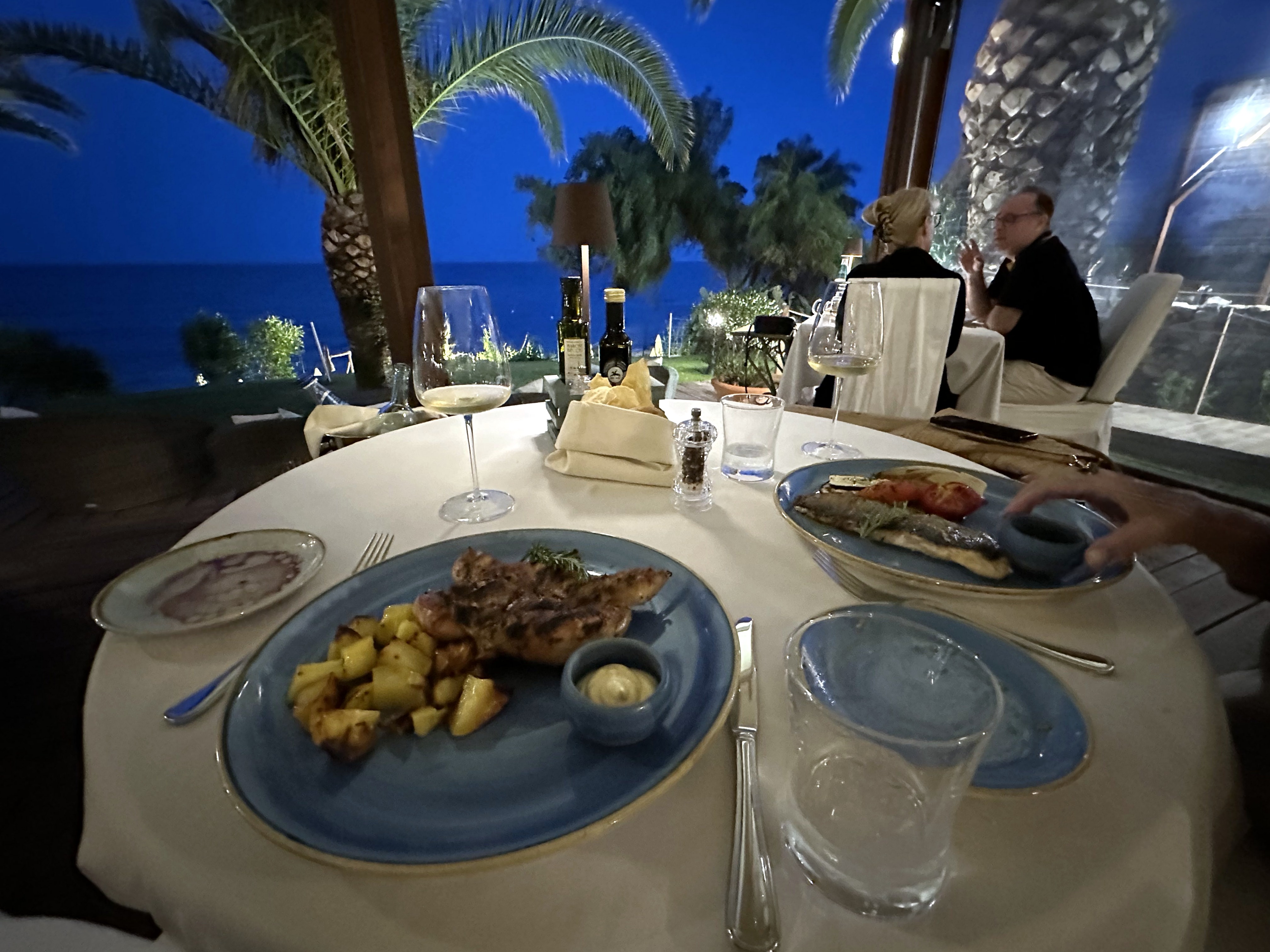
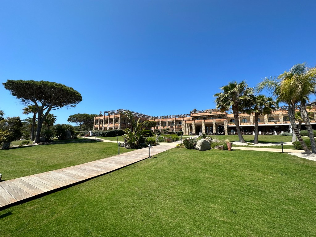
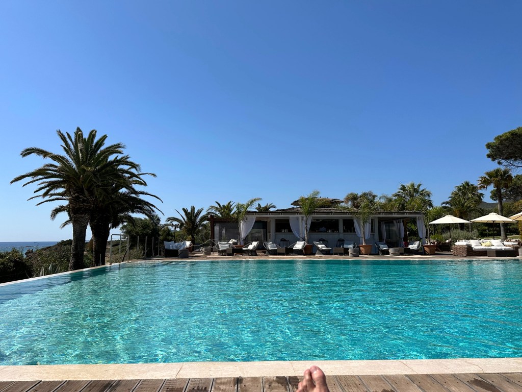
Also, classic Amalfi coast pool setting at our place:
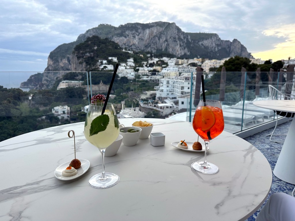
Pre-aperitivo aperitivos at our place before heading to Capri Town’s piazzetta for the main event.
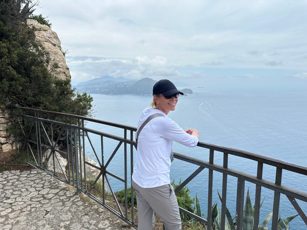
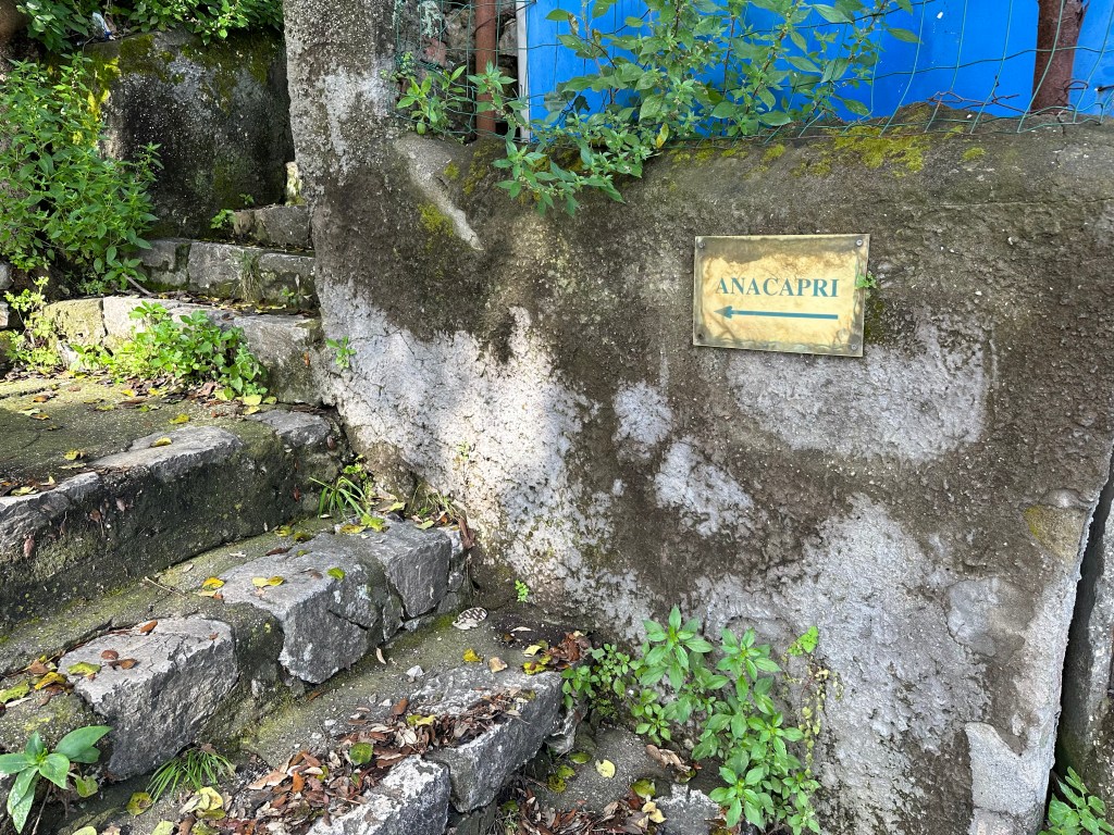
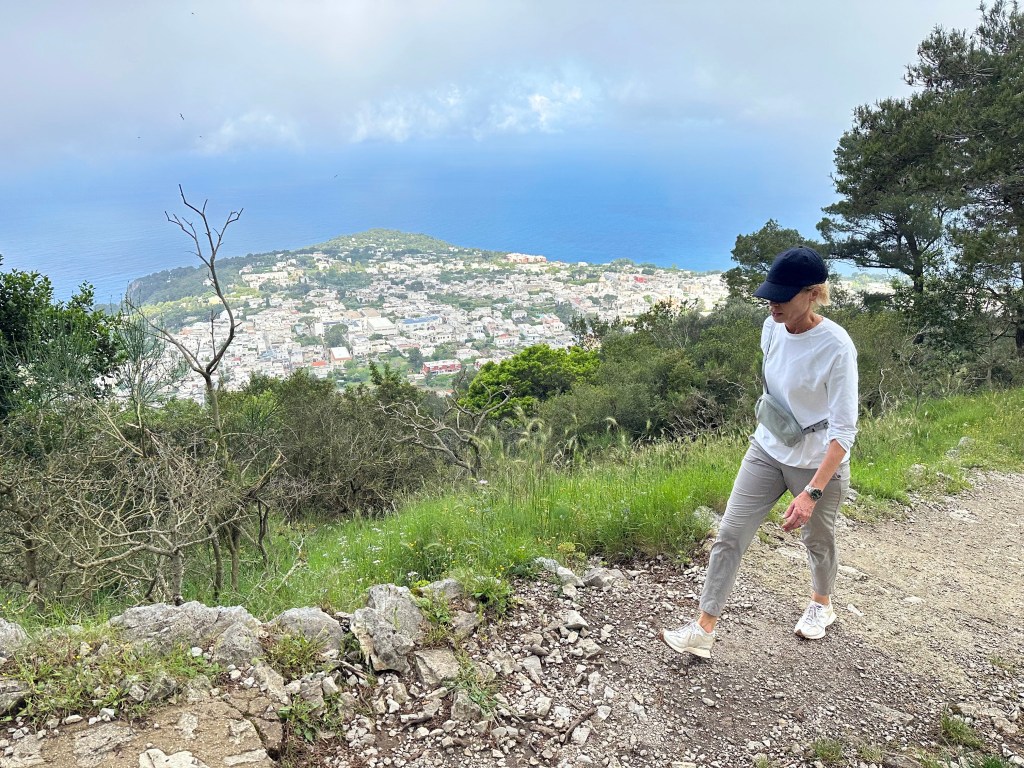
The next day, a hike to the other side of the island and Anacapri.
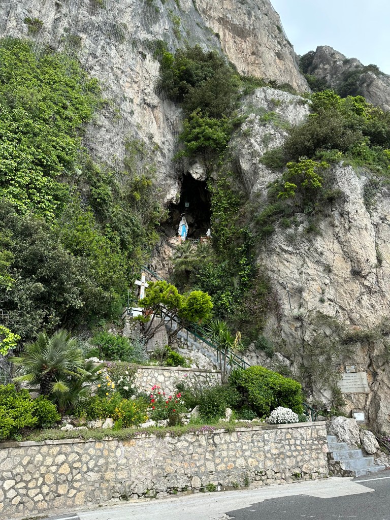
Little shrine on the way:
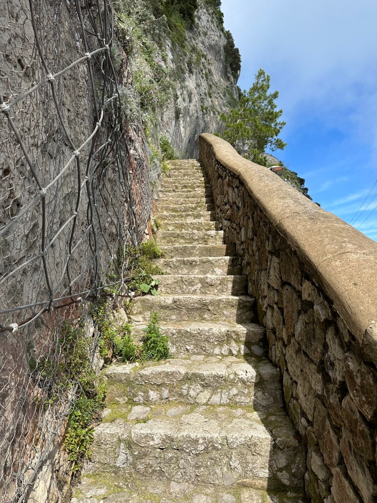
It was a hike, man.
But worth it.
Views on the way back to the ferry port:
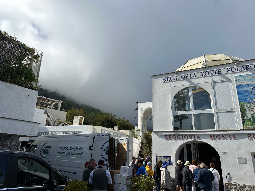
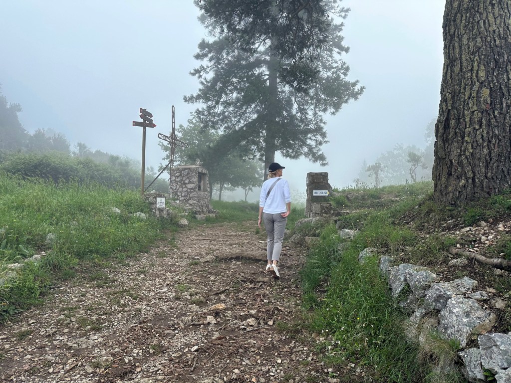
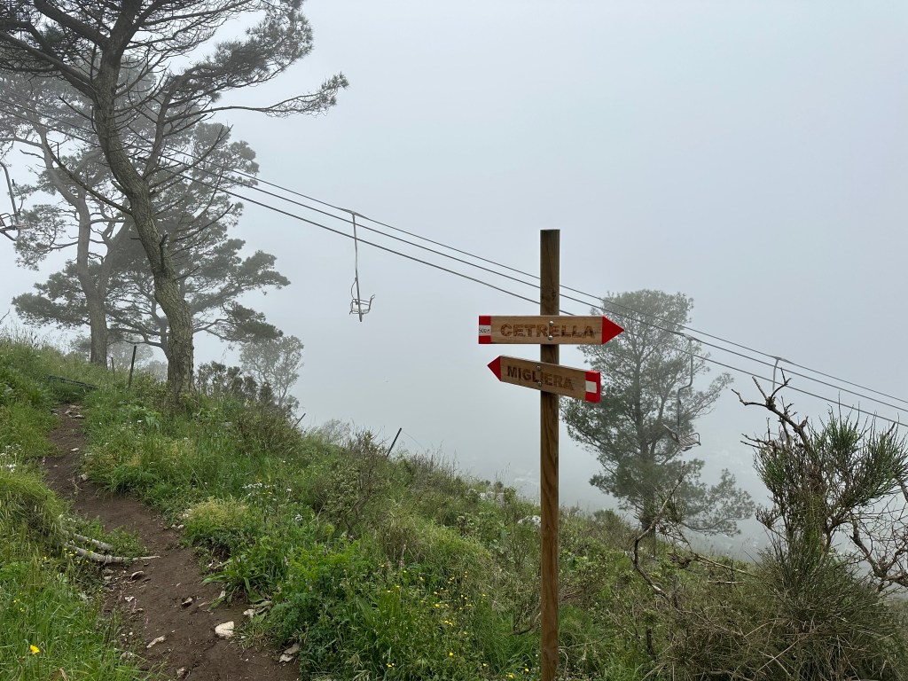
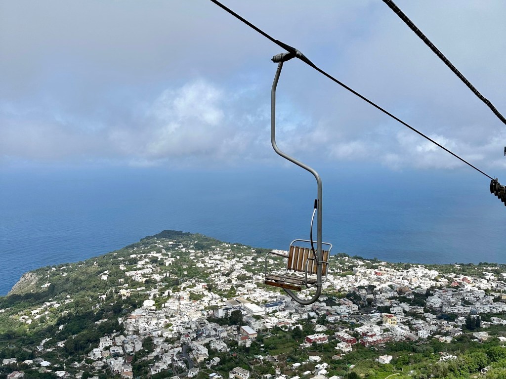
This was our objective: the chair lift to the top of Monte Solaro.
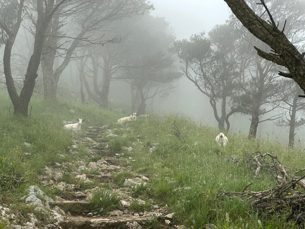
But the whole mountain was fogged in, so there’s not much to see on the trip up.
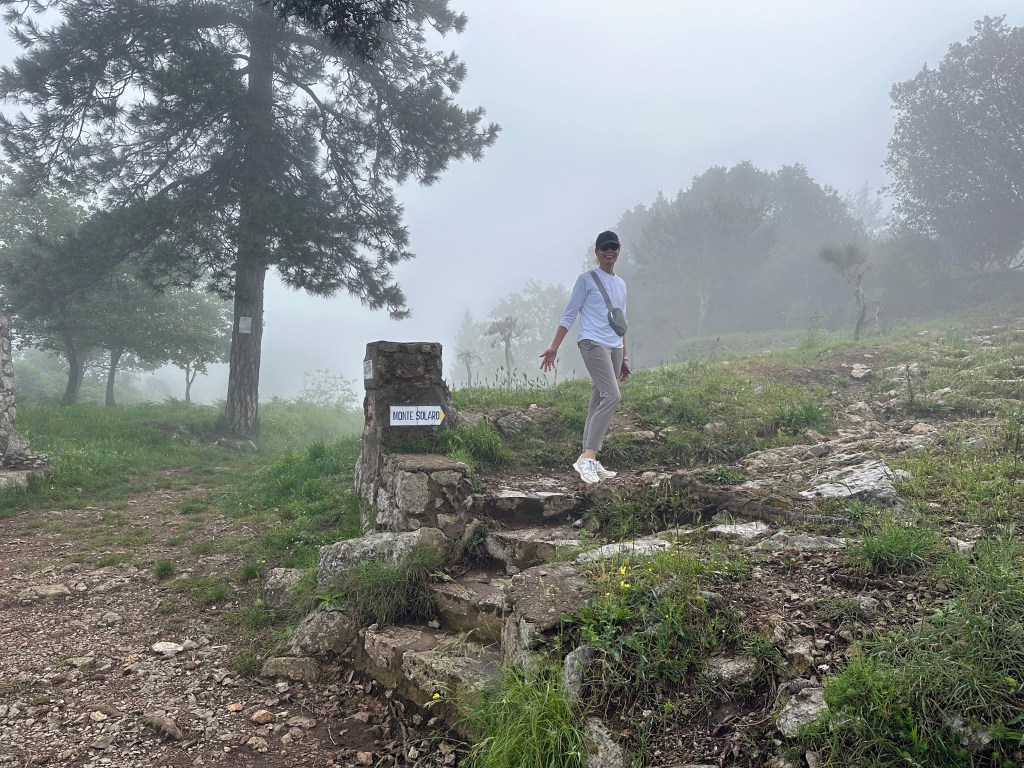
So we kept hiking all the way to the top, instead.
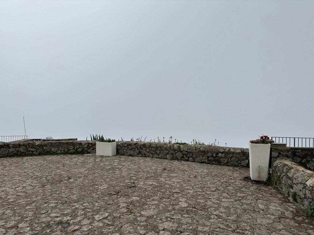
Still socked in:
But at least the trail was marked.
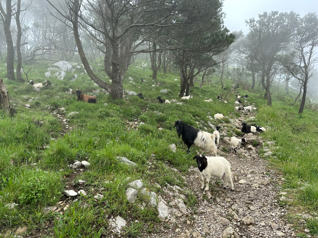
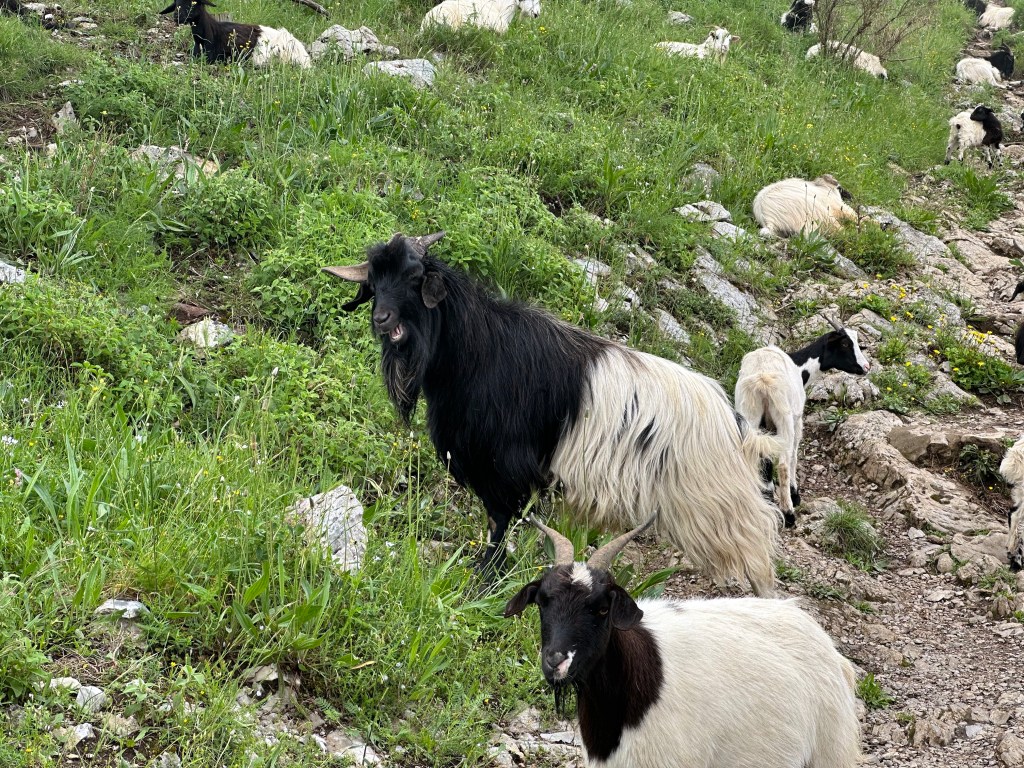
And out of the mist? Goats!
Definitely added some character to the hike.
A sign that we were nearing the peak:
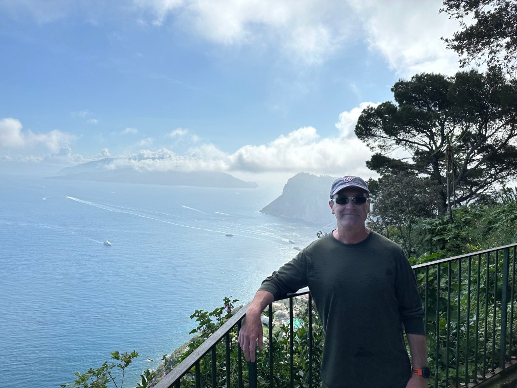
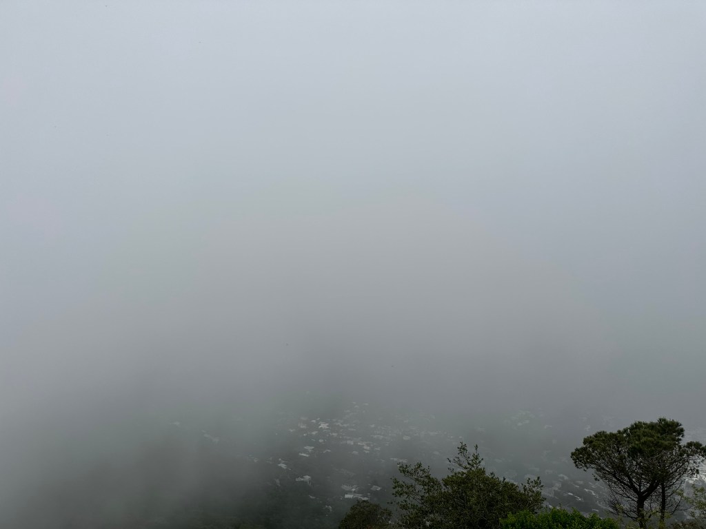
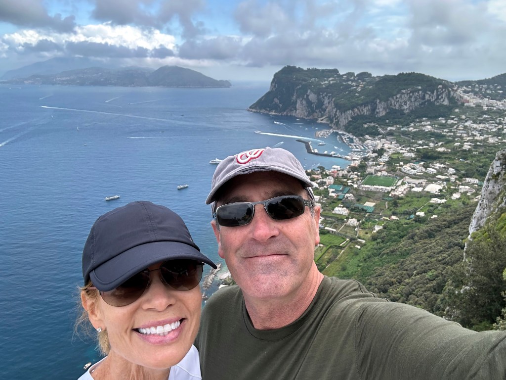
Finally, a great view from the top of the tallest mountain on Capri!
Or, as it unsurprisingly turned out, a replay of our hike’s apex on Arthur’s Seat in Edinburgh: zero visibility.
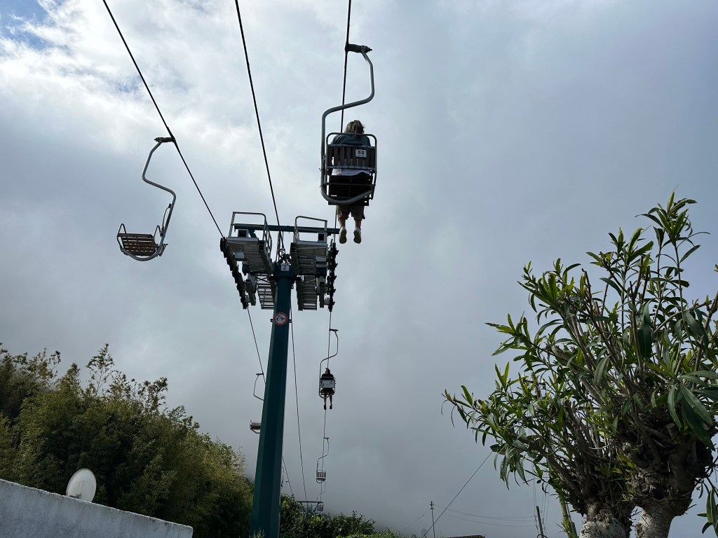
But after we quaffed a couple of macchiatos, the fog had burned off, so we grabbed the chairlift for a much more relaxing (and shorter) trip back down:
To wit:
Hike up:
Chair down:
Pretty great views without the fog:
And then pre-pre-aperitivos at Caesar Augustus on the cliff in Anacapri:
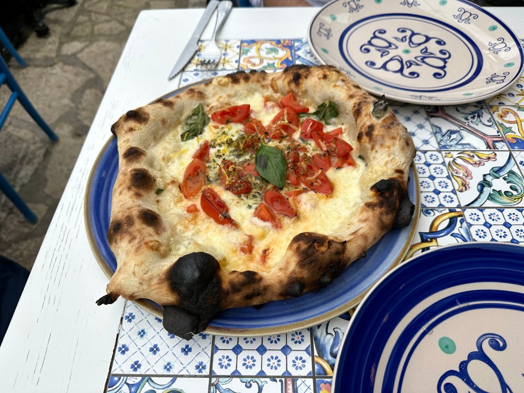
Followed by some decent, Neapolitan-style pizza at a place in Anacapri town:
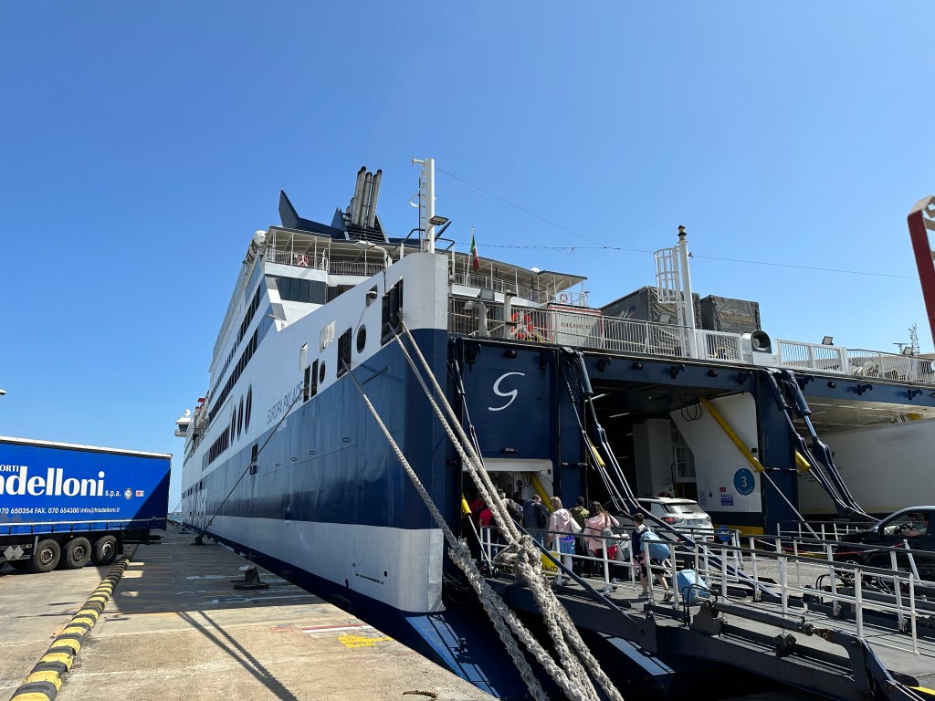
After a few days on Capri, we ferried back to Sorento and picked up our rental from the car cave. Surprisingly, we did make it on the ferry that disembarked at the timetable slot we ~arbitrarily picked when we dropped the car off, so the guy had it waiting for us, half in / half out of the car cave. Good stuff.
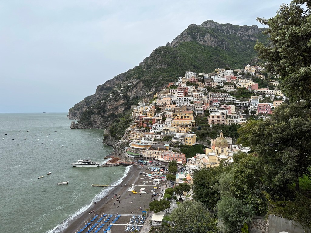
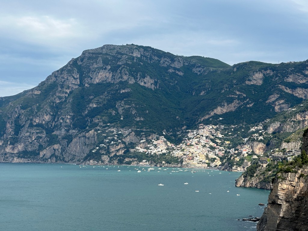
We hightailed it out of Sorento and headed ever further south to Positano and beyond. We originally planned to stay in Positano as our base for exploring the Amalfi Coast, but our safari travel friends advised us instead to just visit Positano and stay instead at one of the smaller towns nearby, but a little further down the coast. They didn’t have great things to say about Positano; and they were right. A little more on that later.
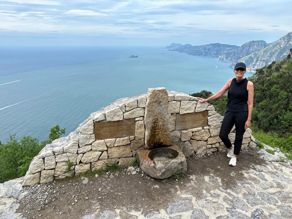
So, we ended up staying in one of the hotels and towns they recommended: Casa Angelina in Praiano, just 10 minutes away from Positano (and in sight of it). But first, we had to get there.
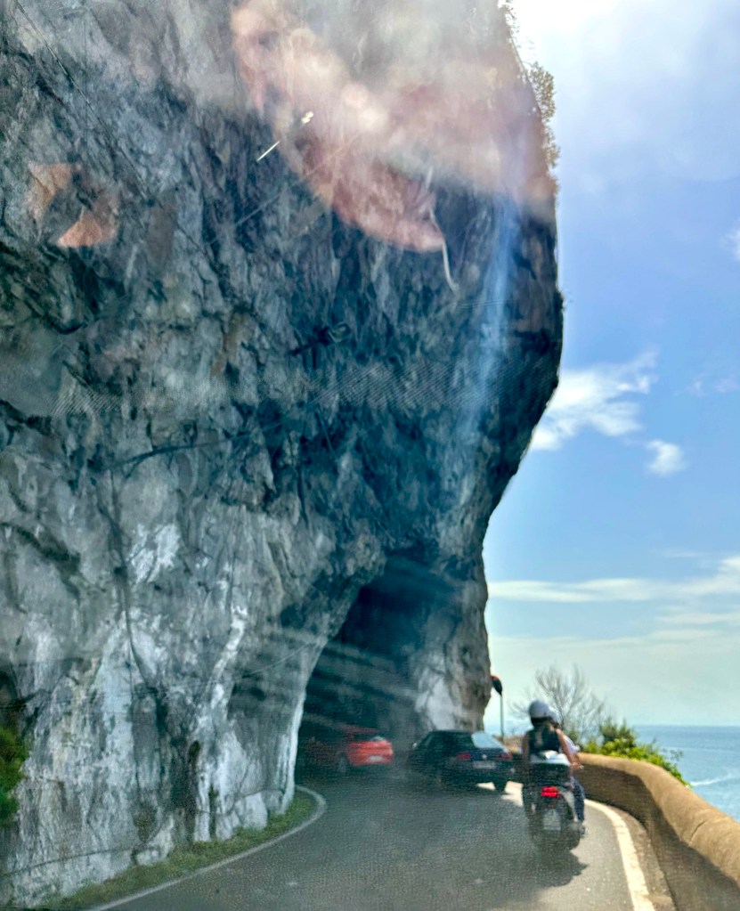
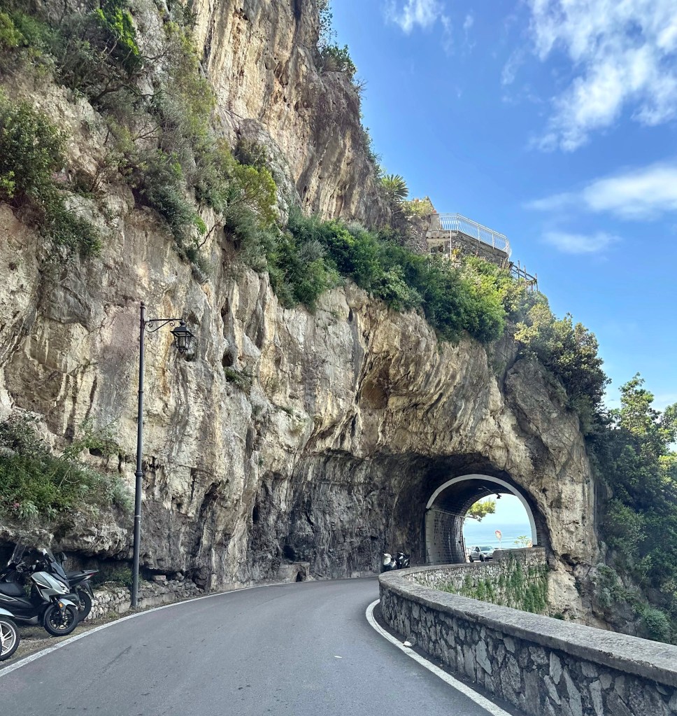
Driving the Amalfi Coast is one of the most nail-biting exercises in automobile navigation that one can undertake.
For the driver. For the passenger. It’s pretty insane.
And we’ve had insane driving experiences – along a chasm almost the width of the tiny rental car in St. Kitts; over miles of washed out, shack-lined country roads in Jamaica; and driving on 1.75-lane, 12-foot-tall-hedge-lined roads masquerading as 2-lane roads in Cornwall (all while driving on the wrong side of the road on the wrong side of the car and with the wrong hand on the stick everywhere in the UK). But the Amalfi Coast road is a beast in a category all its own.
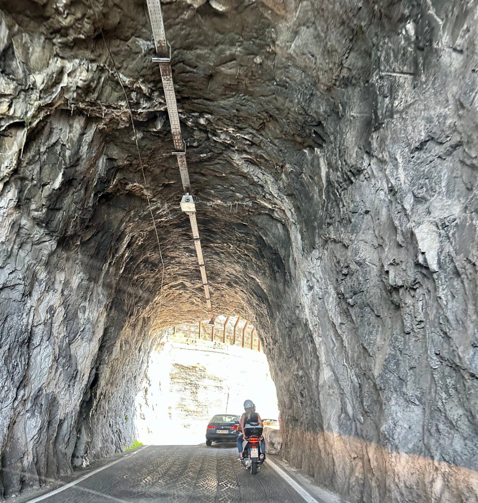
There’s one coast road, and it – like Cornwall, but without the hedges – has about 1.75 lanes for two-way traffic. Oh, and in Amalfi, you’re constantly one bump away from being sent hurtling down a 1000-foot cliff.
Because rock faces tumble straight into the Mediterranean in many places, the road transits a honeycomb of tunnels (also barely wide enough for two cars, let alone a bus coming the other way [one of which really did almost take us out on a turn]).
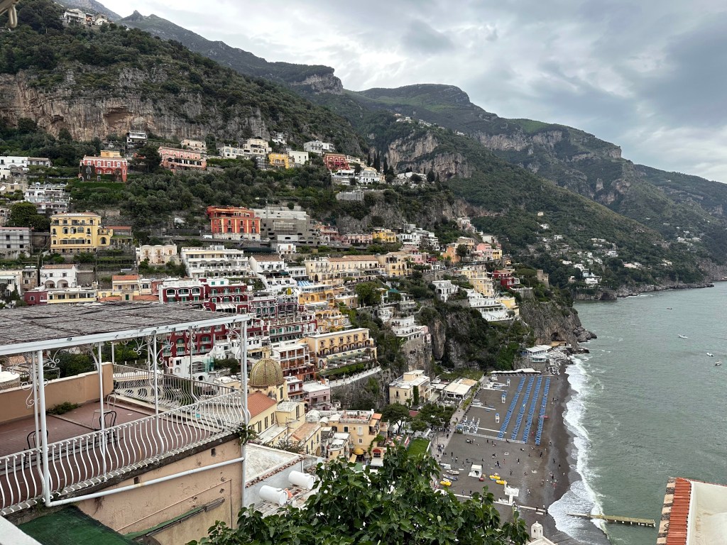
Plus, on our drive from Sorento to Praiano, where our hotel was located, we took a wrong turn and drove down the mountain and THROUGH Positano instead of skirting above it on the coast road. It was a white-knuckle affair, particularly for the WolfeStreetPassenger, who is absolutely not happy with roads like this to begin with. But at least we weren’t driving down steep, hairpin roads that are the very worst, right? And soon we’d be safely tucked away at our hotel, right?
The hotel’s driveway off the Amalfi Coast road:
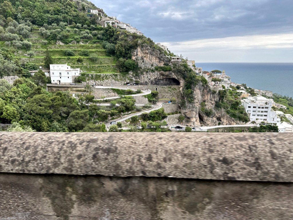
Another view from a hike later in our stay to provide an even more dramatic perspective:
The hotel (white structure with windows at the edge of town) and its entrance at the terminus of the hairpin-turn-ridden ride:
The bellmen hauled our luggage and the now-catatonic WolfeStreetPassenger into the haven that we finally reached after a harrowing day of driving.
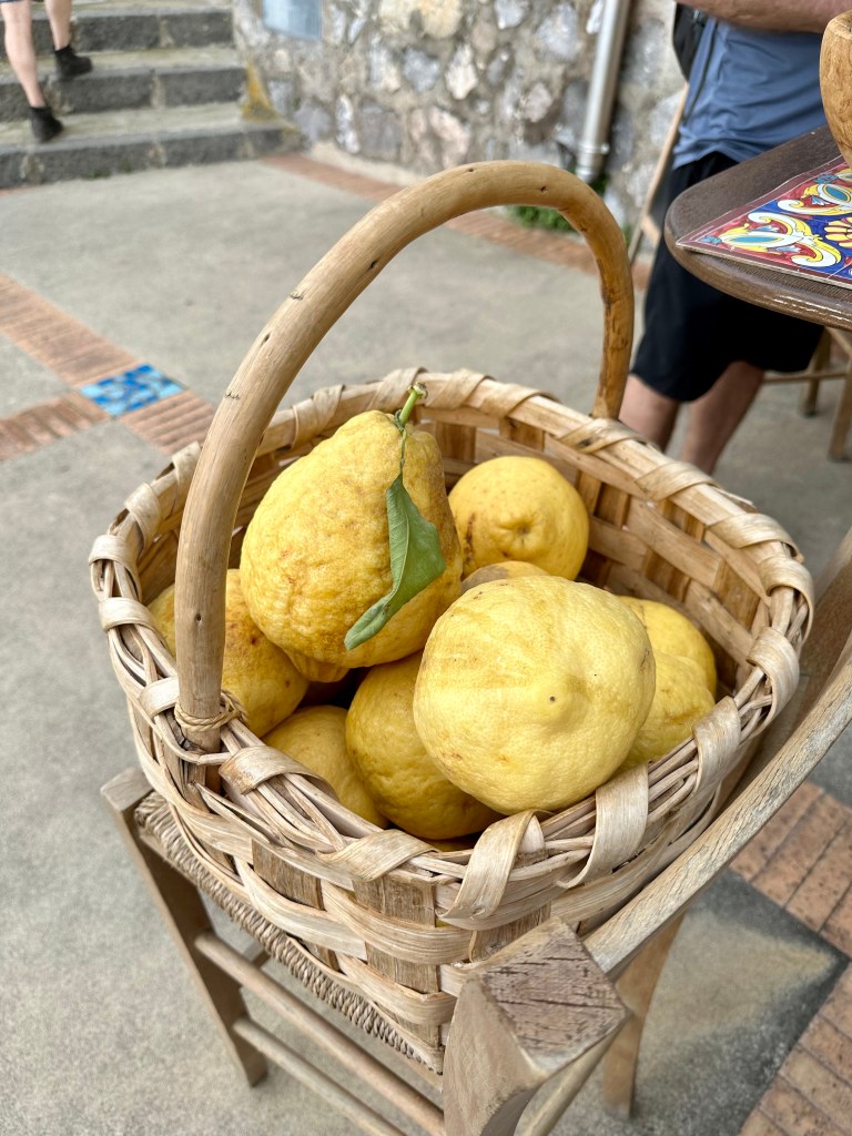
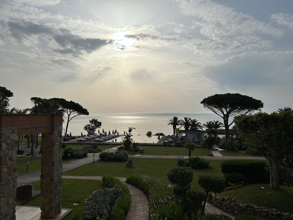
And holy shit what a haven. Amalfi is know for their lemons, and the pool had an entire, in-season, lemon tree arbor over one end:
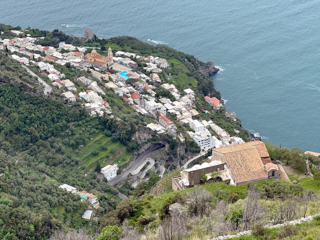
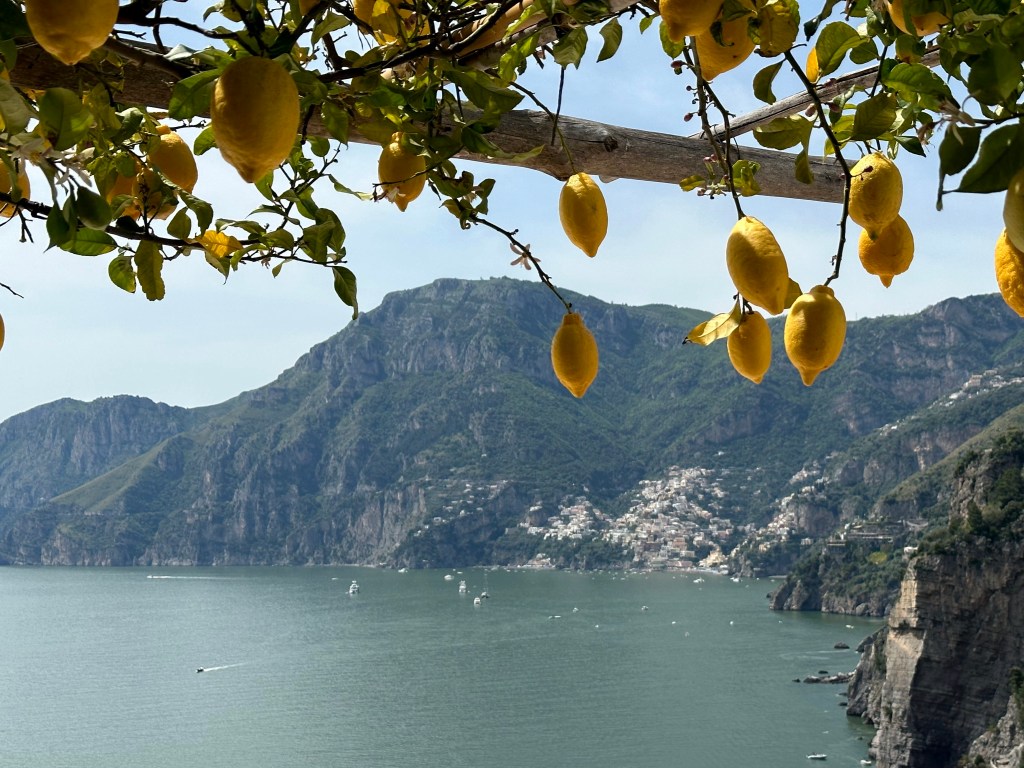
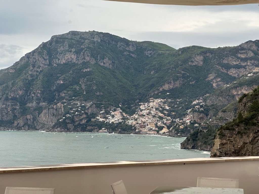
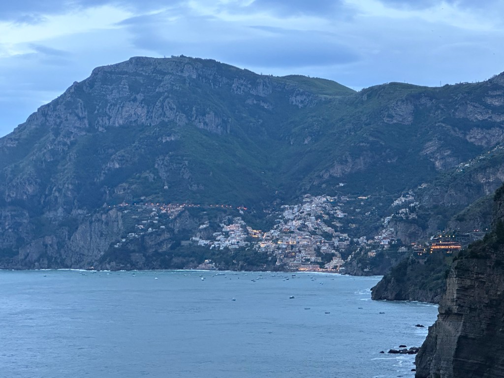
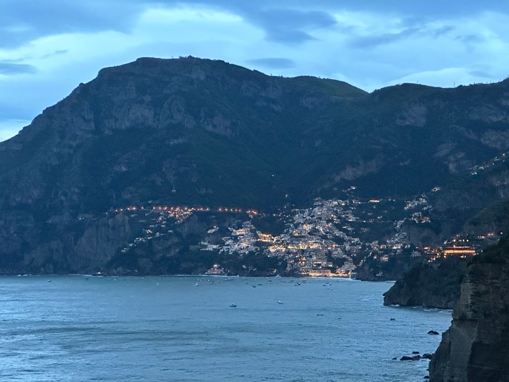
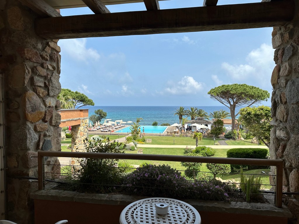
And a cliffside view to Positano, which was pretty cool.
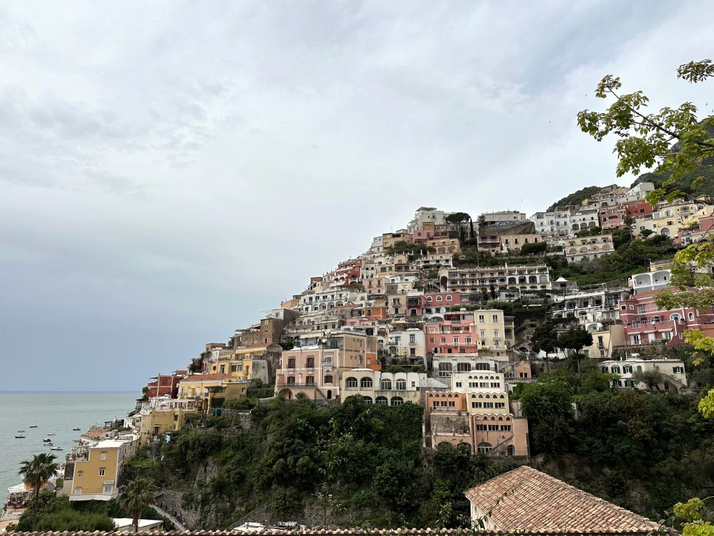
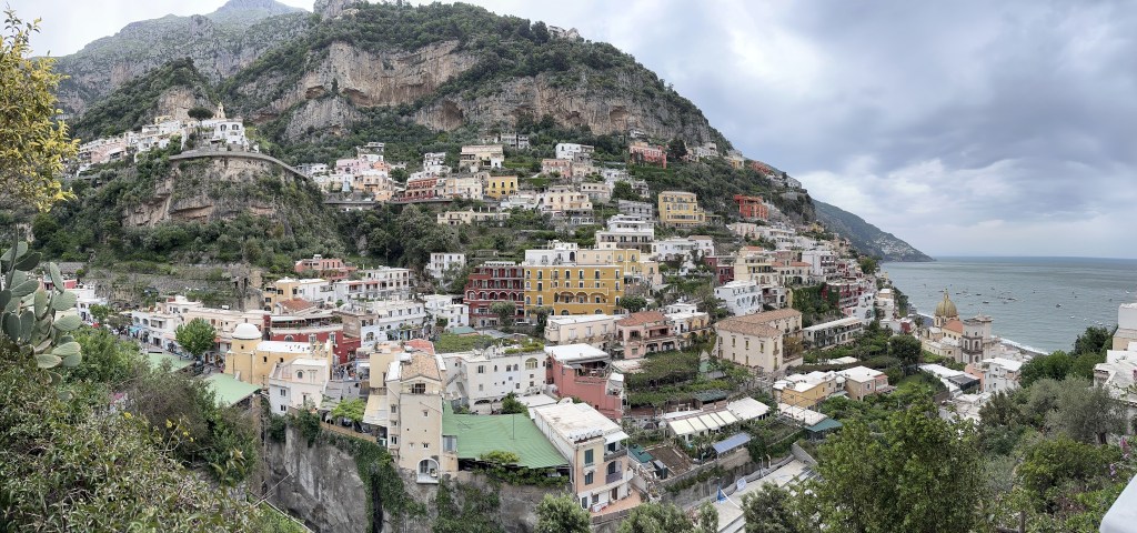
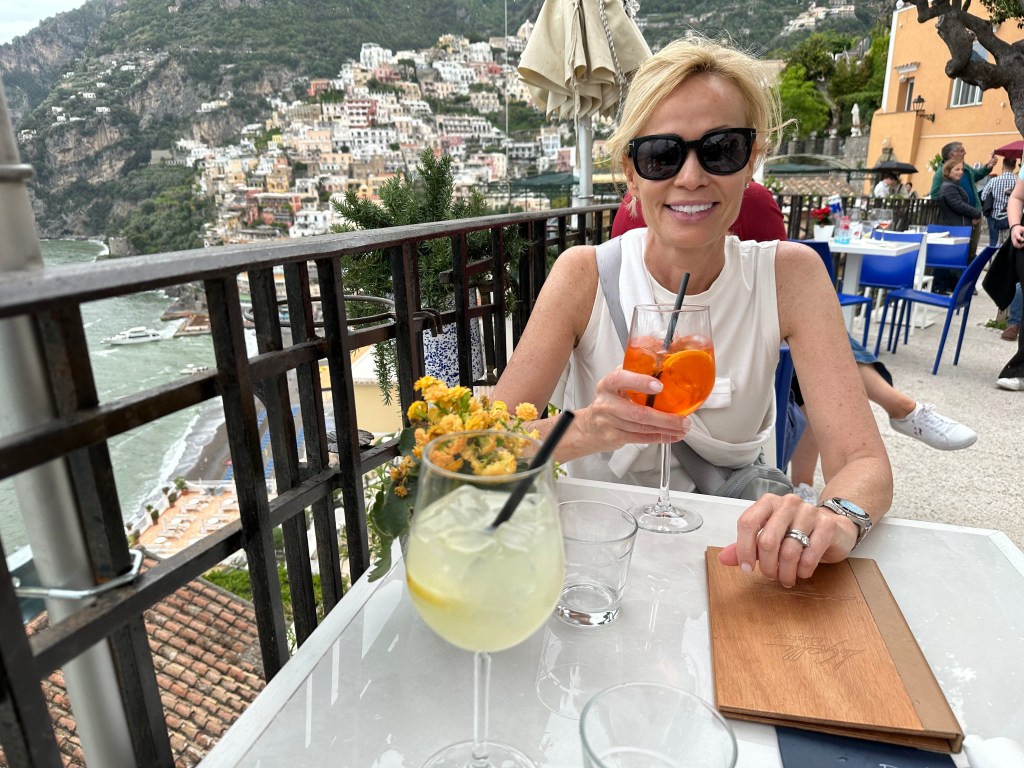
And the next day, we’d check out Positano up close, courtesy of our hotel’s “shuttle” (which turned out to be a little Mercedes coupe, which was nice). So, why not stay in Positano? If you perused Instagram in 2022 and 2023, you would see that THIS was the Instagrammer place of the moment, and a destination for vapid, 20-something trust fund princesses who had more resources than sense. Although the popular appeal intrigued us about Positano, the presence of these self-absorbed, superficial narcissists certainly put us off.
Most importantly, though, was the recommendation from our safari travel friends. They strongly recommended against staying in Positano because it was too touristy, and instead suggested that we stay in Praiano, Amalfi, or Ravello – towns near Positano from which you could visit, but protected you from actually having to stay there. We had already booked a hotel and two dinners in Positano by the time we had this conversation, but we trusted this couple, and changed our plans. Thankfully. It’s a shitshow.
As we noted in an Instagram post after our visit to Positano and experiencing the shoulder-to-shoulder crowds of tourists (and we were there in May) and the labyrinthine collection of alleys full of shops selling tourist crap, Positano is not the charming town visitors claim it is through their Instagram posts. It is, in fact, a land-locked cruise ship of clueless (mostly American) tourists that happens to be tumbling – in a very picturesque way! – down a hillside on the Amalfi coast. It is best viewed from afar.
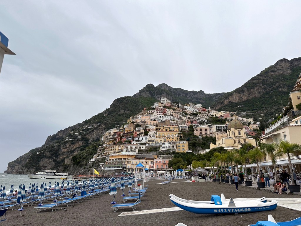
Positano’s unappealing gray-sand beach:
Still – a certain appeal (from a distance):
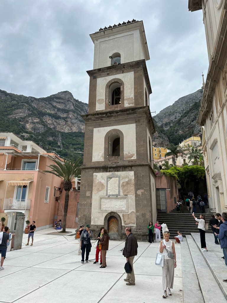
Bell tower of the Assumption Parish of Our Lady Positano, based on the location of an abbey founded in the 10th century.
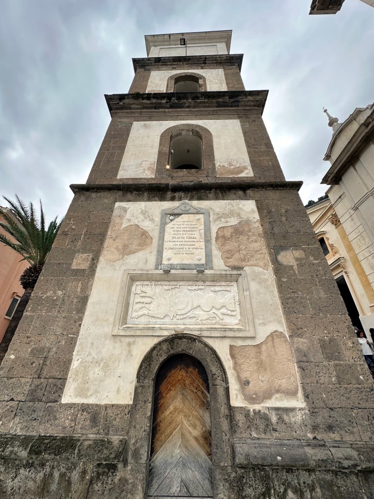
The tower’s pastrice (sea monster) bas relief on its base:
After navigating around and through town, we had enough.
A reward for a job well done.
Safely back in Praiano and away from Positano.
With more rewards to celebrate our return.
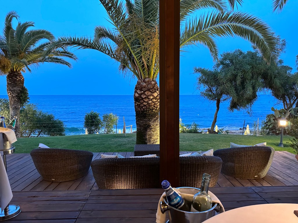
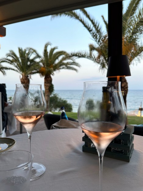
Pretty cool sunset views, as well.
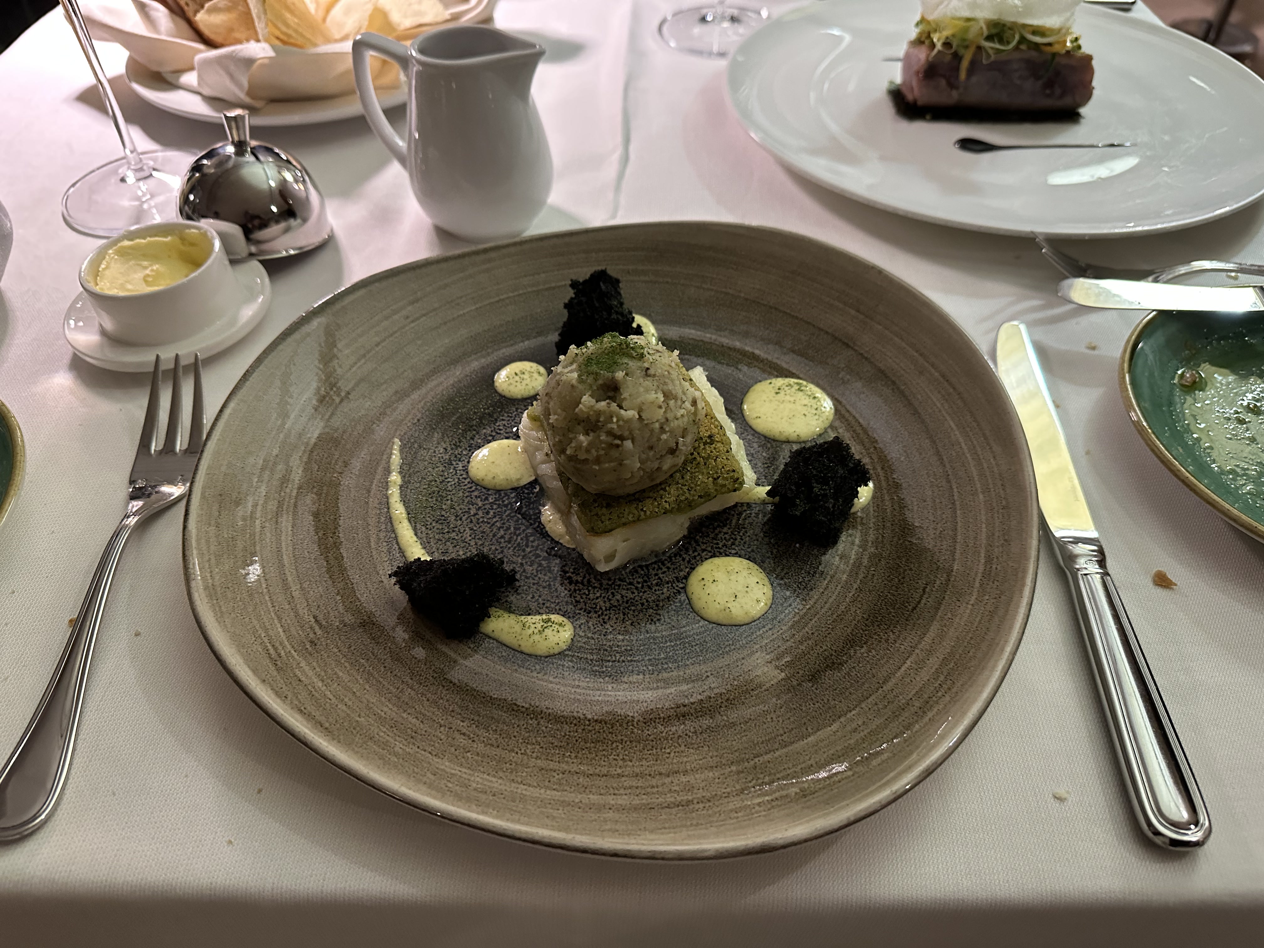
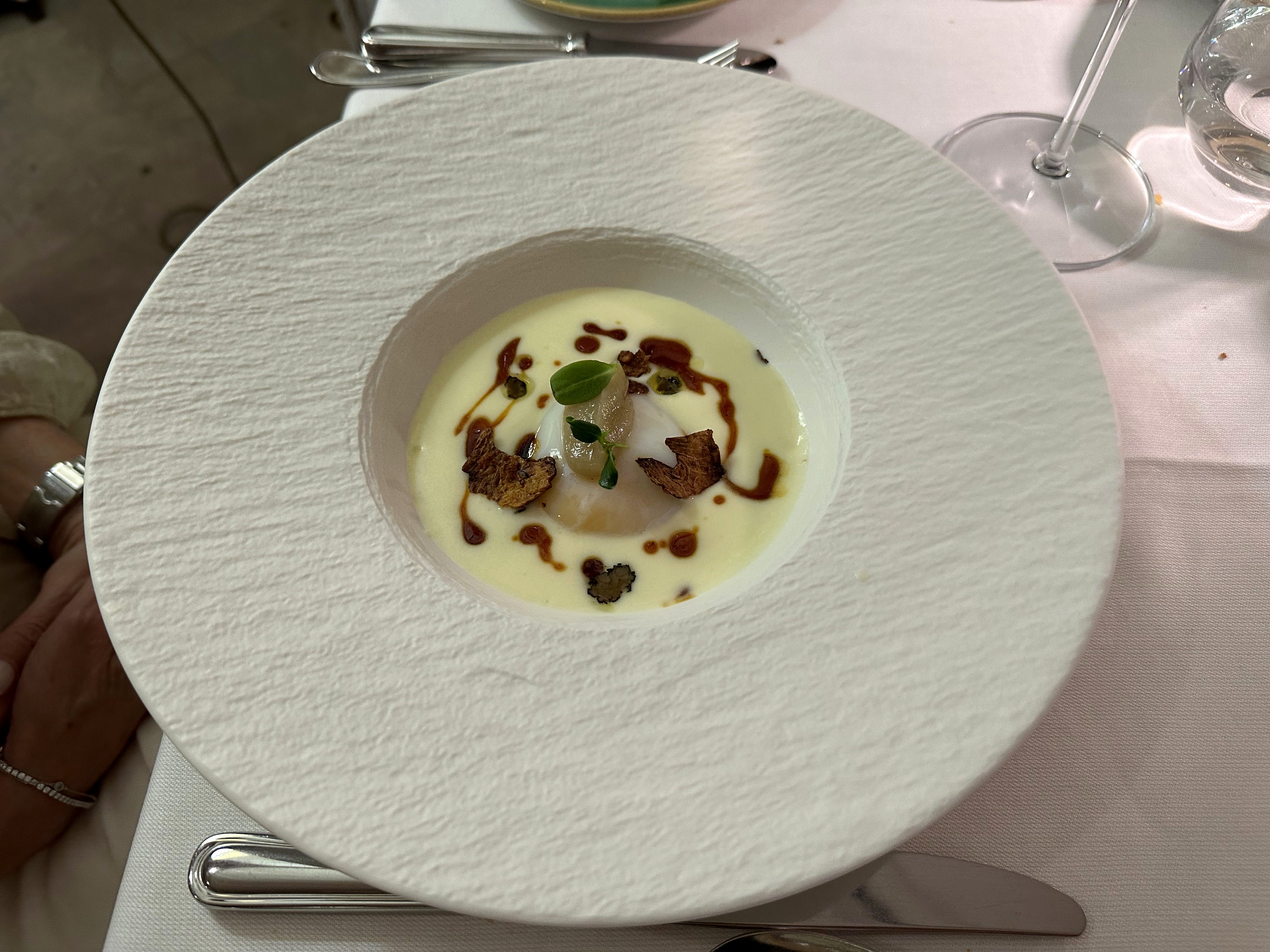
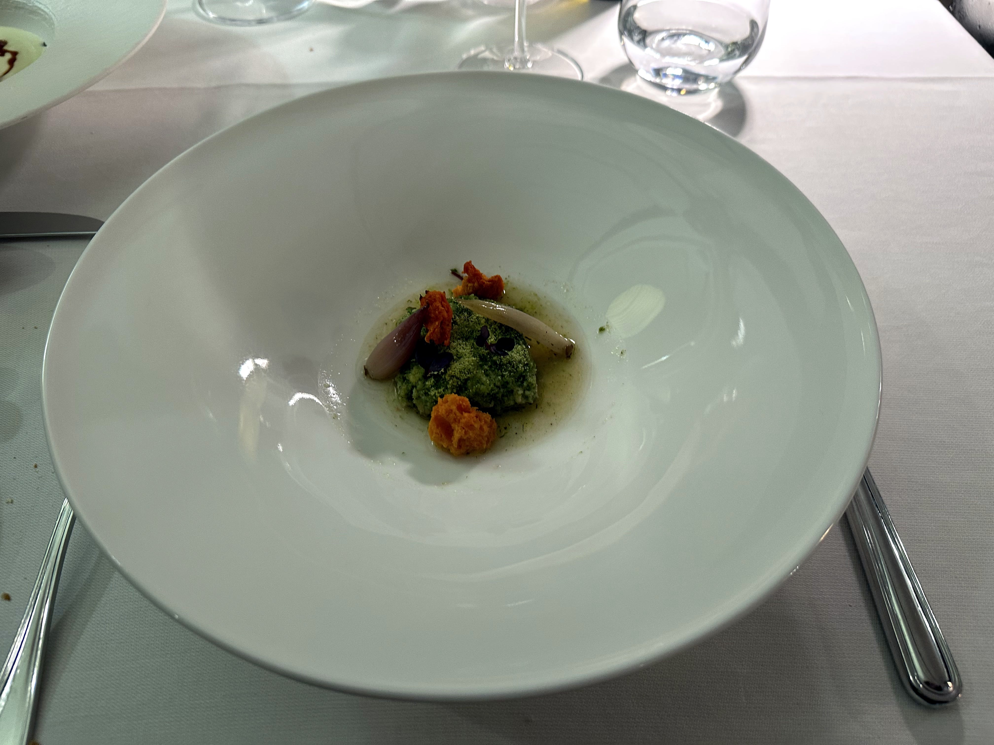
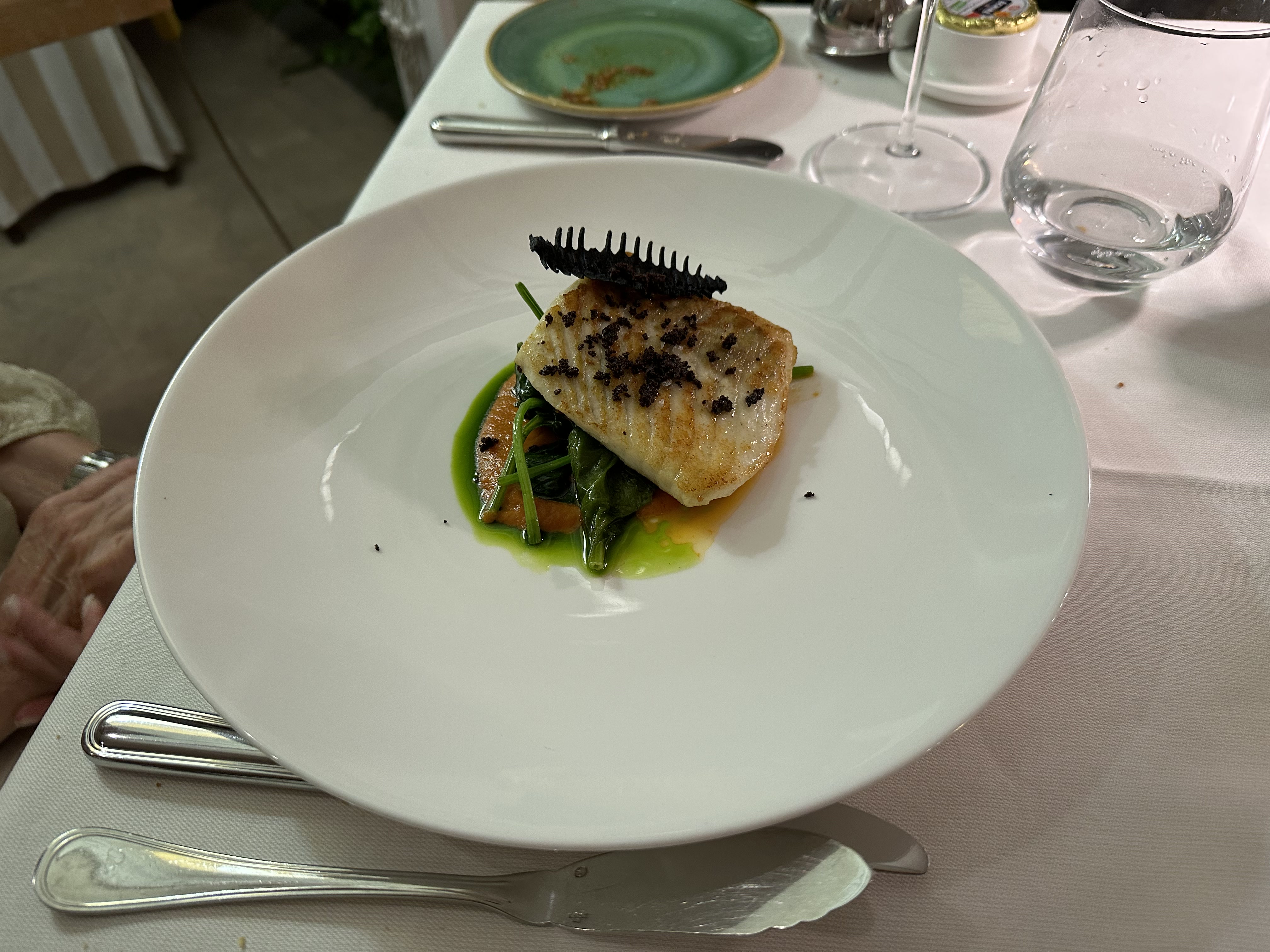
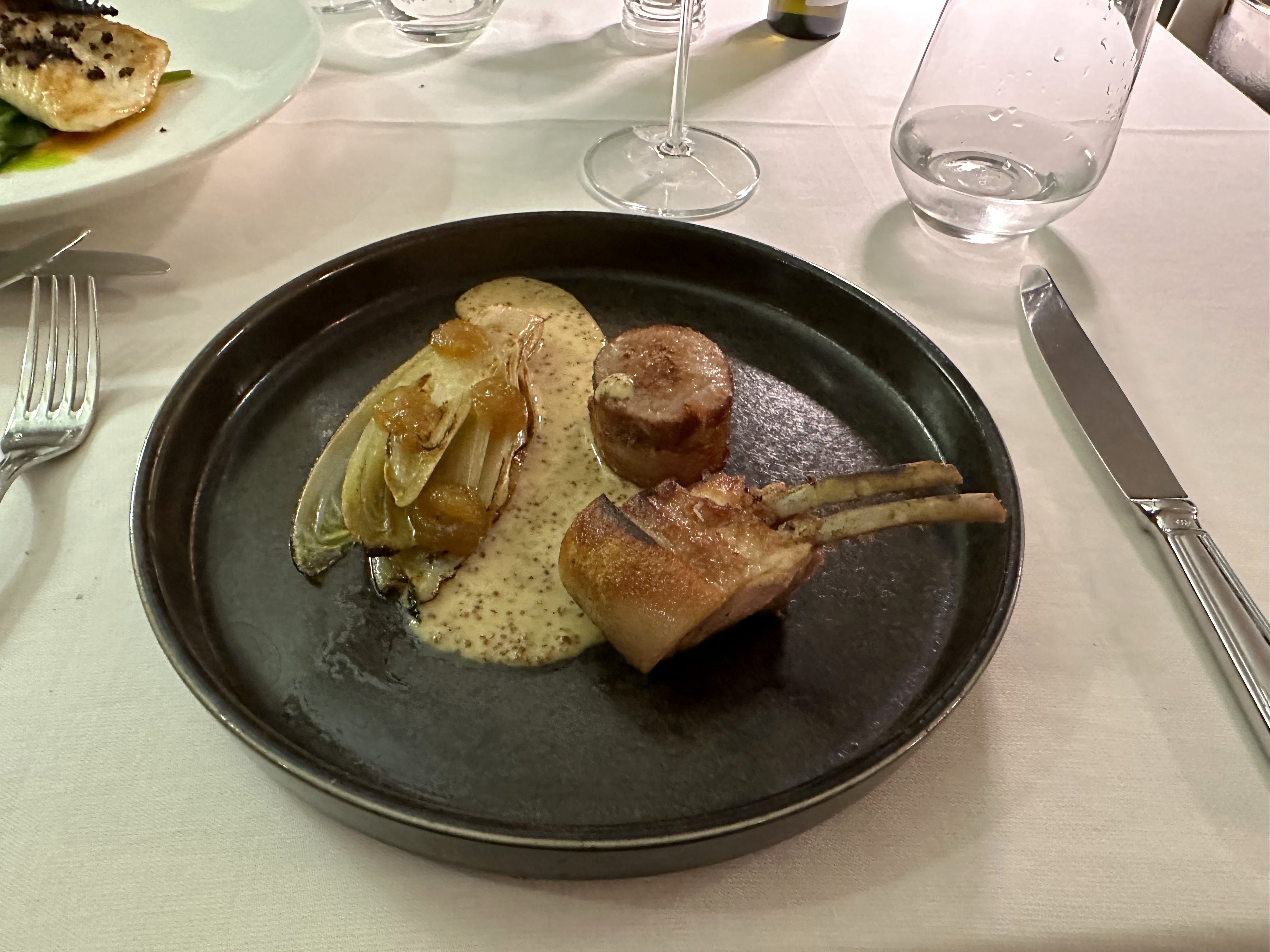
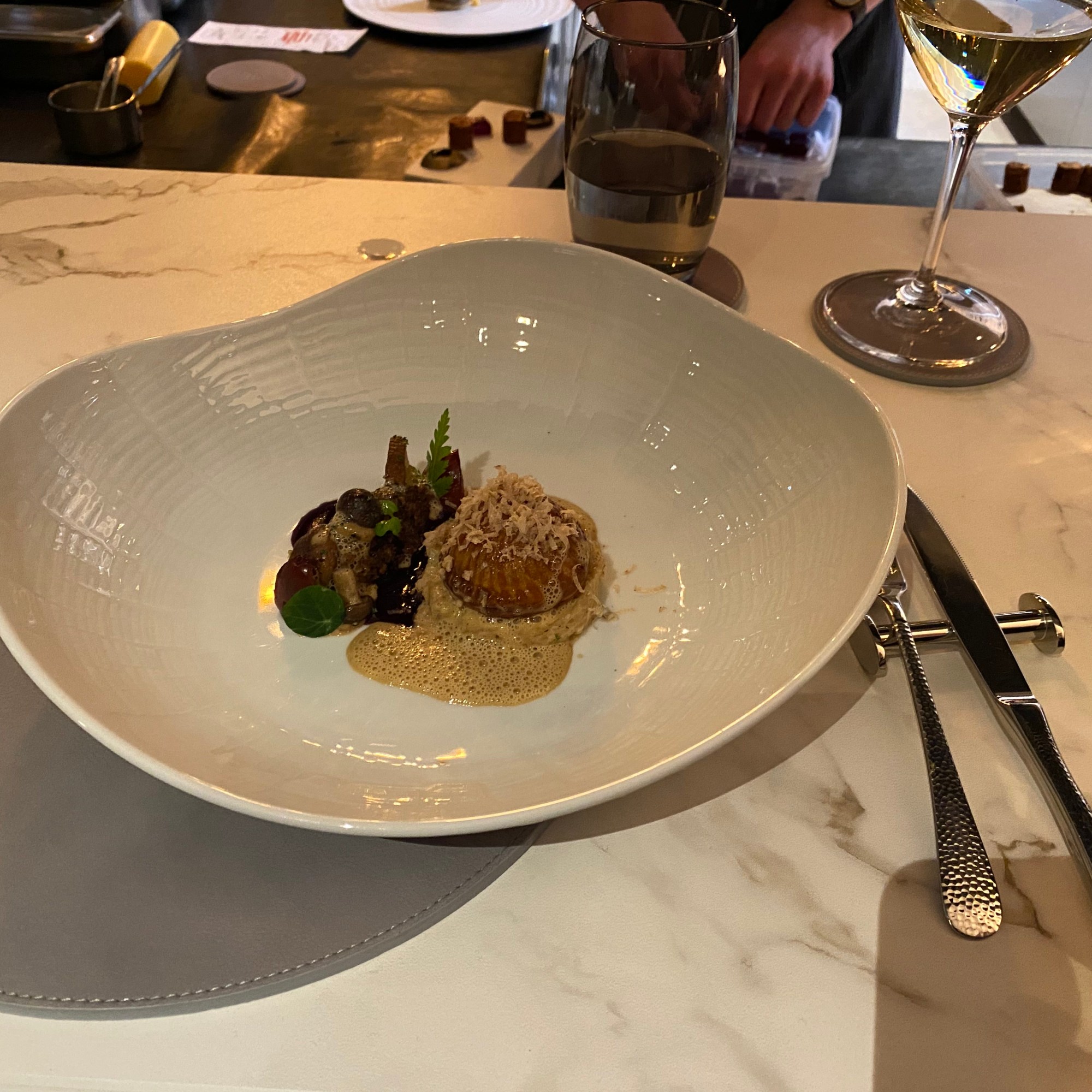
And our first Michelin-starred dinner of the trip:
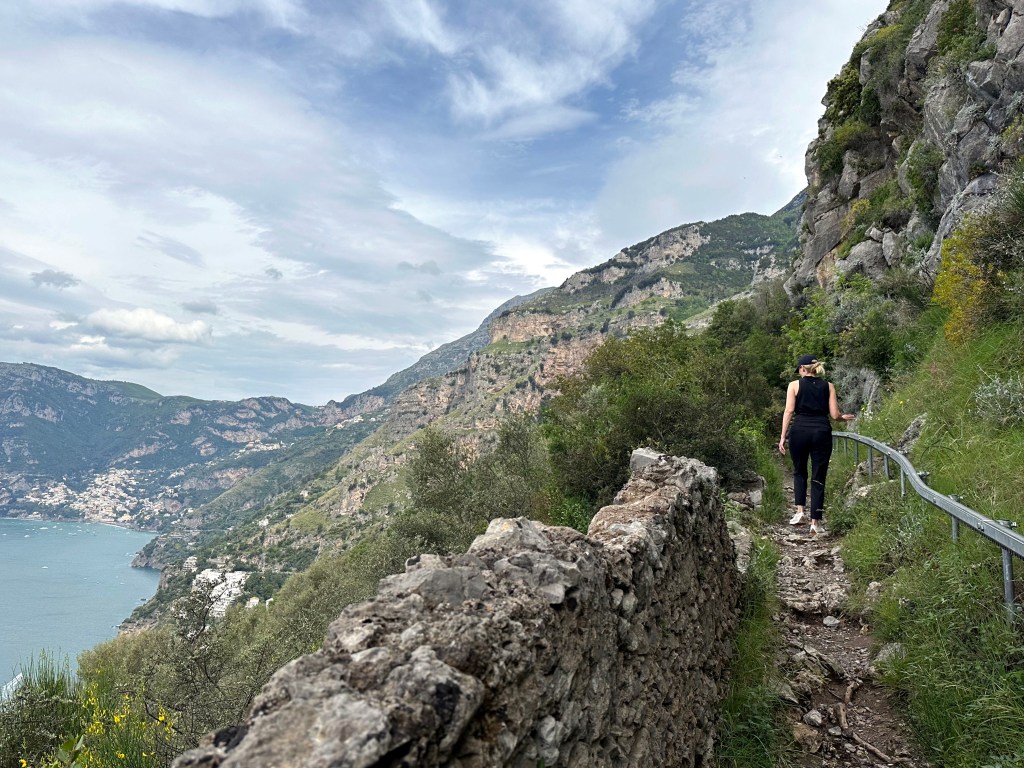
The next day, and epic hike we had been anticipating with some relish:
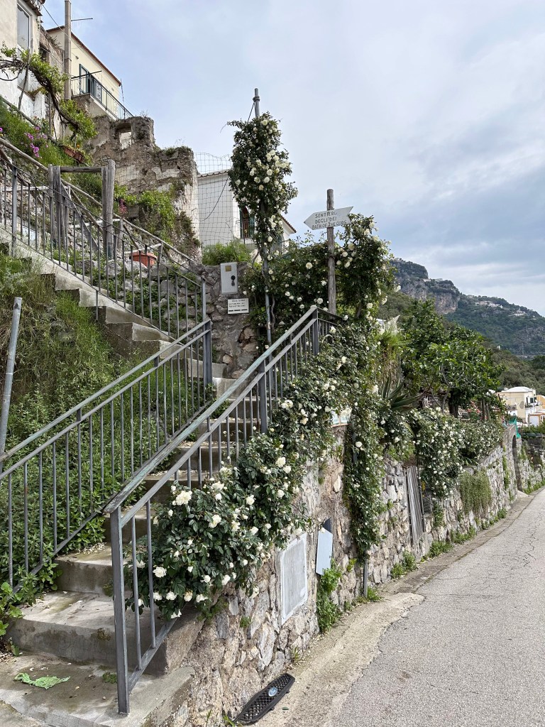
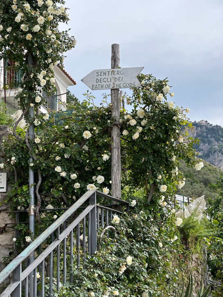
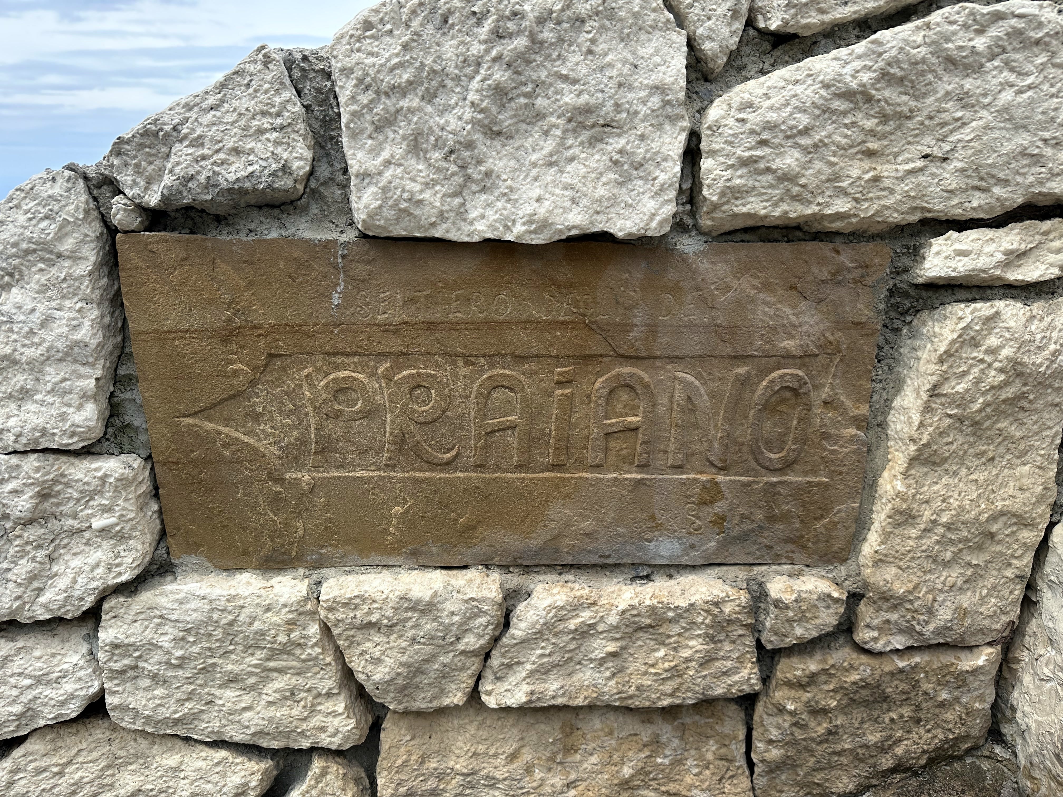
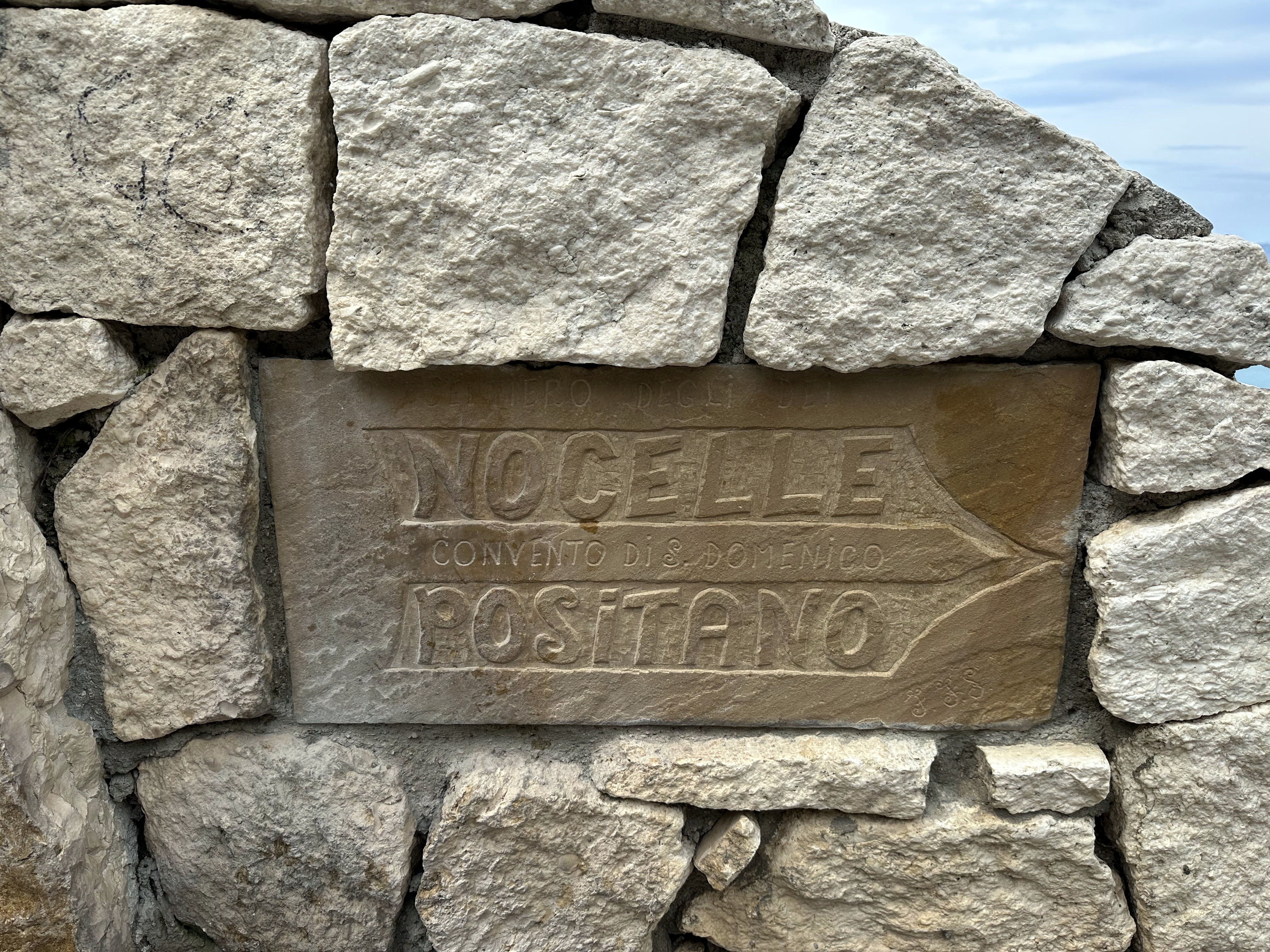
The Path of the Gods!
The Path of the Gods, as we hiked it, offers a 5.3-mile trek from our hotel at the edge of Praiano up 2000 feet, then across the ridgeline to a point 1500 steps ABOVE Positano, then a knee-buckling climb down said steps.
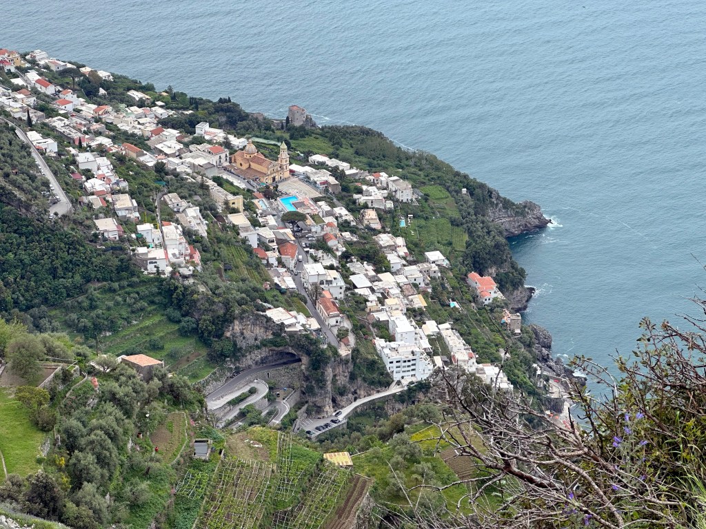
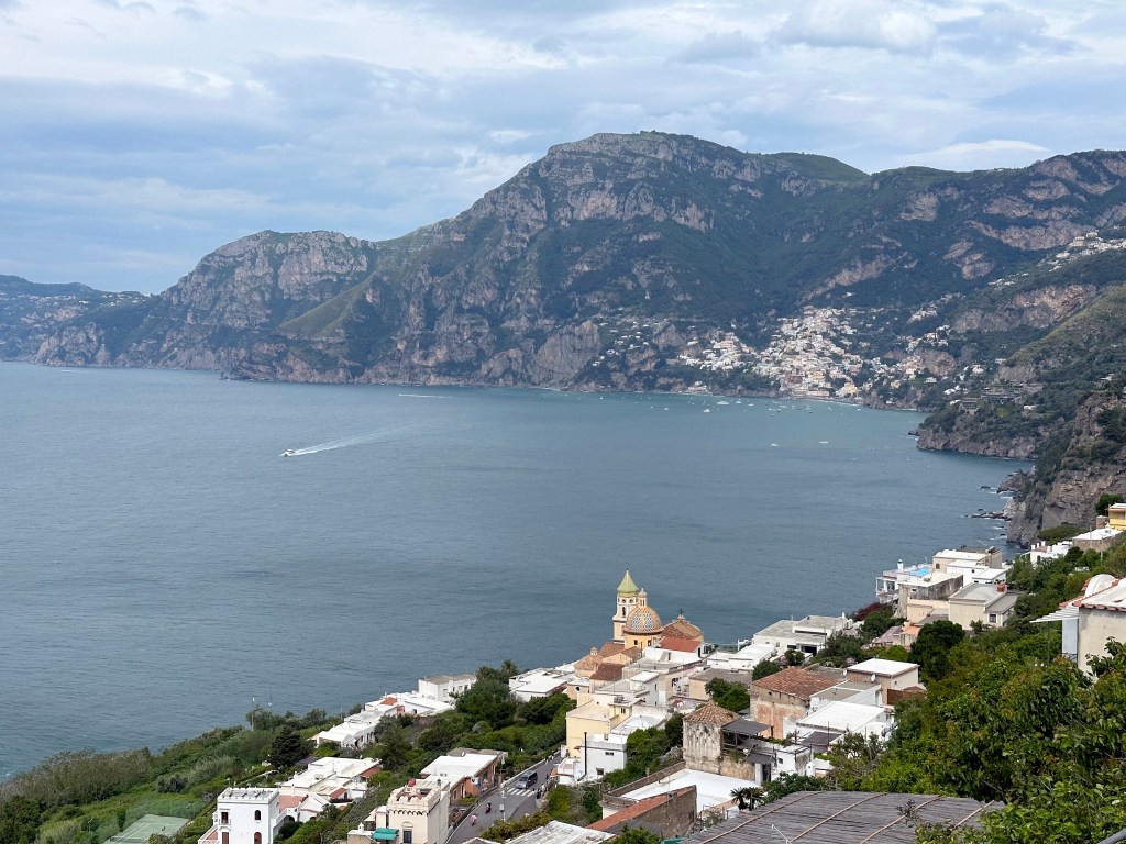
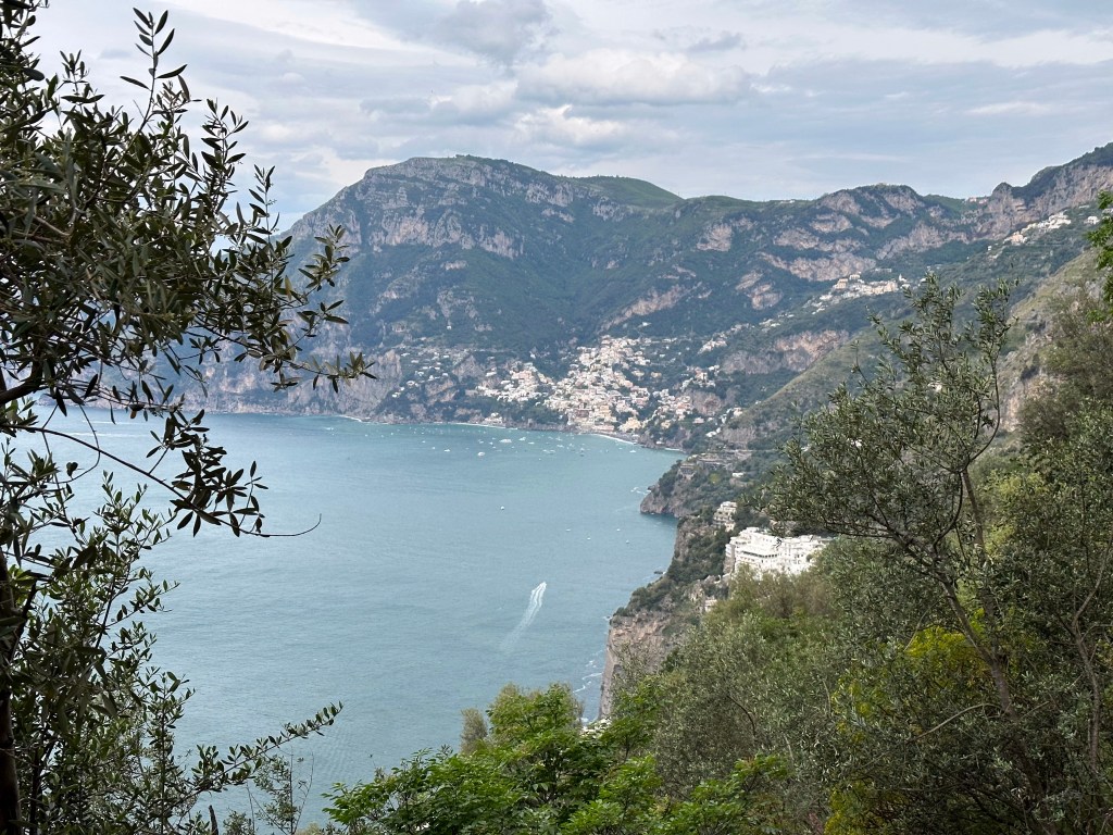
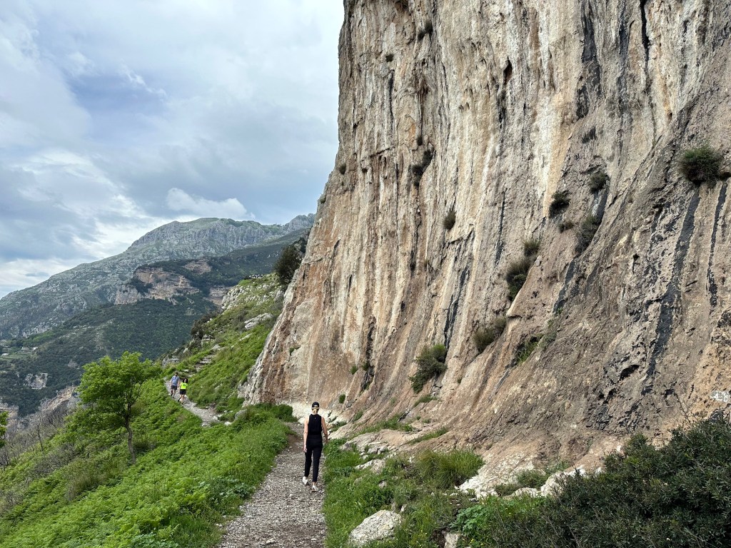
Views to Positano above Praiano:
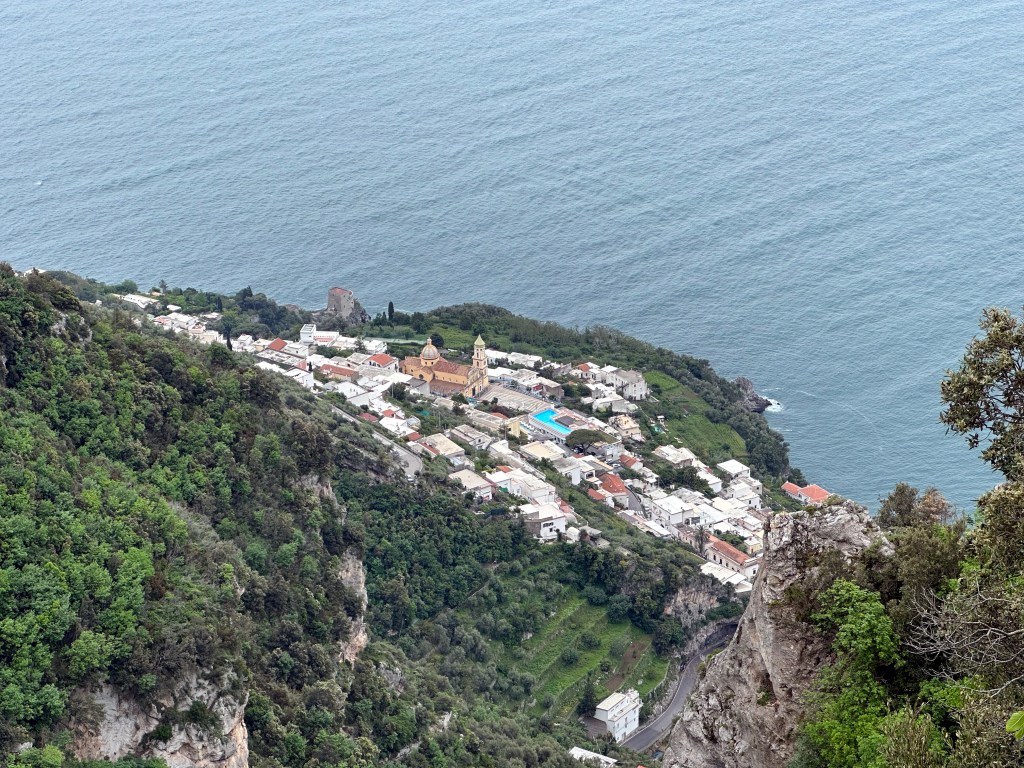
Praiano from above:
Once you reached the ridge, the hiking wasn’t too challenging; it was just getting to there (and then down the damn steps):
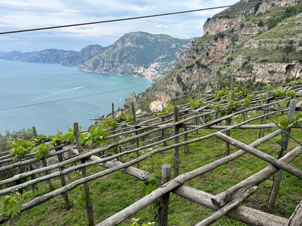
At the halfway point:
Getting closer to Positano:
View into Positano’s bay on the way down the freakin’ steps:
A reward part of the way down: Italian ice made with Amalfi’s ubiquitous (and iconic) big-ass lemons:
After a “shuttle” ride back to Praiano, a last night on the Amalfi Coast:
When we decided to buy one-way plane tickets to Europe for our first prolonged foray to celebrate the second of the two retirements, we knew we wanted to return to Italy as a start, but the destinations within Italia, and certainly beyond, weren’t intuitive at the outset. We know we’d be in Tuscany because of the Brandts; we knew we wanted to visit the Amalfi Coast for the first time; we knew we wanted to spend time in Sicily; one of us knew he wanted to check out Herculaneum; the other knew she wanted to visit Portofino. But some locations we were familiar with, but were not on our list, nonetheless ended up on our itinerary simply because they were a convenient stopping point between one target and the next (like Orvieto).
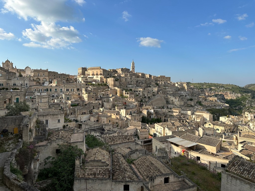
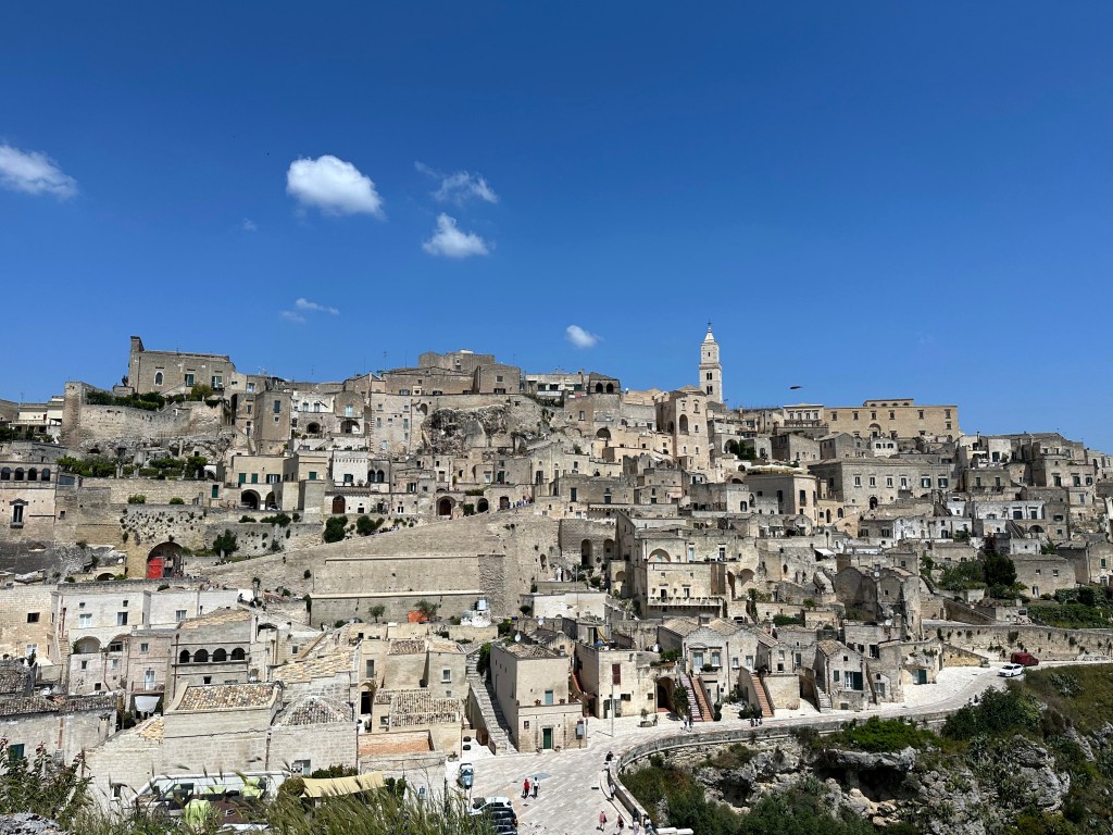
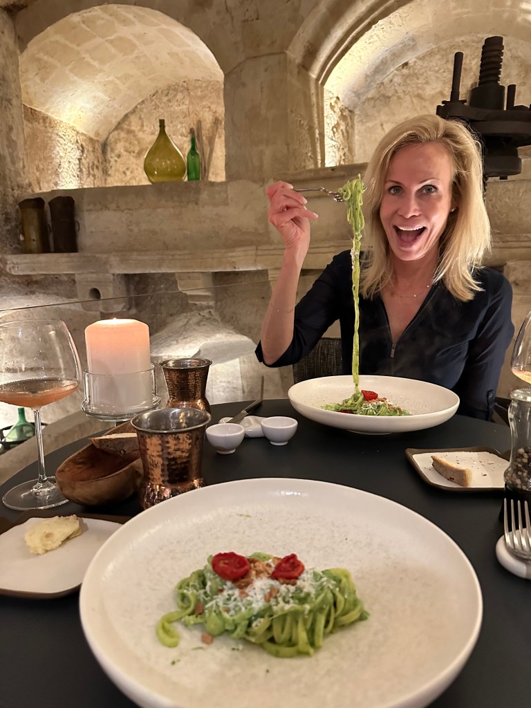
Then, there’s Matera. Not only did Matera not rate a “let’s make sure we go there” spot on the aspirational list – it wasn’t even a town that was known to us. Instead, we stumbled upon this gem during trip planning.
As part of our planning process, the Chief Adventure Officer creates a Google Map with potential places of interest and – overlaid on top – hotels that are part of our favored collections (Relais & Chateau, Small Luxury Hotels, Design Hotels, Rosewood, and some others). If a location highlighted on travel sites or on Instagram looks appealing AND that is home to hotels from one or more of our collections, we figure it really is worth seeing, since boutique hotels wouldn’t be in some shit town. When we overlaid Design Hotels on the Italy map, the town of Matera was suddenly on our radar. And it was between the Amalfi Coast and Bari, where we’d be on a plane headed for Sardinia. So we started researching this new discovery.
Definitely the right choice
“Before its integration into the modern Italian state, the city of Matera had experienced the rule of the Romans, Lombards, Arabs, Byzantine Greeks, Swabians, Angevins, Aragonese, and Bourbons. Although scholars continue to debate the date the dwellings were first occupied in Matera, and the continuity of their subsequent occupation, the area of what is now Matera is believed to have been settled since the Palaeolithic (tenth millennium BC). This makes it potentially one of the oldest continually inhabited settlements in the world.” (From here.) (And we thought Cadiz‘ history was epic.)
Matera’s Sassi—neighborhoods of cave dwellings carved into soft limestone—provided shelter, water collection, and natural insulation. Over centuries, however, population growth and abandonment by the state turned this ingenious landscape into one of extreme deprivation: families lived packed into single-room caves, often sharing the space with livestock, with little ventilation, no running water, no sewage, and widespread disease. By the 19th and early 20th centuries, a stark social divide had formed – Matera’s poorest residents were confined to the Sassi while wealthier families, professionals, and institutions moved up to the piano, the healthier, flatter upper city with light, air, and services. This physical separation mirrored a deeper economic and social gulf, making the Sassi a powerful symbol of southern Italy’s poverty and exclusion. Only after World War II did national attention and government intervention begin to dismantle these conditions, setting Matera on a long path from neglect to preservation.
Carlo Levi, a fiercely anti-fascist doctor, was exiled by Mussolini’s regime to the Basilicata region in 1935 and he described Matera as proof that Italy was actually two civilizations: a modern, northern one and a forgotten, quasi-prehistoric southern one. “Inside those black caves that had walls made of soil, I could see the beds, the poor furnishings, the clothes hanging. Dogs, sheep, goats, and pigs were lying down on the floor. Typically, every family owns just one of those caves as a house, and they sleep all together: men, women, children, animals. There was an infinite number of children. . . sitting in the baking sun, on the doorsteps of their houses, into the dirt, their eyes were half closed and their eyelids red and swollen. This was due to trachoma. I knew that here people suffered from it: but seeing its effects in filth and in extreme poverty it is a different thing. . . it seemed to be in a city stricken by the plague.”
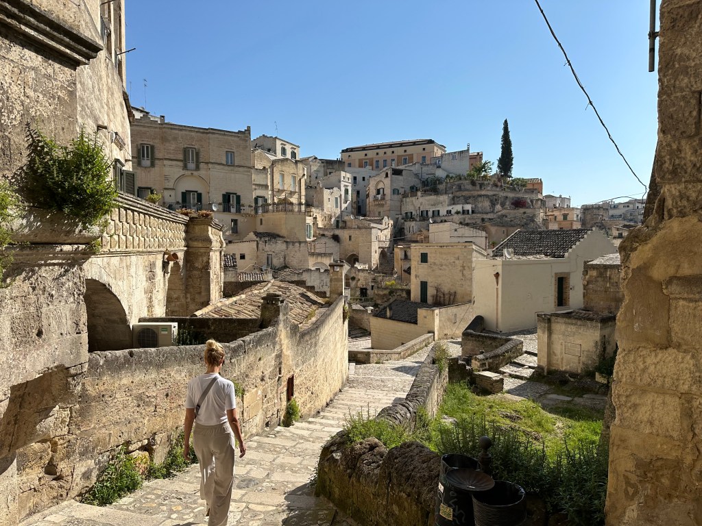
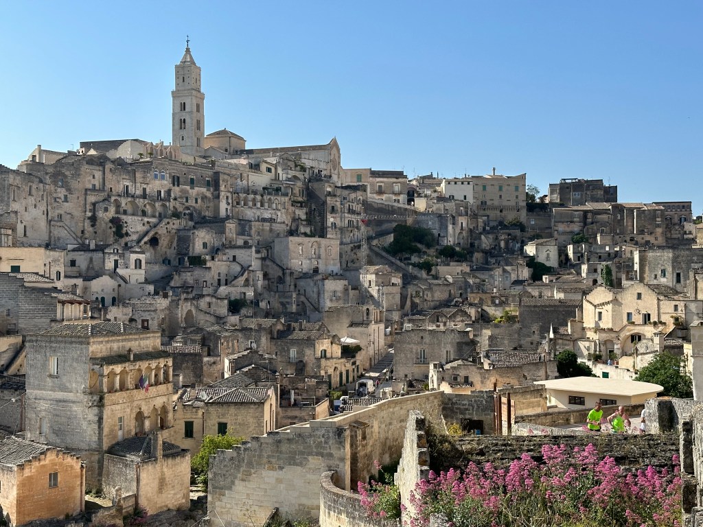
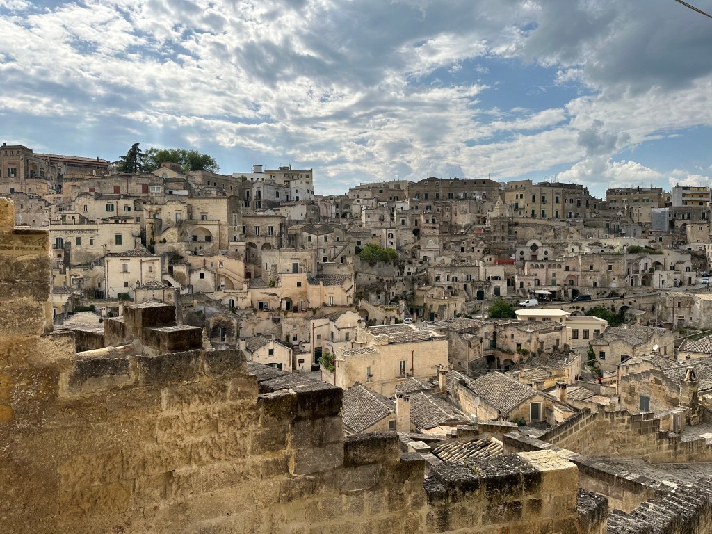
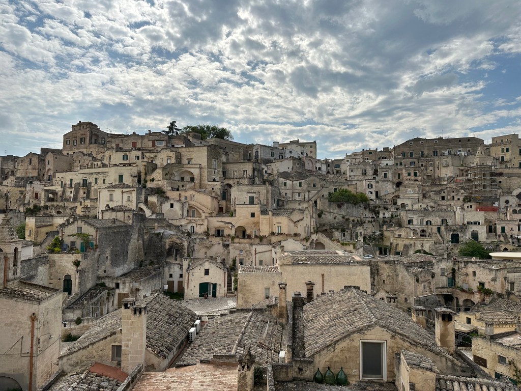
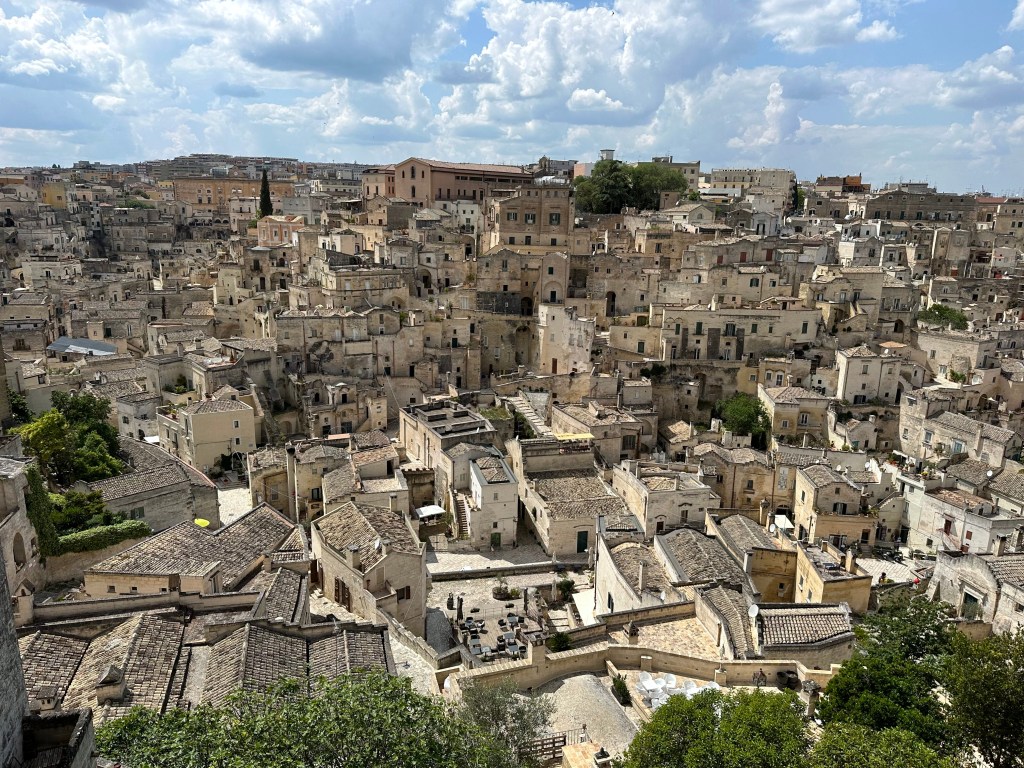
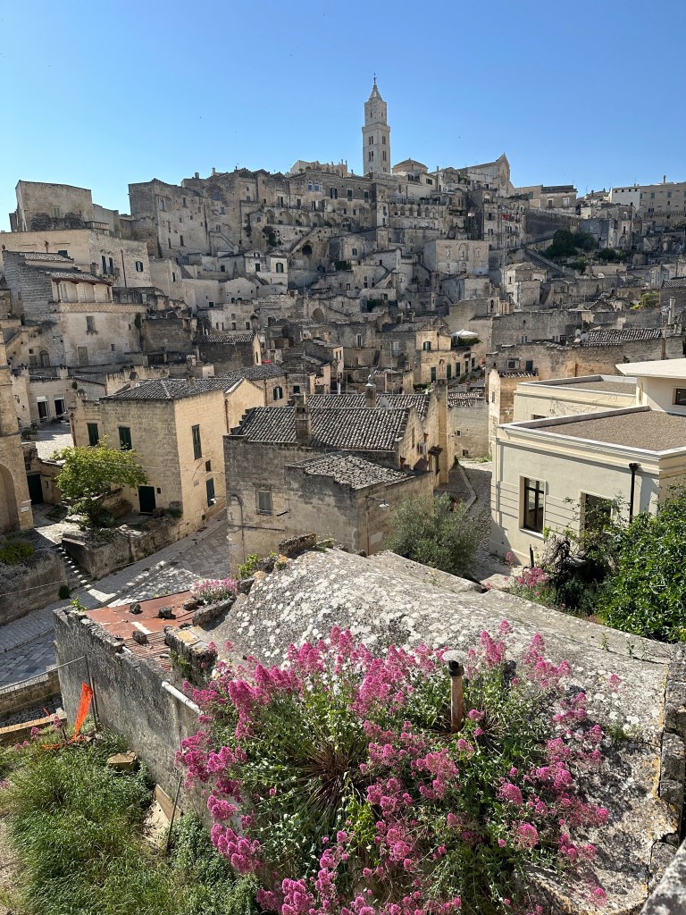
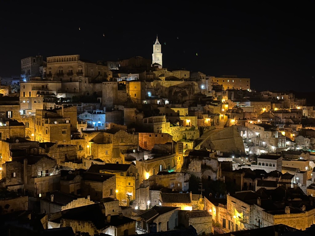
Despite the have and have not history of Matera and the primitive conditions of the sassi, this place has come into its own. Freaking amazing warren of troglodyte homes and alleys built into the soft limestone of the valley. It was like an inverted Gordes – picturesque and full of character.
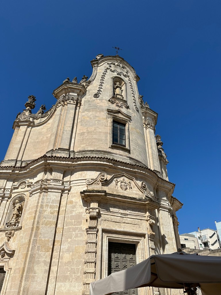
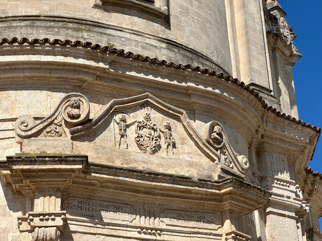
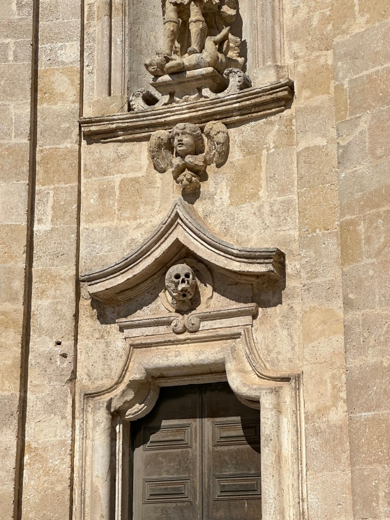
At the edge of the sassi lies Chiesa del Purgatorio (Church of Purgatory).
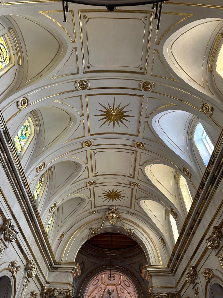
The church was built in the 18th century and embodies baroque church architecture (which we’d see plenty of a couple of weeks later in central Sicily), but that’s not why it’s notable.
It’s notable for it’s embellishments everywhere that serve as reminders of mortality (memento mori),
and the need to pray for souls in pergatory.
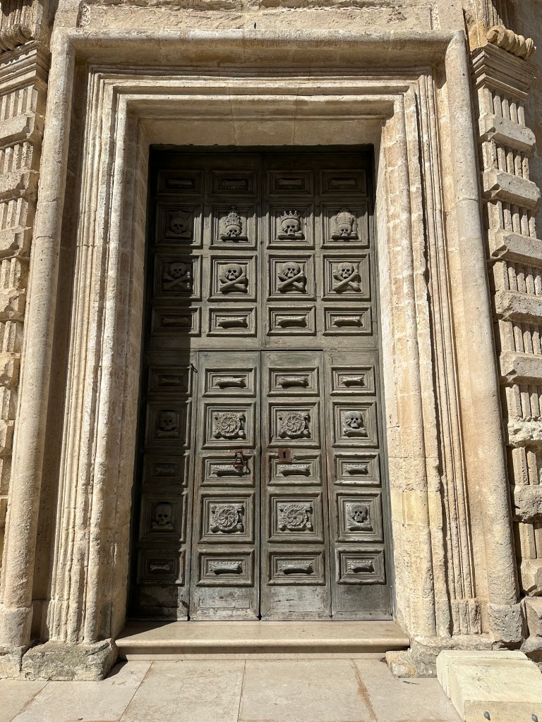
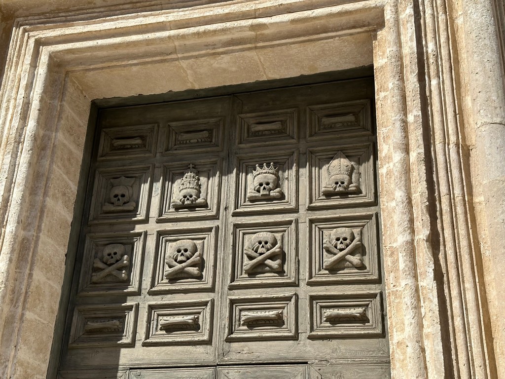
The door is the coolest part.
“It’s decorated with four skulls of nobles and clergymen and just under these, four skulls representing common people, with four more on the side of the entrance.” (From here.)
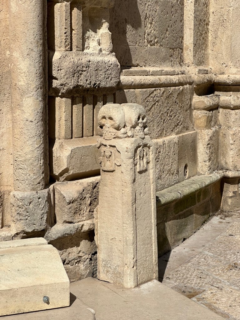
But the skulls-on-a-plinth are a good look, too:
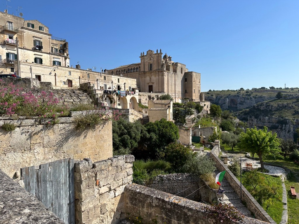
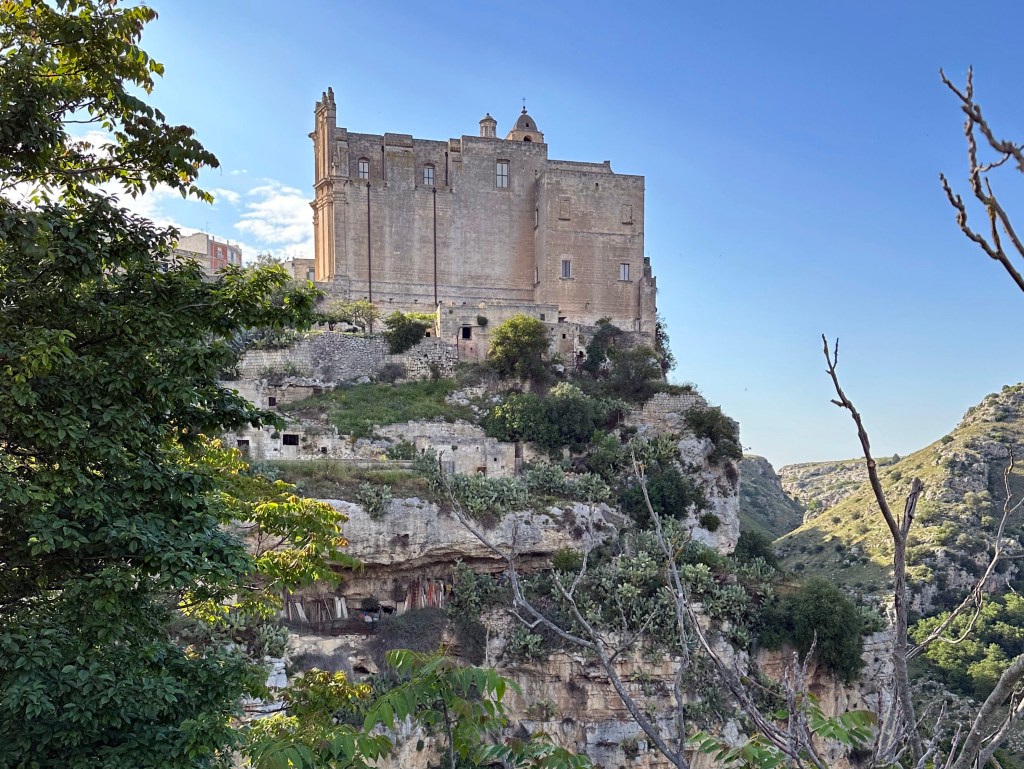
At the other end of town, a different religious institution: The Convent of Saint Augustine.
A relative latecomer, having been founded in 1591, it’s still a pretty impressive and monolithic structure, perched on a cliff at the very edge of the sassi.
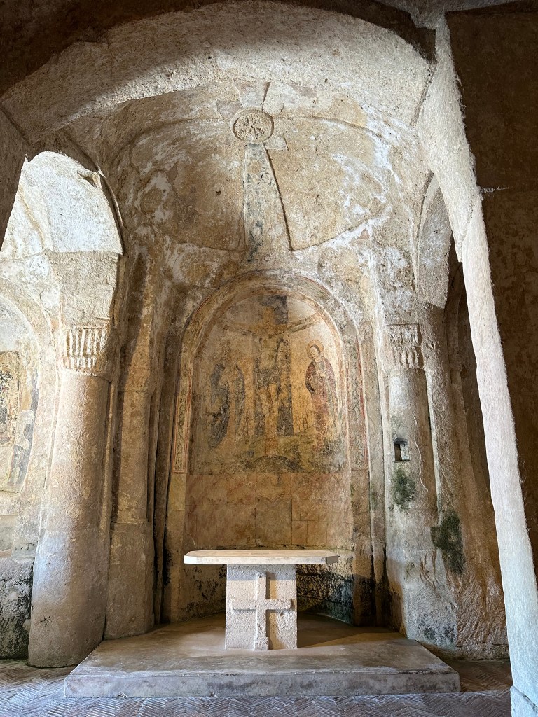
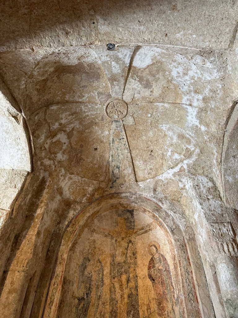
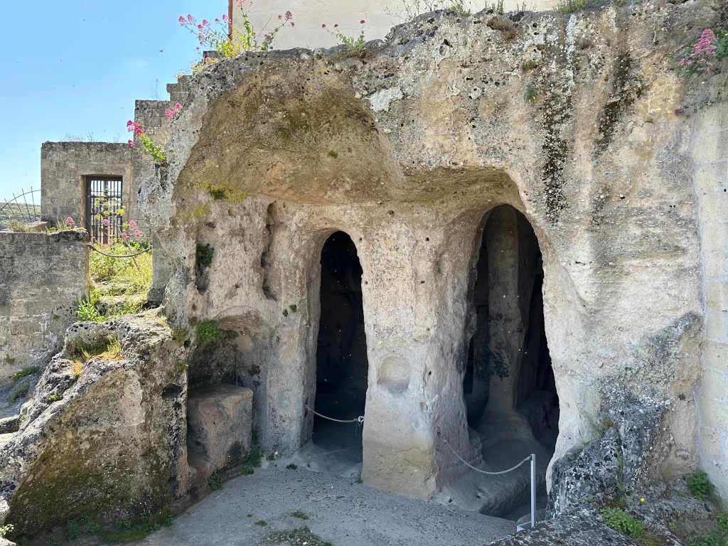
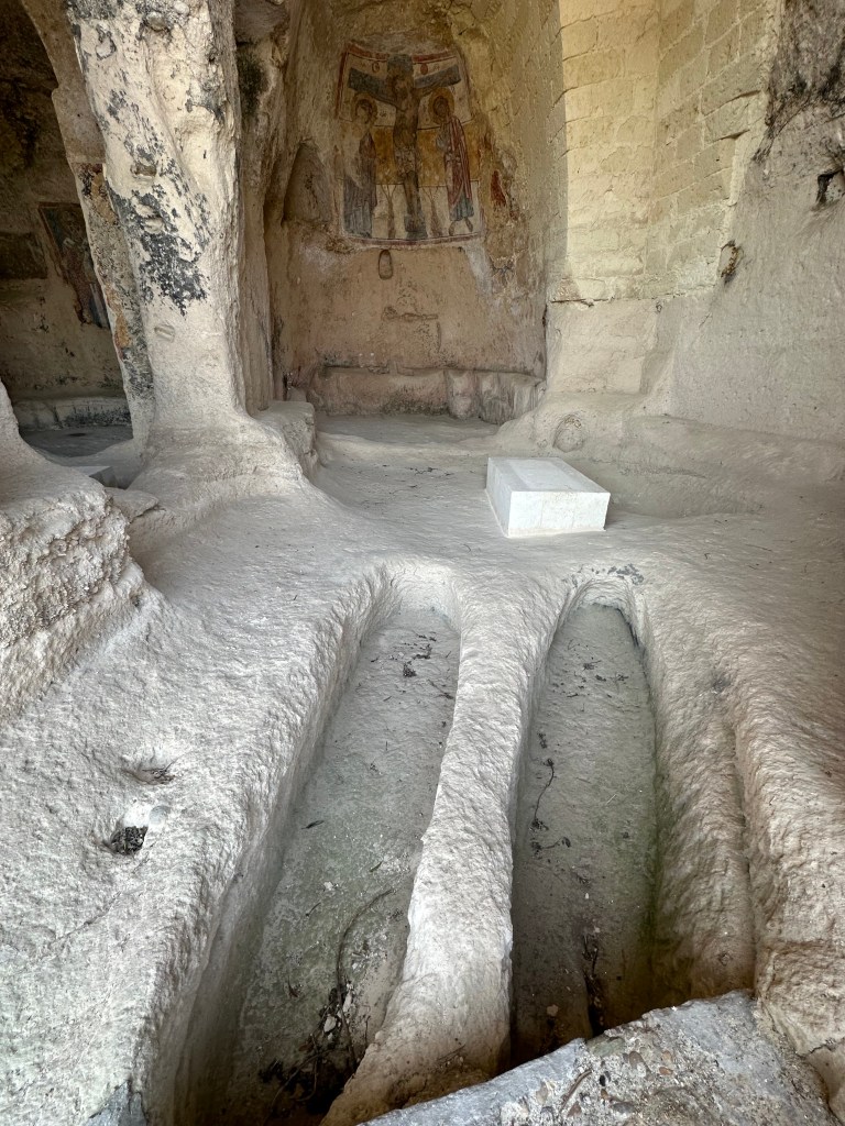
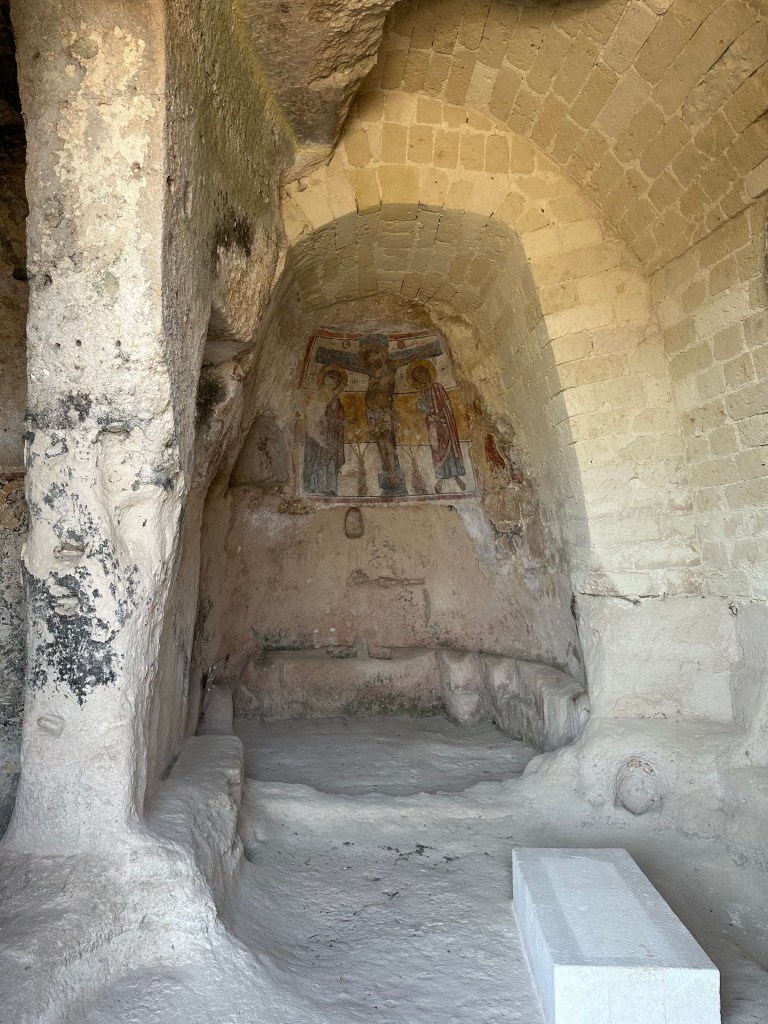
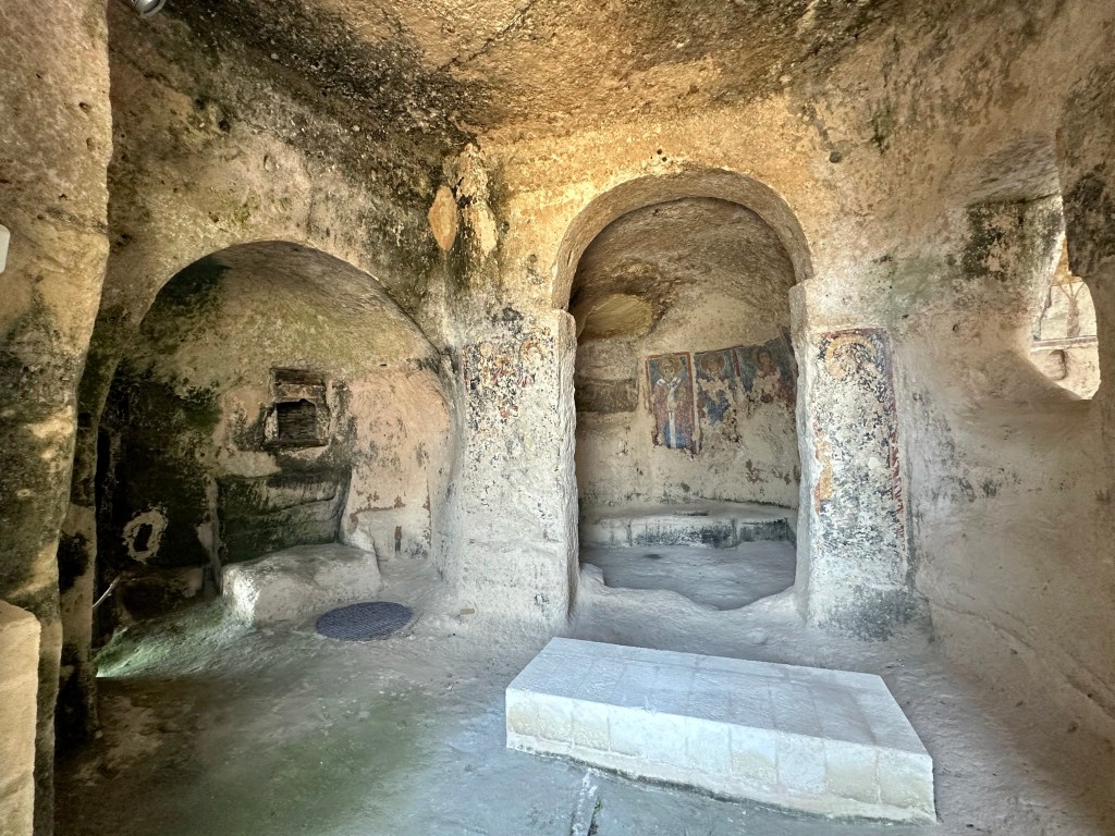
And in its shadow, a humble rupestrian church (new term to us! we would have characterized this cave church as troglodyte [like we did in this post from Cappadocia], but rupestrian works too).
Founded in the 10th century, San Nicola Dei Greci originated as a Greek Orthodox church (see Byzantine Greek rule reference above
The triptych fresco depicting Saint Nicolas, Saint Barbara, and Saint Pantaleon (not to be confused with Saint Pantaloons, patron saint of trousers and culottes) dates from the 12th to 13th centuries:
Check this shit out! This is why Europe is so incredible; we were just wandering about a troglodyte church with 800-year-old frescos adorning its walls with the same casualness as walking into a Starbucks.
With that under our belt, we head out in search of some lunch.
Outside the sassi in the Piazza San Pietro Caveoso with the cathedral’s bell tower looming over town:
Chiesa di San Pietro Caveoso (The Church of Saints Peter and Paul, the latter of whom apparently went the way of Hamilton of Booz Allen Hamilton in the church name):
The original church dates to 1218, but the current appearance reflects a comprehensive overhaul in the 17th century. Picturesque, and with a well-positioned plaza facing the sassi (as noted above), it’s still not quite as cool as the rupestrian church above it.
“Dating to the 8th century, when it was built as the Benedictine Order’s first foothold in Matera, this cliff-face church has a number of 13th-century frescoes, including an unusual breastfeeding Madonna. The church originally comprised three aisles, with two later adapted as dwellings.” (From here.) We got to see the inside, which did indeed have multiple frescoes, as with the other rupestrian church, but no cameras were allowed in this one or in another one we popped into inside the sassi area.
A view of the other end of the sassi facing the valley:
What’s a town to do for a dump truck if most of the roads are narrow, up-and-down alleyways? This:
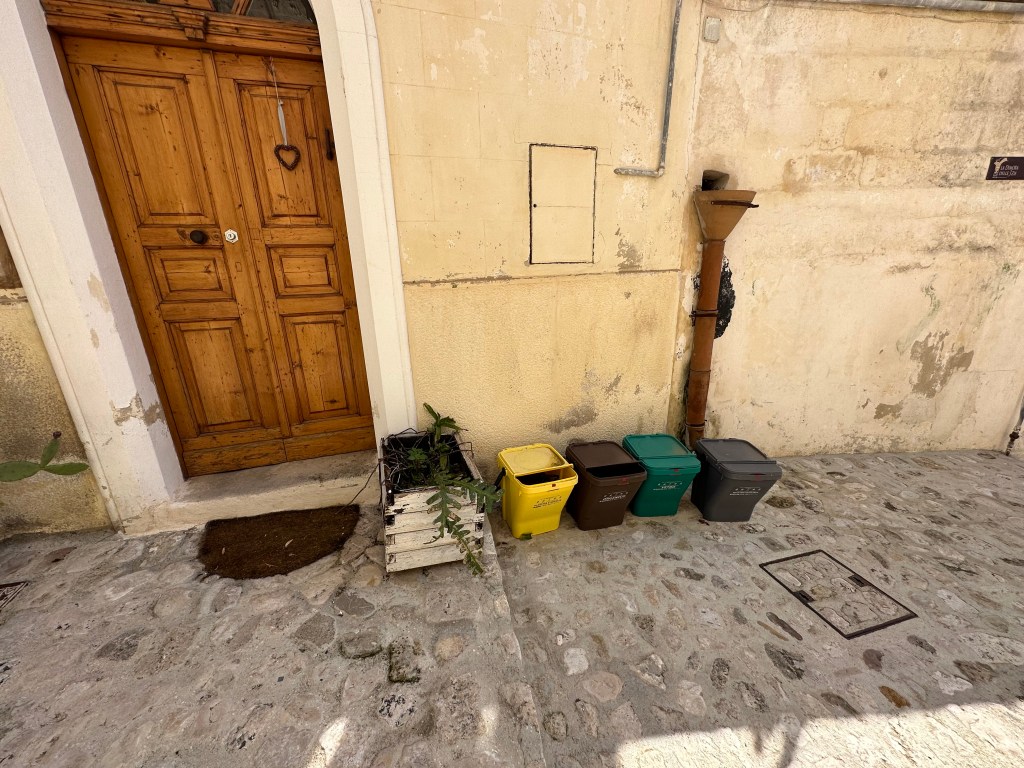
Also, a picture that captures the recycling specificity that uniquely characterizes Italy and no other country, European or otherwise, that we’ve visited:
We first encountered this during our second visit to Siena, and then at our AirB&B in Portofino. You’ve got to separate glass from metal from paper from food waste and from general refuse (not that there’s much left after all of that sorting). Which raises questions like, where do we deposit the paper coffee filter (paper) filled with coffee grounds (food waste)? Or this burnt out light bulb comprised of brass (metal) and glass (um, glass)? These are the challenges WolfeStreetTravel must cope with!
Heading out for aperitivos high up in the sassi and then dinner on our last night:
One of the best dinners of the visits, actually.
Pretty awesome conversion of a troglodyte church into a wine bar:
And some good freakin’ pesto:
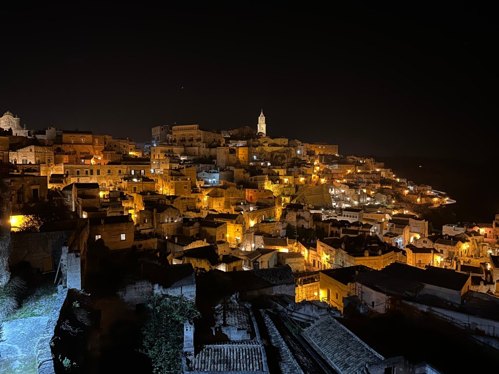
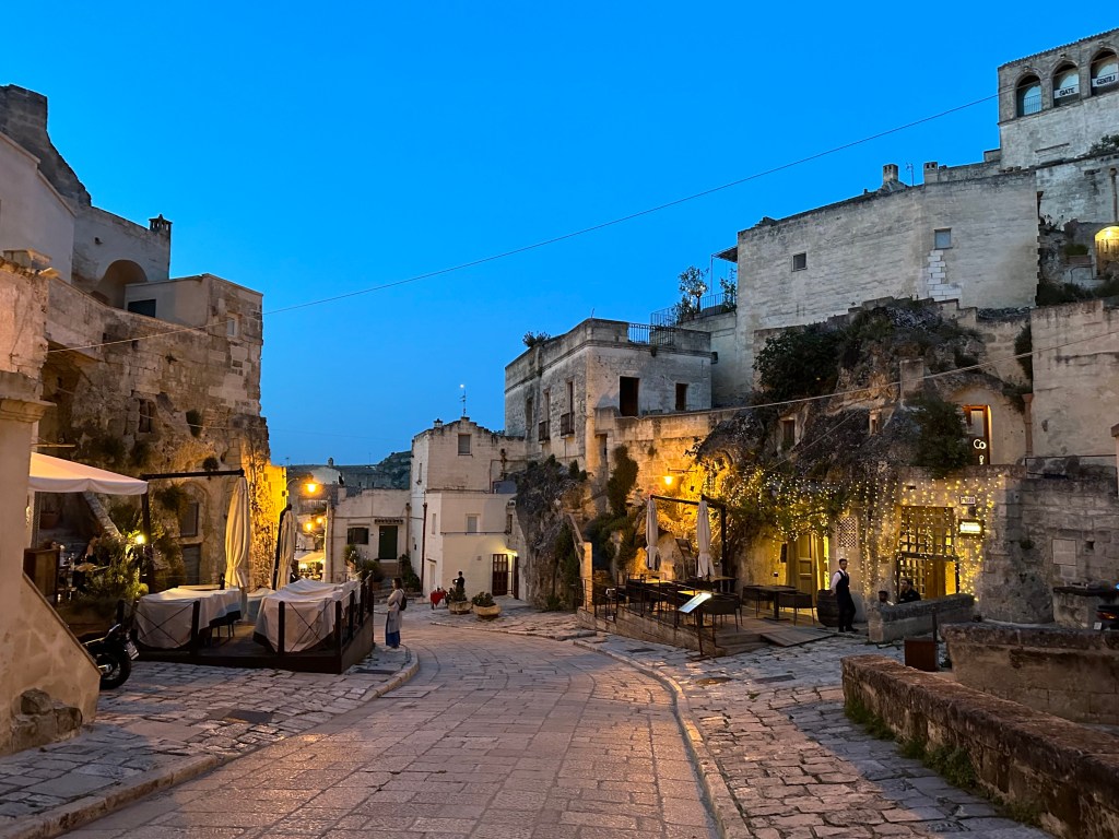
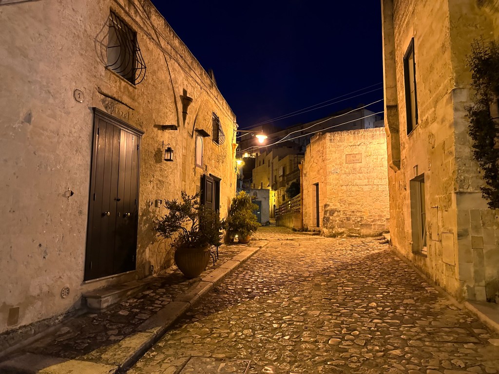
Sassi day time:
Sassi night time:
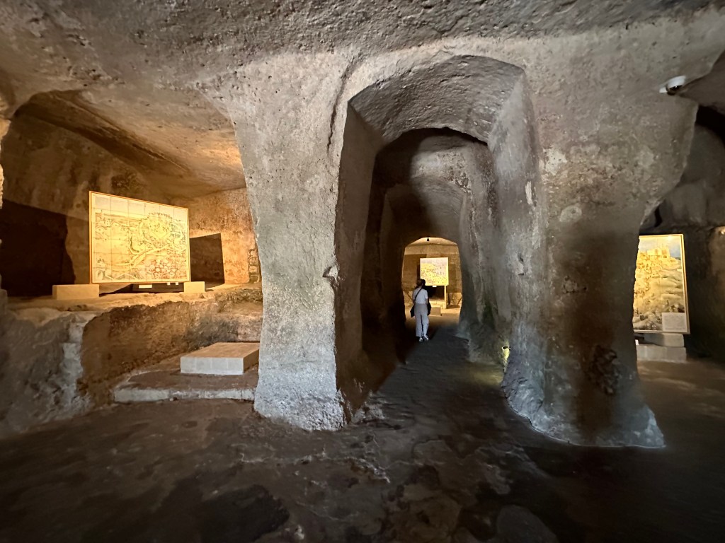
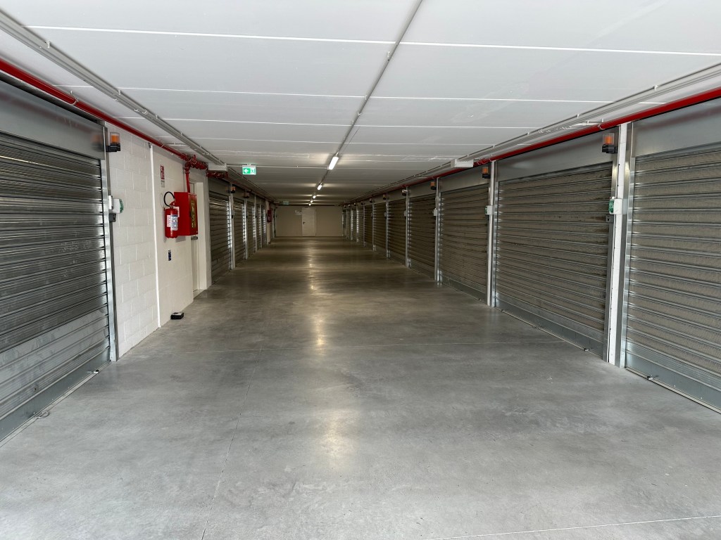
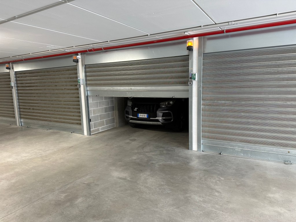
The next morning, we retrieved our car for the drive to the Bari airport. In what appears to be a self-storage warehouse:
But behold! A bunch of tight garages for sassi residents who can’t bring their cars (for obvious reasons) into town:
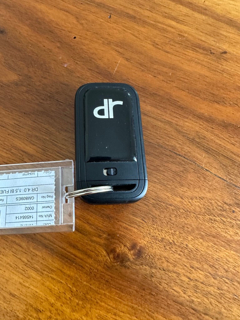
And the weirdest car to date: a dr, which is an Italian car brand that uses Chinese auto bodies. Go figure. Regardless, this was our last day with it.
After a couple of days in Matera, we drove east in the morning across the remainder of the Italian peninsula to drop off the car at the Bari airport and catch a flight to the Costa Rei at the southeastern tip of Sardinia. Our time in Matera brought a close to the Italian peninsula segment of the trip and beginning the next (albeit very brief) leg. (An overview of the trip sequencing is posted in the, uh, overview post.)
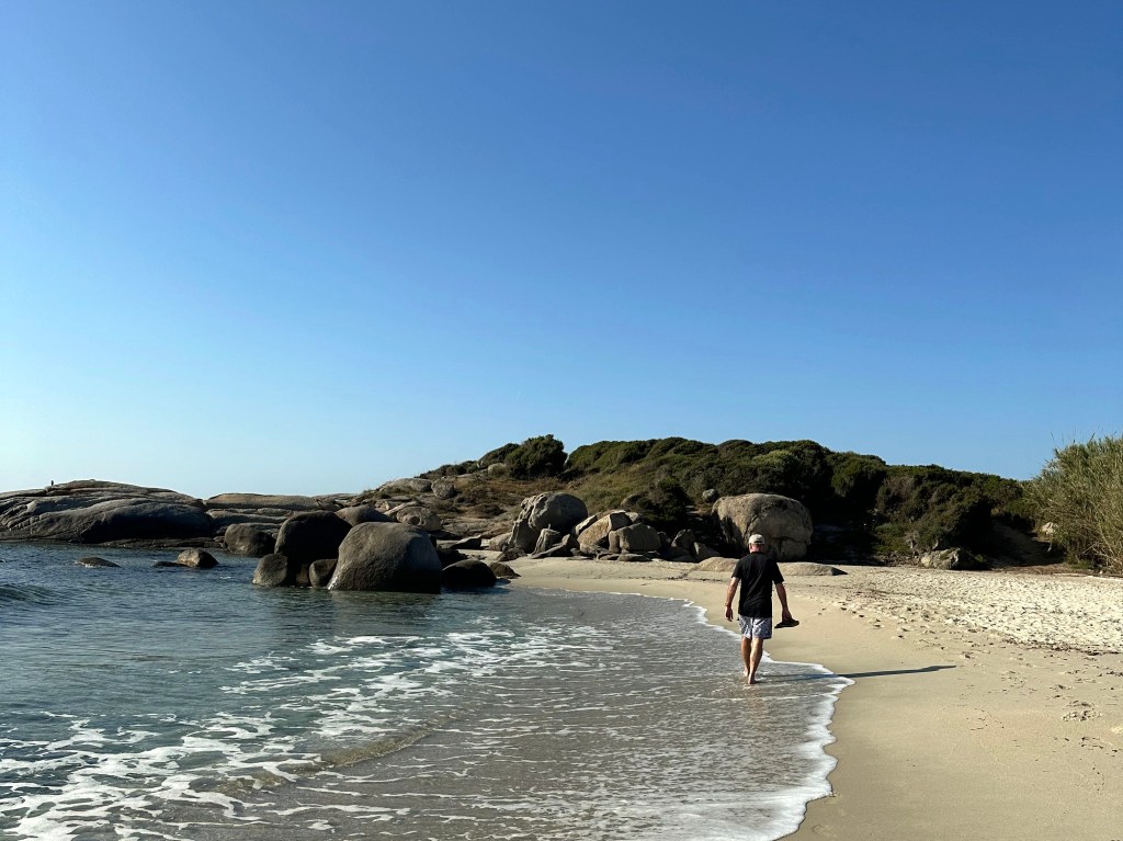
Unlike the other stops on our trip thus far, this would be focused only on chilling – no history, no exploration (other than beach walks each day). So, very little commentary – just some pics.
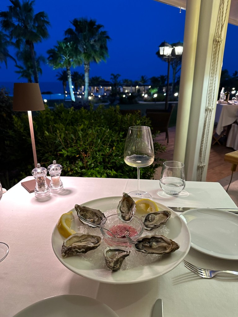
Okay – here’s some commentary: Sardinian oysters are outstanding. (They’ll be bested by the Normandy oysters we’d have a month and a half later, and also by the Wellfleet oysters we’d have on our New England road trip the following year, but still – really good!)
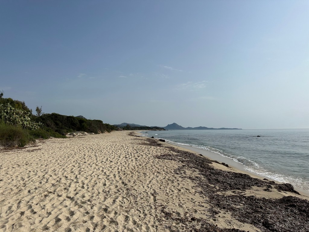
Decent digs with a pretty good view:
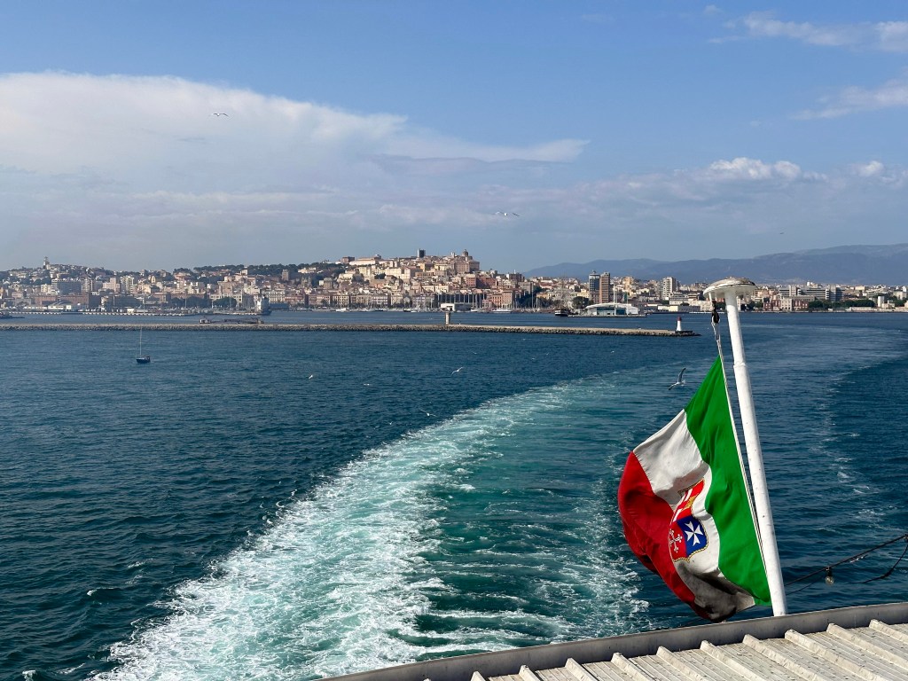
After a few days lounging around Costa Rei, we headed to the port and grabbed an overnight ferry to our next destination: Palermo and Sicily.
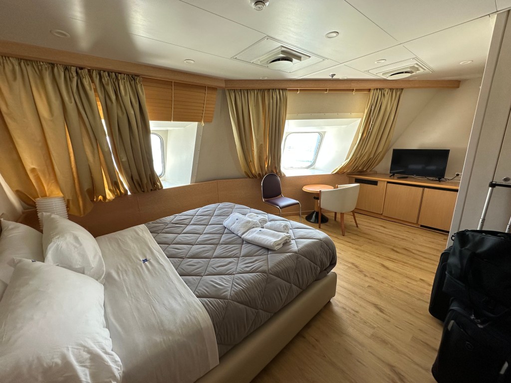
No bad digs here either – also a pretty efficient use of time to sleep en route to Sicily (just like our overnight train from Lisbon to Madrid on our very first European trip in 2002).
After an overnight ferry ride from Sardinia, we arrived in Palermo, Sicily, early the next morning. This would be our first time ever setting foot on the island. An island with a remarkably layered history of conquerors and competition – perhaps more so than with any other region to which we’ve traveled.
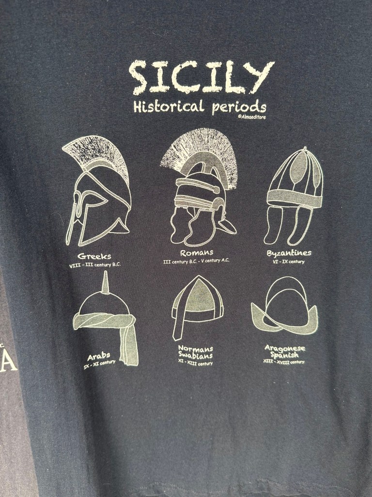
During our time on the island, we read Sicily: Three Thousand Years of Human History, by Sandra Benjamin, which provided great context to the historical backgrounds of the locations we visited and the architecture we witnessed. Although super conversational and easy to digest (would 100% recommend), the history book nonetheless was, indeed, a history book. What we could have done instead was just roll up to a souvenir shop (this one located in the beach town of Taormina on the other side of the island) and get the Cliff Notes version of Sicilian history on this spectacularly informative T shirt:
Below, a brief overview of each of those helmets provides a reasonable starting point to Sicily’s millennia of history (plus the addition of two critical cultures by WolfeStreetTravel that are not included on the T shirt and represent egregious omissions – you’d think all tourist T shirts would have been subjected to a rigorous peer review process and thorough QC before being printed!):
Ancient Greeks (c. 750–241 BCE) – Greek colonists founded powerful city-states such as Syracuse and Agrigento, making Sicily part of Magna Graecia and a major center of philosophy, theater, and trade. Their legacy includes Doric temples (notably in the Valley of the Temples), urban planning, coinage, and a lasting imprint on Sicilian dialect, cuisine, and coastal settlement patterns.
Carthaginians (c. 550–241 BCE, western Sicily) – Carthage controlled western Sicily in a long struggle with the Greeks, using ports such as Mozia as strategic trade and naval hubs. They reinforced Sicily’s role as a Mediterranean crossroads and left Phoenician-Punic archaeological remains, maritime trade traditions, and early fortification systems.
Ancient Romans (241 BCE–476 CE) – After defeating Carthage in the First Punic War, Rome made Sicily its first province and a vital grain supplier to the Republic and later Empire. Roman rule brought roads, villas with elaborate mosaics, Latin language foundations, administrative systems, and early Christian communities.
Byzantines (535–827 CE) – Reclaimed under Justinian, Sicily became a key Byzantine outpost bridging Constantinople and the western Mediterranean. They strengthened Orthodox Christianity, introduced Greek liturgical traditions, fortified cities, and preserved classical learning during the early medieval period.
Arabs (827–1091 CE) – Muslim rulers transformed Sicily into a prosperous emirate centered on Palermo, then one of Europe’s largest cities. Their legacy is profound: irrigation systems, citrus and sugar cultivation, advances in science and mathematics, Arabic influences in Sicilian vocabulary, and architectural elements such as gardens, domes, and decorative geometric motifs.
Normans (1091–1194 CE) – The Norman conquest created the multicultural Kingdom of Sicily, blending Latin, Greek, and Arab traditions under rulers like Roger II of Sicily. Their architectural masterpieces (e.g., the Palatine Chapel in Palermo and the cathedrals of Monreale and Cefalù) fused Romanesque, Byzantine mosaics, and Islamic artistry into a uniquely Sicilian style.
Swabians (1194 – 1266) – After the Norman line ended with William II of Sicily in 1189, the crown passed through marriage to Henry VI of the Hohenstaufen dynasty, who became King of Sicily in 1194. His son, Frederick II, then ruled Sicily and turned it into one of the most sophisticated and culturally advanced courts in medieval Europe.
Angevins (1266 – 1282) – The Angevins, led by Charles I of Anjou, seized control of Sicily from the last Hohenstaufen ruler, Manfred of Sicily, in 1266 and ruled with heavy taxation and strong French influence, which bred deep local resentment. This culminated in the Sicilian Vespers, a popular revolt that overthrew Angevin rule on the island and shifted power to the Crown of Aragon.
Aragonese (1282–1479 CE; broader Spanish rule until 1713) – After the Sicilian Vespers, the Crown of Aragon ruled Sicily, integrating it into the Spanish Mediterranean world. They shaped Sicily’s feudal aristocracy, fortified coastal defenses, introduced Catalan-Gothic influences, and embedded Spanish elements in language, governance, cuisine, and Baroque artistic development.
Sicily feels palpably layered because each time one culture overcame the previous, that former layer just accreted – it was never supplanted. Unlike much of Europe, where one dominant power replaced another, Sicily’s conquerors often built on top of existing systems rather than wiping them out. The result is not a linear history, but a vertical one: Doric temples from the Ancient Greeks stand within sight of Roman villas, Byzantine domes, Arab garden layouts, Norman mosaics, and Spanish Baroque facades — sometimes within the same city block.
The island’s geography made this possible. Sitting at the center of Mediterranean trade routes between Europe, North Africa, and the Near East, Sicily was too valuable to abandon and too prosperous to dismantle; each incoming power adapted existing administrative systems, agricultural innovations, and urban frameworks rather than starting from scratch.
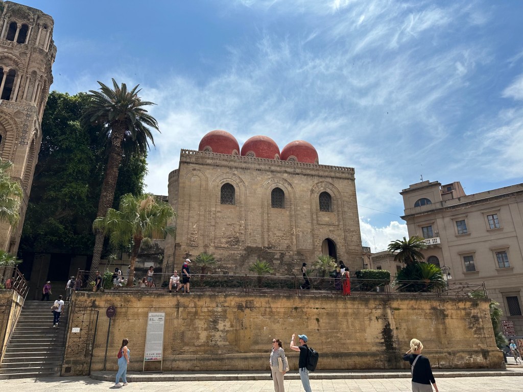
Our favorite example? When the Normans conquered the Muslim emirate, they retained Arab administrators and artisans, which is why you get Islamic muqarnas ceilings inside Christian chapels in Palermo. Case in point: the Arabo-Norman Church of San Cataldo in Palermo, dating from 1140:
This layering also explains Sicily’s cultural contradictions: citrus groves introduced under Arab rule grow beneath Norman cathedrals; Spanish street grids frame Greek archaeological parks; Sicilian dialect carries Arabic, Greek, Catalan, and Latin roots simultaneously. The island feels neither fully Italian nor fully Mediterranean in a single-direction sense — it feels like a distilled Mediterranean civilization.
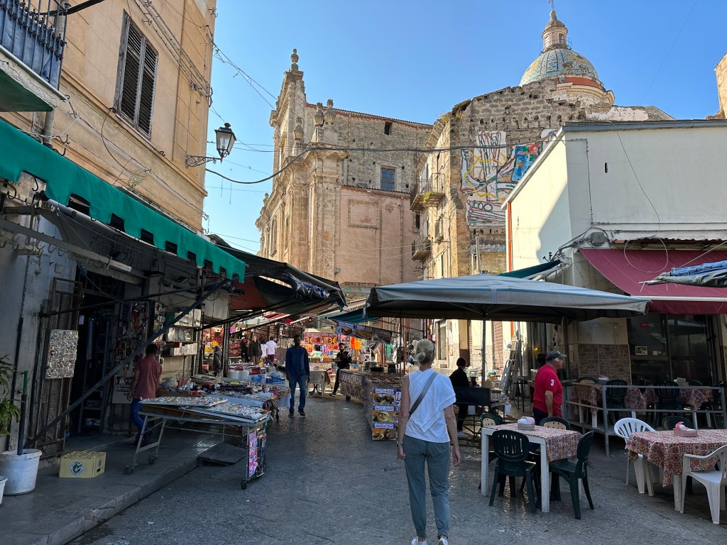
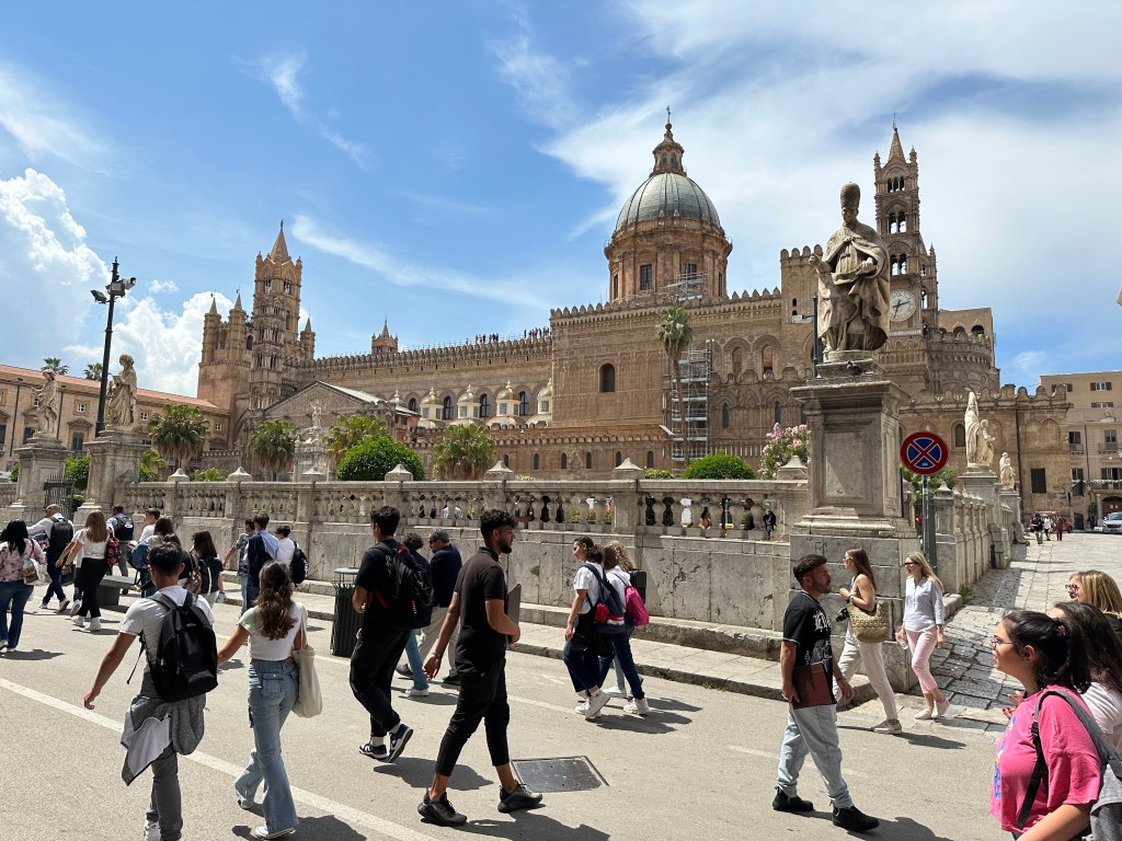
Although Sicily’s long history is better witnessed in cities like Syracuse on the southeast coast, where the Greeks first settled and which dominated trade and politics, we began our stay on Sicily in its current capital of Palermo, in the northwest. After the Arab conquest in the 9th century, the focus shifted westward to Palermo, which became the administrative and commercial capital under Muslim and later Norman rule. Its superior harbor and position on Mediterranean trade routes cemented Palermo’s long-term dominance.
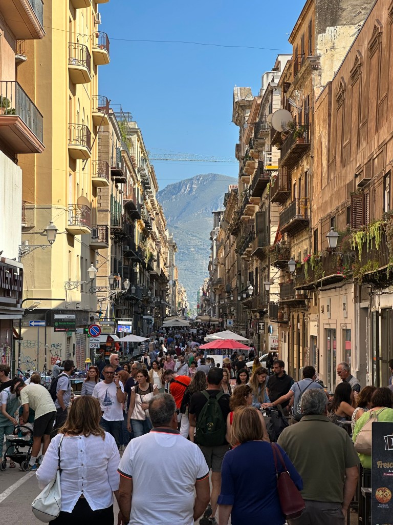
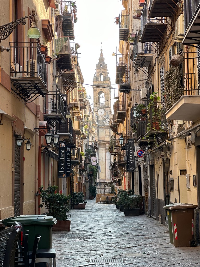
Palermo’s main drag of Via Maqueda, where we’d find ourselves each day at some point:
Cool little side street our first morning highlighting the cathedral bell tower:
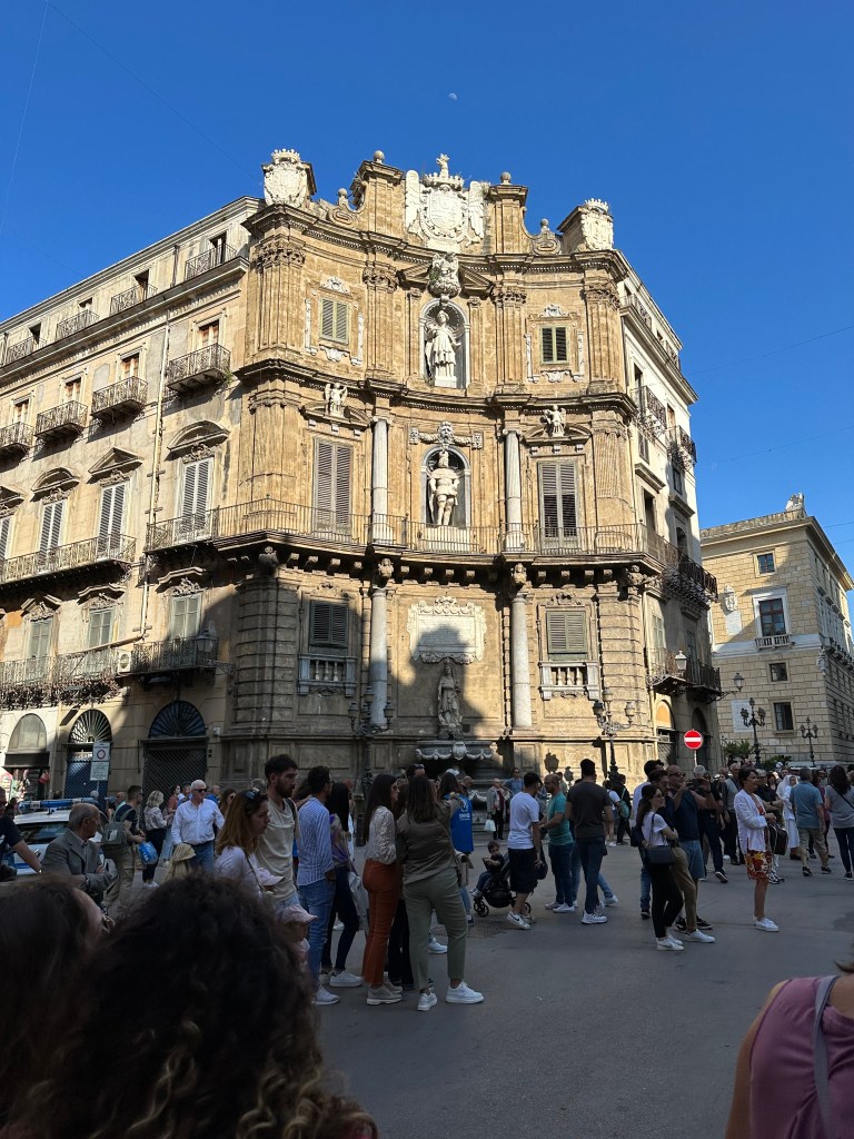
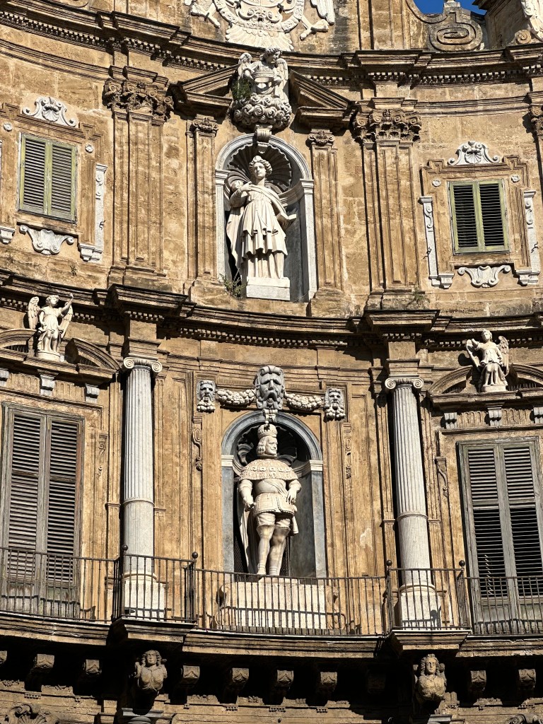
Palermo’s Baroque Quatro Canti square at the intersection of the Via Maqueda and the Corso Vittorio Emanuele:
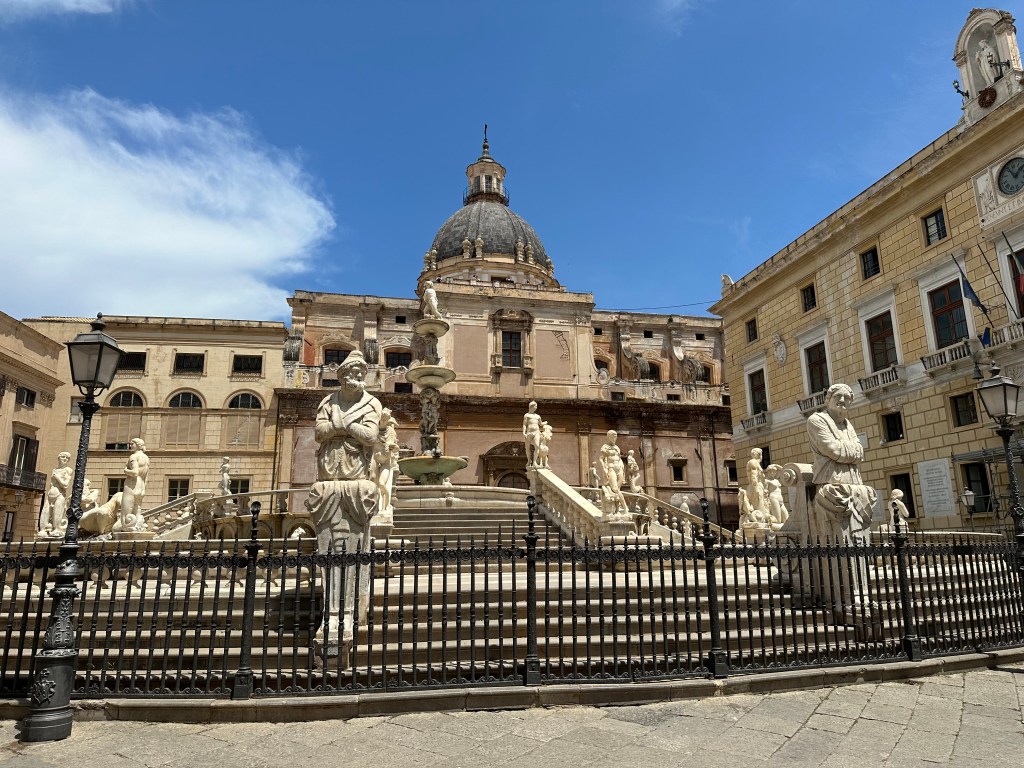
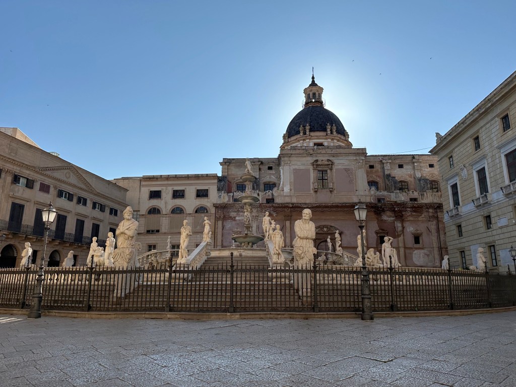
The ornate, 16th-century Praetorian Fountain on Via Maqueda, sporting 16 nude statues of nymphs, humans, mermaids, and satyrs (offending some delicate souls, who declared it Fontana della Vergogna [Fountain of Shame]):
Pretty awesome town in which to just wander around.
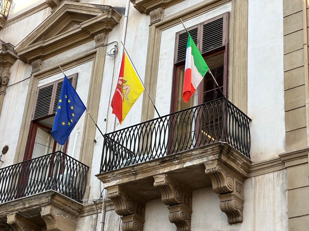
Sicily’s super-intriguing Trinacria flag, flanked by the EU and Italian flags on balcony in town. We’ll get into that little vexillological nugget in a future post, featuring beer. Cold, delicious beer. Mmmm; beer.
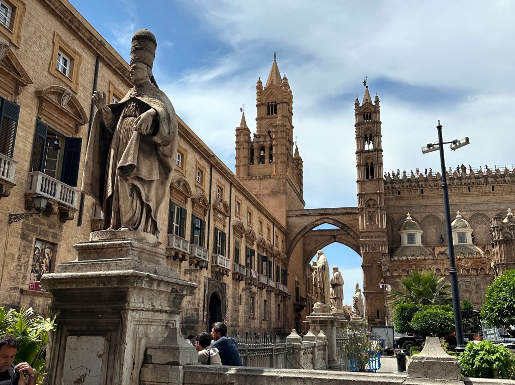
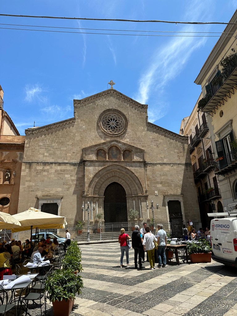
Palermo Cathedral:
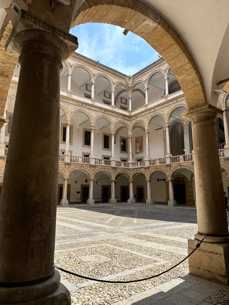
We didn’t go in, but instead walked through, making a beeline to the much more interesting Palazzo dei Normanni (Palace of the Normans):
Inside the palace’s main courtyard:
The Norman Palace “was built on the highest point of the city, above a Punic [see?! Carthaginians!] structure discovered in 1984 beneath the Duke of Montalto Halls. During Arab rule, the earliest nucleus of the building arose between the rivers Kemonia and Papireto, designed with defensive features typical of fortresses. This building was also used during the Roman Byzantine era.
Following the Norman conquest in 1072, the Normans built a new building consisting of a castle, with the function of royal residence and administrative hub. In 1130, after the coronation of Roger II of Altavilla—the first Norman king of Sicily—the Palatine Chapel was constructed, becoming a symbol of Norman cultural and Christian religious.
The palace’s core was marked by four towers and included facilities such as workshops and textile laboratories (nobiles officinae or tiraz). It served as the seat of successive Norman courts, including those of Roger II, William I (known as “the Mean”), and William II (“the Good”), who oversaw a remarkable confluence of diverse cultures. Frederick II, grandson of Roger II and son of Henry VI of Hohenstaufen and Constance of Altavilla, continued this legacy. He played a pivotal role in its administration and in fostering cultural life, notably supporting the Sicilian School of poetry.” (All from here.) [BTW, we also would highly recommend the podcast “Norman Centuries” by Lars Brownworth; outstanding!]
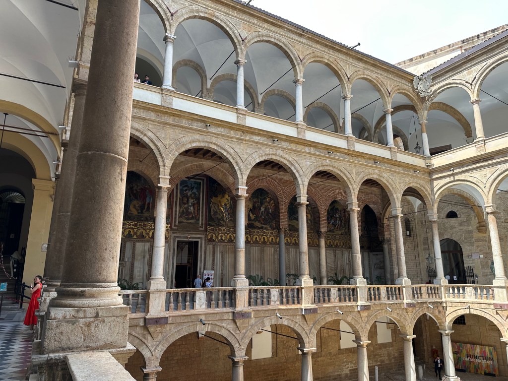
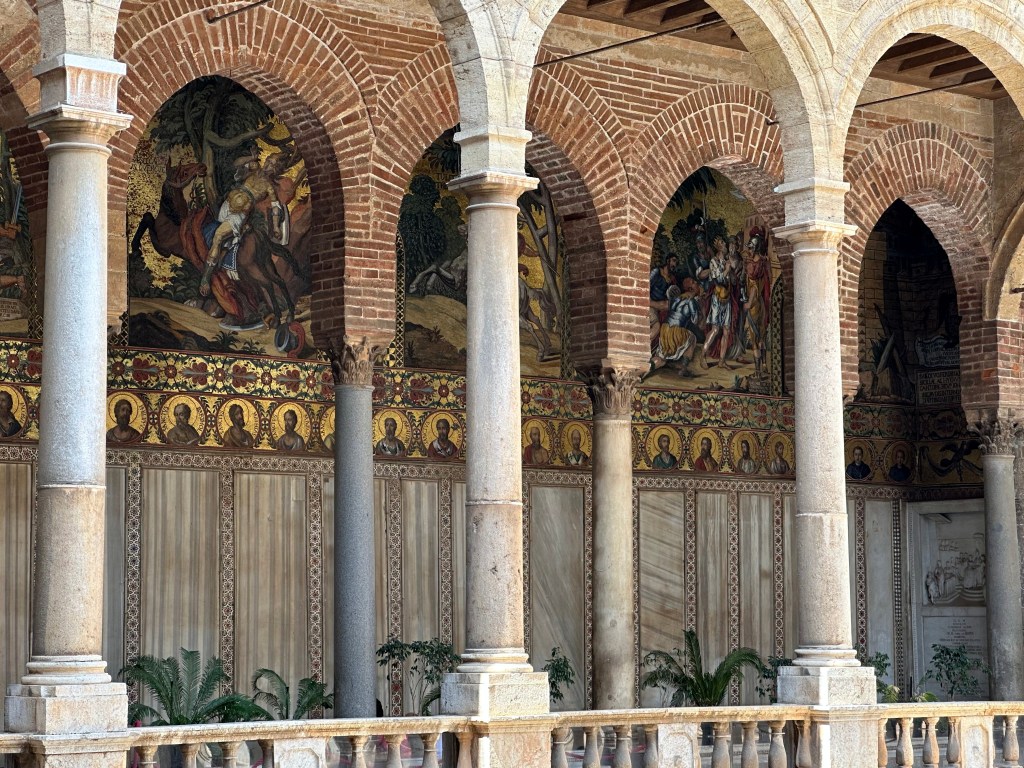
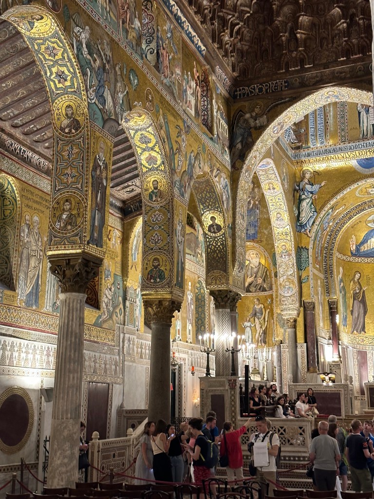
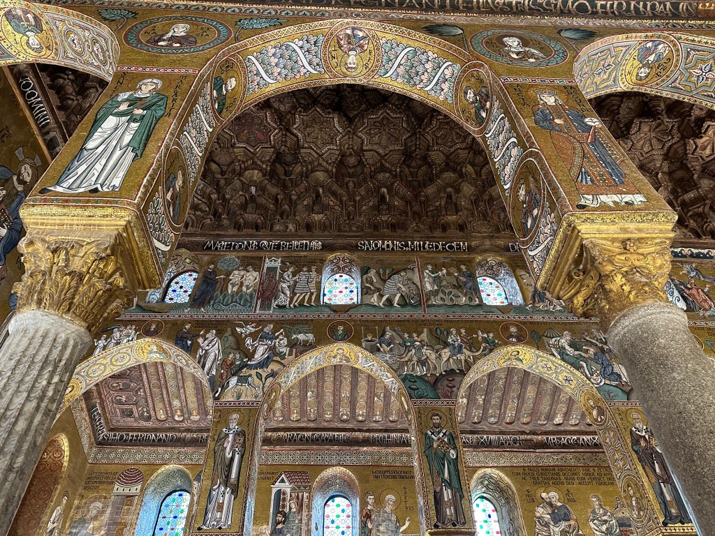
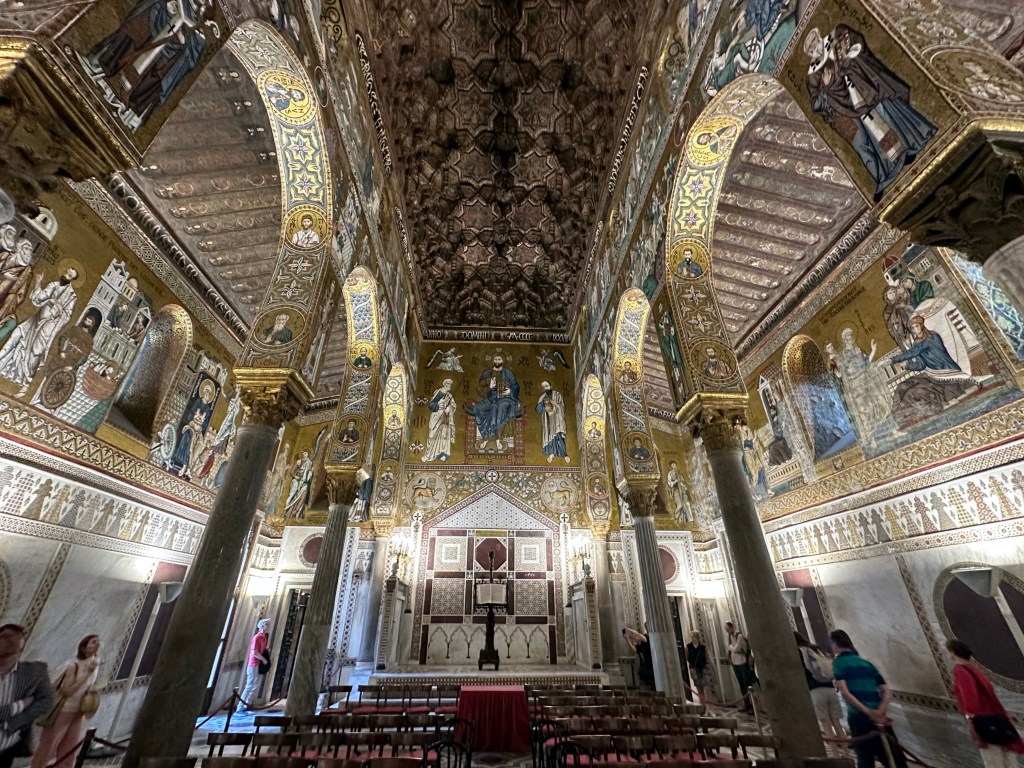
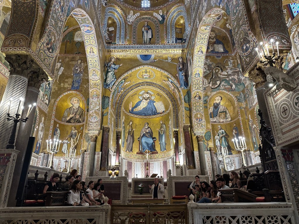
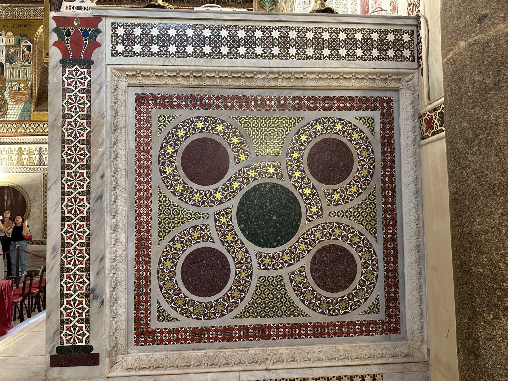
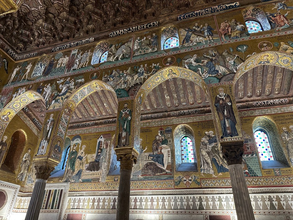
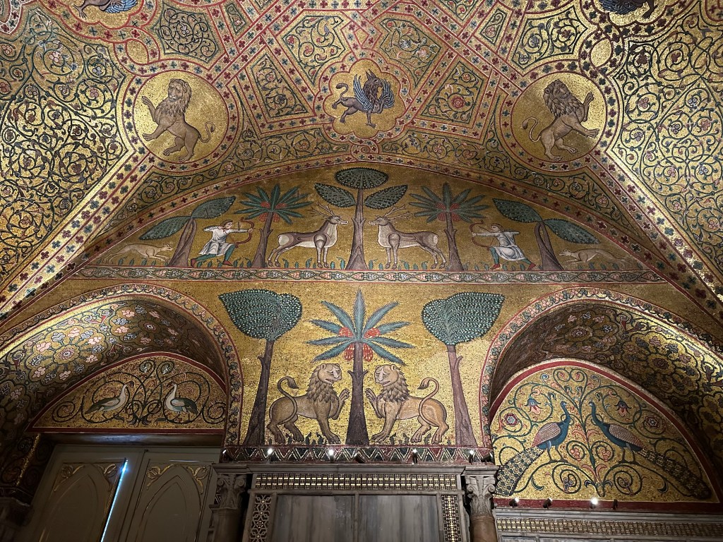
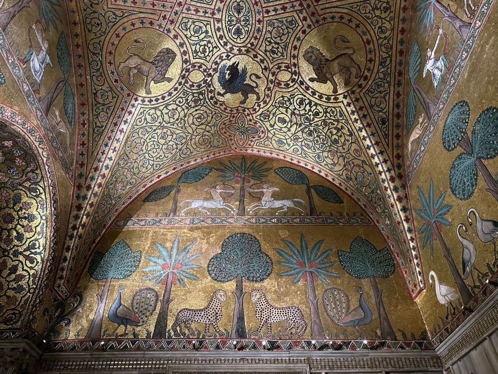
The palace’s extraordinary (and super Byzantine) Palatine Chapel:
Commissioned by Roger II of Sicily in 1132, the architecture represents a blend of Byzantine, Norman, and Fatimid styles that is unique to Sicily (we’d see another, even grander example right after we left Palermo).
To wit: a Norman church structure adorned with Byzantine-style mosaics and topped with a Fatimid-style muqarnas ceiling (identical in style to those we experienced at the Moorish Alhambra in Granada):
Byzantine-style mosaics dominate the walls of the ambulatory:
And geometric Fatimid Arab designs are evident along knee walls and other structures:
Although the mosaics covering the ceiling and dome date from the 1140s and were, indeed, created by Byzantine artists, others above the aisles were created in the 1160s and 1170s by local craftsman and are more Latin in style (including Latin inscriptions):
An abrupt transition to the 18th- and 19th-century Pompeian hall:
King Ruggaro (Roger II) Hall within The King’s Apartments, with its characteristic hunting scene mosaics:
Including its signature leopards, which now are not only the symbol of the palace, but, we found at a stay later, adorn a line of high-end Sicilian toiletries at hotels (the brand name itself is the urban island in Syracuse, which we’d visit later in the trip – this whole experience keeps folding in on itself).
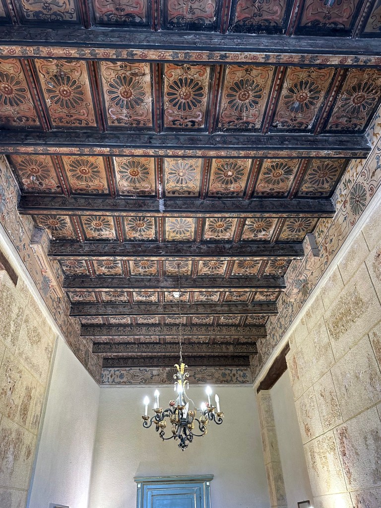
Medieval painted wooden ceilings in King Ruggero’s Hall:
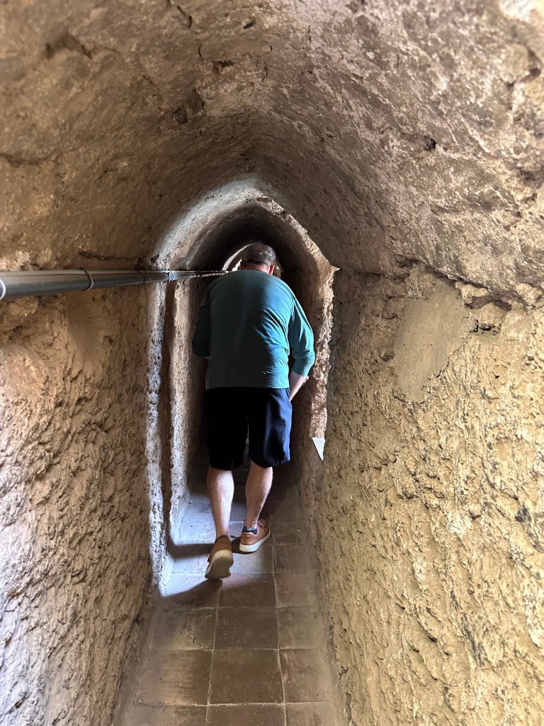
Climbing through one of the passageways in the fortified tower:
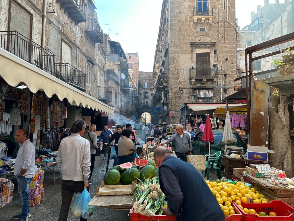
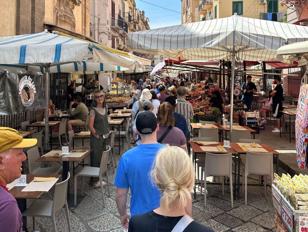
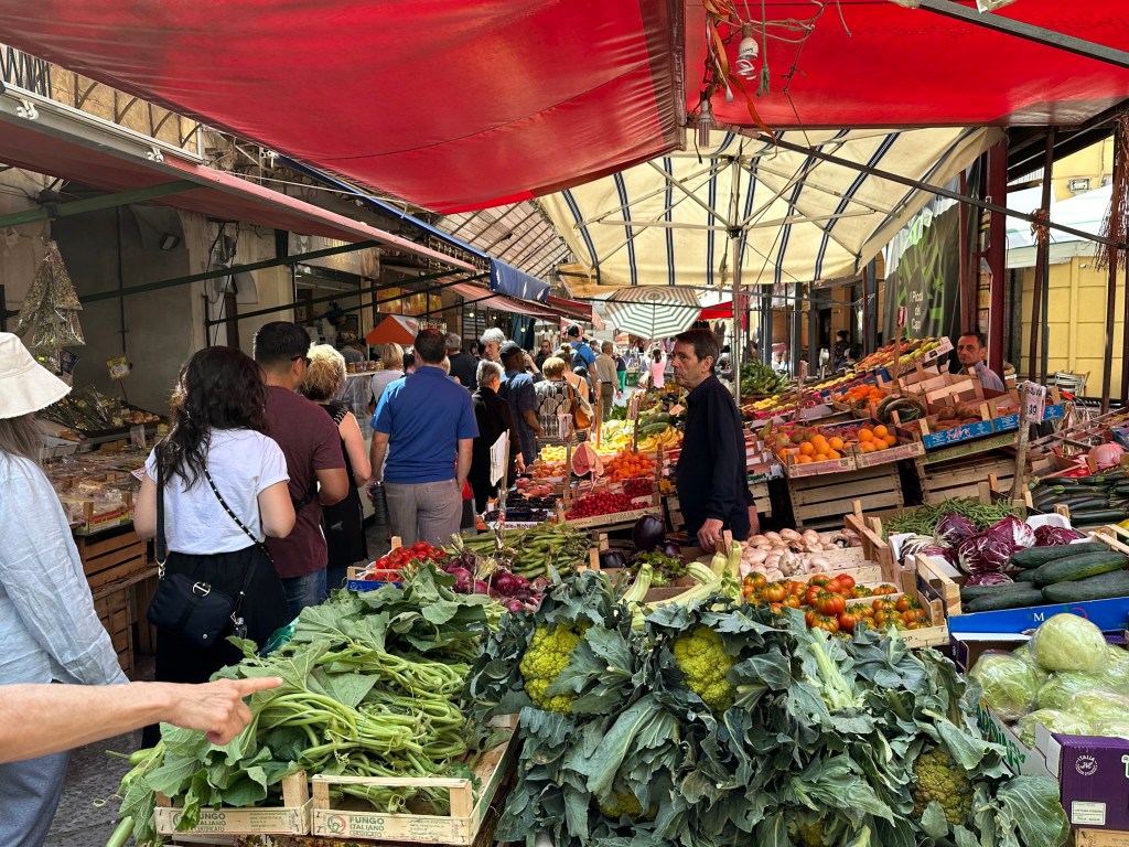
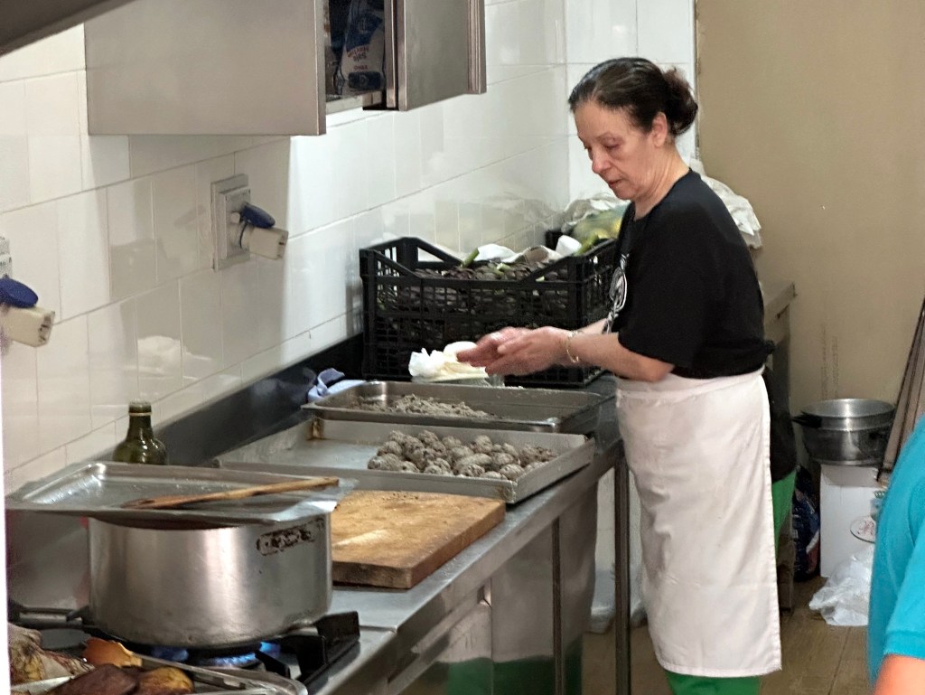
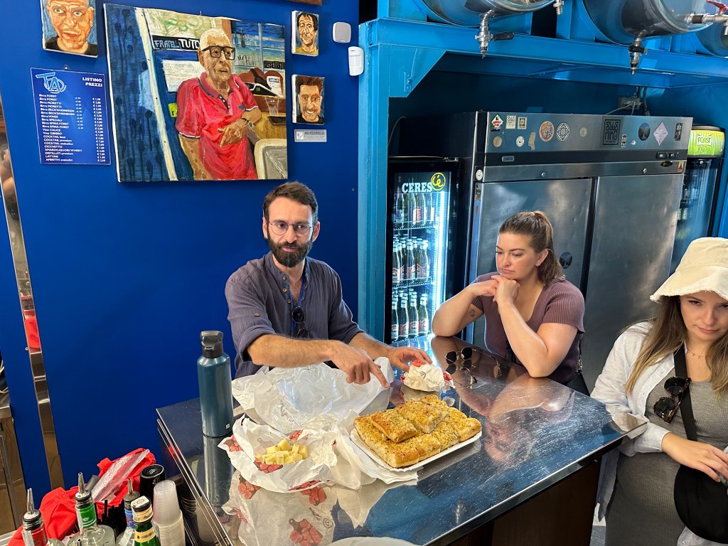
Back out on the street and in a street food tour!
A little nona at work:
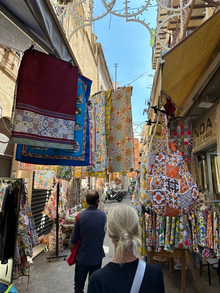
Parading through the fabric district:
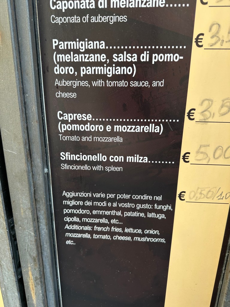
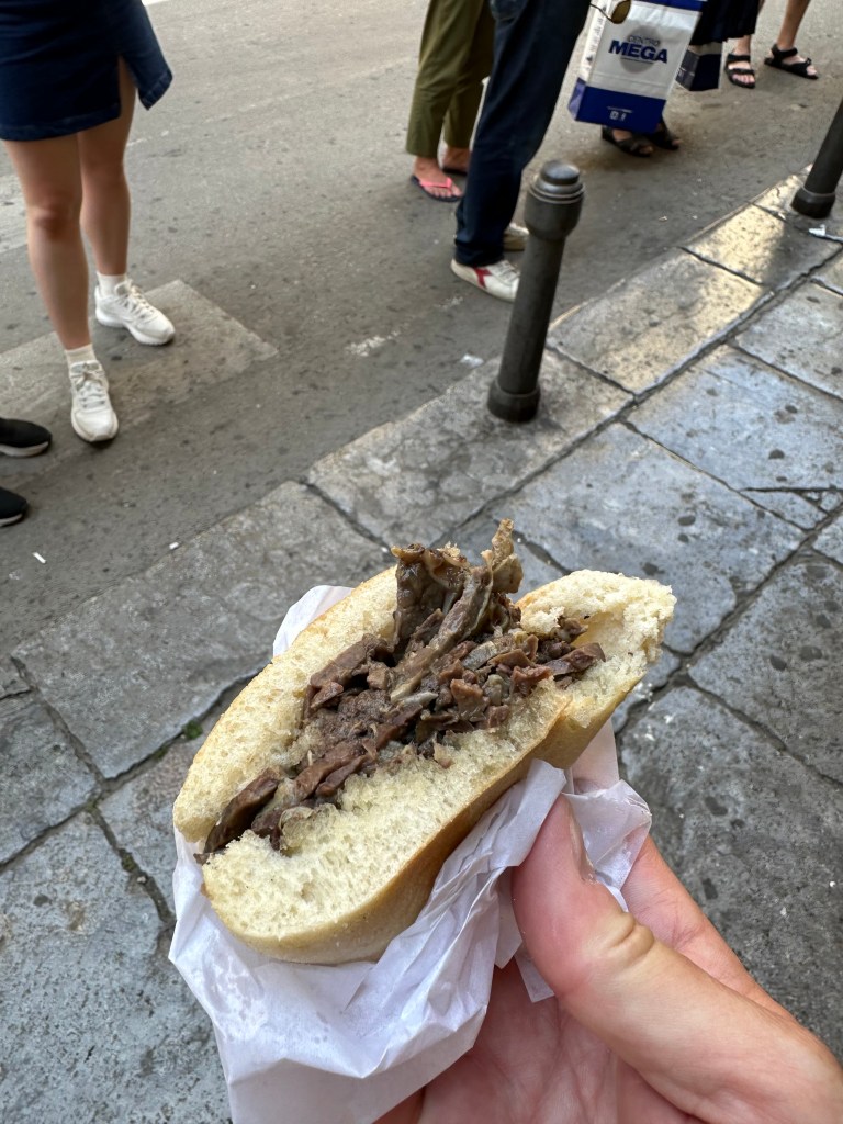
The highlight (lowlight?) of the tour? Spleen sandwich!
Would love (love!) to report that it’s splendid (hahahaha!), but 4/10 – would not recommend. And for context, we’ve had foal in Slovenia, brain in Hungary, and puffin in Iceland. (But our niece, Tara, who visited Sicily during her time in Italy, apparently digs it!):
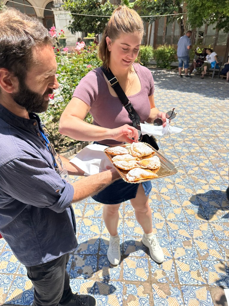
In a sharp contrast, we stopped last at a local convent, where the nuns earn a little walkin’ around money by baking treats for sale:
The treats in question:
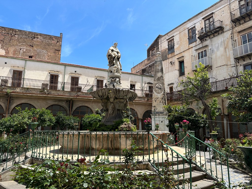
Nice setting in the convent’s cloister for our dessert round:
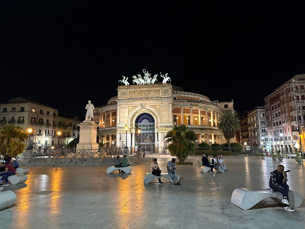
One evening on the way from aperitivos on Via Maqueda to dinner, we stumbled into this performance in one of the (many) churches on the street:
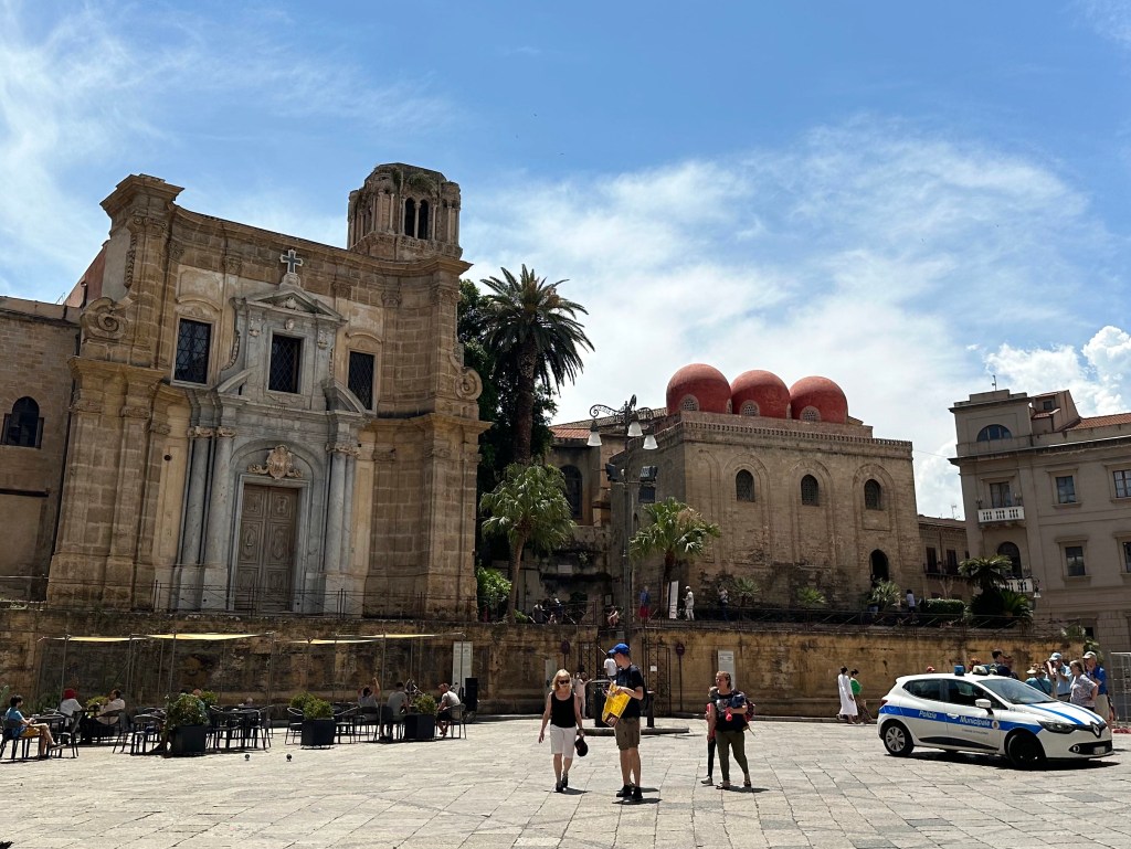
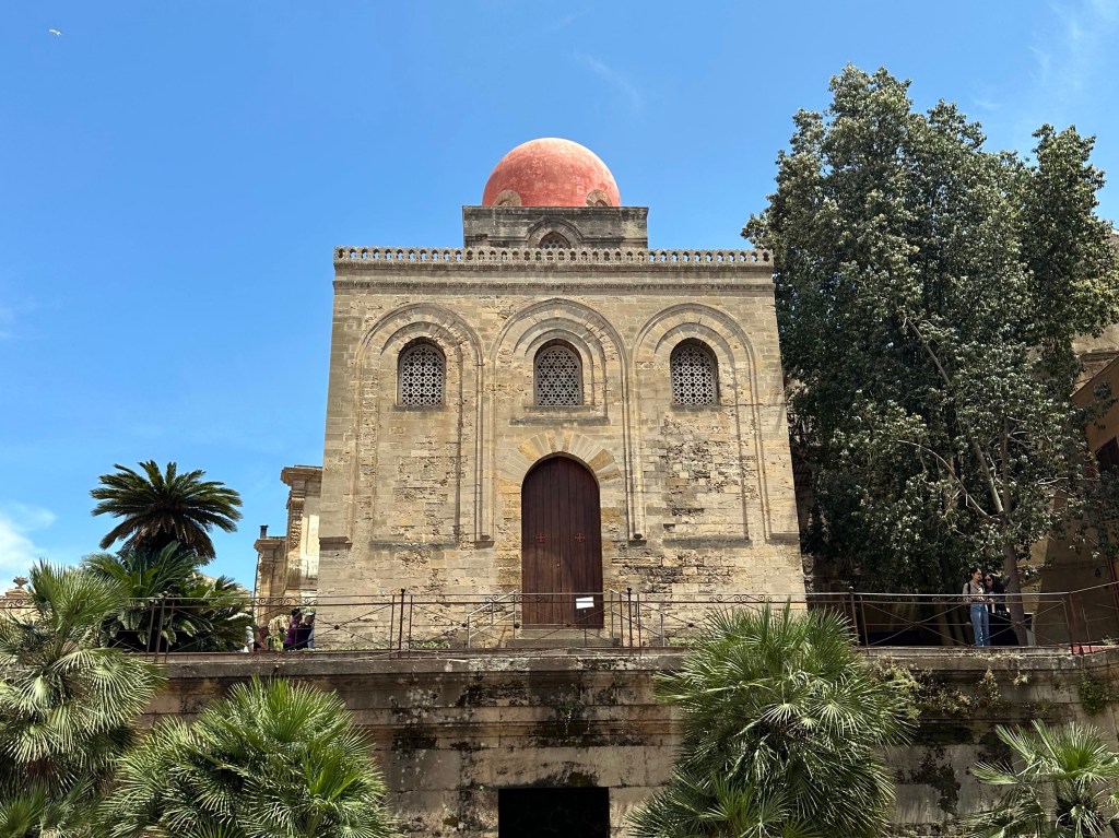
The next day, the star of Arabo-Norman architecture, San Cataldo:
Built in 1154 during Norman rule, the church not only embodies the melding of Arabic and Norman French architecture, it also serves as an example of the severe, militaristic, almost-fortified forms that even religious structures of the Normans exhibited.
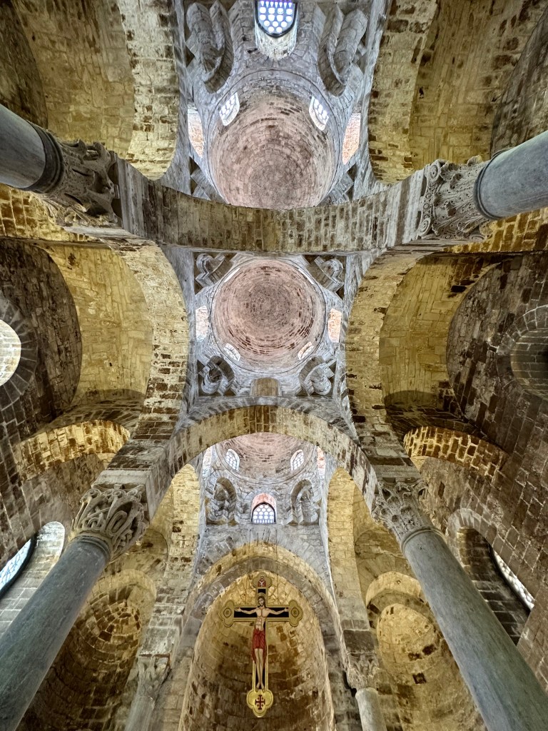
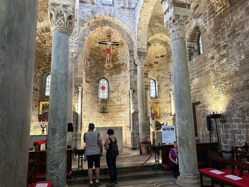
An inside view of the three domes (balls, bulbs, inflamed cysts, whatever):
The church interior felt very compact and vertical to us – not a lot of breadth here:
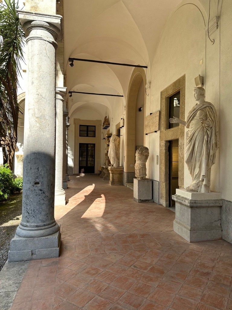
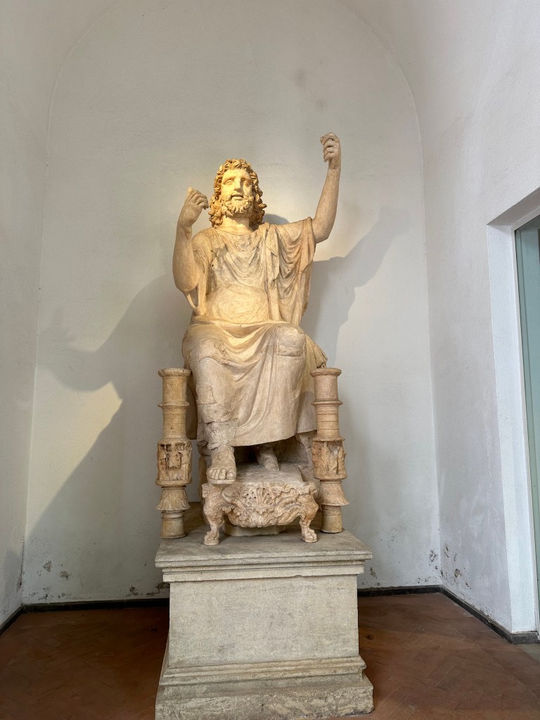
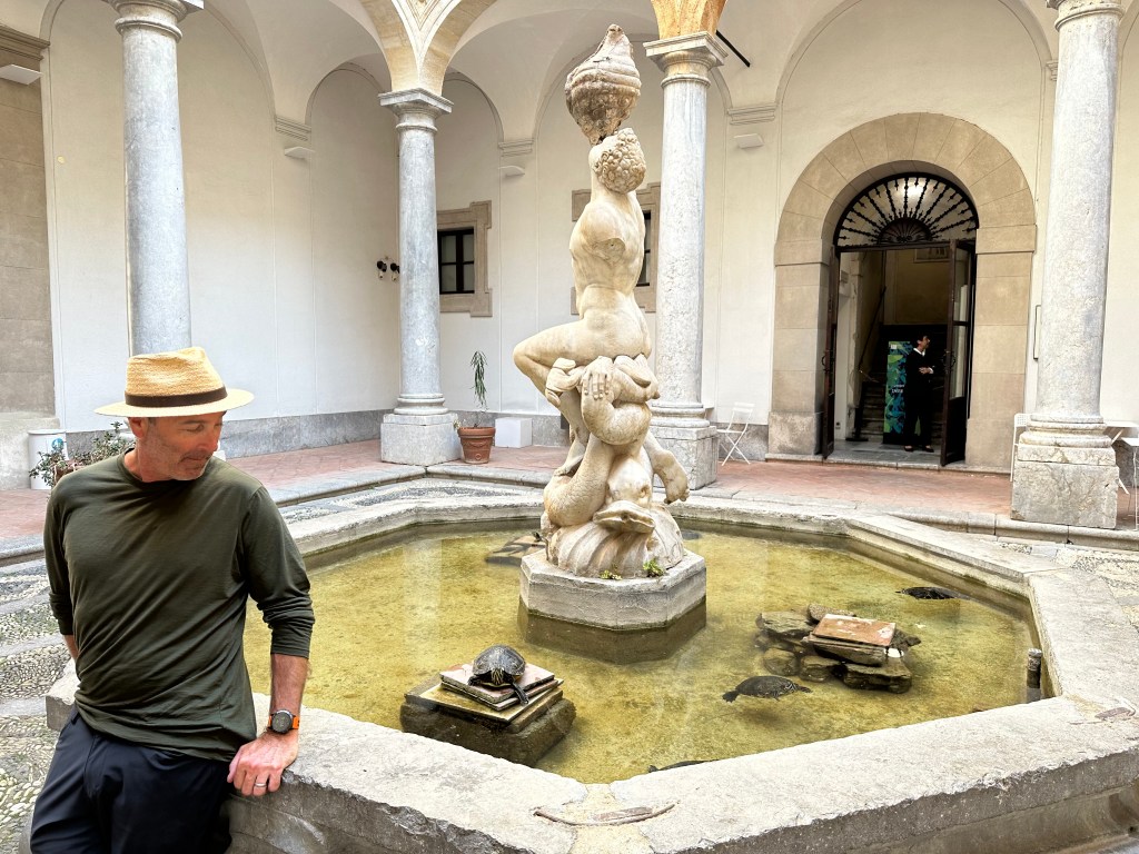
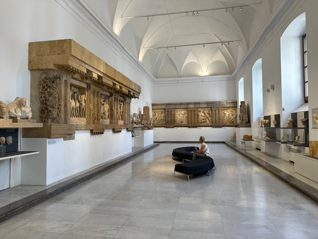
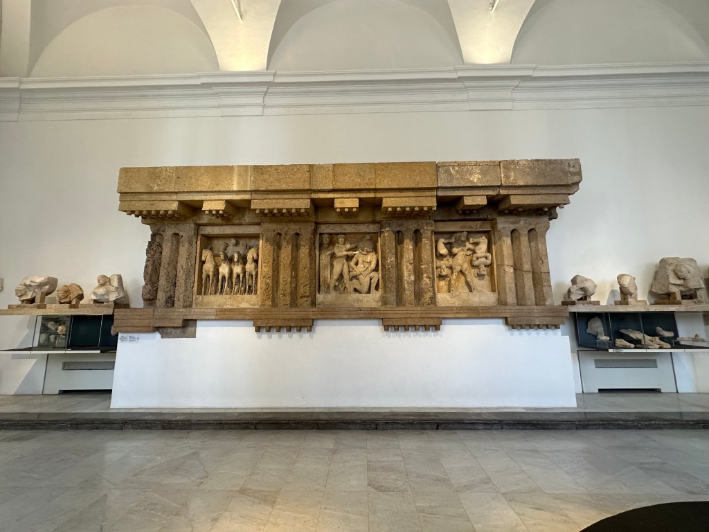
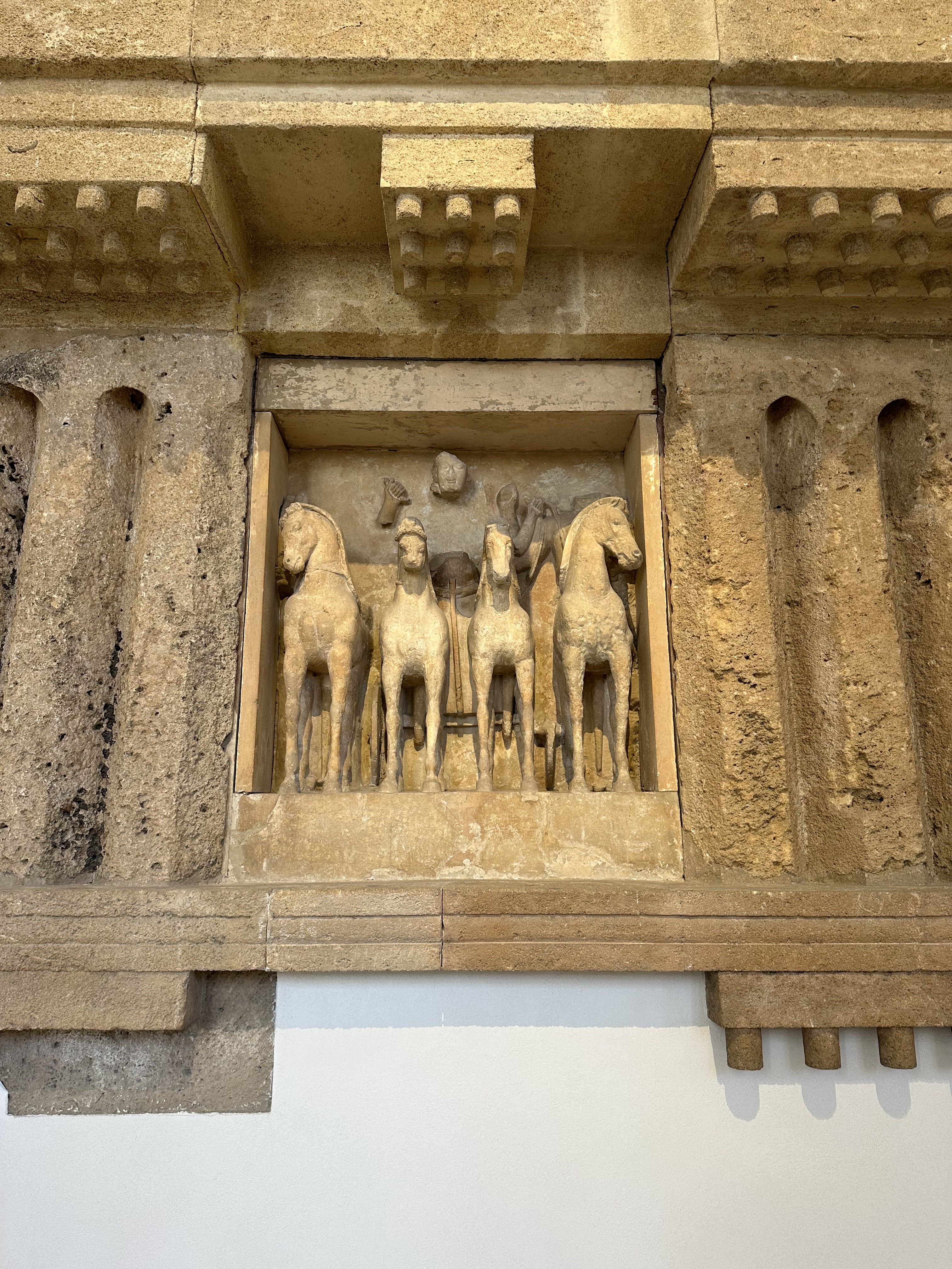
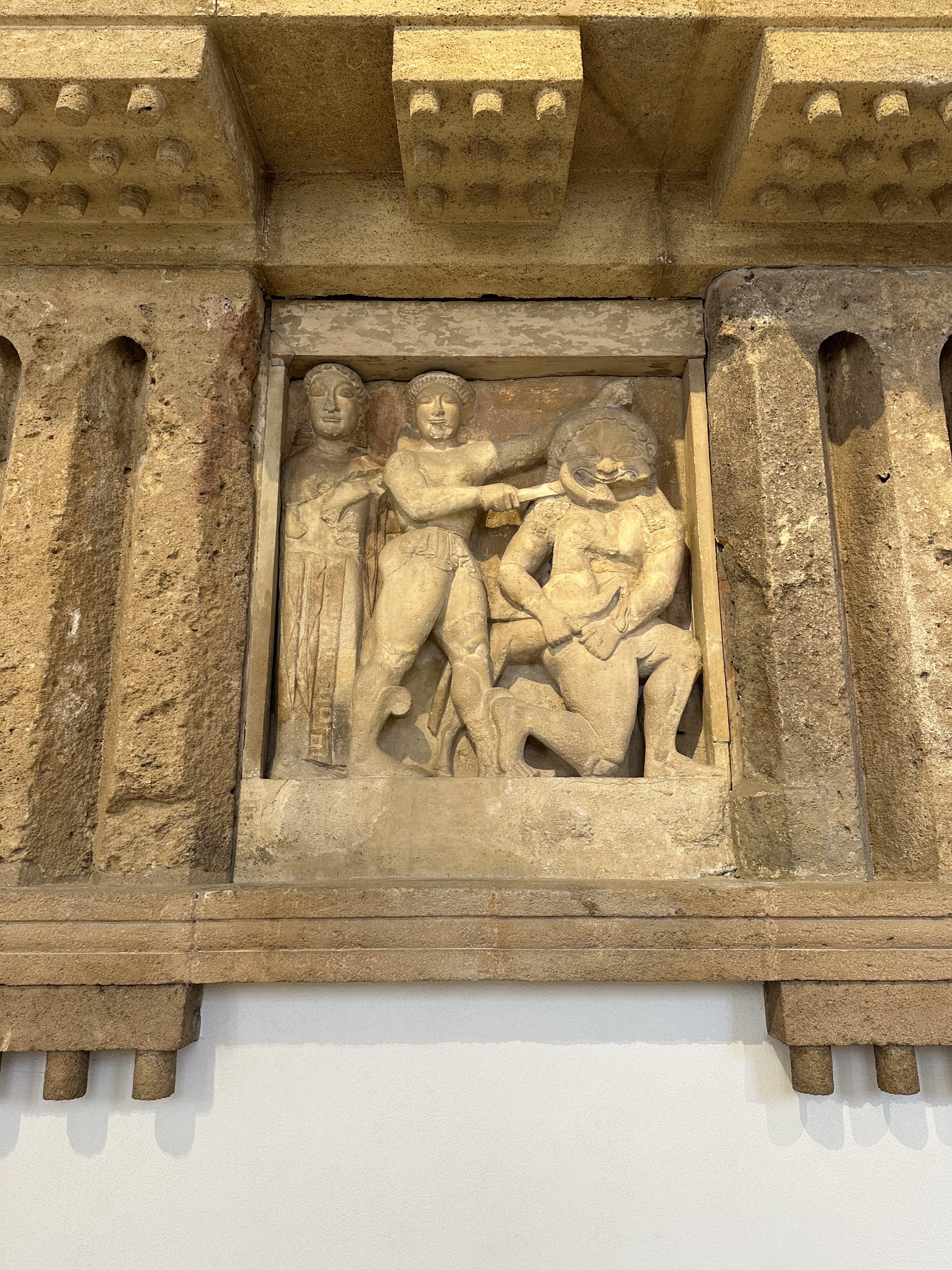
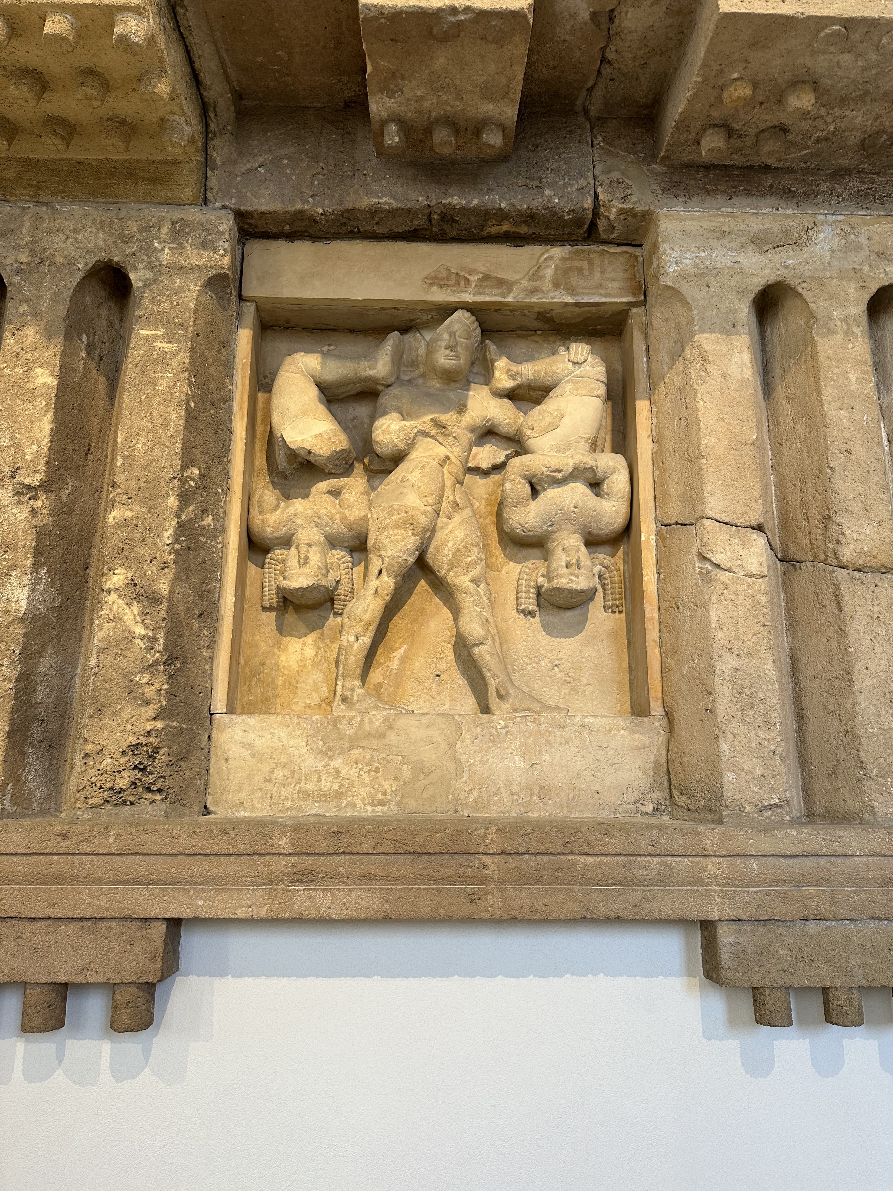
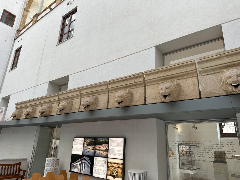
Down the street, Antonino Salinas Regional Archeological Museum:
The museum is home to one of the richest collections of Punic and Ancient Greek art in Italy, including this 2nd- to 1st-century BC statue of Zeus:
Oh, and turtles!
Taking in the frieze from a mid-6th-century BC temple from the ancient city of Selinunte:
Pretty awesome detail and workmanship from 7 millenia ago.
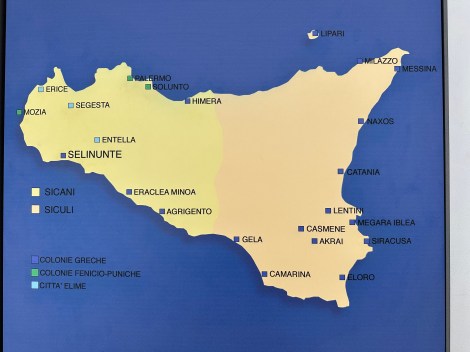
A helpful map of Punic (Carthaginian) and Ancient Greek cities from the period (Selinunte is in the west on the bottom of the island and was Greek, even though the Phoenicians and later Carthaginians occupied the same zone in the north):
Roof-edge drip stones from moldings on classical temples – in this case, from Agrigento, which would be our next stop on the island:
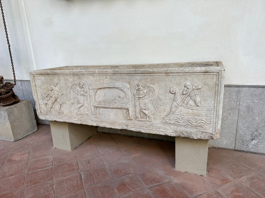
Very cool, later, Roman sarcophagus featuring Charon on the right and Hercules on the left:
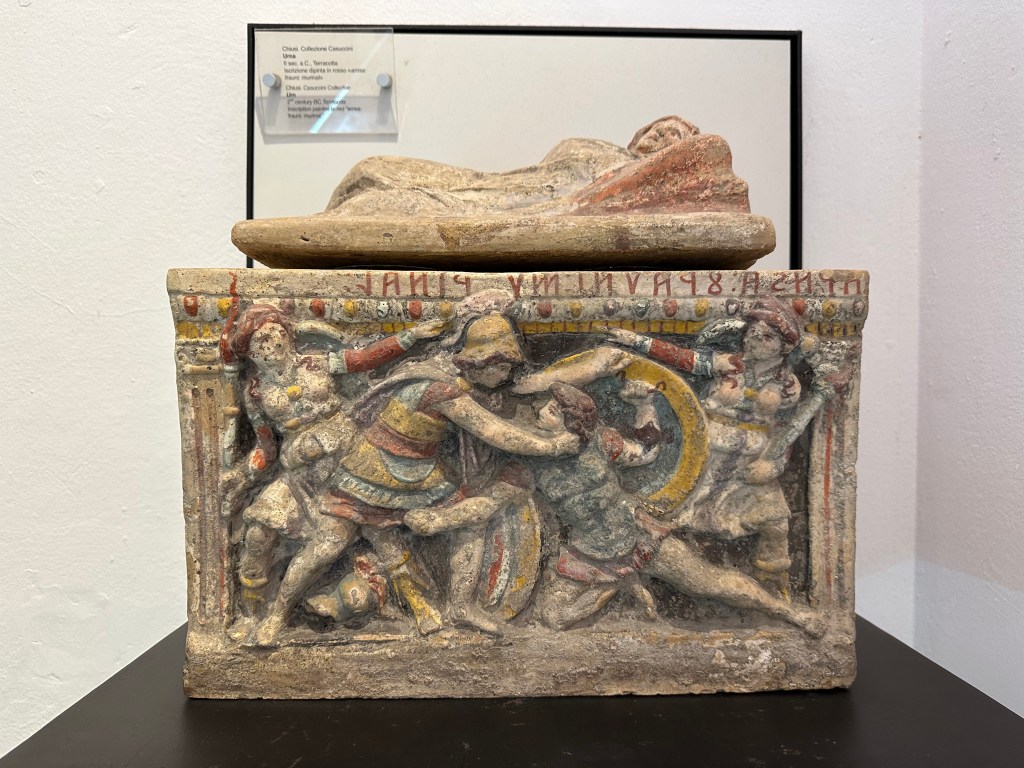
And a 2nd-century BC gladiator-themed, painted terra cotta, urn:
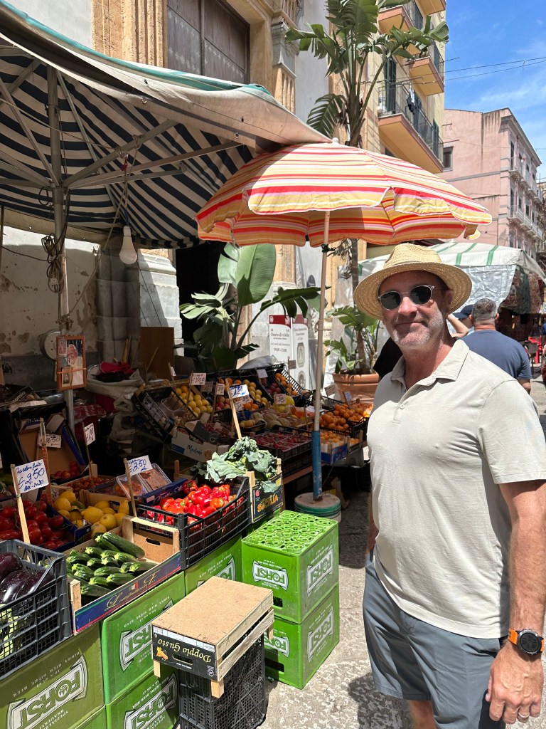
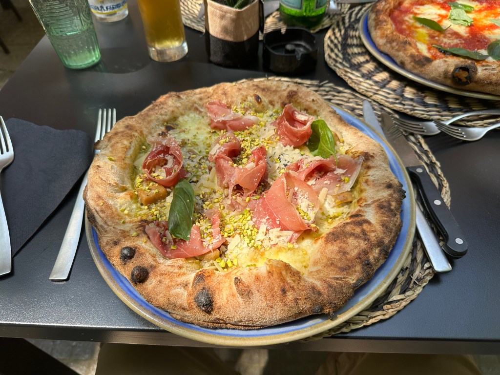
All of which made us hungry. Hungry for pizza with, um, pistachios? This would be a staple on the island – the Sicilians LOVE their pistacios:
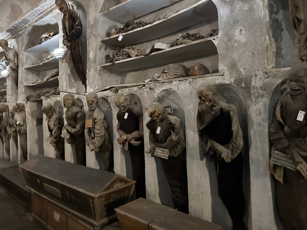
And with full bellies, and not a fear in the world of our lunch being returned to the outside world, we headed through town to the Capuchin Catacombs of Palermo, which contain around 8000 corpses and 1252 mummies; the last body was interred in 1939.
Aaaaah! There is a fear of the above occurring.
“Palermo’s Capuchin monastery outgrew its original cemetery in the 16th century and monks began to excavate crypts below it. In 1599 they mummified one of their number, the recently deceased brother Silvestro of Gubbio, and placed him in the catacombs.[citation needed]
Bodies were dehydrated on racks of ceramic pipes in the catacombs and sometimes later washed with vinegar. Some bodies were embalmed and others were enclosed in sealed glass cabinets. Friars were preserved with their everyday clothing and sometimes with ropes they had worn in penance.[citation needed]
Initially the catacombs were intended only for deceased friars. However, in later centuries it became a status symbol to be entombed in the Capuchin catacombs. In their wills, local luminaries would ask to be preserved in certain clothes, or even have their clothes changed at regular intervals. Priests wore their clerical vestments, while others were clothed according to contemporary fashion. Relatives would visit to pray for the deceased and to maintain the body in presentable condition.”
“The catacombs were maintained through donations from the relatives of the deceased. Each new body was placed in a temporary niche and later placed into a more permanent location. So long as contributions continued, the body remained in its proper place but if relatives stopped sending money, the body was put aside on a shelf until they resumed payments.” (All from here.)
The nudie fountain on our last evening in town:
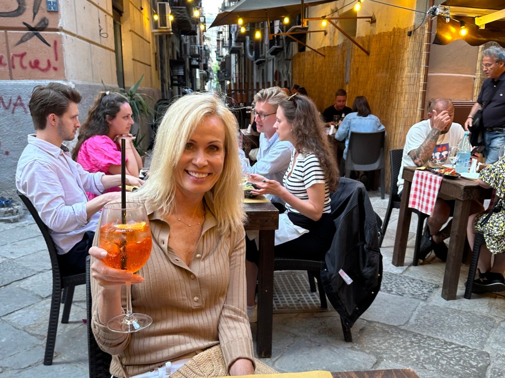
And a final Aperol spritz (in Palermo, not on the trip!):
After intentionally foregoing Europe at Christmas for the last 4 years, a few factors drove us back this year: nostalgia for winter weather in the season, a truly authentic Christmas experience, and the paucity of other options with availability and reasonable travel costs. One day we’ll get to Namibia or Peru for Christmas, but not this year.
We initially targeted all three of the Baltic states for this year’s trip: Estonia, Latvia, and Lithuania:
Northern Europe to meet the winter climate criteria
Great Christmas tradition (Tallinn holds the distinction of hosting the Europe’s first public Christmas tree in 1441)
Have not visited any of them before (they would put WolfeStreetTravel’s country count over 70)
However, WolfeStreetTravel flight criteria and the need to keep the trip limited in length due to work resulted in the following refinements:
Lop Lithuania off the itinerary (maybe we’ll get back there when we can also visit adjoining Belarus; we certainly can’t go there now, with Putin stooge and corrupt autocrat Lukashenko in charge)
Bookend our stay in the Baltic states with some time in another country with direct flight in and out of Europe
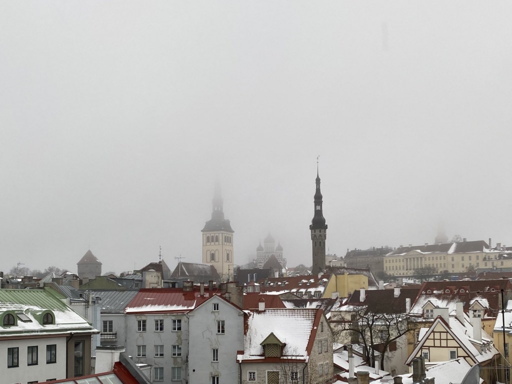
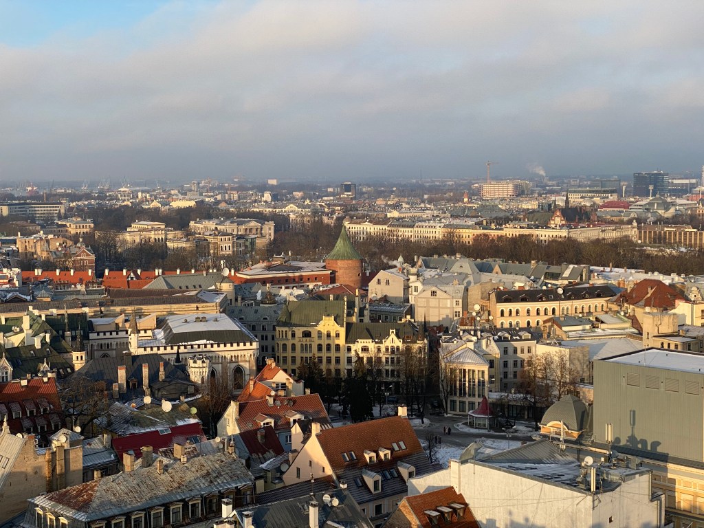
The UNESCO World Heritage site of Old Town Tallinn, Estonia, from atop the castle hill of Toompea:
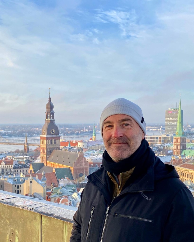
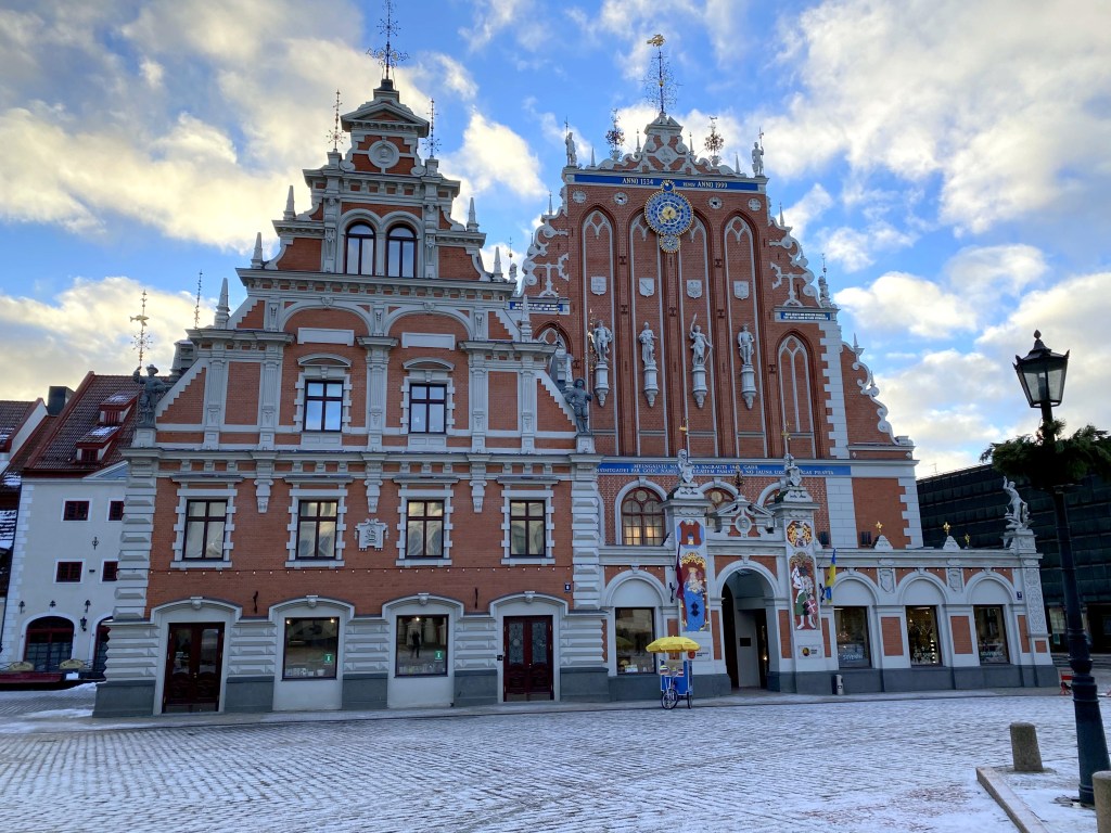
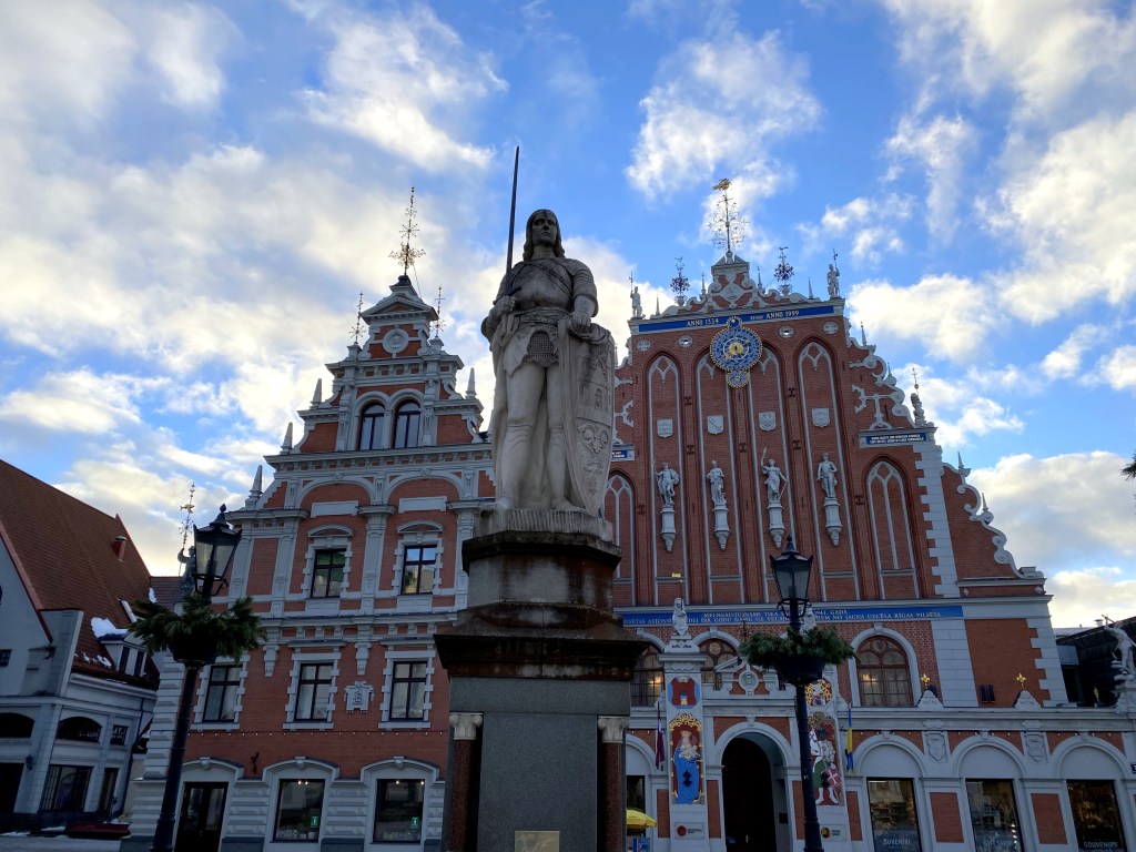
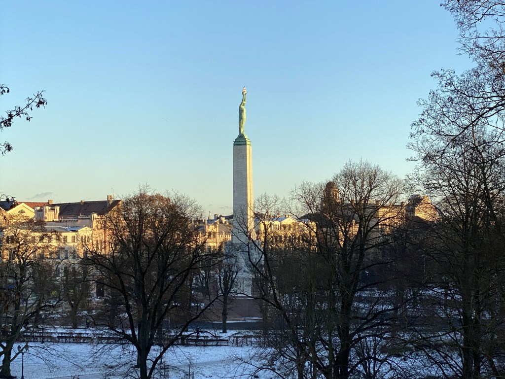
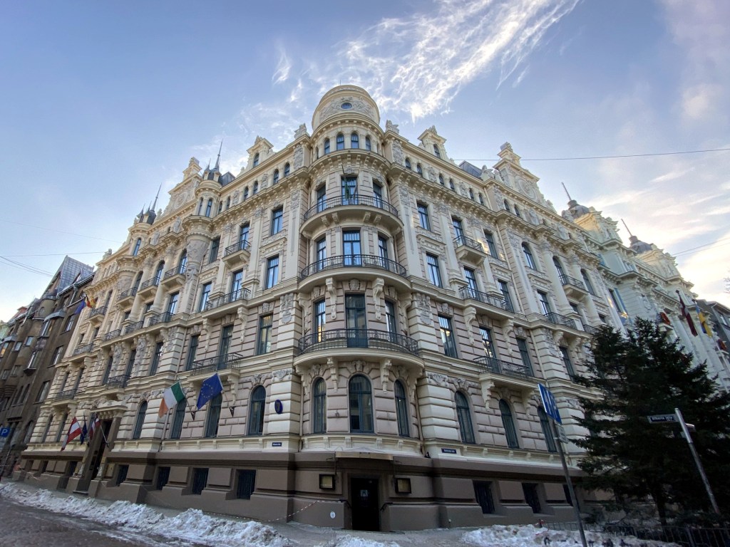
Riga, Latvia, from the spire of St. Peter’s Lutheran Cathedral in the center of town:
Regarding the direct flight bookend, we found a perfect candidate in Amsterdam’s Schiphol airport. United offered direct flights there from IAD, and BalticAir offered direct flights to Estonia and Latvia from Schiphol. Plus, we’d add a few days in Haarlem on the front end and a few days in Amsterdam on the back end to break up the flying time.
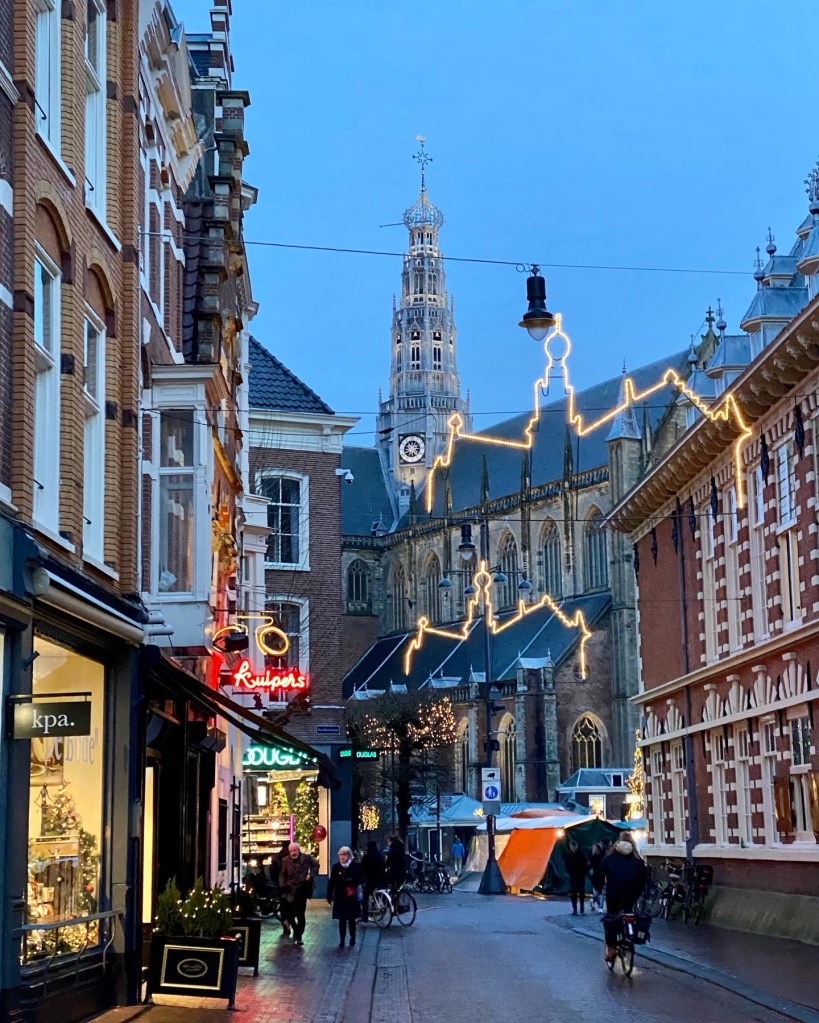
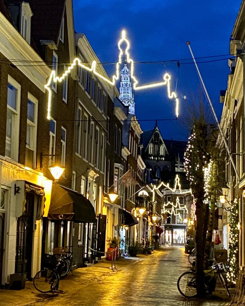
Haarlem decked out for Christmas:
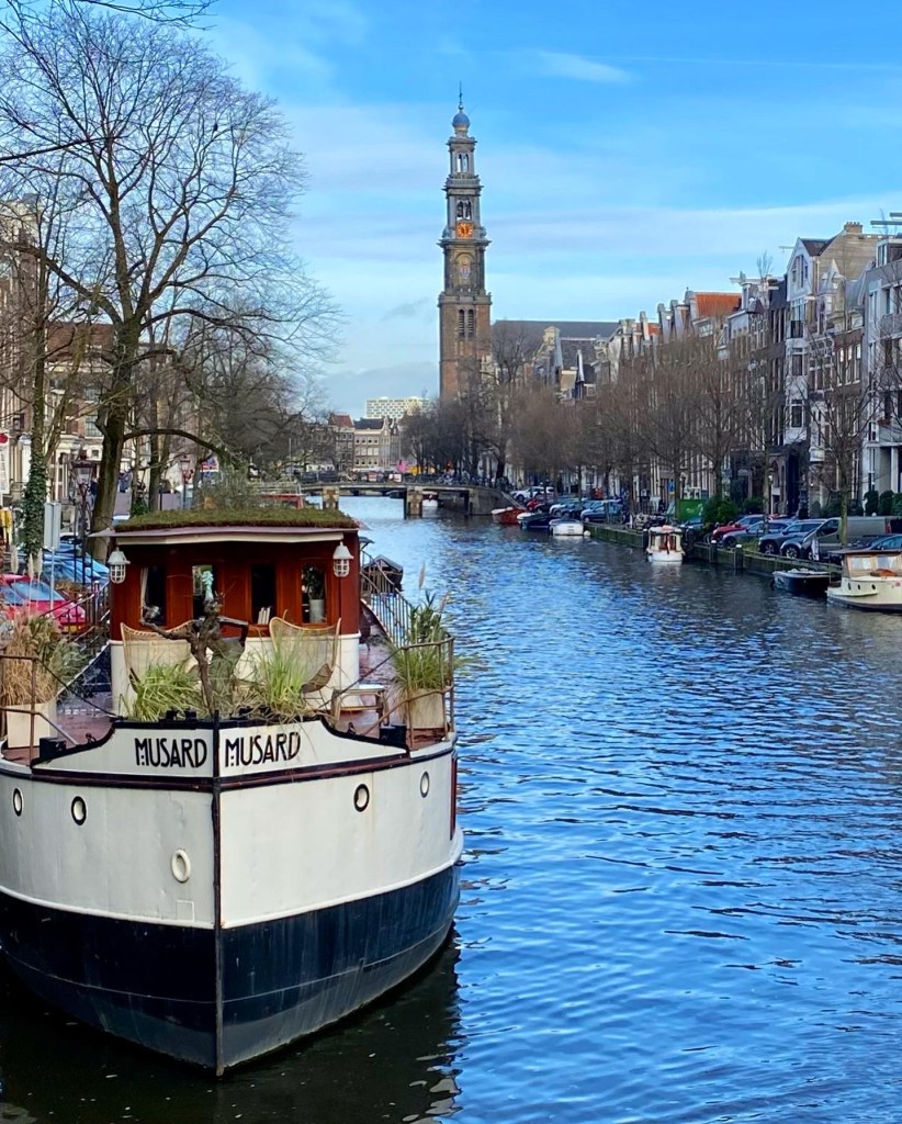
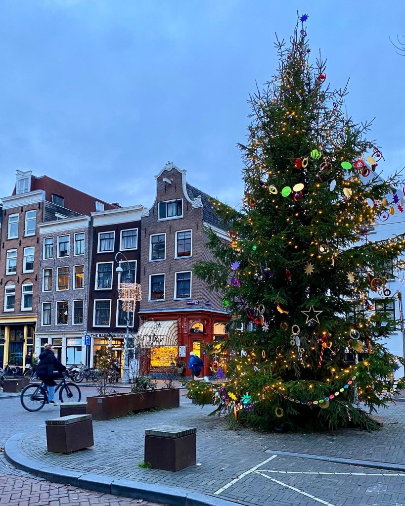
The canals of Amsterdam during our stay:
In the middle, we’d fly direct:
From Amsterdam to Tallinn, Estonia, then
From Tallin to Riga, Latvia, then
From Riga back to Amsterdam
Between the direct flights to and from Europe and the direct flights to, within, and from the Baltics, we planned this perfectly to minimize the impacts of inevitable flight delays. Nothing could go wrong now, with no connecting flights that could be impacted by delays on the initial leg – the bane of any traveler’s existence.
Then, more than a month after we bought our tickets, United saw fit to eliminate the direct flight from IAD to Amsterdam, screwing things up and requiring some rework and now unavoidable two-leg flights in and out of Europe. Not a disaster by any means, but it just meant more risks.
Which, of course, did materialize into actual problems, although none too bad, in the great scheme of things: our connecting flight on the way in got cancelled when we were in the air, and the connecting flight on the way back resulted in total travel time almost twice as long as the time the original direct flight would have taken. But, we weren’t impacted by domestic air travel calamity wrought by the massive Christmas snowstorm, and got back on time on December 28, so we consider ourselves relatively lucky.
After arriving (late) at Schiphol, we beelined it to Haarlem, where we stayed for the next 3 days (including watching the World Cup Final, where we were cheering on Argentina and the Dutch were rooting for France simply because Argentina beat them in the Semis, which was fun).
Haarlem’s Christmas lights throughout the city were the profile of the town’s landmark cathedral:
The functioning Molen de Adriaan windmill right in the heart of town, which we toured while there. Super cool.
From Haarlem, we flew northwest to Tallinn, Estonia, which was still initially blanketed by snow, which is exactly what we were hoping for.
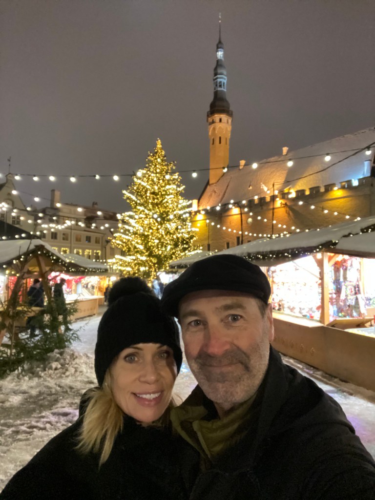
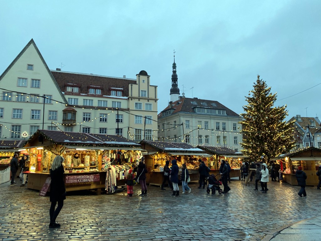
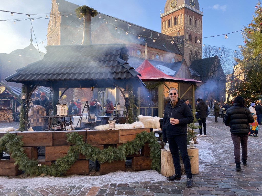
Heading into the town square, dominated by Tallinn’s 15th-century town hall and host to the town’s Christmas Market.
St. Alexander Nevsky Cathedral on Toompea in Tallinn, a vestige of the Russian Empire’s role in Estonia’s history (and also, we got some good snow!):
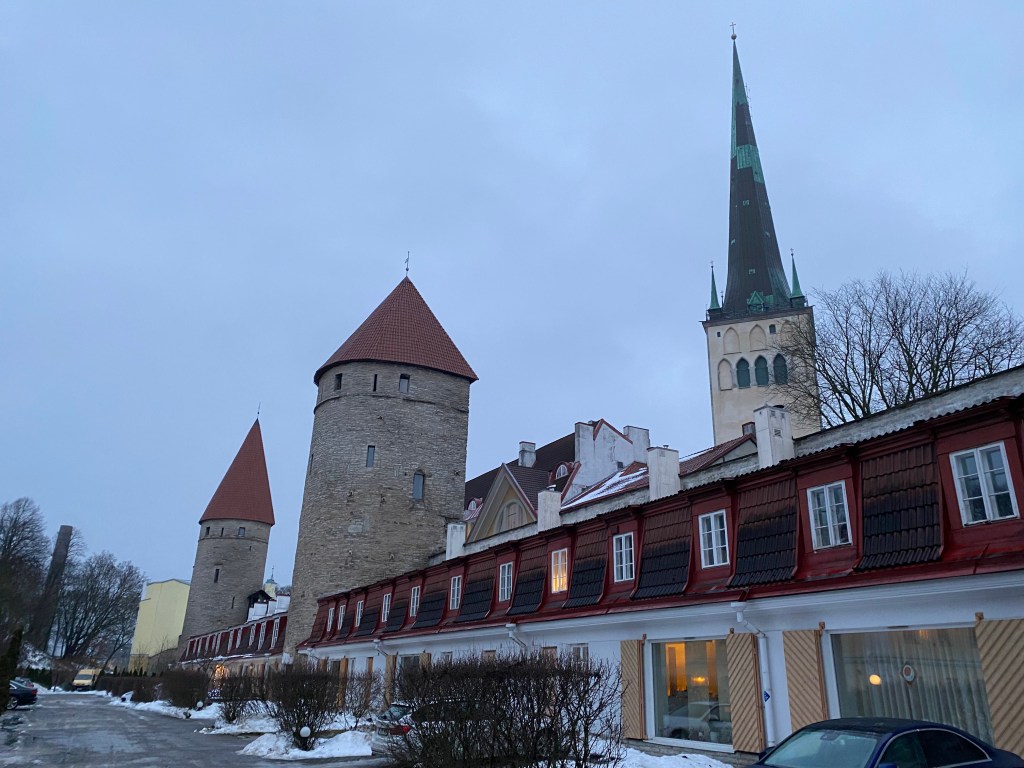
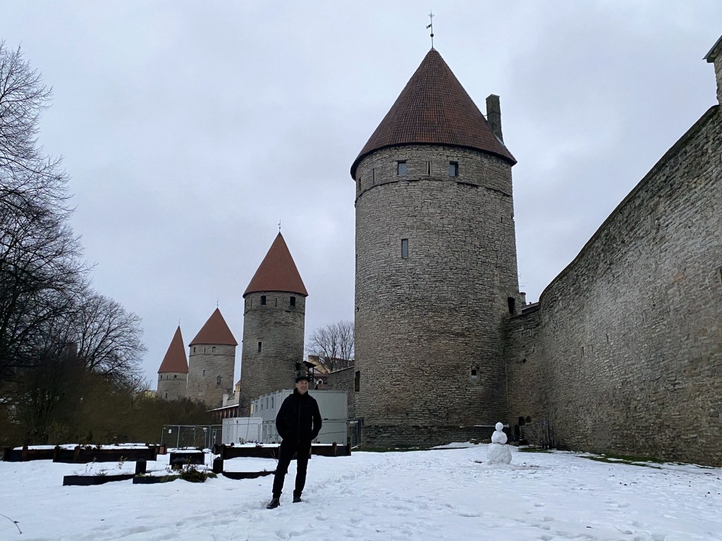
Tallinn was mostly undamaged during WW II, and its medieval walls and defensive towers are still intact:
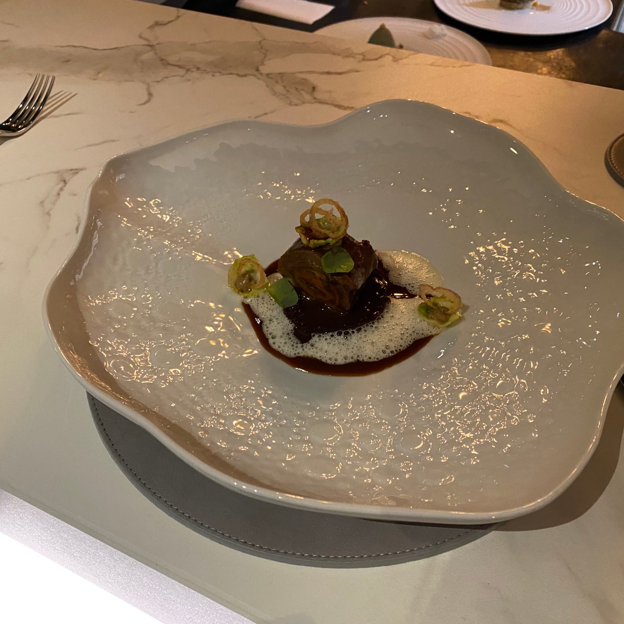
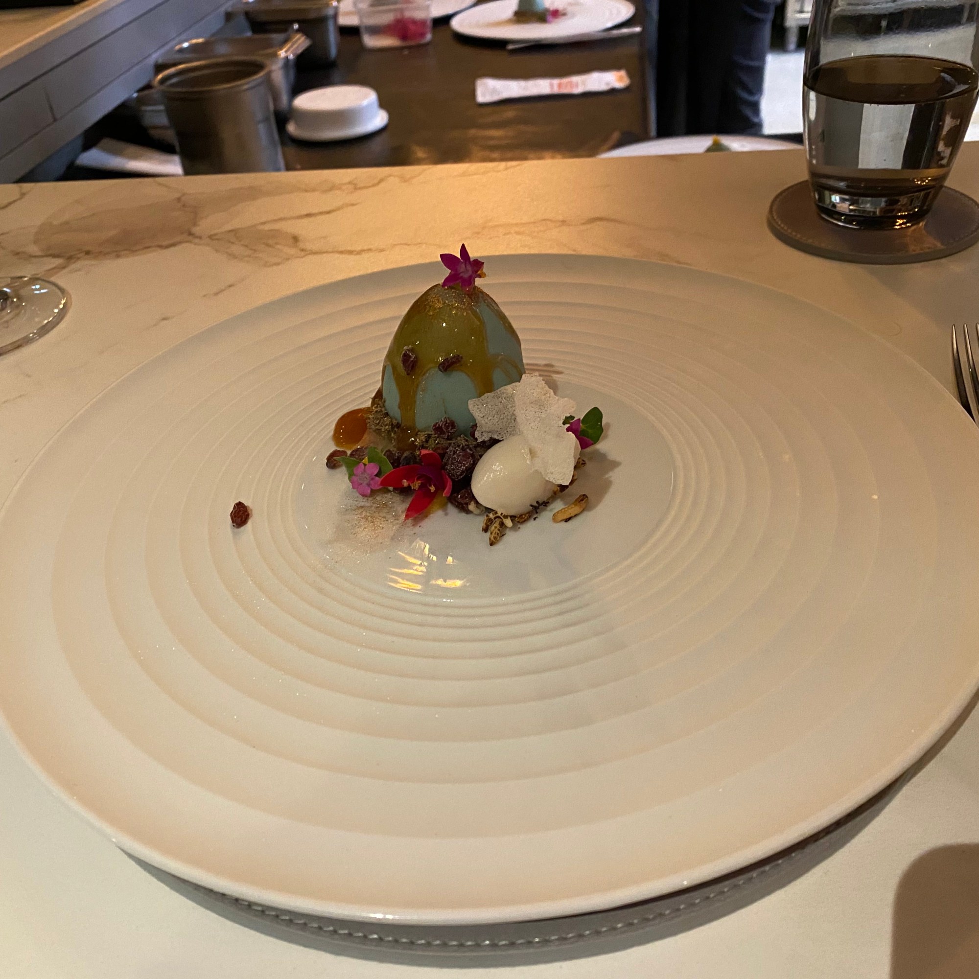
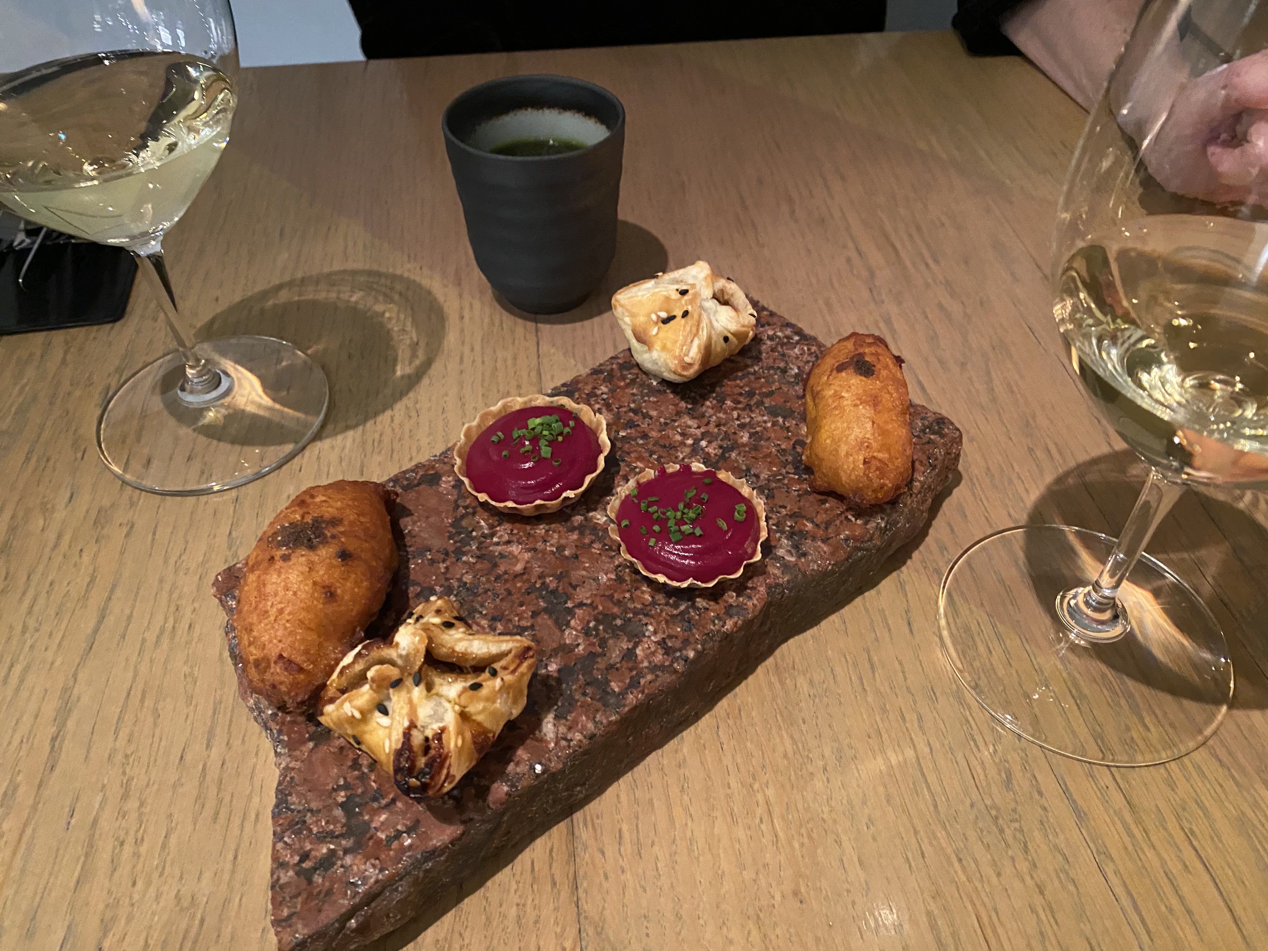
Dining highlight during our stay at the Chef’s Table of 180 Degrees Restaurant, which lasted 4.5 hours. This was about an hour and a half longer than it needed to be.
Due to Tallinn’s latitude, the sun set at 3:20 during our stay, resulting in lots of surreal, perpetual twilight afternoons in town:
After 3 days in Tallinn, we headed a little south, to Riga, Latvia – country # 70 for WolfeStreetTravel:
23 degree weather on Christmas Eve!
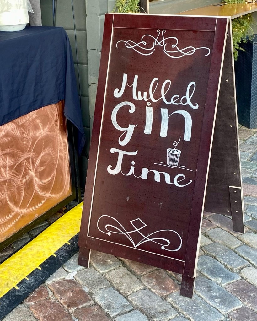
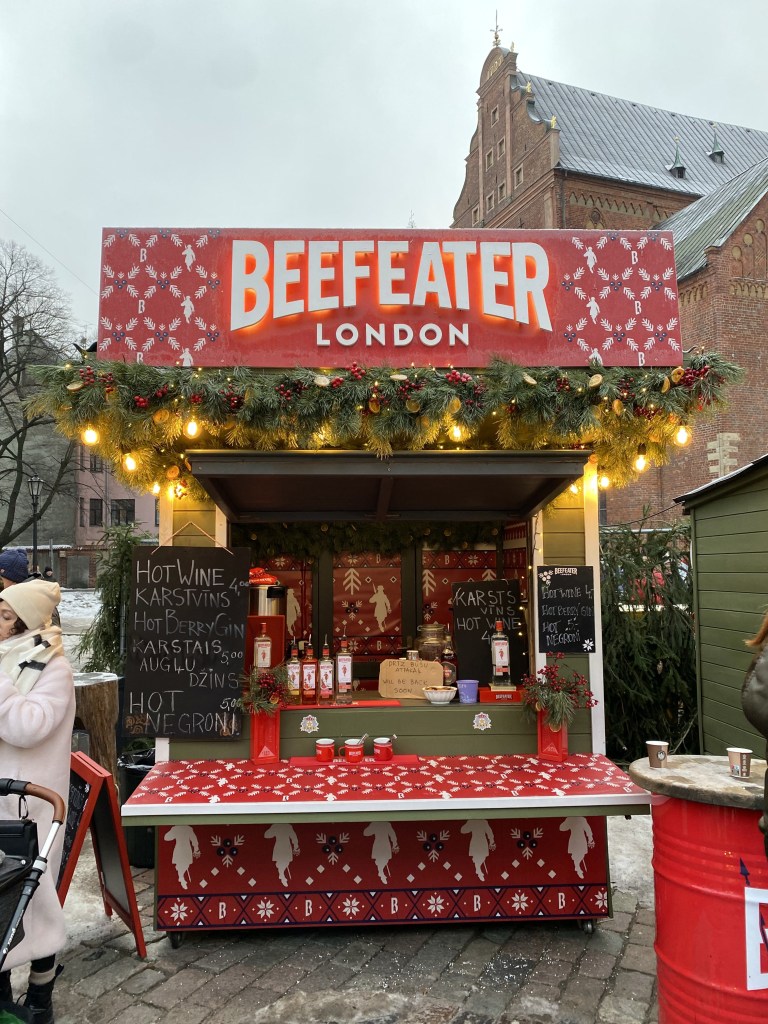
Riga’s Christmas Market was actually better than Tallinn’s.
And boasted multiple stalls across the market hawking mulled gin, which was a new one to us. It was fine, but we prefer traditional gluhwein (they had that too).
Riga still maintained some of their town’s fortifications, as well.
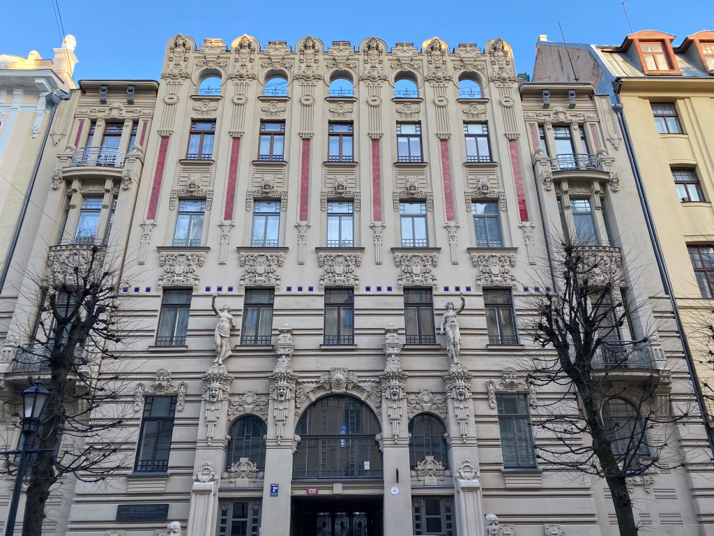
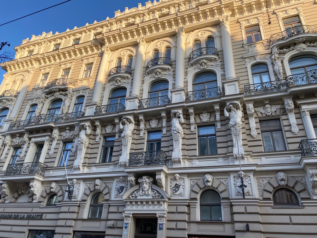
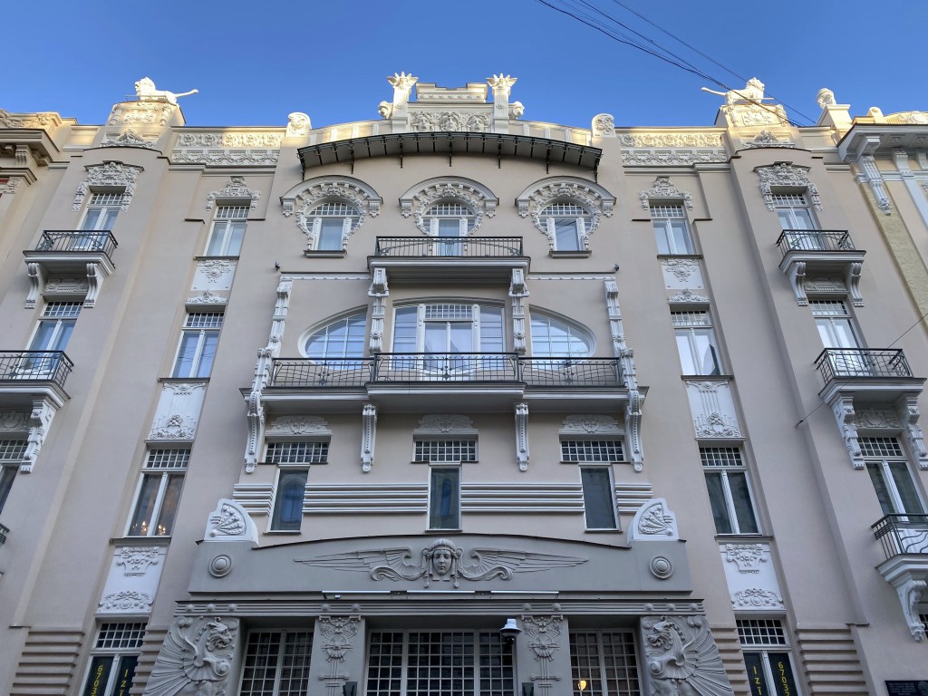
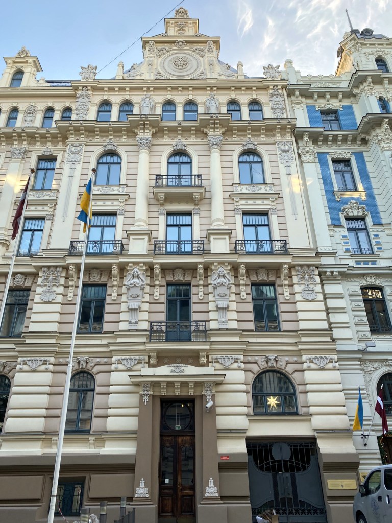
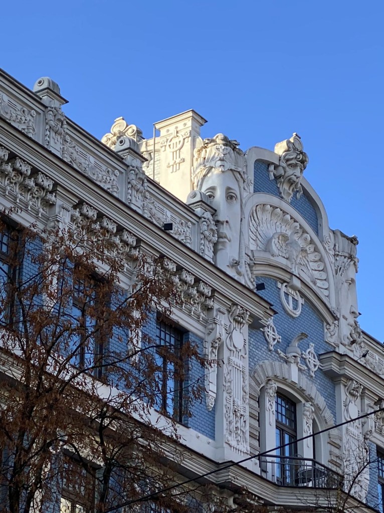
And was also home to Europe’s greatest concentration of Art Nouveau architecture, since Riga’s prosperity peaked at the same time as this arts and architecture movement at the turn of the century, and Riga wasn’t bombed into oblivion during WW II, preserving the buildings in this district.
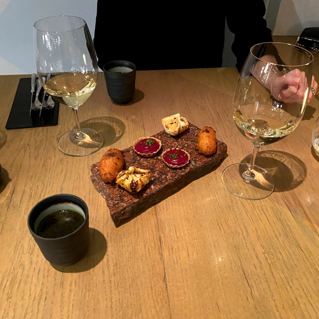
Christmas night dinner at 3 pavāru restorāns in Riga, which bested the much fancier 180 Degrees a few days earlier in Tallinn.
After a couple of days in Haarlem, we headed to the first of our actual Baltic destinations: Estonia and its capital city of Tallinn. We were hoping for snow, and we got some! (Initially, anyway.)
Tallinn’s main square and Christmas Market on our first evening – perfect!
But the next day (and throughout our stay), the snow on many of the streets and squares turned a little slushy.
Definitely more of a winter, Christmas atmosphere than Alexandria, but still. . .
Tallin’s settlement dates back thousands of years but the first fortress appeared around 1050 AD, demonstrating the importance of the town to the north Estonia region.
As a trading town on the Baltic coast, the town (then known as Reval) became a member of the Hanseatic League in 1285. We previously visited the Hanseatic towns of Lübeck and Hamburg in Germany and Bergen, Norway. (Riga, Latvia, another Hanseatic town, would be our next stop on this trip. Apparently, Berlin, Cologne, and Krakow also were Hanseatic towns due to the river system, but we have decided to ignore this because they’re not on the Baltic coast.)
Snow still covered some streets – very cool medieval town.
Tallinn Old Town is one of the best-preserved medieval cities in Europe and is listed as a UNESCO World Heritage Site.
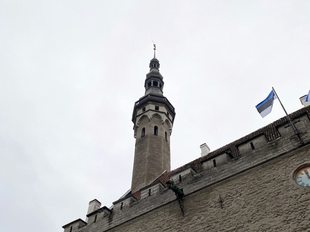
The spire of Tallinn’s Town Hall:
The town hall was first mentioned in 1322,
but the structure actually dates back to the 1200s.
It’s the oldest surviving town hall in Europe.
At the top of the spire stands Old Thomas, first placed there in 1530.
The figure memorializes a peasant who became famous for winning a crossbow competition held by the Baltic German Elite.
The tower – and Old Thomas – was damaged in 1944 during a bomb attack during the war. A new Old Thomas went up with the repaired tower in 1952, but it was weathering too much, and the Estonians put another one up there in 1996. The 1952 Old Thomas hangs out in the Tallinn City Museum. Nice codpiece.
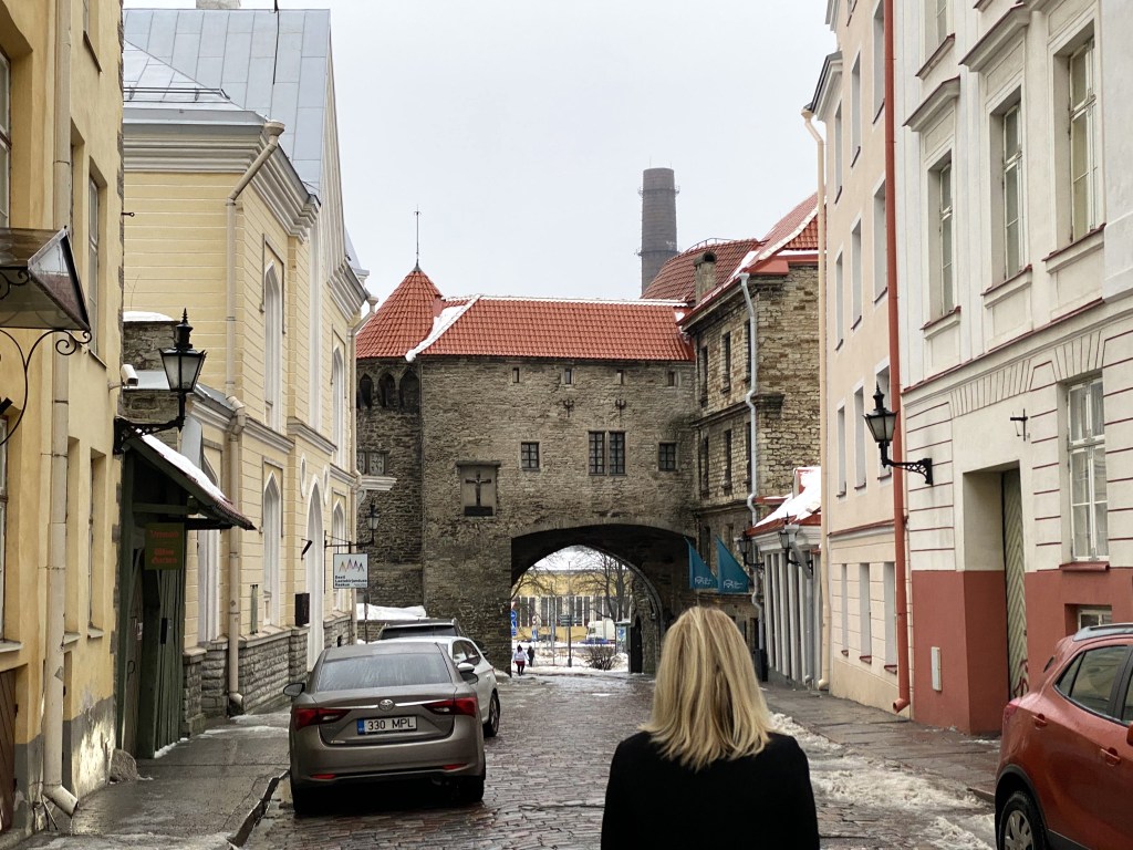
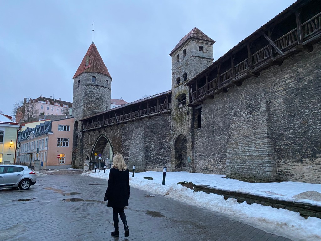
Viru Gate – one of the original eight gates in Tallinn’s city walls.
The first wall around Tallinn was ordered to be constructed by Queen Margaret of Denmark in 1265 (Denmark controlled northern Estonia from the early 13th century until 1346, when the Danish king sold it to the Teutonic Knights).
Fully taking shape during the next three centuries, Tallinn’s city wall was one of the strongest defense systems in Northern Europe at the time.
Plus, there are chunks that are still intact and walkable (that’s Tower behind Monks in the background)
Not a lot of snow, but Tallinn proved to be pretty atmospherically wintery, nonetheless:
Located across town, we found Tallinn’s Great Coastal Gate, first mentioned in 1359:
The Great Coastal Gate was the most important gate when Tallinn was a Hanseatic town because it protected the main route for traffic between the port and the market square.
Above the gate stands an impressive dolomite carving bearing Tallinn’s coat of arms (from 1529):
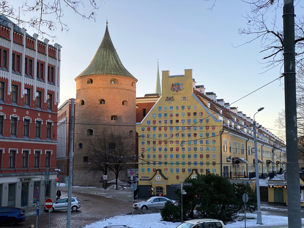
Protecting the Great Coastal Gate? FAT MARGARET! Dating from the early 16th century, Fat Margaret not only served as a fortification against invaders of the town’s port but also a military monstrosity to impress visitors arriving by sea.
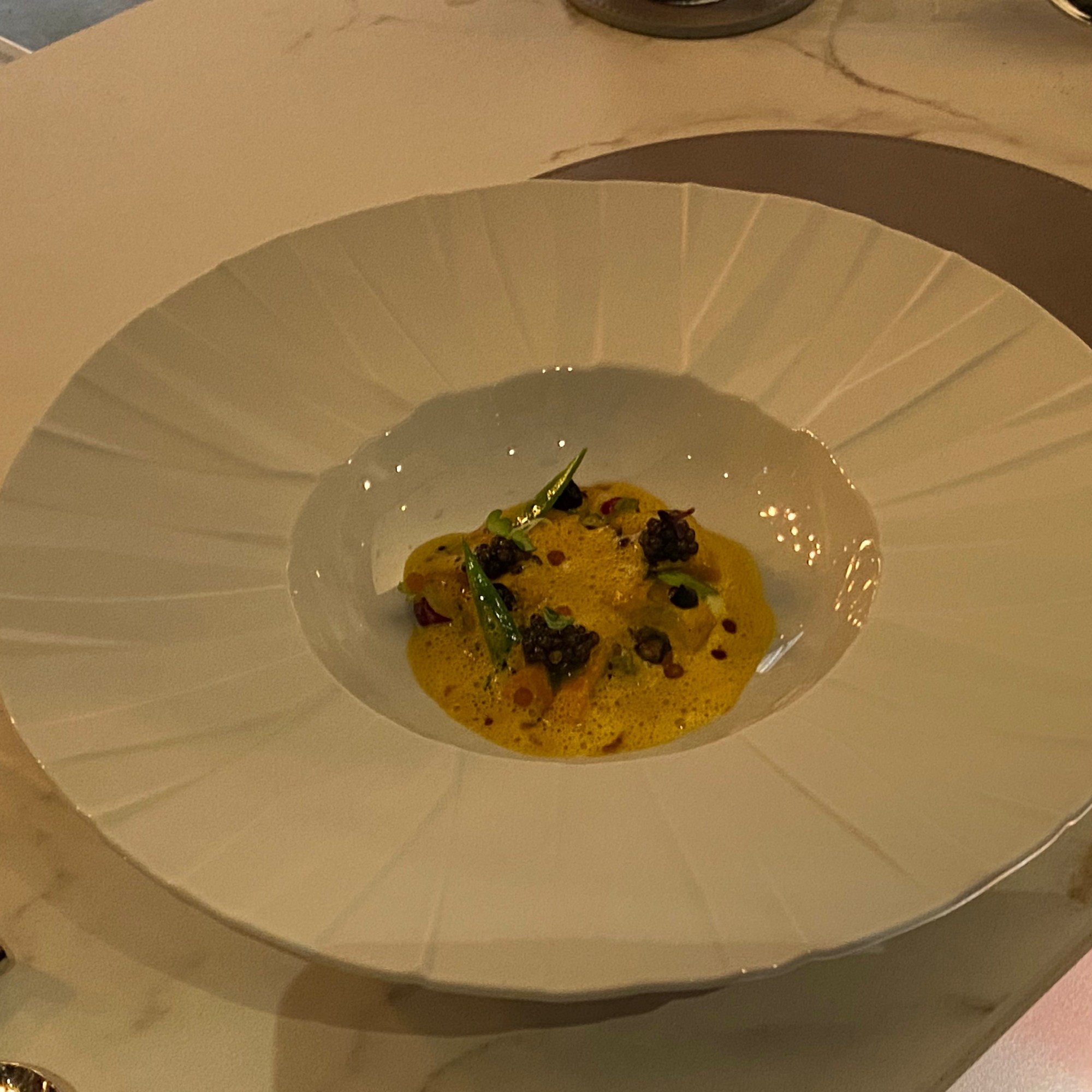
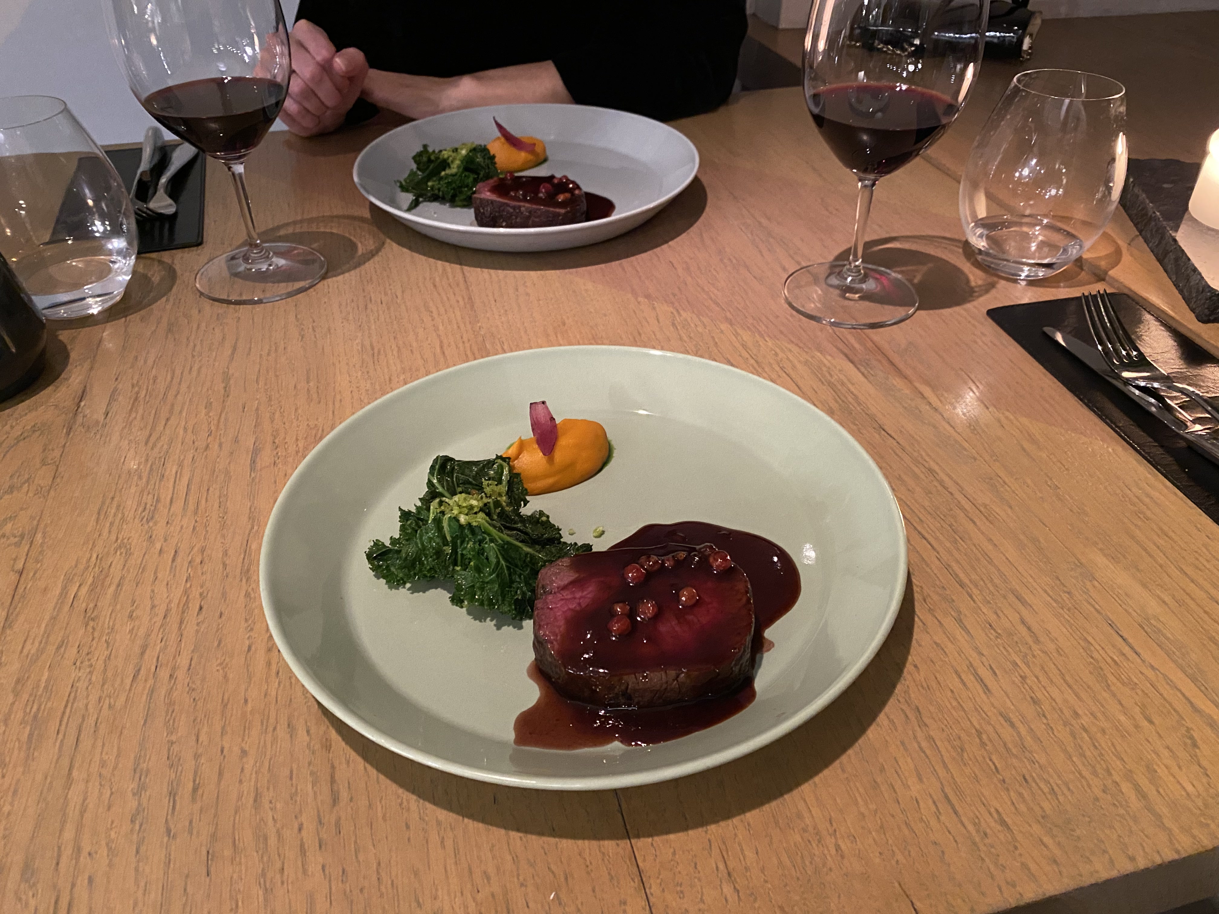
Michelin 2* dining experience at 180 Degrees:
Pretty good perch at the Chef’s Table
where we could watch all the cooking and prep work for multiple courses.
Heading up the next morning to Toompea, Tallinn’s central hill district, which is home to. . .
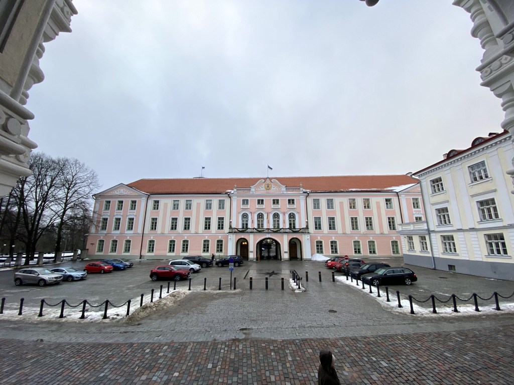
Estonia’s Parliament, the Riigikogu:
And also the Orthodox Alexander Nevsky Cathedral, built in the late 19th century:
Crests for local noble families along one wall:
Because the church was built when Estonia was part of the former Russian Empire, and because it represents Russian Orthodoxy, and because the Estonians are outraged by Russia’s aggression against Ukraine, there’s a movement in Tallinn to raze it and replace it with a park.
Back through the walls:
To yet another stretch of Tallinn’s extant city wall. Here, we have Kiek in de Kok (“Peek into the Kitchen”) on the left, an artillery tower so named because the garrison could see into the kitchens of the nearby houses; and Maiden’s Tower on the right.
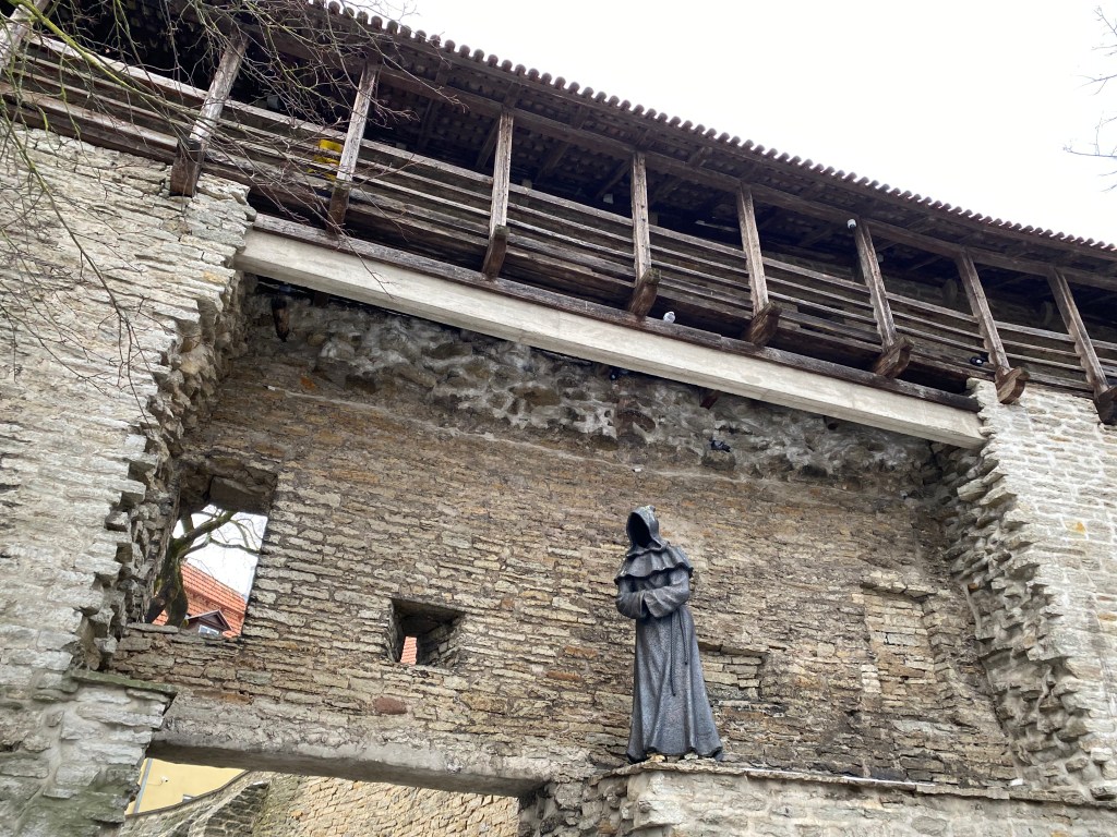
And a creepy, faceless monk statue perched on one segment of the wall. This is one of three faceless monks in this area; this one is “Observing Monk.”
More city wall-and-towers action:
Loewenschede Tower:
Enough with the tower names; here’s a buttload of towers. Definitely a cool, preserved medieval town.
Heading to dinner one night; one cannot escape the walls, man.
Rataskaevu Street, where the novels featuring Melchior, the 15th-century Tallinn apothecary / amateur sleuth are set (or at least where his apothecary is located). The first book – pretty good! The second – should have been tossed down that well.
Featured in the Apothecary Melchior novels are Tallinn’s medieval guilds. The Great Guild hall, dating from the very early 15th century is right off the main square. It was used as the headquarters of various merchant and artisan guilds until as recent as 1920.
Aaand, the House of the Brotherhood of Black Heads. Also featured in the Melchior novels.
Described as a social club for single merchants and other tradesmen in the Melchior books, it “was a professional association of ship owners, merchants, and foreigners dating from the 14th century.“
“The House of the Blackheads was visited by several Russian Emperors including Peter I, Paul I and Alexander I who also became honorable members the Brotherhood.“
Just some Art Nouveau architecture down the street, which was pretty cool. (But NOTHING like we’d see later in Riga.)
Toompea at night.
Tallinn’s Victory Column on Freedom Square, commemorating the Estonian War of Independence at the end of WW I.
More winter scenes from Toompea’s stretch of wall.
From Tallinn, Estonia, we headed slightly south to the capital of Latvia: Riga.
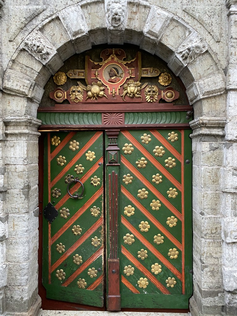
Although not a walled, medieval, historically preserved town like Tallinn, Riga nonetheless offered its own flavor of charm and architectural notability. Case in point, Riga’s own House of the Blackheads. As with Tallinn’s House of the Blackheads, Riga’s building housed the Brotherhood of Blackheads, a guild for unmarried merchants, shipowners, and foreigners in Riga.
Unlike Tallinn’s modest townhouse (albeit with a very cool door and lunette), Riga’s House of the Blackheads is huge and ornate. The original building erected in 1334 was the largest public building in Riga at the time.
Unfortunately that building, updated over the centuries, was bombed out of existence in 1941 during a battle between Germany and the Soviets. The Soviet government razed what was left in 1948, but it was rebuilt in the late 1990s based on extensive archeological studies.
Right around the corner from the Blackheads lies Riga’s capitol building. Very unassuming, we thought.
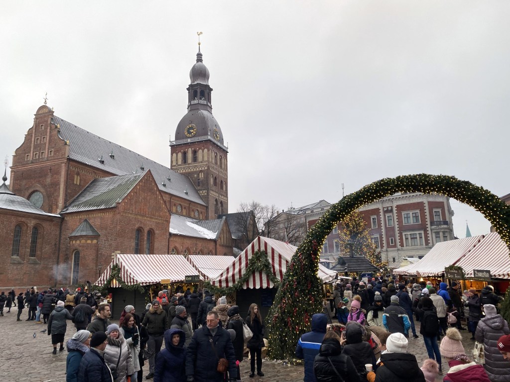
Riga’s Christmas market in the shadow of the Dome Cathedral was pretty great.
But some stalls were actually branded, which we’d never seen before, and gave areas of the Christmas market a commercial taint that we didn’t welcome:
Nonetheless, the overt booziness of the place was pretty cool – not just glühwein, but all sorts of booze, including – weirdly for both time and place – gin stalls.
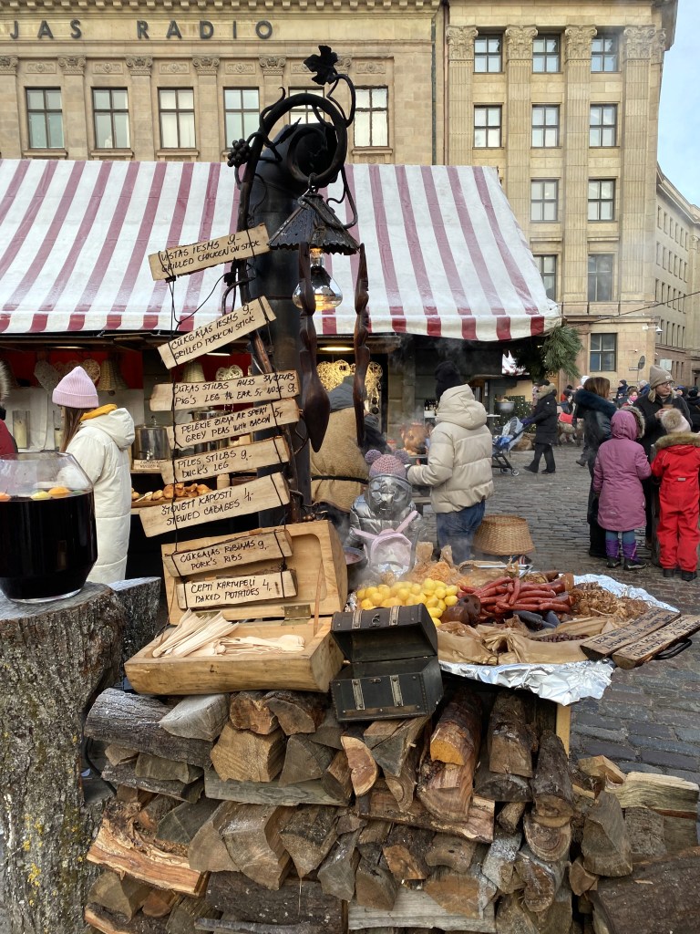
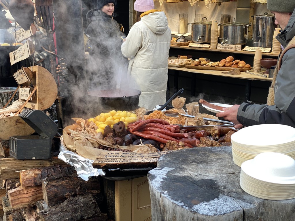
Lots of food. . .
which had a distinct eastern Europe flair – check out the pig snout:
Or maybe it’s an entire pig submerged down there? Who knows.
Pigs a poppin’ in this place:
Riga’s Powder Tower, originally built in 1330 as part of the defensive wall system, that one was destroyed during an attack by the Swedes on the Polish-Lithuanian Commonwealth in 1621. (Livonia [which encompasses parts of multiple modern Baltic nations including Latvia] was a fiefdom at the time).
The current iteration dates from 1650.
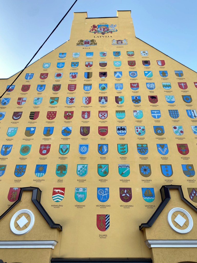
Next door lies Jacob’s Barracks, built in the 18th century to house the garrison, the structure continued to be used until 1997 by various militaries as the area’s geopolitics evolved over time. The length of the barracks are now home to bars and restaurants, but the end, with its depiction of the coats of arms of Latvian towns and municipalities, was the most intriguing to us.
Portions of the old city wall running along the barracks:
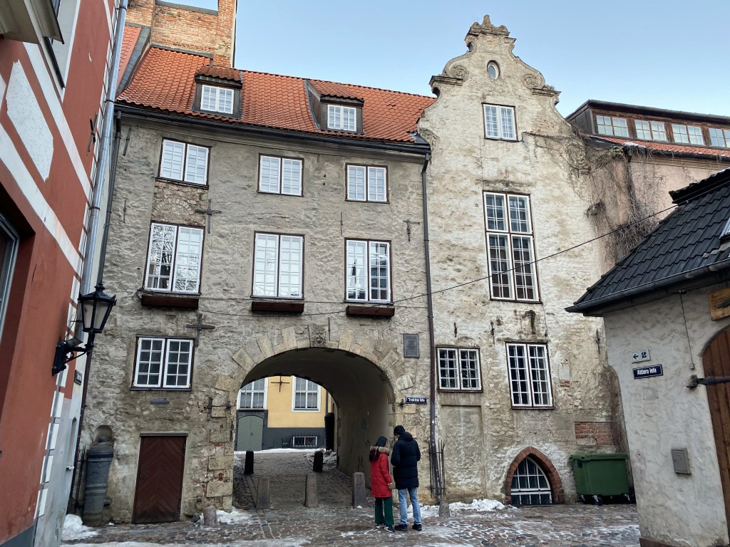
The Swedish Gate – the only portal in the medieval city walls to still exist. Beyond lies Trokšņu iela (Noisy Street) which ironically is one of the quietest and most charming street in Riga now. I’m sure we walked through here and down this apparently amazing street, but we have no visible evidence of this. ¯\_(ツ)_/¯
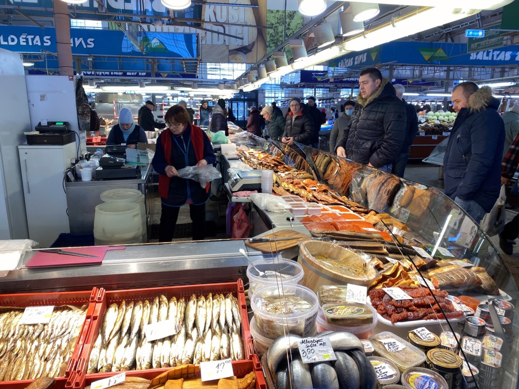
Instead, here’s some pics of Riga’s mammoth Central Market.
Absolutely any variety of food one could desire is available here.
The Riga Central Market (there’s a bird’s eye view later in the post) is composed of multiple, massive, hanger-like structures and is not only the largest shopping destinations in Latvia, but one of the largest markets in Europe.
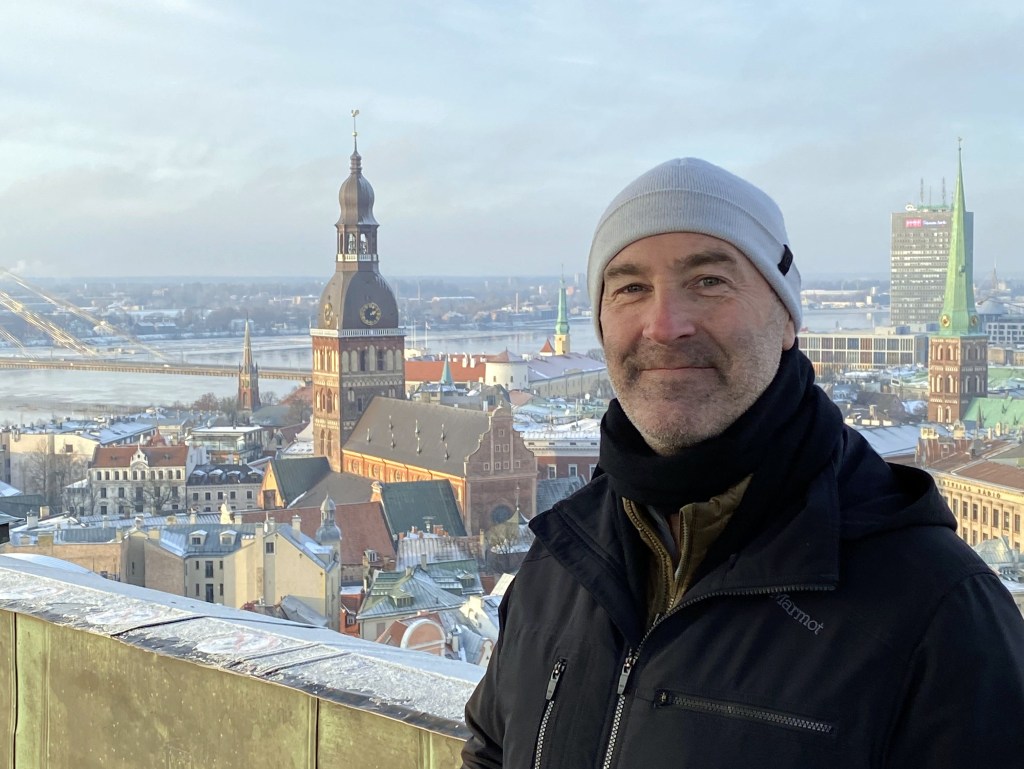
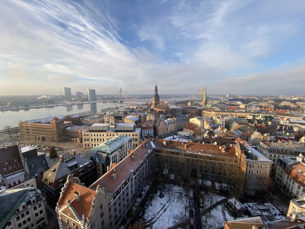
The aforementioned bird’s eye view would come courtesy of St. Peter’s Church steeple.
Built in chunks over centuries, the first St. Peters was constructed as early as 1209; then a few decades later, in the middle of the 13th century; then the early 15th century; then at the end of the 17th century. Pretty plain brick church though, much like the Scandinavian Gothic brick churches encountered in Denmark.
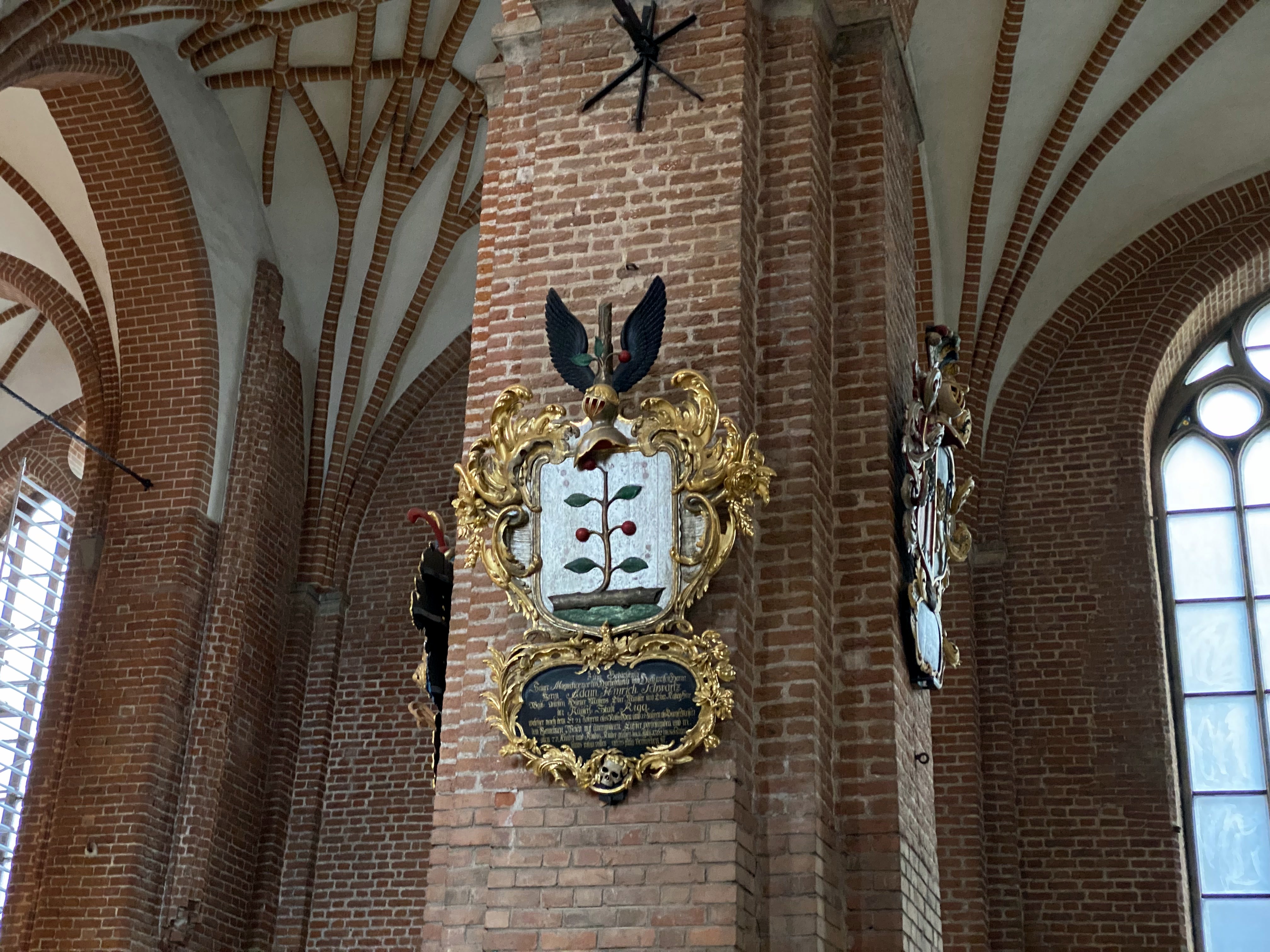
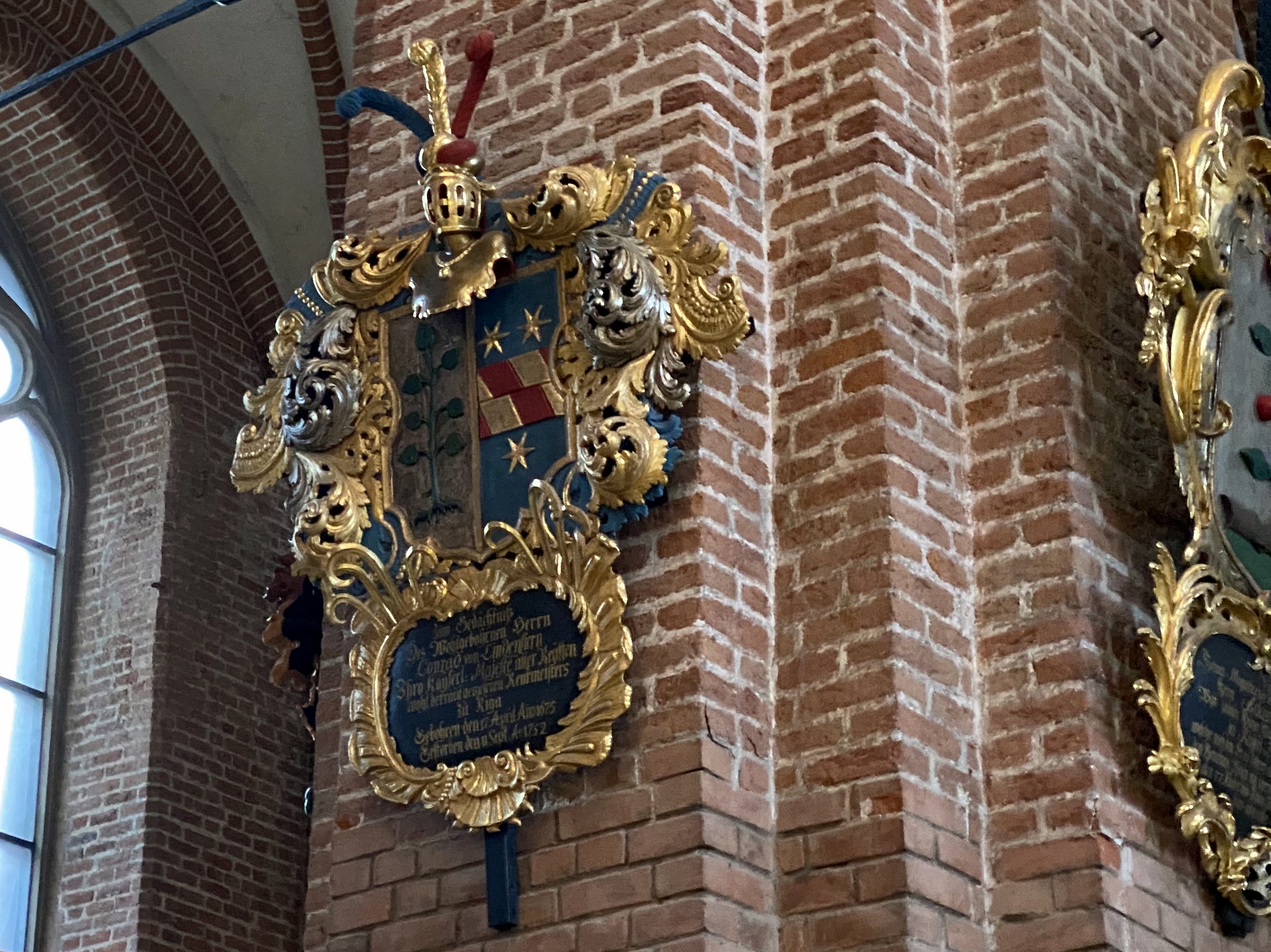
As with Tallinn’s cathedral, portions of the interior are adorned with local noble family coats of arms (one of which looks dangerously close to the esteemed crest of the Connells):
Something in the crypt we think? Dunno – pretty cool though.
Views from St. Peter’s steeple observation deck – pretty awesome perspective on the town.
Renaissance facades in front of the Dome Cathedral:
Another, higher view of the Powder Tower:
Riga’s Central Market hangers:
Down the street lies Riga’s Freedom Monument. A large statue of Peter the Great astride a horse once occupied this plaza, but it disappeared during WWI and the Latvians weren’t eager to replace it. Instead, the Freedom Monument was erected in its place in 1935.
Flowers are allegedly placed at the foot of the monument each day (we didn’t see any) as an act of defiance – such a gesture was punishable by deportation to Siberia during the Soviet era.
Dinner at 3 Pavāru Restorāns – definitely the dining highlight of our stay.
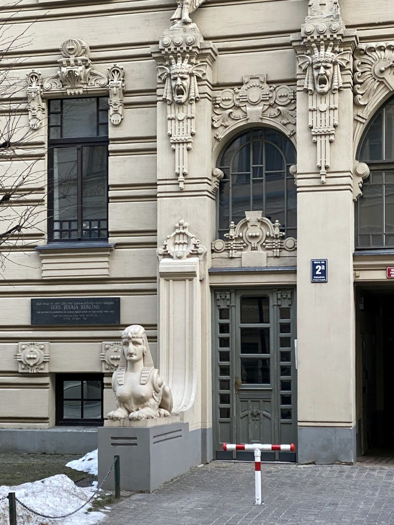
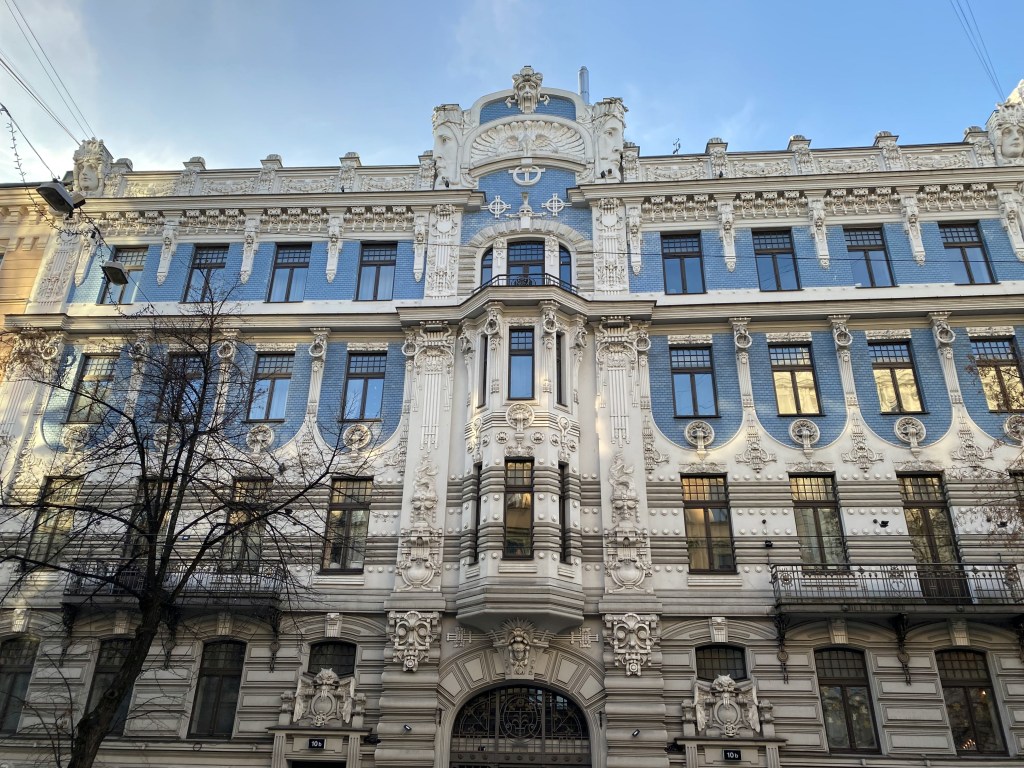
Riga’s Art Nouveau district on our Christmas Day walk. Riga’s period of peak prosperity happened to coincide with the Art Nouveau arts and architecture movement between 1890 and the outbreak of WWI. Although not at all unique to Riga, the town benefited from not being bombed into oblivion during WWII, resulting in a concentration of buildings in this style not seen anywhere else in Europe.
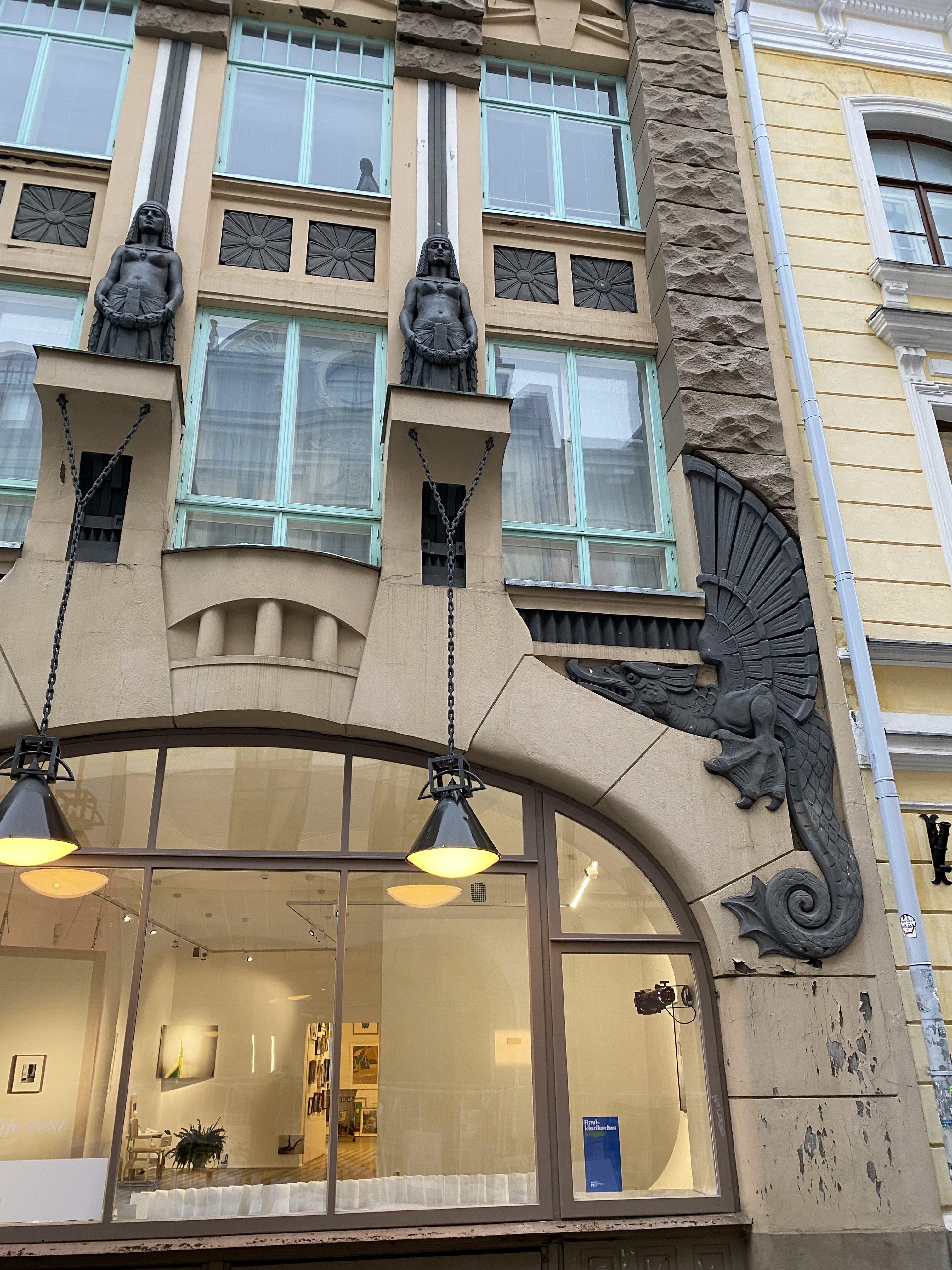
Perhaps the coolest: No. 10b, with a peacock (the symbol of art nouveau) flanked by big-ass faces.
Perfect winter weather in Riga for a Christmas visit.