Mappy Hour

Mappy Hour: One House in Four Countries

Right on the heels of our post Five Legs in Six Weeks trip overview, the New York Times slyly attempted to one-up our juggernaut media platform with this “One House in Four Countries” article:

Clearly a knockoff of WolfeStreetTravel and a blatant brand encroachment violation, but we’ll let it pass because the situation described in the article is very cool, and certainly aligns with our interest in European history and cartography. The gist (and hook) of the article is pretty much captured in the first three paragraphs of the New York Times article:

“ ‘Wait until you find out how everyone in my family has come from a different country,’ says Alex Zigante on a recent summer afternoon.

Mr. Zigante, a 30-year-old engineer, takes a breath and lays out the family tree: His great-grandmother, Angela, was born in Austria-Hungary. His grandmother, Maria, 90, in Italy. His father, Aldo, 61, in Yugoslavia. And Alex was born and raised in Slovenia.

And yet, all of them have lived their lives here in Portorož, a seaside village in what is now southwestern Slovenia, where the family’s roots go back centuries to the Venetian Empire, and where their modest three-story home has been a fixed point on an ever-changing map.”

Even better (for WolfeStreetTravel’s interests, anyway) is the series of maps included with the article, depicting the fluid and ever-evolving geopolitical construct that swirled around Portorož over a 100-year period:

Super freakin’ cool, from our perspective, to have your property caught up in the maelstrom of pre- and post-world war political territory restructuring; then revolution; then restructuring. Absolutely enthralling.

And who doesn’t want the occasional reminder of the scope and size of the extinct but still-mildly intriguing Austro-Hungarian Empire?

Categories: Mappy Hour | Leave a comment

Well, Would You Look at This! And Just Hours after Our Post on Denmark’s Change to their Coat of Arms

The New York Times reported “Trump Suggests U.S. Territorial Expansion and Airs Grievances:
In a news conference, President-elect Donald Trump refused to rule out the use of military force or economic coercion to take Greenland and the Panama Canal.”

“President-elect Donald J. Trump said (“In a rambling, hourlong news conference”) Tuesday that he would not rule out the use of military or economic coercion to force Panama to give up control of the canal America built more than a century ago and to force Denmark to sell Greenland to the United States.”

We at WolfeStreetTravel, believe that Trump’s threats are an immediate reaction to the story on Denmark’s coat of arms that we just posted. We’ll try to be more discrete in the future.

The full story from the Times is here.

Categories: Mappy Hour | 2 Comments

Denmark Just Changed Their 800-Year-Old Coat of Arms to Symbolically Highlight Greenland

WolfeStreetTravel finds interest in all things cartographic, vexillologic, and heraldric. Particularly the compelling cartographic oddities we encounter on our travels. But yesterday, multiple news outlets (and several travel Instagram accounts we follow) reported a development directly relevant to the last item in the list.

As reported in the UK’s Guardian, “The Danish king has shocked some historians by changing the royal coat of arms to more prominently feature Greenland and the Faroe Islands – in what has also been seen as a rebuke to Donald Trump.”

The previous Danish coat of arms was formalized in 1972, but elements of the current heraldric symbols can be traced back to the rule of King Canute VI around1194. The old coat of arms did acknowledge Greenland, but subordinated its polar bear to a position in quarters within quarters upon the field (shield shape). The Greenland polar bear shared a quartered space in the lower left quadrant of the field with the Faroe Islands ram, below three crowns, “symbolizing “the symbol of the Kalmar Union between Denmark, Norway, and Sweden, which was led by Denmark between 1397 and 1523.”

The previous coat of arms appears on the left:

From The Guardian’s article

Denmark’s new coat of arms more prominently devotes an entire quarter of the field – the same lower left quadrant – to the polar bear symbol of Greenland. Although not as relevant to the story, the Faroe Islands’ ram gets its own quarter a the top right quadrant of the field, and the crowns are now gone. (They made cosmetic updates to the dudes with the clubs, too, but no one is commenting on the rationale for this change.)

All of this, of course, in response to Trump’s declaration that owning Greenland is in America’s strategic interest. Trump wrote yesterday on Truth Social, ““Greenland is an incredible place, and the people will benefit tremendously if, and when, it becomes part of our Nation. We will protect it, and cherish it, from a very vicious outside World.”

The Washington Post reported that “For the Danish government, this situation is “a huge headache,” according to Mikkel Runge Olesen, senior researcher at the Danish Institute for International Studies. “It cannot be seen to be pressuring Greenland or jeopardize relations with Washington, which it depends on for security guarantees through NATO.”

Headache or not, WolfeStreetTravel finds it fascinating that the Danes are asserting their sovereignty over Greenland through updates to their ancient heraldric symbols while this whole thing plays out in the lead up to the new presidential administration.

Categories: Mappy Hour | Tags: , , , | Leave a comment

Mappy Hour: A Cartographic History of Ukraine

As Russia continues their belligerent posturing along the Ukraine eastern border (and now on Ukraine’s northern border with Belorussia, where Putin has begun positioning even more troops), it’s helpful to understand the history of Ukraine’s borders in the political and cultural fluidity that characterizes central Europe. (Let’s be serious – fluidity across all of Europe, which is why the place is so freaking interesting from a historical and cartographic perspective.)

Our buddy, Jim, who also follows WolfeStreetTravel, recently recommended this really compelling Washington Post article from 2015 on the evolution of Ukraine’s territory and borders. This article was published when Putin was previously taking aggressive actions to absorb Ukraine’s Crimean Peninsula into mother Russia. Definitely recommended reading for anyone following the crisis unfolding around Ukraine.

The Washington Post’s resident cartographer, Gene Thorp, developed for the article several really helpful and really compelling maps depicting how Ukraine’s territory transformed over the centuries as empires, warring factions, and treaty agreements changed. To wit:

Catherine the Great’s encroachment into what previously was either sovereign Ukrainian territory or land ruled by the Polish-Lithuanian Commonwealth in the 17th century. (WolfeStreetTravel previously included latter in another Mappy Hour post on the evolution of Europe during the Brexit buildup.)

Or, a severed Ukraine after the post-WW I Treaty of Brest-Litovsk, where Poland wound up with most of western Ukraine, including the major city of Lviv, but lost the territory during the Russian civil war, after which Ukraine joined the USSR as the Ukrainian Soviet Socialist Republic within the union.

The body of the article includes more maps and some really great context for how and why Ukraine looked like it did at different times during the last 1000+ years, as well as how the native people of Ukraine changed due to Soviet actions. Good stuff!

Categories: Mappy Hour, Maps and Miscellany | 1 Comment

We Missed a Micronation!

Our friend Bill last night forwarded an article on a micronation previously unknown to us that we totally could have visited during our Tiniest 5 for the Big 5-0 trip in 2017. During that trip, we drove to all five European continental micronations – Vatican City, San Marino, Liechtenstein, Monaco, and Andorra.

We totally missed the Principality of Seborga!

The micronation (merely self-proclaimed, to be sure) is enclaved within Italy, just like San Marino:

Seborga’s claim that their principality is an independent nation and not a part of Italy is based on a sale document that was never fully executed in 1729:

“Allegedly on 20 January 1729, this independent principality was sold to the Savoy dynasty and became a protectorate of theirs. In 1815 the Congress of Vienna overlooked Seborga in its redistribution of European territories after the Napoleonic Wars, and there is no mention of Seborga in the Act of Unification for the Kingdom of Italy in 1861. . . The argument for Seborga’s present-day status as an independent state is based on the claim that the 1729 sale was never registered by its new owners, resulting in the principality falling into what has been described as a legal twilight zone.”

The principality is not recognized diplomatically, and so does not meet one of the actual micronation definition. However, Seborga does indulge in micronation practices, such as producing their own currency, that we’ve seen in other self-proclaimed tiny countries, like the Republic of Vevčani in North Macedonia, where we began our third day of riding during our Biking the Balkans trip earlier this year.

The micronation also is located in the extreme west of Italy, just ~12 miles from Monaco, so we totally could have visited Seborga in 2017 . . .

A fuller history and an absolutely entertaining read on the Principality of Seborga (and the reigning prince) can be found here, on Vice.

Thanks, Bill, for the great story – we’ll try to drop by the principality the next time we’re in the area!

Categories: Mappy Hour, Maps and Miscellany | Tags: , , , | 2 Comments

Mappy Hour: Independent from Spain? One Catalonian Town Already Is (Geographically, at Least)

Events swirling around Catalonia’s lurch toward independence from Spain accelerated rapidly today. Catalonia’s Parliament declared independence and Spain reacted by suspending the region’s government, taking over Catalonia’s police, and calling for December elections.

In the meantime, as the New York Times reported today, the Catalonian town of Llivia has been independent from Spain for 350 years. Geographically, the town is located entirely within France:

The NYT reports that, with regard to independence, “for Llivia, a quaint town tucked about 4,000 feet up in the foothills of the Pyrenees, an important part of that decision was made centuries ago. Llivia is already separated from Spain physically: The five-square-mile municipality is a geographic anomaly resulting from a quirk of the 1659 Treaty of the Pyrenees, which settled a more-than-two-decade round of fighting between Spain and France.

Only “villages,” according to the treaty, were to be ceded to the French crown. Llivia was considered a town, not a village, and so remained part of Spain, and the region of Catalonia.”

Catalonia est non Espana! And, if Catalonia does indeed secede, Llivia won’t be Catalonia (on a map, anyway).

The cartographic coolness never ends.

Categories: Mappy Hour, Maps and Miscellany | 4 Comments

Mappy Hour: Catalonia’s Not the Only European Area Agitating for Autonomy

After an aborted referendum and multiple protests, Catalonia’s president today may or may not have announced that the region will pursue independence (it was so ambiguous that Spain requested that he clarify what he’s actually trying to say). The Washington Post has helpfully published an update on some previous articles they’ve posted on the other restless regions across Europe.

The disappointingly brief article included the usual suspects, including Scotland, Flanders, and the Basque region. However, it also introduced a few we hadn’t known about earlier, including South Tyrol (a German-speaking region in Italy that previously was part of Austria prior to WW I) and the Faroe Islands, who are itching to throw off the distant Danish yoke.

A good quick read if you like European history and geography!

Categories: Mappy Hour, Maps and Miscellany | Leave a comment

Lake Lugano, Switzerland

Day 5 of the micronations road trip took us to a halfway point between Liechtenstein and our next target, the Principality of Monaco. The halfway point we selected was Lake Lugano, Switzerland (which brought our country count for just 5 days of the trip to five, as it happens . . .). GPS route for the day’s drive:

As some have noted, this blog has a particular interest in geography and geographic anomalies. Lake Lugano played to this interest. Although the type of geographical anomaly there is very unusual, we had nonetheless encountered this type of anomaly twice already during the trip: an enclave.

The Italian commune of Campione on Lake Lugano lies entirely inside the Swiss canton of Ticino. The map below shows Swizerland in pink and Lake Lugano in deep blue. The enclaved Italian commune isolated entirely inside of Switzerland is in the southeast section of the lake:

Unlike the enclaves of Vatican City and San Marino, where an entire nation resided inside another country, this enclave represented just a tiny piece of Italy, very similar to the Spanish town (or Catalonian town, if you side with the secessionists there) of Livia stuck inside of France, which we blogged about last year.

Although we’ve only been posting information on why things still exist on the micronation blogs themselves, we figured this enclave deserved some detail, so here’s the explanation for why it exists, courtesy of Wikipedia:

“In the first century BC the Romans founded the garrison town of Campilonum to protect their territories from Helvetii invasions.

In 777, Toto of Campione, a local Lombard lord, left his inheritance to the archbishopric of Milan. Ownership was transferred to the abbey of Sant’Ambrogio. In 1512, the surrounding area of Ticino was transferred from the ownership of the bishop of Como to Switzerland by Pope Julius II, as thanks for support in the War of the Holy League. However, the abbey maintained control over what is now Campione d’Italia and some territory on the western bank of Lake Lugano.

When Ticino chose to become part of the Swiss Confederation in 1798, the people of Campione chose to remain part of Lombardy. In 1800, Ticino proposed exchanging Indemini for Campione. In 1814 a referendum was held, and the residents of Campione opposed it. In 1848, during the wars of Italian unification, Campione petitioned Switzerland for annexation. This was rejected due to the Swiss desire for neutrality.

After Italian unification in 1861, all land west of Lake Lugano and half of the lake were given to Switzerland so that Swiss trade and transport would not have to pass through Italy. The d’Italia was added to the name of Campione in the 1930s by Prime Minister Benito Mussolini and an ornamental gate to the city was built. This was to assert the exclave’s Italian-ness.”

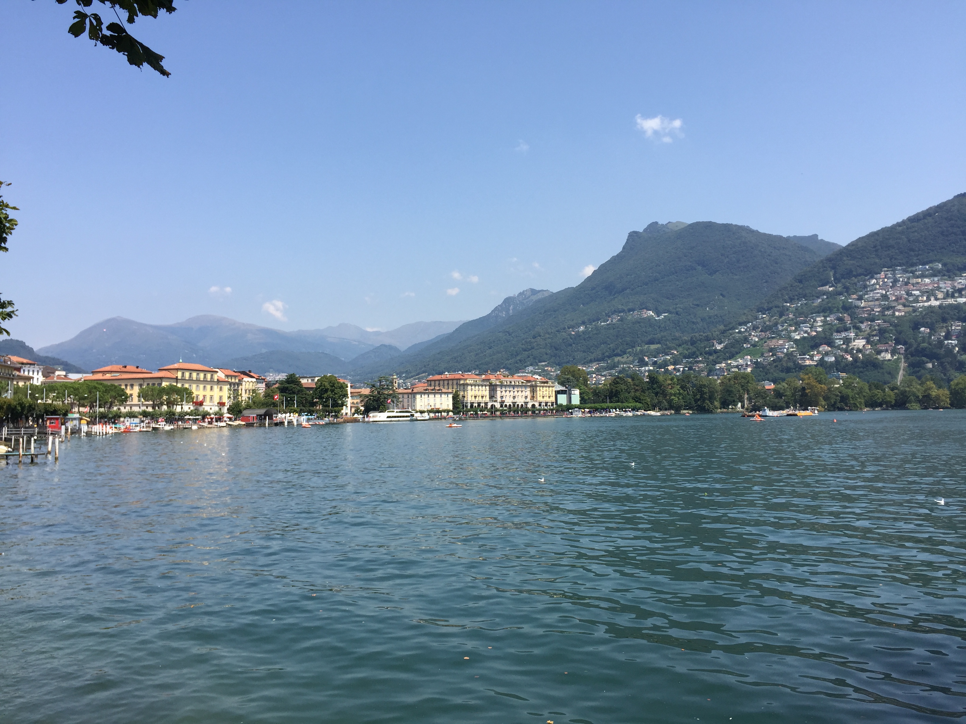
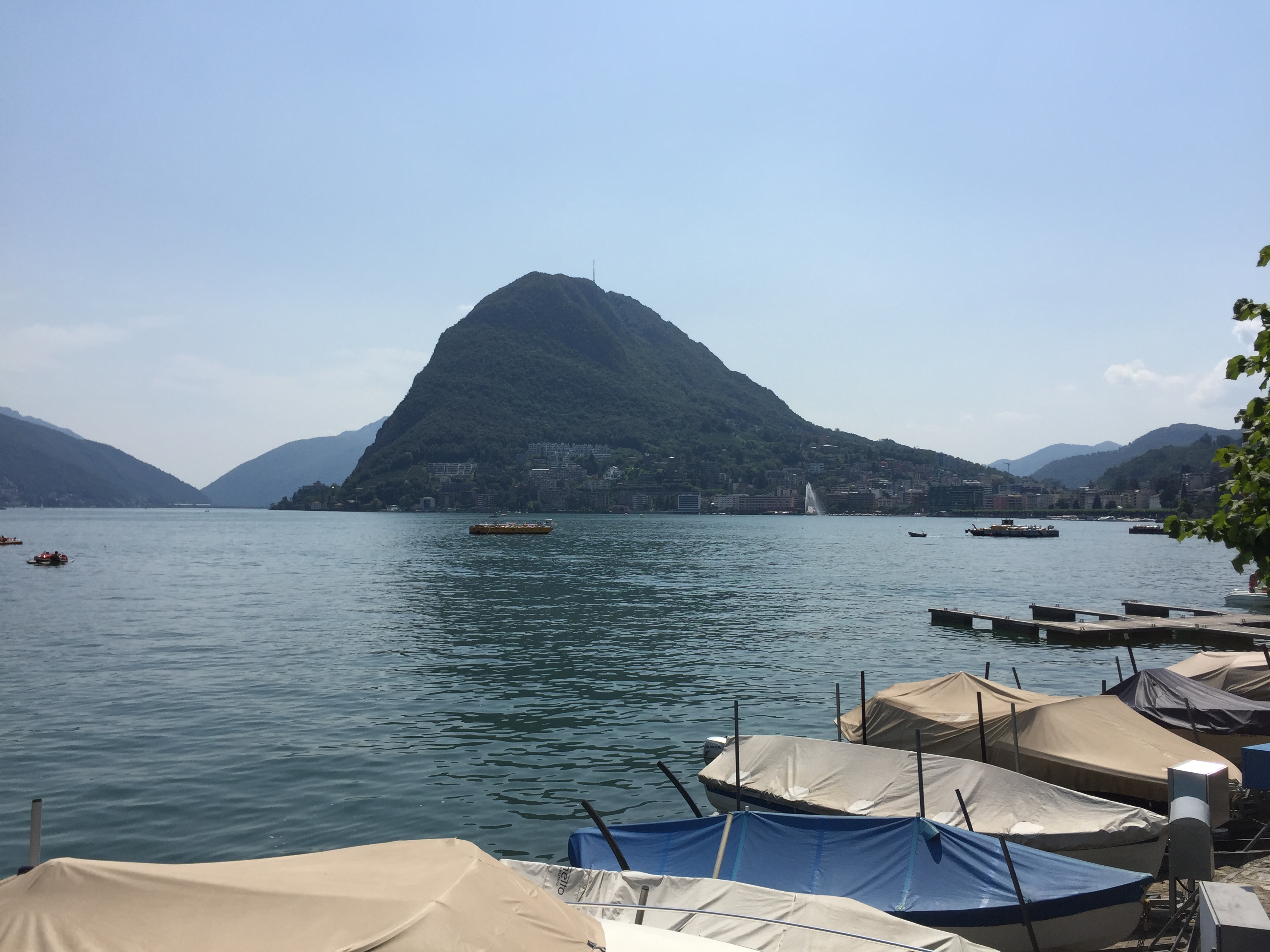
On to our day in Lake Lugano.

First, we definitely picked the right place to stay – spectacular views of the lake:

And a complementary electric Smart Car for forays down to the lake . . .

Along the lake . . .

The Romanesque Church of Santa Maria degli Angeli on the shores of the lake:

The church was built in 1499 in recognition of the cessation of conflict between the Guelphs and Ghibellines and to thank the Observant Franciscans for their work during the plague of 1498. It features a very busy 15th century fresco by a student of Leonardo da Vinci that’s still perfectly intact and considered to be one of the best examples of art during the Lombard Renaissance.

Heading back to The View in our sweet ride:

Incredible dinner outside at The View, overlooking Lake Lugano:


Unbeknownst to us, August 1 is Swiss National Day, so not only did we have a sweet dinner overlooking the lake, but got to experience a great fireworks display, to boot.


Categories: Mappy Hour, Maps and Miscellany, Micronations!, Switzerland | Tags: , , , , , , , | 2 Comments

Mappy Hour: Evolution of the National Mall

The Smithsonian’s new National Museum of African American History & Culture opens on September 24 – the latest structure to be added to the National Mall in DC. The Washington Post this week published a series of maps that depict the 200-year evolution of the Mall, from swamp to canals to a railway station to “temporary” WW II offices that stuck around until the 1970s.

Excerpts from the excellent article are below. The full story and 8 intriguing maps can be found here.

The Mall in 1860, before land was reclaimed for the Jefferson and Lincoln Memorials and when a canal snaked to within blocks of the capital:

1860

The Mall in 1940, when temporary WW II offices crowded the north side of the reflecting pool:

1940

The Mall today, with the addition of the new National Museum of African American History & Culture immediately to the northeast of the Washington Monument:

mall

Categories: Mappy Hour, Maps and Miscellany | Leave a comment

Mappy Hour: On the Eve of the Brexit Vote, a Cartographic Summary of Prior European Unions

This Thursday, Britain votes to remain in the European Union or to simply Brexit, stage left. In advance of Britain’s vote, which could reshape Europe once again, the Washington Post helpfully published today a very cool history of other amalgamations of European countries (or kingdoms, empires, grand duchies . . .) that resulted in past European unions.

The full article is here. Below are some blasts from the past that highlight previous combinations of territory that have shaped the political makeup of Europe. These selections include:

The predictable . . .

Roman

Napoleon

The combinations we learned in school, but immediately forgot . . .

Hanseatic

Charlemagne

And the obscure and charmingly insignificant . . .

Pol-Lith

Benelux

For the record, the Polish-Lithuanian Commonwealth apparently existed between the 14th and 18th centuries.

And it even included a Grand Duchy.

Categories: Mappy Hour, Maps and Miscellany | Leave a comment

Blog at WordPress.com.