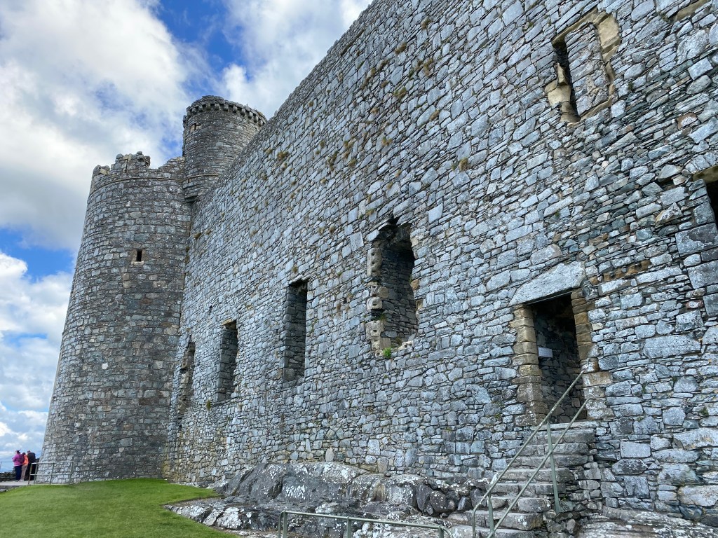
After the charm overload of Cotswolds villages – the priority for one half of WolfeStreetTravel – we finally pivoted Welsh castles – the priority for the other half, as noted in the trip overview post. After overnighting at Palé Hall on the Welsh / English frontier, we headed further west to visit our first castle: formidable Harlech.
An absolutely stupendous introduction to our Welsh castlepalooza. “UNESCO considers Harlech, with three others at Beaumaris, Conwy, Caernarfon, to be one of ‘the finest examples of late 13th century and early 14th century military architecture in Europe.’“ (Our next two castles to hit after Harlech were, indeed, Caernarfon and Conwy, so great news for us!)
There are freakin’ medieval castles (examples from previous travels here and here) and even Renaissance castles (examples here and here) all over Europe. Why are Welsh castles so special? Two primary reasons:
They were built at the absolute apex of medieval castle building in the 13th century, immediately before the introduction of gunpowder, which led to the demise of medieval castle as an effective defensive tool
They (generally) were not subject to the siege gun assaults or later, more modern bombing campaigns that damaged or destroyed many other European medieval castles
As a result, you can wander around Wales and experience the best preserved, most quintessentially “castle-y” castles in the world.
Most of the famous Welsh castles were all directed to be built by one man: Edward I. He may be known to the world as Longshanks or The Hammer of the Scots (a moniker he liked so much that it’s on his tomb in Westminster Abbey (“Scottorum malleus”)), but his real passion was to subjugate Wales. During his reign, he invaded Wales, ultimately conquering most of the region.
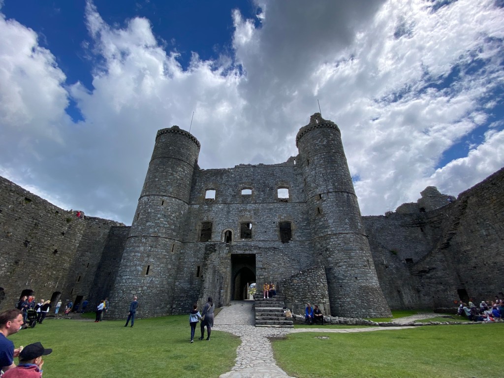
Harlech was one of four castles Edward I directed to be constructed in Snowdonia, in the north of Wales to create his “ring of stone” to consolidate English rule in the area and address the inevitable insurgencies that would follow the conquest.
Harlech was built under the supervision of James of Saint George, a military architect from Savoy (notable only because James also served as the military architect of Caernarfon and Conwy castles we’d see later.
“Harlech was established with a garrison of 36 men: a constable, 30 men, including 10 crossbowmen, a chaplain, a smith, carpenter and stonemason, and Master James was rewarded by being made the constable of Harlech from 1290 to 1293.“
Harlech was besieged five times over 500 years, trading hands along the way:
English garrisons defensed against the native Welsh in the early 1300s
The Welsh captured Harlech and they themselves were besieged by the English in the early 1400s
A Lancastrian garrison defended Harlech against the Yorkists in the late 1400s during the War of the Roses
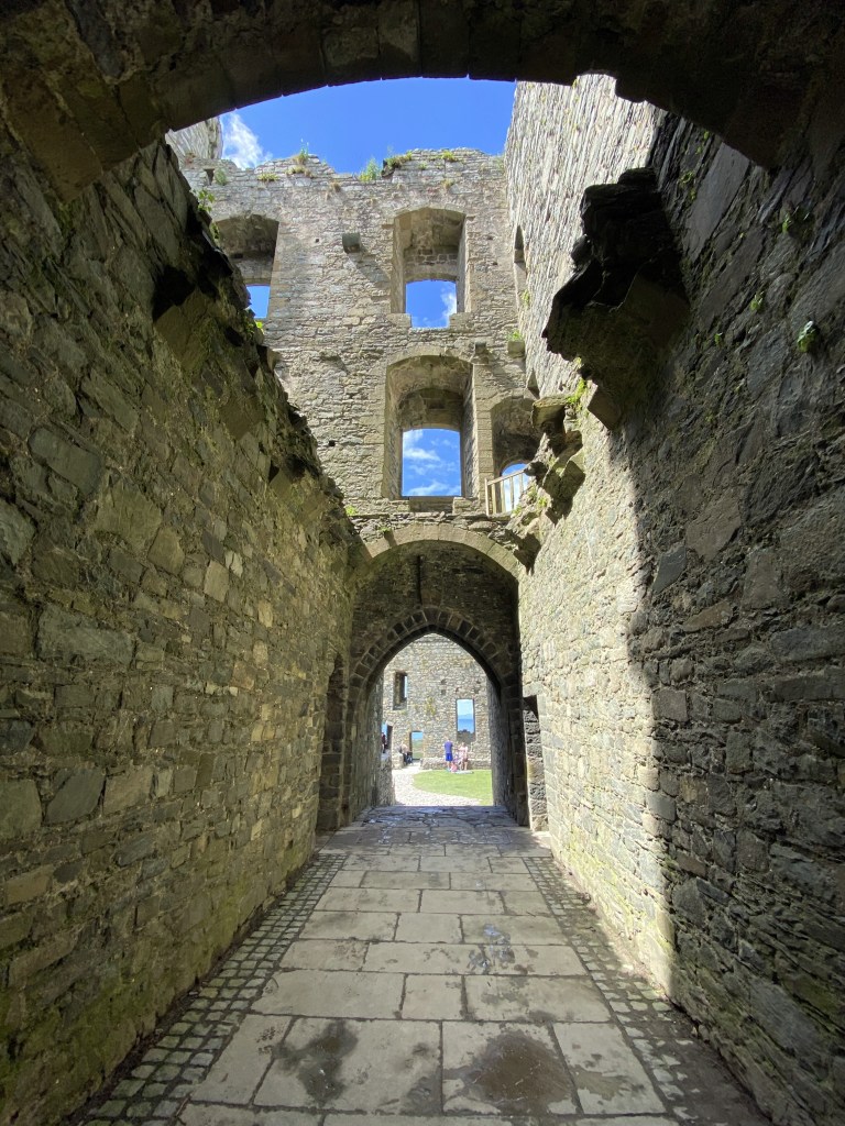
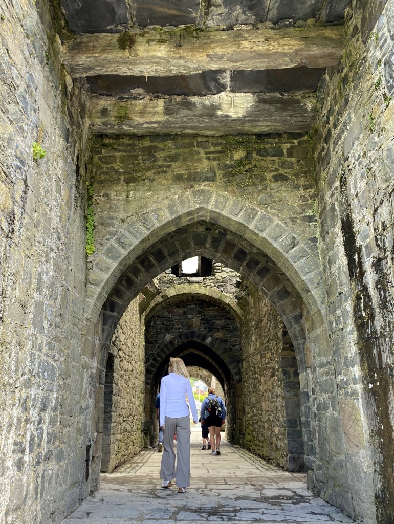
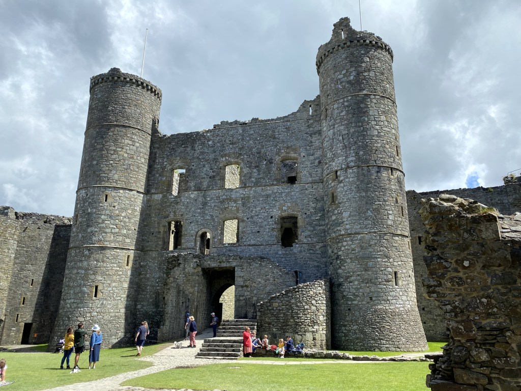
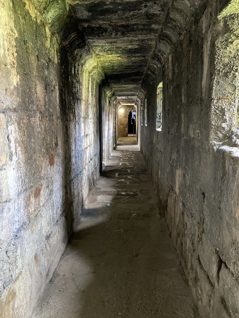
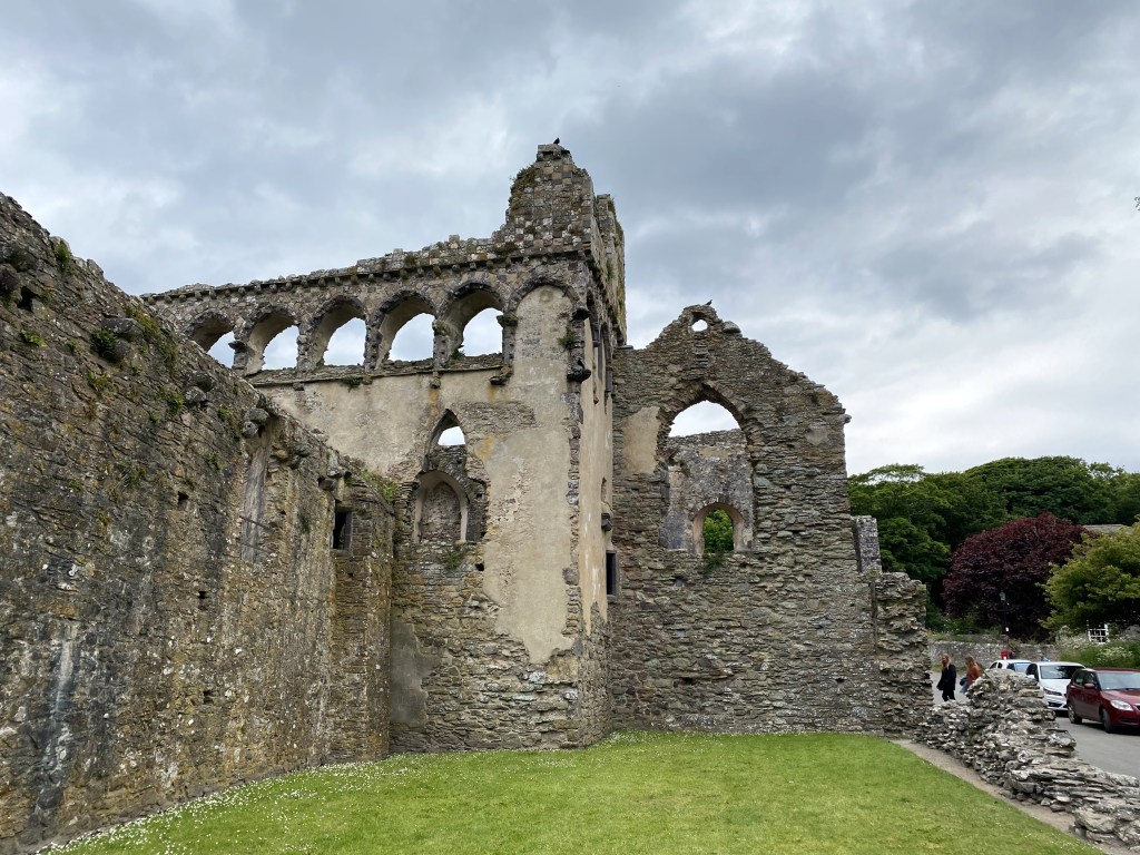
Master James’ now-classic concentric fortifications design, with fortified gatehouse serving as a castle-within-a-castle for layered defense:
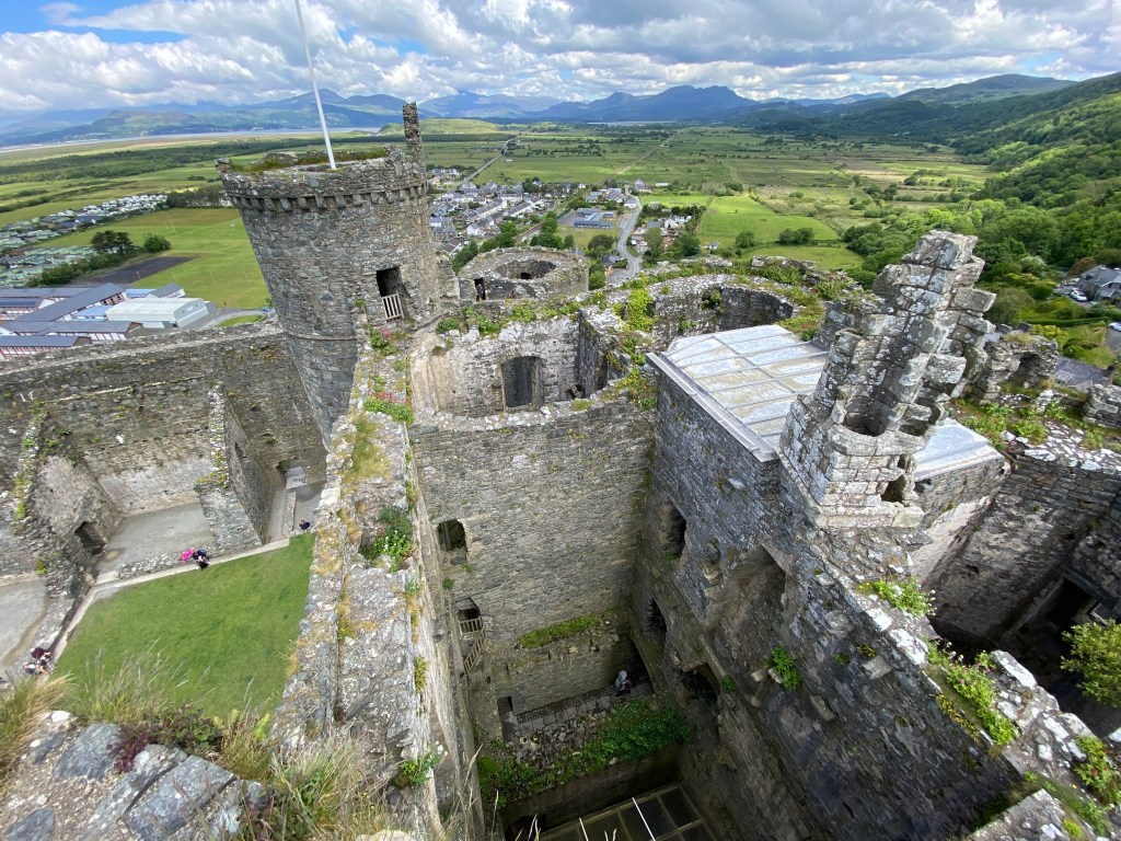
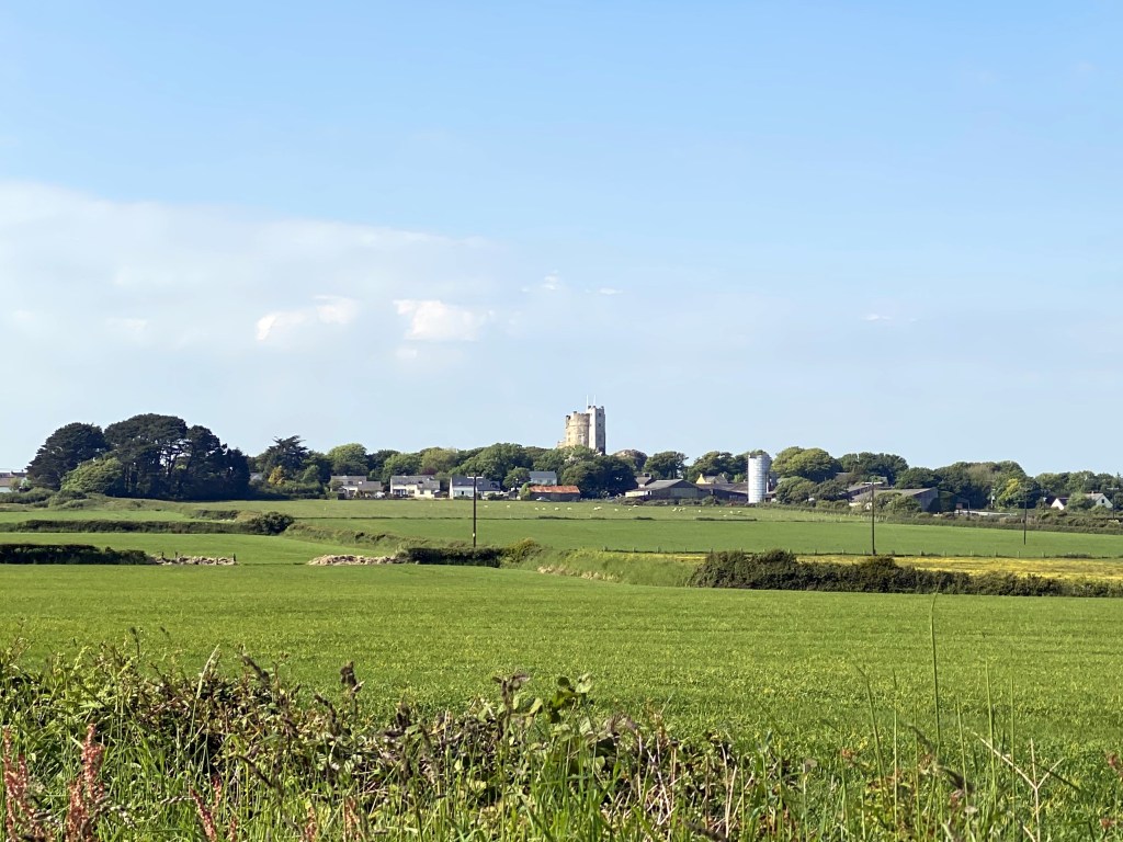
A view north into Snowdonia (and our next destination) from the top of one of the gatehouse towers:
Harlech’s tiny town below the castle:
That’s it for Castle 1 of WolfeStreetTravel’s 2022 Welsh Castlepalooza. And Castle 2 lies less than an hour’s drive north. . .
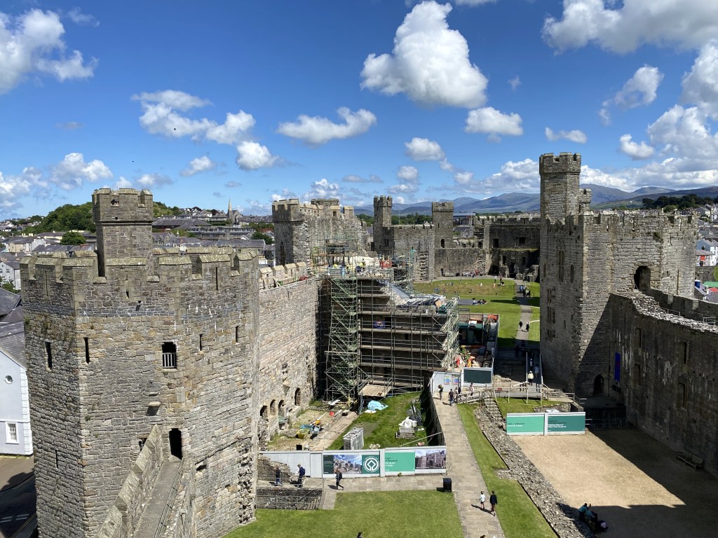
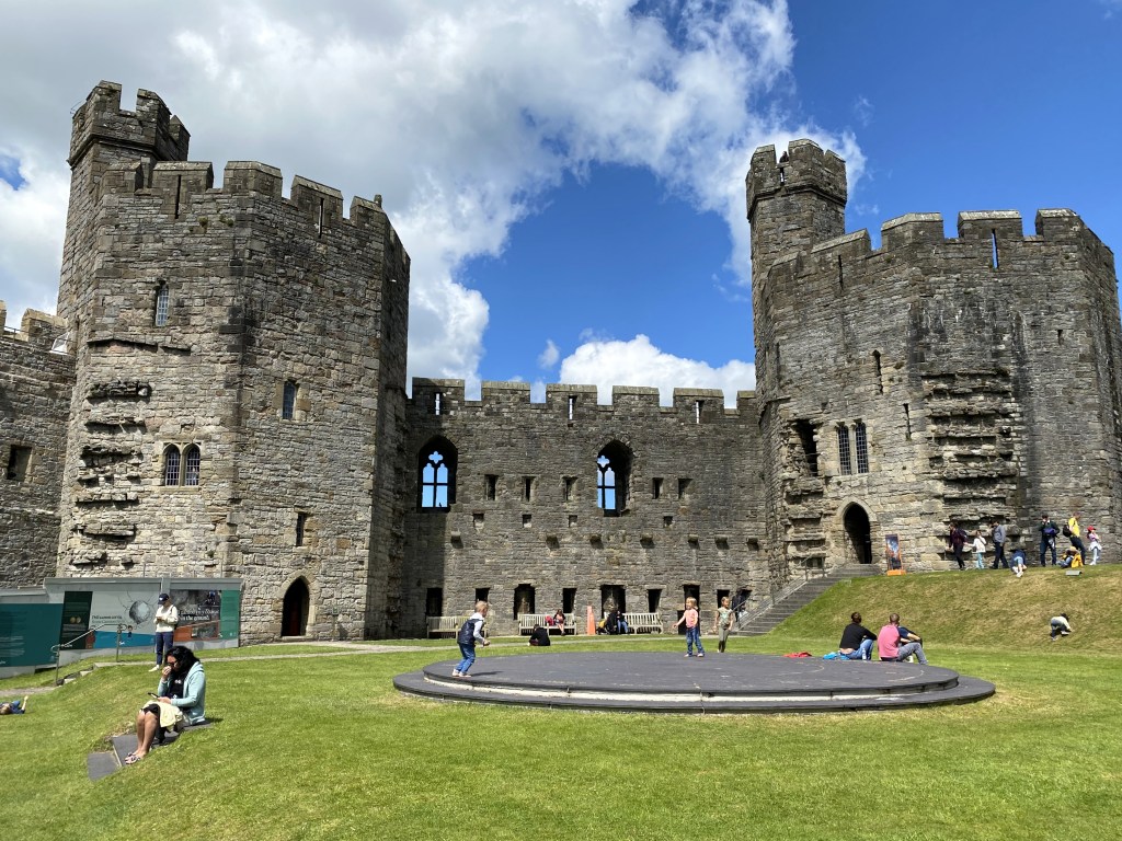
Arguably the most important castle in Wales also is indisputably the most distinctive in style: Caernarfon Castle in the northwest corner of the country.
The Romans recognized the strategic value of the site a thousand years before the Normans, and constructed their own fort – Segontium, or Caer Segent, to the Welsh (caer is Welsh for fort or castle, for those who read about Caer Dallben and Caer Dathyl when they were kids). When Edward built the current castle in the 13th century, he allegedly found the body of Roman Emperor Magnus Maximus and reburied it in a new church built in his honor. (Magnus Maximus was, indeed, the Roman governor of Britain in the 4th century, and usurped Gratian to supplant him as emperor, but Magnus Maximus was executed in Gaul, so there’s little chance of Edward finding him on the northwest coast of the island.) Little is known of the history of the site during the 600 years between the Roman’s departure and the Norman’s arrival.
After the Normans got down to business, though, the place becomes very well documented. A marcher lord under William already was in place according to the Domesday survey in 1088, and his successor (the first one was killed by the Welsh) built the first Caernarfon Castle – a rudimentary motte and bailey fortification.
The Welsh reconquered the region (then, as today, Gwynedd) in 1115, and Llywelyn the Great (who we’d see a couple of days later in Conwy) and later Llywelyn ap Gruffudd both stayed in Caernarfon on occasion. Then Edward came along. . .
Hostilities between the English and the Welsh broke out again in 1282 and by 1283, Edward’s forces were surging through Gwynedd recapturing existing castles and building others. Including Harlech, Conwy, and Caernarfon.
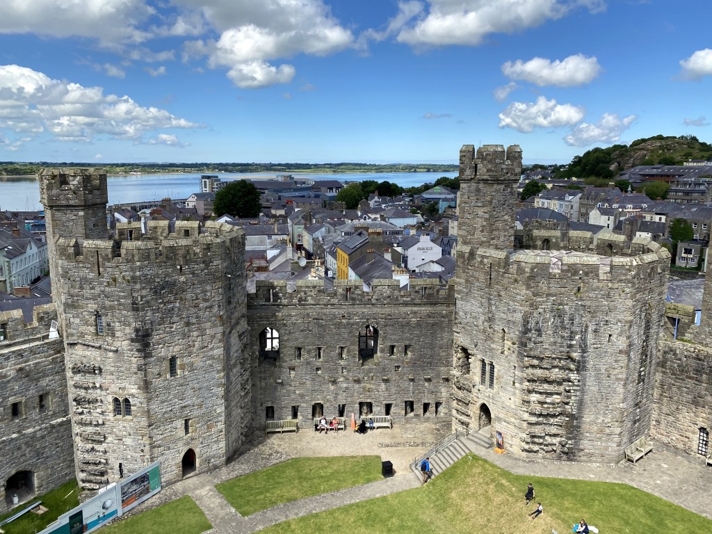
The distinctive angular turrets (versus the rounded turrets of Harlech and, soon, Conwy), were designed by Edward I’s royal military engineer to evoke images of Constantinople to convey Edward’s vision of his rule extending from Britain and Gascony to now Wales, as an empire. Super distinctive from other Norman castles in Britain (less so from some of the angled Crusader castles of the same time period in the Levant).
Wales once again rebelled under Madog ap Llywelyn, Prince of Wales and the Welsh attacked and then took Caernarfon and Caernarfon Castle as one of their first acts, since the English based their administration of Gwynedd here.
The English quickly retook the town and refortified the castle. (Which, true to so many of our travels, was under renovation when we visited.)
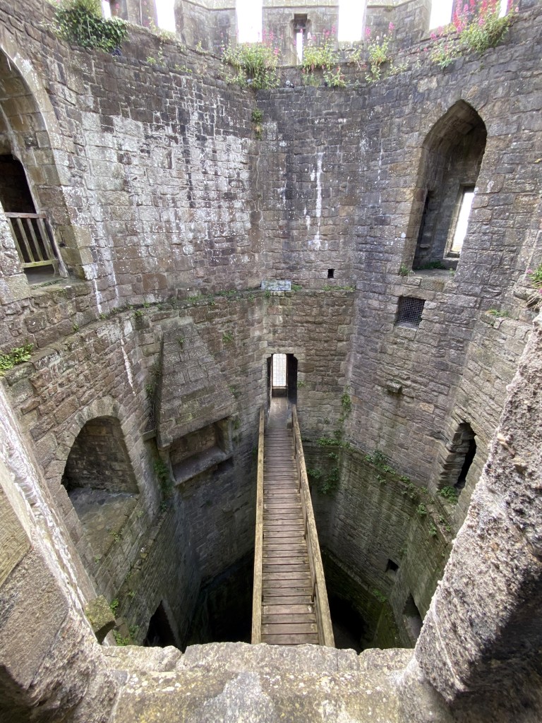
The hollowed out hull of one of the towers (King’s Gate tower, we think), with a fireplace serving a middle floor still visible.
The Upper Ward.
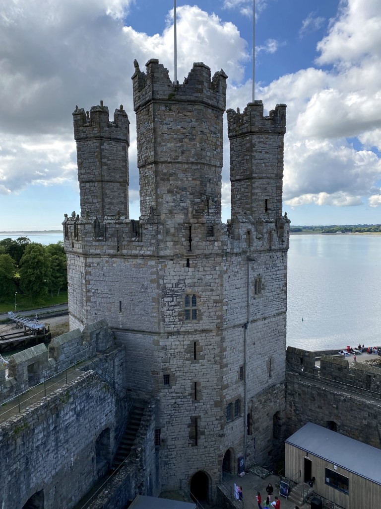
In addition to its distinctive angled tower walls, Caernarfon Castle offers another notable element: the birthplace of the first English Prince of Wales and the site of investiture of the modern Princes of Wales. According to tradition Edward’s first-born son, Edward II, was born in the newly constructed Caernarfon Castle in 1284, and Edward proclaimed him in 1301 to be Prince of Wales, with control over the country and its income. Since then the title has traditionally been held by the eldest son of the monarch, including the dude who just this year became King of England.
The dais in the middle of the Upper Ward commemorates the spot of Charles’ investiture as Prince of Wales in 1969.
Inside the castle walls.
In the early 15th century, rebellion again broke out in Wales, and Caernarfon Castle was besieged, but held.
The rise of the Tudor dynasty in the late 15th century brought about an improved relationship between the English and the Welsh, and the reduced tensions – and resulting reduced need for fortified bases with armed garrisons in “occupied” Wales – led to Caernarfon Castle falling into disrepair.
The last time the castle witnessed warfare was in the 17th century, when Royalists held the castle (successfully) against Parliamentarians.
Peering over the walls and between two of the castle’s nine towers into the small, adjacent town of Caernarfon.
A street through one of the old gates into the walled town of Caernarfon. . .
sporting one of the better street names we’ve seen on our travels.
St Davids served as our base of operations for the next several days in the heard of Pembrokeshire, in southern Wales. The town is named after the 6th-century Saint David, the patron saint of Wales, and also serves as his resting place. As a cathedral city (the weirdest one we’ve ever encountered, as you’ll see), St Davids qualifies as a “city” in the UK beginning in the 13th century.
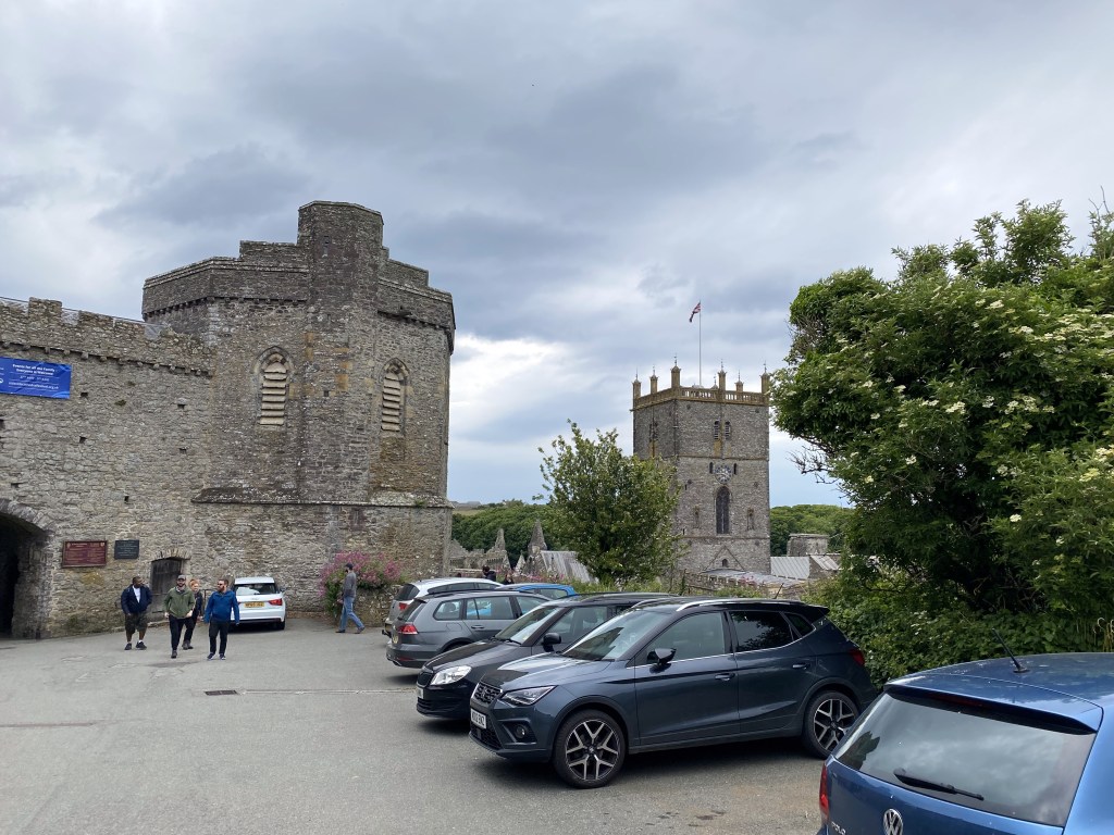
A small town square at the heart of St Davids with its cathedral looming over the town:
Don’t see it?
How about now? Just massive and looming over everything, right?
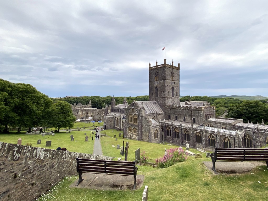
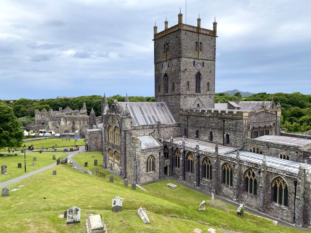
What the hell? St Davids cathedral sits in a depression at one edge of town, well below the rest of the structures in the municipality.
You have to look down from town into a grassy pit to actually catch a glimpse of the cathedral.
The cathedral, with the tomb of its celebrity saint namesake, became a reasonably prominent pilgrimage site in the middle ages. “At its height, the city was visited by many pilgrims, including noblemen and kings such as William the Conqueror in 1077, Henry II in 1171, and Edward I and Queen Eleanor in 1284. Pope Calixtus II decreed that two pilgrimages to St Davids were equivalent to one to Rome (“Roma semel quantum dat bis Menevia tantum“). This allowed a vast income to be raised from visiting pilgrims in the Middle Ages.” (From here.)
You gotta walk uphill from the cathedral to get back into town. St Davids is to the town / cathedral relationship is what Snowshoe is to ski resorts.
“The monastic community was founded by Saint David, Abbot of Menevia, who died in 589. Between 645 and 1097, the community was attacked many times by raiders, including the Vikings; however it was of such note as both a religious and an intellectual centre that King Alfred summoned help from the monastic community at St Davids in rebuilding the intellectual life of the Kingdom of Wessex. Many of the bishops were murdered by raiders and marauders, including Bishop Moregenau in 999 and Bishop Abraham in 1080.” (From here.)
Construction of the current cathedral began in the 12th century in typical Norman martial style, and has been renovated, rebuilt, expanded, and remediated multiple times over the centuries. Notably, the floor of the cathedral slopes, resulting in a height difference of almost 4 meters from one side to the other. Four freakin’ meters of slope.
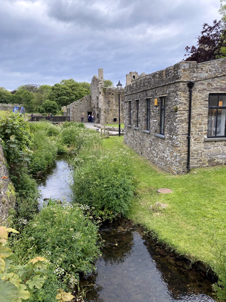
The community’s 14th-century Bishops Palace, now a ruin that was hosting a RenFest-type affair during our visit (we declined both jousting and presumed turkey leg offerings).
For anyone who’s read Bernard Cornwell’s Saxon Tales, King Alfred’s sanctimonious asshole scribe, Asser, actually grew up in St Davids and was a monk in the monastery here until Alfred recruited him.
Back in town – surprise! – fish and chips and mushy peas! Pretty good exemplars of the dish. The day before, after our hike, we arrived at the same pub (The Bishops, which made it into the first pic above) at around 2:55 and wandered around until we found a free table. Sat down, then tried to order at around 3:02. Nope – kitchen closes at 3:00. No exceptions, apparently. We headed out and down the street to an entirely different place to get some lunch. Today, we got our priorities in order, since we arrived close to 3:00 again, and ordered first at the bar, THEN found a table.
So. Our Wales Castlepalooza would not really be complete unless we STAYED in a castle. So we did, here in St Davids. Our first view of the castle from the road coming in from the north, the day we arrived from Conwy and Snowdonia:
Roch Castle:
Roch Castle was built in the late 12th century as part of the march – the borderlands between England and Wales. “
At the time of its construction, Roch Castle served as one of a group of border strongholds that fortified Anglicised Wales from the independent Welsh to the North, guarding the Flemish settlers who inhabited the surrounding “hundred of Rhoos”, and it also served as a lookout for the bay of St Brides to ward off invasions from the sea.
The first known inhabitant of the castle was a Norman knight by the name of Adam de Rupe. His name probably derived from the rock on which the castle was built, “de Rupe” being “charter” latin for “of the rock”. This name however was soon changed to the Norman (or French) “de la Roche”. Adam de Rupe’s ancestors were of the first rank of Norman families and had the province of the “hundred of Rhoos” committed to their care (probably) by Henry II. Their authority extended from Newgale to Milford Haven. Benton Castle marked the other extremity of their domain. However, the Castle of Roche was the family seat, and a member of the family was visited with the hereditary title of “Comes Littoris”, or “Count of the Shore”.
A legend recounts that Adam de Rupe erected his abode on a rock as a result of a prophecy that he would die from the bite of a viper. His precaution was in vain, as he met his fate when a viper, carried into the castle in a bundle of firewood, bit and killed him.” (From here.)
The coat of arms at the gate incorporates the elements of the legend. “The one raven above holding a snake in its beak and a basket of twigs in its claws represents the story of Adam de Rupe, the Norman knight who built Roch Castle. He was cursed to die of a vipers bite, so he placed his bedroom at the top of the tower away from snakes, but a snake hiding in a basket of firewood bit him and he died. A further two Ravens with outstretched wings on the shield makes a total of three Ravens. These honour Llewellyn ap Gruffudd, the last prince of Wales’ shield, which was of three Ravens. Around the shield are blue and white bands representing the blue of the sea and white of the surf of St Davids. The motto, “bid ben bid bont” from the Mabinogion and spoken by Bran the giant as he laid himself over the River Liffey for his armies to cross, “be a head (leader) be a bridge (facilitator)”.” (From here.)
The de la Roche family held the castle for more than 200 years. “When Thomas de la Roche of Roche died in 1420, he left no sons. Thus, the direct male line of the de la Roches ended in this year. He did however, leave two daughters who inherited the castle. Daughter Ellen married Edmund de Ferrars, fifth lord of Chartley, and daughter Elizabeth married Sir George Longueville. By the reign of Henry VIII, a contemporary Lord Ferrars and a Sir John Longueville were the owners of the property.
During the reign of Queen Elizabeth, it is recorded that the Earl of Essex and the Earl of Longueville were the possessors of Roche. It then passed to their descendants who maintained possession until 1601. About this time, the castle and “manor” of Roche passed to the Walter family of Rosemarket (apparently by sale). The Walter family was an important family of Pembrokeshire. About 1630, William and Elizabeth Walter gave birth to a daughter, Lucy, who became a mistress of King Charles II bearing his child, the Duke of Monmouth.” (From here.)
“Parliament became extremely restive under King Charles I, and soon openly rebelled under Cromwell’s leadership. In 1644, King Charles garrisoned many of the castles in South Wales and supplied a garrison for Roche Castle under the command of Captain Francis Edwards of Summerhill (he being from a neighbouring estate). On February 17th, 1644, the castle was attacked by Cromwell’s troops under the command of Colonel Roland Laugharne. After a fierce siege, the castle was surrendered on February 25th, having been badly damaged by cannon and also by fire.” (Also from here.)
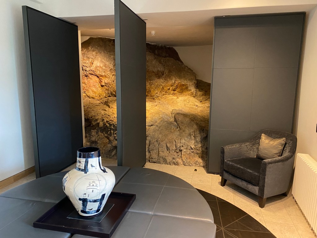
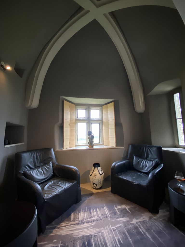
The rock base under the castle, exposed in a sitting room on the first floor.
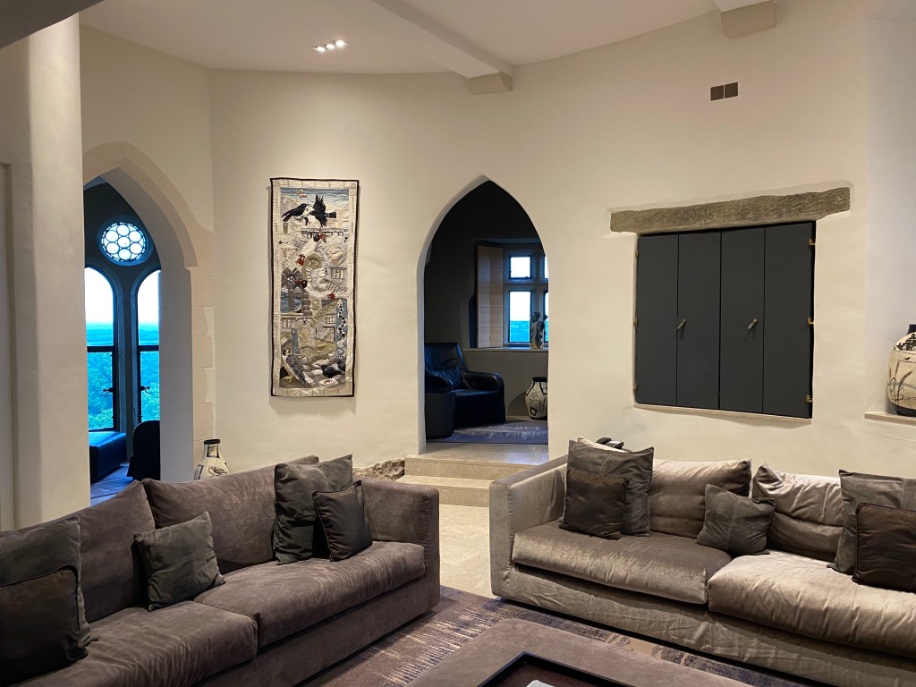
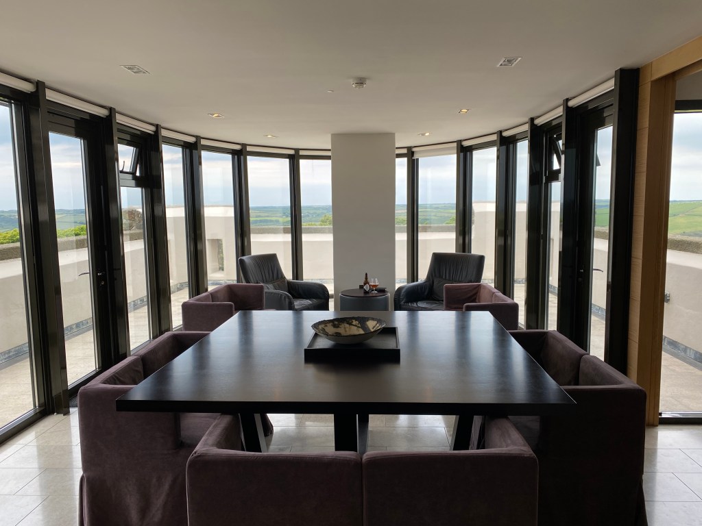
Main level of the castle, hosting the common areas.
Modern castle common area and viewing platform. They definitely modernized the castle.
Pretty good view, at that.
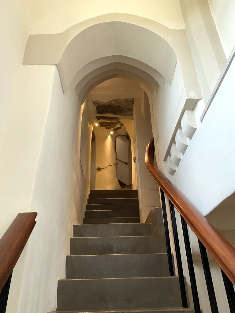
Heading up to our room, at the top of the castle.
The de Rupe room, but, of course.
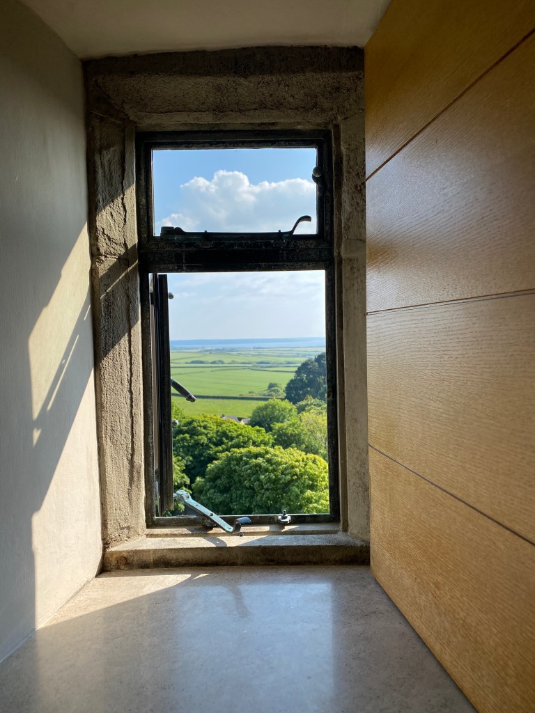
View through the room’s tower walls to the countryside and coast below:
Wales played Ukraine during our stay during the World Cup qualifying round; Wales won and earned a slot on Group B for the World Cup. We assumed we could watch this at the pub down the road with a bunch of rowdy Welsh, which we were looking forward to. But it was Sunday, and the pub served their weekly Sunday dinner, then closed before the game, which we absolutely could not believe. So, we watched it in the castle, instead.