
Road Trips
Protected: The Slow Role: Toulouse
Protected: The Slow Roll: San Sebastián – Around Town
Protected: The Slow Roll: San Sebastián – Gastronomy
The Smallest 5 for the Big 5-O
One of us turns 50 this year. In recognition of the milestone, we’re hitting all 5 of Europe’s “microstates” in a single road trip.
What prompted a birthday trip through Europe’s microstates? An inexplicable fixation with them since our first trip to Europe in 2002, which included a leg by train from Barcelona, Spain, to Avignon, France. When we planned the trip and looked at the train route, we noticed something to the west on the map – a country we didn’t know existed was positioned between France and Spain.
A entire freakin’ country – Andorra – lurking between France and Spain.
One of us (the one with the birthday, to be clear) has been fascinated ever since, and even tried to add a side trip to Andorra to our bike trip in Catalonia in 2009. (This was overruled in favor of Cadaques, which, we think you’ll agree, was a pretty good idea when you check out that post.)
Nonetheless, the impetus to visit the microstates persisted, and the 50th birthday milestone provided a great opportunity to finally see them.
There are some tiny regions in Europe and elsewhere, but not all can be considered microstates. For example, Gibraltar, at the southwest tip of Spain, is tiny, but it’s not independent – it’s a British Overseas Territory. Luxembourg, on the other hand, is independent, but not tiny (it covers 1000 square miles). By contrast, the microstates are truly micro – most cover less than 25 square miles and none of them exceed an area of 200 square miles.
So, other than being incredibly small, what defines a microstate?
- Independence
- Diplomatic recognition
- Control of territory
- Permanent population
- Government
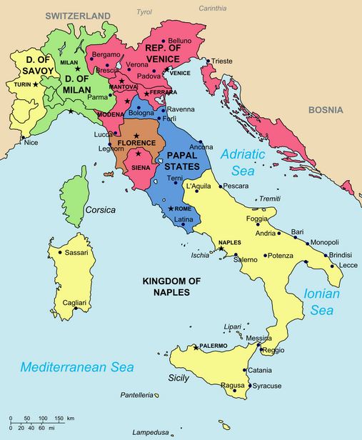
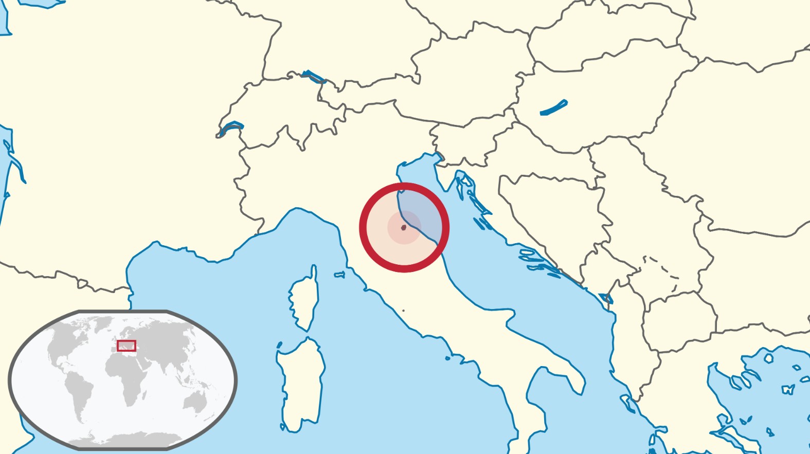
Based on these characteristics, the following sovereign countries within continental Europe qualify and will be part of the trip:
- The Principality of Andorra (finally!)
- The Principality of Liechtenstein
- The Principality of Monaco
- The Most Serene Republic of San Marino
- The State of Vatican City

Because none of the microstates, other than Vatican City, have rail stations (particularly Andorra and Liechtenstein – Nice and Rimini are somewhat close to Monaco and San Marino), we had to forego train travel, which otherwise is the best way to get around Europe. Instead, we’re renting a car and making this a road trip.
In our planning, we had a choice:
- Drive directly from one microstate to another, resulting in a couple of long days of driving, but providing a couple of rest days with no driving, or
- Add interim destinations between some of the microstates, so that we’re never driving more than 3 or 4 hours, but we would be driving every day
We chose Option 2:
The map above depicts the following itinerary:
- Take a redeye to Rome
- Day 1: Vatican City
- Day 2: Drive to San Marino
- Day 3: Drive to Bergamo, Italy
- Day 4: Drive to Liechtenstein
- Day 5: Drive to Lake Lugano, Switzerland
- Day 6: Drive to Monaco
- Day 7: Drive to Carcassonne, France (another place we’ve wanted to visit – last stronghold of the Cathars!)
- Day 8: Drive to Andorra
- Day 9: Drive to Barcelona
- Day 10: Fly back
We’ll spend every afternoon and night in the destination town / country to check things out before heading off the next morning to the next target.
Today, we’re part of the way through the tip, in Vaduz, Liechtenstein. We’ll post highlights of the trip when we get back!
European Microstate Road Trip: Overview
Our epic 9-country road trip designed to hit all 5 European microstates came to an end on Sunday. Despite some initial trepidation, it turned out to be fantastic!
This was one of our best trips, in fact, despite encountering this choice little nugget on 2 of the tiny 5 from a Cadogan guide book that we used several years ago on a previous trip:
“It’s a sleazy little paradise, [Microstate X]. . . Today, the [inhabitants] have found a way to exploit every single possibility open to a grasping, sweaty-palmed pipsqueak principality. They’ve turned their lovely corner of the [region] into a single, garish supermarket. It’s a worthy competitor for Europe’s other Ruritanian craphole, [Microstate Y], which, if you’ve never been, is the first country in the world to be entirely paved over with factory outlet car parks.”
Yow! We’ll reveal which of the pipsqueak nations the Cadogan guide was referencing in subsequent posts, but we were infatuated with the tiny countries and undeterred! We persisted and planned and executed a pretty ambitious itinerary to hit all 5 microstates in a single trip.
Information on continental Europe’s 5 tiniest nations – and the characteristics that define a microstate – was previously posted here. A repost of the map with the location of each is below:
Location of the continental Europe’s five microstates
The trip was great adventure, overall – both based on the tiny countries and some of the outstanding start, stop, or stopover locations in Italy, Switzerland, France, and Spain that we included in the trip to keep driving distances practical. Our experiences in the five microstates spanned the spectrum:
- Two exceeded our fairly modest expectations (biased in part by the pithy and brutal opinion proffered by the Cadogan guide) and we really enjoyed our visit to both
- One was precisely as expected
- Two were definitely not as awesome as we thought they would be – one was simply not as magnificent as we had envisioned, while the other turned out to be every bit just an outrageously expensive Disney world
These reactions will be assigned to the appropriate country in future posts, but some highlights of the tiny five are below, presented in the order in which we encountered the little buggers.
No. 1 of 5: The State of Vatican City:

Hallway of maps in the Vatican Museum
At the border between Vatican City and Rome – No. 1 complete
No. 2 of 5 – The Most Serene Republic of San Marino:

Guaita (1st Castle) on San Marino’s Mount Titano

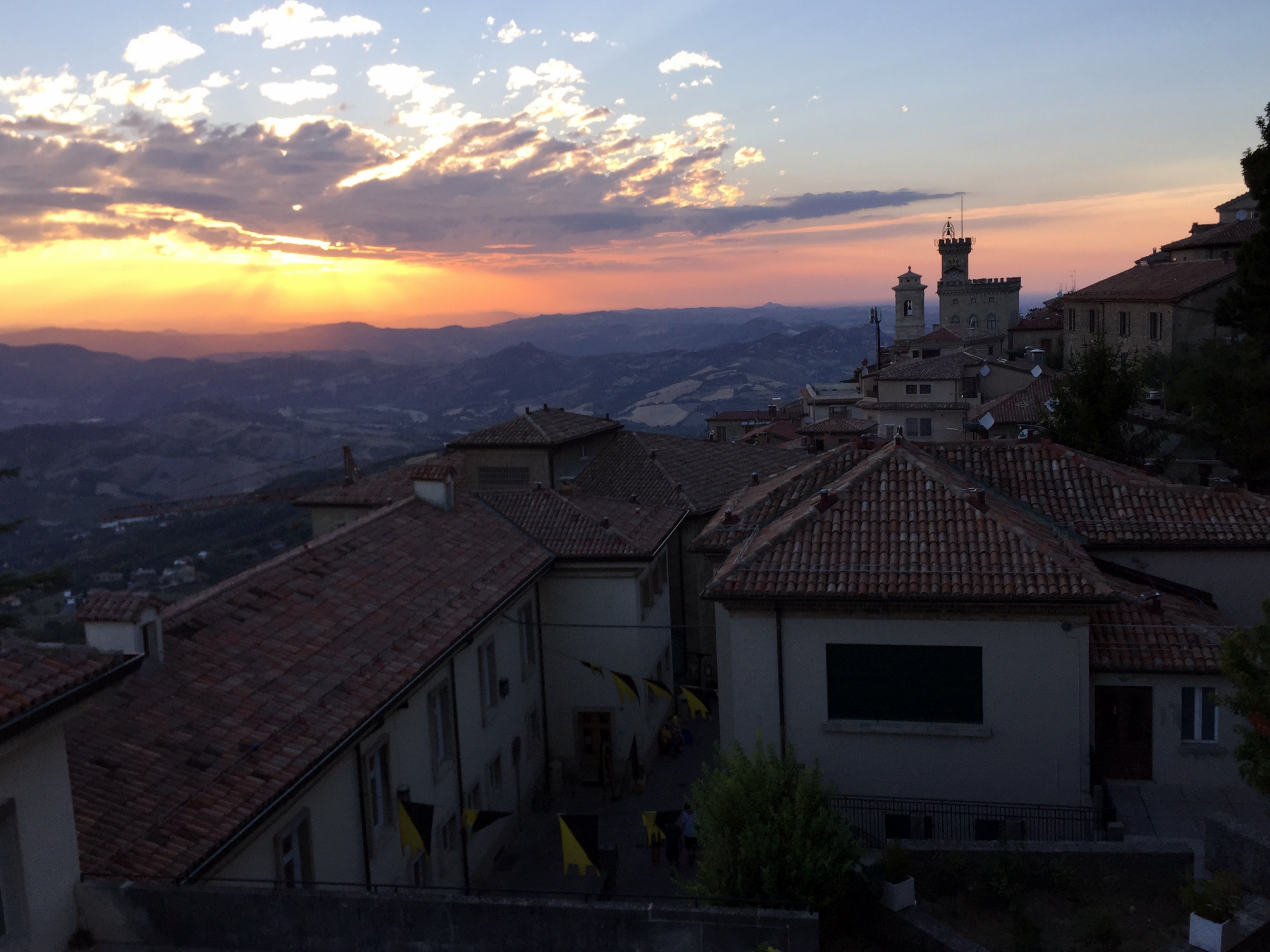
San Marino’s town hall at sunset

View from Cesta (2nd Castle) to Guaita (1st Castle) on Mount Titano in San Marino – Microstate No. 2 complete
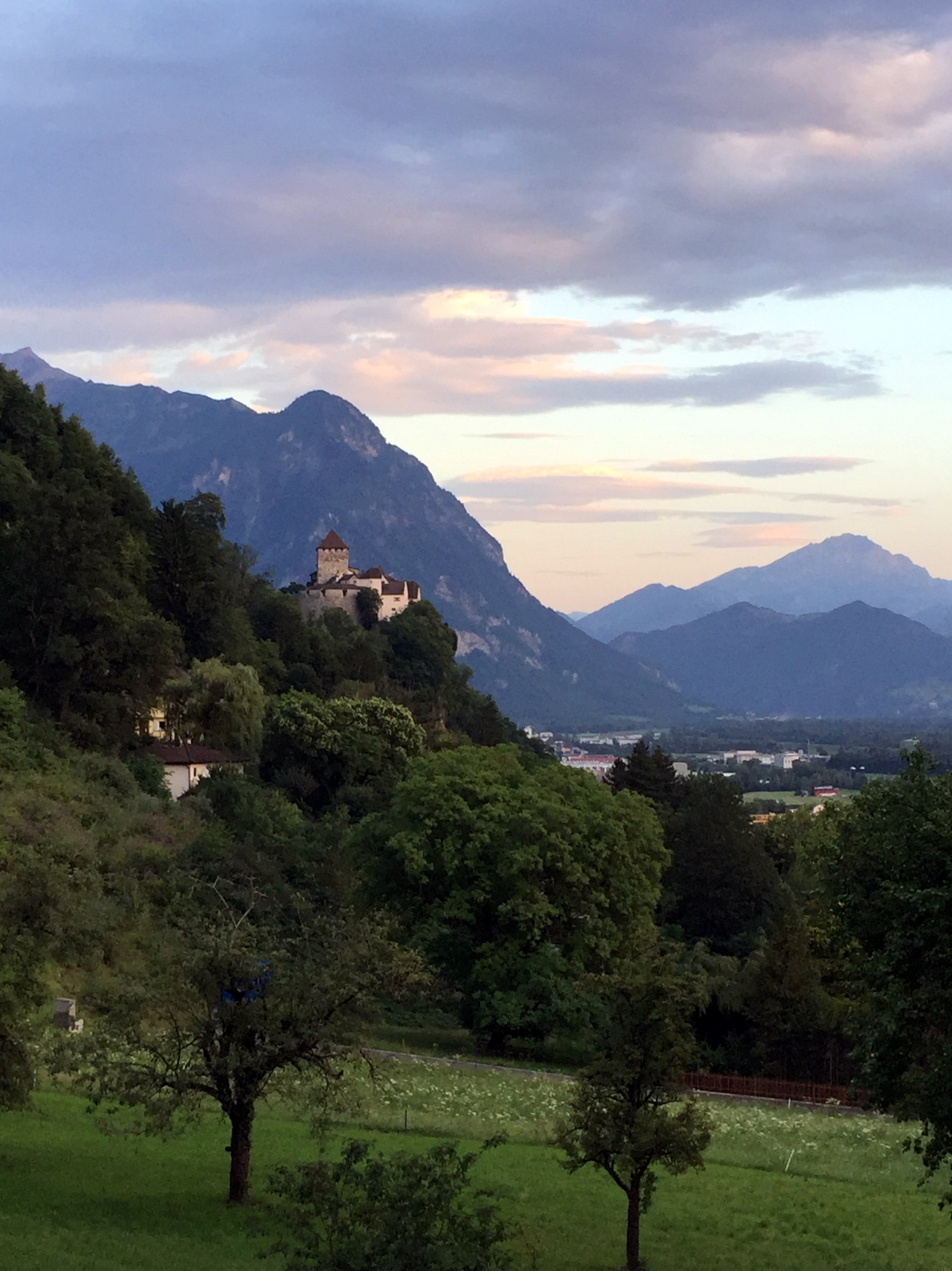
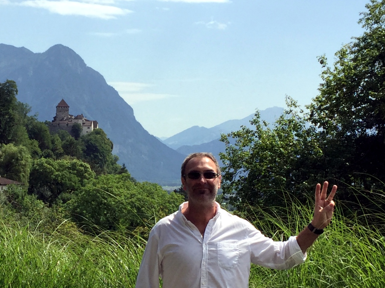
No. 3 of 5 and location for the Big 5-0 milestone – the Principality of Liechtenstein:

Vaduz castle from afar

and up close – No. 3 complete
4 of 5 – Principality of Monaco:

Monte Carlo casino our evening in Monaco

Above the port of Monte Carlo – No. 4 complete
And finally, No. 5 of 5 and the microstate that started it all – the Principality of Andorra:

11th-century Sant Joan de Caselles church with Lombard-style tower in Andorra

Casa de la Vall in Andorra la Vella – headquarters of the General Council of Andorra; No. 5 of 5 complete!
Before we left the US, we were a little concerned that the trip could turn out to be an arduous box-checking exercise involving too much driving and not enough time to enjoy each destination, based on the itinerary we designed:
- Take a redeye to Rome
- Day 1: Vatican City (1 of 5 . . .)
- Day 2: Drive to San Marino (2 of 5 . . .)
- Day 3: Drive to Bergamo, Italy
- Day 4: Drive to Liechtenstein (3 of 5 . . .)
- Day 5: Drive to Lake Lugano, Switzerland
- Day 6: Drive to Monaco (4 of 5 . . .)
- Day 7: Drive to Carcassonne, France
- Day 8: Drive to Andorra (5 of 5!)
- Day 9: Drive to Barcelona
- Day 10: Fly back
Instead, our daily cadence ended up providing a good balance – we’d drive for a few hours each morning in our rockin’ diesel Skoda family truckster . . .

Our trusty Skoda after navigating the narrow alleyways of Bergamo on Day 3
. . . then arrive at our destination in the early afternoon to explore things, typically log some downtime in the evening at the hotel pool, then grab dinner.

Sweet pool in Carcassonne, our stopover between Monaco and Andorra
Although the trip focused on the microstates, some of the stopovers proved to be just as rewarding, including staying in a hotel that overlooked Lake Lugano in Switzerland on August 1, without realizing beforehand that this was the Swiss National Holiday – spectacular!

Fireworks over Lake Lugano to celebrate the Swiss National Holiday
We’ll post highlights of each of the five micronations plus the very cool stopover locations during the next few weeks.
Oh, and the book read as we started the trip?


Of course.
Microstates! The State of Vatican City
So, we’re finally getting around to publishing posts from the “Tiniest 5 for the Big 5-0” road trip last year. We have an inordinately high level of interest in the microstates, which, although ridiculous, was nonetheless explained in our initial post on the trip planning.
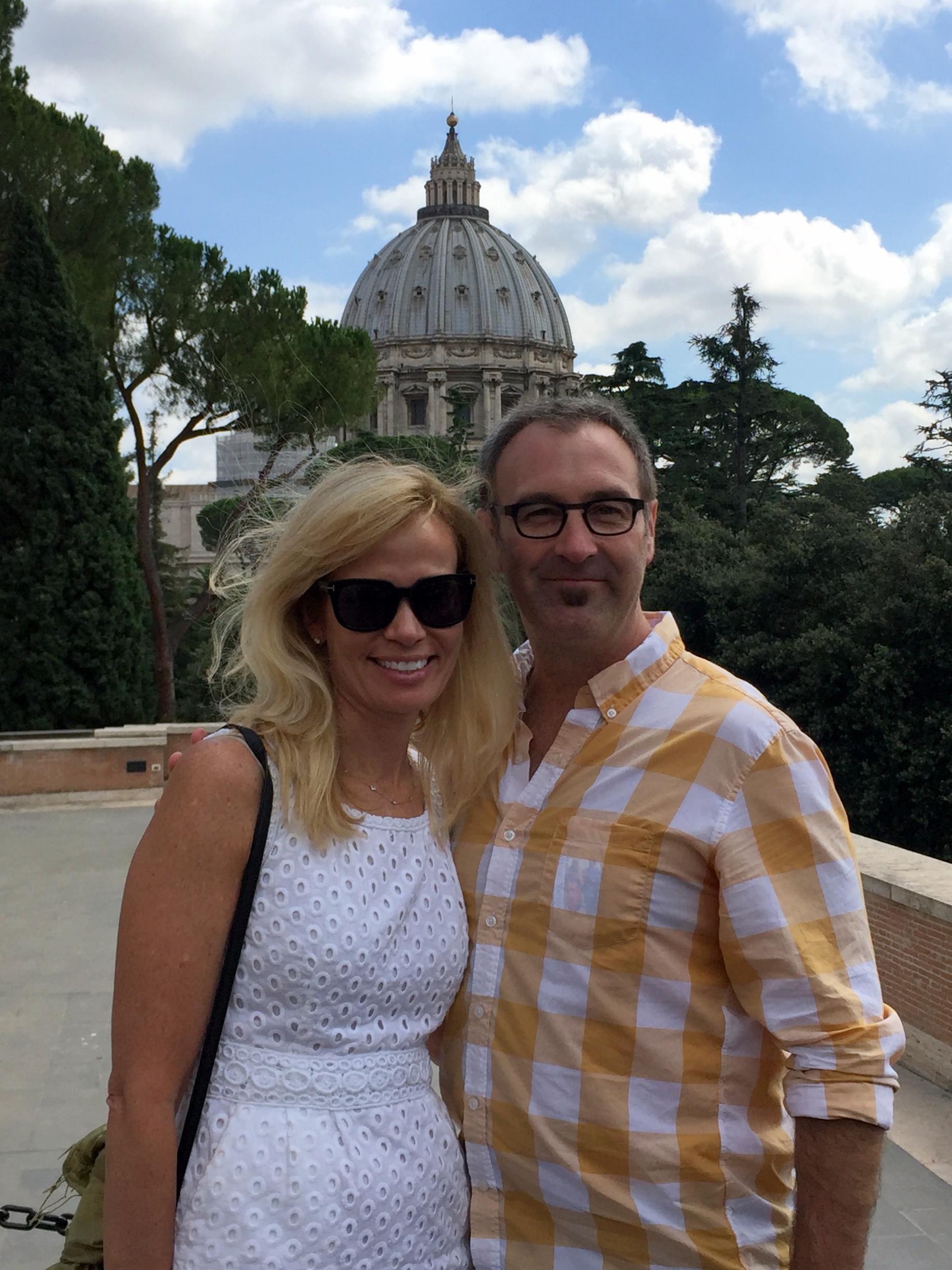
Last July’s Magical Microstate Tour began with what we’re sure is the most visited tiny territory of them all – Vatican City, located within the city of Rome:

For what it’s worth, we weren’t particularly excited about Vatican City because it’s the least exotic and most known of the microstates. Our expectations in this regard were pretty much met – interesting, but certainly not fascinating.
State Synopsis
History: Starting in the 700s and continuing until the 19th century, the pope controlled a hell of a lot more than the postage stamp that Vatican City currently occupies. Although the popes began collecting properties before the 8th century, the millennium-long history of the Papal States really began with the Donation of Pepin. In the 750s, the Lombards had overrun the last remnants of the Roman Empire in Italy around Ravenna, and were demanding the submission of Rome and tribute from the Papacy. Pope Stephen II sent envoys to Pepin the Short, King of the Franks (as well as father of Charlemagne and founder of the Carolingian Empire) requesting his support in resisting the Lombards. In return for an official coronation by Pope Stephen, Pepin and his Frankish army forced the Lombard king to cede their recent Italian conquests. Pepin then conferred upon the pope these territories in 756:
The Papal States in the early 1800s, prior to Italian unification.
For more than a millennium, the Papal States occupied this chunk of Italy – waxing and waning over time, but always substantial. However, during Italian unification efforts in the 19th century, the Papal States were annexed and integrated into the secular state of Italy, leaving only the Holy See within the Vatican walls. The popes did not recognize the Italian king’s right to rule in Rome, and they refused to leave the Vatican compound in resistance of any move to integrate Vatican City.
Why it still exists: The impasse was resolved in 1929, when the Lateran Treaty between the Holy See and the Kingdom of Italy was signed by Benito Mussolini, on behalf of King Victor Emmanuel III, and by Cardinal Secretary of State Pietro Gasparri for Pope Pius XI. The treaty, which became effective on June 7,1929, established the independent State of Vatican City and reaffirmed the special status of Catholicism in Italy.
Absolute size: 0.17 square miles
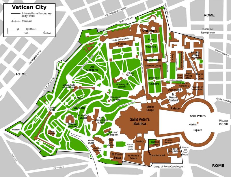
Relative size: Vatican City is the smallest of the five European microstates and is smaller than the City of Alexandria, at 15 square miles. Moreover, “Vatican City is the smallest state in the world by both area and population. However, formally it is not sovereign, with sovereignty being held by the Holy See.”*
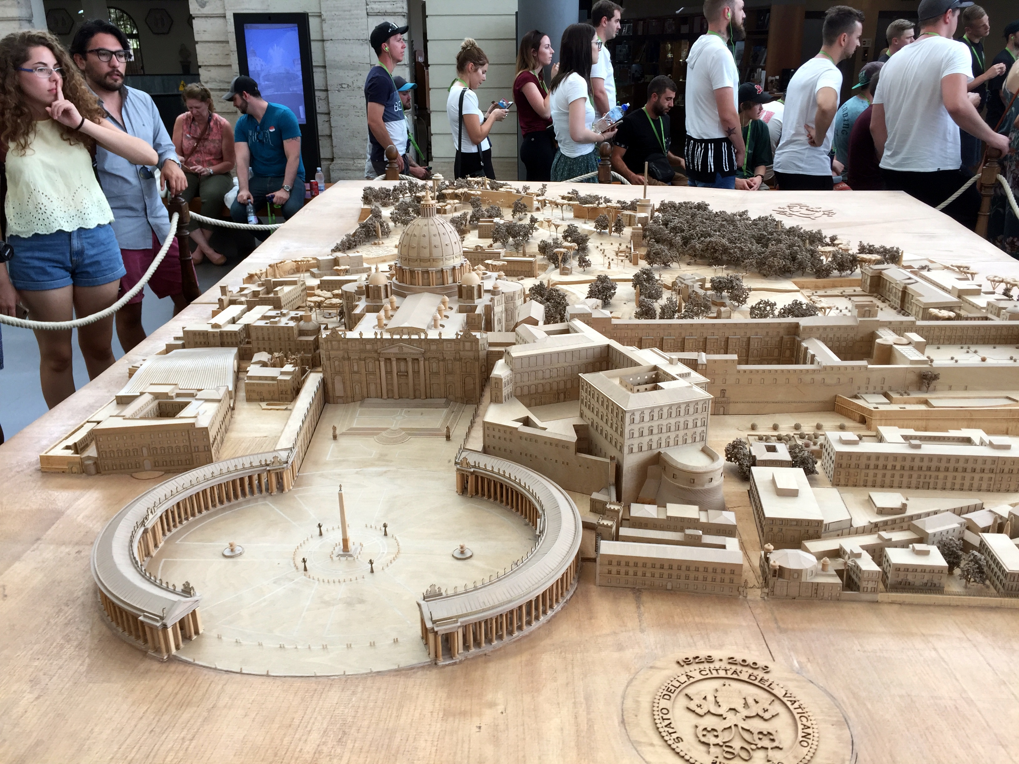
Scale model of Vatican City near the entry point:
Population: 600
Capital: Yeah, it’s Vatican City, so there you go.
Government: Vatican City is an absolute elective monarchy ruled by the pope. The location we visited officially is both the State of Vatican City and The Holy See. (The Holy See is the central government of the Catholic Church, while Vatican City is the independent state where the Holy See operates). The Holy See is a non-hereditary monarchy. (Speaking of which, Absolute Monarchs: A History of the Papacy, read in part during the road trip, is a wildly entertaining overview of the politics and personalities of the papacy, particularly in the early middle ages when the pope were pawns of powerful families or corrupt themselves. We’ll let Wikipedia summarize the relationship between Vatican City and the Holy See: The Holy See is the ecclesiastical jurisdiction of the Catholic Church in Rome, the episcopal see of the Pope, and an independent sovereign entity. As an independent sovereign entity, holding the Vatican City enclave in Rome as sovereign territory, it maintains diplomatic relations with other states.
Note that we would be remiss in not recognizing that the Popes did not always lead from their enclave in Rome – seven Popes (or anti-Popes, depending on with whom you were aligned) ruled from Avignon in the 14th century (which happens to have been the start and finish of our first bike trip in Europe . . .).
Tiny nation trivia: “At several times during the Vatican’s history, popes escaped through a secret passageway. In 1277, a half-mile-long elevated covered passageway, the Passetto di Borgo, was constructed to link the Vatican with the fortified Castel Sant’Angelo on the banks of the Tiber River. It served as an escape route for popes, most notably in 1527 when it likely saved the life of Pope Clement VII during the sack of Rome. As the forces of Holy Roman Emperor Charles V rampaged through the city and murdered priests and nuns, the Swiss Guard held back the enemy long enough to allow Clement to safely reach the Castel Sant’Angelo, although 147 of the pope’s forces lost their lives in the battle.”
In the Vatican Gardens with St. Peter’s in the background:
Vatican stuff (most of the information comes from the Vatican Museum’s website:


Sarcophagus of St Helena:
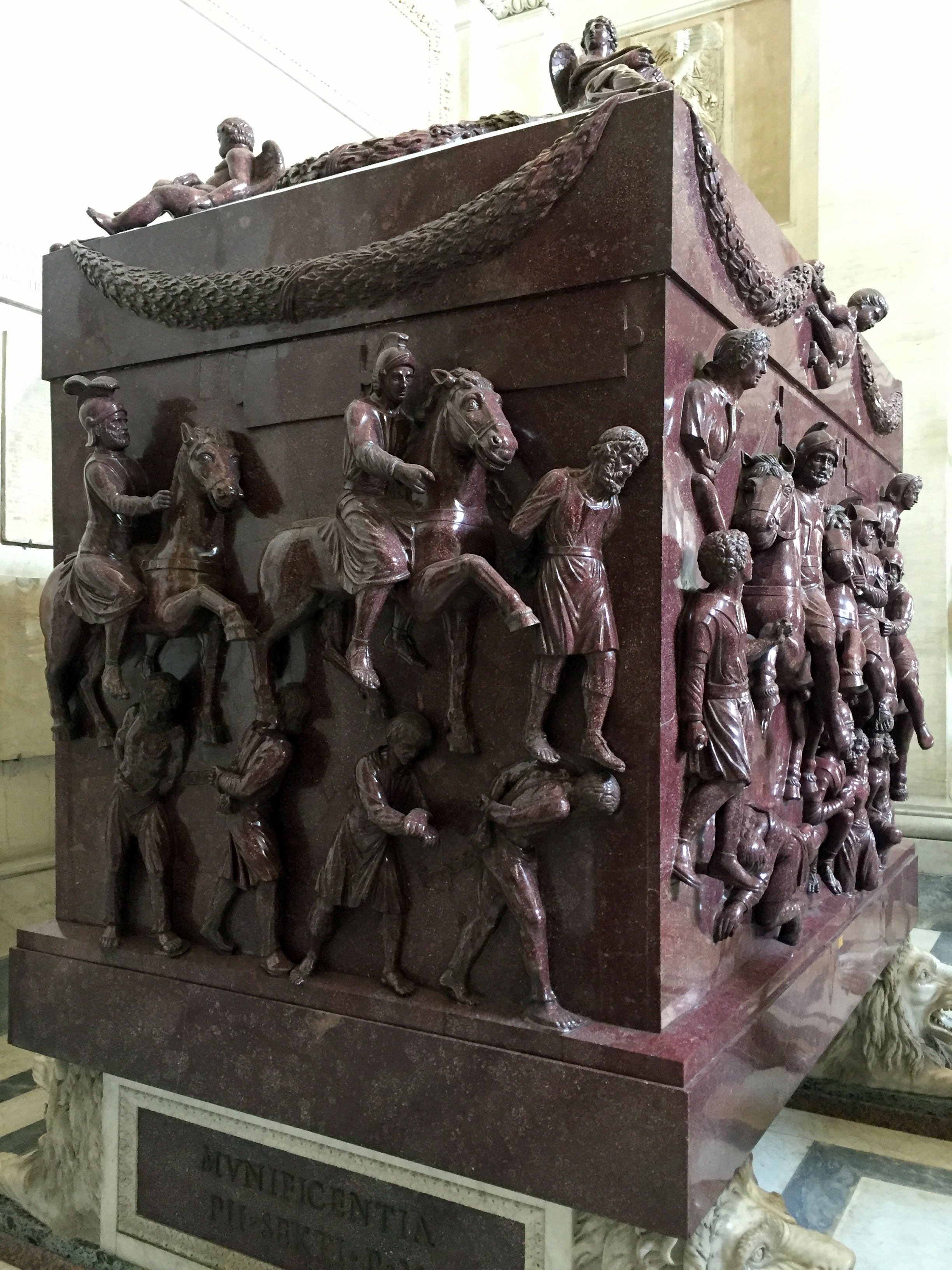
“This monumental red porphyry sarcophagus is believed to have held the remains of Helena, mother of Constantine the Great, who died around 335 A.D. The coffin is carved with military scenes with Roman soldiers on horseback and barbarian prisoners. This very military decoration, not really suitable for a female burial, has led scholars to suppose that the sarcophagus was originally made for a male member of the Imperial family, such as Helena’s husband, Constantius Chlorus or, more probably, Constantine himself.”
Gallery of Maps with works commissioned by Pope Gregory XIII in the late 16th century. Very cool snapshots in time, with respect to the relative size and importance of Renaissance cities to one another, as well as the extent of urbanization in Europe and awareness of non-European locales.


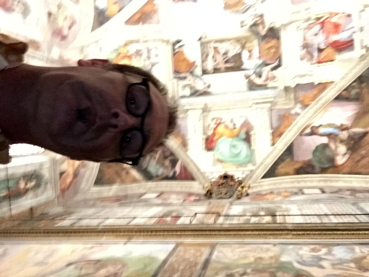
On to the Sistine Chapel, which we really did not expect to be as small and rectangular as it is. Lisa arranged for a private tour for us, and our tour guide (who was really good) took us aside before we entered the chapel to provide us with a detailed lesson on the history of the chapel and of the individual artworks. You’re supposed to be reverent and quiet while in the chapel, so there’s no speaking. Our guide used her iPad to provide insight into the individual panels.
The whole “reverent and quiet” rule would be ignored by the packed assembly of tourists, so every 2 minutes or so, one of the guards would intone in a booming voice: “SILENCIO!” Everyone would then become quiet again. Until the rule was ignored after a bit, prompting another outburst from the guards. This resulted in a sinusoidal pattern of noise – very quiet immediately after the dire warning, then a swiftly rising crescendo of noise, peaking until the guard bellowed yet another “SILENCIO!” Then quiet, then noisy, then “SILENCIO!” then repeat. Good stuff.
We were prohibited from taking pictures as well (although we tried surreptitiously, with abysmal results . . .):
In lieu of purloined pics from us, you can take a virtual tour here, on the Vatican Museum’s website. (Note that this virtual tour will not convey the signature, sinusoidal sound effect described above . . .).
St. Peter’s Basilica


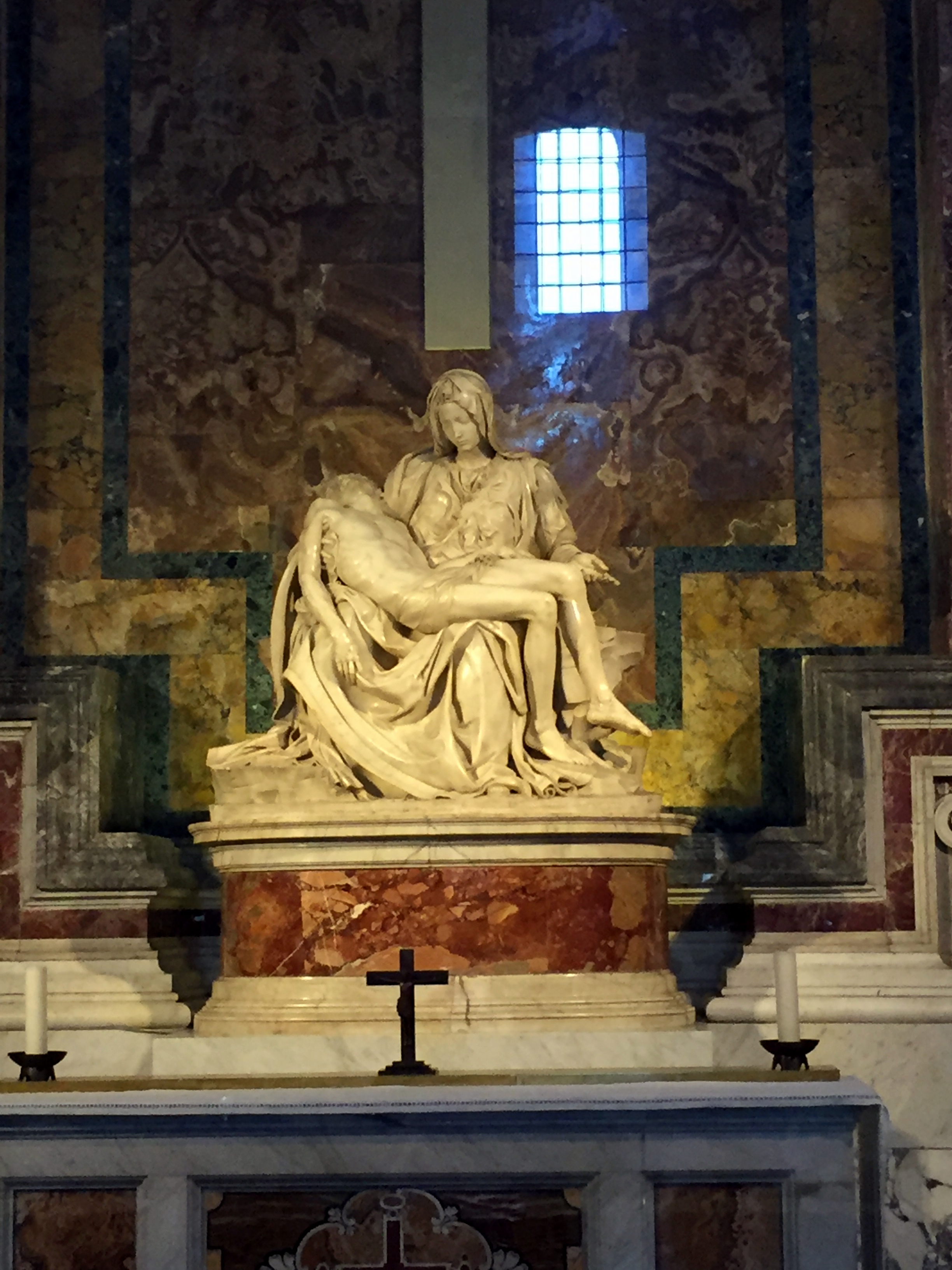
Michelangelo’s Pietà – now behind glass. In 1972 “a mentally disturbed geologist, the Hungarian-born Australian Laszlo Toth walked into the chapel and attacked the sculpture with a geologist’s hammer while shouting “I am Jesus Christ; I have risen from the dead!” With fifteen blows he removed Mary’s arm at the elbow, knocked off a chunk of her nose, and chipped one of her eyelids. Onlookers took many of the pieces of marble that flew off. Later, some pieces were returned, but many were not, including Mary’s nose, which had to be reconstructed from a block cut out of her back.”
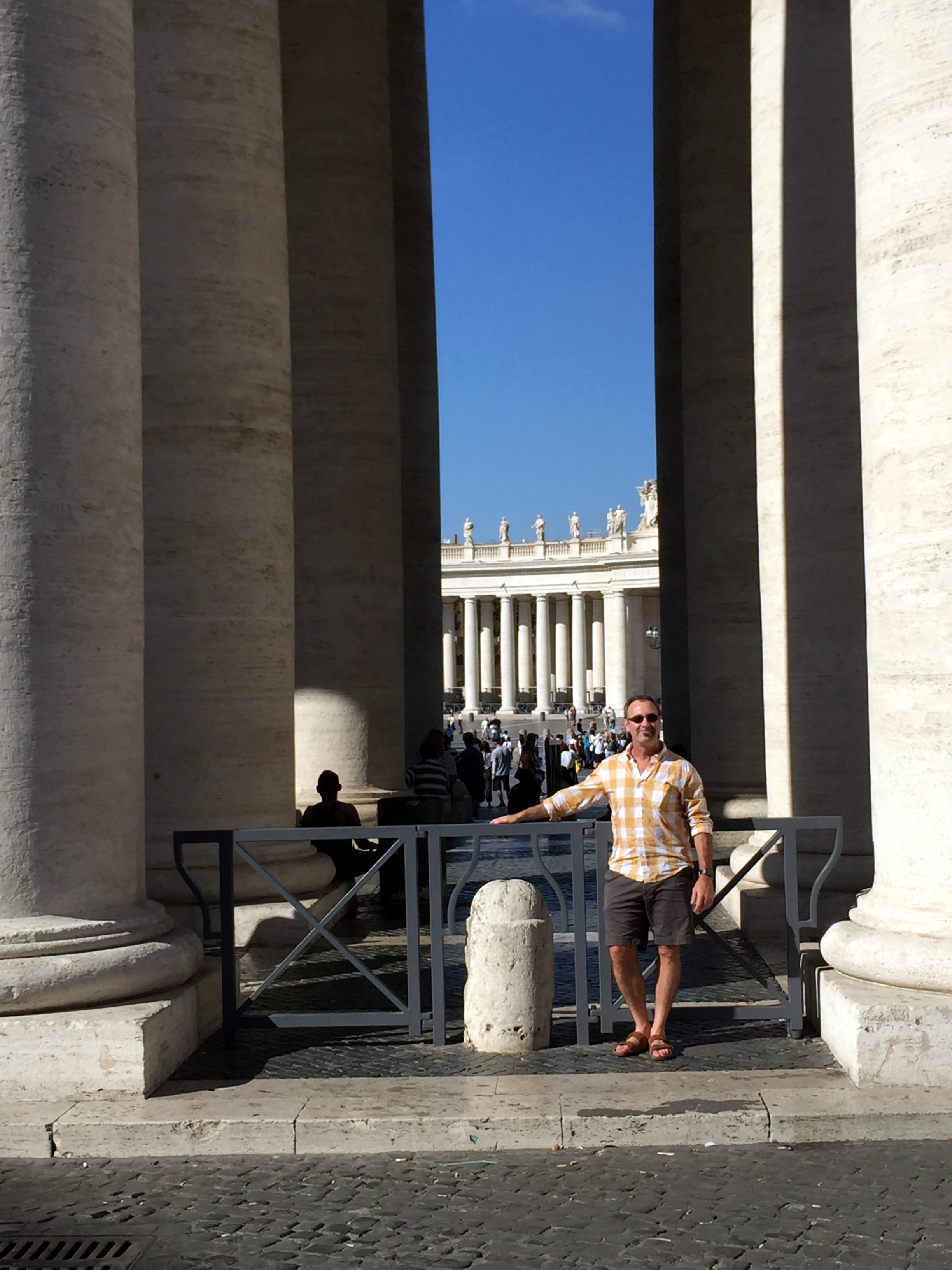
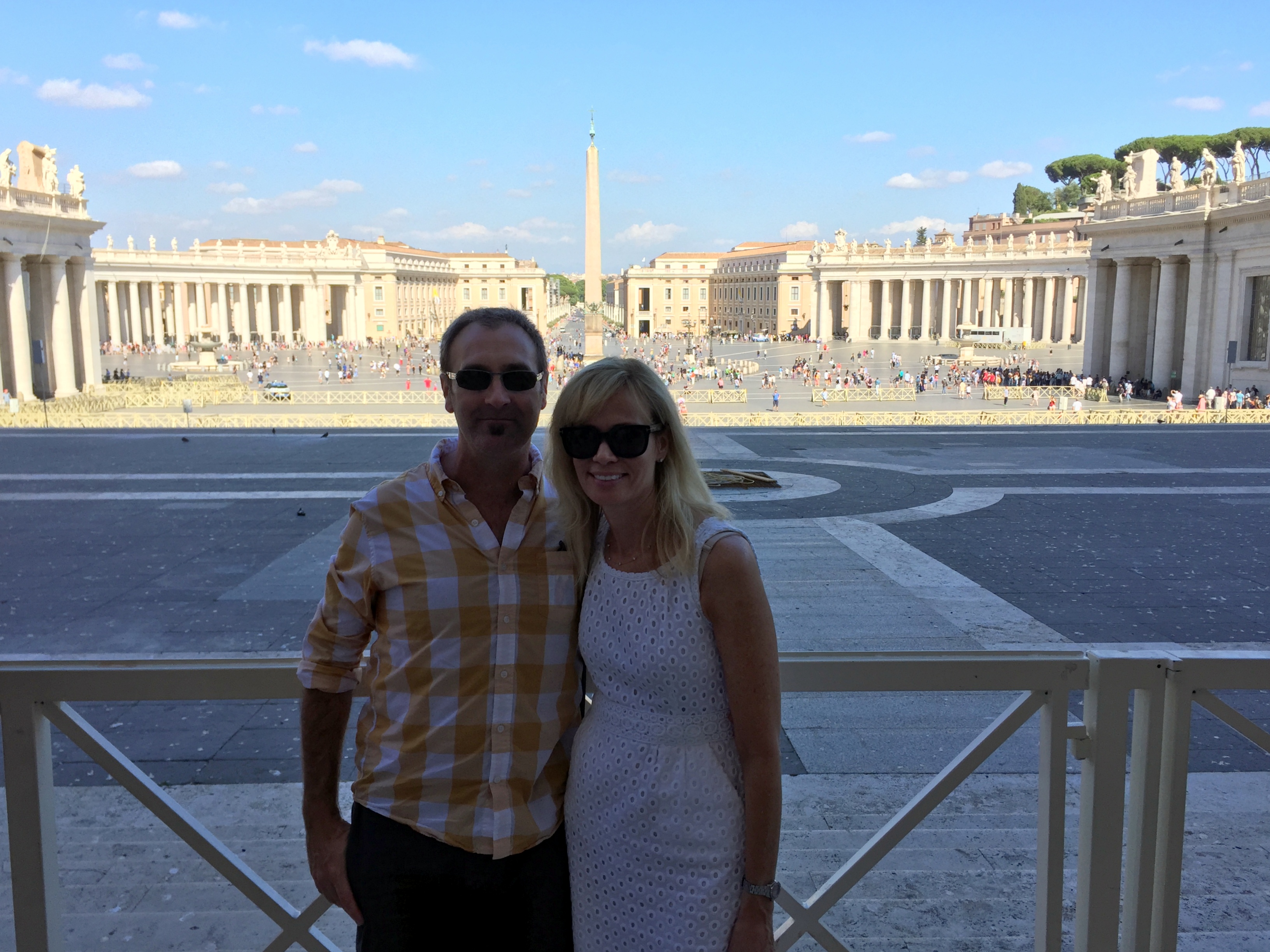
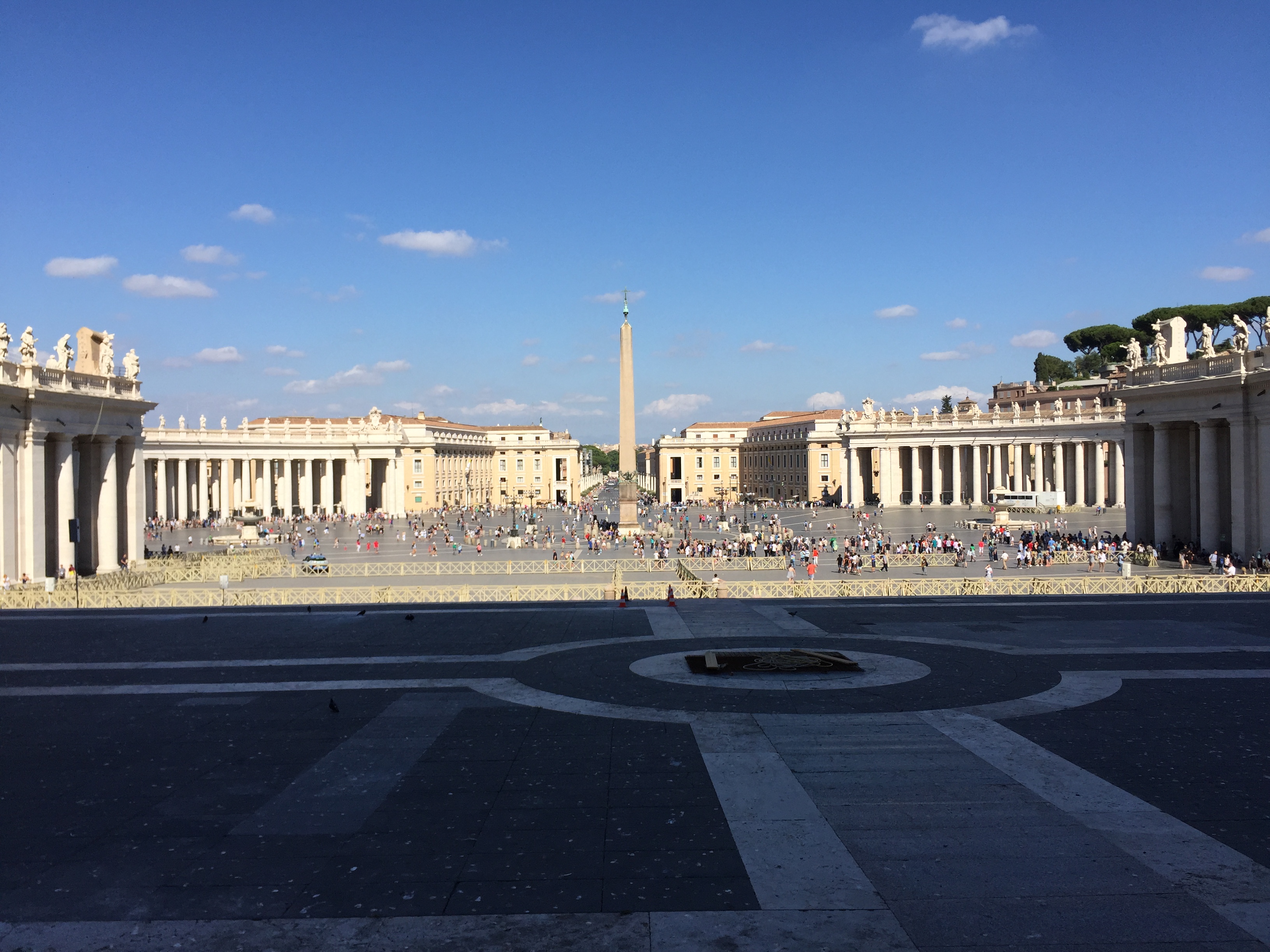
Back outside, in St. Peter’s Square
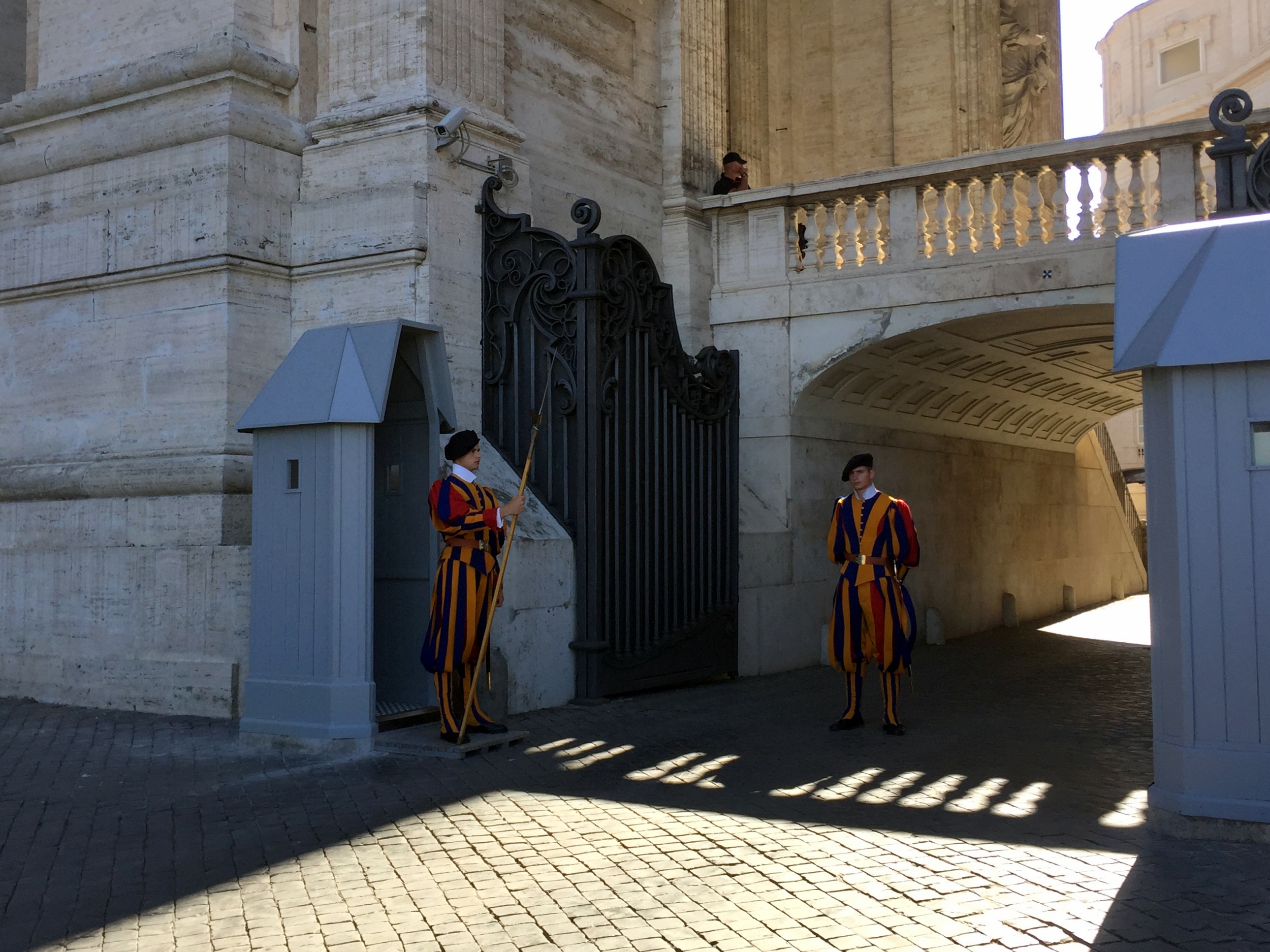
“The Swiss Guard, recognizable by its armor and colorful Renaissance-era uniforms, has been protecting the pontiff since 1506. That’s when Pope Julius II, following in the footsteps of many European courts of the time, hired one of the Swiss mercenary forces for his personal protection. The Swiss Guard’s role in Vatican City is strictly to protect the safety of the pope. Although the world’s smallest standing army appears to be strictly ceremonial, its soldiers are extensively trained and highly skilled marksmen. And, yes, the force is entirely comprised of Swiss citizens.”
“Roman Emperor Caligula built a small circus in his mother’s gardens at the base of Vatican Hill where charioteers trained and where Nero is thought to have martyred the Christians. To crown the center of the amphitheater, Caligula had his forces transport from Egypt a pylon that had originally stood in Heliopolis. The obelisk, made of a single piece of red granite weighing more than 350 tons, was erected for an Egyptian pharaoh more than 3,000 years ago. In 1586 it was moved to its present location in St. Peter’s Square, where it does double duty as a giant sundial.”
Microstate 1 of 5 complete!

At the border (literally) of Vatican City
The Castel Sant’Angelo noted in the trivia above, spotted on the way back through Rome from Vatican City (the structure began as the Mausoleum of Hadrian):

Around Rome, mostly retracing steps taken during our brief visit before biking in Tuscany back in 2004.


Unbelievably cool retreat on the rooftop of our villa hotel to chill out for a bit late in the day:


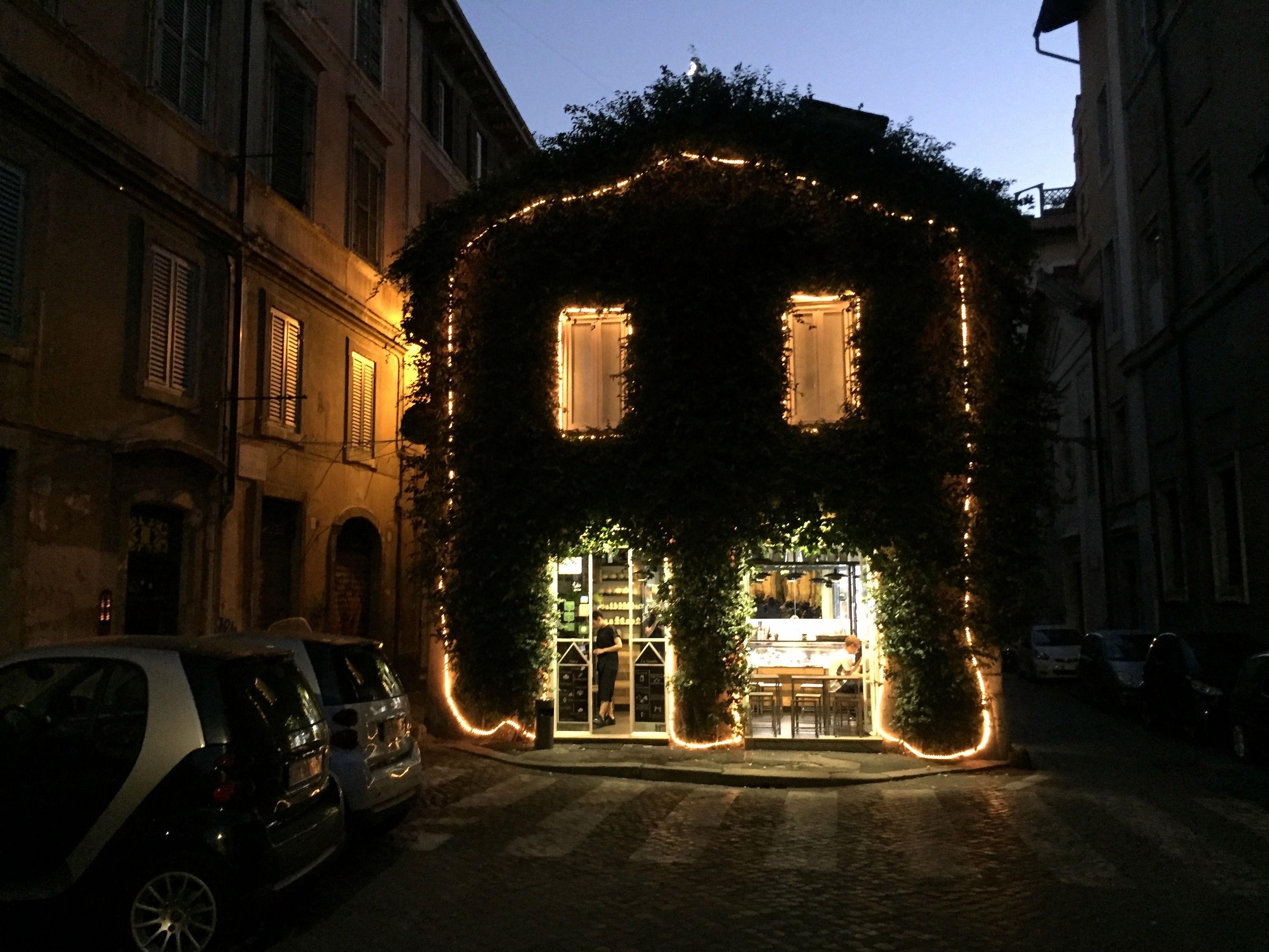
End of the day on the way to dinner in Rome:
Microstates! The Most Serene Republic of San Marino
The Most Serene Republic of San Marino is the lone relic of what once were scores of city states across Europe in the middle ages. Founded in 301 AD, the country has survived intact for more than 1700 years, withstanding threats by other Italian city states, the Napoleonic Wars, the unification of Italy, and two world wars. It is the oldest republic in the world.
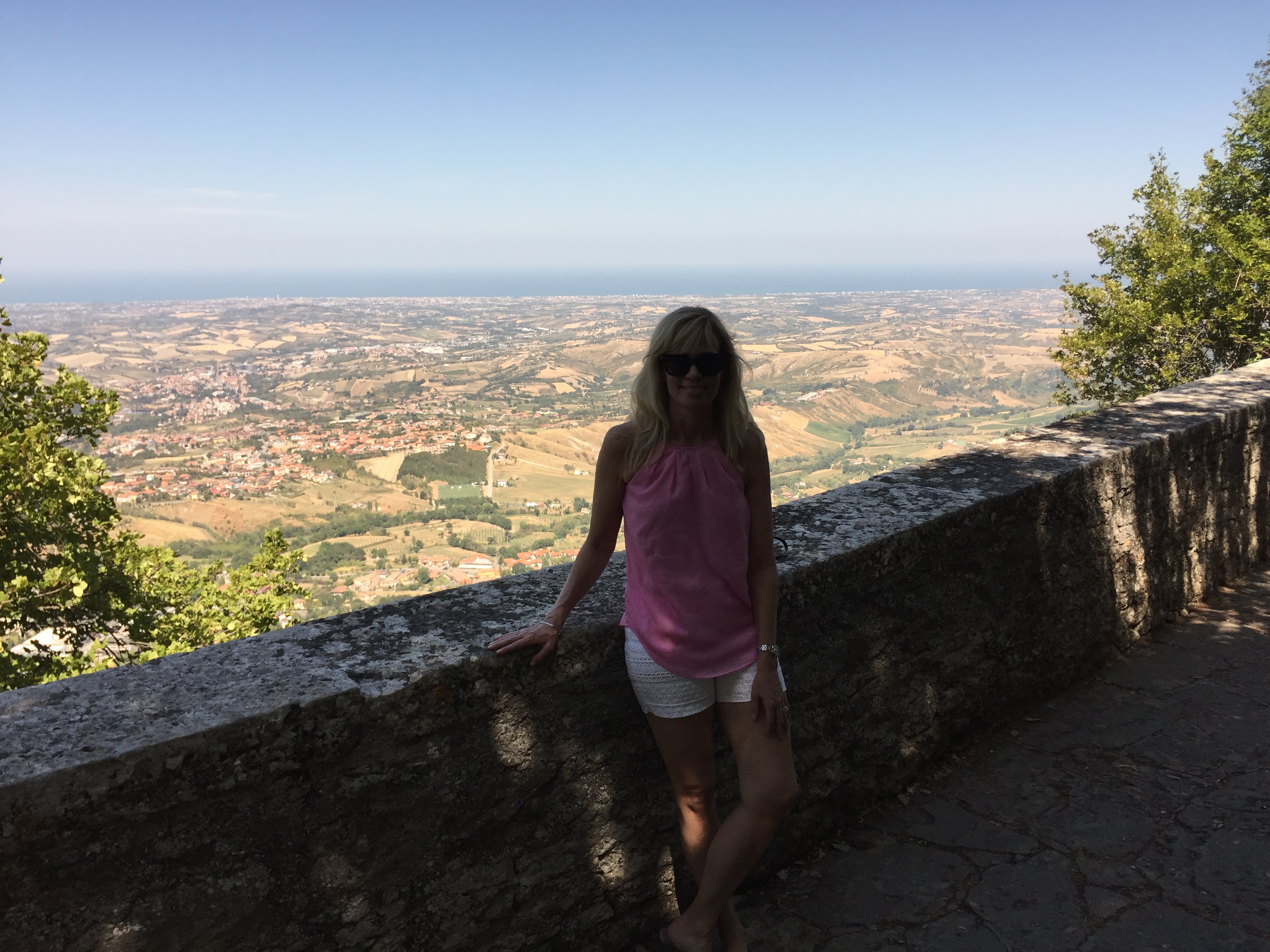
The country is surrounded by Italy and located immediately inland from the Adriatic. Most of the microstate is perched atop the three peaks of a formidable mountain – Monte Titano:
We traveled on Day 2 from Vatican City (or nearby in Rome, anyway) to San Marino. This was the only time during the trip that we would drive directly from one microstate to another without an intermediate stop. Connections during the rest of the trip will require a layover in an Italian, Swiss, or French town (each of were great destinations in their own rights). Our drive out of Rome took us north and east, initially on highways, but for the last enjoyable half hour or so on crazy switchback roads through the Italian countryside to reach San Marino:

Review of the Republic
History: The country is named after Marinus, a stonemason from a Roman province across the Adriatic in what’s now Croatia. According to legend, Marinus traveled in AD 257 to Rimini, a city on the Italian coast, immediately to the east of modern day San Marino, to support rebuilding the city’s walls. Marinus later was ordained as a deacon by the Bishop of Rimini, then fled inland to seek refuge on Monte Titano to escape the third-century Diocletianic Persecution of Christians. He subsequently founded an independent monastic community in AD 301, a date that is recognized as the official year of San Marino’s founding.
By the 12th century, San Marino had developed into a commune ruled by its own statutes and consuls. The country’s isolation atop Mount Titano and its mountain fortresses enabled San Marino to retain its independence despite attacks by the Duke of Rimini and other powerful families and bishops. Although the country originally consisted only of Monte Titano, it grew to include some adjoining towns and castles in 1463, when Pope Pius II granted these in return for its support for a successful alliance against the Duke of Rimini. The country has remained this size ever since, declining an offer of increased territory by Napoleon in the late 18th century. (San Marino’s Regent stated the “Only in poverty and insignificance could San Marino hope to maintain herself free and sovereign through the centuries.”)
Why it still exists: Two reasons: Napoleon and Garibaldi.
- The advance of Napoleon’s army in 1797 threatened to absorb San Marino into the rest of recently conquered Northern Italy. One of the country’s two Regents at the time cultivated a friendship with Napoleon and he subsequently promised to protect its independence (Napoleon will make an appearance in Andorra’s history, as well.)
- During the Italian unification process in the 19th century, San Marino served as a refuge for Italians persecuted because of their support for unification. In recognition of this support, Giuseppe Garibaldi accepted the wish of San Marino not to be incorporated into the new Italian state. As a result, it has remained an independent country and a medieval time capsule ever since.
Absolute size: 24 square miles
Relative size: San Marino is the third smallest (or third largest – take your pick) of the five European microstates and is slightly larger than the City of Alexandria, at 15 square miles.
Population: 33,562
Capital: City of San Marino
Government: San Marino is the world’s oldest extant sovereign state and is a parliamentary representative democratic republic. The first written mention of San Marino as a republic is in the 9th century. The Captains Regent, an elected pair, serve as San Marino’s heads of state. Both are elected every six months by the Grand and General Council of San Marino. San Marino also sports the earliest written governing documents of any nation – the Constitution of San Marino (Leges Statutae Republicae Sancti Marini), written in Latin in the late 16th century, the constitution dictates the country’s political system.
Tiny state trivia: Here are several cool nuggets:
- The foundation of San Marino’s army continues to be the Crossbow Corps, which has existed continuously as a statutory military unit since 1295. (Reminiscent of the status of the English longbow in The Mouse that Roared . . .)
- San Marino is one of only three nations that are enclaved – entirely surrounded by one other country. The other two are Vatican City and Lesotho, in South Africa.
- In 1861, immediately before our Civil War, the government of San Marino wrote a letter to President Abraham Lincoln, proposing an alliance between the two democratic nations and offering the President honorary San Marino citizenship. Lincoln accepted the offer, writing in reply, “Although your dominion is small, your State is nevertheless one of the most honored in all history. It has, by its experience, demonstrated the truth, so full of encouragement to the friends of Humanity, that Government founded on Republican principles is capable of being so administered as to be secure and enduring.”
A view of Mount Titano as we near San Marino.

Sign in town demonstrating the mountainous nature of San Marino via its twisting, switchback roads (the country’s three fortifications appear here, as well):

Hiking up to the Cesta tower (the middle of the three), with a view from Mount Titano to the Adriatic:
Guaita Tower from one of the rooms in the Cesta Tower, which was built in the 13th century atop the remains of a Roman fort:
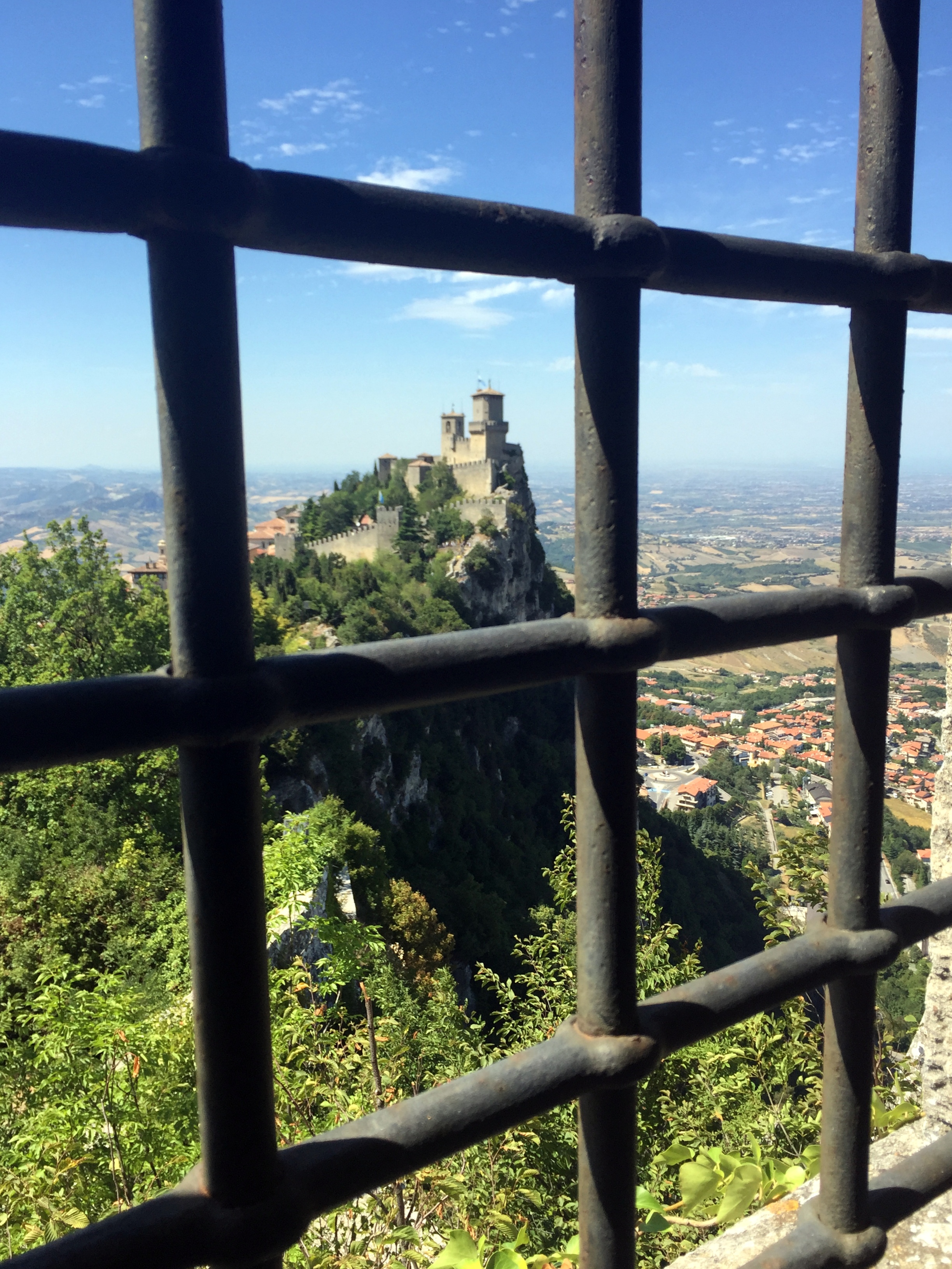
Iconic image of Guaita Tower directly above the town of San Marino on Mount Titano:
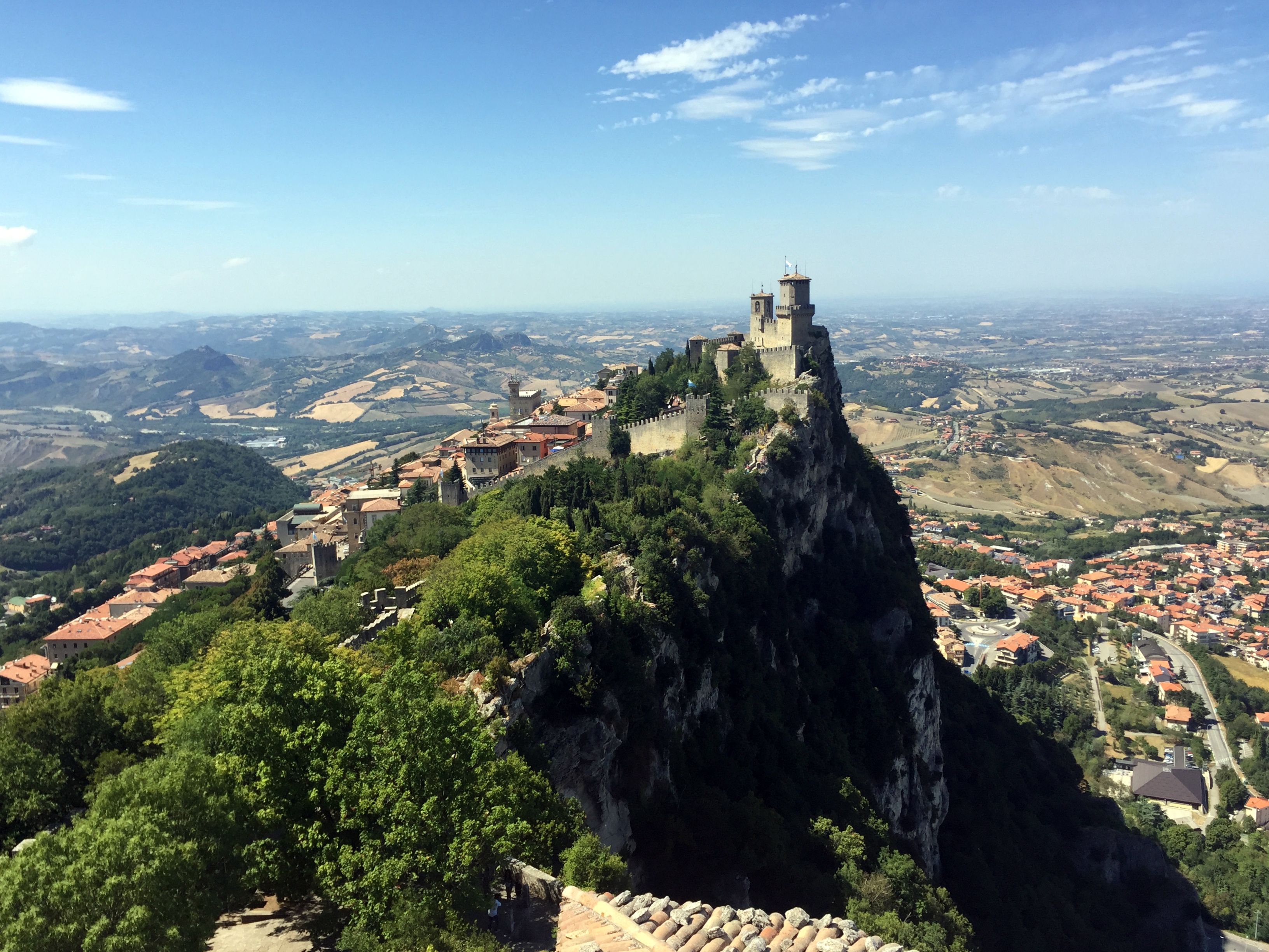
Heading up to Guaita Tower:

Guiata Tower was originally constructed in the 11th century, then reinforced in the 15th century as protection against the House of Malatesta that ruled Rimini and had designs on San Marino:

San Marino’s public square with their Statue of Liberty:

Palazzo Pubblico, San Marino’s capital building:

The founding father himself, perched on the right corner of the city hall:
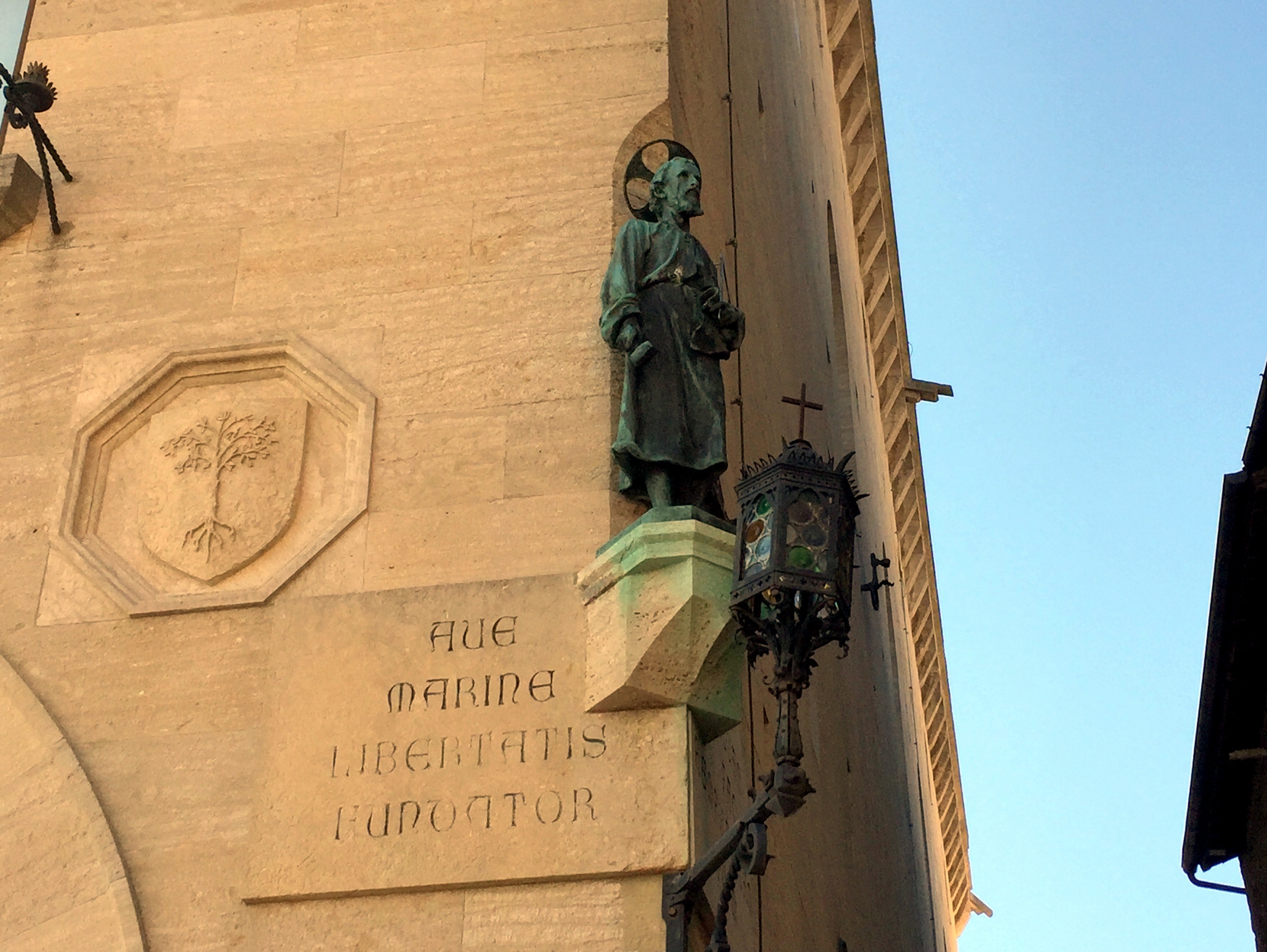
Inside the Palazzo Pubblico, featuring multiple instances of the country’s coat of arms, which feature the three towers (each topped with an ostrich plume – we still have no idea why):


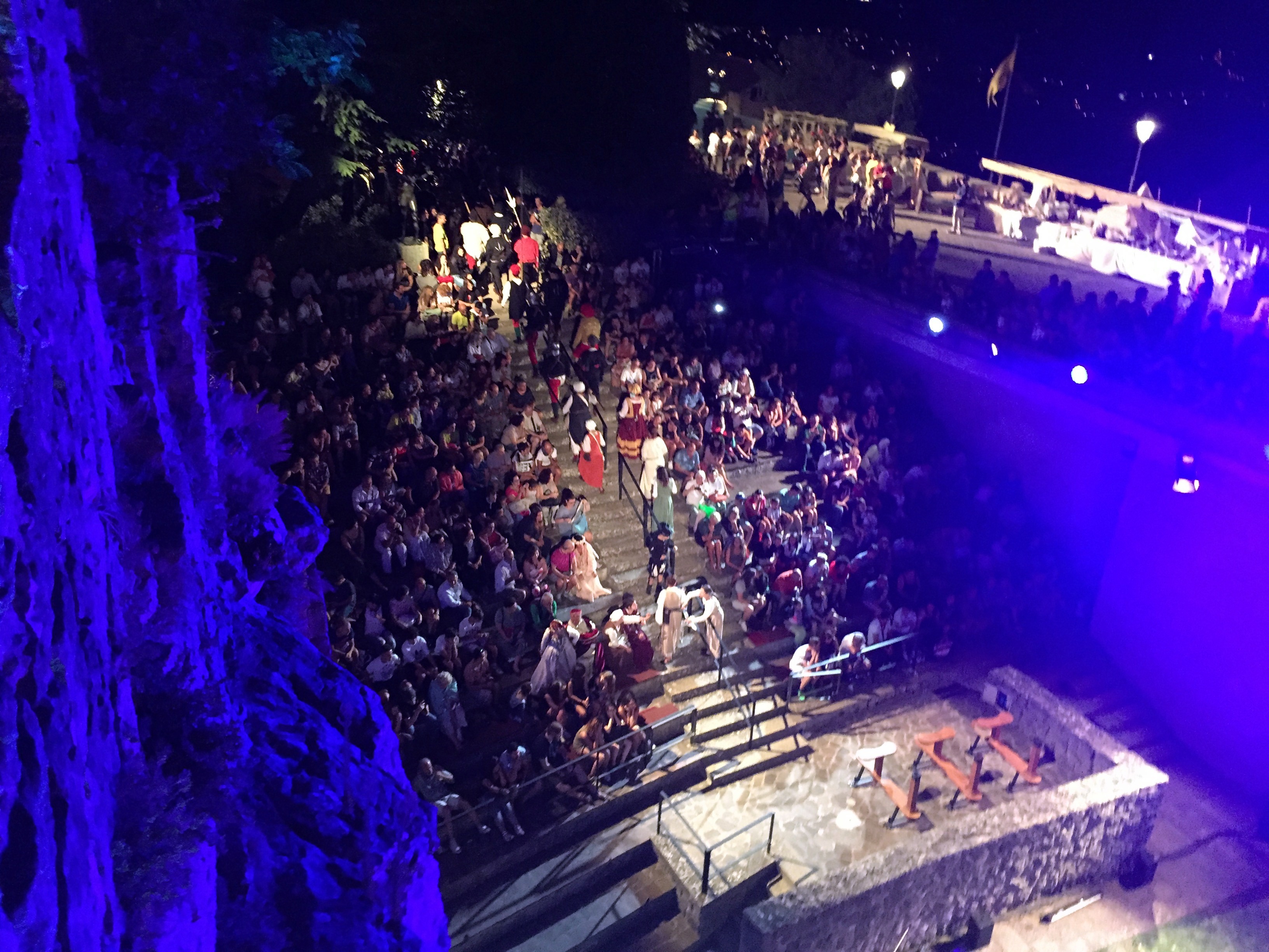
The country was holding a medieval festival while we were there, so there was a lot of this going on:

The kid’s definitely diggin’ it:
Freakin’ awesome views at lunch . . .


and from our craptastic hotel (albeit with a sweet balcony overlooking the countryside):
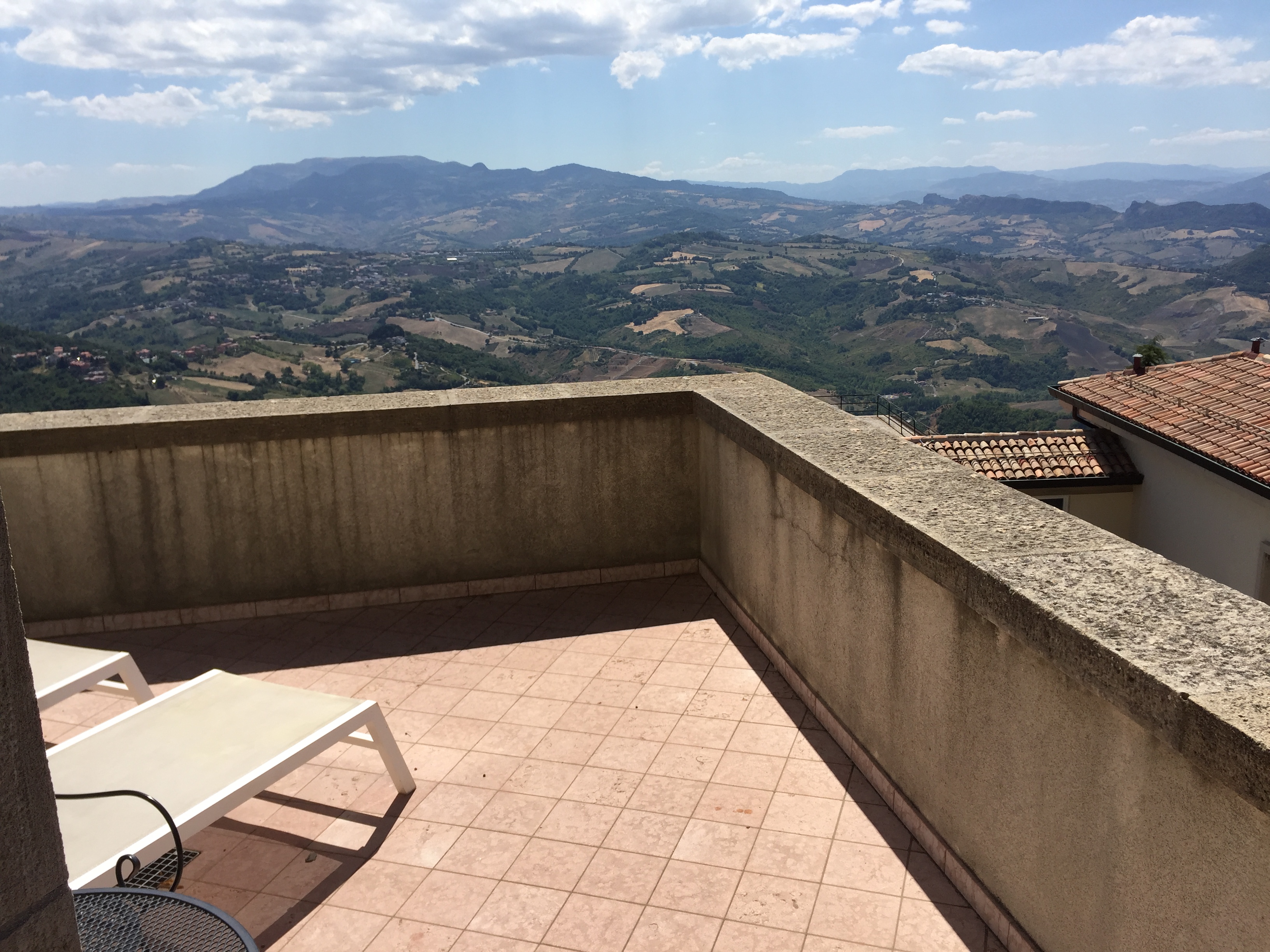

View of the Cesta Tower from the same location:

View into town from our balcony (three ways):


San Marino’s public square at night – quite the crowd!

And some outdoor concert action:
Two down, three to go!

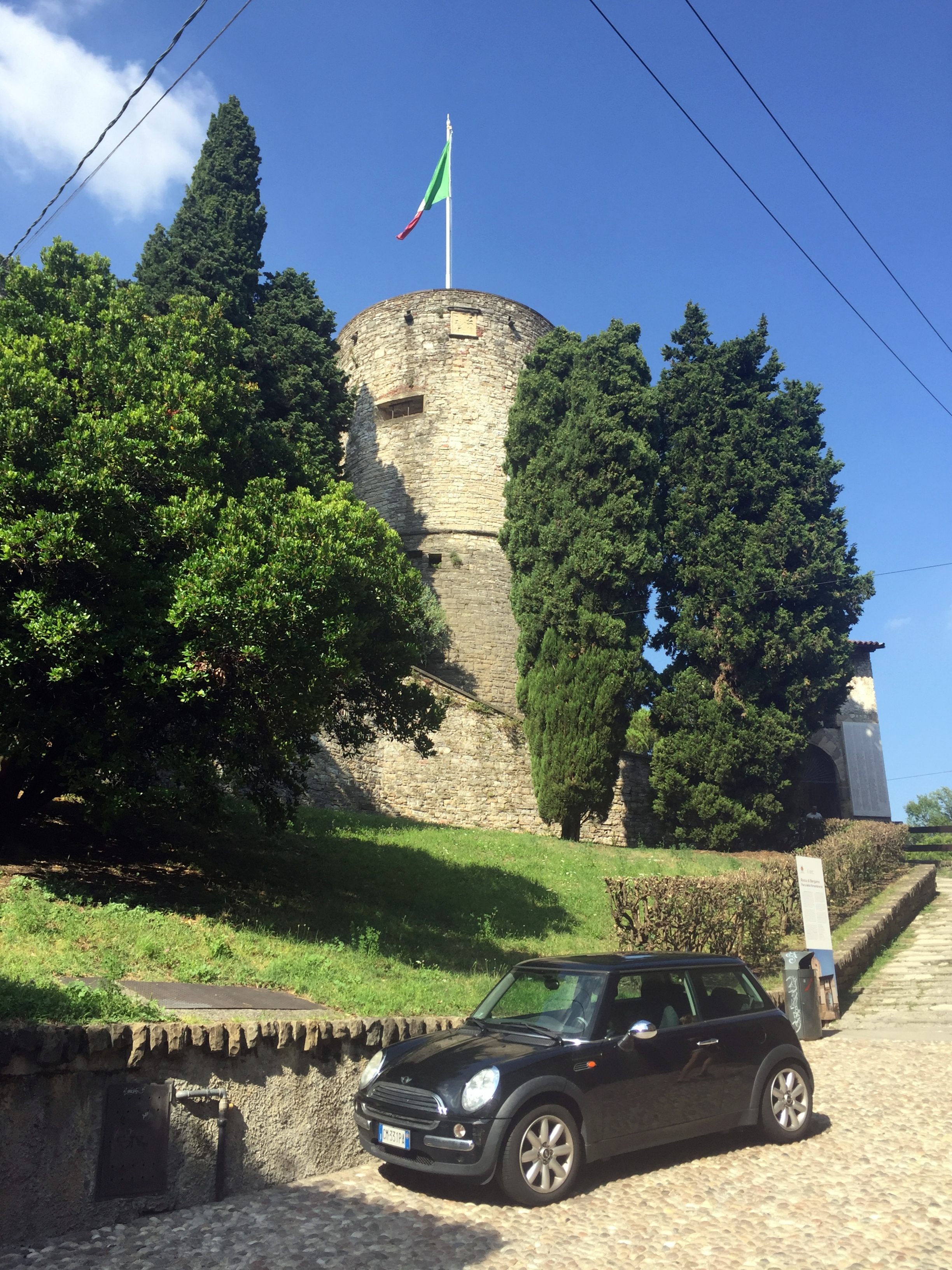
Bergamo, Italy
After San Marino, the next target on our micronation road trip was the country of Leichtenstein. However, driving there directly would take almost 8 hours, so we picked an appealing half way point to stop over on the way – Bergamo, Italy:

Driving through the more modern outskirts of town toward the fortified Città Alta (Upper Town), where we’d spend our time:

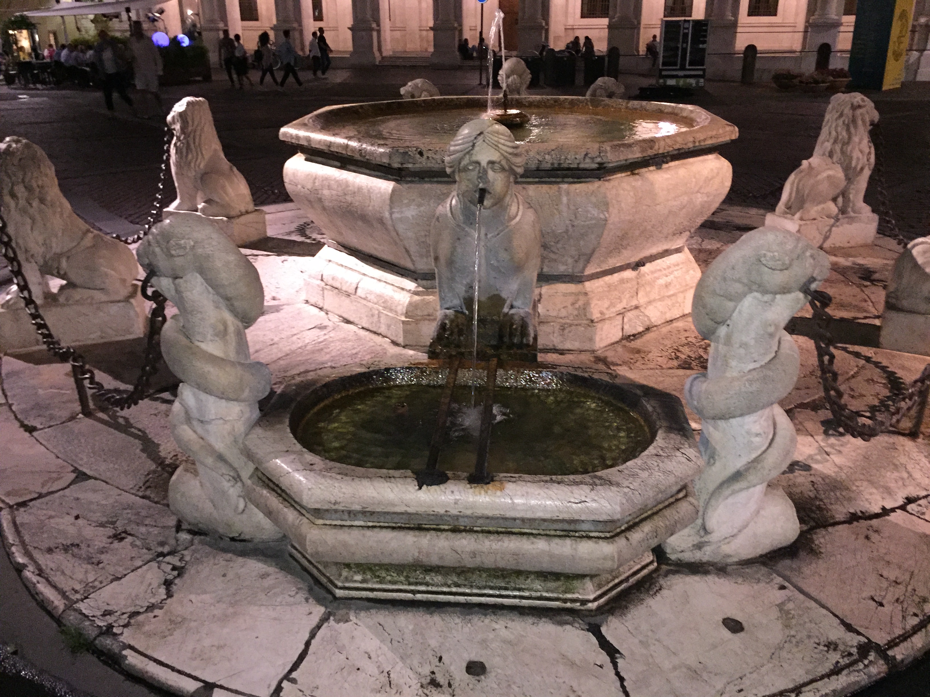
Bergamo’s main square – Piazza Vecchia, located precisely where the old Roman forum once existed.

The piazza’s 1780 Contarini fountain, where you can still refill your water bottles with potable water flowing from the sphynx’s mouths:


On one side of the piazza lies the Venetion-styled Palazzo Nuovo (New Palace), which served as Bergamo’s Town Hall until 1873:

On the other lies the Palazzo della Ragione, the oldest municipal seat in Lombardy, with the Venetion lion still over the door from when Bergamo was part of the independent Venetion empire:

Just beyond is the Basilica di Santa Maria Maggiore, built starting in 1137 in fulfillment of a promise by the townspeople to dedicate a church to Mary if she helped them avoid the plague in the early years of the 1100s:


Down the street lies the Torre Dell’Orologio (Clock Tower) that serves as the gateway into town through the town’s citadel, dating to 1355:

A climb up from town in the opposite direction brought us to Rocca of Bergamo (the Fortress of Bergamo):
On one side of the fortress are great views of the medieval skyline of Bergamo’s Città Alta:
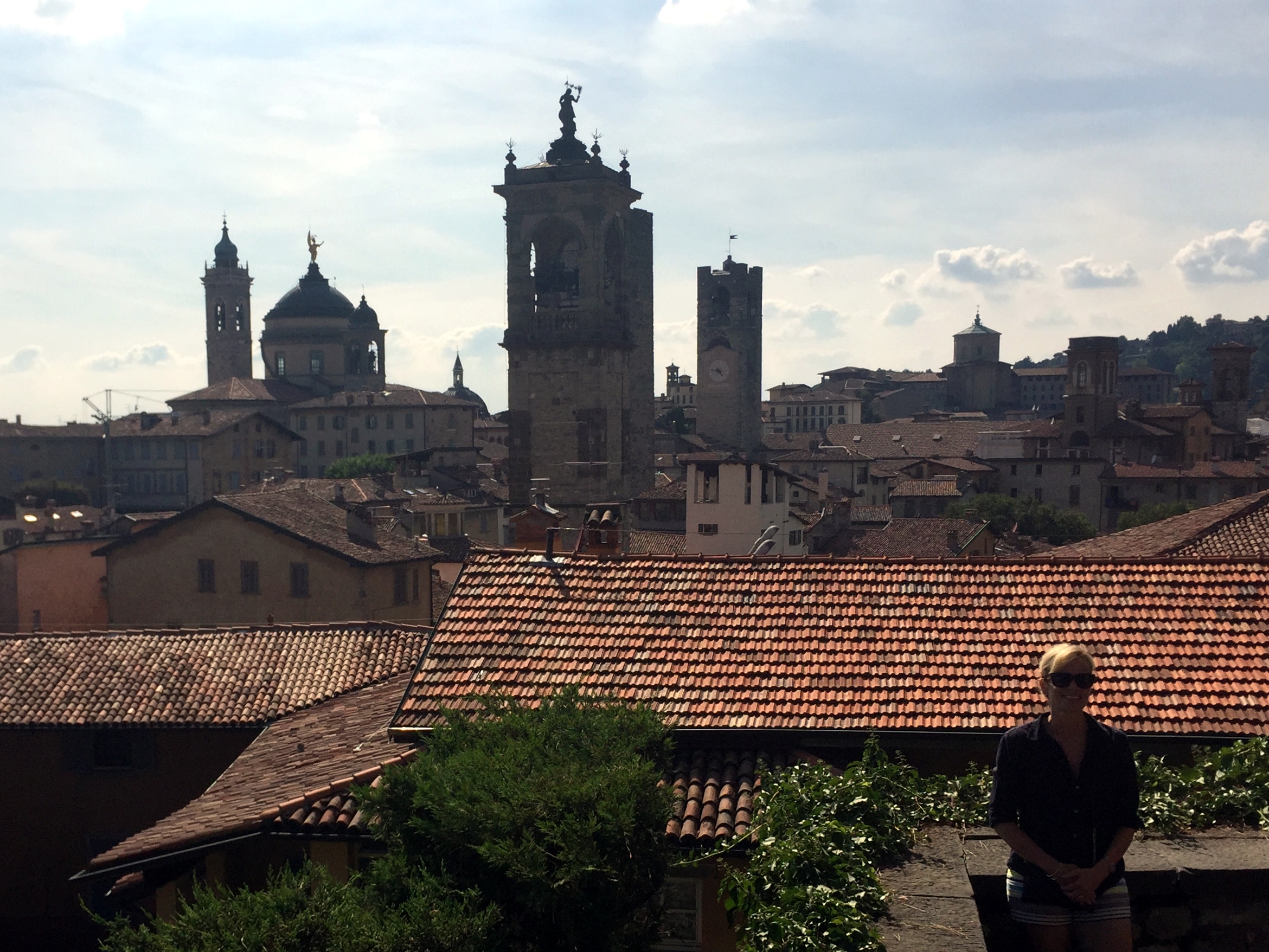
On the other are views to the valley below, as captured by this mighty cool panorama:

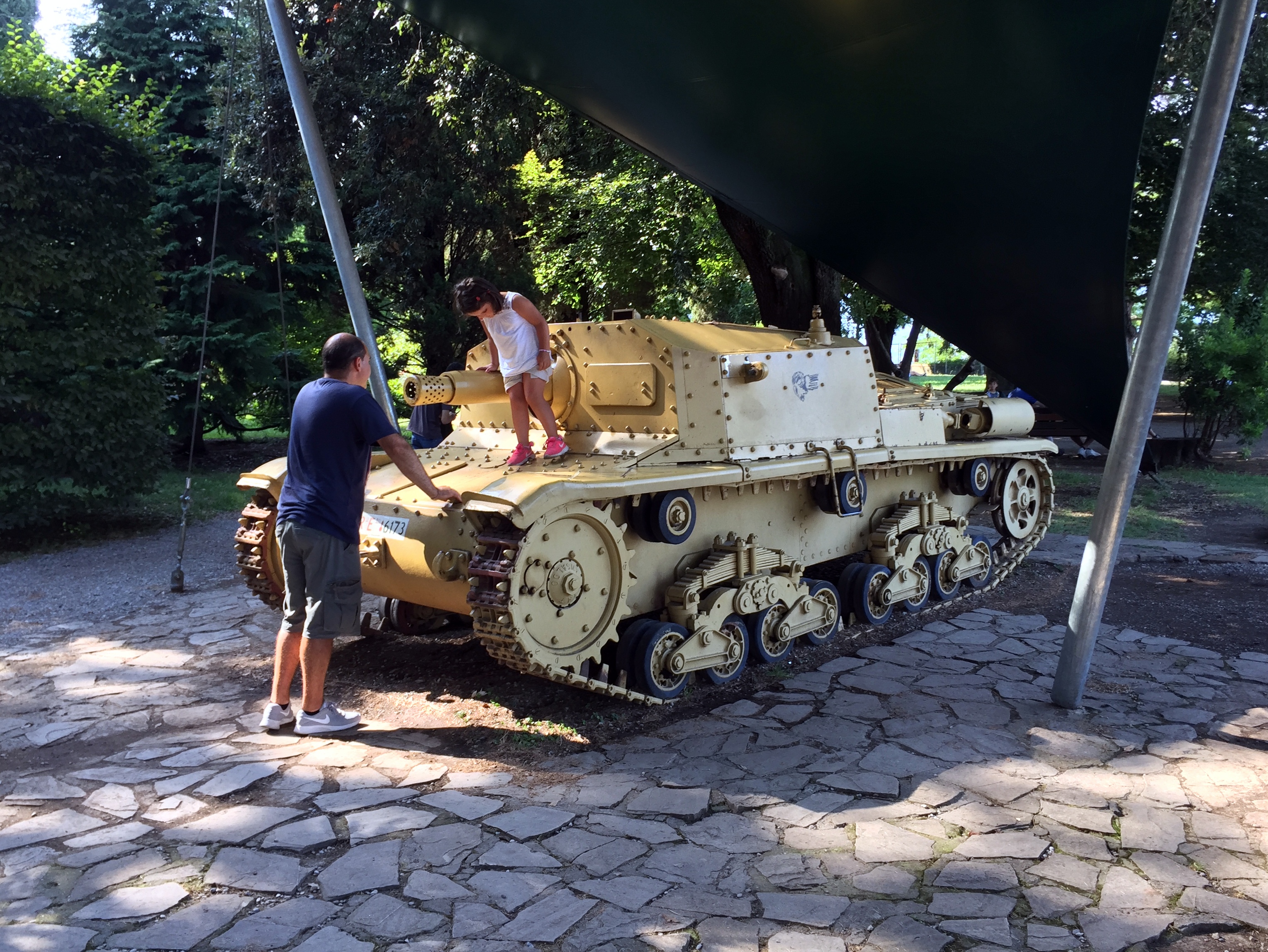
The grounds of the fortress now serves as a site for Italian war memorials:


We’re not sure which elements of this image is more incongruous: a little girl and an Italian tank . . . or simply an Italian tank:
Our cool design hotel, abutting the Gombito Tower, built in 1200 as a symbol of power of one of the feuding families in town (a la San Gimignano, experienced during our bike trip through Tuscany). It once controlled access to Piazza Vecchia from the roads leading into Città Alta from the valleys below:

Right next to the hotel (near a nice location for an afternoon cigar) lies Bergamo’s last Lavatoio Medievale, a communal wash house built in 1881 to combat sanitation problems that led to a cholera epidemic in the late 1800s. It’s a pretty cool structure with a decorative cast iron roof, and continues to serve as a communal gathering location for locals based on activities during our visit:

We had dinner outside that evening at a restaurant on Piazza Vecchio and ended up in an extended conversation with the owner, who was interested in hearing about our micronation trip and had some good stories about Bergamo, Lombardy, and San Marino.

The mildly creepy Contarini fountain that evening:
View over to the Camponone bell tower at Piazza Vecchio the next morning from our room . . .

before hitting the road for the drive into the Swiss alps and on to Leichtenstein in the family truckster – our killer diesel Skoda, shown here on the streets of Bergamo:
Microstates! The Principality of Liechtenstein
The Principality of Liechtenstein is squished between the eastern border of Switzerland and the far western border of Austria:
Principality Précis:
History: We’ll skip the Romans, the Alemanni, and the Frankish empire – all of which occupied Liechtenstein – and start with the Holy Roman Empire. When the Hapsburgs had control of the Holy Roman Empire under King Rudolf I, the County of Vaduz and the Lordship of Schellenberg, as well as other lands in the region, were enfoefed to the Counts of Hohenems in the 13th century. In 1396, the Holy Roman Emperor elevated Vaduz (the southern region of Liechtenstein) to the status of “imperial immediacy” and as such became a subject directly to the Holy Roman Emperor (a critical development, as noted below). By the 18th century, however, the House of Hohenems was financially strapped.
Meanwhile, in Moravia and Austria, the House of Liechtenstein held multiple territories, but all with fealty to lords at one or more levels below the Holy Roman Emperor. Because they did not hold territory that reported directly to the emperor, they were ineligible to hold a seat in the Imperial Diet in Vienna. “Even though several Liechtenstein princes served several Habsburg rulers as close advisers, without any territory held directly from the Imperial throne, they held little power in the Holy Roman Empire.”
“During the early 17th century Karl I of Liechtenstein was made a Fürst (prince) by the Holy Roman Emperor Matthias after siding with him in a political battle. Hans-Adam I was allowed to purchase the minuscule Herrschaft (“Lordship”) of Schellenberg and county of Vaduz (in 1699 and 1712 respectively) from the Hohenems. Tiny Schellenberg and Vaduz had exactly the political status required: no feudal lord other than their comital sovereign and the suzerain Emperor. On 23 January 1718, after the lands had been purchased, Charles VI, Holy Roman Emperor, decreed that Vaduz and Schellenberg were united and elevated the newly formed territory to the dignity of Fürstentum (principality) with the name “Liechtenstein” in honour of “[his] true servant, Anton Florian of Liechtenstein”. It was on this date that Liechtenstein became a sovereign member state of the Holy Roman Empire. It is a testament to the pure political expediency of the purchase that the Princes of Liechtenstein never visited their new principality for almost 100 years.”
Although the principality was part of the Holy Roman Empire and, later, the Austro-Hungarian Empire, and although the House of Liechtenstein was primarily Austrian and Moravian, the county and lordship that became Liechtenstein was more Swiss than Austrian. Its inhabitants spoke (and still speak) Swiss German and had closer economic ties with the Swiss cantons than with Austria. And, like Switzerland, Liechtenstein remained neutral in both world wars.
Why it still exists: Several reasons:
- When the independent Swiss cantons unified to create Switzerland in 1848, Liechtenstein wasn’t interested in becoming part of the new country and was left out.
- Through Napoleon, the downfall of the Holy Roman Empire and the Congress of Vienna Liechtenstein, became independent.
- With the collapse of the Austro-Hungarian Empire after WW I, Liechtenstein had no fealty to Austria and so remained independent.
Absolute size: 62 square miles
Relative size: Liechtenstein is the second largest of the five European microstates and almost two of the countries could fit inside Nantucket, which is 105 square miles.
Population: 37,877
Capital: Vaduz
Government: Liechtenstein has a constitutional monarch as Head of State, and an elected parliament which enacts the law. It is also a direct democracy, where voters can propose and enact constitutional amendments and legislation independent of the legislature.
Tiny state trivia:
- Liechtenstein is a double-landlocked country. It’s surrounded by Austria and Switzerland, both of which are landlocked themselves. The only other country in this condition is Uzbekistan.
- The country has one of the world’s lowest crime rates; the last murder occurred in 1997. Conversely (but not surprisingly), the country has one of worlds highest per capita income rates (the highest, when adjusted for purchasing power parity).
- The country was unintentionally invaded by Switzerland in 2007, when a unit of the Swiss army on maneuvers inadvertently crossed an unmarked border. Liechtenstein maintains no military and had no idea, and had to be informed by Switzerland of the international incident.
With that out of the way, on to the trip.
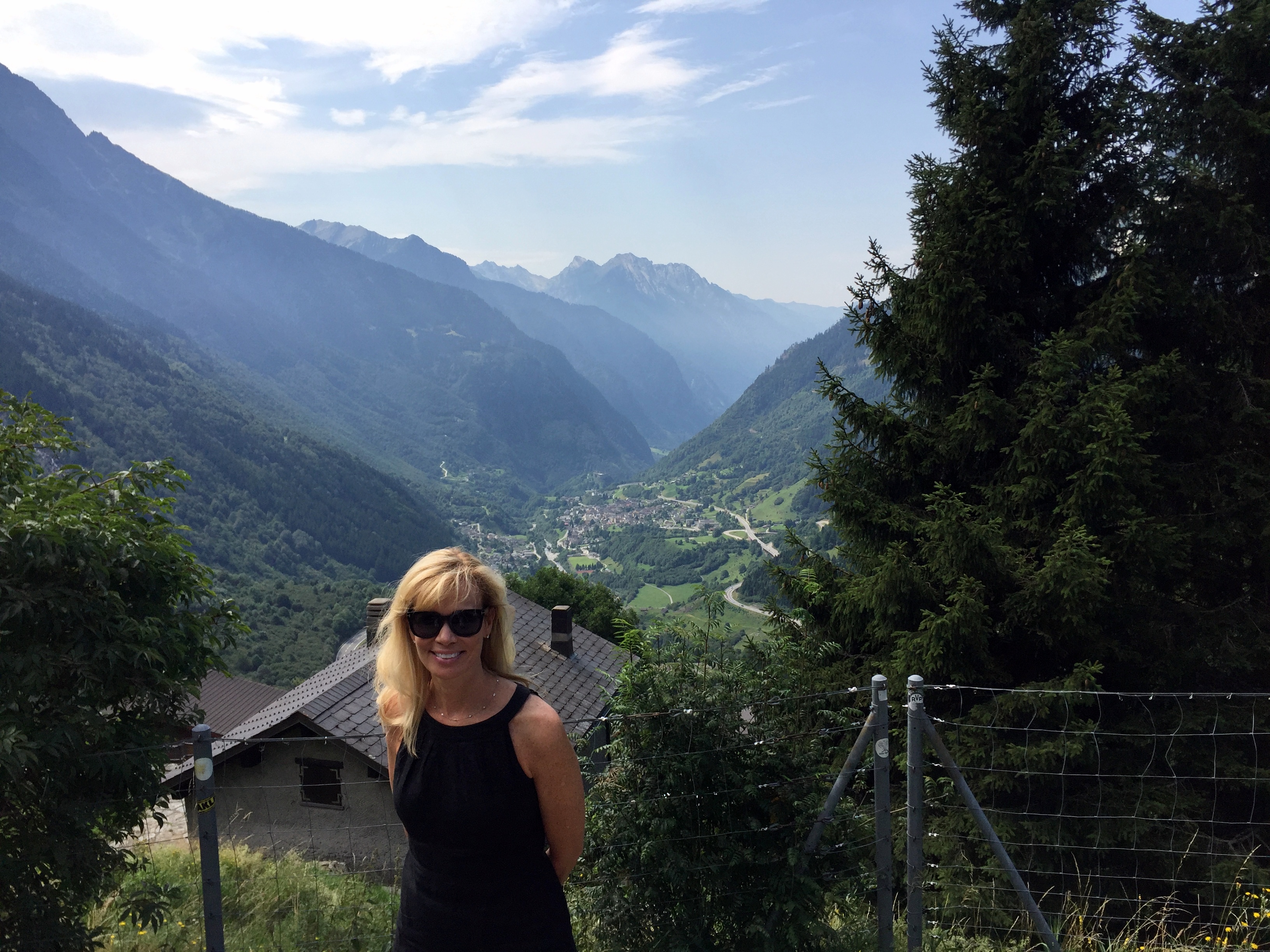
We traveled north from Bergamo through the Swiss Alps to reach Liechtenstein.

Really beautiful drive – we drove almost continually uphill during the middle portion of the trip and passed a dozen tiny Swiss hamlets and larger villages.

Overlooking a valley in Switzerland between Bergamo and Liechtenstein:
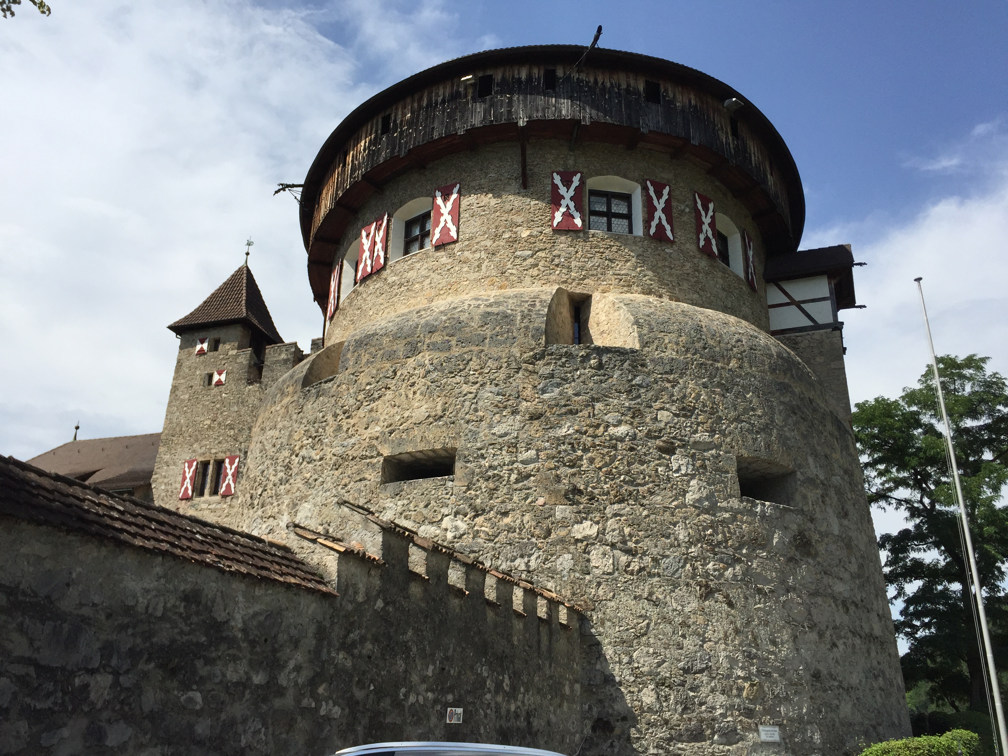
Vaduz Castle looming above Liechtenstein’s valley:
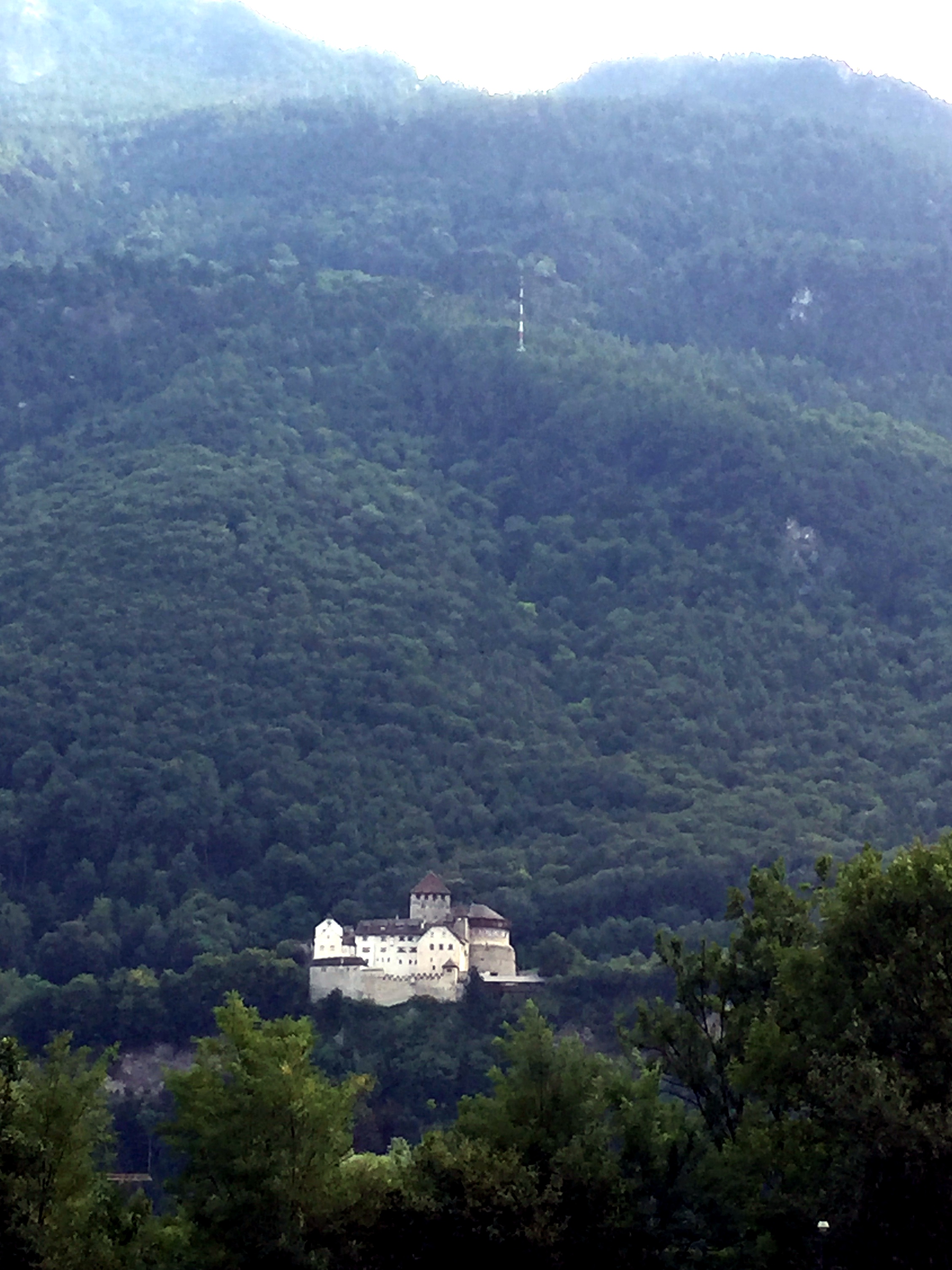
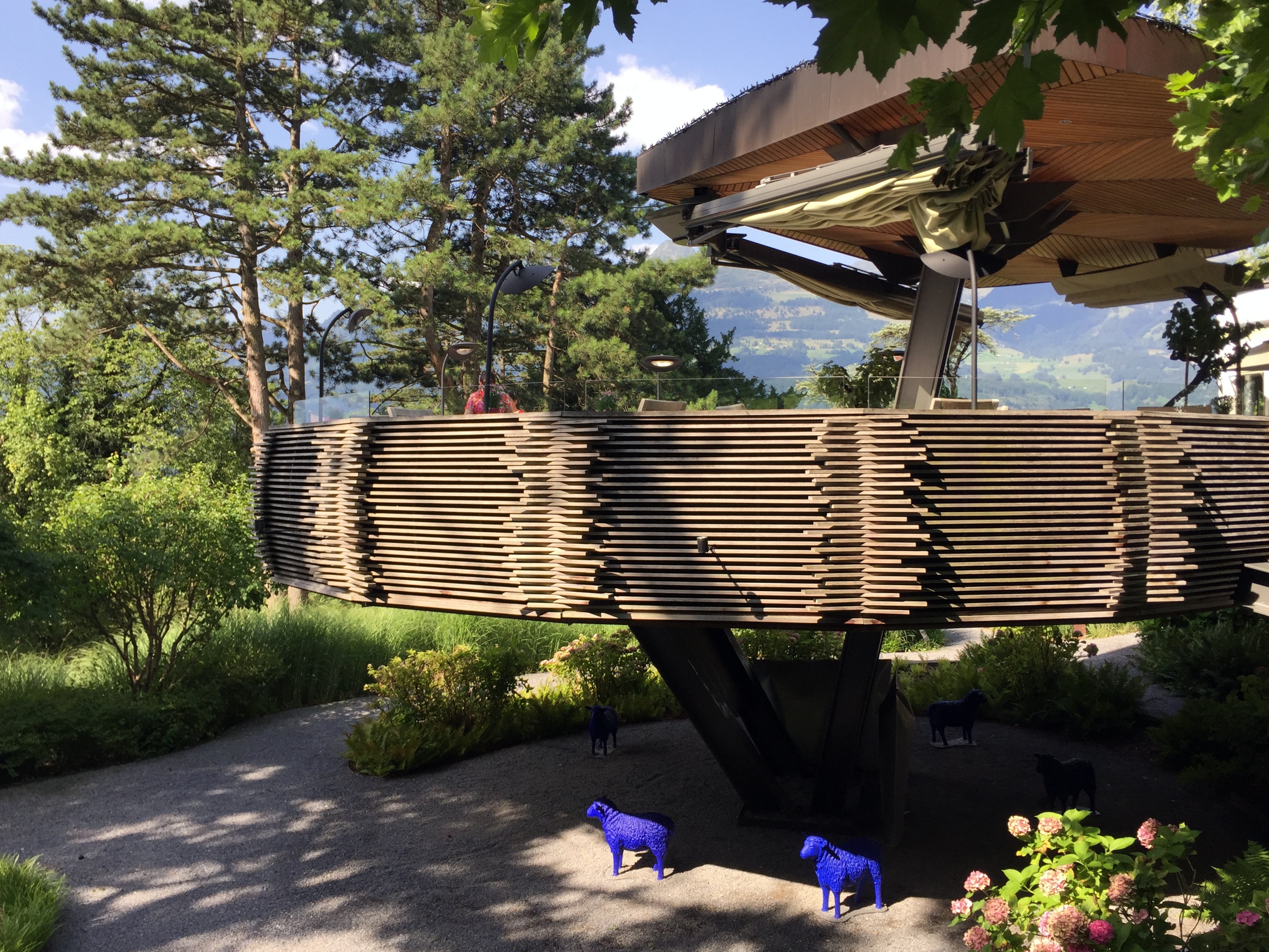
The castle was an omnipresent site from our hotel, which featured a birds nest-like outdoor dining area.
See? Looming.

And who knew? Liechtenstein Brauhaus beer!

Amazing day (it was, after all, July 31) and amazing view:


Our destination after lunch – a hike through the woods to the castle:

Pretty accessible, actually:

The castle was originally built in the 12th century, burned in 1499 during the Swabian War by the Swiss Confederacy, improved by the House of Hohenems in the 17th century, and last renovated in the early 20th century by the House of Liechtenstein:
The seat of government in downtown Vaduz, plus a cool manor house spotted while heading back to the hotel:


Amazing birthday dinner outdoors at La Maree:


Castle during dinner:
And at breakfast before heading south (and there’s a difference in an element featured in this picture that’s directly related to the date we were in Liechtenstein):

Three down, two to go!
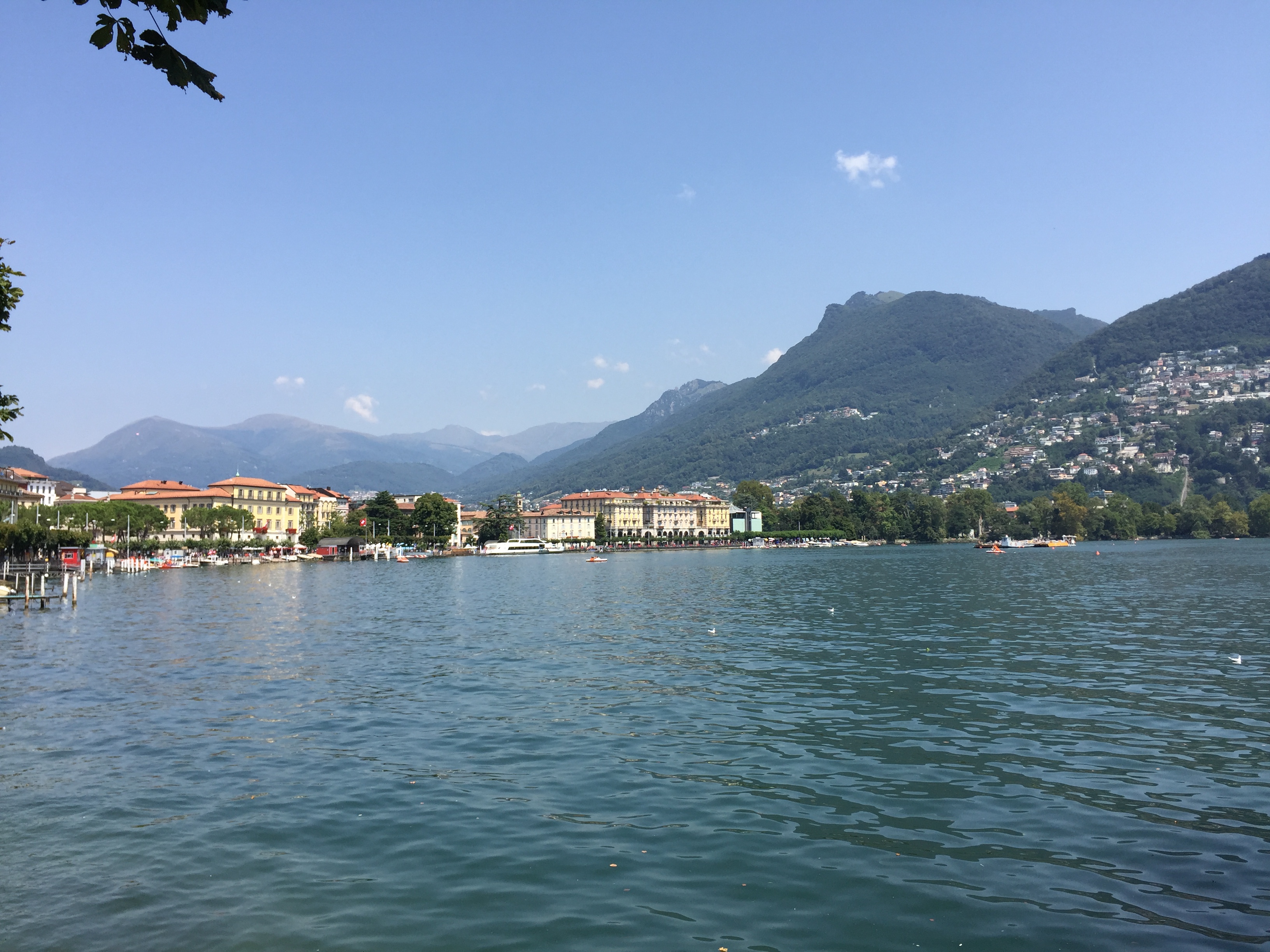
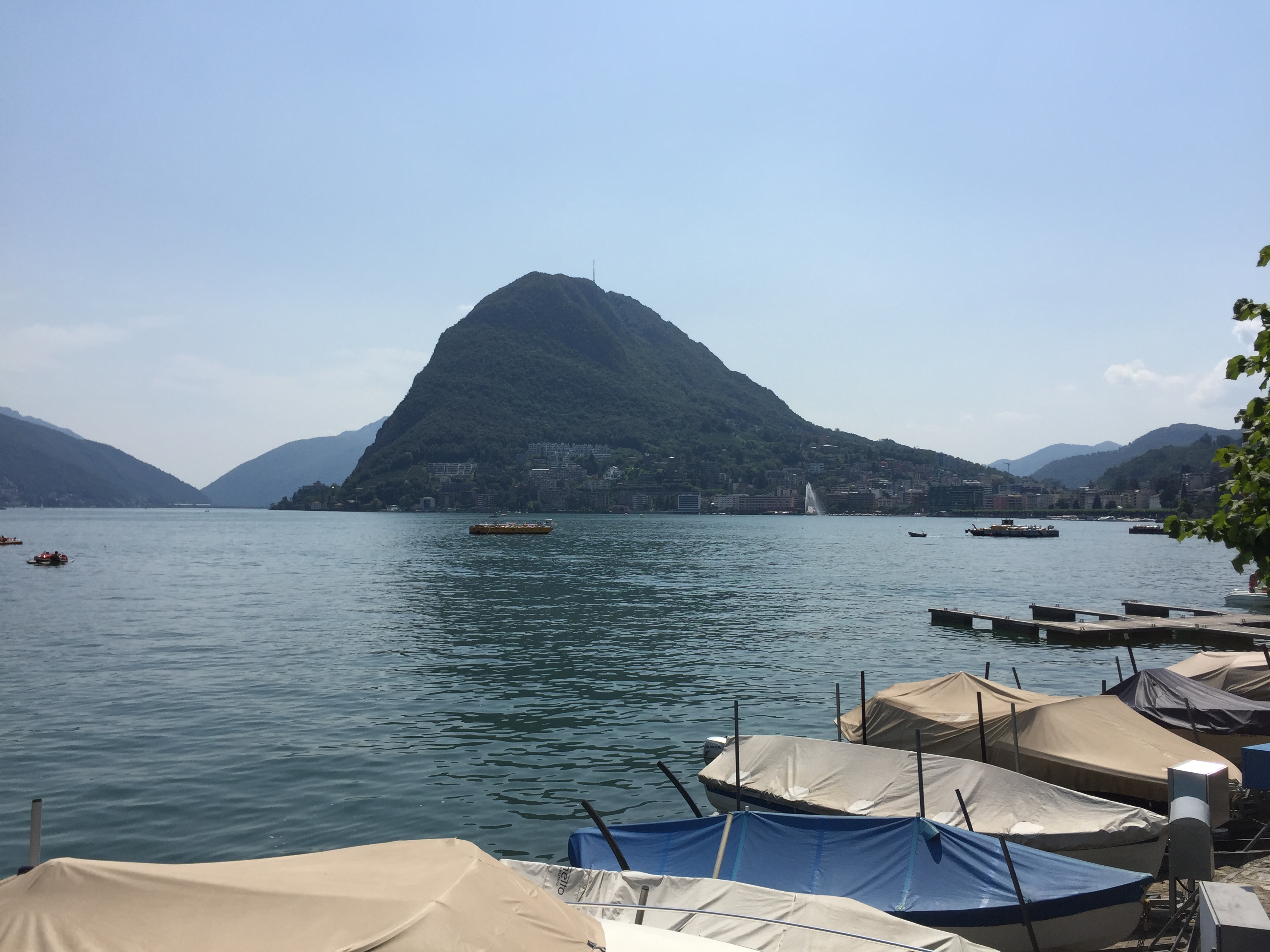
Lake Lugano, Switzerland
Day 5 of the micronations road trip took us to a halfway point between Liechtenstein and our next target, the Principality of Monaco. The halfway point we selected was Lake Lugano, Switzerland (which brought our country count for just 5 days of the trip to five, as it happens . . .). GPS route for the day’s drive:

As some have noted, this blog has a particular interest in geography and geographic anomalies. Lake Lugano played to this interest. Although the type of geographical anomaly there is very unusual, we had nonetheless encountered this type of anomaly twice already during the trip: an enclave.
The Italian commune of Campione on Lake Lugano lies entirely inside the Swiss canton of Ticino. The map below shows Swizerland in pink and Lake Lugano in deep blue. The enclaved Italian commune isolated entirely inside of Switzerland is in the southeast section of the lake:

Unlike the enclaves of Vatican City and San Marino, where an entire nation resided inside another country, this enclave represented just a tiny piece of Italy, very similar to the Spanish town (or Catalonian town, if you side with the secessionists there) of Livia stuck inside of France, which we blogged about last year.
Although we’ve only been posting information on why things still exist on the micronation blogs themselves, we figured this enclave deserved some detail, so here’s the explanation for why it exists, courtesy of Wikipedia:
“In the first century BC the Romans founded the garrison town of Campilonum to protect their territories from Helvetii invasions.
In 777, Toto of Campione, a local Lombard lord, left his inheritance to the archbishopric of Milan. Ownership was transferred to the abbey of Sant’Ambrogio. In 1512, the surrounding area of Ticino was transferred from the ownership of the bishop of Como to Switzerland by Pope Julius II, as thanks for support in the War of the Holy League. However, the abbey maintained control over what is now Campione d’Italia and some territory on the western bank of Lake Lugano.
When Ticino chose to become part of the Swiss Confederation in 1798, the people of Campione chose to remain part of Lombardy. In 1800, Ticino proposed exchanging Indemini for Campione. In 1814 a referendum was held, and the residents of Campione opposed it. In 1848, during the wars of Italian unification, Campione petitioned Switzerland for annexation. This was rejected due to the Swiss desire for neutrality.
After Italian unification in 1861, all land west of Lake Lugano and half of the lake were given to Switzerland so that Swiss trade and transport would not have to pass through Italy. The d’Italia was added to the name of Campione in the 1930s by Prime Minister Benito Mussolini and an ornamental gate to the city was built. This was to assert the exclave’s Italian-ness.”
On to our day in Lake Lugano.
First, we definitely picked the right place to stay – spectacular views of the lake:


And a complementary electric Smart Car for forays down to the lake . . .

Along the lake . . .

The Romanesque Church of Santa Maria degli Angeli on the shores of the lake:

The church was built in 1499 in recognition of the cessation of conflict between the Guelphs and Ghibellines and to thank the Observant Franciscans for their work during the plague of 1498. It features a very busy 15th century fresco by a student of Leonardo da Vinci that’s still perfectly intact and considered to be one of the best examples of art during the Lombard Renaissance.

Heading back to The View in our sweet ride:

Incredible dinner outside at The View, overlooking Lake Lugano:


Unbeknownst to us, August 1 is Swiss National Day, so not only did we have a sweet dinner overlooking the lake, but got to experience a great fireworks display, to boot.


