We are seriously going to try to post the entirety of our trip backlog this year. Starting with the remaining two dozen posts on this, our first, post-retirement, long-duration trip. Posts on WolfeStreetTravel.com unfortunately take a back seat, priority-wise, to trip planning and actual trips, relegating this activity to “when we have some time.” But the first half of this year offers a rare opportunity of no planned travel, so we should be able knock a bunch of backlogged posts out over the next 6 months. The reason for no planned travel is that the ACTUAL Wolfe Street (an actual place where we really do reside), is getting torn up for a sewer upsizing project that one of the WolfeStreetTravelers pressured the city into undertaking for reasons we don’t need to go into here. (The city’s project page is here.)
The reason we want to be in residence during this process and not in Japan or Slovenia or Ecuador or something is that we have 100-year-old clay lateral lines that connect our house to the sewer pipe in our street. Read that again. 100-year-old CLAY pipes. Seriously. Because these fragile artifacts are prone to damage during this construction, we don’t want to have to deal with problems remotely or, worse, cut short a trip to come home and deal with them. So, we’re sticking around until we can confirm that our fragile porcelain China plumbing fixtures are undamaged and the project has progressed beyond the point where they are endangered.
With that, back to travel.
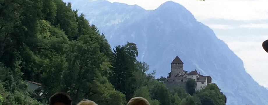
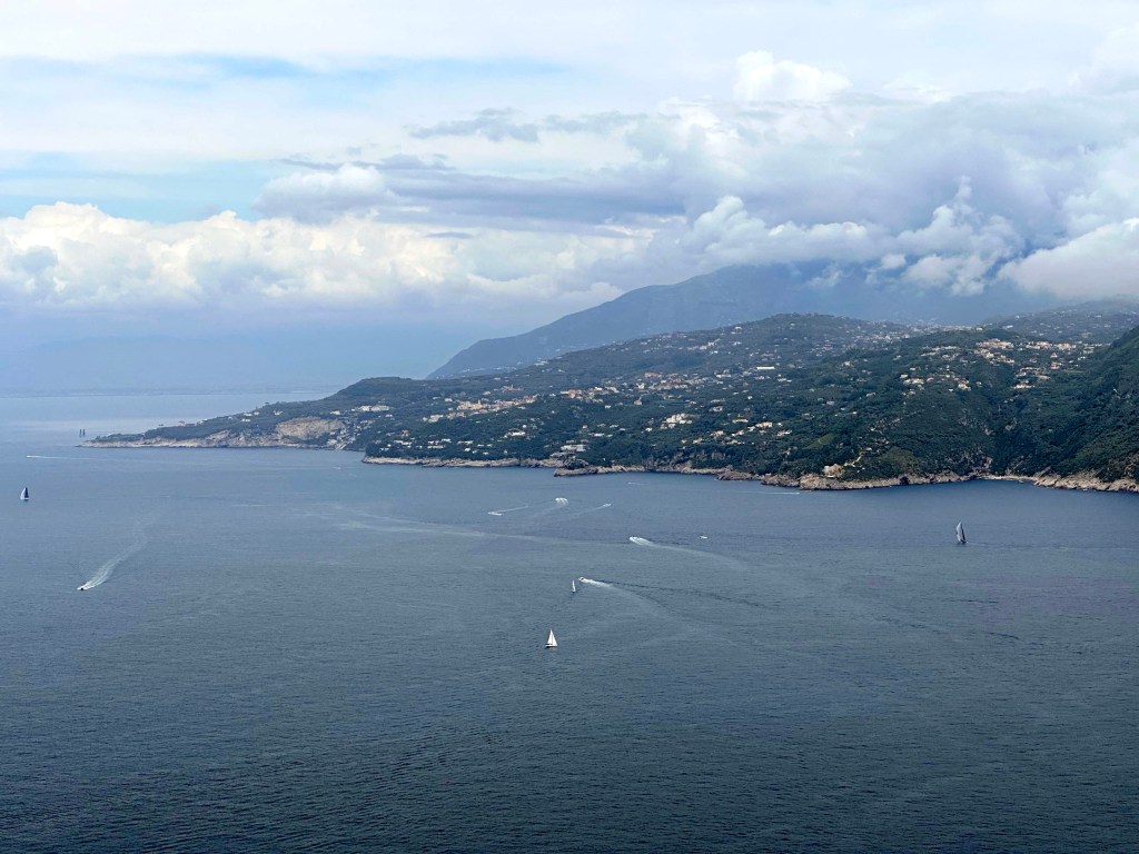
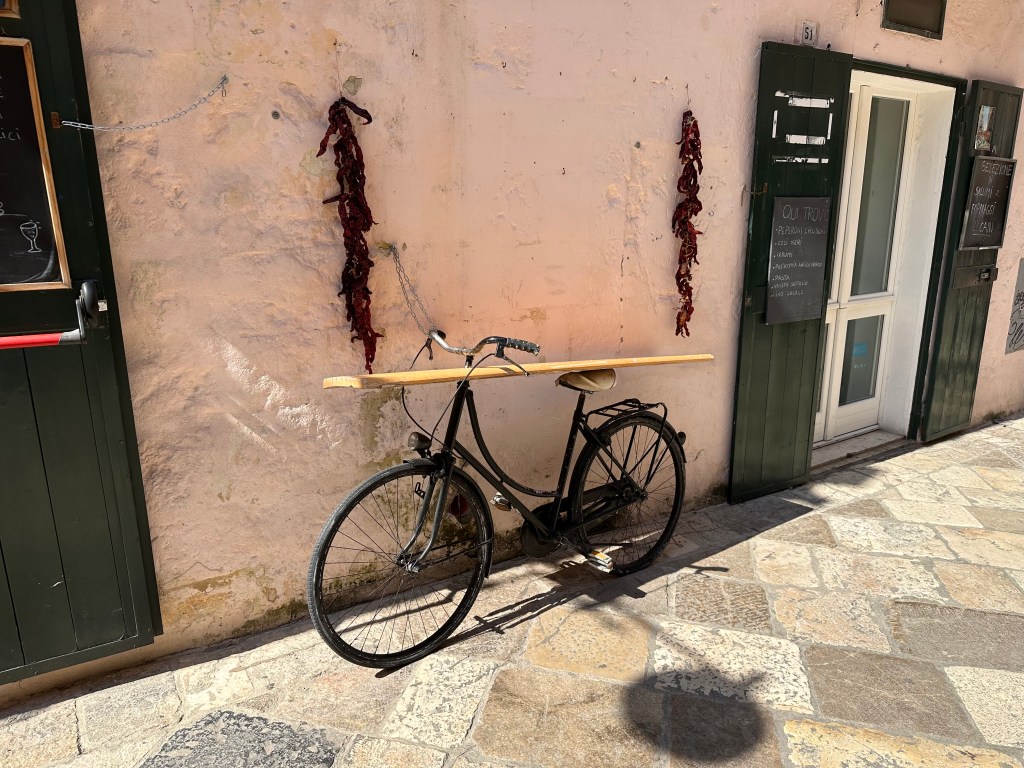
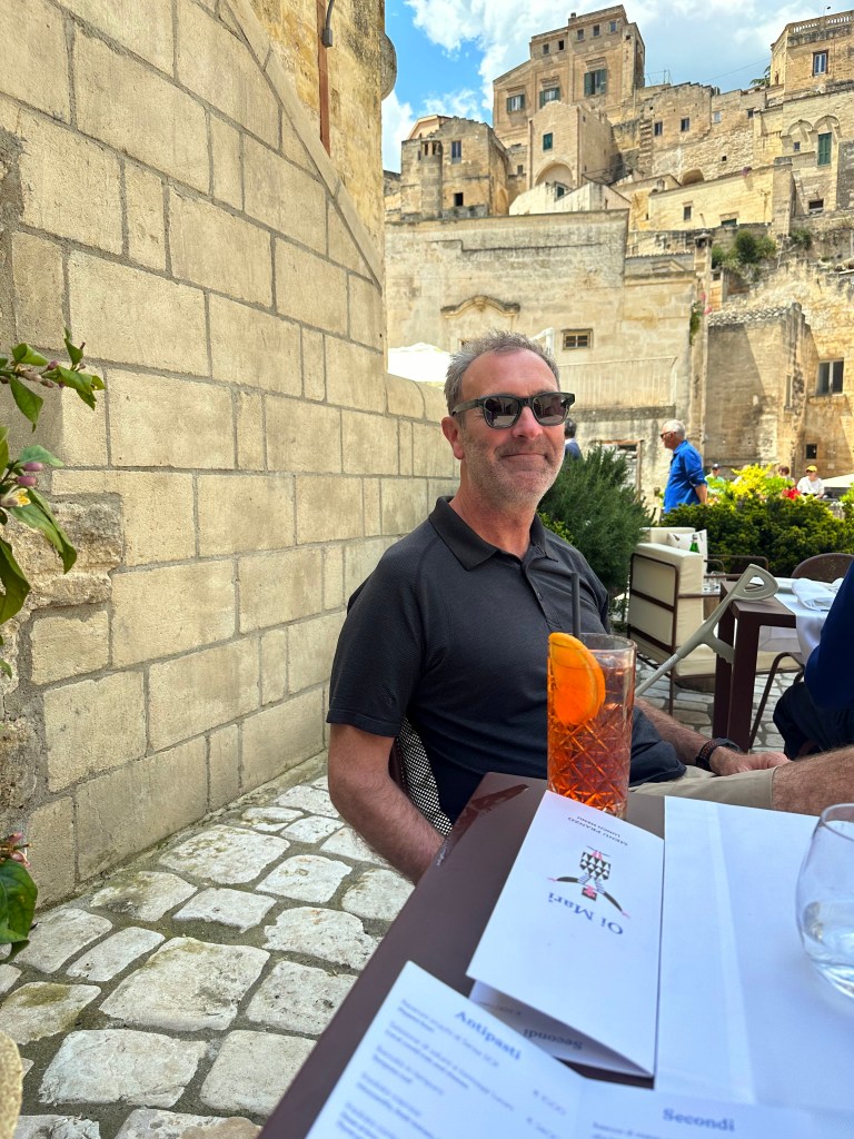
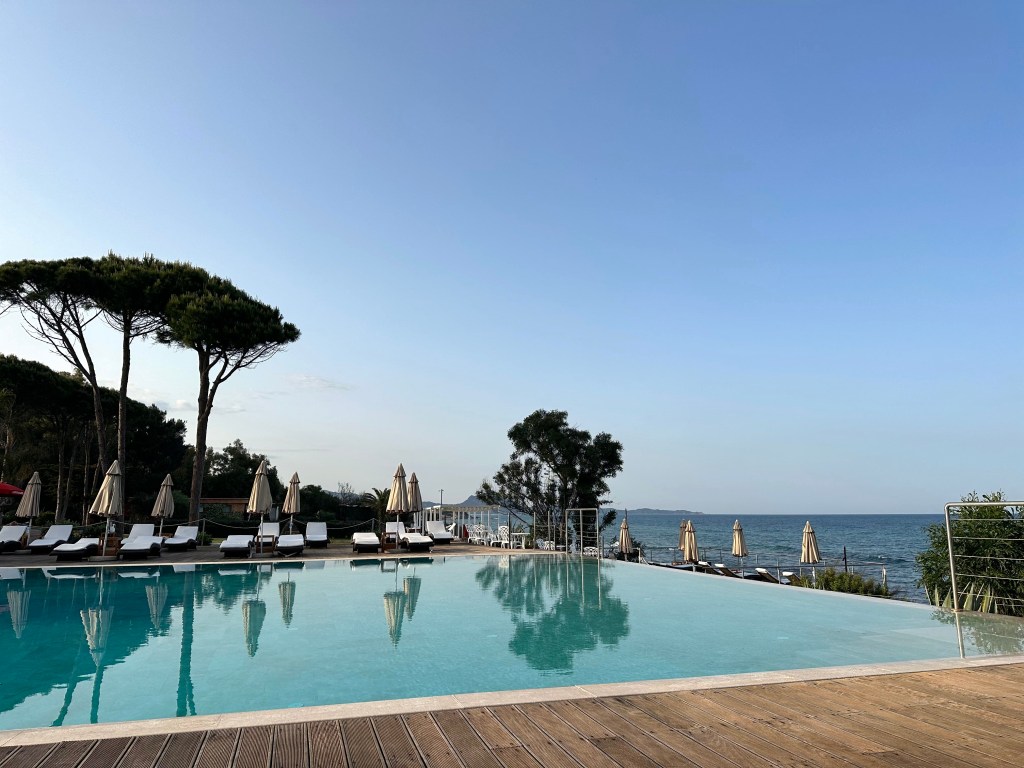
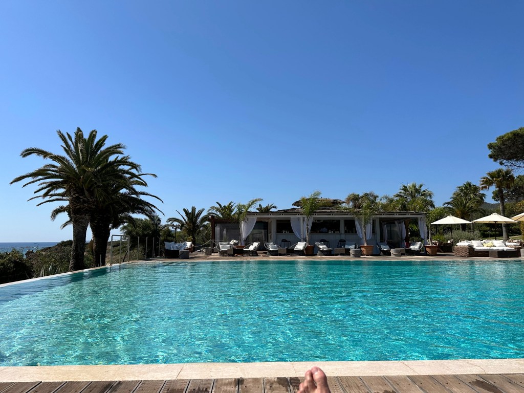
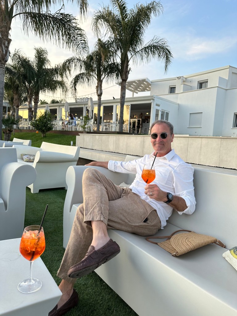
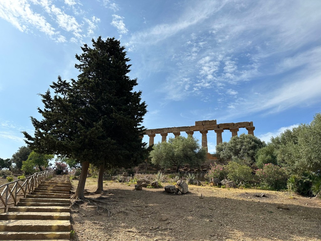
After completing our detour north to picture-perfect Portofino, we finally headed south within the Italian peninsula to our next destination: the Roman ruins of Herculaneum. But the drive was unacceptably long (we try to keep our road trip daily drives to no more than 4 hours), so we stopped at a halfway point: Orvieto in Umbria. (This was not our first choice, however. We originally planned to stop in Montemerano, in southern Tuscany, based on its small, hill-town charm and a Michelin-starred restaurant there. But the restaurant abruptly cancelled our reservation during our planning phase, citing a private event, so we pivoted to another appealing stop that still would be approximately halfway between Portofino and Herculaneum.)
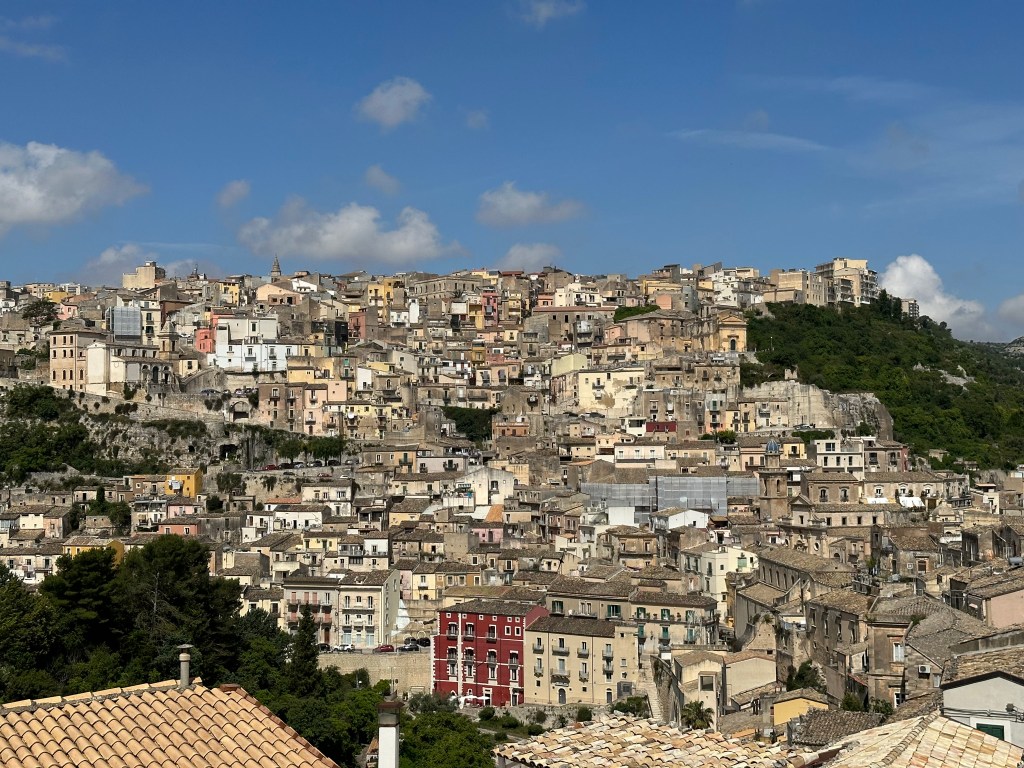
So, why Orvieto? Popes and history (and a cool perch on a defensive bluff). But before the popery and such, a little earlier history. As with Volterra, far to its north, Orvieto originated as an Etruscan metropolis, and celebrated, historic Etruscan tombs punctuate the area (none of which we had time to visit, but they sounded very cool, to be sure). Then, Rome overran the area in the 3rd century BC, then Western Roman Empire collapsed, then Goths controlled the area, then the Lombards, and – finally – the city became a self-governing commune in the 10th century. But one with close ties with the papacy that would grow closer still with each successive century.
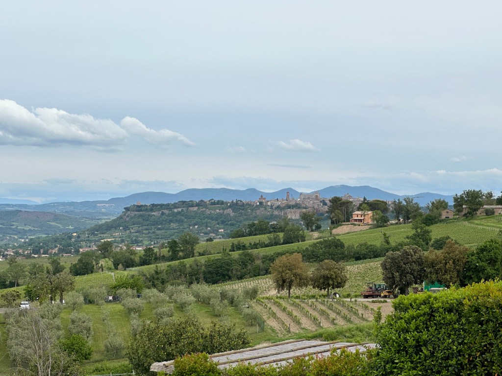
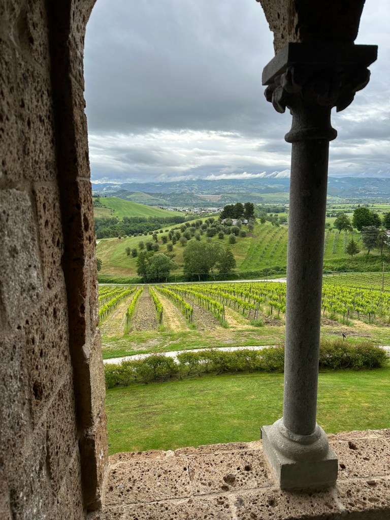
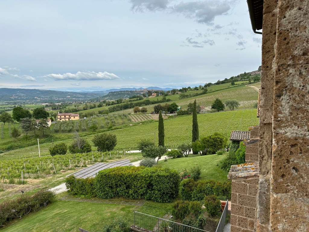
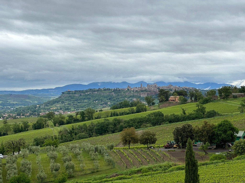
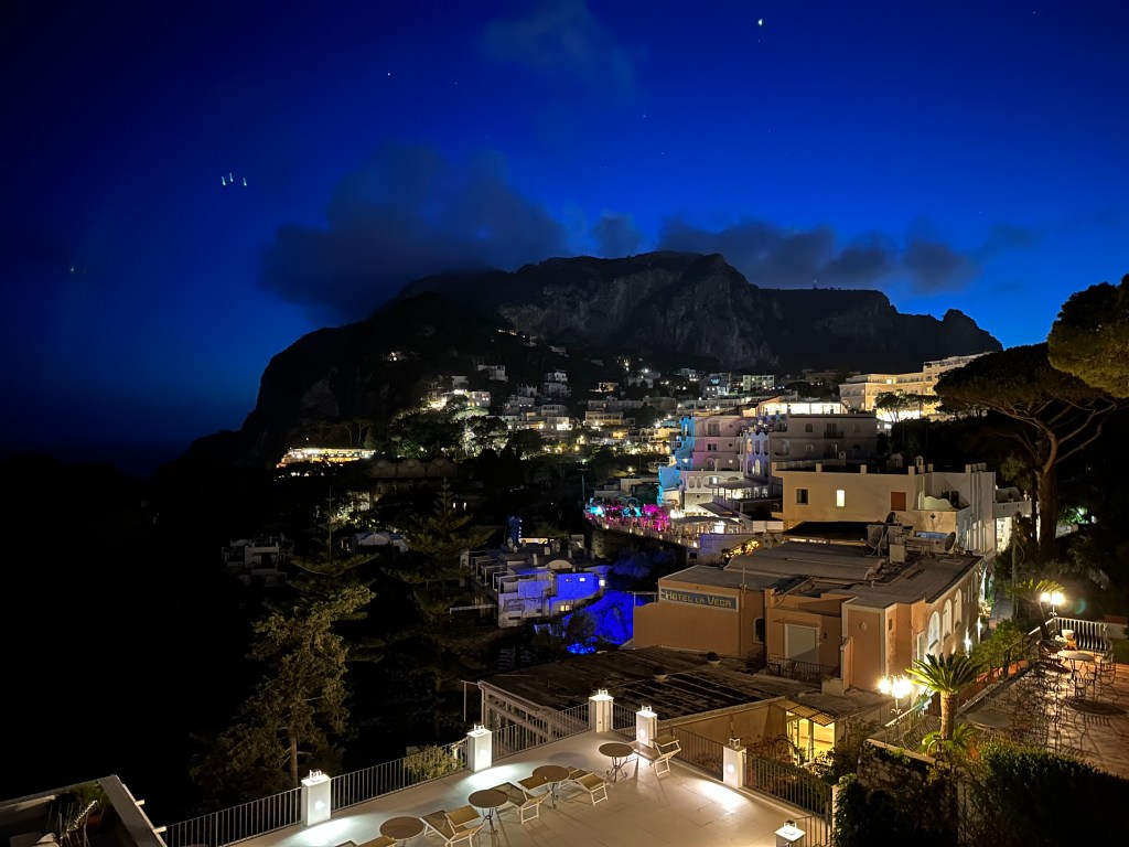
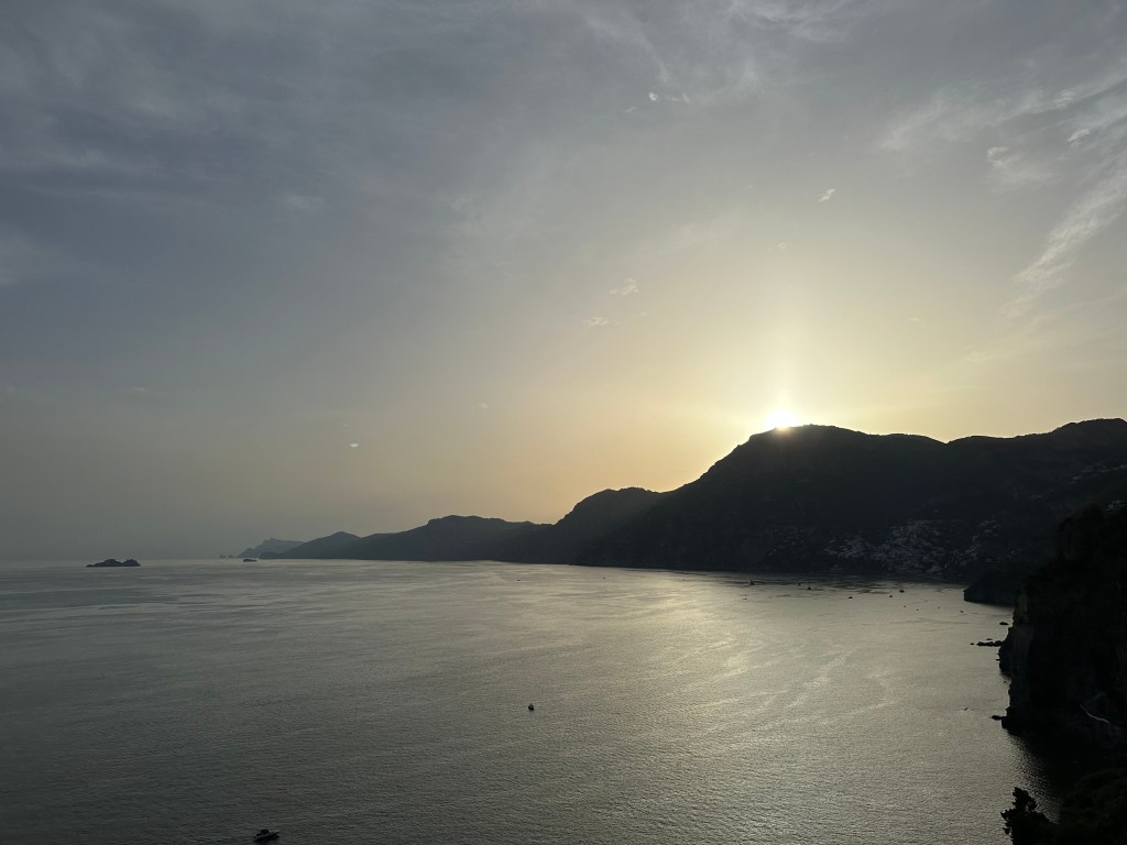
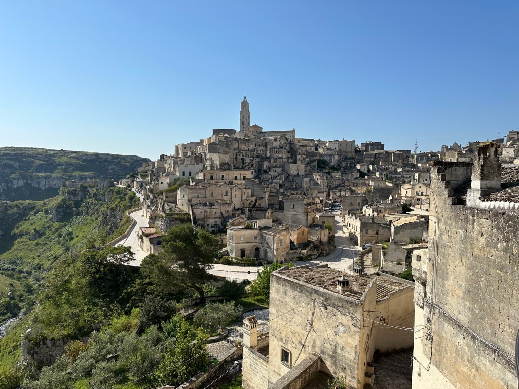
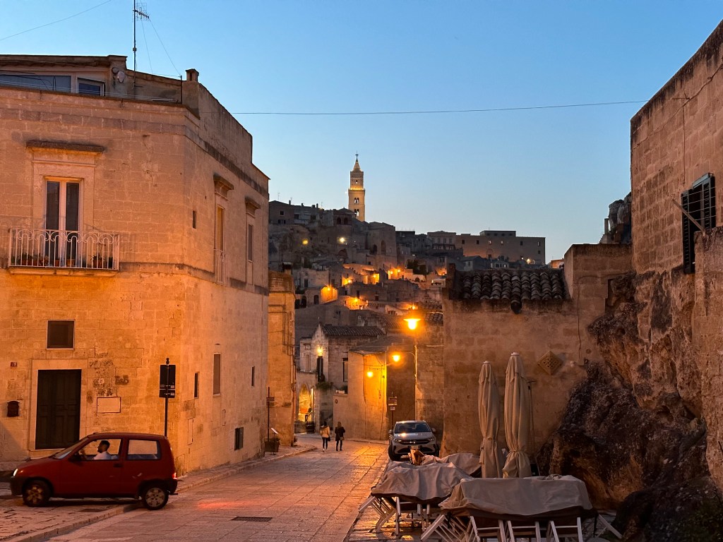
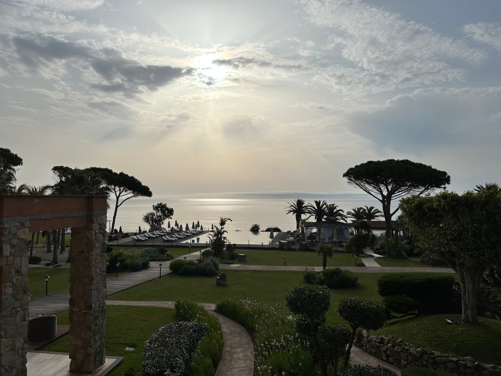
Orvieto in the distance, seen from our lodging that evening.
Pope Benedict VII was fond of the city, and his nephew became consul of the commune in 1016; Orvieto became Benedict’s retreat from Rome. A pattern emerged, and Orvieto sported three papal palaces from their extended stays there by the 13th century. The role of papal retreat reached its apogee with Pope Urban IV, who resided in Orvieto instead of Rome from 1262 to 1264. (As an aside, we cannot recommend highly enough reading Absolute Monarchs: A History of the Papacy, in which Orvieto appears on every third page or something during the reign of the medieval popes. Regardless, a wildly entertaining, mildly entertaining history tome.)
Considering all of this, Orvieto fell under de facto papal control starting in 1200 and ultimately became an official part of the Papal States in 1354. This rule lasted until 1860, during Italian unification.
With that historical context addressed, let’s check out the town.
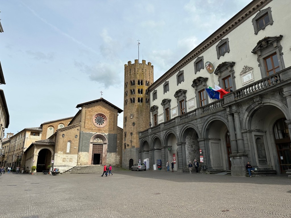
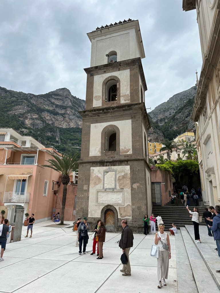
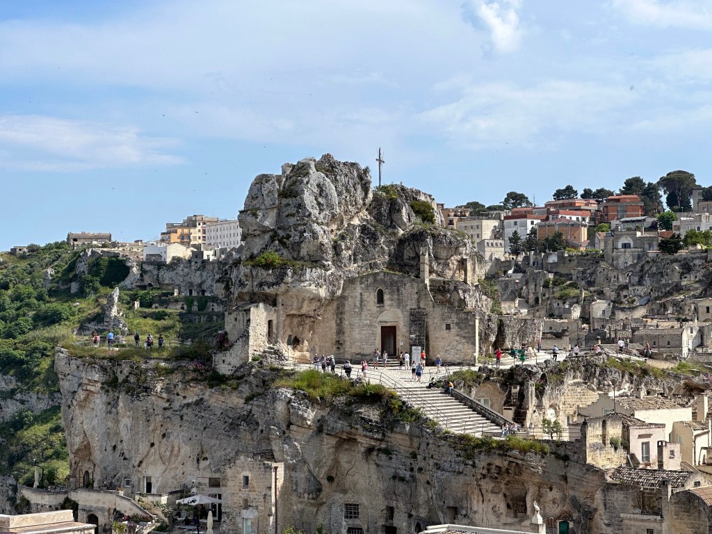
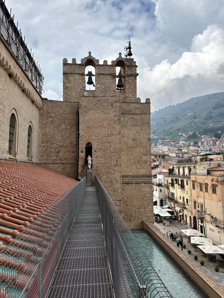
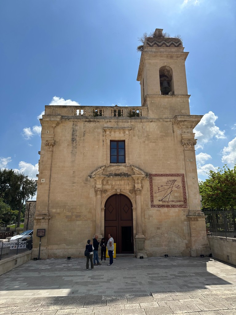
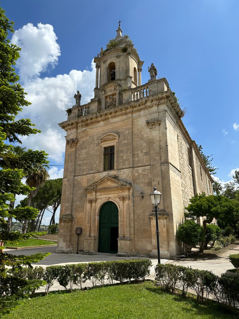
The Romanesque, 12th-century Sant’Andrea church and its distinctive, 13th-century decagonal bell tower.
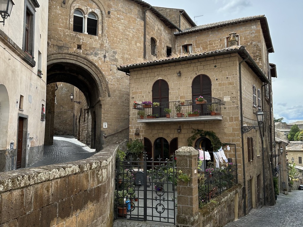
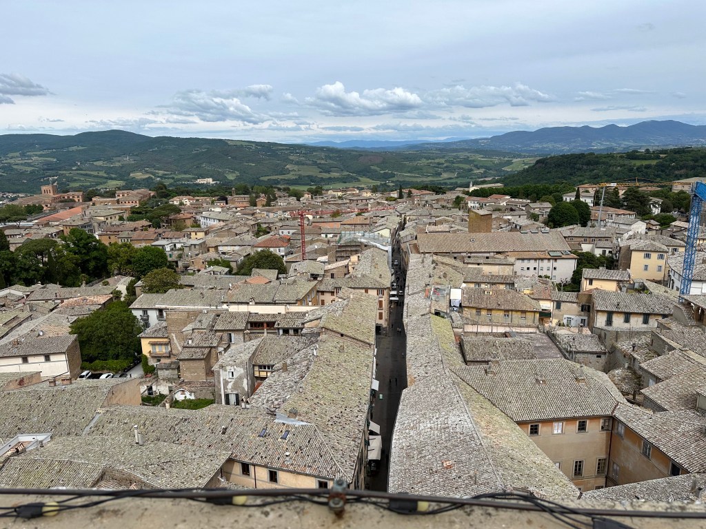
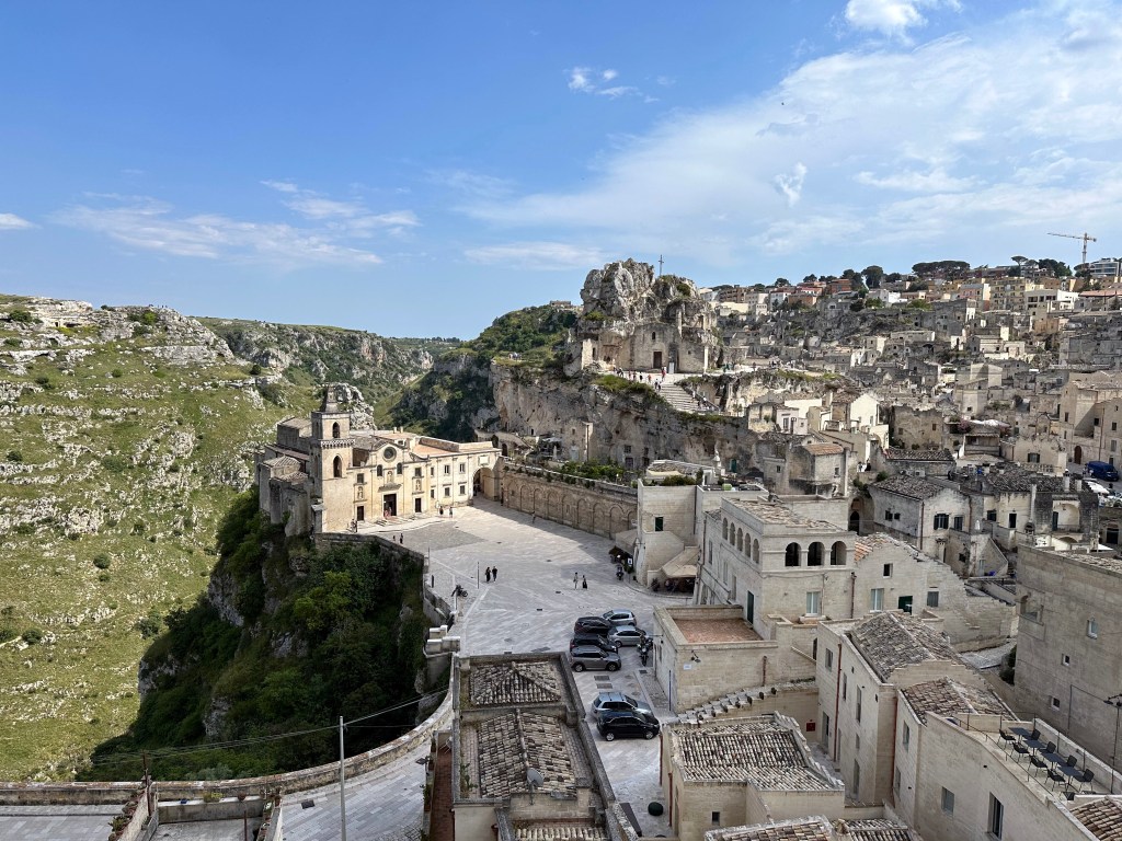
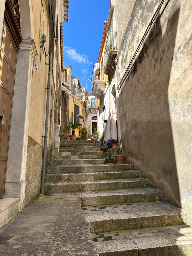
The whole town is build on an escarpment, but the elevation doesn’t stop after you enter the walled town:
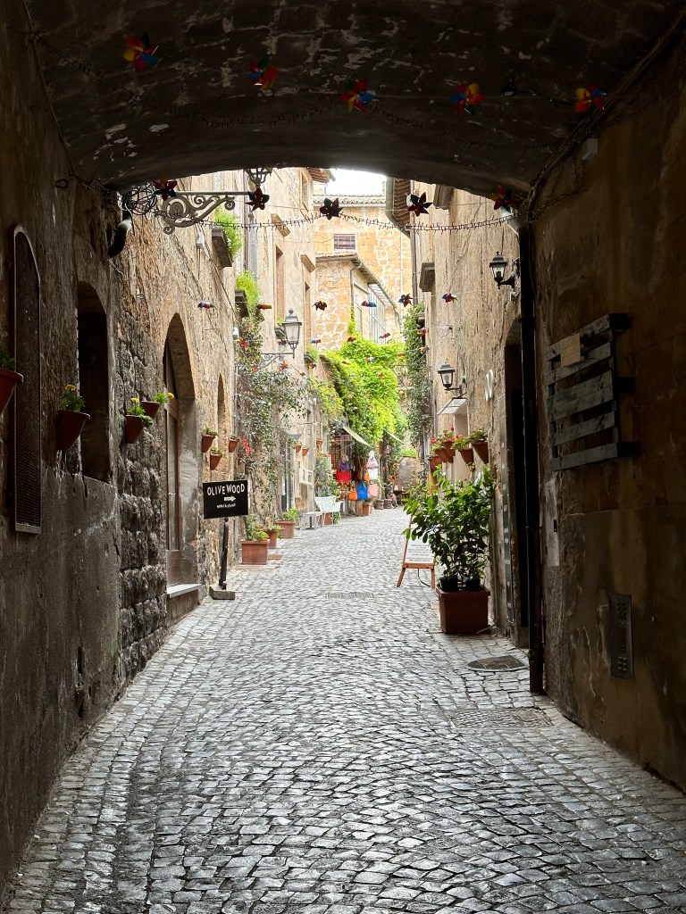
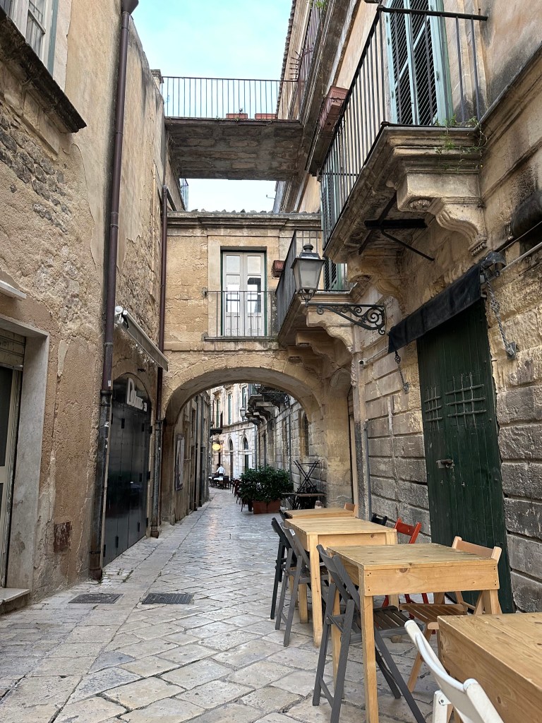
There are pretty cool, medieval warren of streets in some areas:
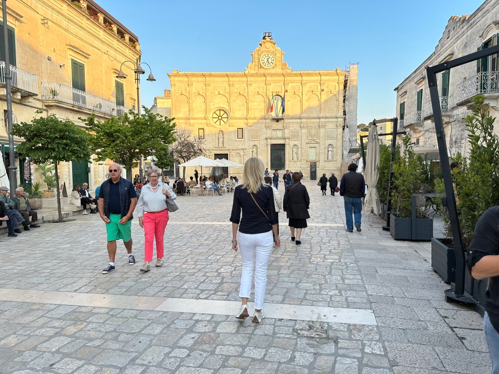
while others are more spaced out, like the street heading to the cathedral:
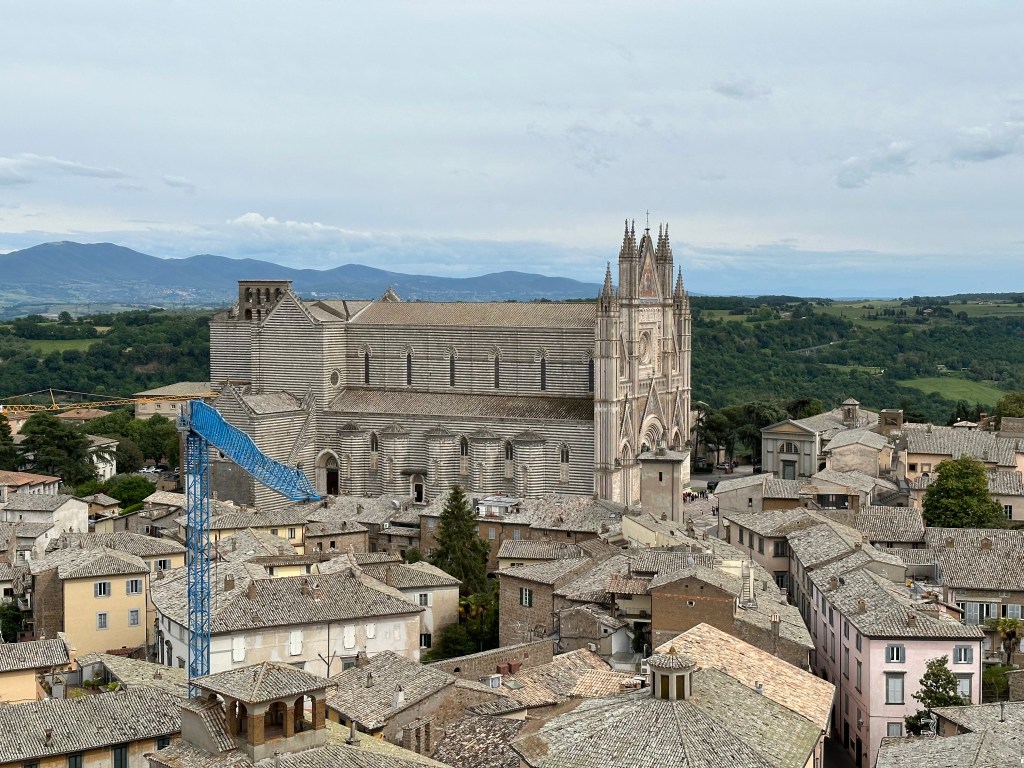
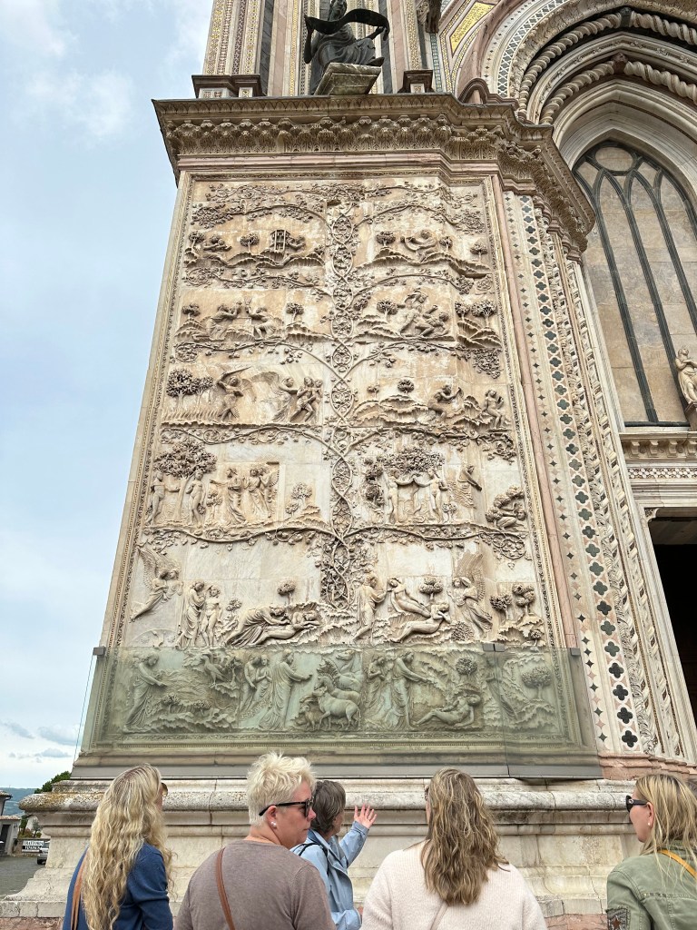
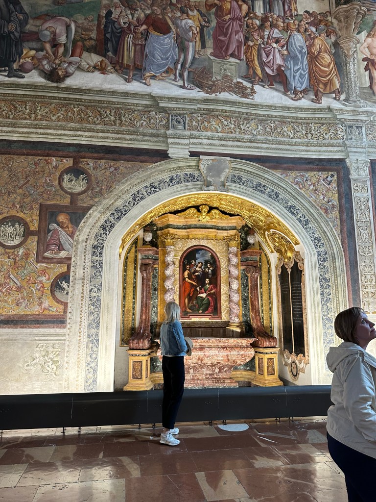
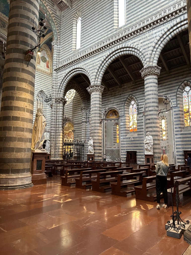
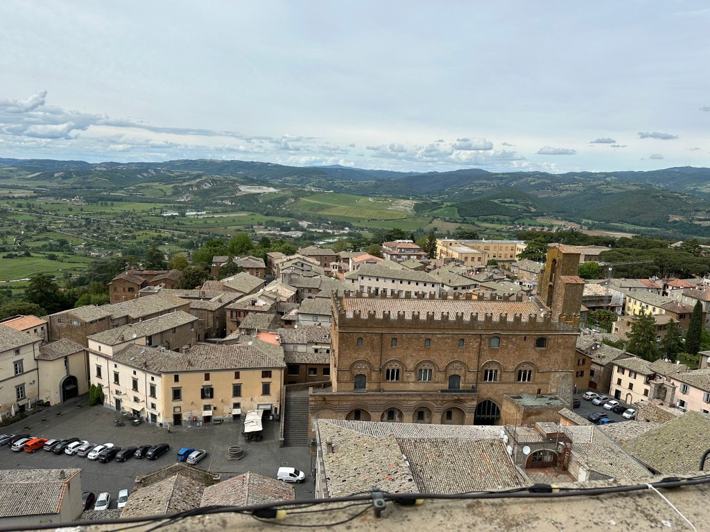
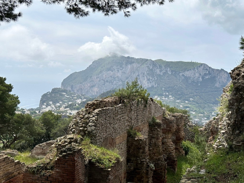
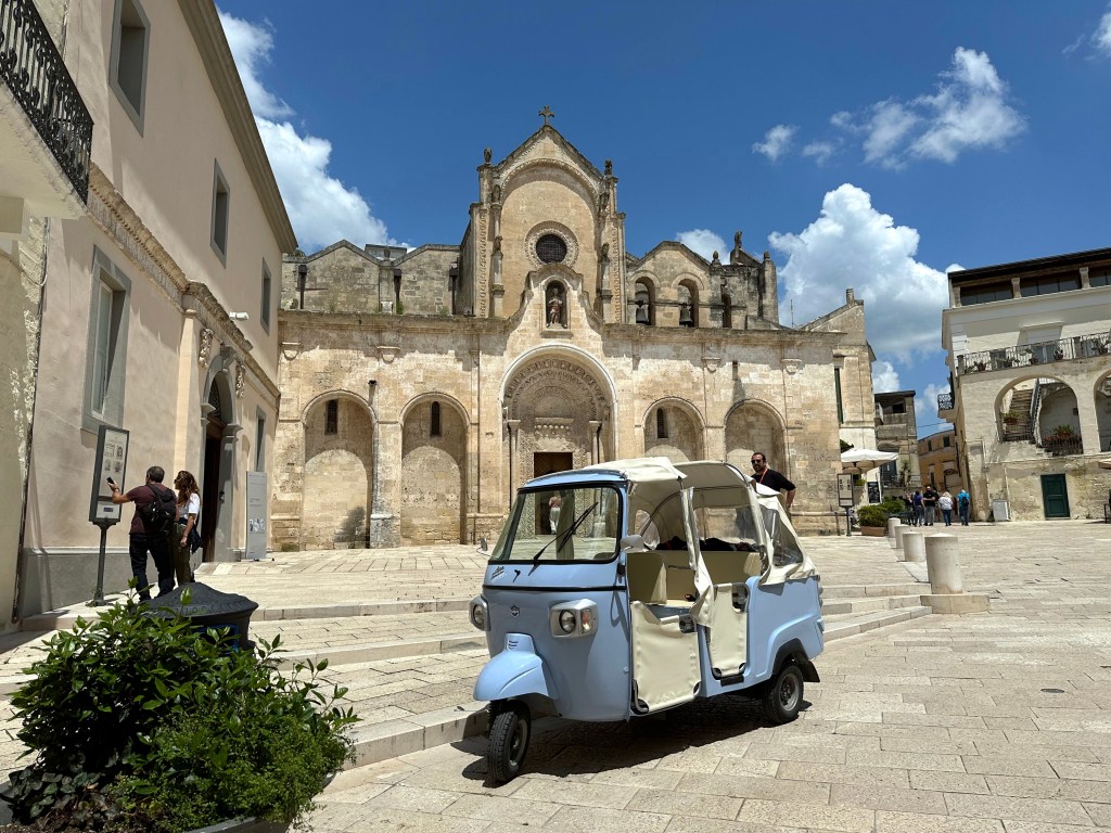
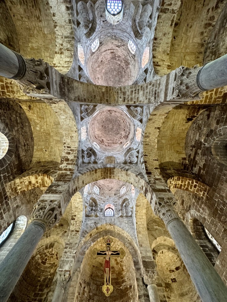
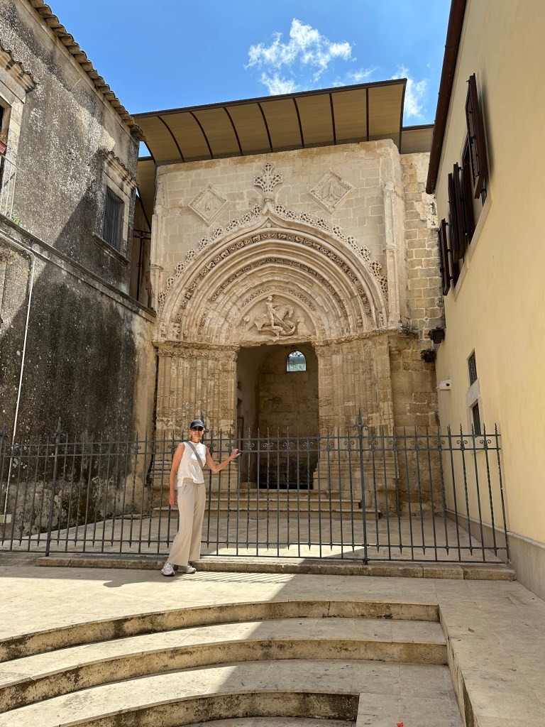
Orvieto’s primary attraction (other than the town-on-the-cliff itself): the 14th-century Duomo di Orvieto (also, the Cattredale di Santa Maria Assunta), seen here from la torre del Moro, which we’ll address below.
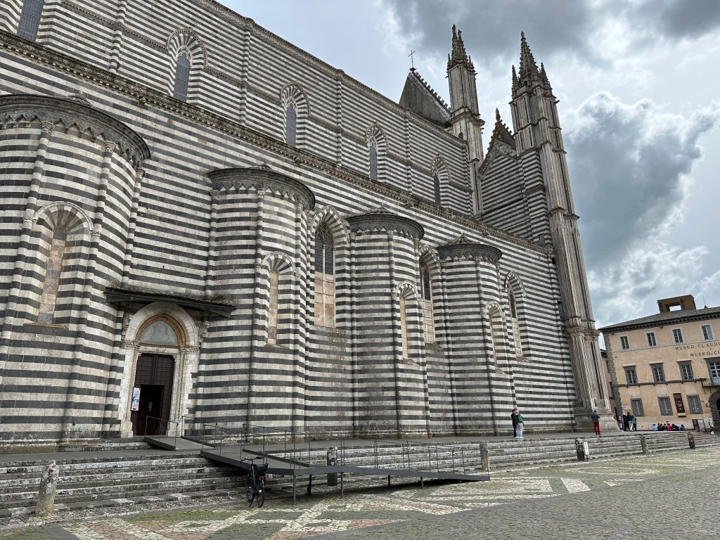
Those familiar with our posts from Cinque Terre will recognize the Ligurian Romanesque (or Pisan Romanesque) black-and-white stacked architectural style of the cathedral:
“The building was constructed under the orders of Pope Urban IV to commemorate and provide a suitable home for the Corporal of Bolsena, the relic of miracle which is said to have occurred in 1263 in the nearby town of Bolsena, when a traveling priest who had doubts about the truth of transubstantiation found that his Host was bleeding so much that it stained the altar cloth. The cloth is now stored in the Chapel of the Corporal inside the cathedral.” (From here.)
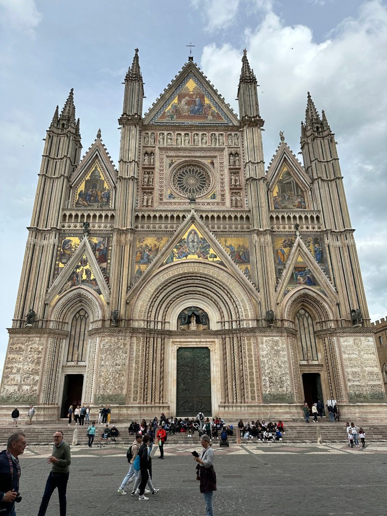
Pretty awesome, polychrome facade of the cathedral – a Late Middle Ages architectural masterpiece (but oddly still not as cool to us as the other polychrome facade we came across one evening in Lucca).
Bas relief of Genesis on the extreme left of the cathedral’s exterior:
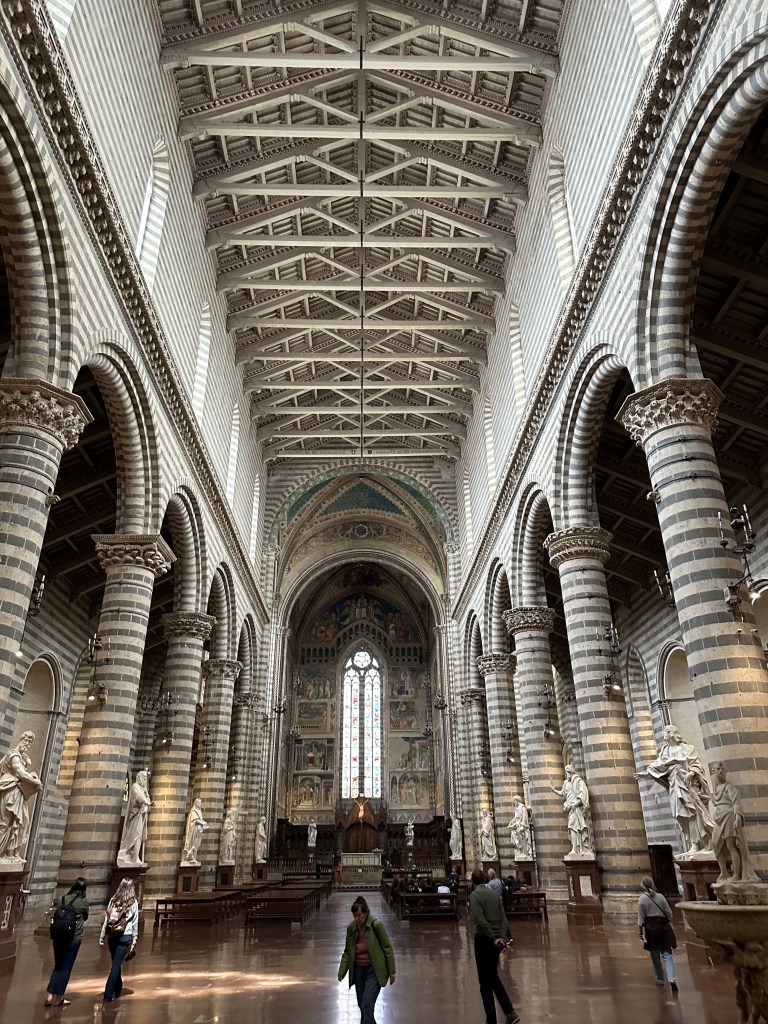
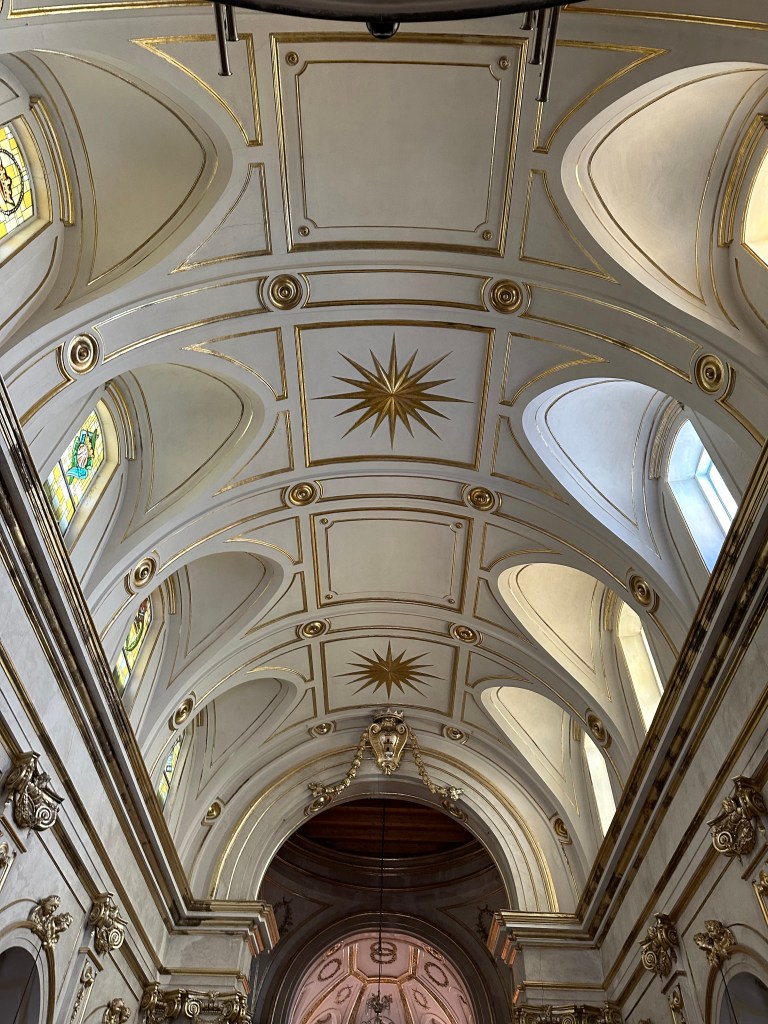
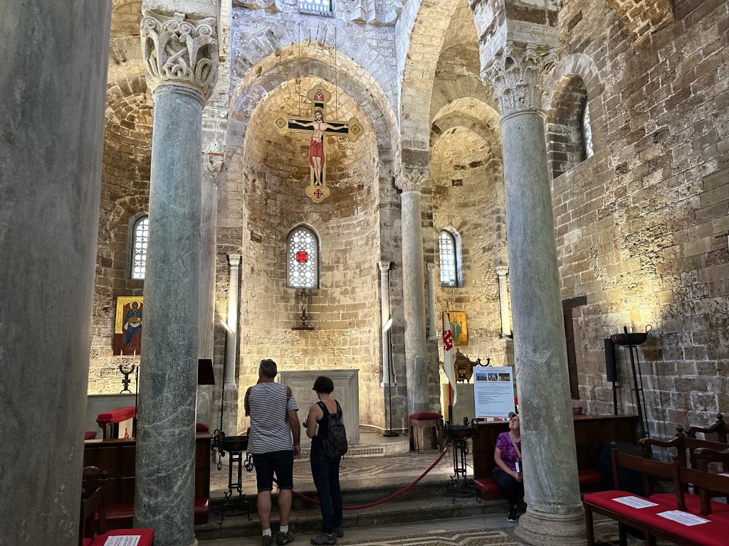
The cathedral’s soaring exterior and trussed timber roof:
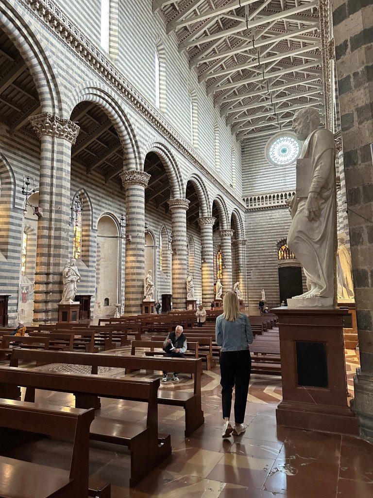
But its size is surprisingly intimate:
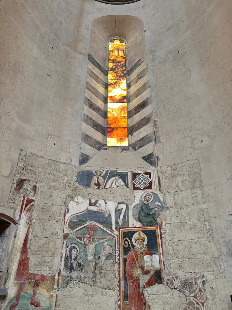
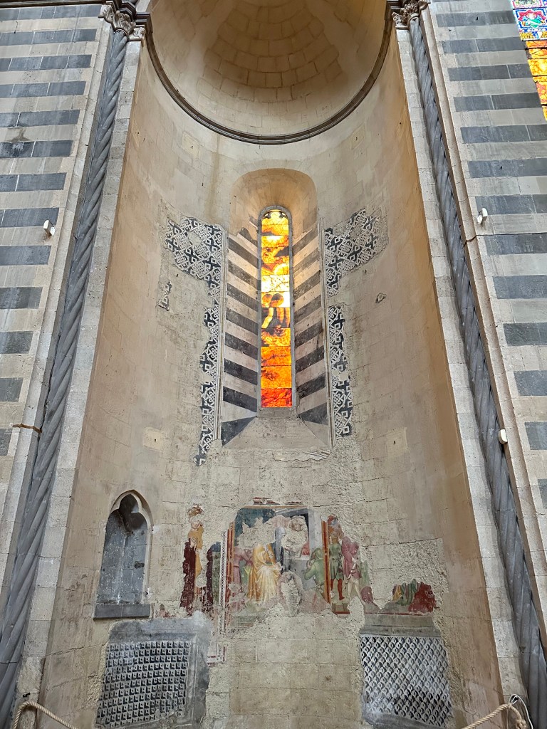
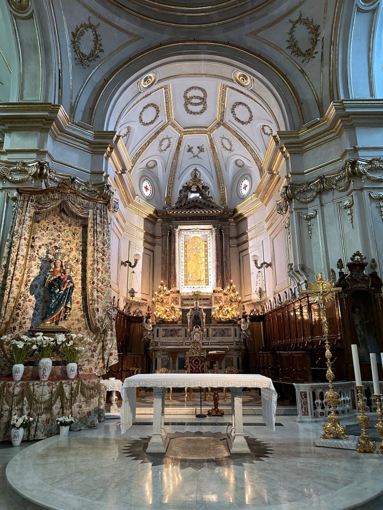
Frescos abound:
As do small chapels:
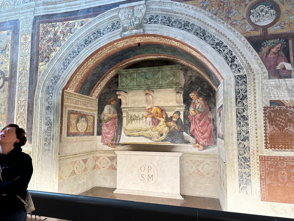
The later, 15th-century Chapel of the Corporal, with some pretty cool vaulting, all completely covered in frescoes (Christ in Judgement, apparently).
The remains of earlier decorations still visible in the cathedral (as well as alabaster windows, which are always of interest):
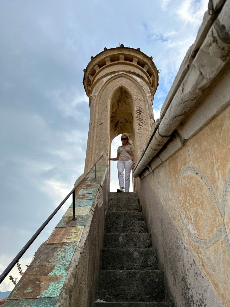
The visit to the cathedral complete, we headed to Torre del Moro (Tower of the Moor) built in 1200 for a view over Orvieto:
A view of the Capitano del Popolo, the Captain of the People (basically the representative head of the city):
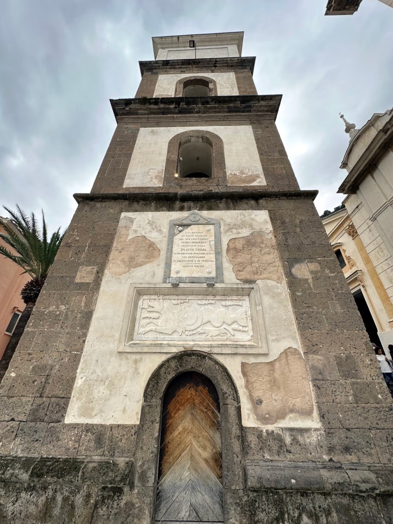
A different perspective on the Sant’Andrea church and its decagonal bell tower encountered earlier when we entered Orvieto:
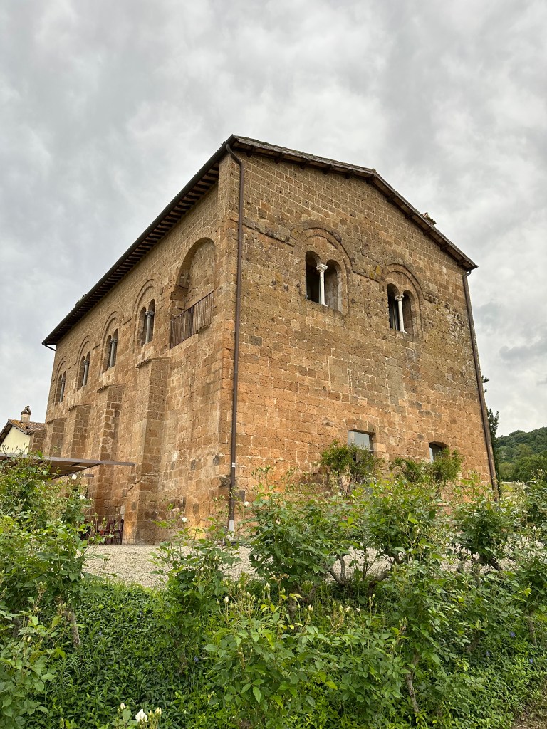
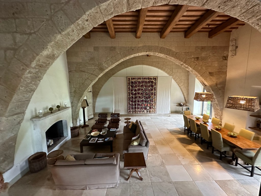
And then on to our lodging for the evening, a location we selected because of its similarly storied history.
“Locanda Palazzone is a historic residence from the medieval period. . . Taking into account its residential typology and its location of relative isolation in the countryside in the vicinity of Orvieto, it can be thought that the building may have been built as a “hospitalis,” in the sense of a hostel for prelates and wayfarers or a post station for pilgrims heading to Rome, since it was precisely in 1300 that Boniface VIII formalized the first Jubilee.”
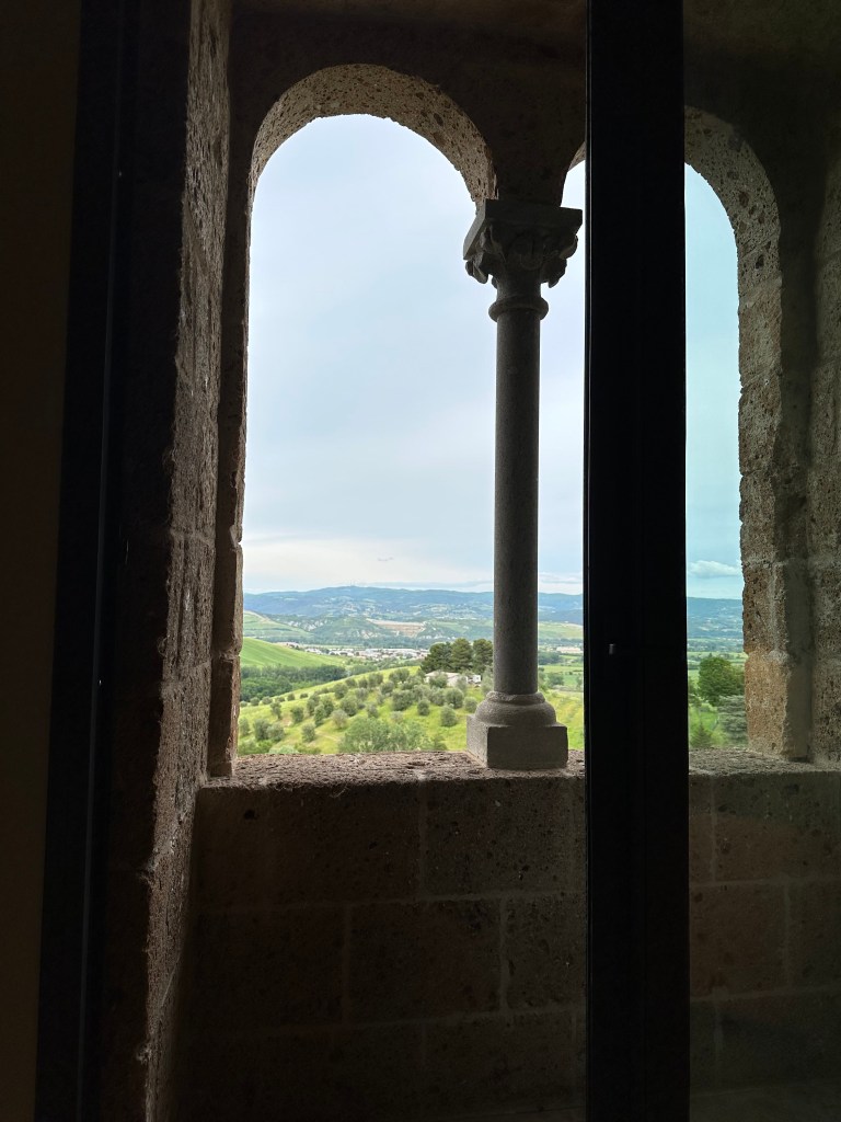
View out the ornate window of our room. . .
which, if you crane your neck out an around. . .
allows for a view across the valley. . .
to Orvieto itself.
Pretty cool place with lots of history.
On to Herculaneum and an amazing time capsule of Roman culture!
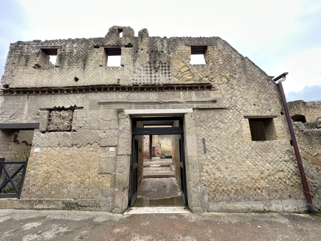
From Orvieto (purely a stopover town – albeit a very nice one – to keep our drive time under control), we headed further south to our next real destination: Pompeii’s red-haired step brother, Herculaneum.
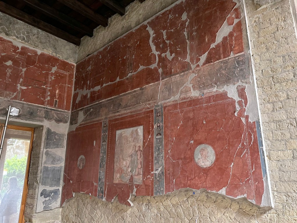
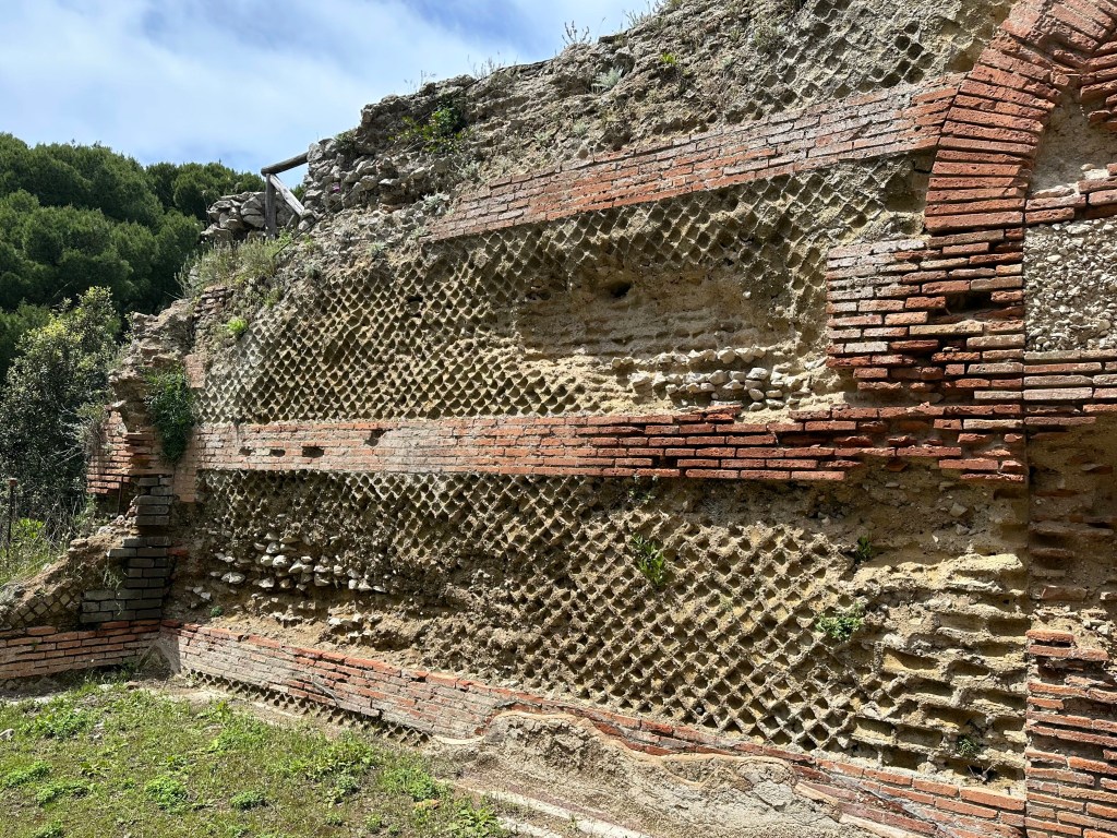
The eruption of nearby Mount Vesuvius destroyed Pompeii slowly with pumice and ash, collapsing roofs but preserving buildings and voids. The same eruption destroyed Herculaneum (an affluent seaside resort town much smaller than Pompeii) but with high-velocity pyroclastic surges, which immediately carbonized all of the organic matter, in addition to instantaneously encasing (and preserving) buildings. As a result, entire structures, mosaics, murals, ceramics, and even wood framing materials and furniture were better preserved than in Pompeii. Plus, fewer tourists; always a bonus.
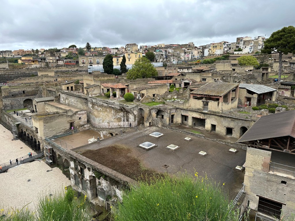
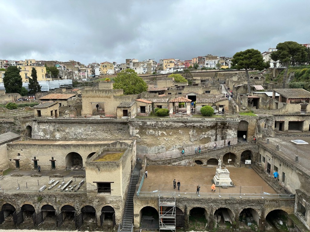
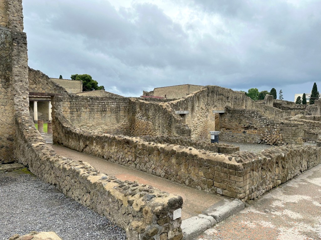
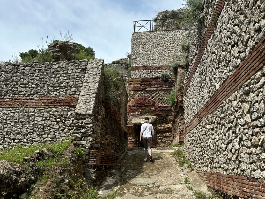
A partial view over Herculaneum; the arches in the bottom left corner were part of the port, when the Town abutted the coast.
Despite the multiple blocks of the town that are now exposed, 75% of Herculaneum still is unexcavated.
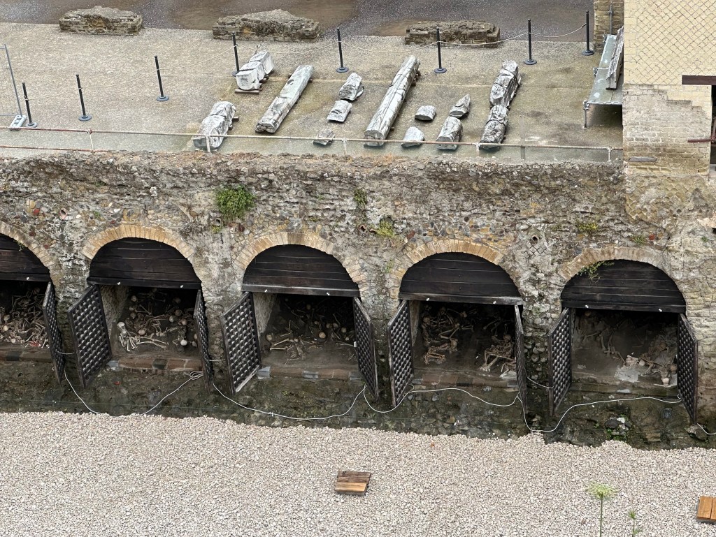
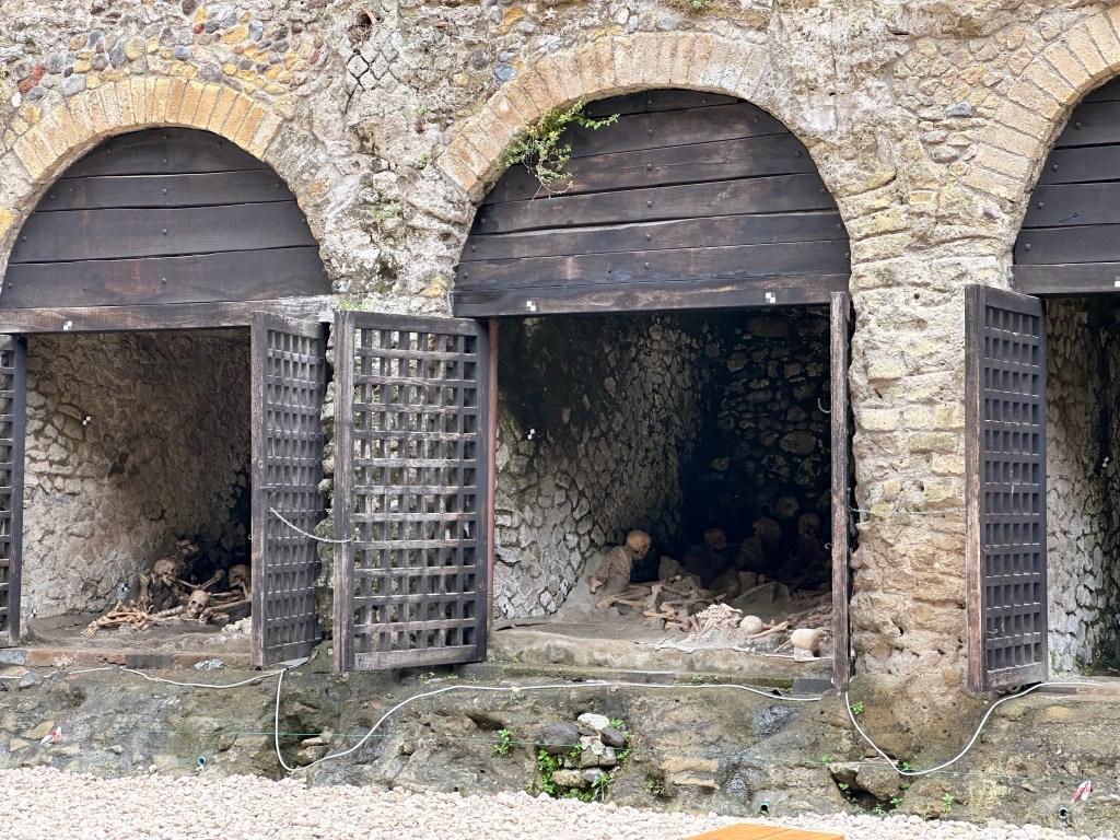
In addition to the preserved building components that we’d see, one of the first preserved elements we encountered were casts of skeletons of the residents who unsuccessfully sought refuge in the port’s boat sheds:
More than 300 skeletons are in the sheds.
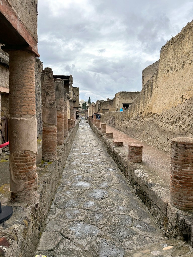
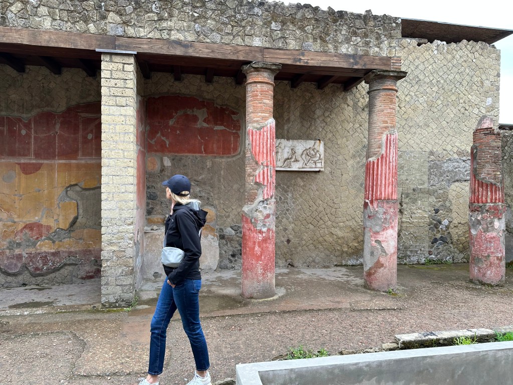
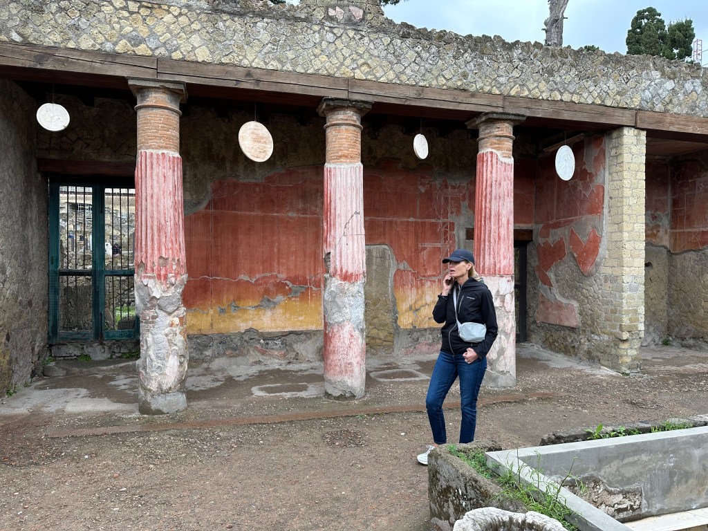
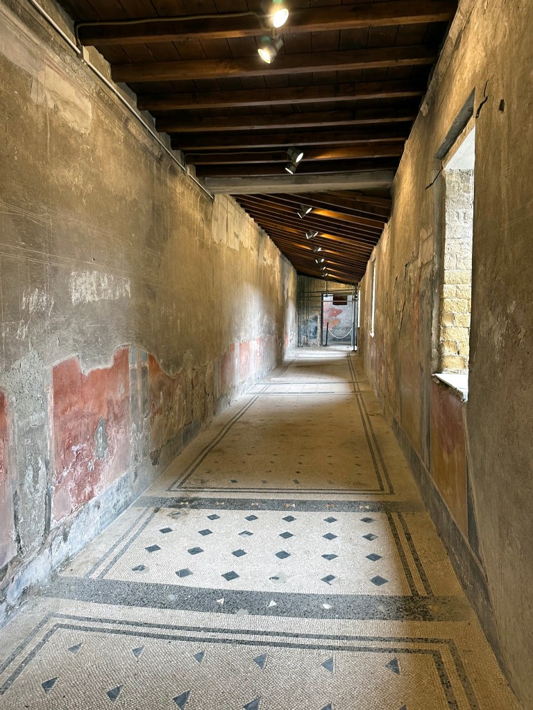
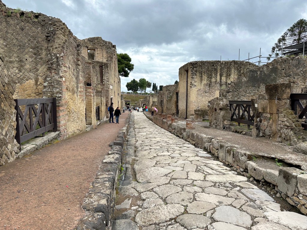
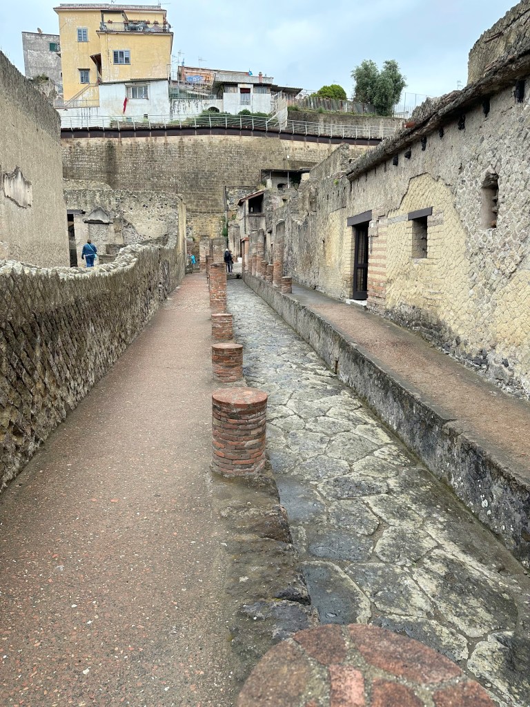
A perfectly preserved Roman street in Herculaneum:
The preserved interiors of houses along the street. . .
including bas relief sculptures found there.
More house facades. . .
Including those with preserved polychrome-painted pillars.
“Built between 27 BC and 14 AD on the panoramic ridge overlooking the marina, this three-story home was decorated with a number of sculptures from the Neo-Attic school, including one with a relief of Telephus (Rilievo di Telefo), son of legendary found of the city, Hercules. The atrium is lined with columns supporting the upper floor, and the spaces between them were decorated with oscilla, or marble discs with reliefs of Dionysus used to guard against evil spirits.” (From here [or maybe from the audio guide Lisa’s listening to. Who knows?])
Aaaaand a snack bar! They appear every block or so; the Romans loved their fast food, served right out of heated, sunken amphora. Pretty amazing, frozen-in-time, cultural nugget.
One of us may have been getting hungry.
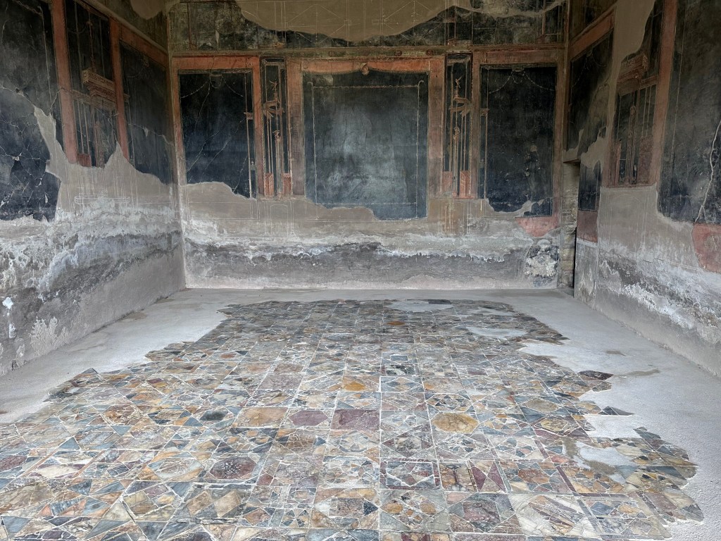
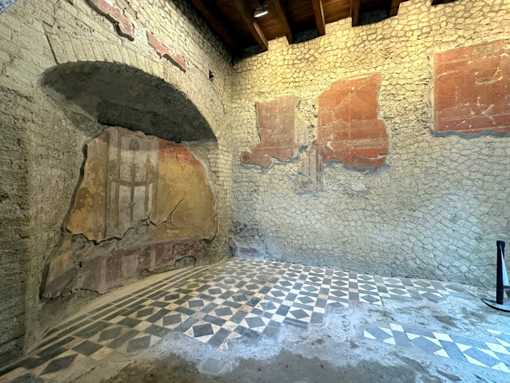
Preserved hallway and mosaic floors in the House of the Beautiful Courtyard / House of the Black Salon:
To wit, the Black Salon (albeit with colorful, inlaid marble floors):
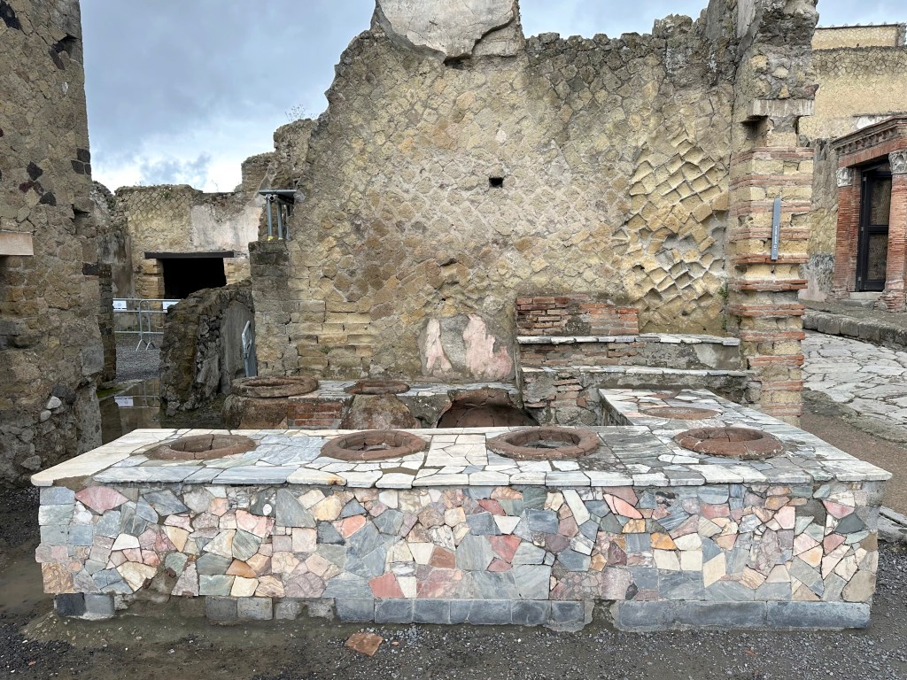
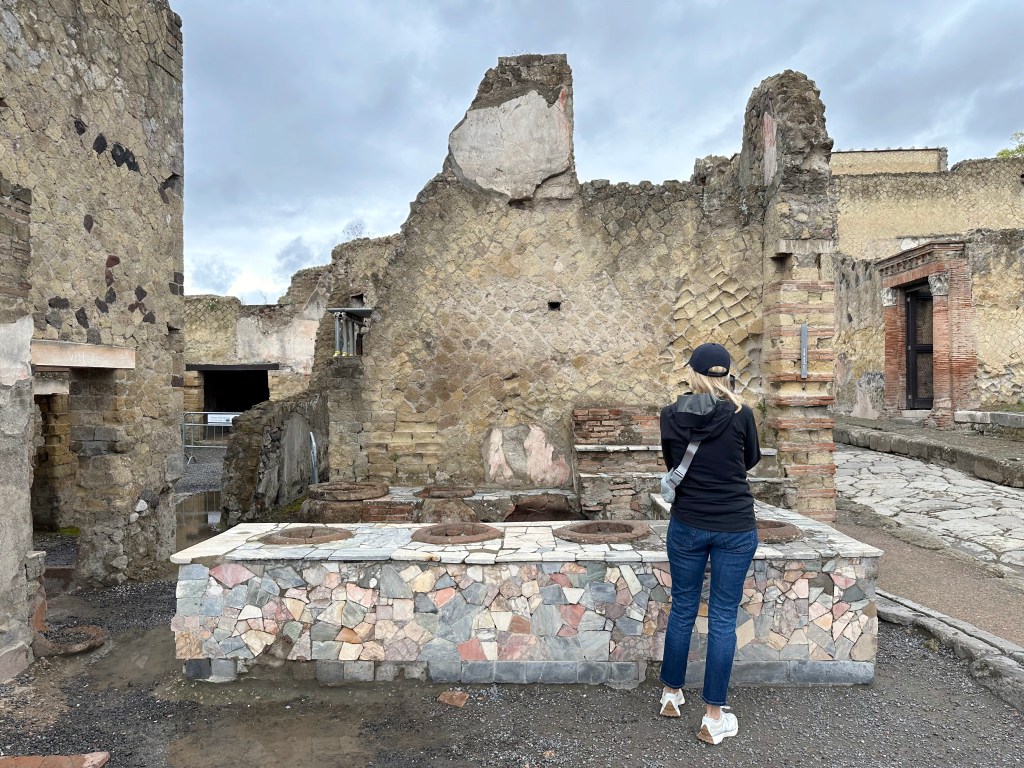
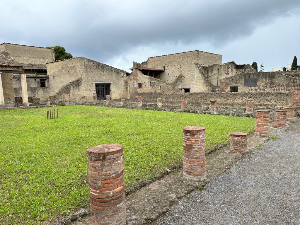
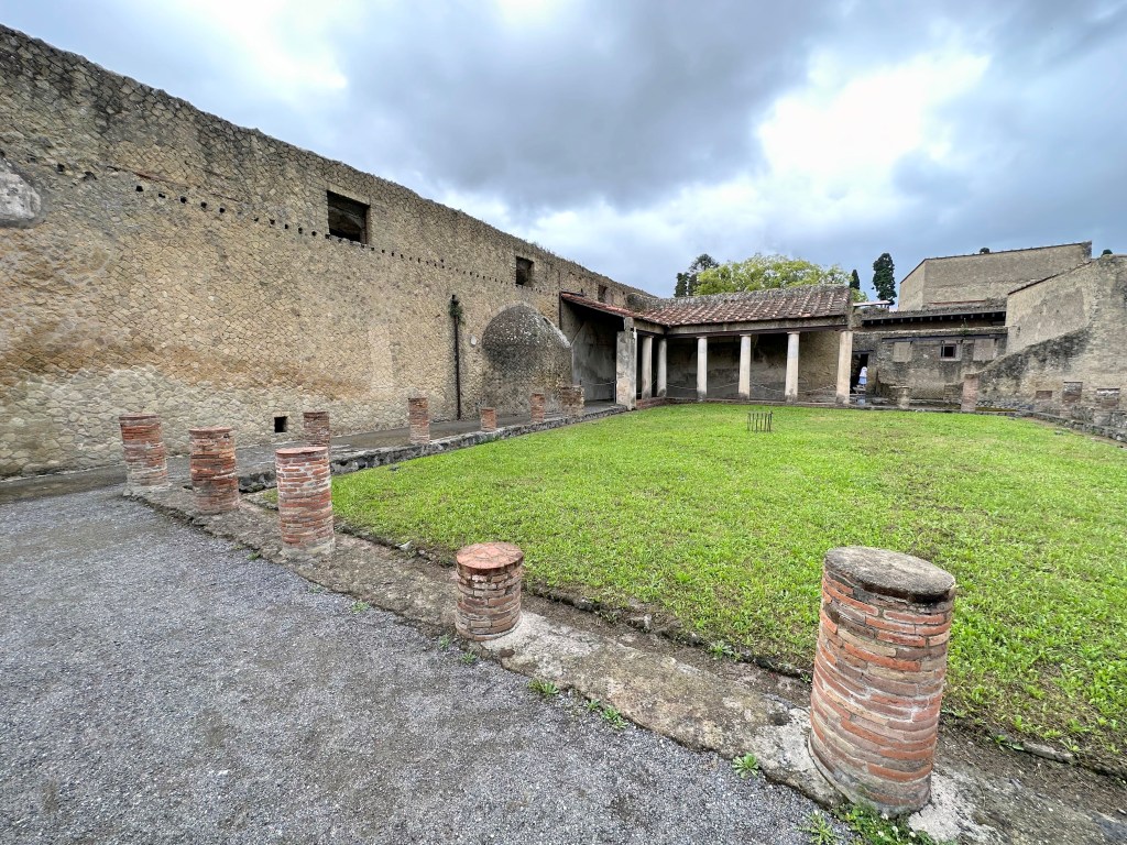
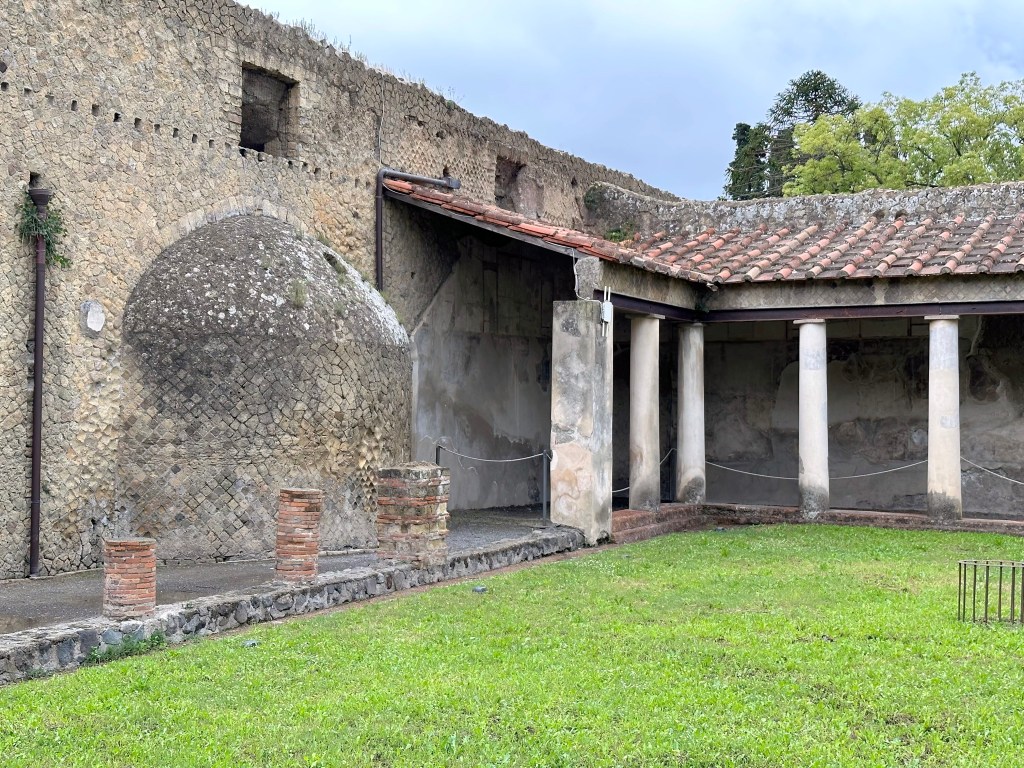
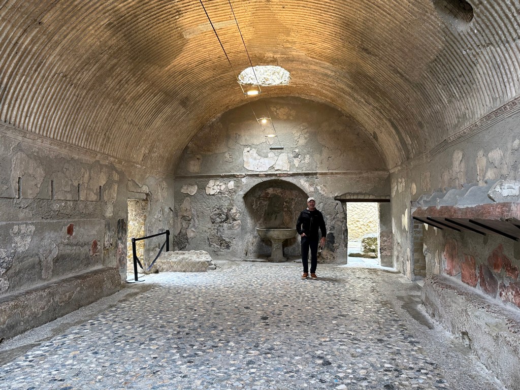
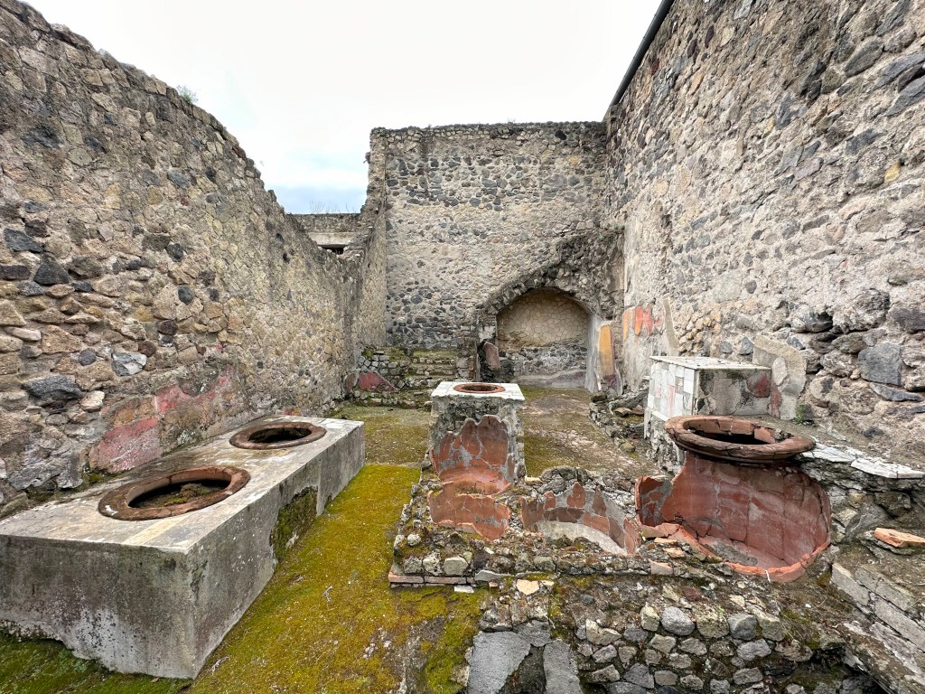
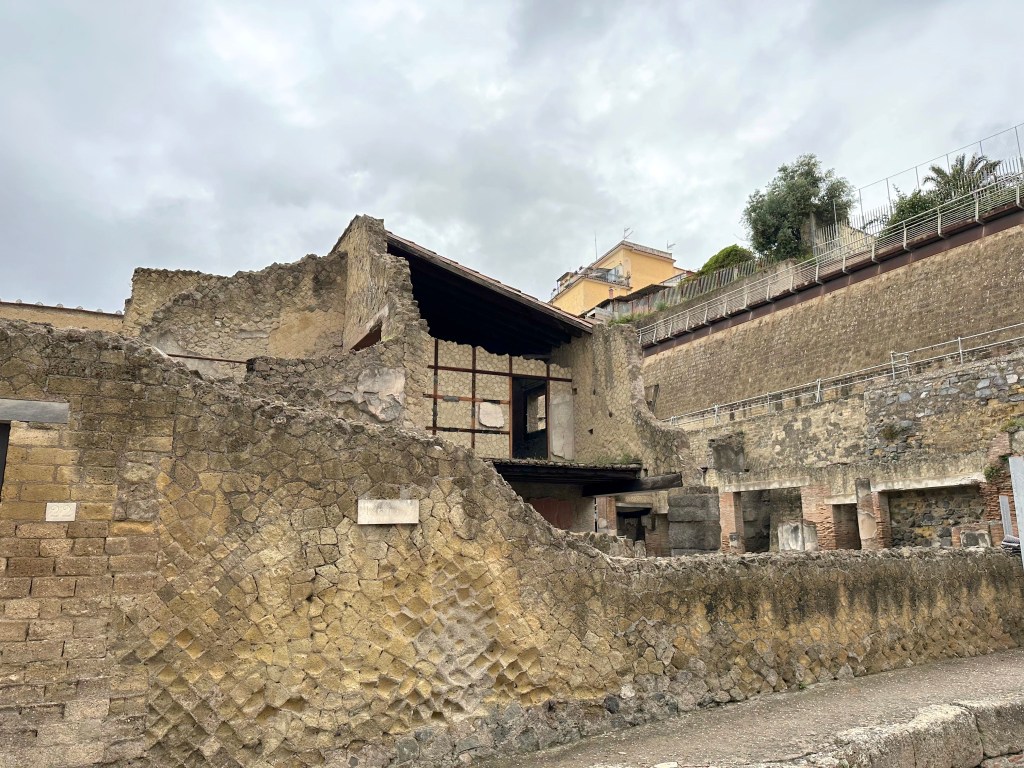
Exterior of Herculaneum’s all important Terme Centrali (Central Baths):
The baths date from the second half of the 1st century BC.
Interior, with niche on the other side of the exterior bulge on the above pic.
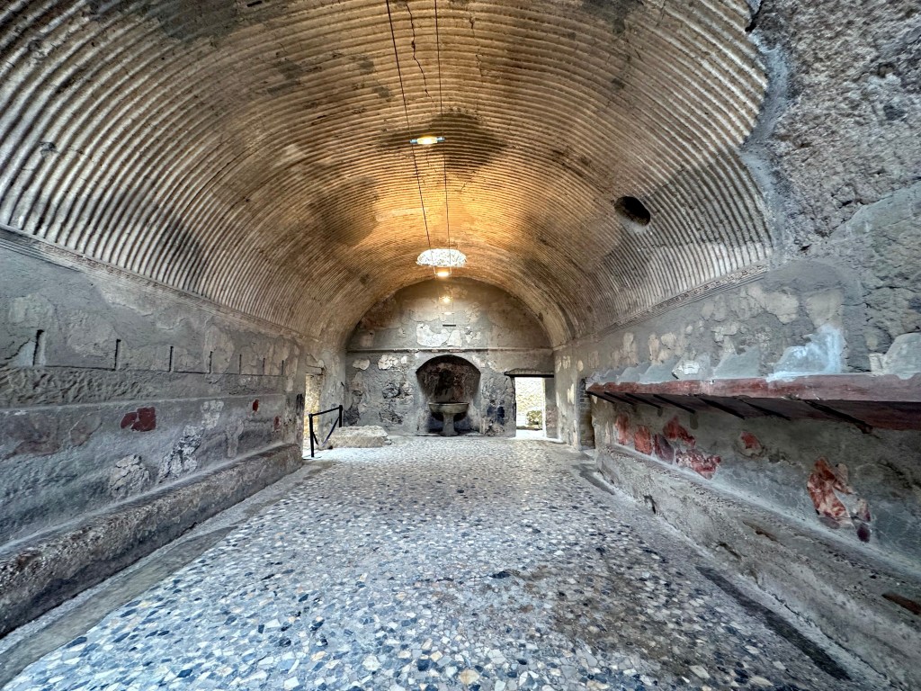
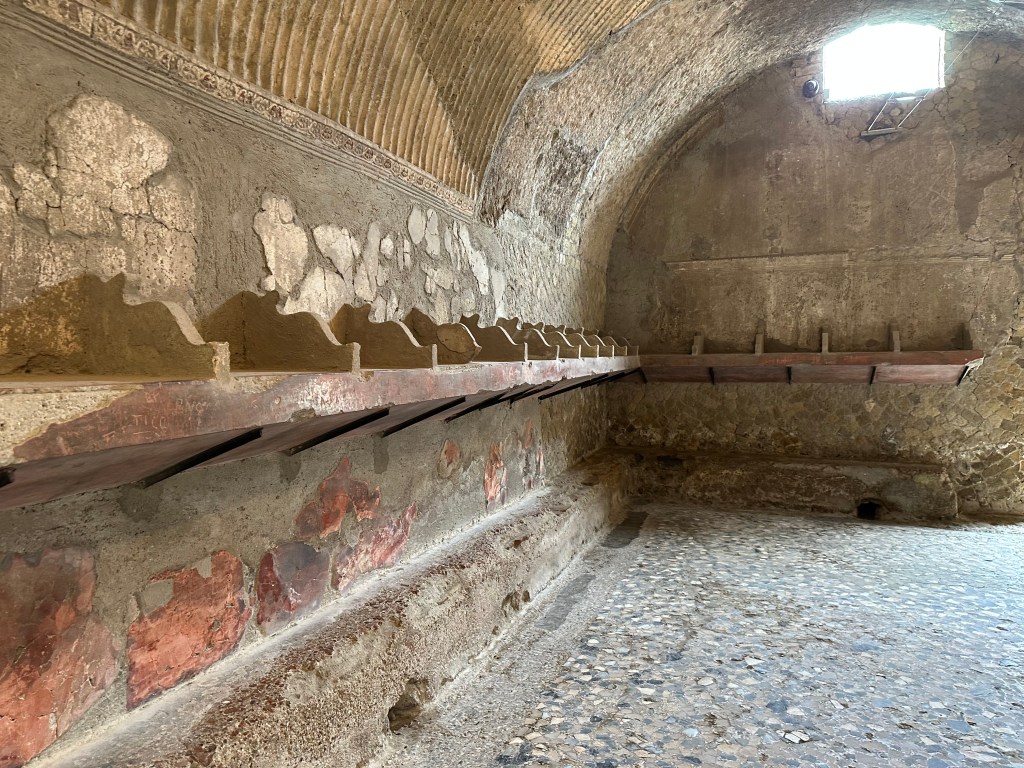
Inside the cavernous Termi Machili – men’s side:
With niches to store your duds:
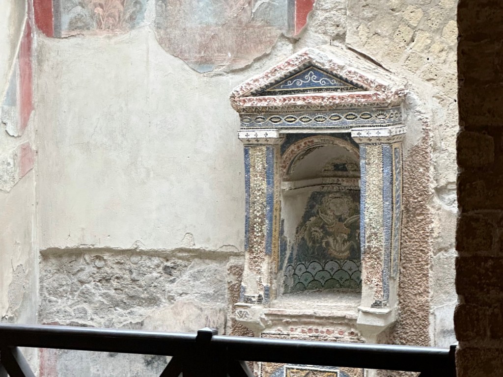
Another house, this time with a mosaic tile ancestors altar:
More street views:
Awesome house facade:
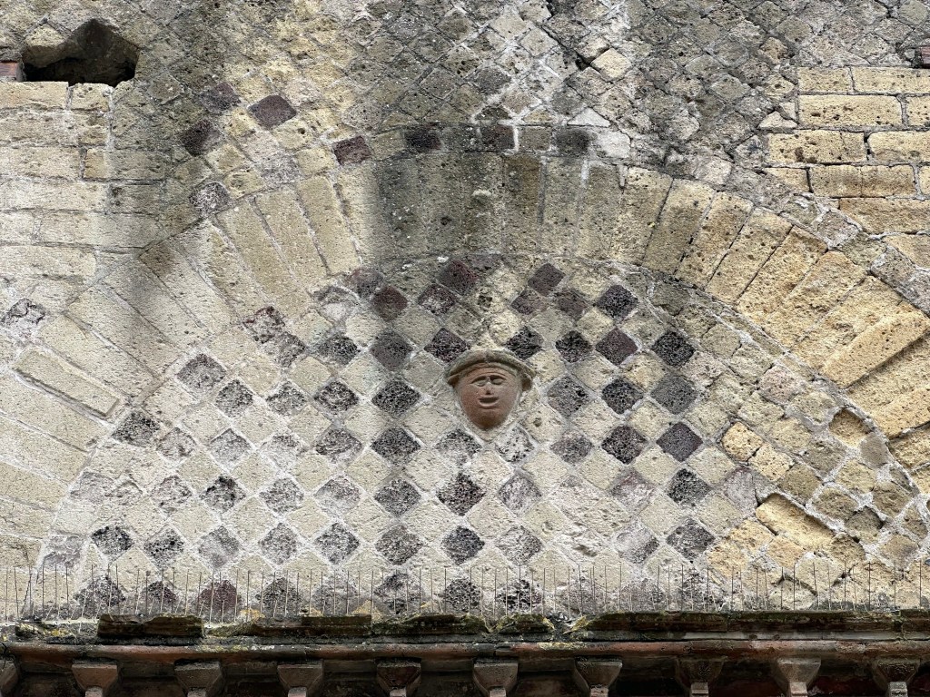
With a happy little guy in the middle of the lunette over the door:
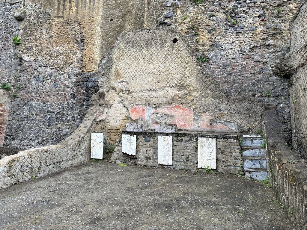
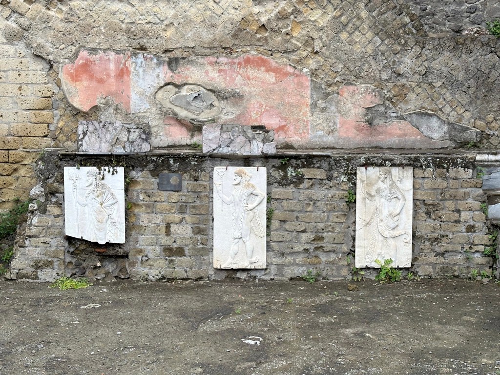
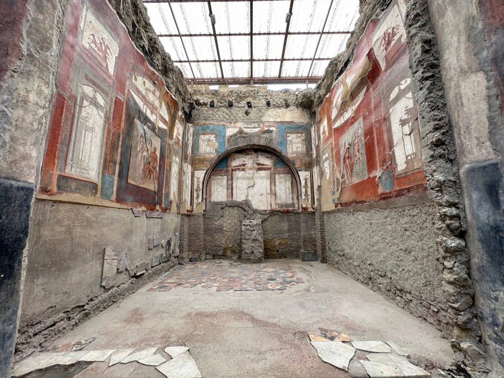
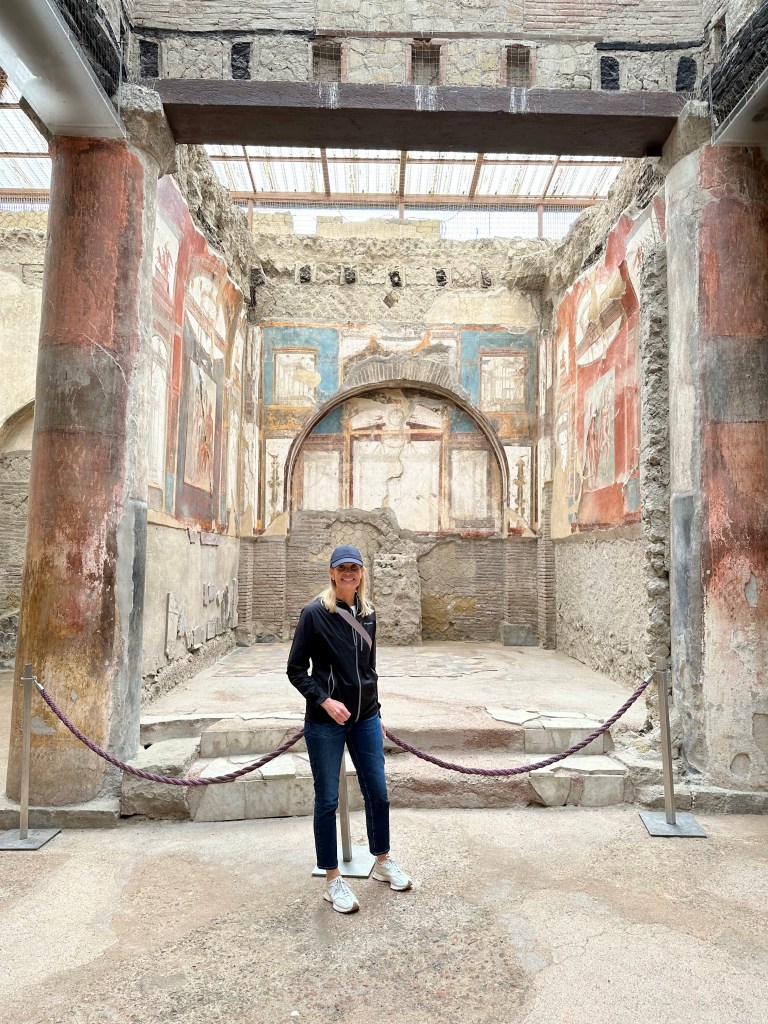
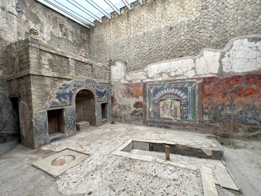
The incredibly preserved reception or audience room of the College of the Augustales, the gathering place for the cult of the emperor. Freakin’ unbelievable.
“This magnificent square structure was seat to the College of the Augustales, free men who were devotees of the cult of the Emperor Augustus. Columns, arches, cocciopesto floors, and two splendid frescoes: on the left wall, there is a depiction of Hercules entering Mount Olympus accompanied by Jupiter, Juno, and Minerva; the fresco on the right wall depicts Hercules wrestling Achelous. The skeleton of the building’s custodian was found in his quarters, laid out on the bed.” (From here.)
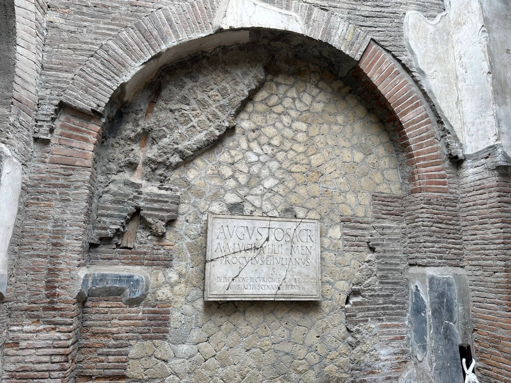
Carved stone plaque honoring Emperor Augustus by a pair of notable citizens who funded a civic feature in town. The plaque reads: “Sacred to Augustus. Proculus and Julianus, sons of Aulus (of the Menenian tribe), dedicated this.”
Around the corner? Another snack bar!
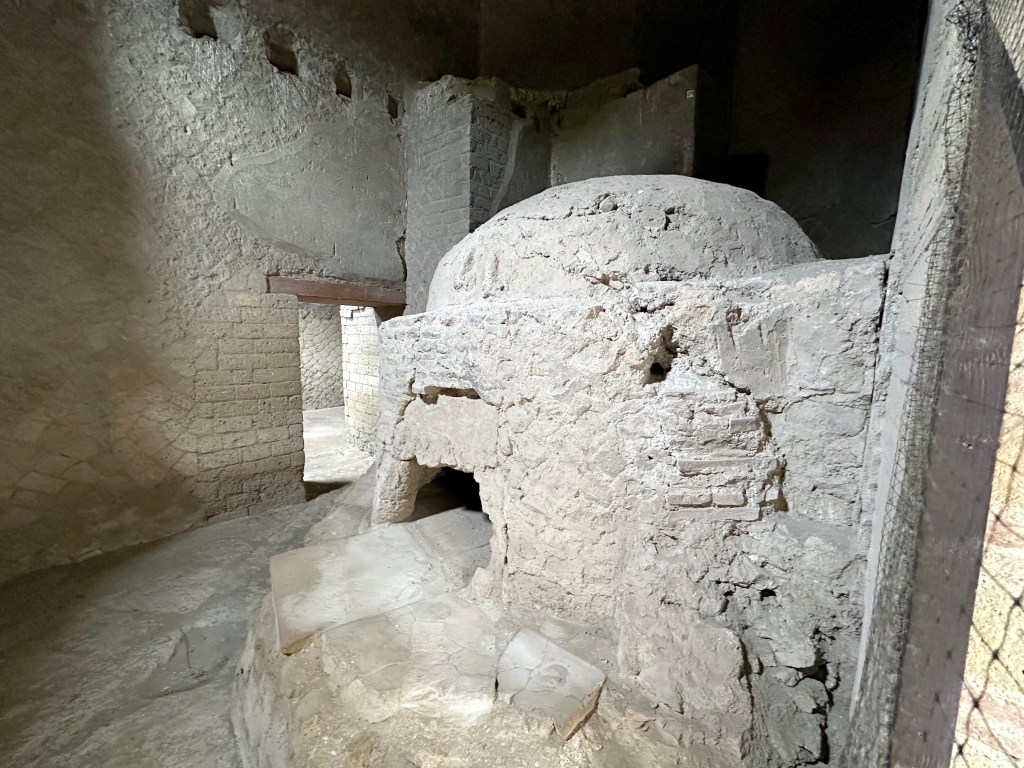
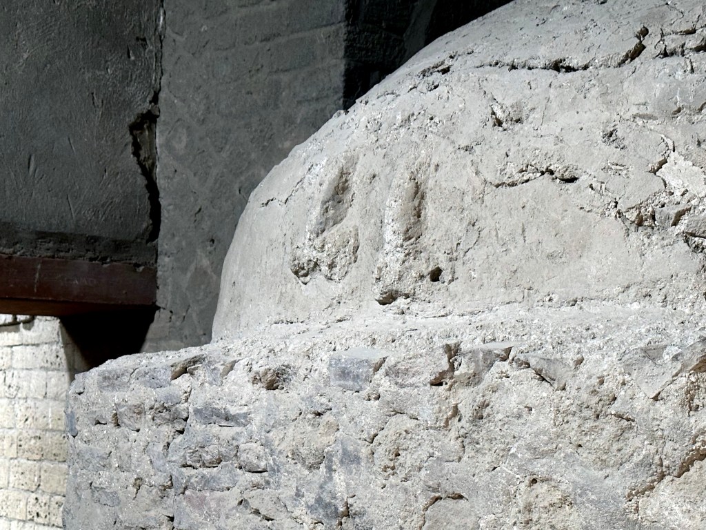
A bakery in Herculaneum, with its large bread oven:
And, just was we saw next to the gate in the stone wall in the Roman ruins of Empuries in Catalonia, two prominent phalluses right above the door to this oven. (Maybe they specialized in baguettes hahahaha!)
Another preserved, Roman-engineered street, complete with textbook cambering.
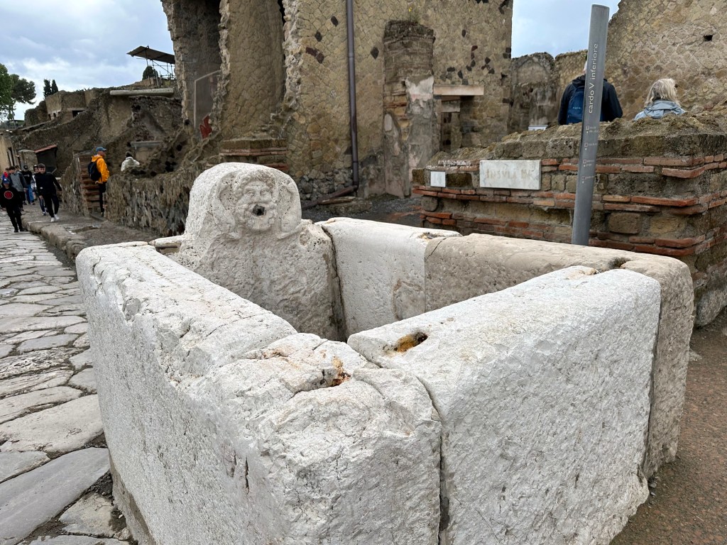
One of many preserved fountains / wash basins scattered throughout town:
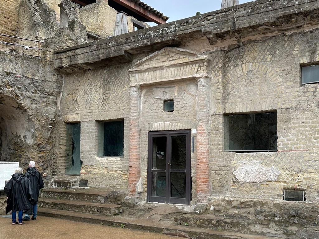
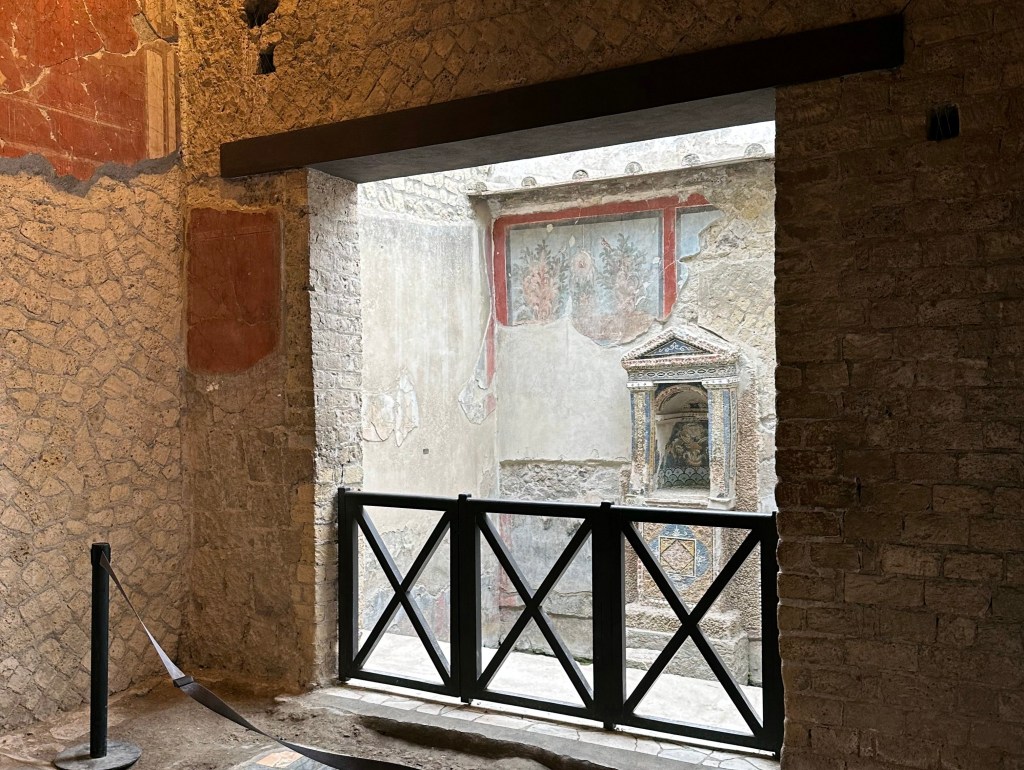
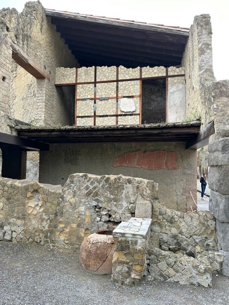
Preserved second floor residence over a shop:
Still-vibrant, ornate, painted walls preserved by Vesuvius’ pyroclastic surges, which sealed the buildings and their interiors:
Yet another colonnaded street; due to materials from the eruption and over time, Herculaneum lies tens of meters beneath the modern town above:
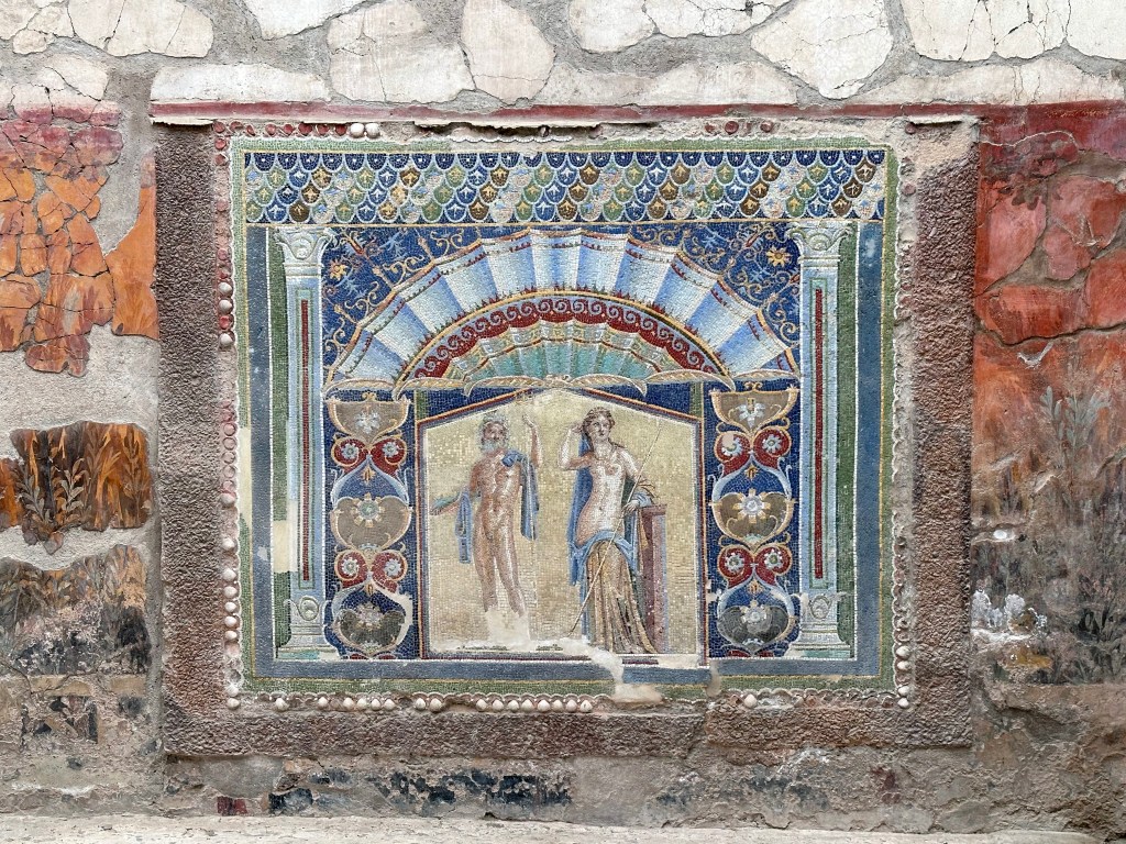
The “House of Neptune and Amphitrite,” so called because of its exceptional polychrome mosaics. The best are in the triclinium – a dining area defined by a three-sided dining couch, below in the middle.
The house’s namesake mosaic of Neptune and Amphrite on the eastern wall of the triclinium, visible from the street:
“Neptune, the god of the sea, is recognizable by his trident, his wild beard, flowing locks, and blue mantle, while Amphitrite (in Latin as Salacia), semi-nude, appears as the queen of the sea, adorned with a diadem, necklace, arm band, and earrings. Neptune fell in love with Amphitrite, but she initially fled him. With the help of Delphinus, the dolphin, Neptune found her. Delphinus was rewarded by being turned into a constellation, and Amphitrite became the goddess of the sea. Even though the artist was working with small stones, he still artfully conveyed Neptune’s musculature and Amphitrite’s shapely curves. In both cases, the drapery responds to the shape of their bodies. He stands in a contrapposto pose, suggesting a sculpture of a god or athlete might have been the source for his pose, while she leans against a pillar, indicating that the inspiration for this mosaic was a statue—perhaps, one of Venus. [5]
The gods stand beneath a fan-like light blue sail, under which are scrolls decorated with a red wave pattern, and elaborate vegetal scrolls—composed of red, green, Egyptian blue, and white tesserae, which appear to support the lintel and conch. The mosaic is framed by a border of shells and pumice, reinforcing the mosaic’s maritime theme. The mosaic was inserted into a background of garden paintings, which date to an earlier decorative phase.” (From here.)
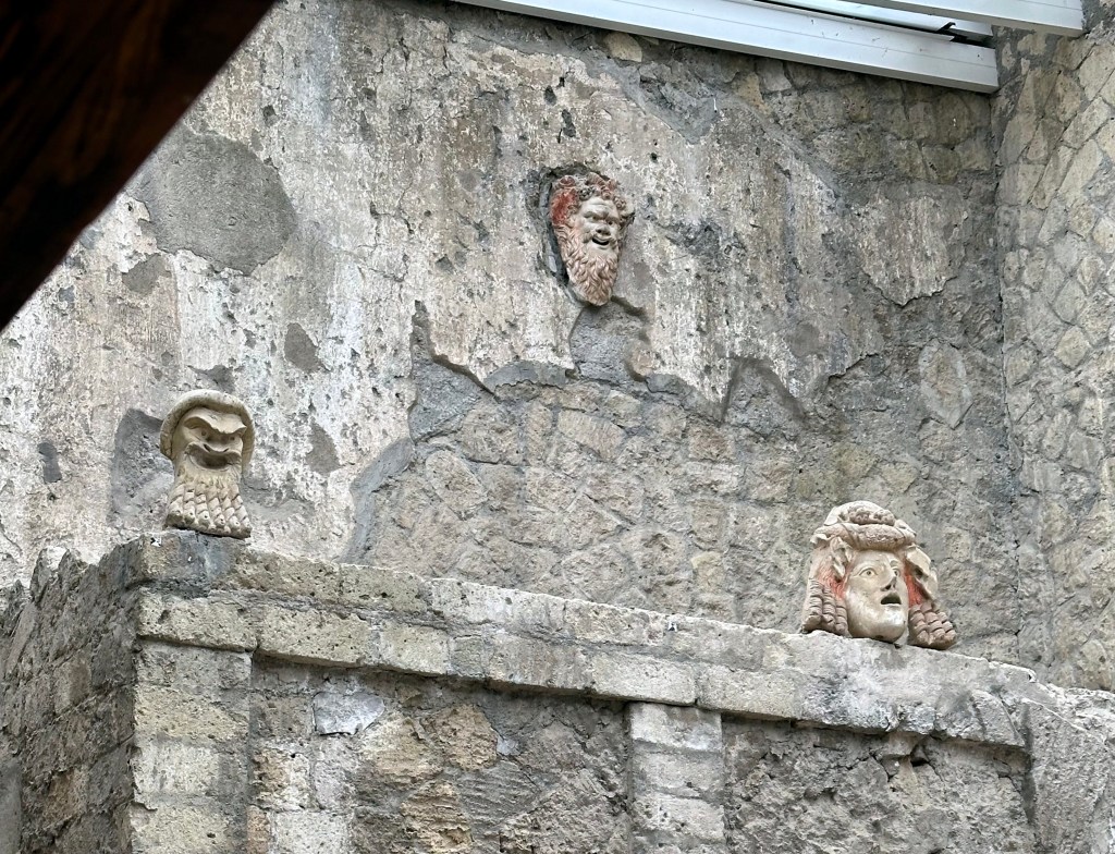
And, above the nymphaeum on the north wall lie three theatre masks: comic on either side and tragic in the center:
Visit complete!
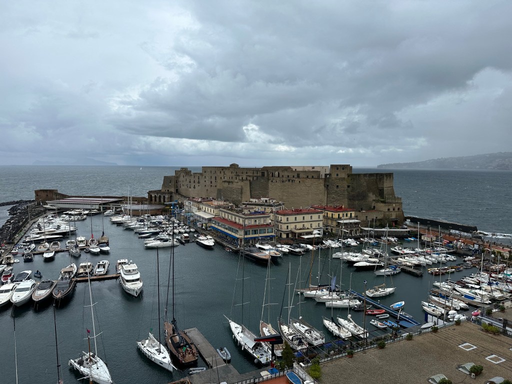
From Herculaneum, we drove about 20 minutes to our location for the night: Naples.
We had NO interest in Naples as a town (city) to visit, but logistically it made sense to stay there.
But because we’d heard horror stories about the traffic in town (the pic above is a mild example; we were most concerned not with an obstacle-course of a narrow street to navigate – which we do in Europe all the time – but in the no-rules battle royale among drivers that takes place on Naples busy thoroughfares), we chose a place on the very edge of the city next to the coast so we didn’t need to venture too far in from the highway.
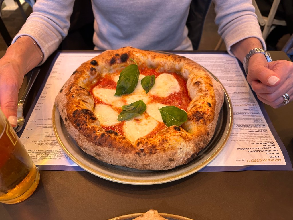
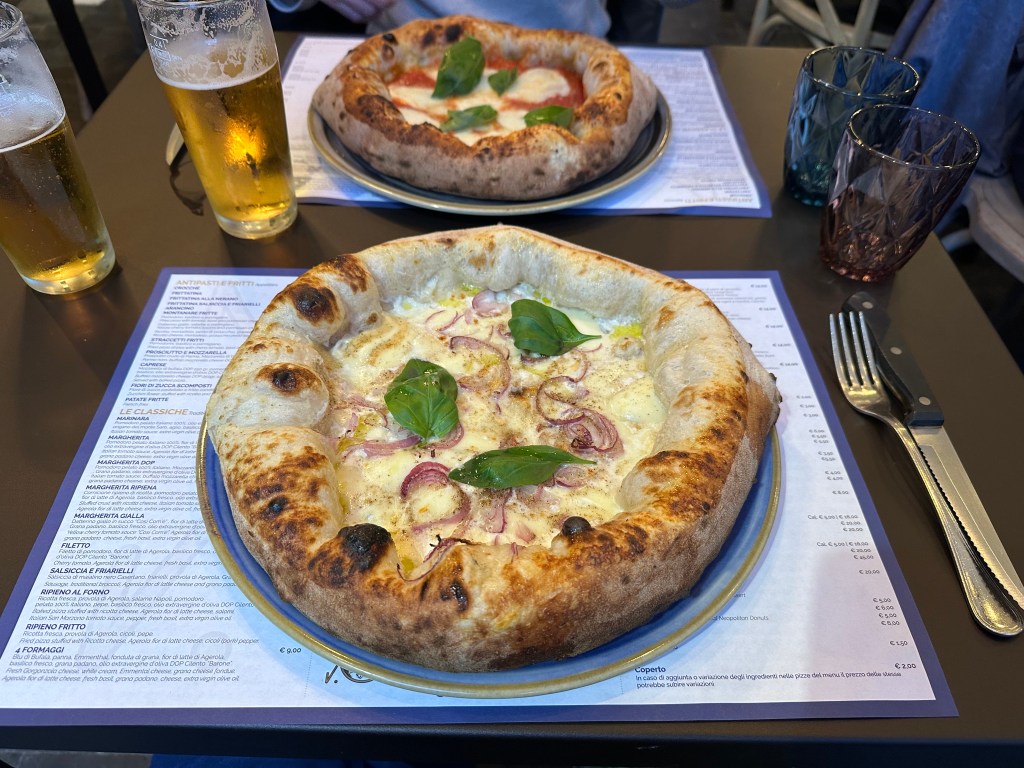
The only objective that Lisa had for Naples was to snag some Neapolitan pizza, so after wandering around in the rain to check out the neighborhood for a while, we focused solely on that.
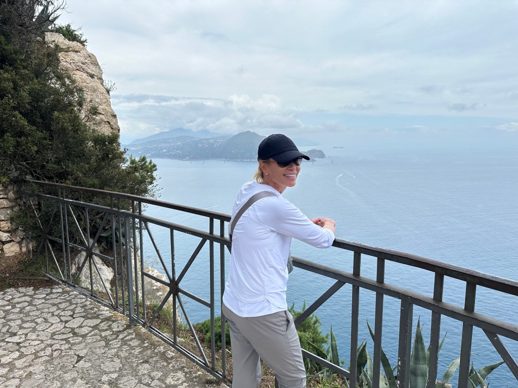
From Herculaneum (and Naples), we originally had planned to head next to Sorento on the Amalfi Coast, and then to Positano. A couple we met in Botswana on safari in 2018, who’s travel style is almost identical to ours, and who we keep in touch with, advised against this. They travel in Italy at least twice a year, and had a lot of insight into the Amalfi Coast, in particular. As far as Sorento went, they found this to be devoid of charm and recommended instead that we spend a few days just opposite that town, on the island of Capri. So we cancelled our Sorento reservations (this discussion occurred during our planning phase) and found a cool place on Capri instead, which is where we headed next. (We’ll cover the Positano issue in the next post.)
Our only experience with Sorento came from our parking and the ferry dock to Capri, since both took place there. Parking was a trip for one of us and deeply traumatic for the other. After careening down a series of urban switchbacks from the center of Sorento down towards the dock and passing a couple of parking lots on the way (that we sped on past because we had no idea how much further ahead the ferry dock actually was, and we had luggage), we passed a portal leading to a cave in the face of the high cliff that abutted the road we were on. In the cave resided a few piggyback car lifts – a garage! Of sorts. But from the cave portal, we could actually see the ferry dock down a hill. Perfect! Thought one of us. WTF?!? Responded the other when the first suggested we just park there. But park we did – kind of.
The WolfeStreetDriver left the car in neutral (it was a stick), got out, and ran over to talk to the cave people. But he didn’t turn the car off or apply the parking break. As a result, the rental car – with the WolfeStreetPassenger still in it, began to drift down the steep decline straight to the ferry dock and, uh, the ocean. This almost led to a coronary by the passenger at the time and definitely created some residual PTSD that remains to this day. The driver remedied the situation before the car drifted too far, and we successfully dropped the car off at the car cave and arranged to pick it up a few days later, when we thought we’d be back. Then strolled like 50 yards down to the ferry dock and caught the next ferry, which, conveniently, departed in just 20 minutes.
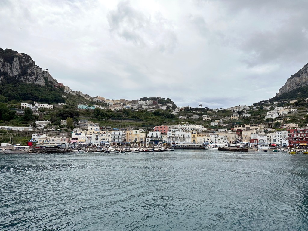
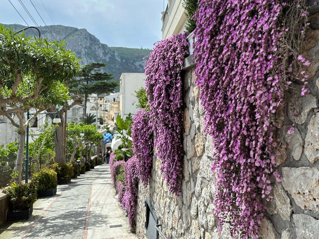
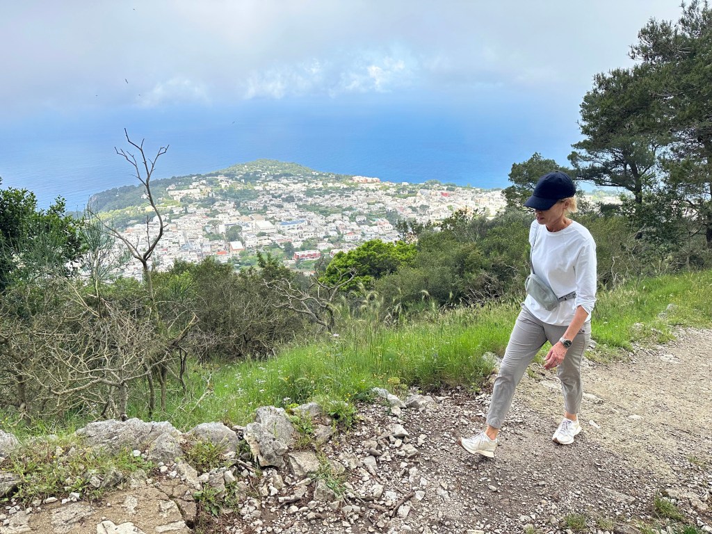
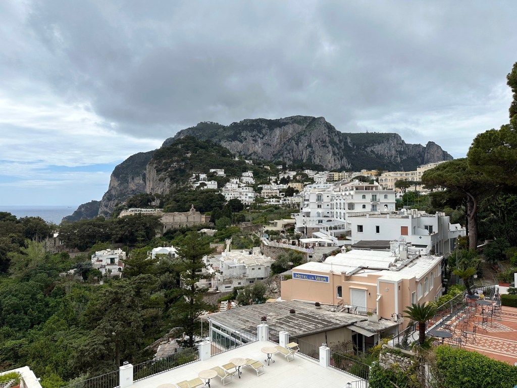
A view of the dock area on Capri. A little misleading, considering how mountainous the rest of Capri is.
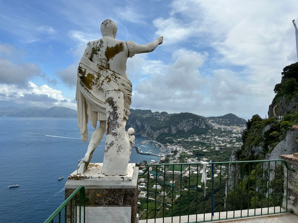
To wit, a view from the Gardens of Augustus on the edge of Capri Town:
A nice hike from town to a historical location that we wanted to make sure we checked out: Villa Jovis.
Super cool entrance to a villa on the hike there:
Pretty great views along the way:
Another villa’s atmospheric entrance:
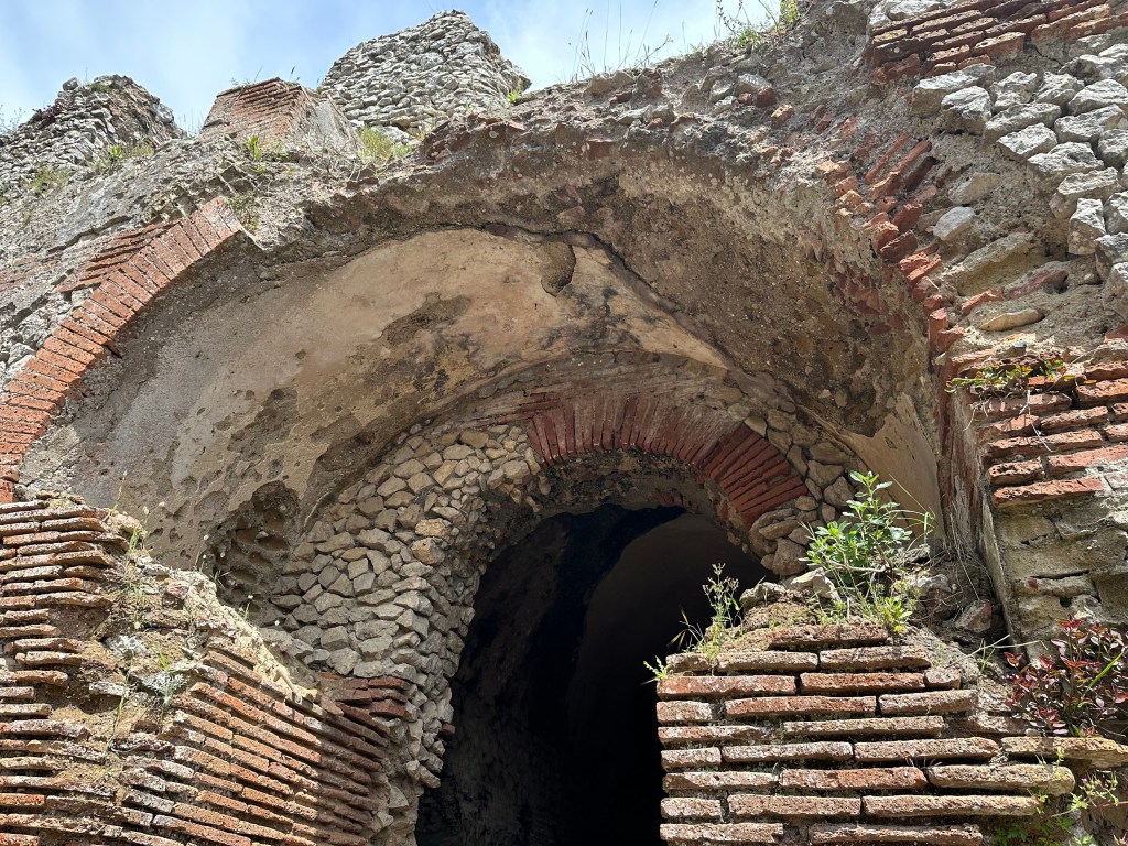
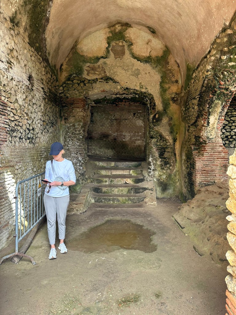
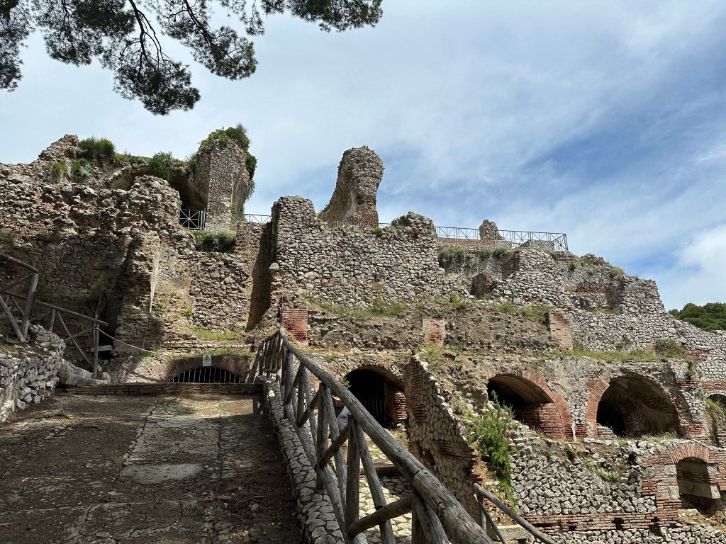
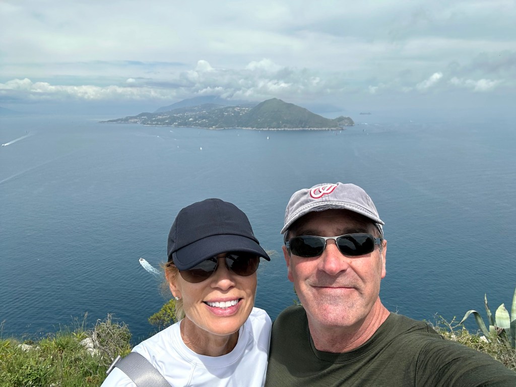
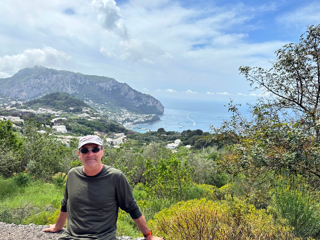
And THE villa! Villa Jovis, accessible only by foot:
Villa Jovis (what remains) holds the distinction as the largest of the 12 villas Roman Emperor Tiberius built on Capri.
Completed in 27 AD, Tiberius spent the last 10 years of his reign ruling from here, away from the bustle – and potential danger – of Rome.
“Apparently, the main motivations for Tiberius’s move from Rome to Capri were his wariness of the political maneuvering in Rome and a lingering fear of assassination. The villa is situated at a very secluded spot on the island and Tiberius’s quarters in the north and east of the palatial villa were particularly difficult to reach and heavily guarded.” (From here.)
Roman engineering still holding up:
The original structure of the villa, which dates to Caesar Augustus, Tiberius’ predecessor, was restructured to meet the requirements of Tiberius when he chose the island as his headquarters from 27 AD to his death in 37 AD.
Villa Jovis continued to serve as the Imperial residence until the 2nd century AD. Subsequent modifications made in the middle ages. The villa was explored during Bourbon rule in the 19th century and excavated systematically by an Italian archeologist between 1932 and 1935.
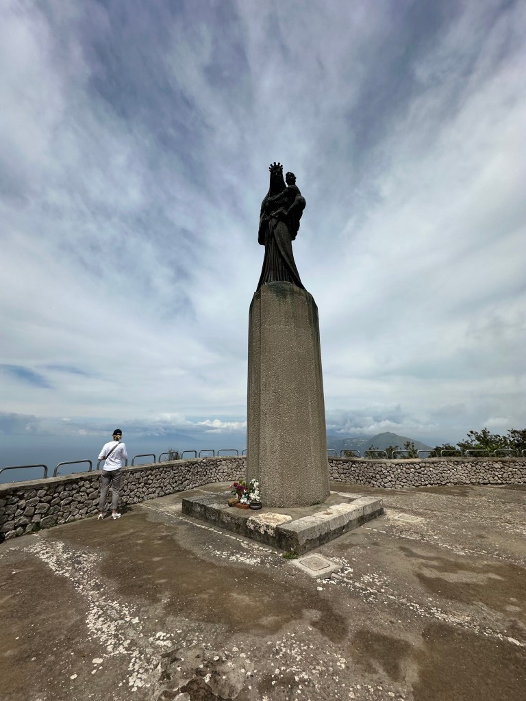
The villa is located atop Mount Tiberio, the second-highest peak of Capri after Monte Solaro (which we’ll get to, to be sure):
Pretty great views back to other areas of Capri:
The remains of Villa Jovis’ watchtower (specula) from which messages would be exchanged with the mainland by fire or smoke:
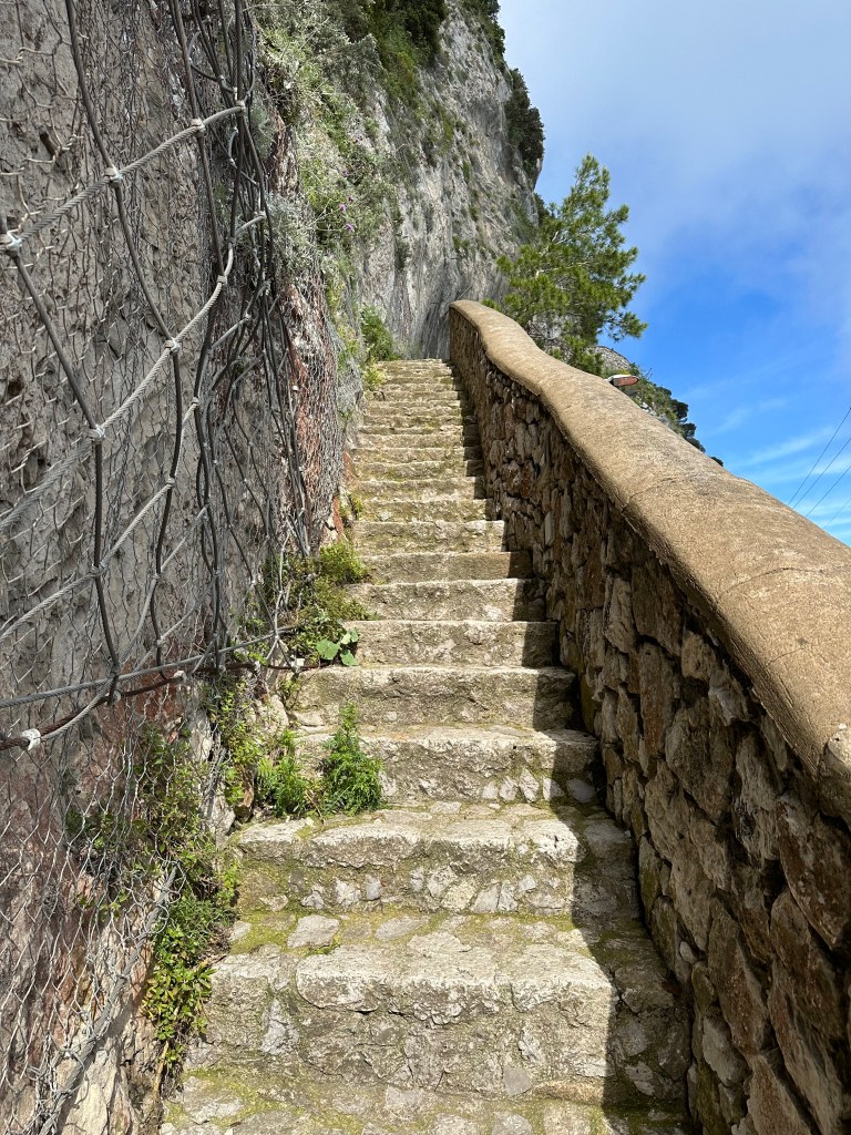
Views still pretty good on the hike back:
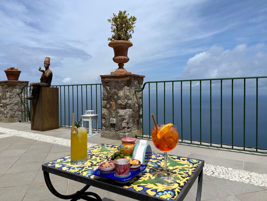
Pretty nice walk into town. One regret is not taking pictures while enjoying aperitivos from Capri Town’s piazetta, where we’d hang out each late afternoon people watching. Pretty great, frankly.
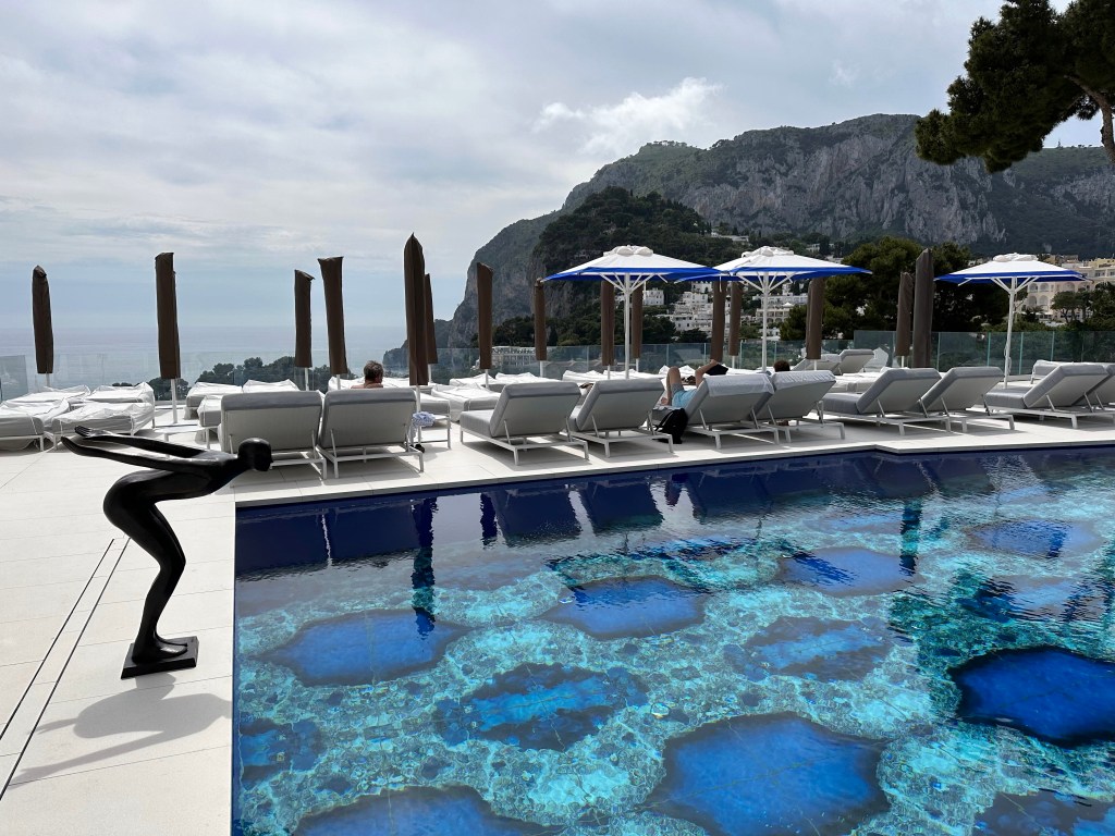
Also, classic Amalfi coast pool setting at our place:
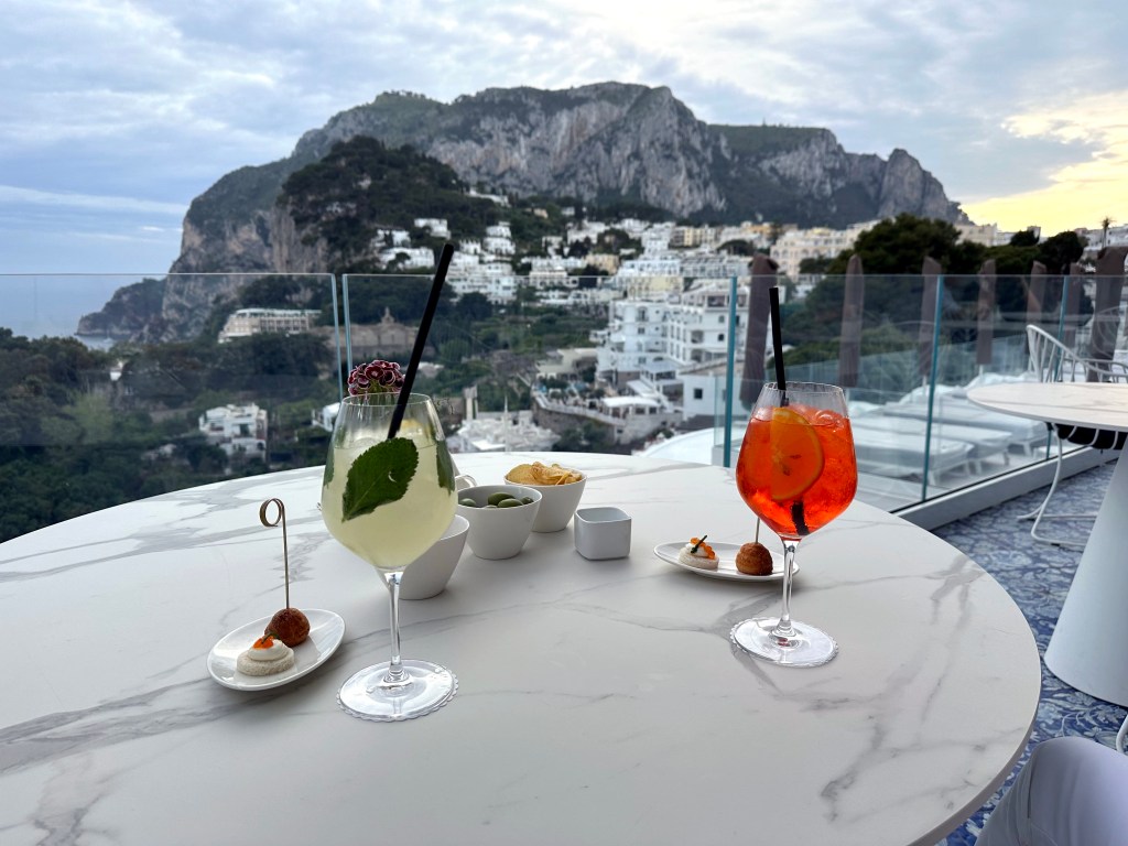
Pre-aperitivo aperitivos at our place before heading to Capri Town’s piazzetta for the main event.
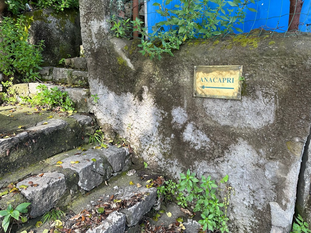
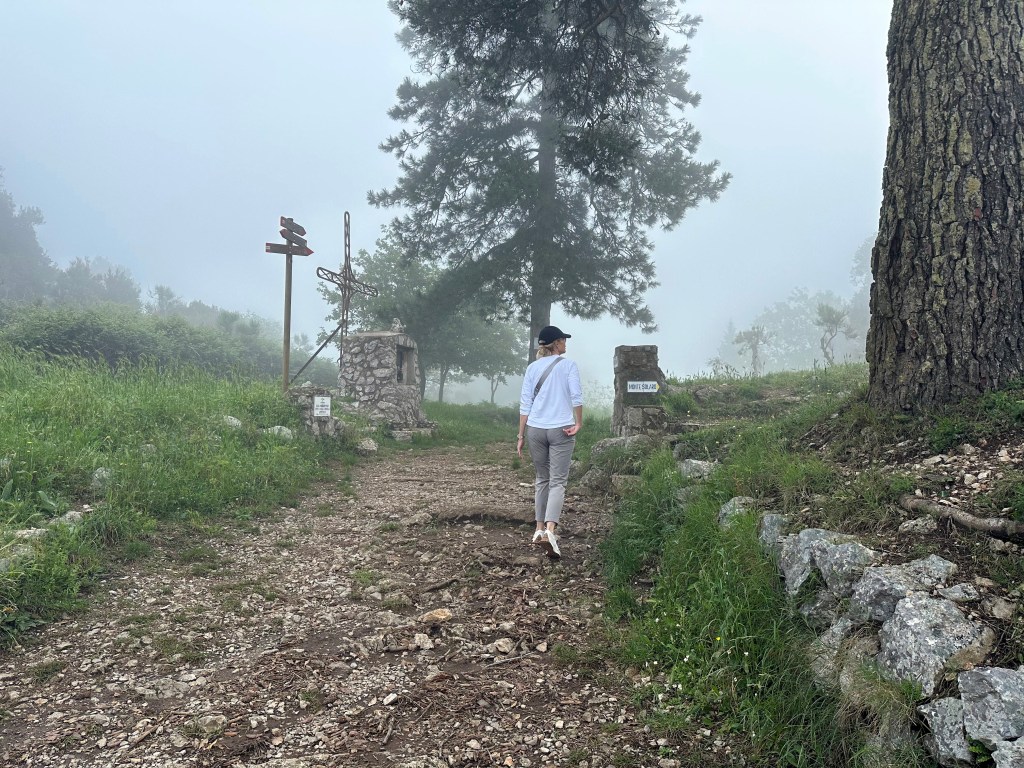
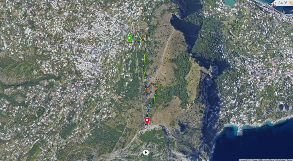
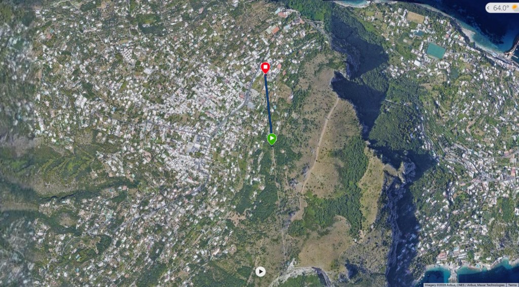
The next day, a hike to the other side of the island and Anacapri.
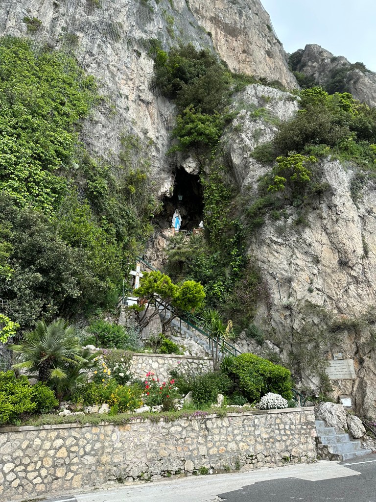
Little shrine on the way:
It was a hike, man.
But worth it.
Views on the way back to the ferry port:
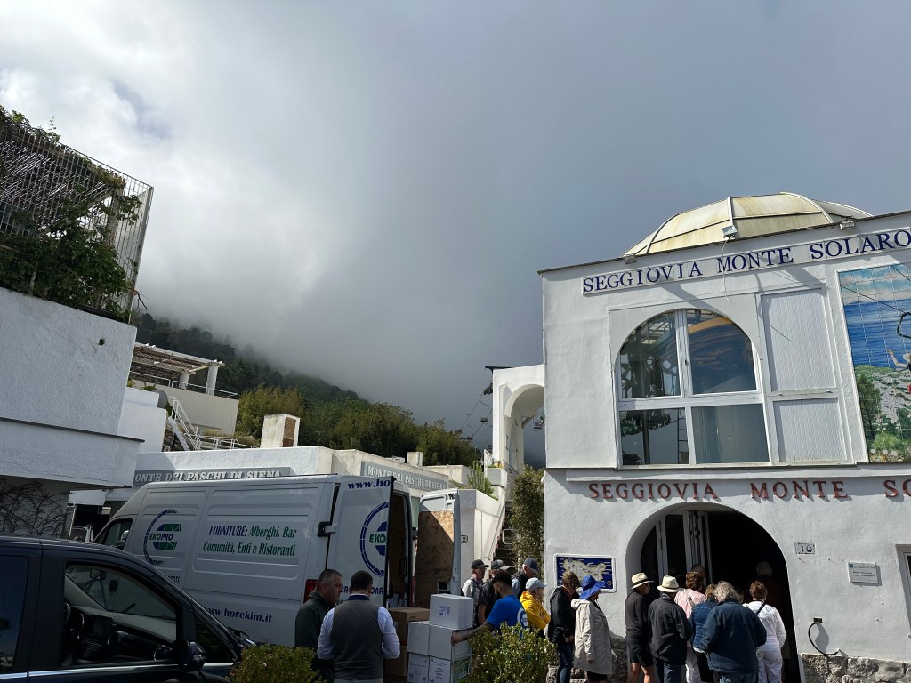
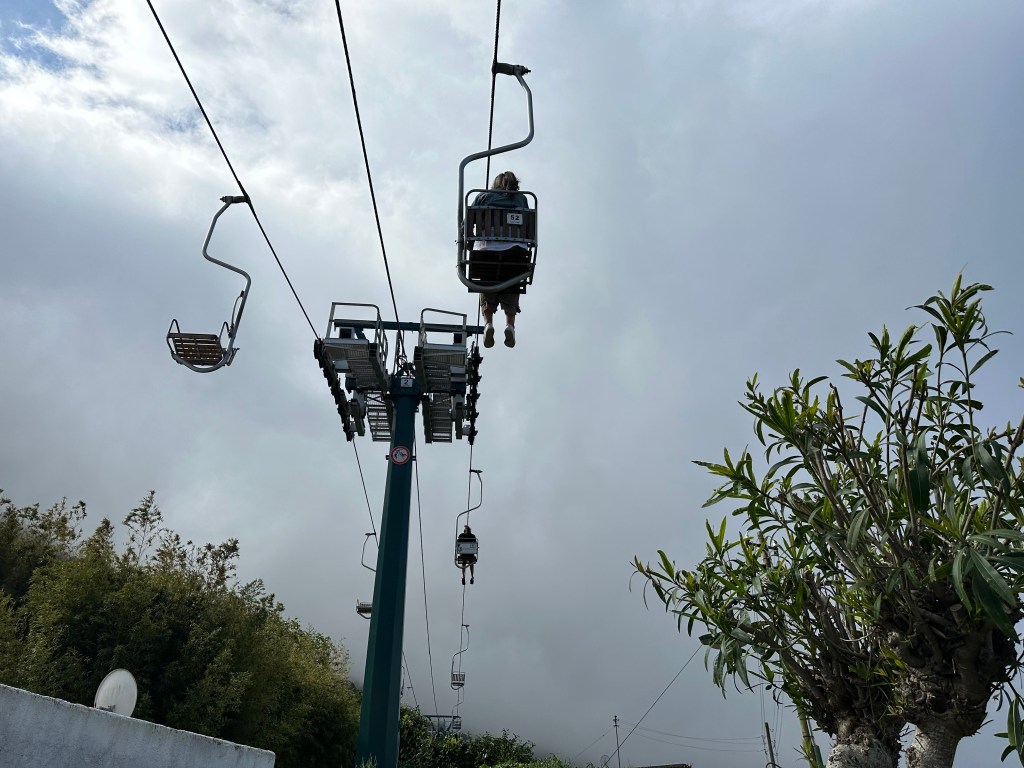
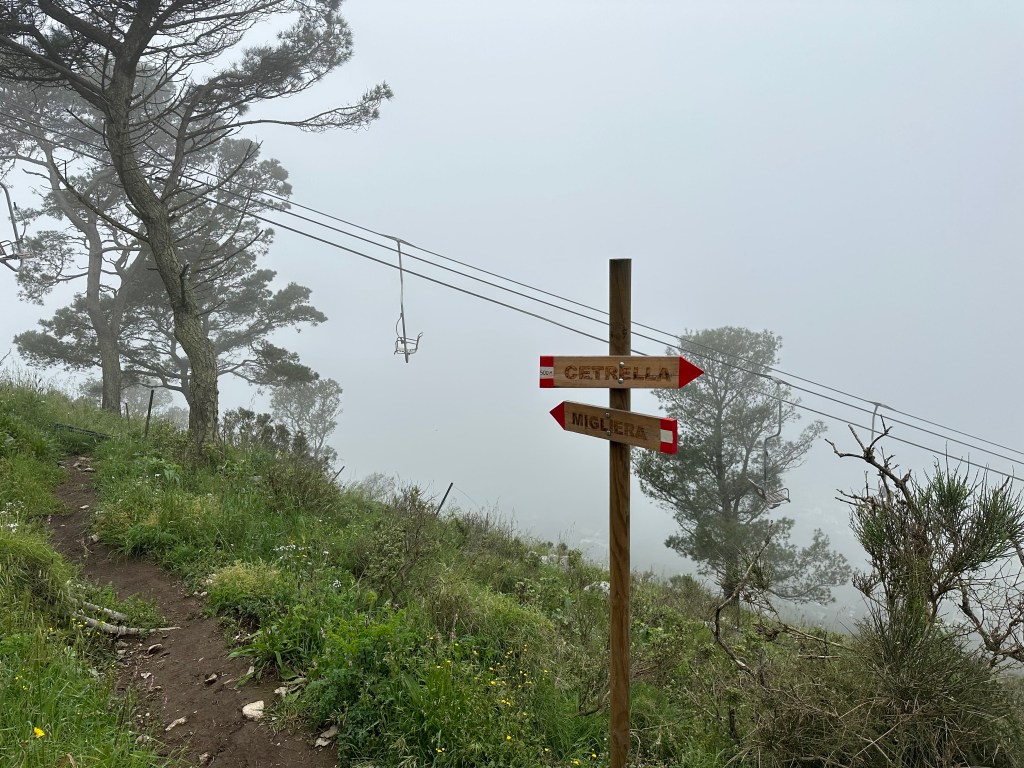
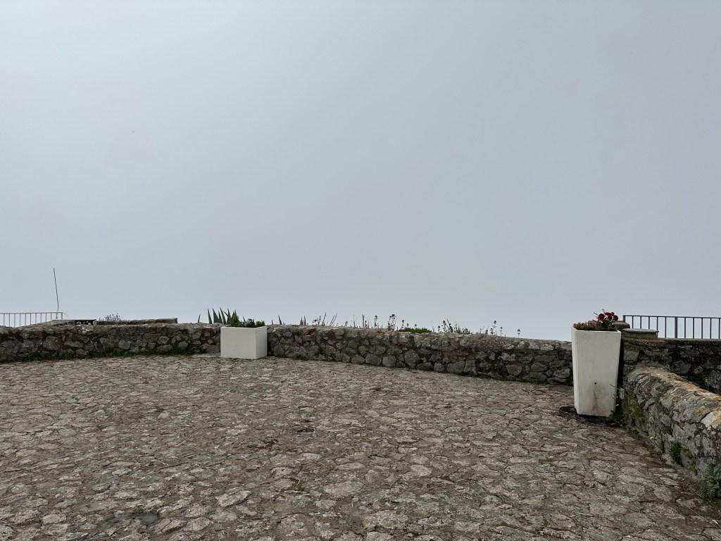
This was our objective: the chair lift to the top of Monte Solaro.
But the whole mountain was fogged in, so there’s not much to see on the trip up.
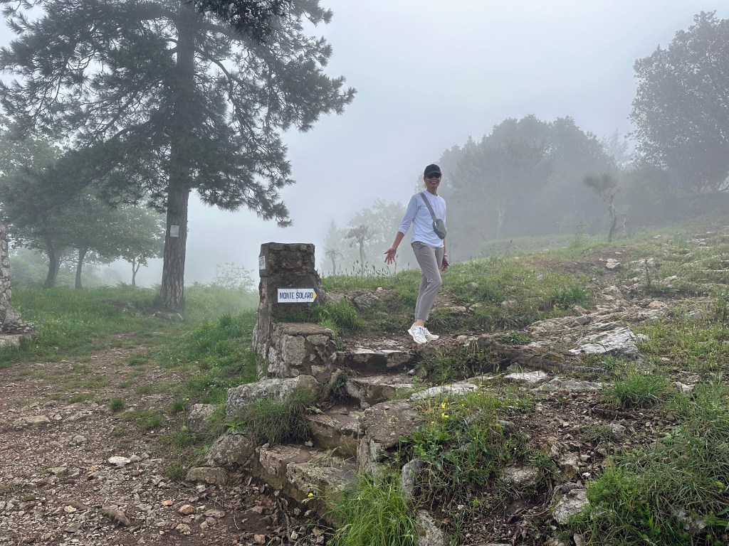
So we kept hiking all the way to the top, instead.
Still socked in:
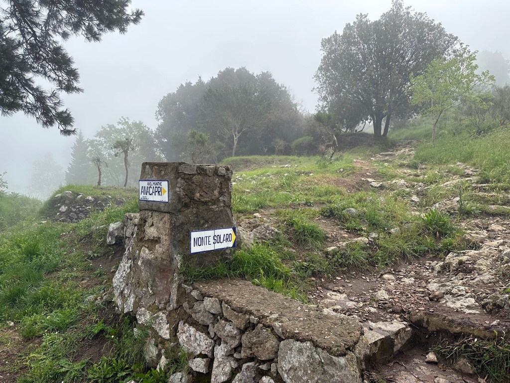
But at least the trail was marked.
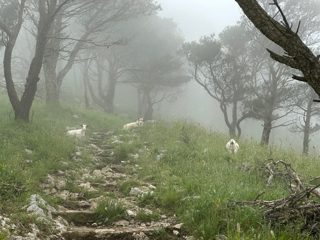
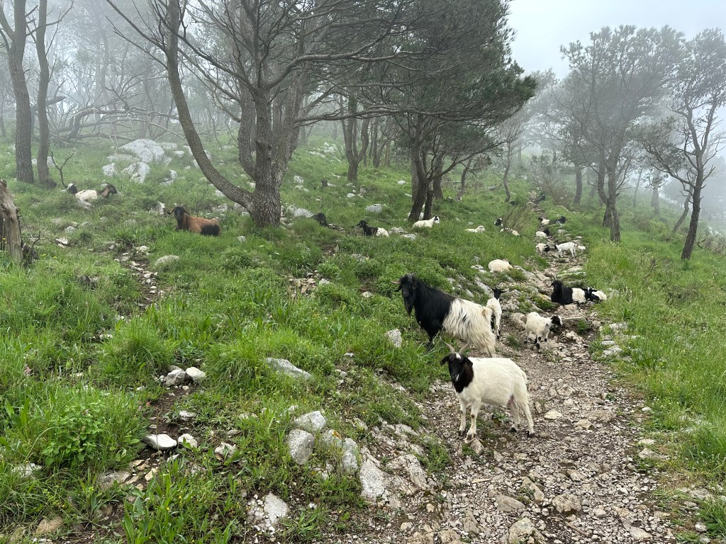
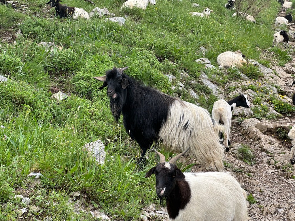
And out of the mist? Goats!
Definitely added some character to the hike.
A sign that we were nearing the peak:
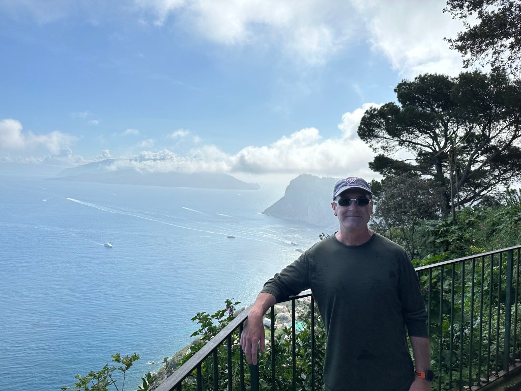
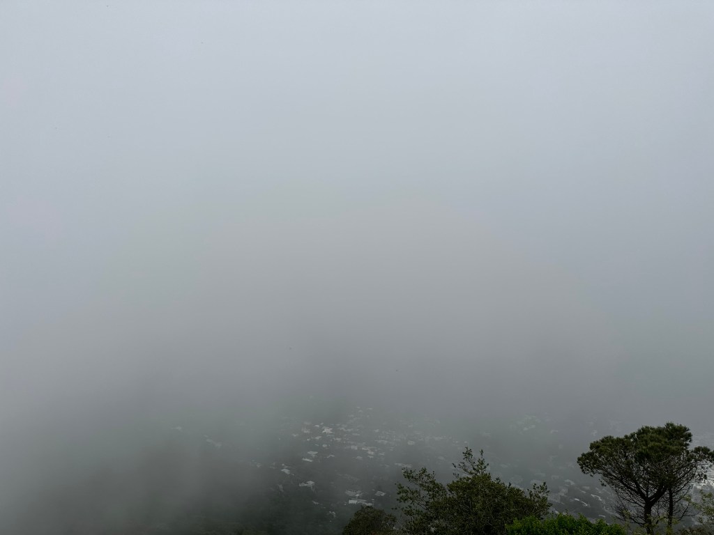
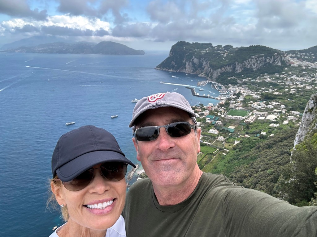
Finally, a great view from the top of the tallest mountain on Capri!
Or, as it unsurprisingly turned out, a replay of our hike’s apex on Arthur’s Seat in Edinburgh: zero visibility.
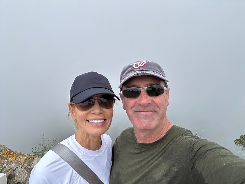
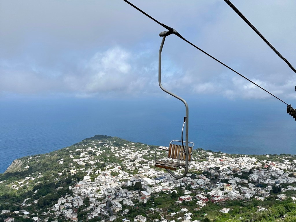
But after we quaffed a couple of macchiatos, the fog had burned off, so we grabbed the chairlift for a much more relaxing (and shorter) trip back down:
To wit:
Hike up:
Chair down:
Pretty great views without the fog:
And then pre-pre-aperitivos at Caesar Augustus on the cliff in Anacapri:
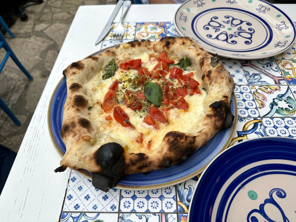
Followed by some decent, Neapolitan-style pizza at a place in Anacapri town:
After a few days on Capri, we ferried back to Sorento and picked up our rental from the car cave. Surprisingly, we did make it on the ferry that disembarked at the timetable slot we ~arbitrarily picked when we dropped the car off, so the guy had it waiting for us, half in / half out of the car cave. Good stuff.
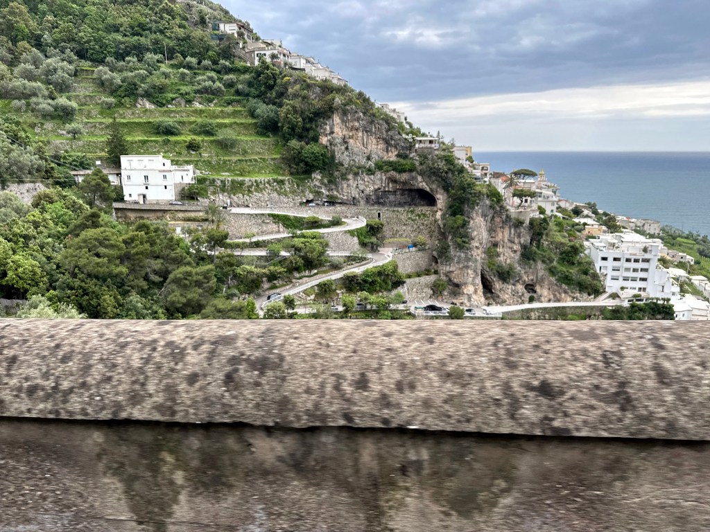
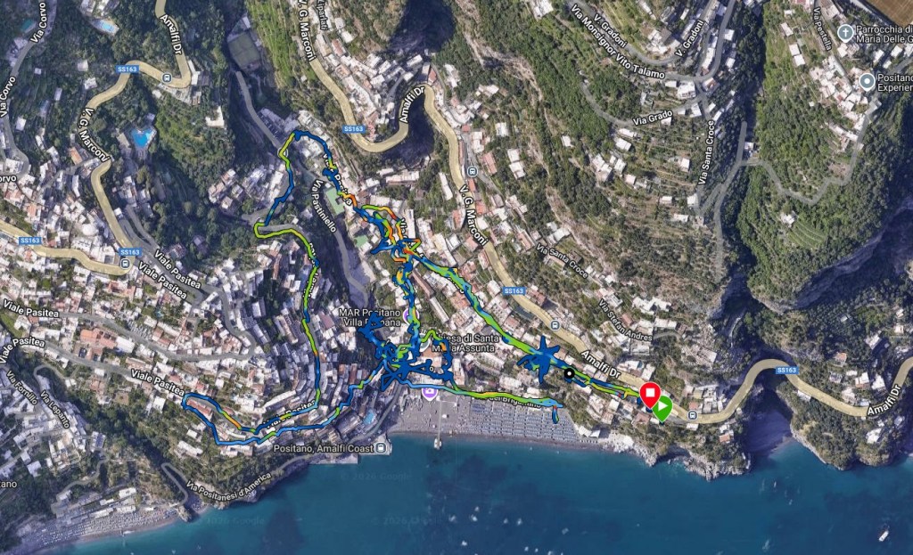
We hightailed it out of Sorento and headed ever further south to Positano and beyond. We originally planned to stay in Positano as our base for exploring the Amalfi Coast, but our safari travel friends advised us instead to just visit Positano and stay instead at one of the smaller towns nearby, but a little further down the coast. They didn’t have great things to say about Positano; and they were right. A little more on that later.
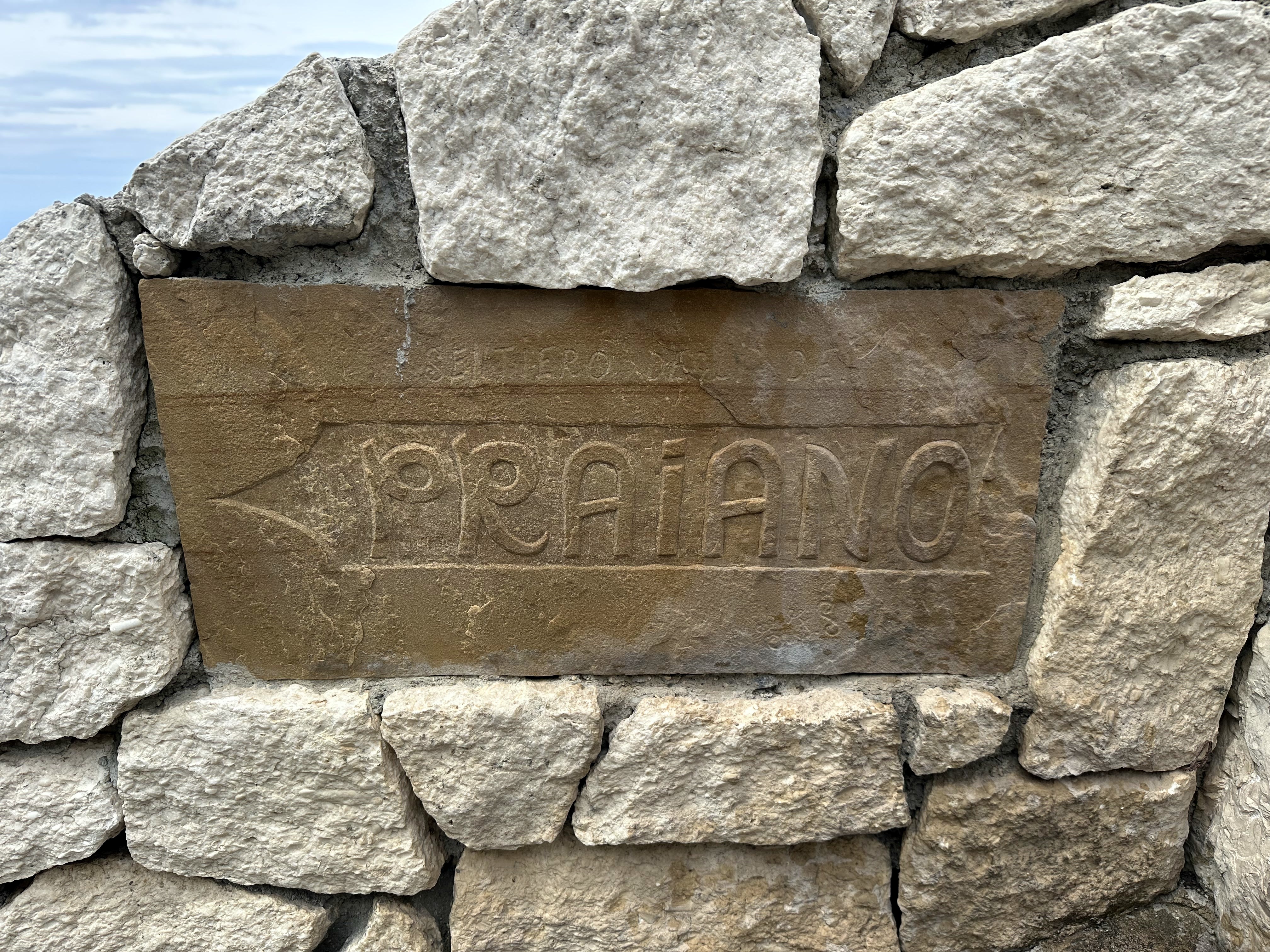
So, we ended up staying in one of the hotels and towns they recommended: Casa Angelina in Praiano, just 10 minutes away from Positano (and in sight of it). But first, we had to get there.
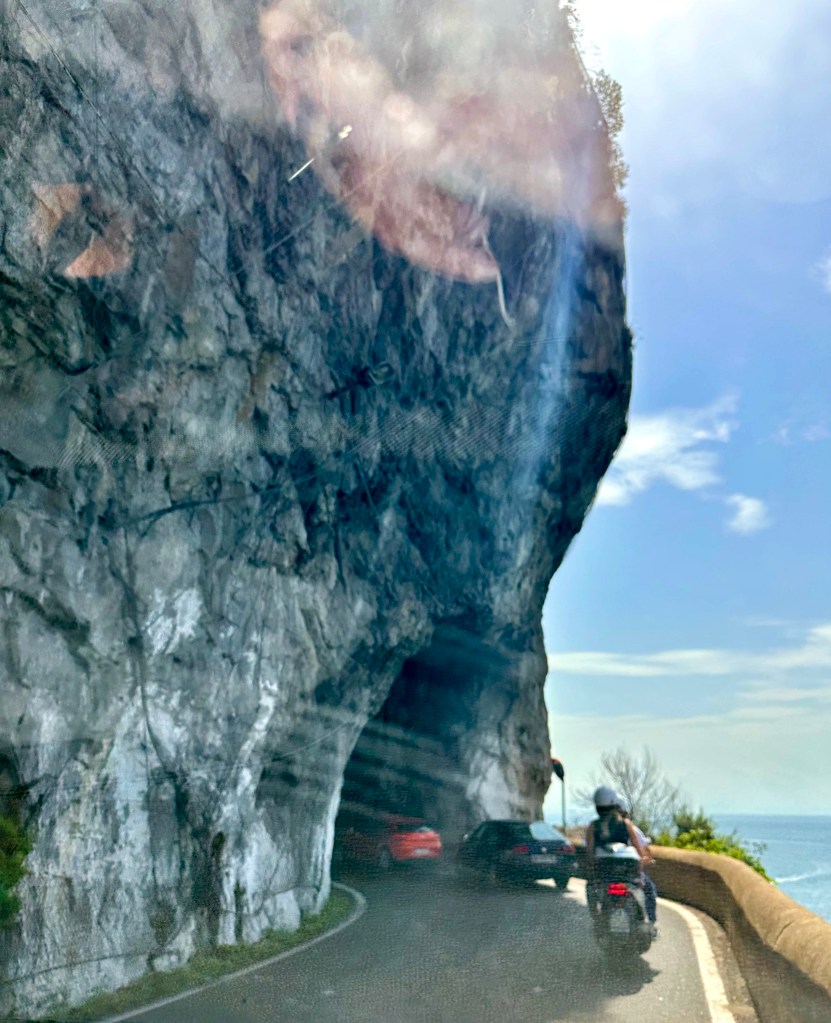
Driving the Amalfi Coast is one of the most nail-biting exercises in automobile navigation that one can undertake.
For the driver. For the passenger. It’s pretty insane.
And we’ve had insane driving experiences – along a chasm almost the width of the tiny rental car in St. Kitts; over miles of washed out, shack-lined country roads in Jamaica; and driving on 1.75-lane, 12-foot-tall-hedge-lined roads masquerading as 2-lane roads in Cornwall (all while driving on the wrong side of the road on the wrong side of the car and with the wrong hand on the stick everywhere in the UK). But the Amalfi Coast road is a beast in a category all its own.
There’s one coast road, and it – like Cornwall, but without the hedges – has about 1.75 lanes for two-way traffic. Oh, and in Amalfi, you’re constantly one bump away from being sent hurtling down a 1000-foot cliff.
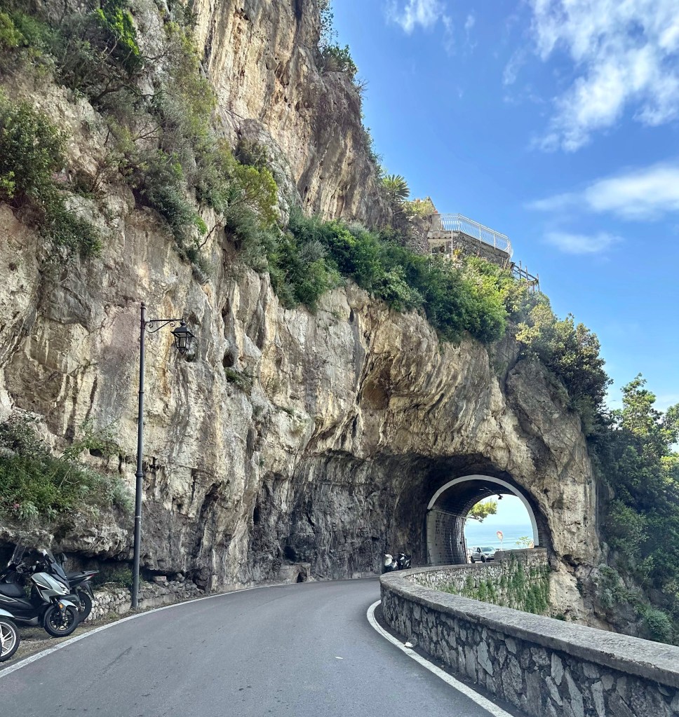
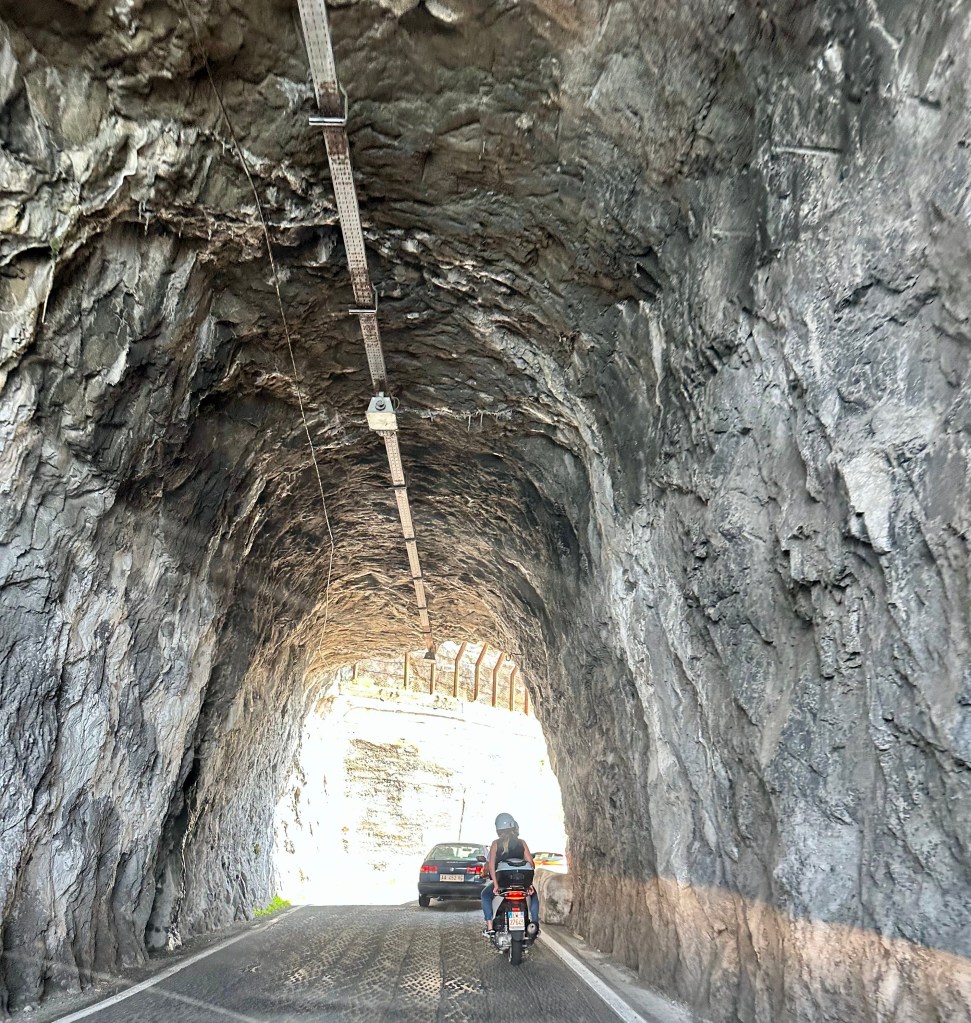
Because rock faces tumble straight into the Mediterranean in many places, the road transits a honeycomb of tunnels (also barely wide enough for two cars, let alone a bus coming the other way [one of which really did almost take us out on a turn]).
Plus, on our drive from Sorento to Praiano, where our hotel was located, we took a wrong turn and drove down the mountain and THROUGH Positano instead of skirting above it on the coast road. It was a white-knuckle affair, particularly for the WolfeStreetPassenger, who is absolutely not happy with roads like this to begin with. But at least we weren’t driving down steep, hairpin roads that are the very worst, right? And soon we’d be safely tucked away at our hotel, right?
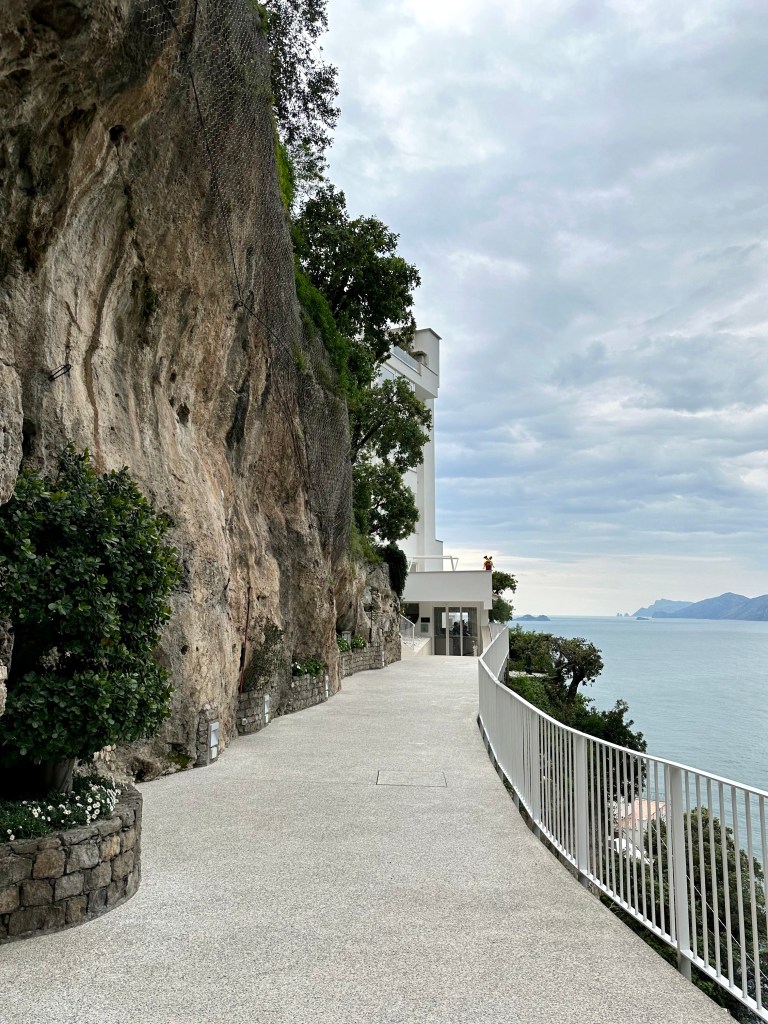
The hotel’s driveway off the Amalfi Coast road:
Another view from a hike later in our stay to provide an even more dramatic perspective:
The hotel (white structure with windows at the edge of town) and its entrance at the terminus of the hairpin-turn-ridden ride:
The bellmen hauled our luggage and the now-catatonic WolfeStreetPassenger into the haven that we finally reached after a harrowing day of driving.
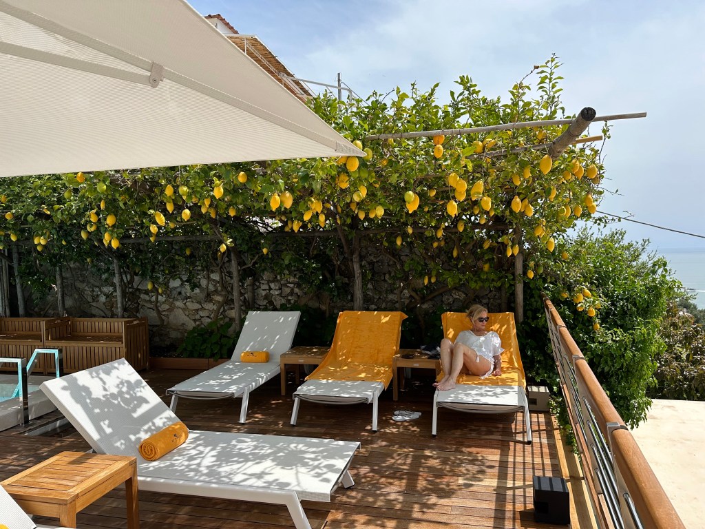
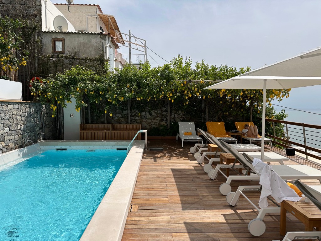
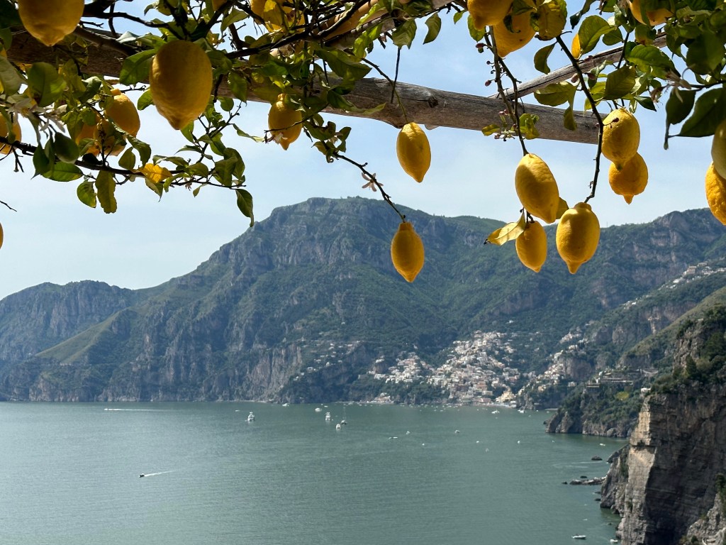
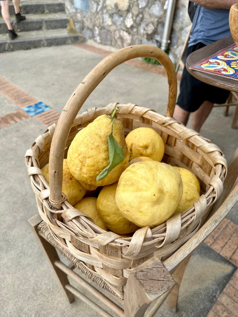
And holy shit what a haven. Amalfi is know for their lemons, and the pool had an entire, in-season, lemon tree arbor over one end:
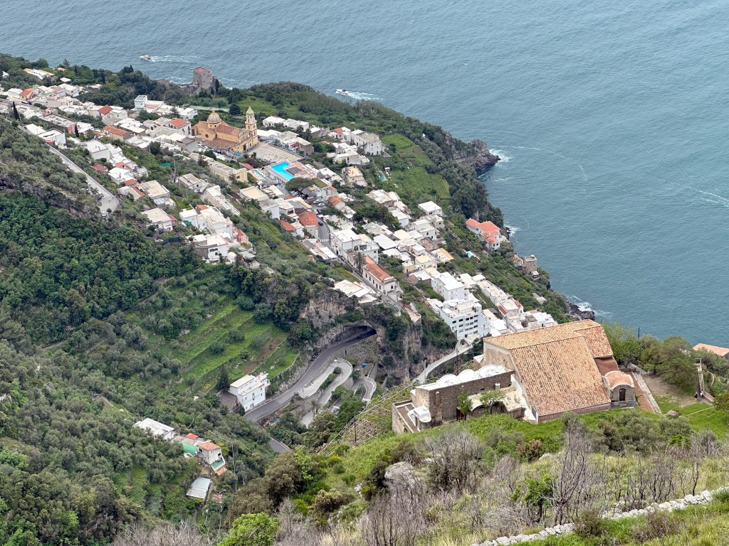
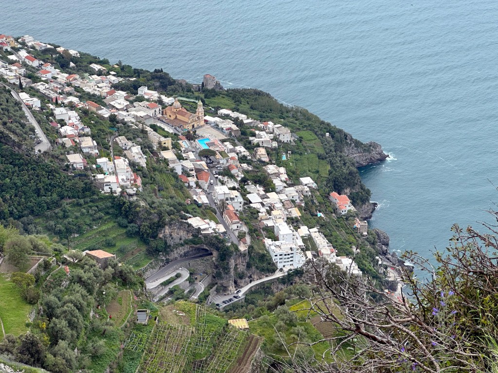
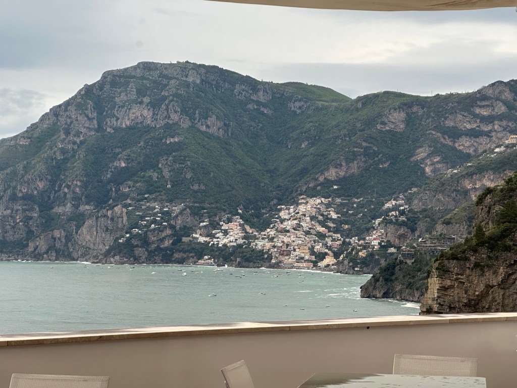
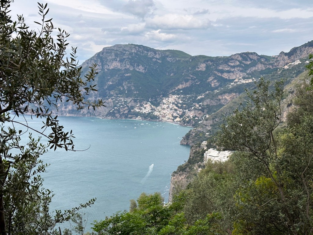
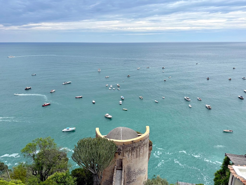
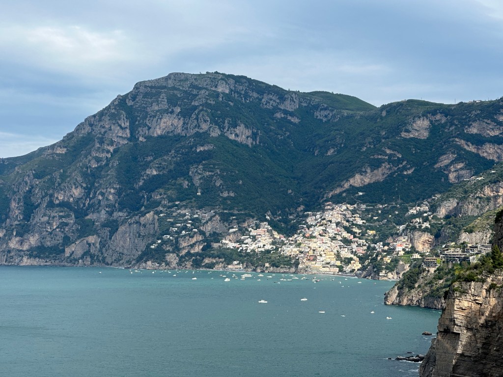
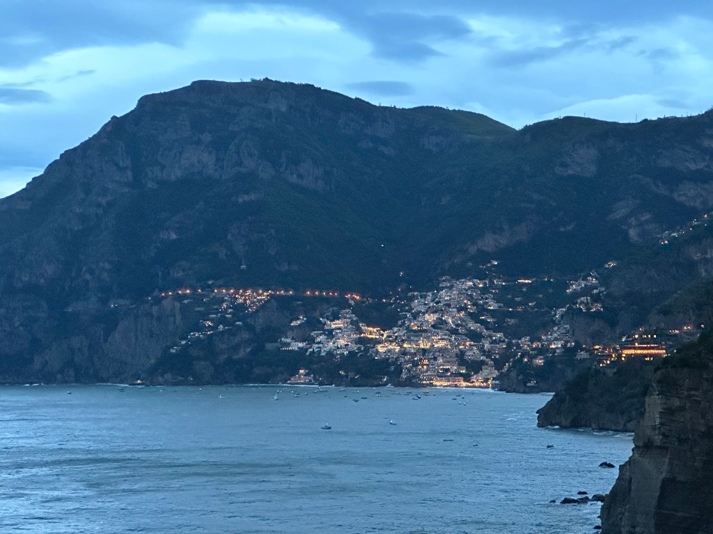
And a cliffside view to Positano, which was pretty cool.
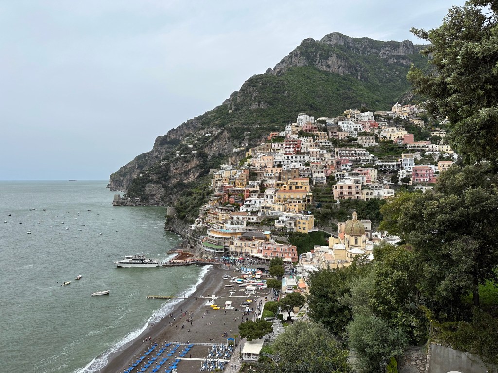
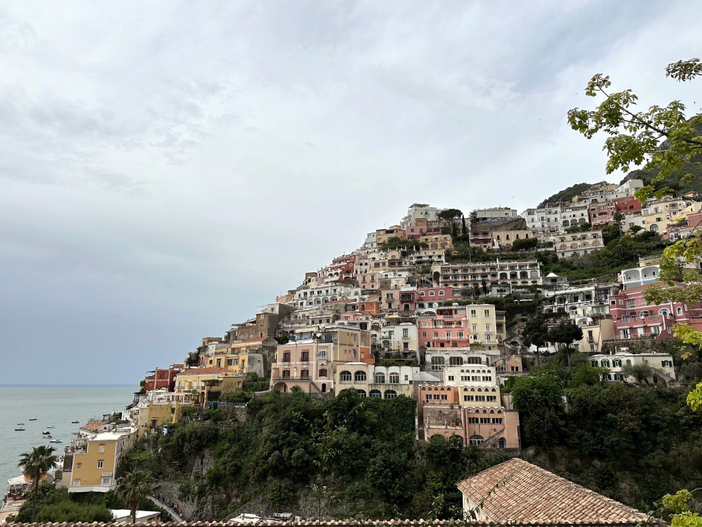
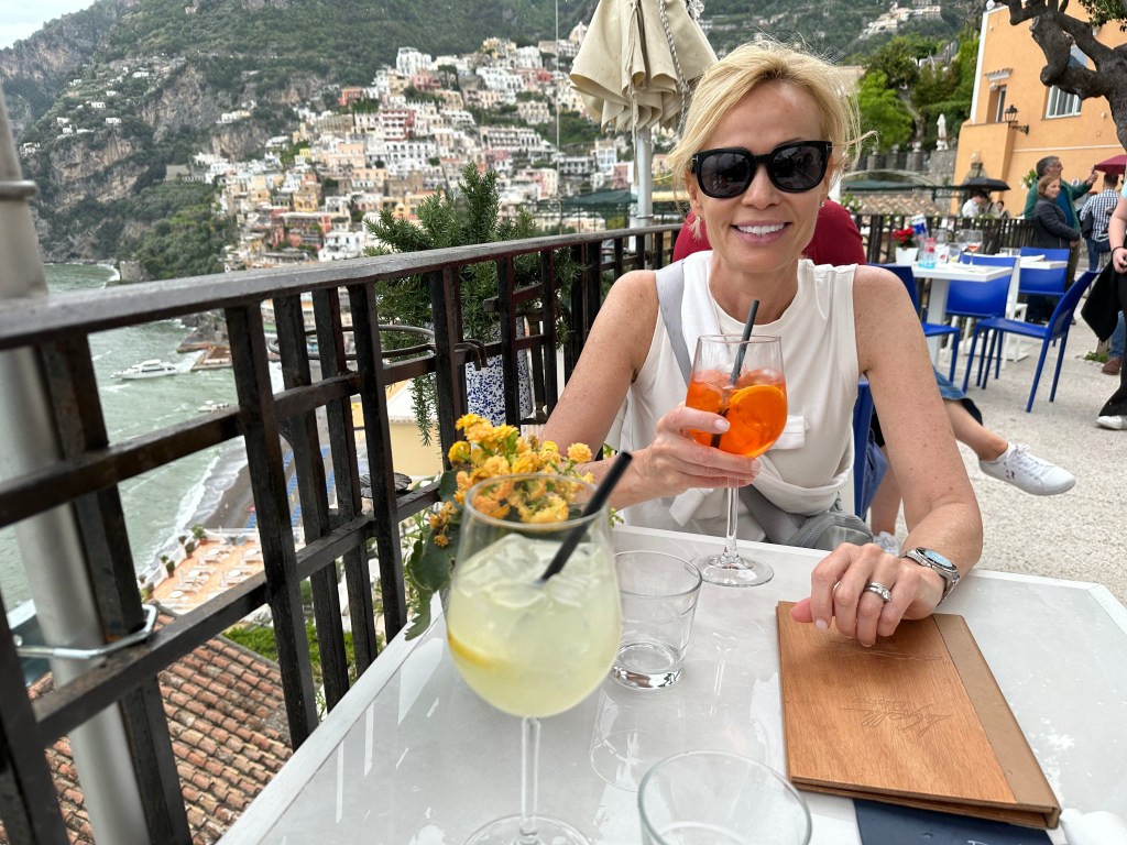
And the next day, we’d check out Positano up close, courtesy of our hotel’s “shuttle” (which turned out to be a little Mercedes coupe, which was nice). So, why not stay in Positano? If you perused Instagram in 2022 and 2023, you would see that THIS was the Instagrammer place of the moment, and a destination for vapid, 20-something trust fund princesses who had more resources than sense. Although the popular appeal intrigued us about Positano, the presence of these self-absorbed, superficial narcissists certainly put us off.
Most importantly, though, was the recommendation from our safari travel friends. They strongly recommended against staying in Positano because it was too touristy, and instead suggested that we stay in Praiano, Amalfi, or Ravello – towns near Positano from which you could visit, but protected you from actually having to stay there. We had already booked a hotel and two dinners in Positano by the time we had this conversation, but we trusted this couple, and changed our plans. Thankfully. It’s a shitshow.
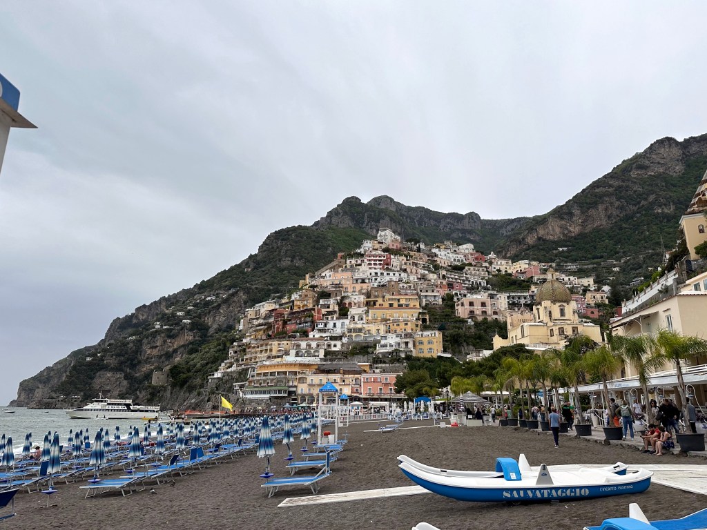
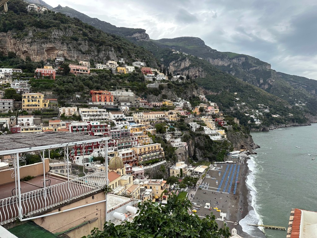
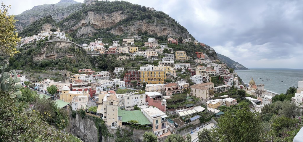
As we noted in an Instagram post after our visit to Positano and experiencing the shoulder-to-shoulder crowds of tourists (and we were there in May) and the labyrinthine collection of alleys full of shops selling tourist crap, Positano is not the charming town visitors claim it is through their Instagram posts. It is, in fact, a land-locked cruise ship of clueless (mostly American) tourists that happens to be tumbling – in a very picturesque way! – down a hillside on the Amalfi coast. It is best viewed from afar.
Positano’s unappealing gray-sand beach:
Still – a certain appeal (from a distance):
Bell tower of the Assumption Parish of Our Lady Positano, based on the location of an abbey founded in the 10th century.
The tower’s pastrice (sea monster) bas relief on its base:
After navigating around and through town, we had enough.
A reward for a job well done.
Safely back in Praiano and away from Positano.
With more rewards to celebrate our return.
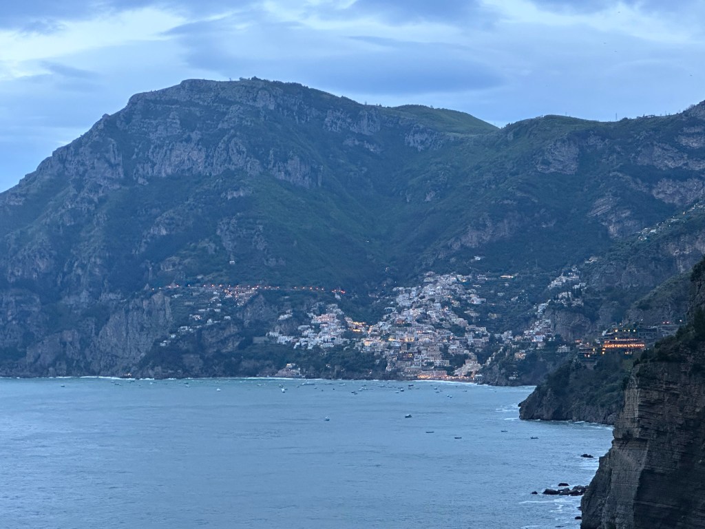
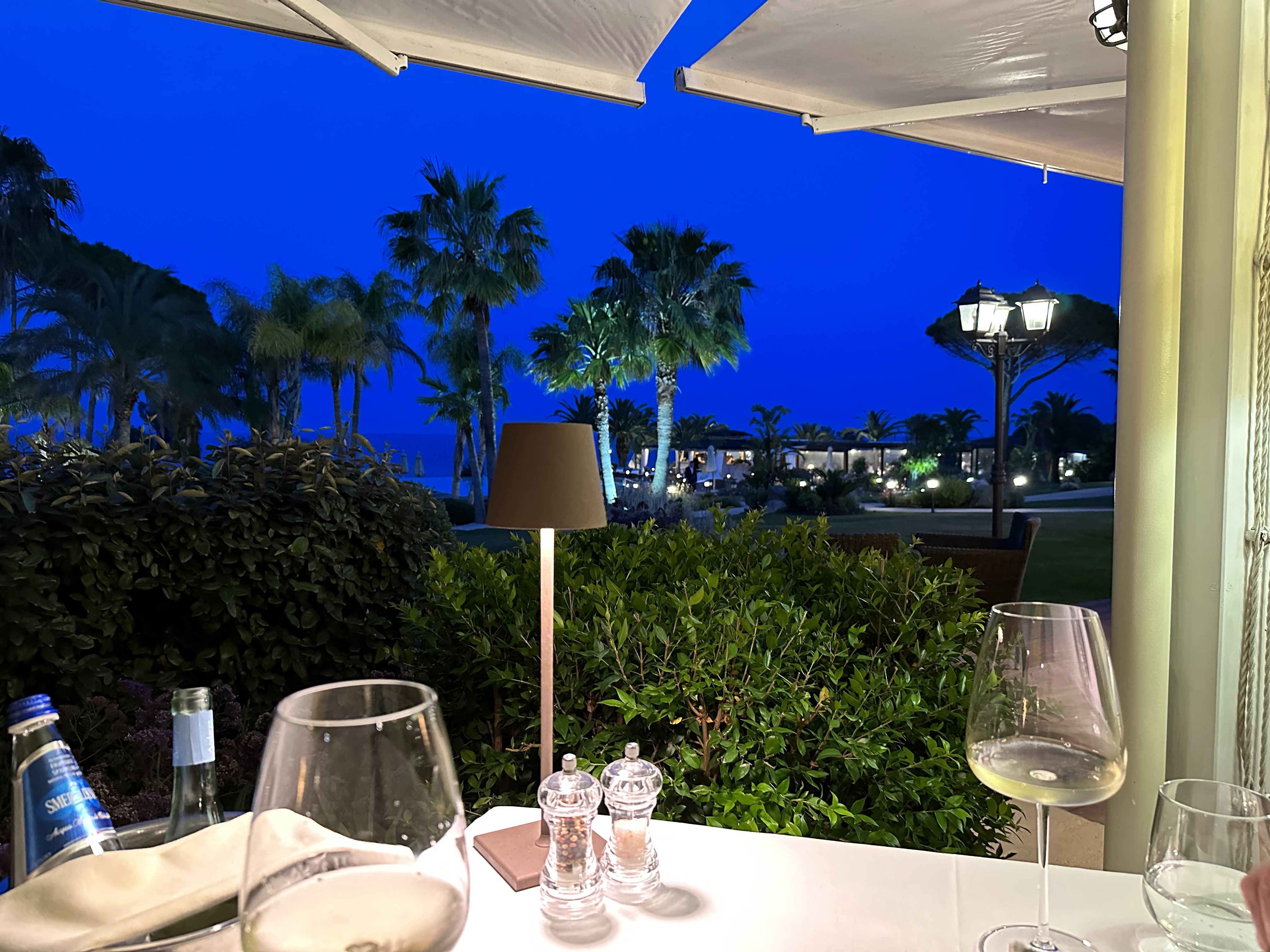
Pretty cool sunset views, as well.
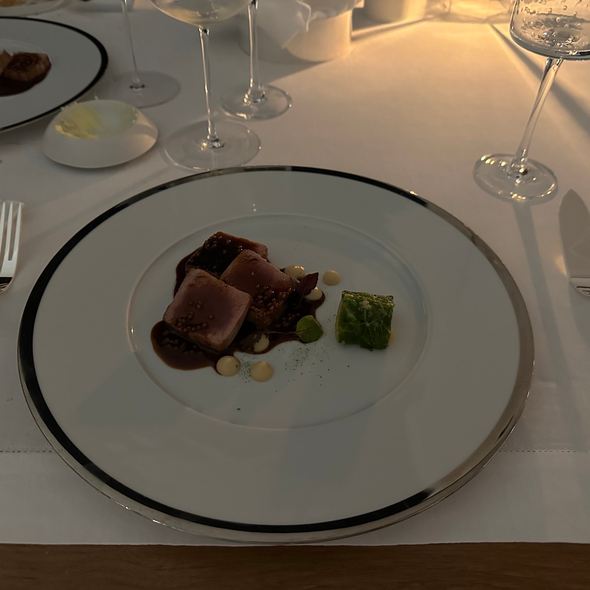
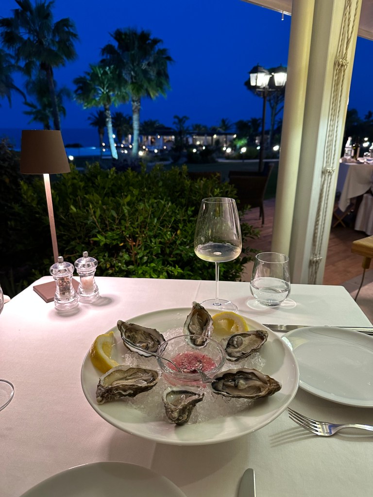
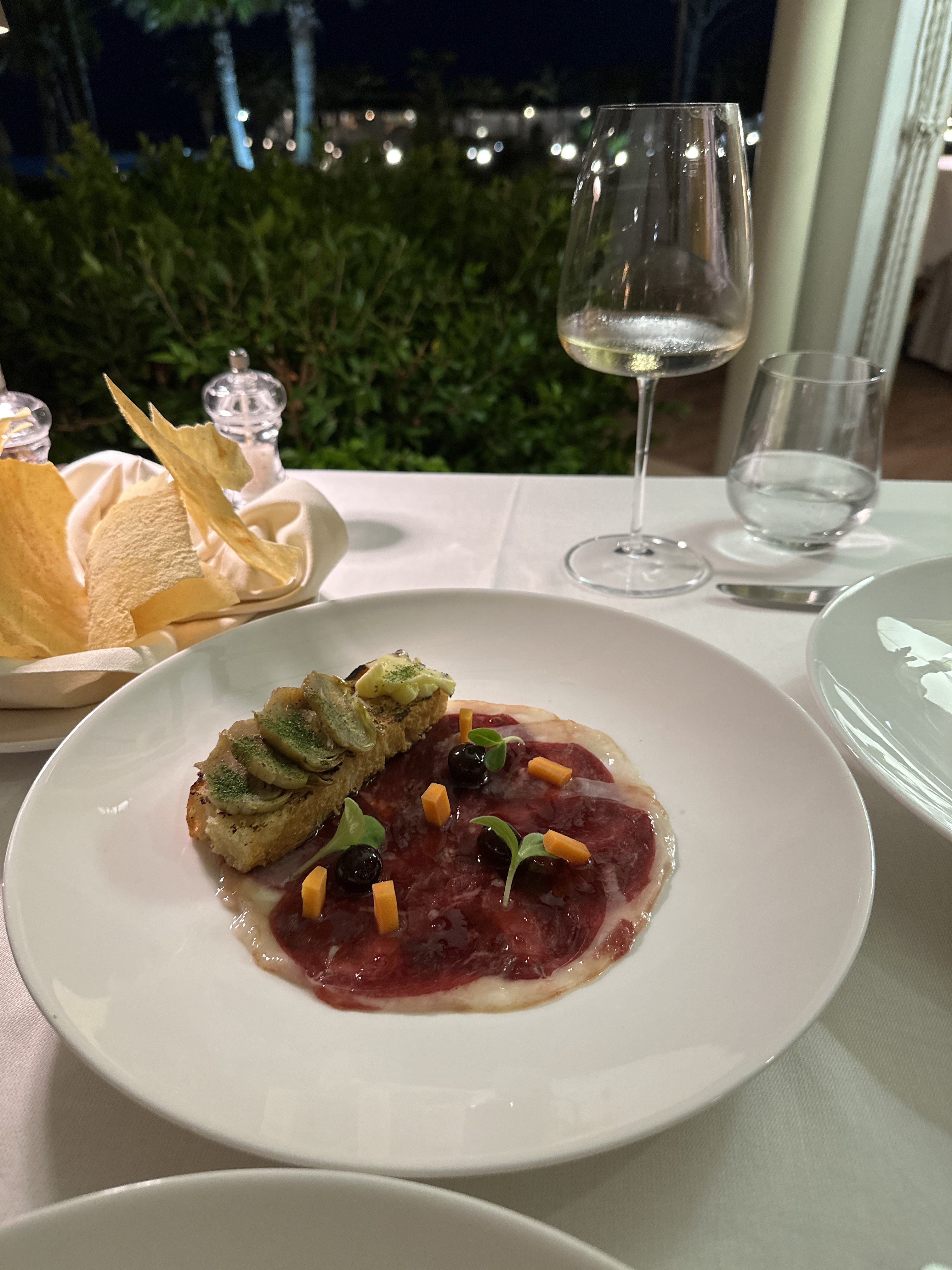
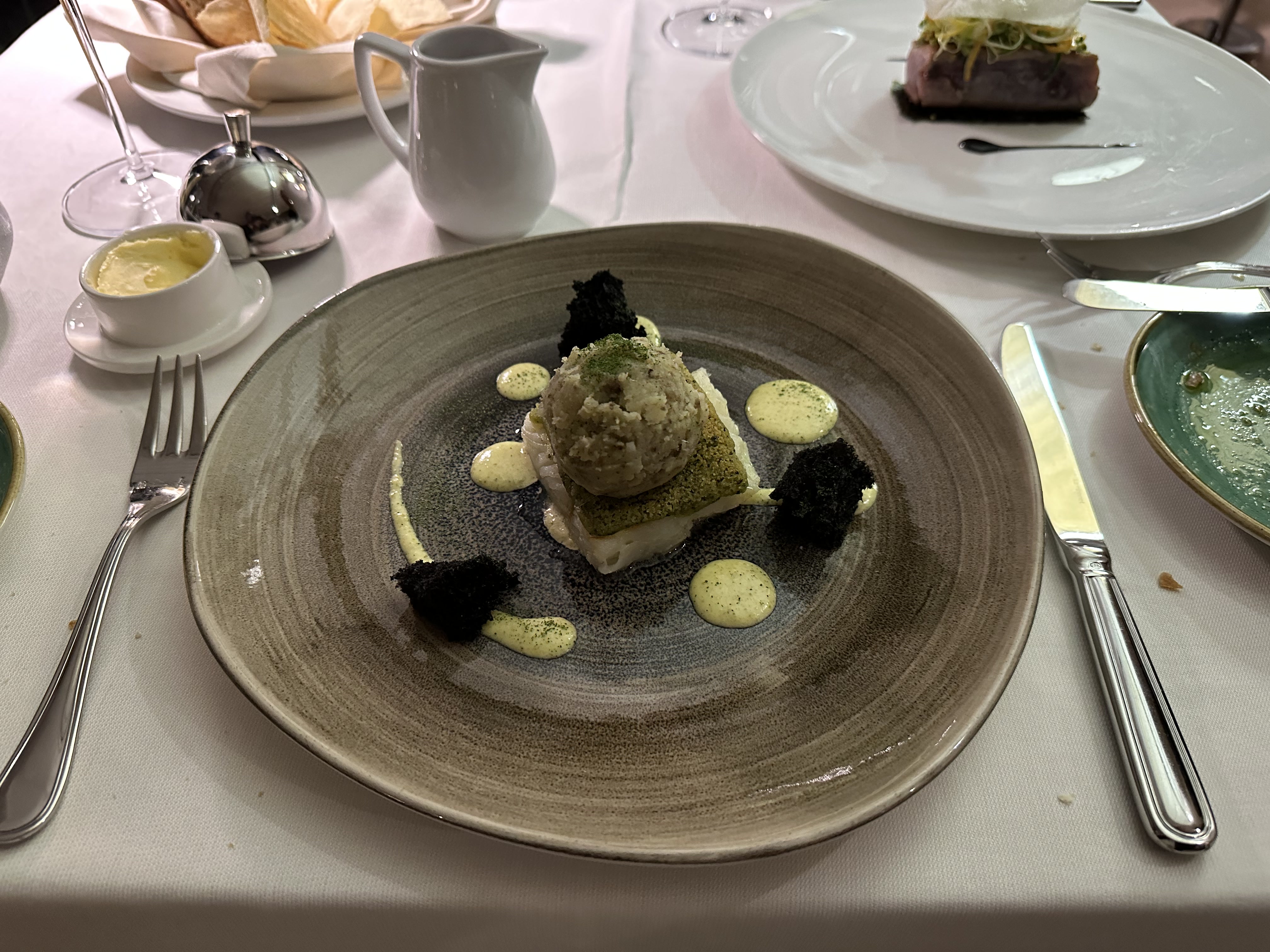
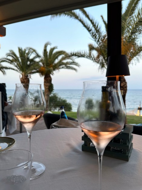
And our first Michelin-starred dinner of the trip:
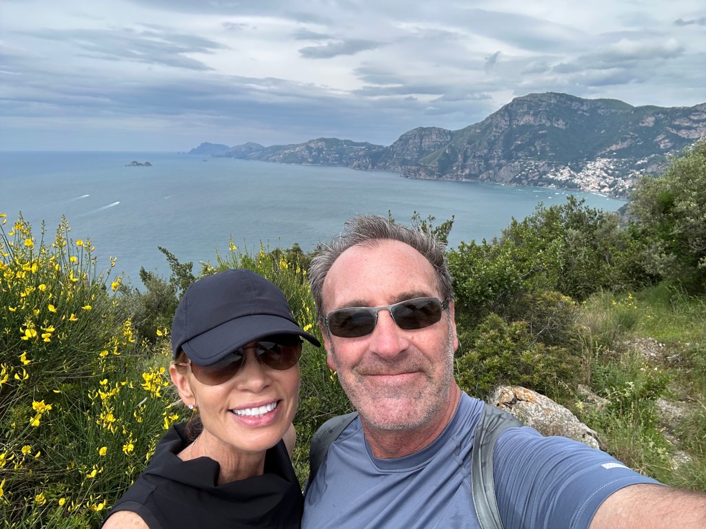
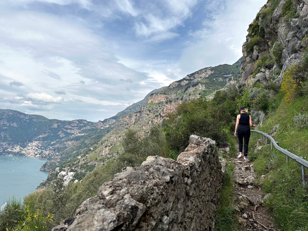
The next day, and epic hike we had been anticipating with some relish:
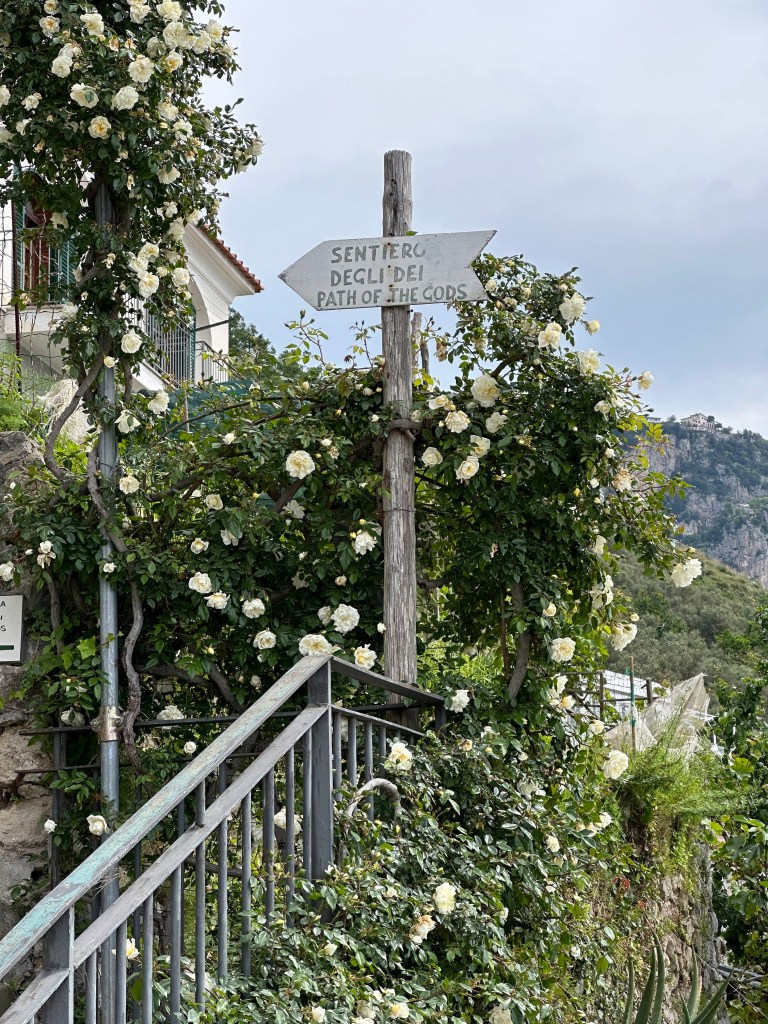
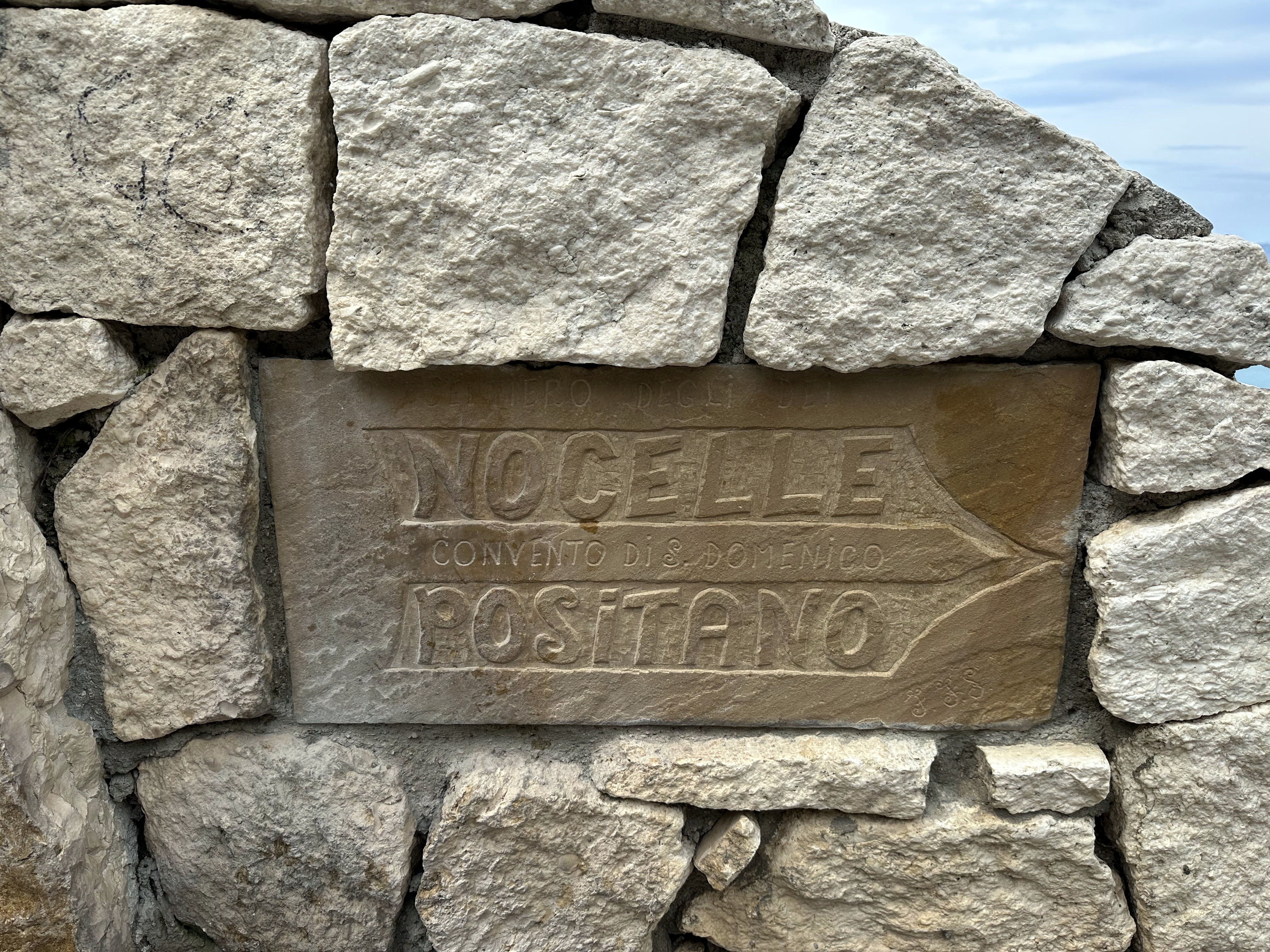
The Path of the Gods!
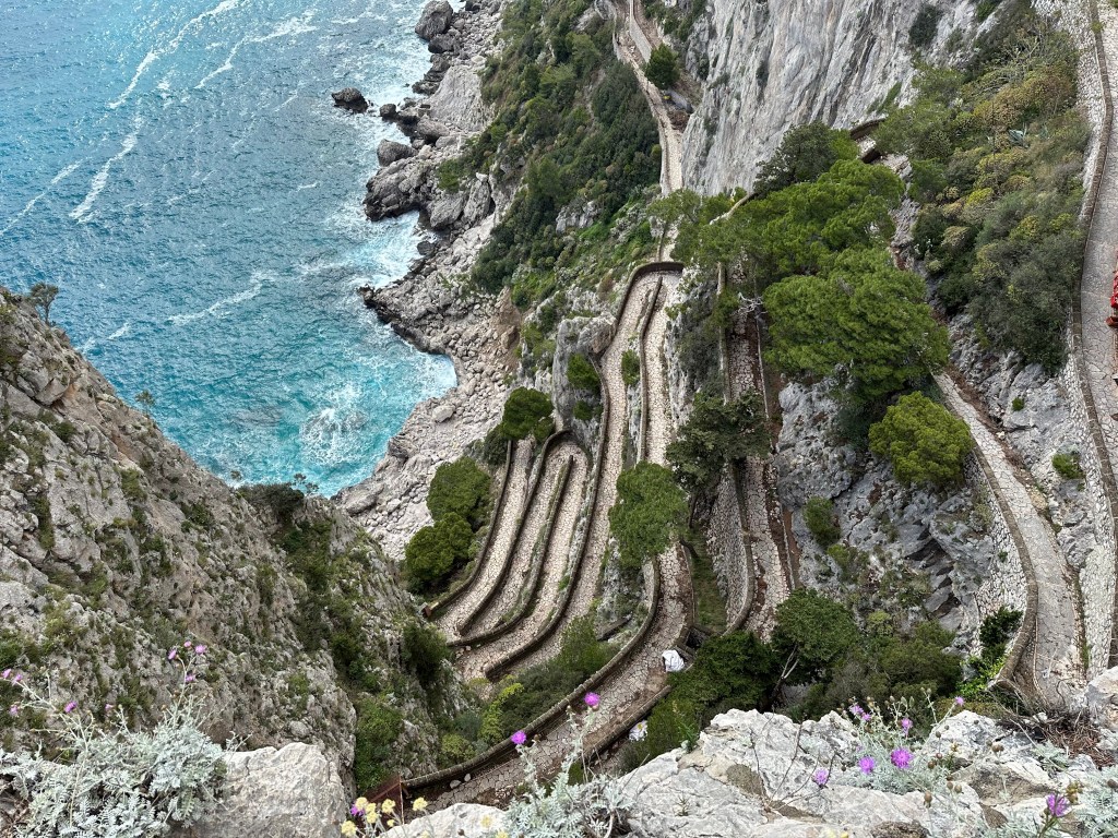
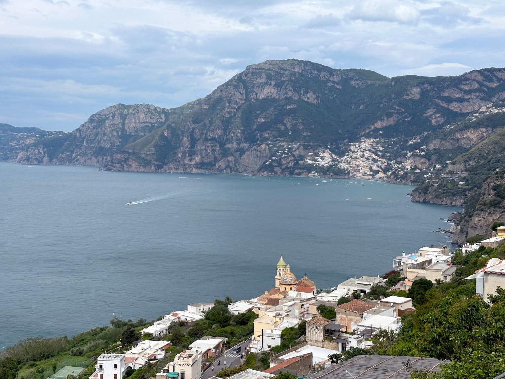
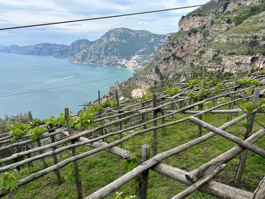
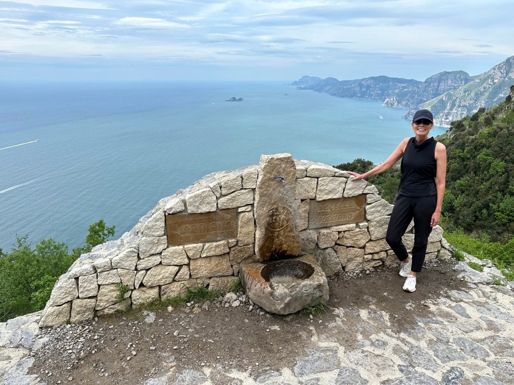
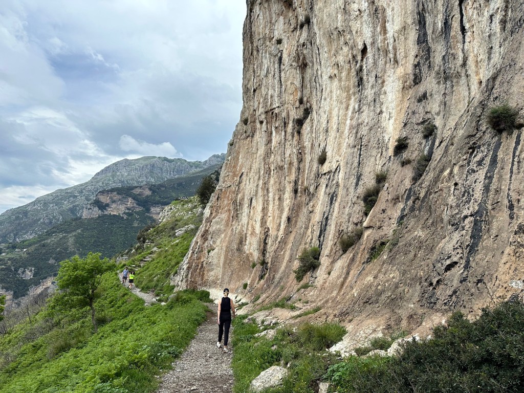
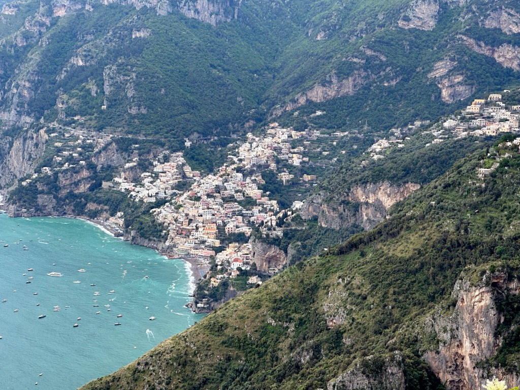
The Path of the Gods, as we hiked it, offers a 5.3-mile trek from our hotel at the edge of Praiano up 2000 feet, then across the ridgeline to a point 1500 steps ABOVE Positano, then a knee-buckling climb down said steps.
Views to Positano above Praiano:
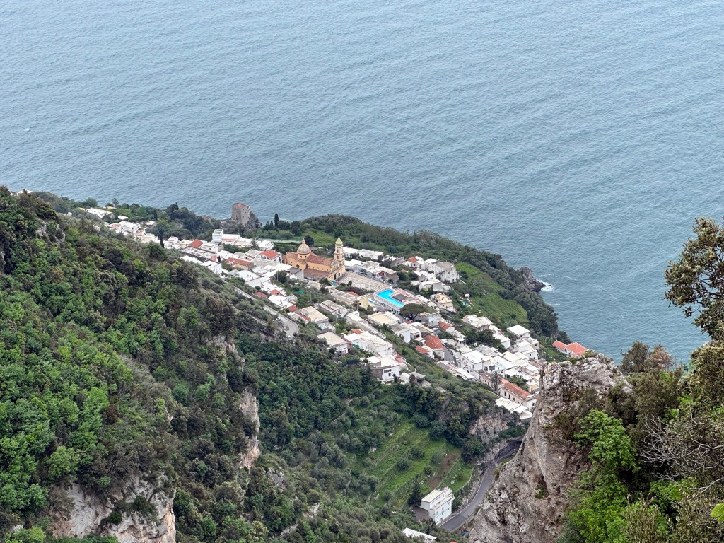
Praiano from above:
Once you reached the ridge, the hiking wasn’t too challenging; it was just getting to there (and then down the damn steps):
At the halfway point:
Getting closer to Positano:
View into Positano’s bay on the way down the freakin’ steps:
A reward part of the way down: Italian ice made with Amalfi’s ubiquitous (and iconic) big-ass lemons:
After a “shuttle” ride back to Praiano, a last night on the Amalfi Coast:
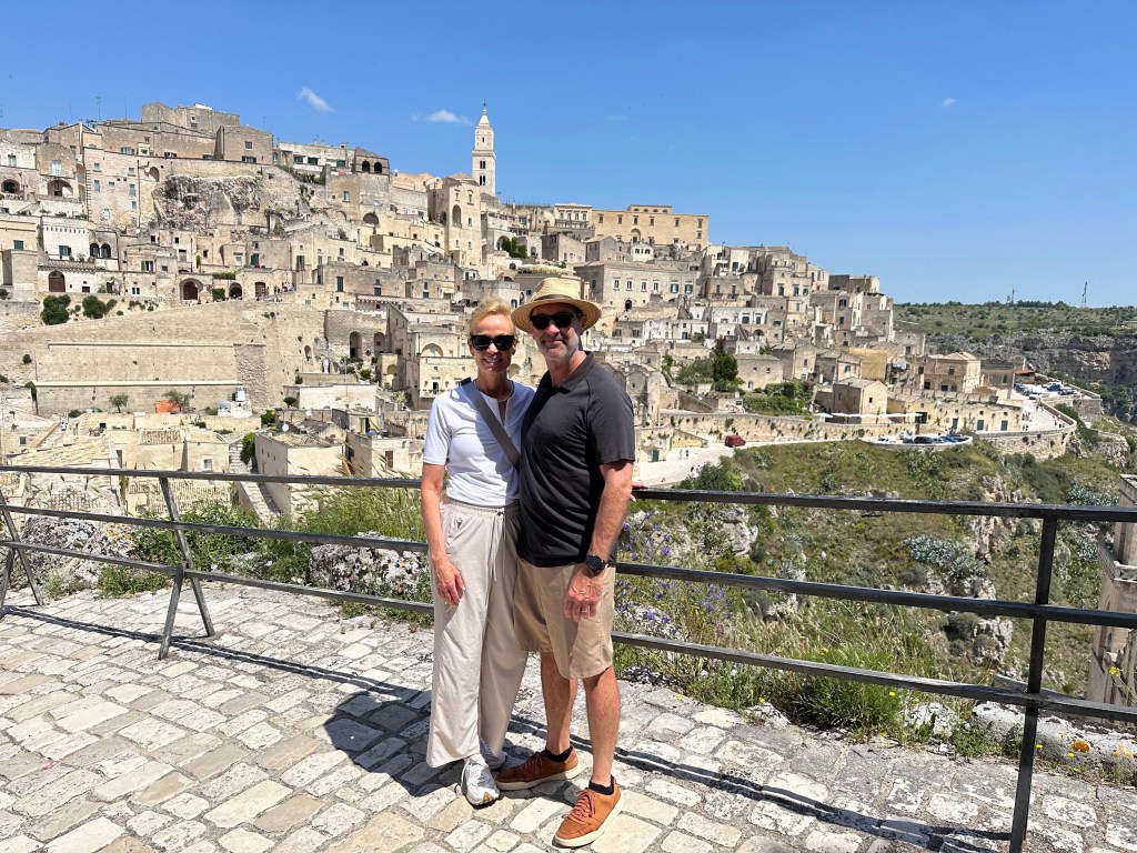
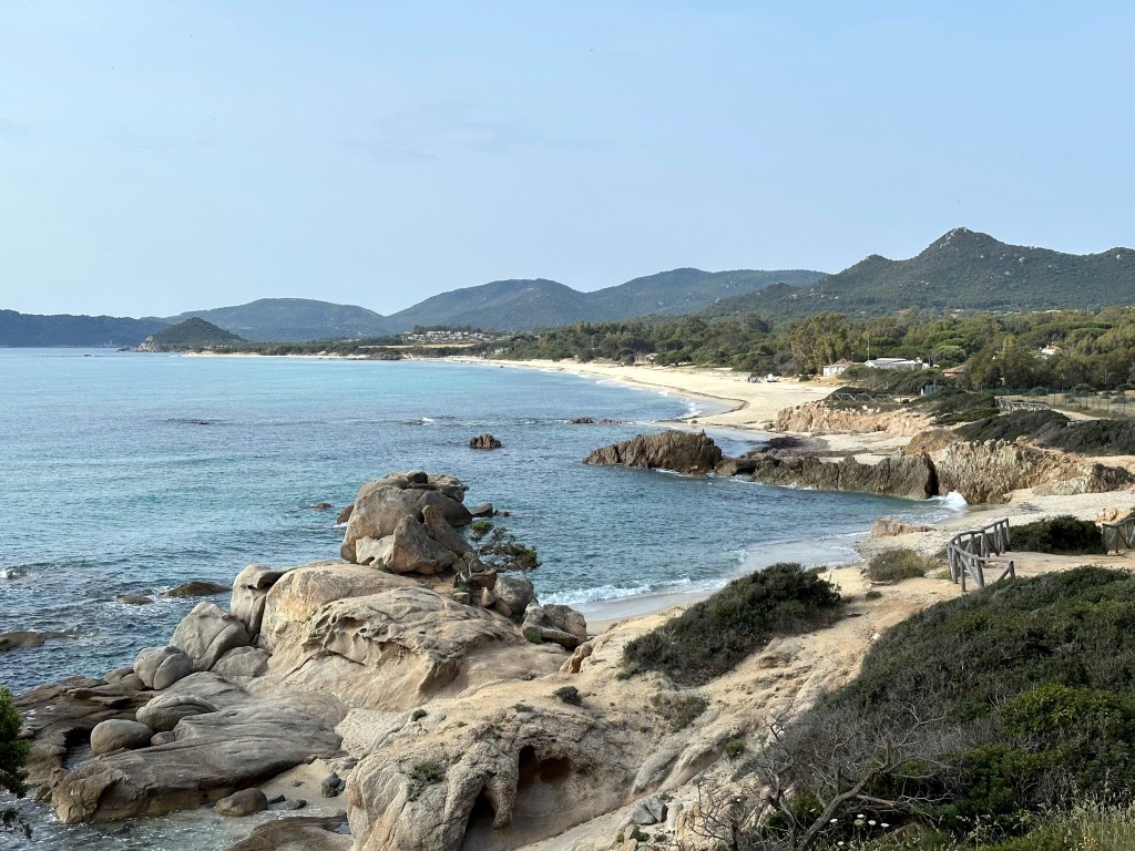
When we decided to buy one-way plane tickets to Europe for our first prolonged foray to celebrate the second of the two retirements, we knew we wanted to return to Italy as a start, but the destinations within Italia, and certainly beyond, weren’t intuitive at the outset. We know we’d be in Tuscany because of the Brandts; we knew we wanted to visit the Amalfi Coast for the first time; we knew we wanted to spend time in Sicily; one of us knew he wanted to check out Herculaneum; the other knew she wanted to visit Portofino. But some locations we were familiar with, but were not on our list, nonetheless ended up on our itinerary simply because they were a convenient stopping point between one target and the next (like Orvieto).
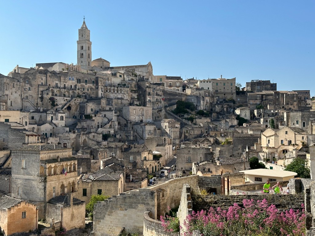
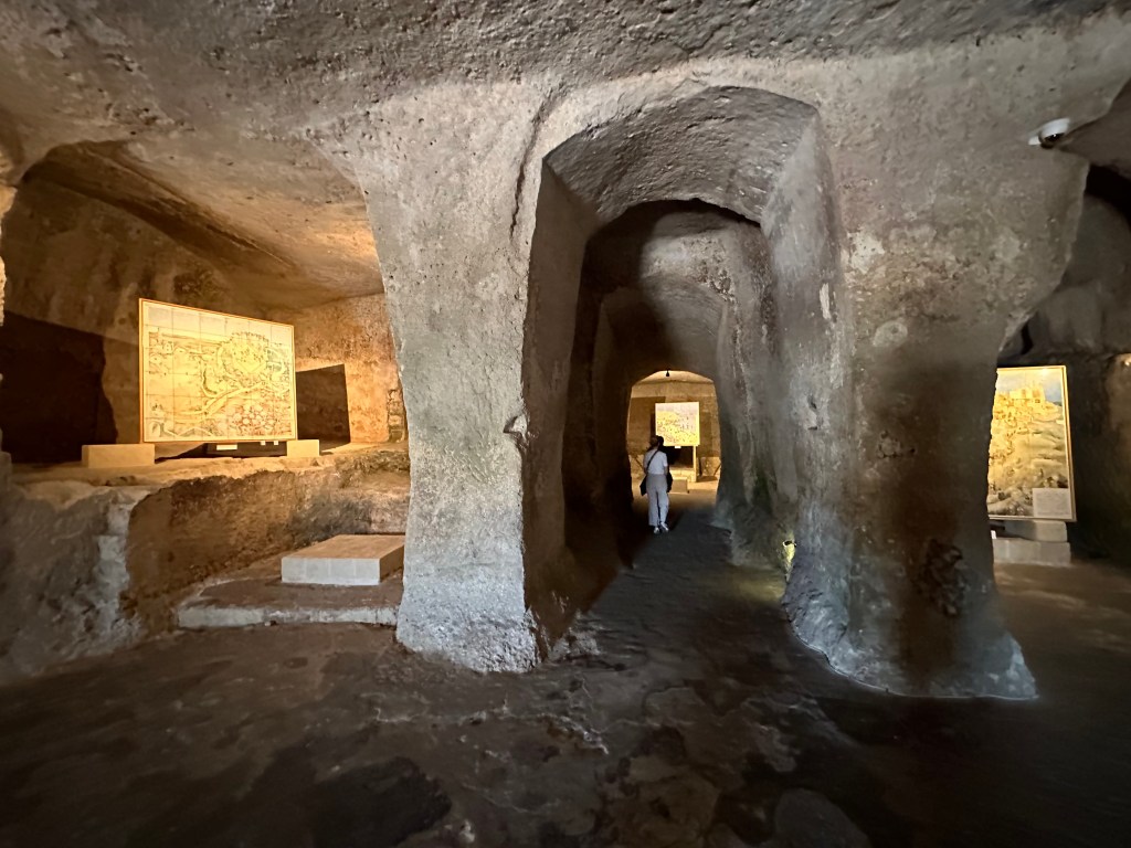
Then, there’s Matera. Not only did Matera not rate a “let’s make sure we go there” spot on the aspirational list – it wasn’t even a town that was known to us. Instead, we stumbled upon this gem during trip planning.
As part of our planning process, the Chief Adventure Officer creates a Google Map with potential places of interest and – overlaid on top – hotels that are part of our favored collections (Relais & Chateau, Small Luxury Hotels, Design Hotels, Rosewood, and some others). If a location highlighted on travel sites or on Instagram looks appealing AND that is home to hotels from one or more of our collections, we figure it really is worth seeing, since boutique hotels wouldn’t be in some shit town. When we overlaid Design Hotels on the Italy map, the town of Matera was suddenly on our radar. And it was between the Amalfi Coast and Bari, where we’d be on a plane headed for Sardinia. So we started researching this new discovery.
Definitely the right choice
“Before its integration into the modern Italian state, the city of Matera had experienced the rule of the Romans, Lombards, Arabs, Byzantine Greeks, Swabians, Angevins, Aragonese, and Bourbons. Although scholars continue to debate the date the dwellings were first occupied in Matera, and the continuity of their subsequent occupation, the area of what is now Matera is believed to have been settled since the Palaeolithic (tenth millennium BC). This makes it potentially one of the oldest continually inhabited settlements in the world.” (From here.) (And we thought Cadiz‘ history was epic.)
Matera’s Sassi—neighborhoods of cave dwellings carved into soft limestone—provided shelter, water collection, and natural insulation. Over centuries, however, population growth and abandonment by the state turned this ingenious landscape into one of extreme deprivation: families lived packed into single-room caves, often sharing the space with livestock, with little ventilation, no running water, no sewage, and widespread disease. By the 19th and early 20th centuries, a stark social divide had formed – Matera’s poorest residents were confined to the Sassi while wealthier families, professionals, and institutions moved up to the piano, the healthier, flatter upper city with light, air, and services. This physical separation mirrored a deeper economic and social gulf, making the Sassi a powerful symbol of southern Italy’s poverty and exclusion. Only after World War II did national attention and government intervention begin to dismantle these conditions, setting Matera on a long path from neglect to preservation.
Carlo Levi, a fiercely anti-fascist doctor, was exiled by Mussolini’s regime to the Basilicata region in 1935 and he described Matera as proof that Italy was actually two civilizations: a modern, northern one and a forgotten, quasi-prehistoric southern one. “Inside those black caves that had walls made of soil, I could see the beds, the poor furnishings, the clothes hanging. Dogs, sheep, goats, and pigs were lying down on the floor. Typically, every family owns just one of those caves as a house, and they sleep all together: men, women, children, animals. There was an infinite number of children. . . sitting in the baking sun, on the doorsteps of their houses, into the dirt, their eyes were half closed and their eyelids red and swollen. This was due to trachoma. I knew that here people suffered from it: but seeing its effects in filth and in extreme poverty it is a different thing. . . it seemed to be in a city stricken by the plague.”
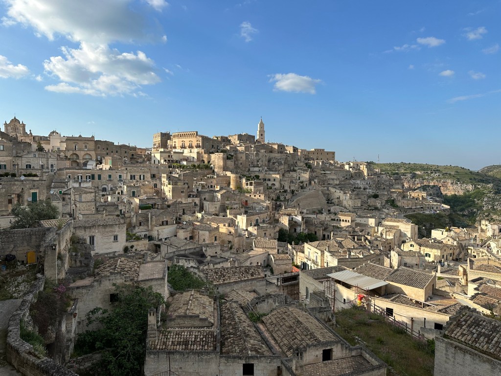
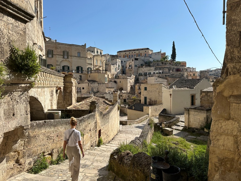
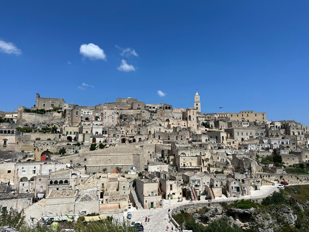
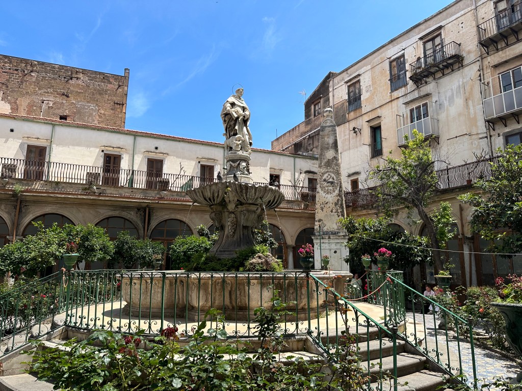
Despite the have and have not history of Matera and the primitive conditions of the sassi, this place has come into its own. Freaking amazing warren of troglodyte homes and alleys built into the soft limestone of the valley. It was like an inverted Gordes – picturesque and full of character.
At the edge of the sassi lies Chiesa del Purgatorio (Church of Purgatory).
The church was built in the 18th century and embodies baroque church architecture (which we’d see plenty of a couple of weeks later in central Sicily), but that’s not why it’s notable.
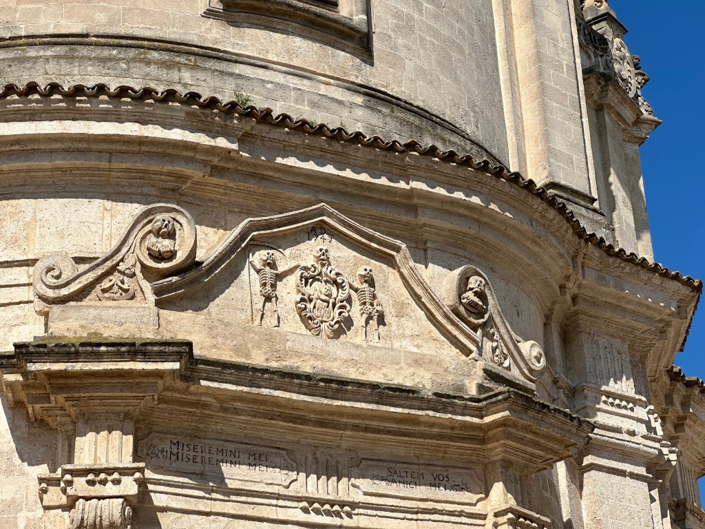
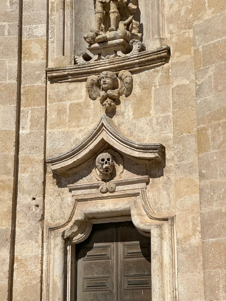
It’s notable for it’s embellishments everywhere that serve as reminders of mortality (memento mori),
and the need to pray for souls in pergatory.
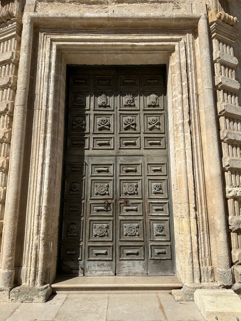
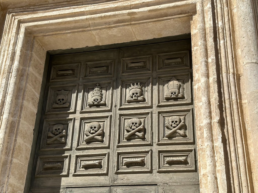
The door is the coolest part.
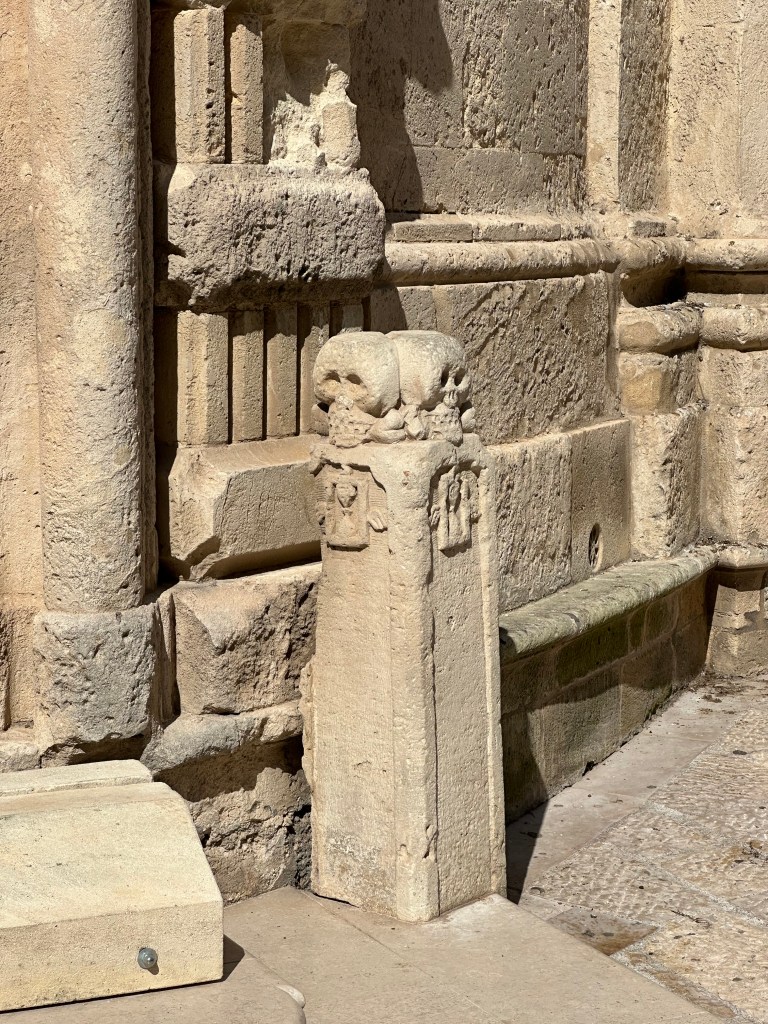
“It’s decorated with four skulls of nobles and clergymen and just under these, four skulls representing common people, with four more on the side of the entrance.” (From here.)
But the skulls-on-a-plinth are a good look, too:
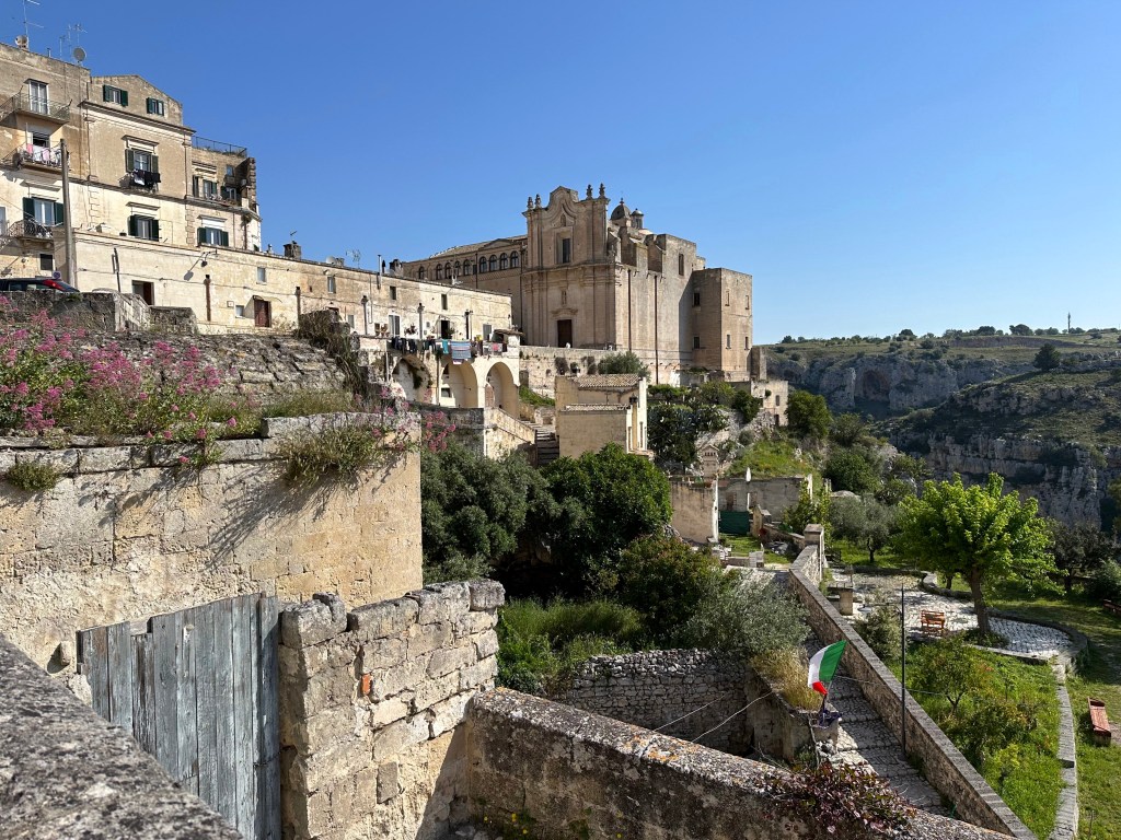
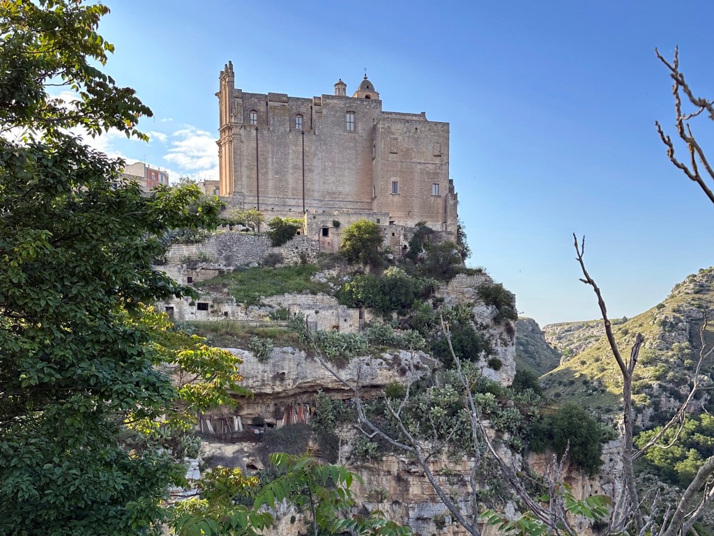
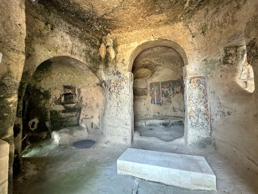
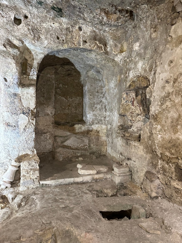
At the other end of town, a different religious institution: The Convent of Saint Augustine.
A relative latecomer, having been founded in 1591, it’s still a pretty impressive and monolithic structure, perched on a cliff at the very edge of the sassi.
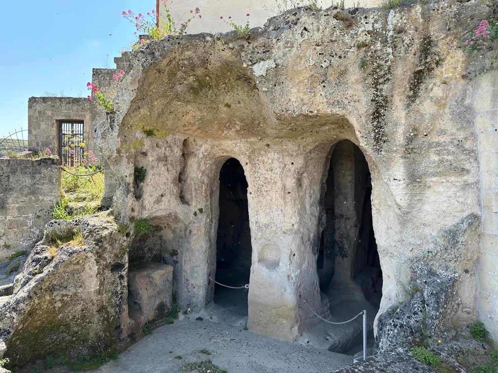
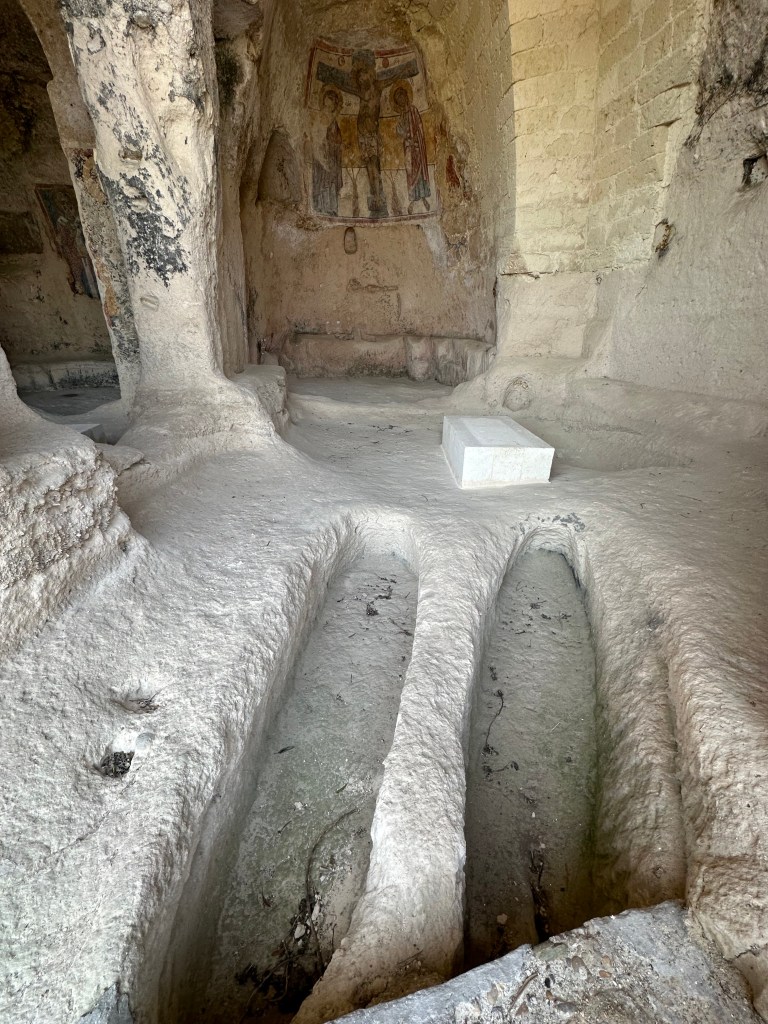
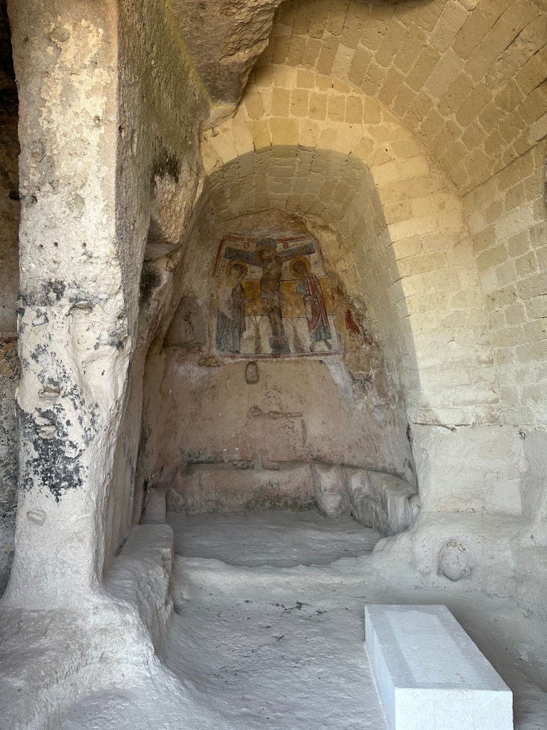
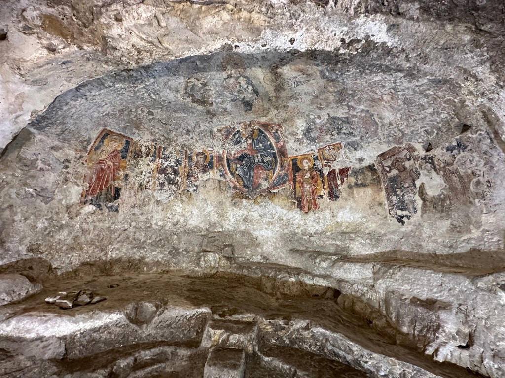
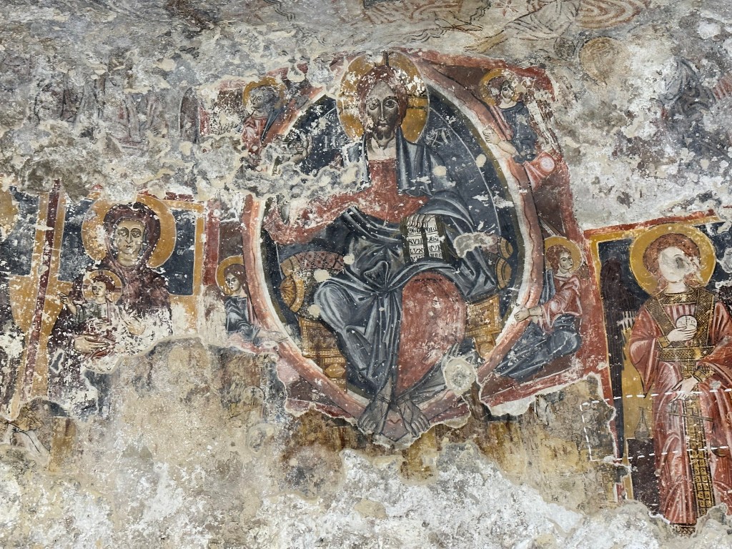
And in its shadow, a humble rupestrian church (new term to us! we would have characterized this cave church as troglodyte [like we did in this post from Cappadocia], but rupestrian works too).
Founded in the 10th century, San Nicola Dei Greci originated as a Greek Orthodox church (see Byzantine Greek rule reference above
The triptych fresco depicting Saint Nicolas, Saint Barbara, and Saint Pantaleon (not to be confused with Saint Pantaloons, patron saint of trousers and culottes) dates from the 12th to 13th centuries:
Check this shit out! This is why Europe is so incredible; we were just wandering about a troglodyte church with 800-year-old frescos adorning its walls with the same casualness as walking into a Starbucks.
With that under our belt, we head out in search of some lunch.
Outside the sassi in the Piazza San Pietro Caveoso with the cathedral’s bell tower looming over town:
Chiesa di San Pietro Caveoso (The Church of Saints Peter and Paul, the latter of whom apparently went the way of Hamilton of Booz Allen Hamilton in the church name):
The original church dates to 1218, but the current appearance reflects a comprehensive overhaul in the 17th century. Picturesque, and with a well-positioned plaza facing the sassi (as noted above), it’s still not quite as cool as the rupestrian church above it.
“Dating to the 8th century, when it was built as the Benedictine Order’s first foothold in Matera, this cliff-face church has a number of 13th-century frescoes, including an unusual breastfeeding Madonna. The church originally comprised three aisles, with two later adapted as dwellings.” (From here.) We got to see the inside, which did indeed have multiple frescoes, as with the other rupestrian church, but no cameras were allowed in this one or in another one we popped into inside the sassi area.
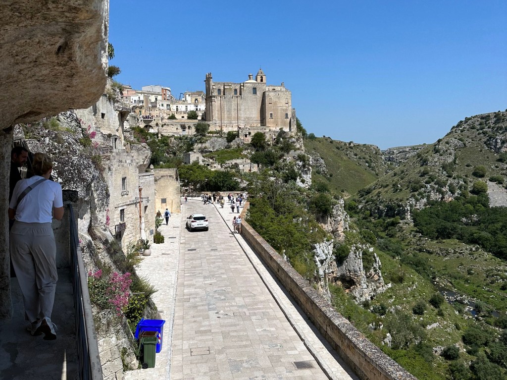
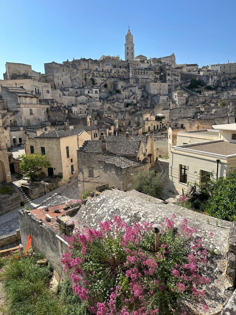
A view of the other end of the sassi facing the valley:
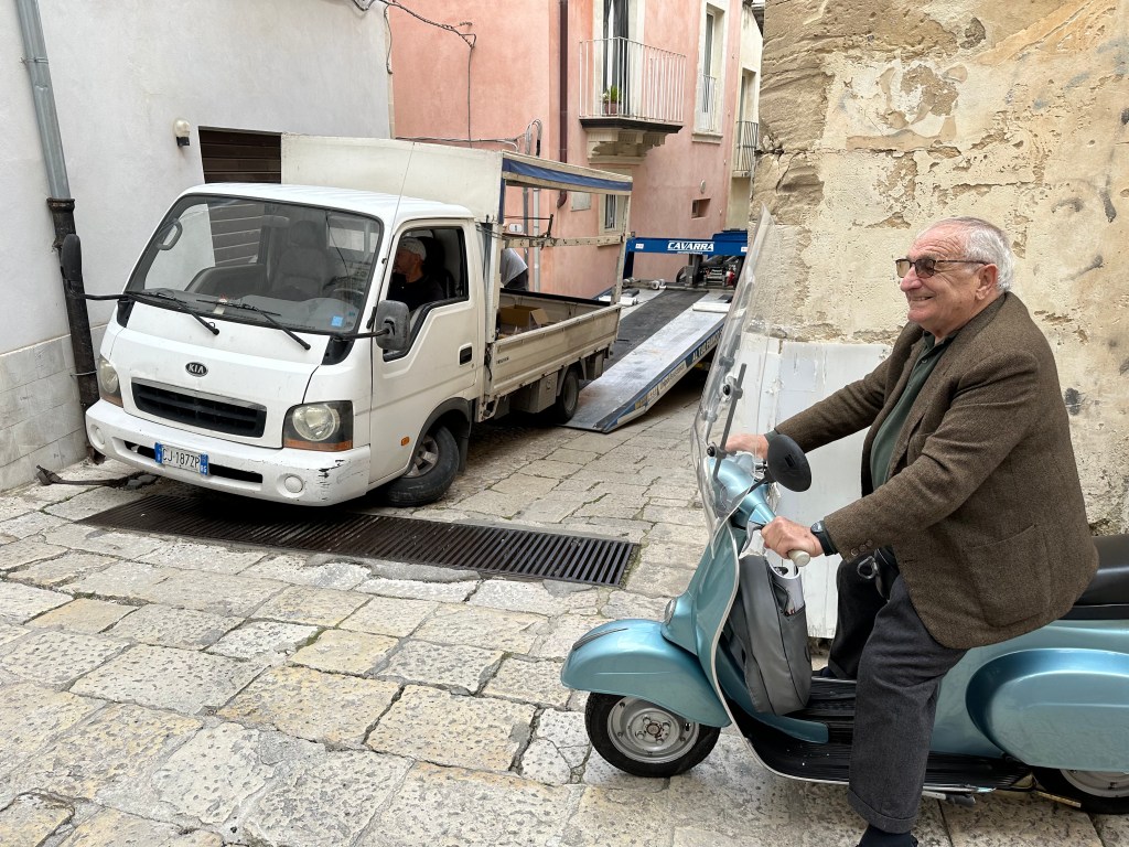
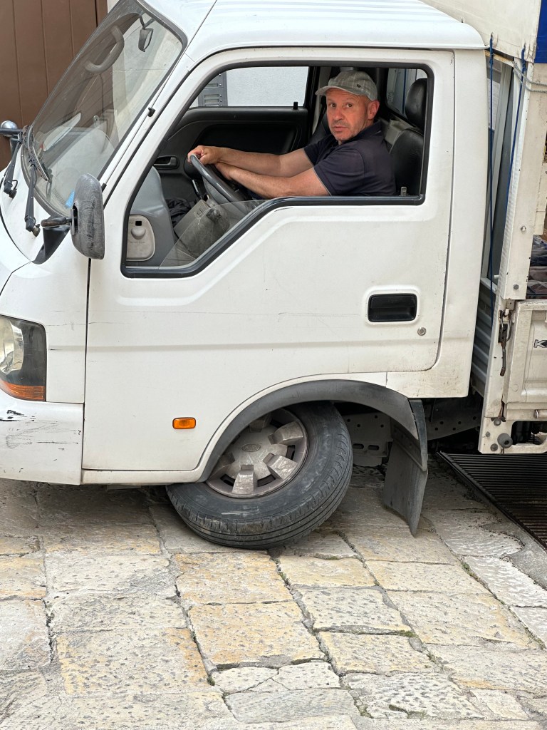
What’s a town to do for a dump truck if most of the roads are narrow, up-and-down alleyways? This:
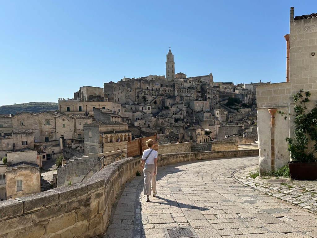
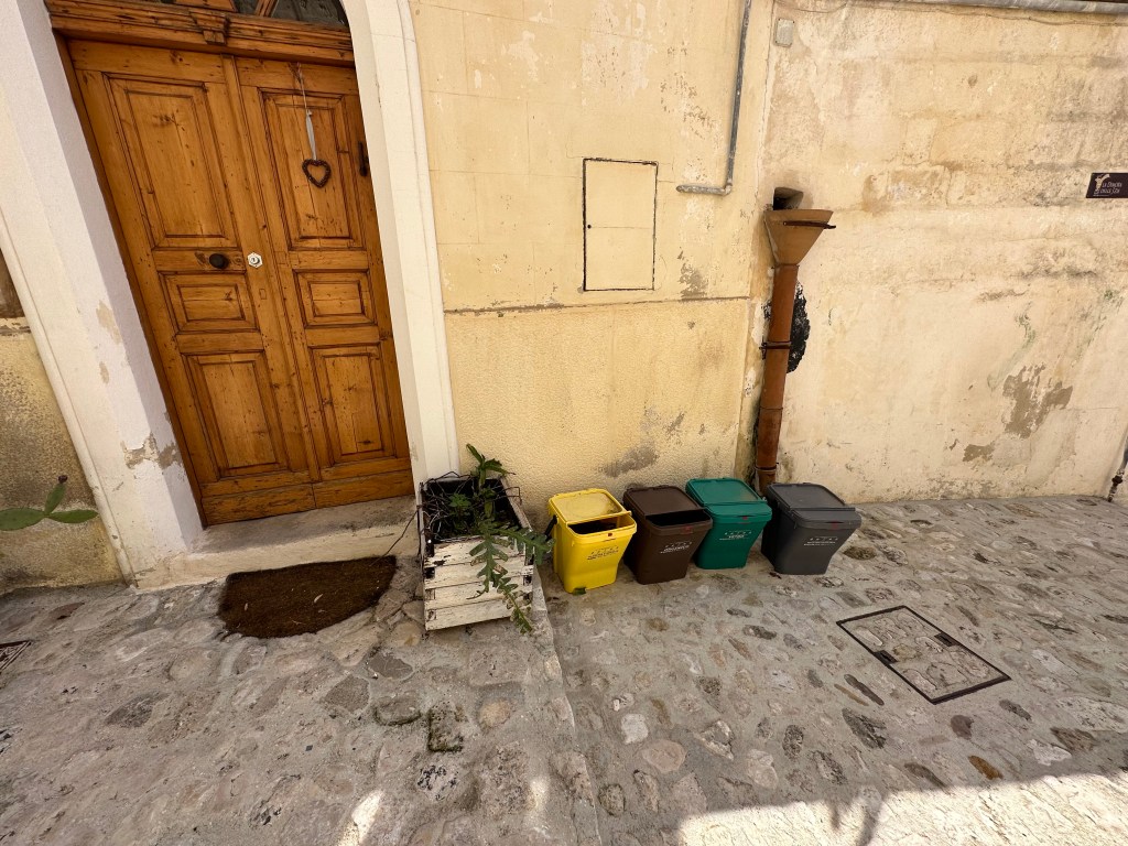
Also, a picture that captures the recycling specificity that uniquely characterizes Italy and no other country, European or otherwise, that we’ve visited:
We first encountered this during our second visit to Siena, and then at our AirB&B in Portofino. You’ve got to separate glass from metal from paper from food waste and from general refuse (not that there’s much left after all of that sorting). Which raises questions like, where do we deposit the paper coffee filter (paper) filled with coffee grounds (food waste)? Or this burnt out light bulb comprised of brass (metal) and glass (um, glass)? These are the challenges WolfeStreetTravel must cope with!
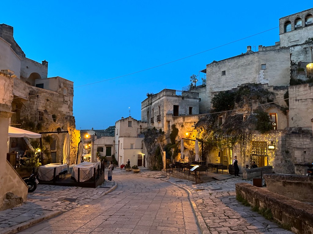
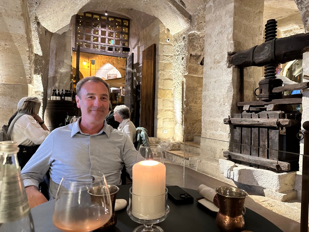
Heading out for aperitivos high up in the sassi and then dinner on our last night:
One of the best dinners of the visits, actually.
Pretty awesome conversion of a troglodyte church into a wine bar:
And some good freakin’ pesto:
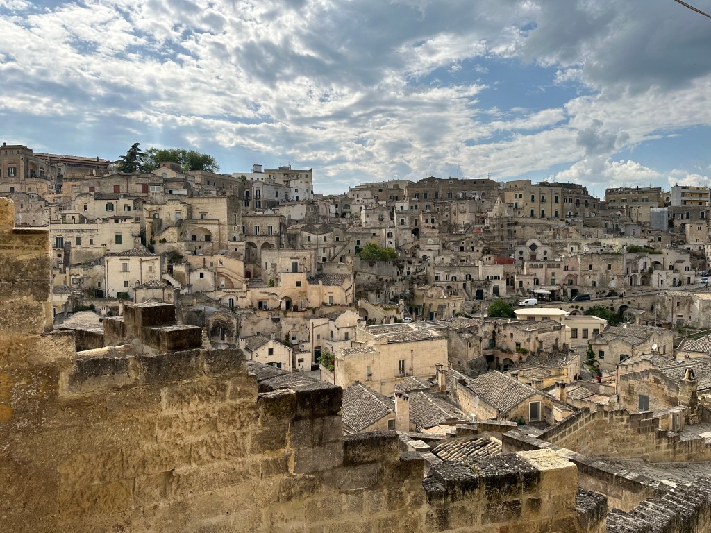
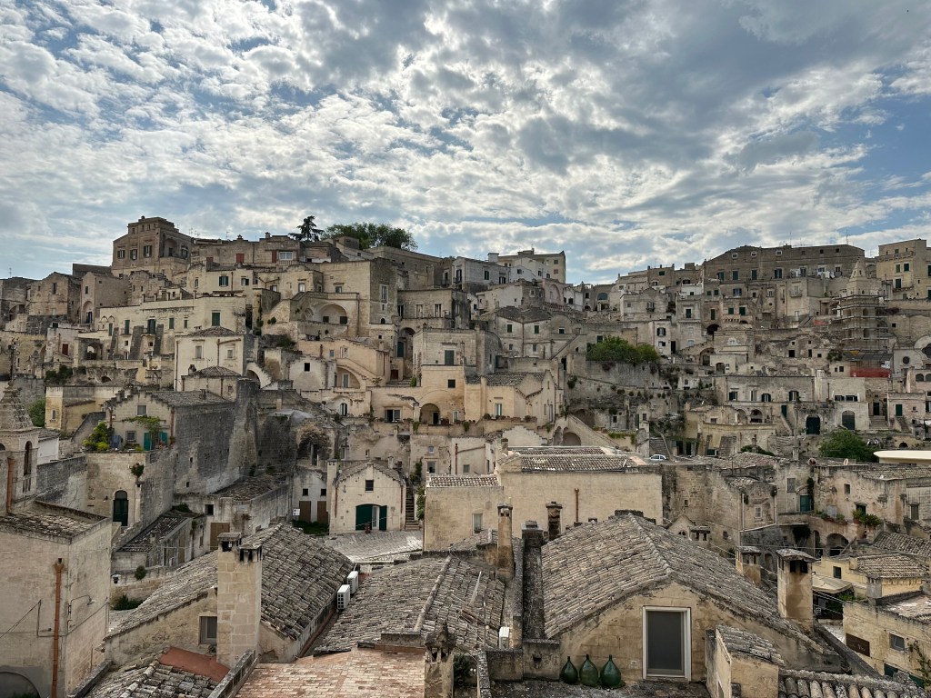
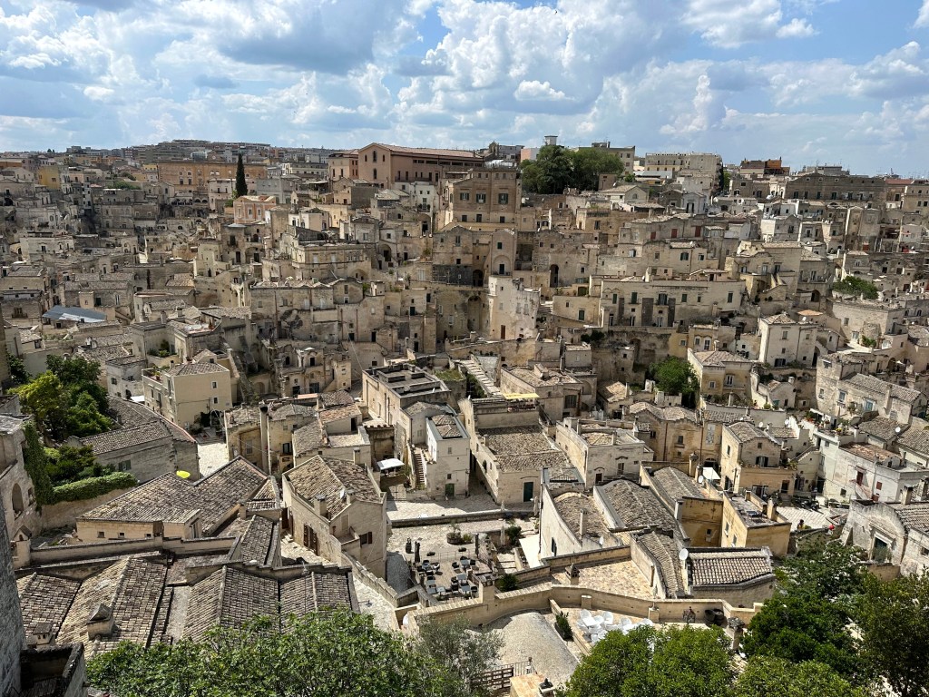
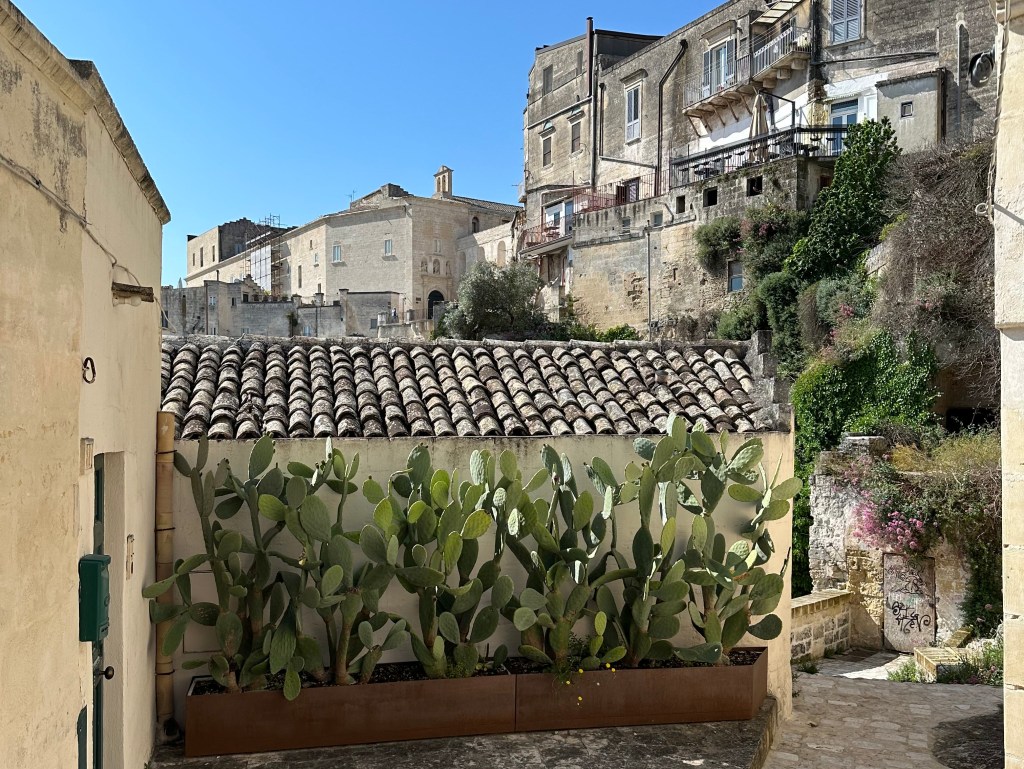
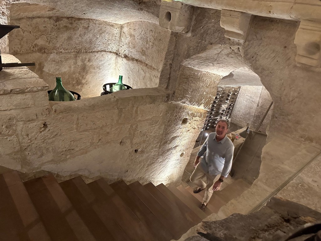
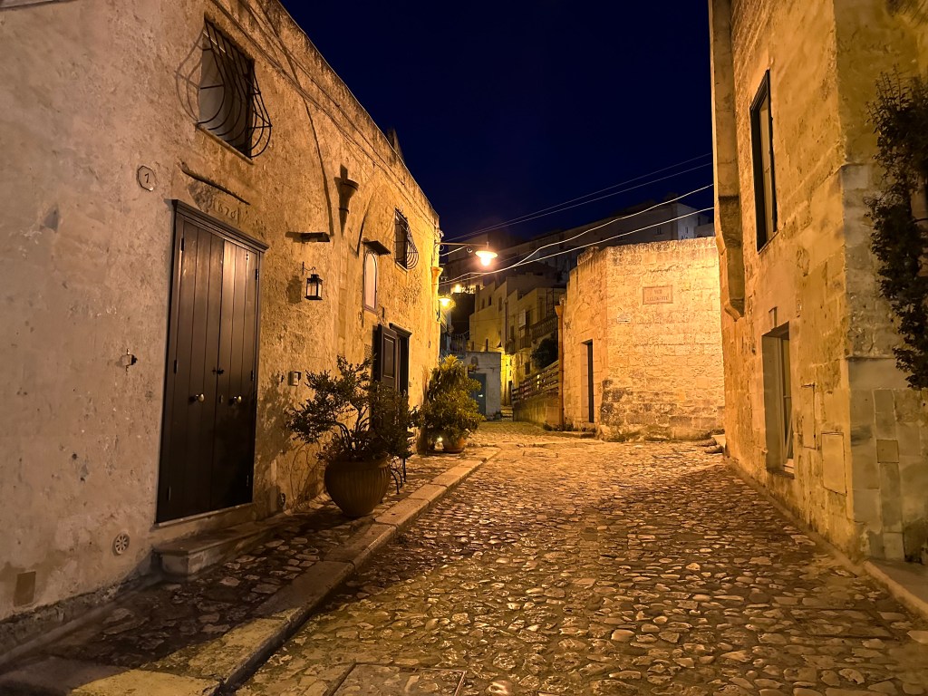
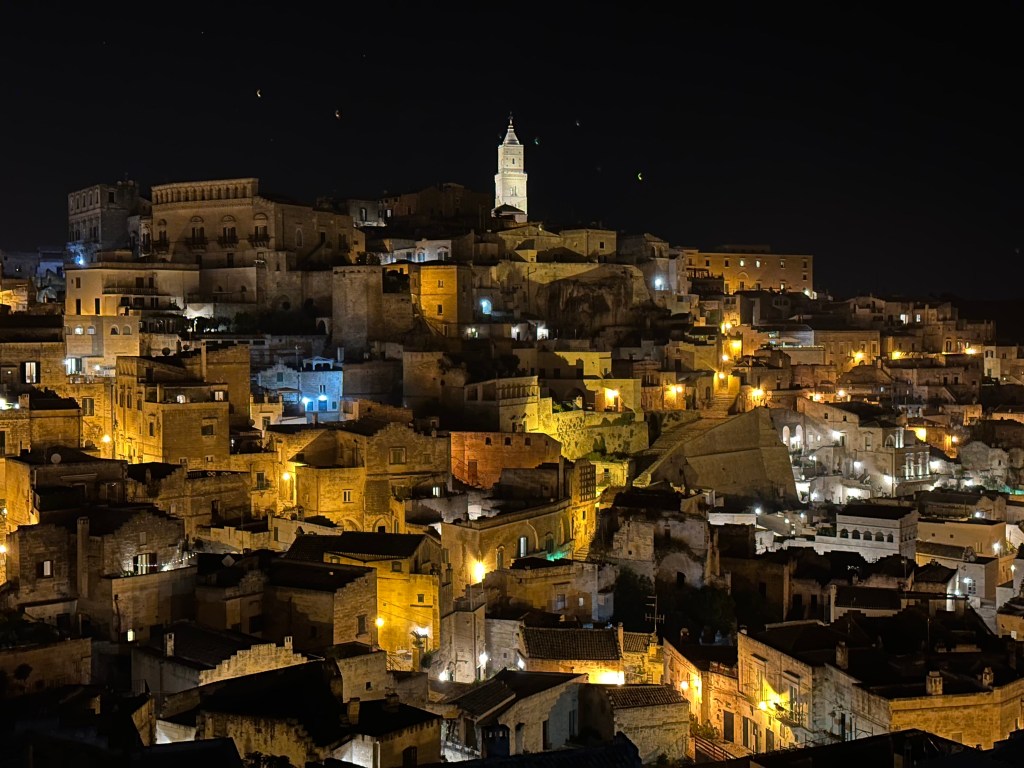
Sassi day time:
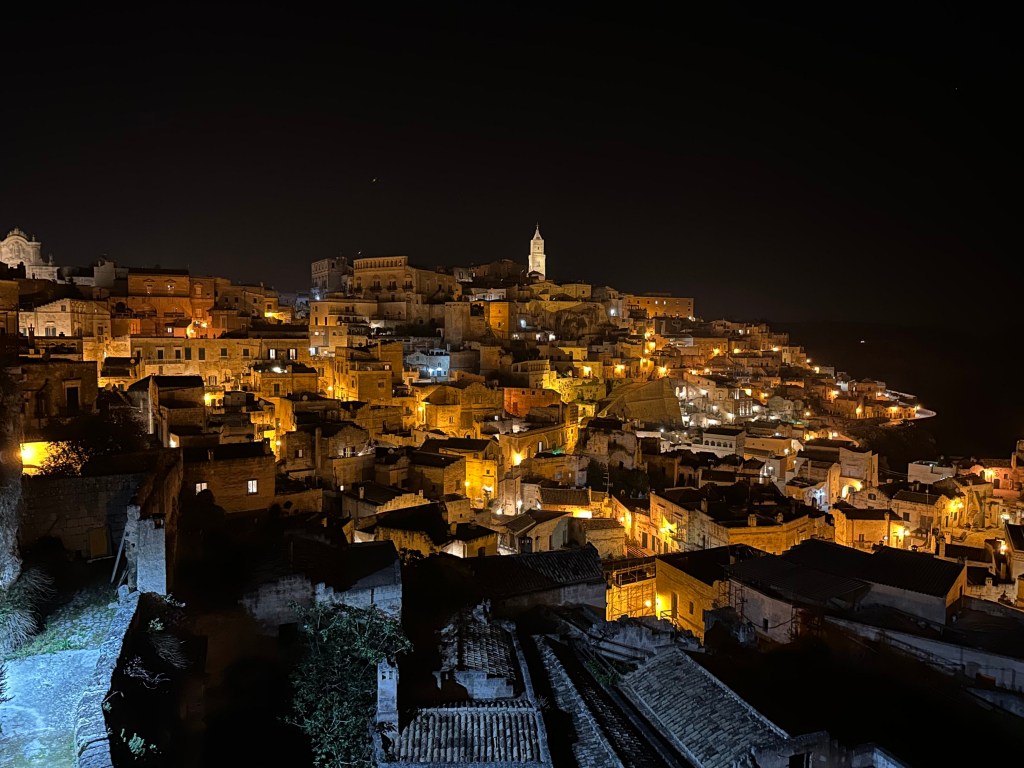
Sassi night time:
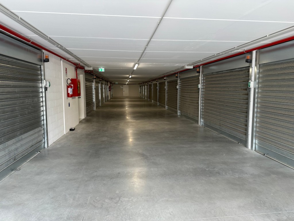
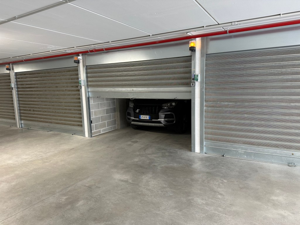
The next morning, we retrieved our car for the drive to the Bari airport. In what appears to be a self-storage warehouse:
But behold! A bunch of tight garages for sassi residents who can’t bring their cars (for obvious reasons) into town:
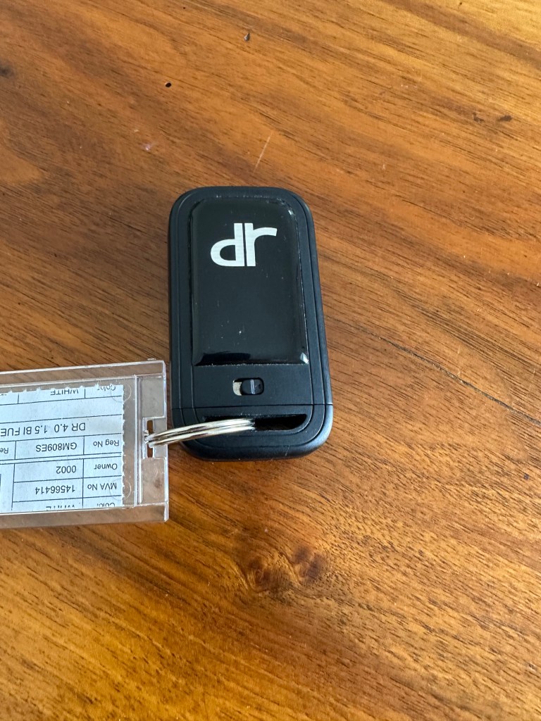
And the weirdest car to date: a dr, which is an Italian car brand that uses Chinese auto bodies. Go figure. Regardless, this was our last day with it.
After a couple of days in Matera, we drove east in the morning across the remainder of the Italian peninsula to drop off the car at the Bari airport and catch a flight to the Costa Rei at the southeastern tip of Sardinia. Our time in Matera brought a close to the Italian peninsula segment of the trip and beginning the next (albeit very brief) leg. (An overview of the trip sequencing is posted in the, uh, overview post.)
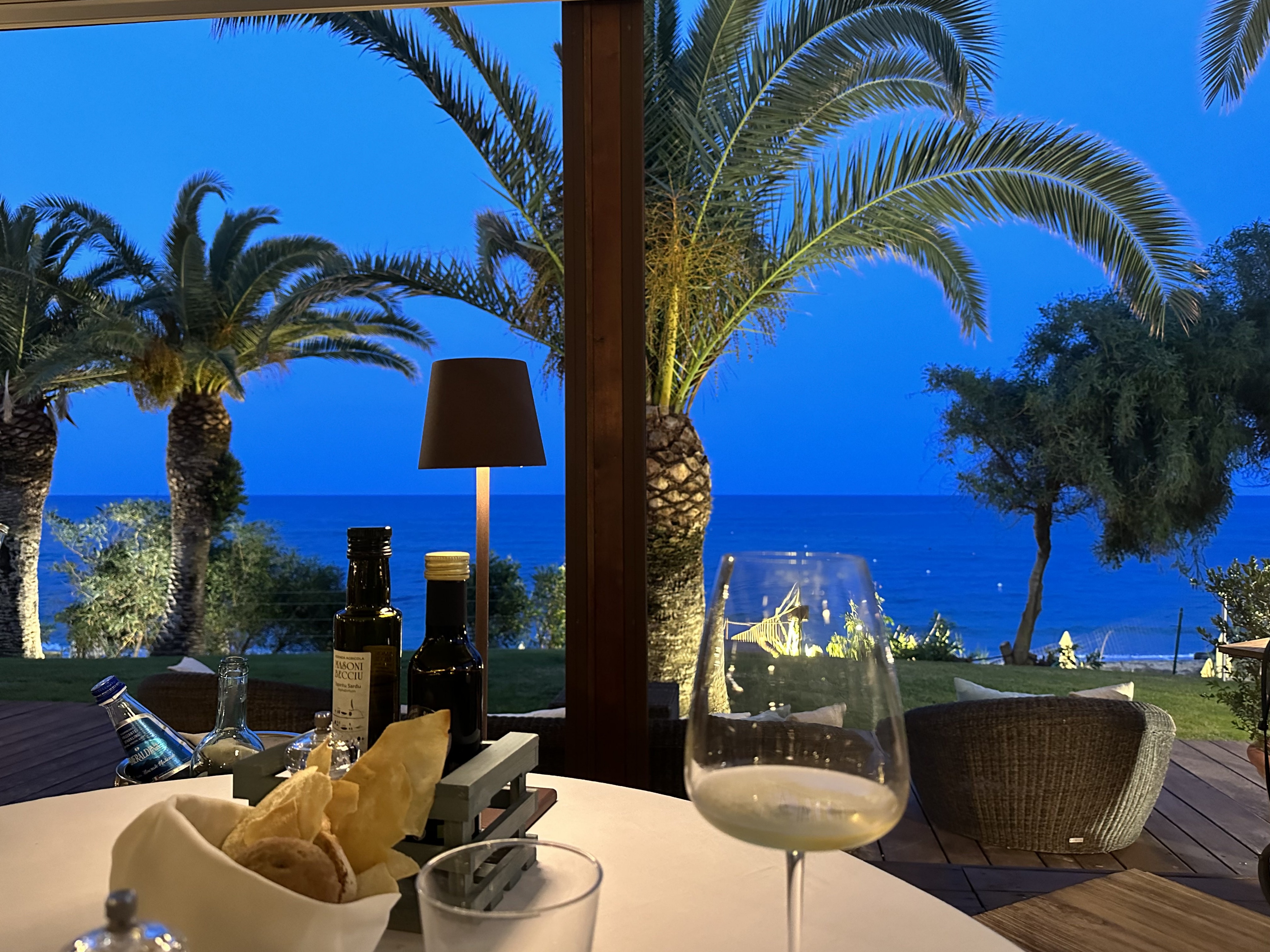
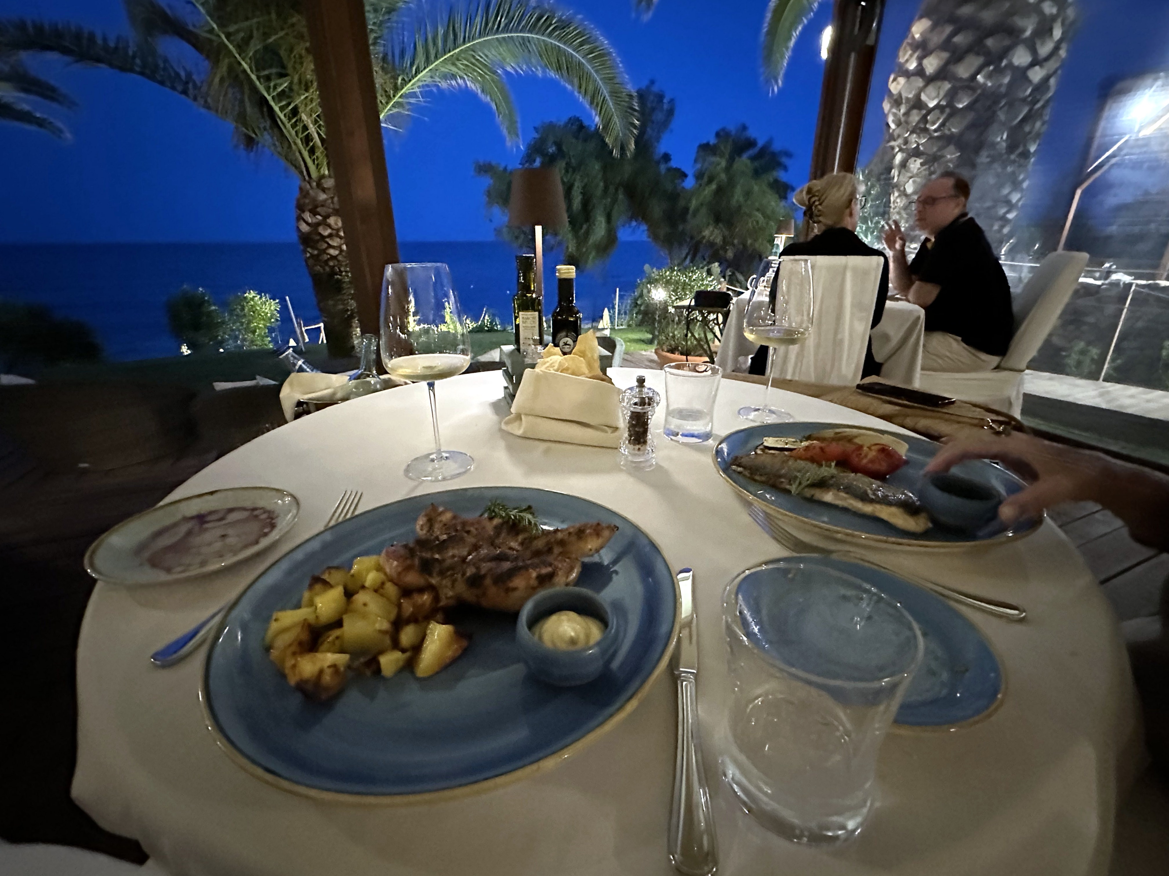
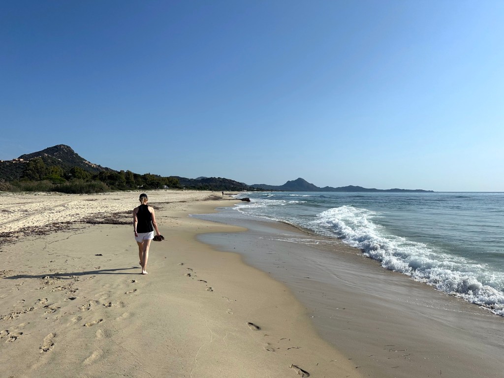
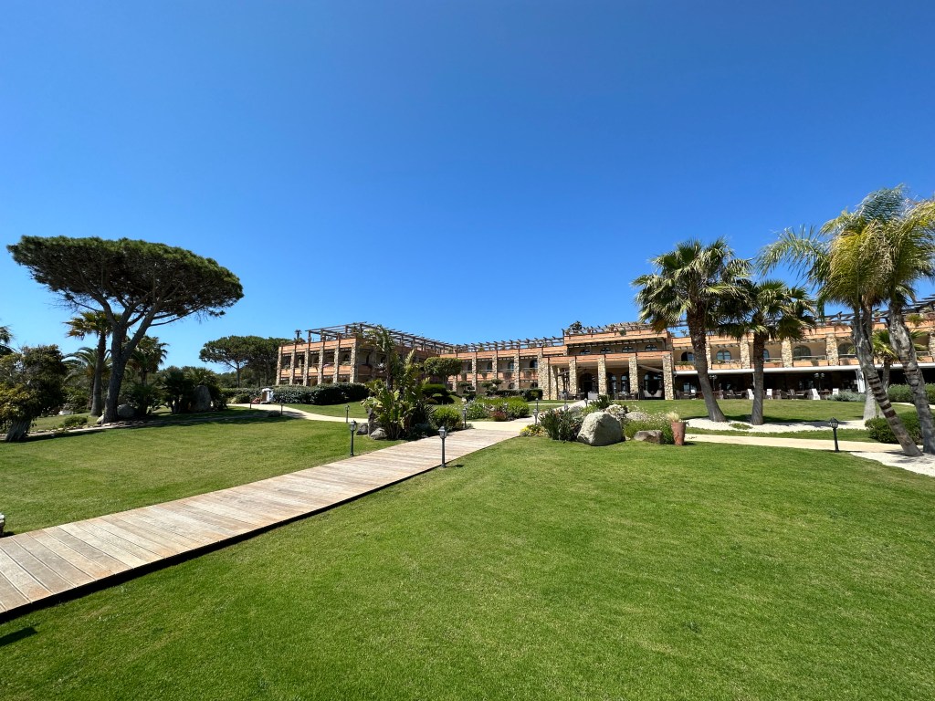
Unlike the other stops on our trip thus far, this would be focused only on chilling – no history, no exploration (other than beach walks each day). So, very little commentary – just some pics.
Okay – here’s some commentary: Sardinian oysters are outstanding. (They’ll be bested by the Normandy oysters we’d have a month and a half later, and also by the Wellfleet oysters we’d have on our New England road trip the following year, but still – really good!)
Decent digs with a pretty good view:
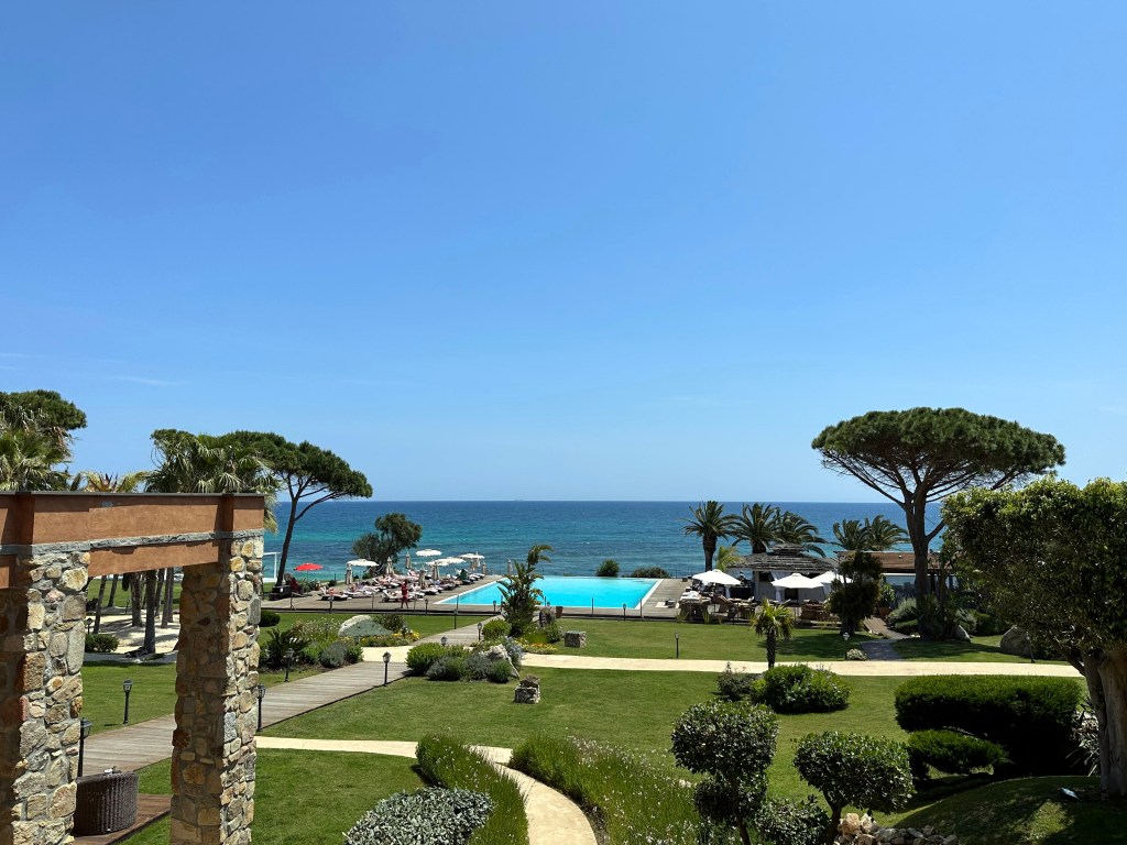
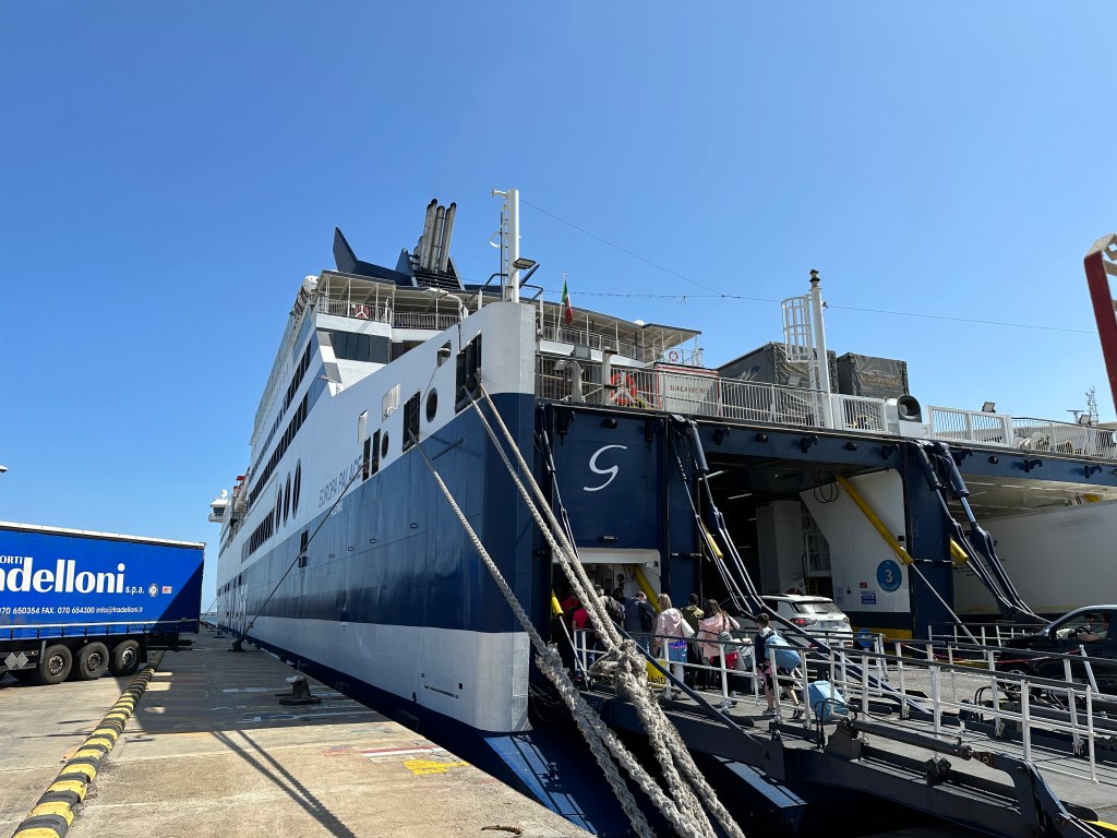
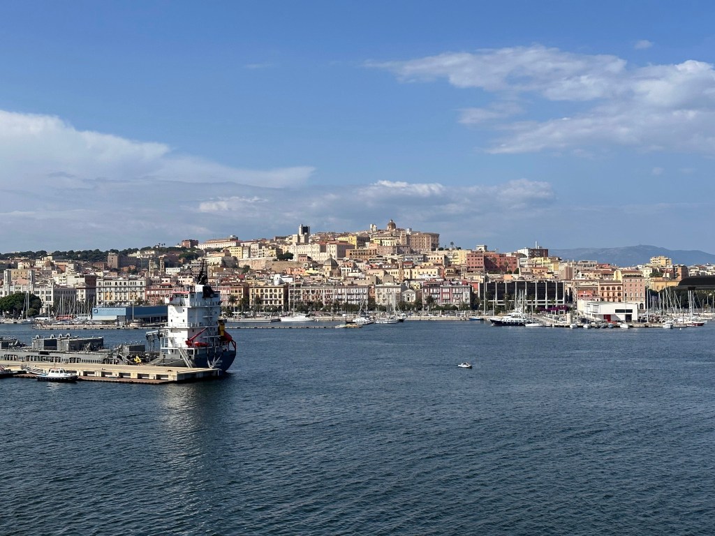
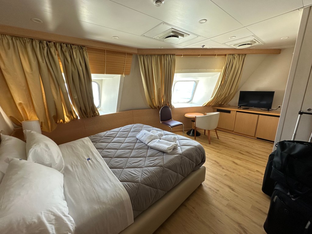
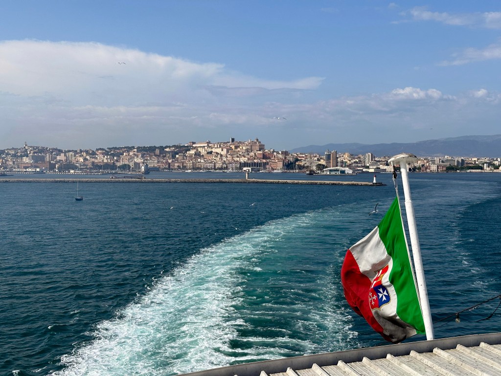
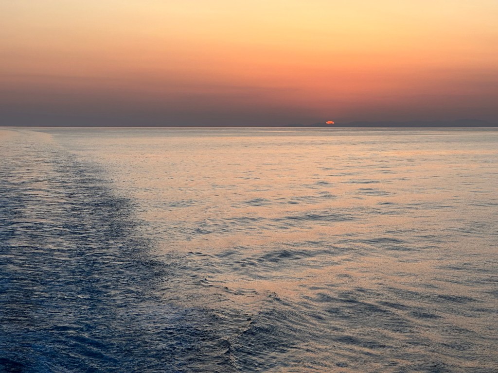
After a few days lounging around Costa Rei, we headed to the port and grabbed an overnight ferry to our next destination: Palermo and Sicily.
No bad digs here either – also a pretty efficient use of time to sleep en route to Sicily (just like our overnight train from Lisbon to Madrid on our very first European trip in 2002).
After an overnight ferry ride from Sardinia, we arrived in Palermo, Sicily, early the next morning. This would be our first time ever setting foot on the island. An island with a remarkably layered history of conquerors and competition – perhaps more so than with any other region to which we’ve traveled.
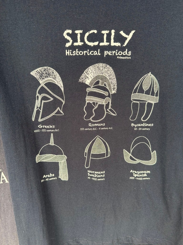
During our time on the island, we read Sicily: Three Thousand Years of Human History, by Sandra Benjamin, which provided great context to the historical backgrounds of the locations we visited and the architecture we witnessed. Although super conversational and easy to digest (would 100% recommend), the history book nonetheless was, indeed, a history book. What we could have done instead was just roll up to a souvenir shop (this one located in the beach town of Taormina on the other side of the island) and get the Cliff Notes version of Sicilian history on this spectacularly informative T shirt:
Below, a brief overview of each of those helmets provides a reasonable starting point to Sicily’s millennia of history (plus the addition of two critical cultures by WolfeStreetTravel that are not included on the T shirt and represent egregious omissions – you’d think all tourist T shirts would have been subjected to a rigorous peer review process and thorough QC before being printed!):
Ancient Greeks (c. 750–241 BCE) – Greek colonists founded powerful city-states such as Syracuse and Agrigento, making Sicily part of Magna Graecia and a major center of philosophy, theater, and trade. Their legacy includes Doric temples (notably in the Valley of the Temples), urban planning, coinage, and a lasting imprint on Sicilian dialect, cuisine, and coastal settlement patterns.
Carthaginians (c. 550–241 BCE, western Sicily) – Carthage controlled western Sicily in a long struggle with the Greeks, using ports such as Mozia as strategic trade and naval hubs. They reinforced Sicily’s role as a Mediterranean crossroads and left Phoenician-Punic archaeological remains, maritime trade traditions, and early fortification systems.
Ancient Romans (241 BCE–476 CE) – After defeating Carthage in the First Punic War, Rome made Sicily its first province and a vital grain supplier to the Republic and later Empire. Roman rule brought roads, villas with elaborate mosaics, Latin language foundations, administrative systems, and early Christian communities.
Byzantines (535–827 CE) – Reclaimed under Justinian, Sicily became a key Byzantine outpost bridging Constantinople and the western Mediterranean. They strengthened Orthodox Christianity, introduced Greek liturgical traditions, fortified cities, and preserved classical learning during the early medieval period.
Arabs (827–1091 CE) – Muslim rulers transformed Sicily into a prosperous emirate centered on Palermo, then one of Europe’s largest cities. Their legacy is profound: irrigation systems, citrus and sugar cultivation, advances in science and mathematics, Arabic influences in Sicilian vocabulary, and architectural elements such as gardens, domes, and decorative geometric motifs.
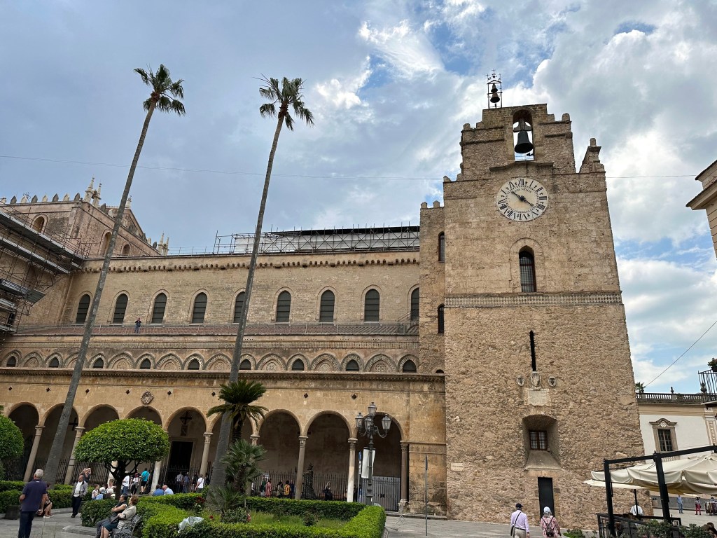
Normans (1091–1194 CE) – The Norman conquest created the multicultural Kingdom of Sicily, blending Latin, Greek, and Arab traditions under rulers like Roger II of Sicily. Their architectural masterpieces (e.g., the Palatine Chapel in Palermo and the cathedrals of Monreale and Cefalù) fused Romanesque, Byzantine mosaics, and Islamic artistry into a uniquely Sicilian style.
Swabians (1194 – 1266) – After the Norman line ended with William II of Sicily in 1189, the crown passed through marriage to Henry VI of the Hohenstaufen dynasty, who became King of Sicily in 1194. His son, Frederick II, then ruled Sicily and turned it into one of the most sophisticated and culturally advanced courts in medieval Europe.
Angevins (1266 – 1282) – The Angevins, led by Charles I of Anjou, seized control of Sicily from the last Hohenstaufen ruler, Manfred of Sicily, in 1266 and ruled with heavy taxation and strong French influence, which bred deep local resentment. This culminated in the Sicilian Vespers, a popular revolt that overthrew Angevin rule on the island and shifted power to the Crown of Aragon.
Aragonese (1282–1479 CE; broader Spanish rule until 1713) – After the Sicilian Vespers, the Crown of Aragon ruled Sicily, integrating it into the Spanish Mediterranean world. They shaped Sicily’s feudal aristocracy, fortified coastal defenses, introduced Catalan-Gothic influences, and embedded Spanish elements in language, governance, cuisine, and Baroque artistic development.
Sicily feels palpably layered because each time one culture overcame the previous, that former layer just accreted – it was never supplanted. Unlike much of Europe, where one dominant power replaced another, Sicily’s conquerors often built on top of existing systems rather than wiping them out. The result is not a linear history, but a vertical one: Doric temples from the Ancient Greeks stand within sight of Roman villas, Byzantine domes, Arab garden layouts, Norman mosaics, and Spanish Baroque facades — sometimes within the same city block.
The island’s geography made this possible. Sitting at the center of Mediterranean trade routes between Europe, North Africa, and the Near East, Sicily was too valuable to abandon and too prosperous to dismantle; each incoming power adapted existing administrative systems, agricultural innovations, and urban frameworks rather than starting from scratch.
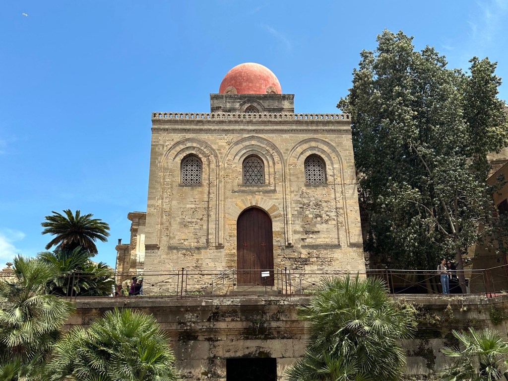
Our favorite example? When the Normans conquered the Muslim emirate, they retained Arab administrators and artisans, which is why you get Islamic muqarnas ceilings inside Christian chapels in Palermo. Case in point: the Arabo-Norman Church of San Cataldo in Palermo, dating from 1140:
This layering also explains Sicily’s cultural contradictions: citrus groves introduced under Arab rule grow beneath Norman cathedrals; Spanish street grids frame Greek archaeological parks; Sicilian dialect carries Arabic, Greek, Catalan, and Latin roots simultaneously. The island feels neither fully Italian nor fully Mediterranean in a single-direction sense — it feels like a distilled Mediterranean civilization.
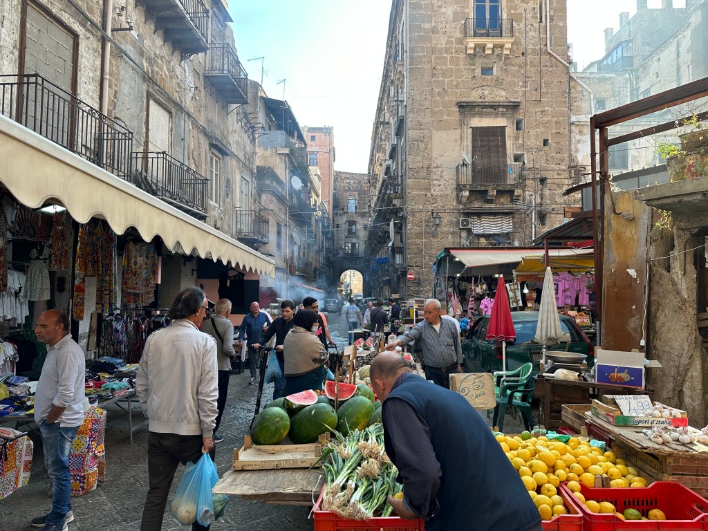
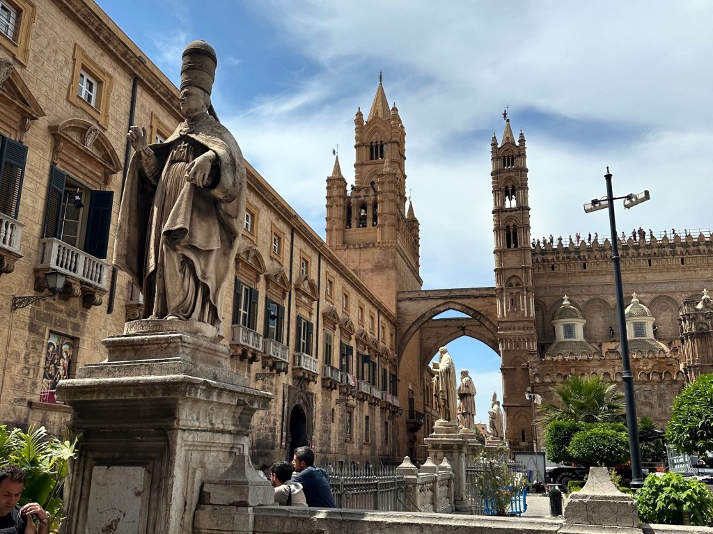
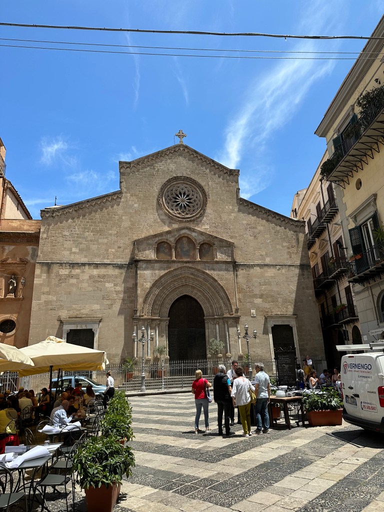
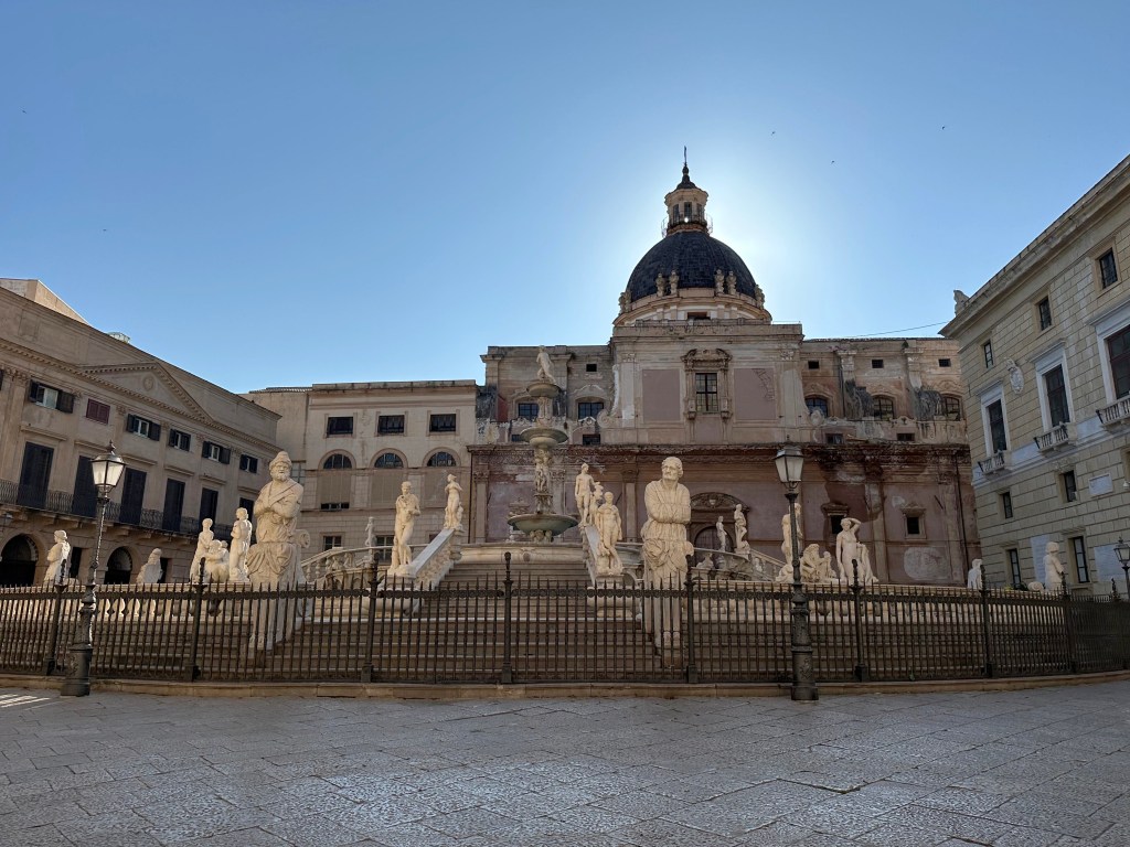
Although Sicily’s long history is better witnessed in cities like Syracuse on the southeast coast, where the Greeks first settled and which dominated trade and politics, we began our stay on Sicily in its current capital of Palermo, in the northwest. After the Arab conquest in the 9th century, the focus shifted westward to Palermo, which became the administrative and commercial capital under Muslim and later Norman rule. Its superior harbor and position on Mediterranean trade routes cemented Palermo’s long-term dominance.
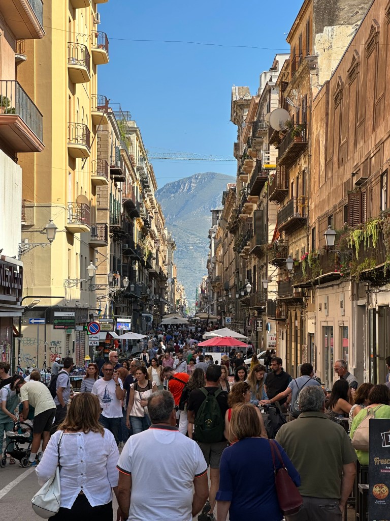
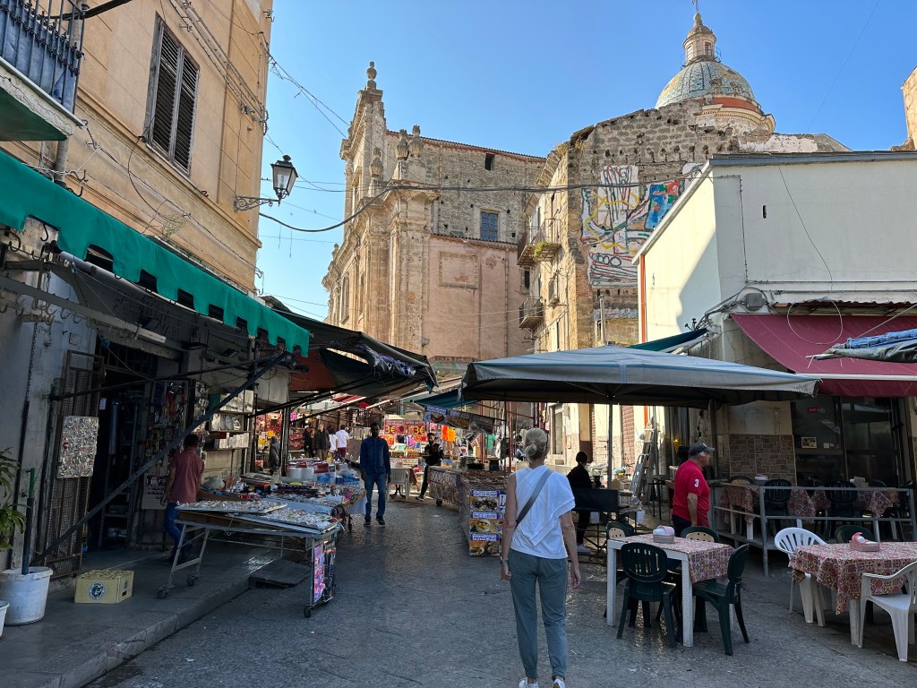
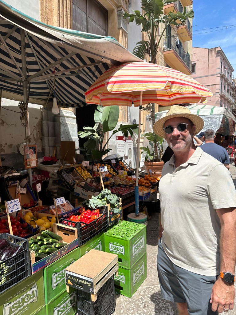
Palermo’s main drag of Via Maqueda, where we’d find ourselves each day at some point:
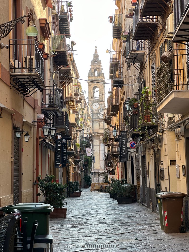
Cool little side street our first morning highlighting the cathedral bell tower:
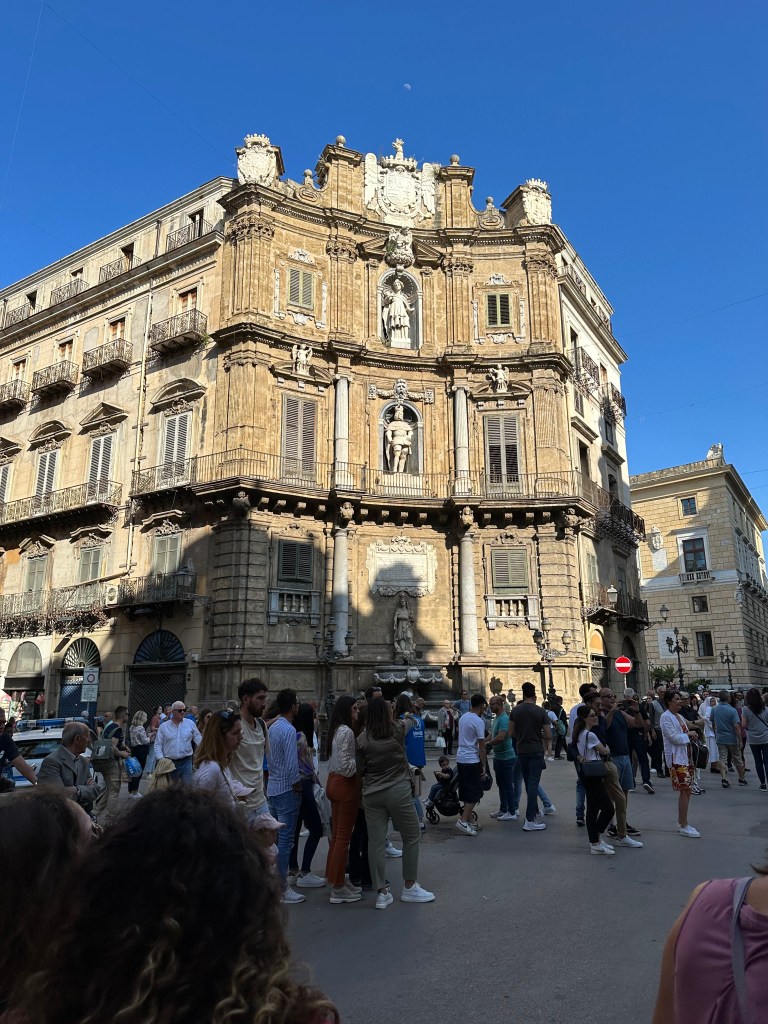
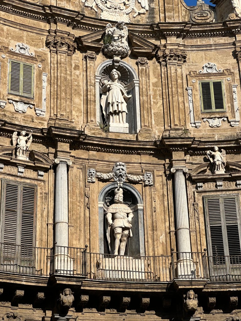
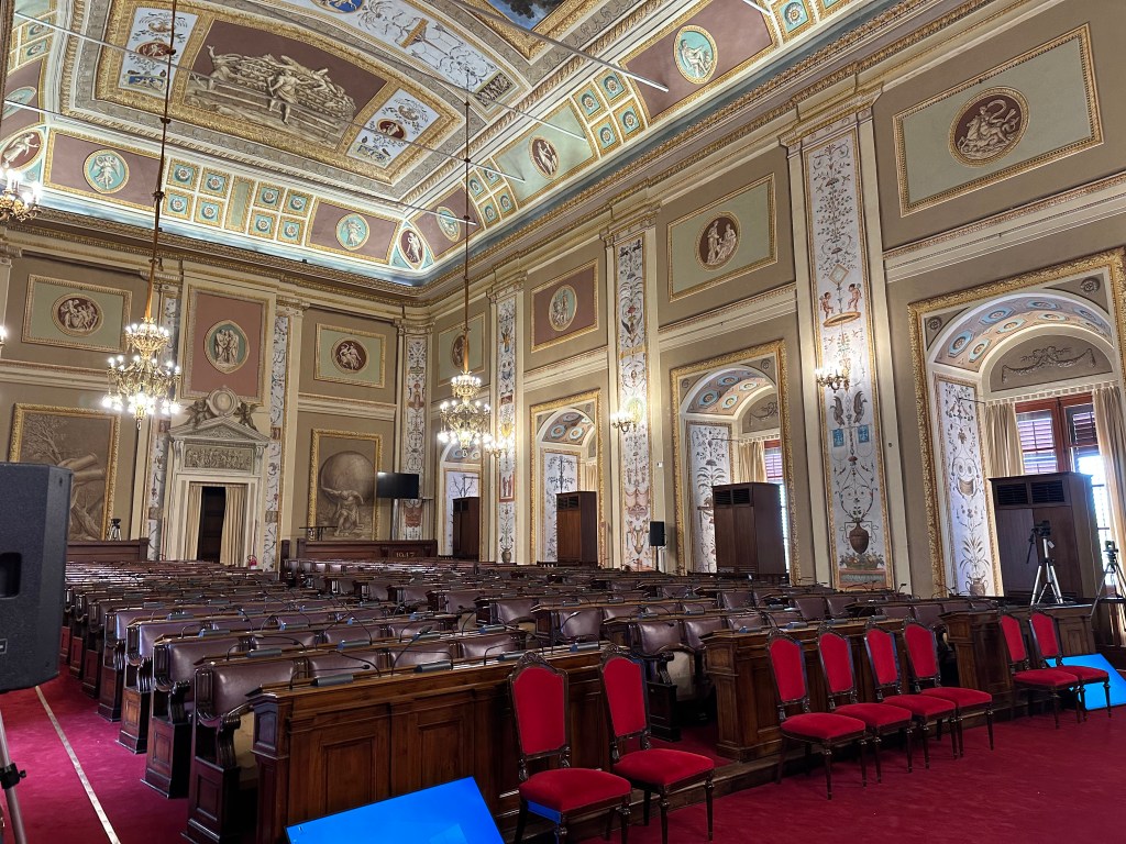
Palermo’s Baroque Quatro Canti square at the intersection of the Via Maqueda and the Corso Vittorio Emanuele:
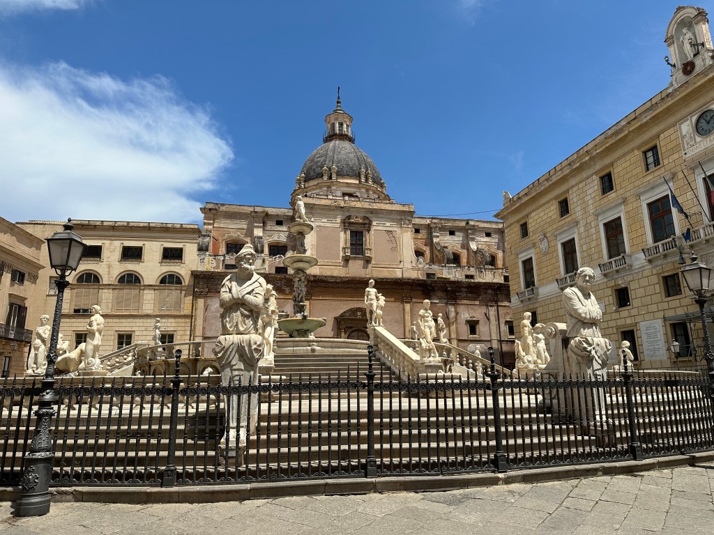
The ornate, 16th-century Praetorian Fountain on Via Maqueda, sporting 16 nude statues of nymphs, humans, mermaids, and satyrs (offending some delicate souls, who declared it Fontana della Vergogna [Fountain of Shame]):
Pretty awesome town in which to just wander around.
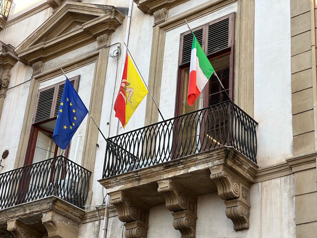
Sicily’s super-intriguing Trinacria flag, flanked by the EU and Italian flags on balcony in town. We’ll get into that little vexillological nugget in a future post, featuring beer. Cold, delicious beer. Mmmm; beer.
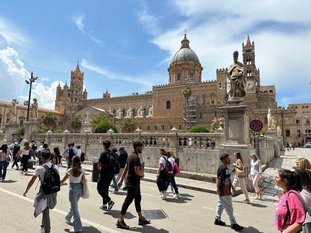
Palermo Cathedral:
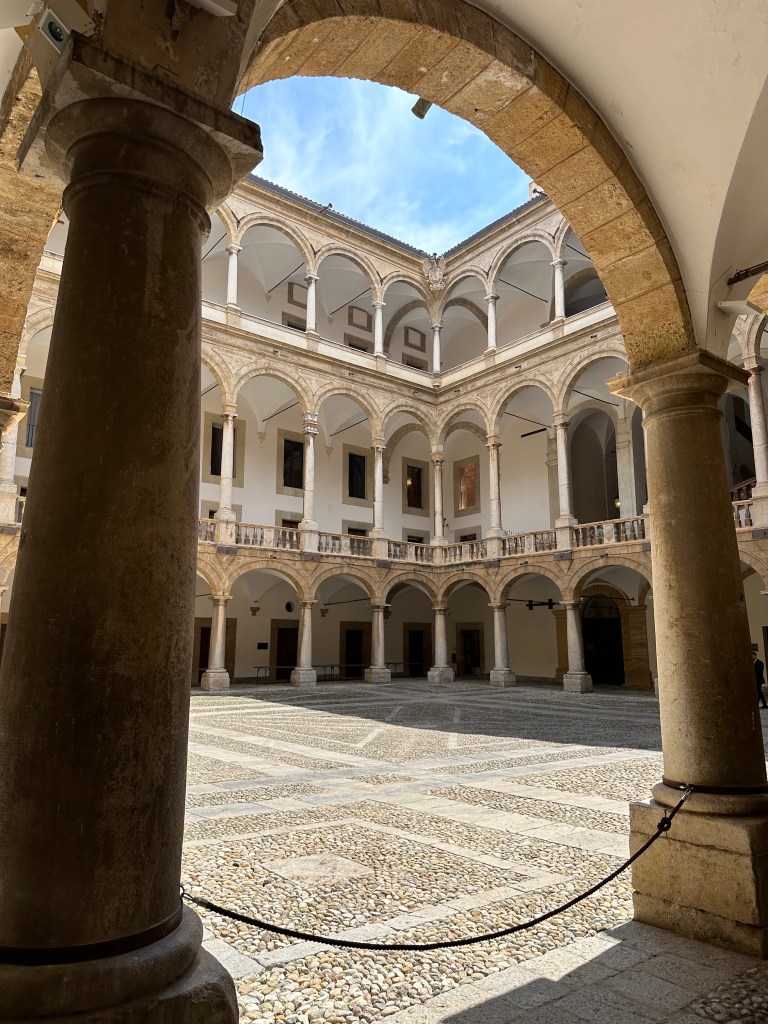
We didn’t go in, but instead walked through, making a beeline to the much more interesting Palazzo dei Normanni (Palace of the Normans):
Inside the palace’s main courtyard:
The Norman Palace “was built on the highest point of the city, above a Punic [see?! Carthaginians!] structure discovered in 1984 beneath the Duke of Montalto Halls. During Arab rule, the earliest nucleus of the building arose between the rivers Kemonia and Papireto, designed with defensive features typical of fortresses. This building was also used during the Roman Byzantine era.
Following the Norman conquest in 1072, the Normans built a new building consisting of a castle, with the function of royal residence and administrative hub. In 1130, after the coronation of Roger II of Altavilla—the first Norman king of Sicily—the Palatine Chapel was constructed, becoming a symbol of Norman cultural and Christian religious.
The palace’s core was marked by four towers and included facilities such as workshops and textile laboratories (nobiles officinae or tiraz). It served as the seat of successive Norman courts, including those of Roger II, William I (known as “the Mean”), and William II (“the Good”), who oversaw a remarkable confluence of diverse cultures. Frederick II, grandson of Roger II and son of Henry VI of Hohenstaufen and Constance of Altavilla, continued this legacy. He played a pivotal role in its administration and in fostering cultural life, notably supporting the Sicilian School of poetry.” (All from here.) [BTW, we also would highly recommend the podcast “Norman Centuries” by Lars Brownworth; outstanding!]
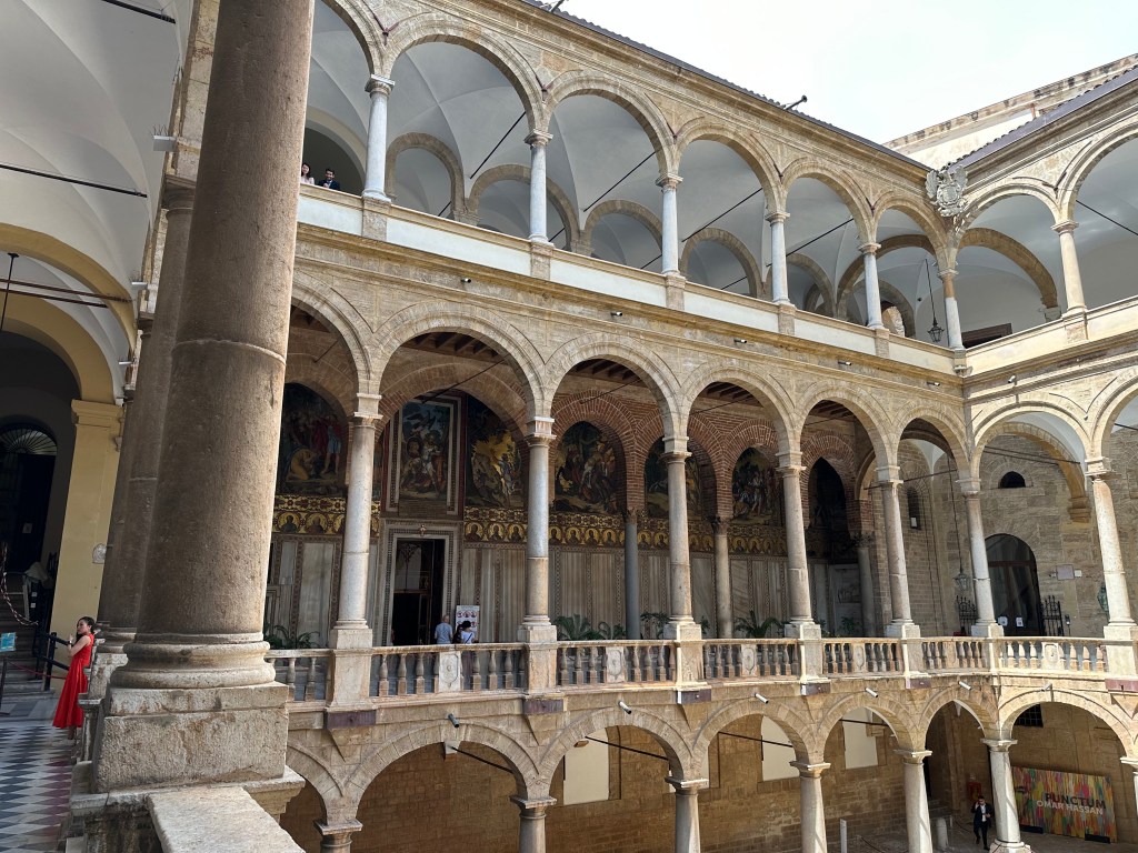
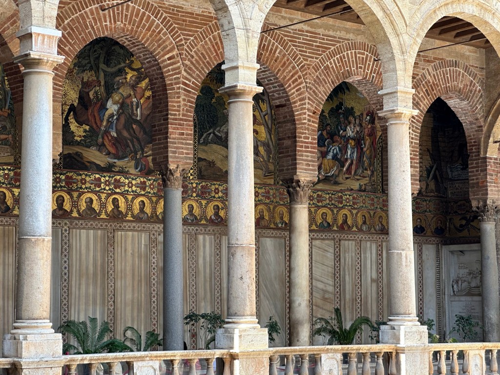
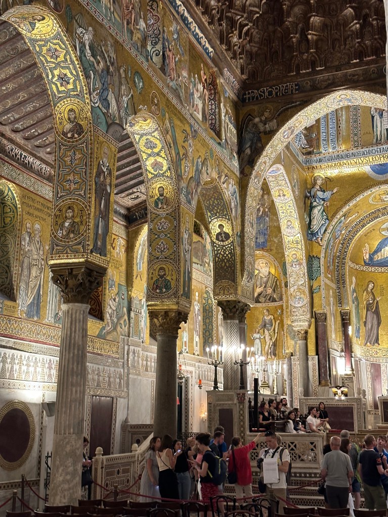
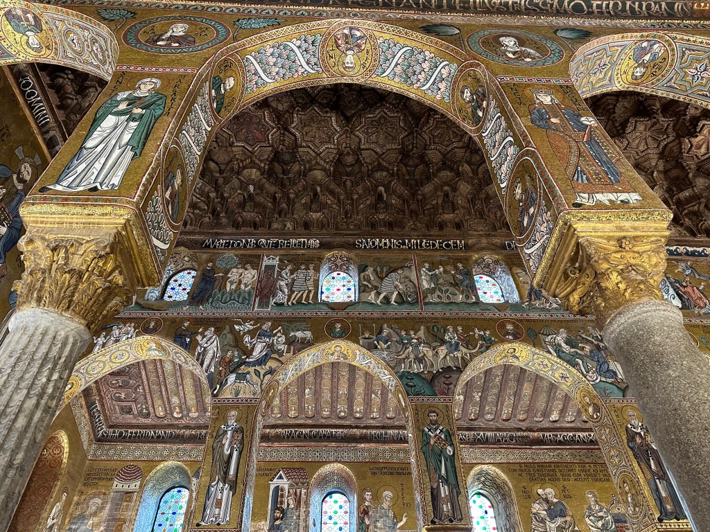
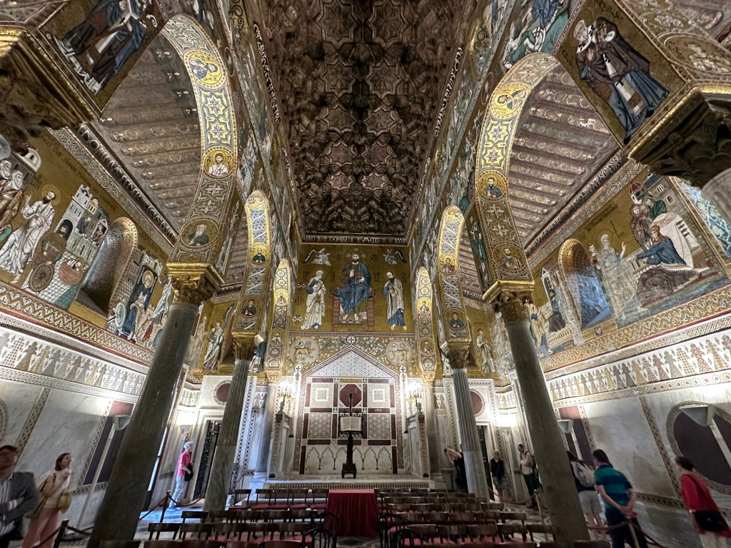
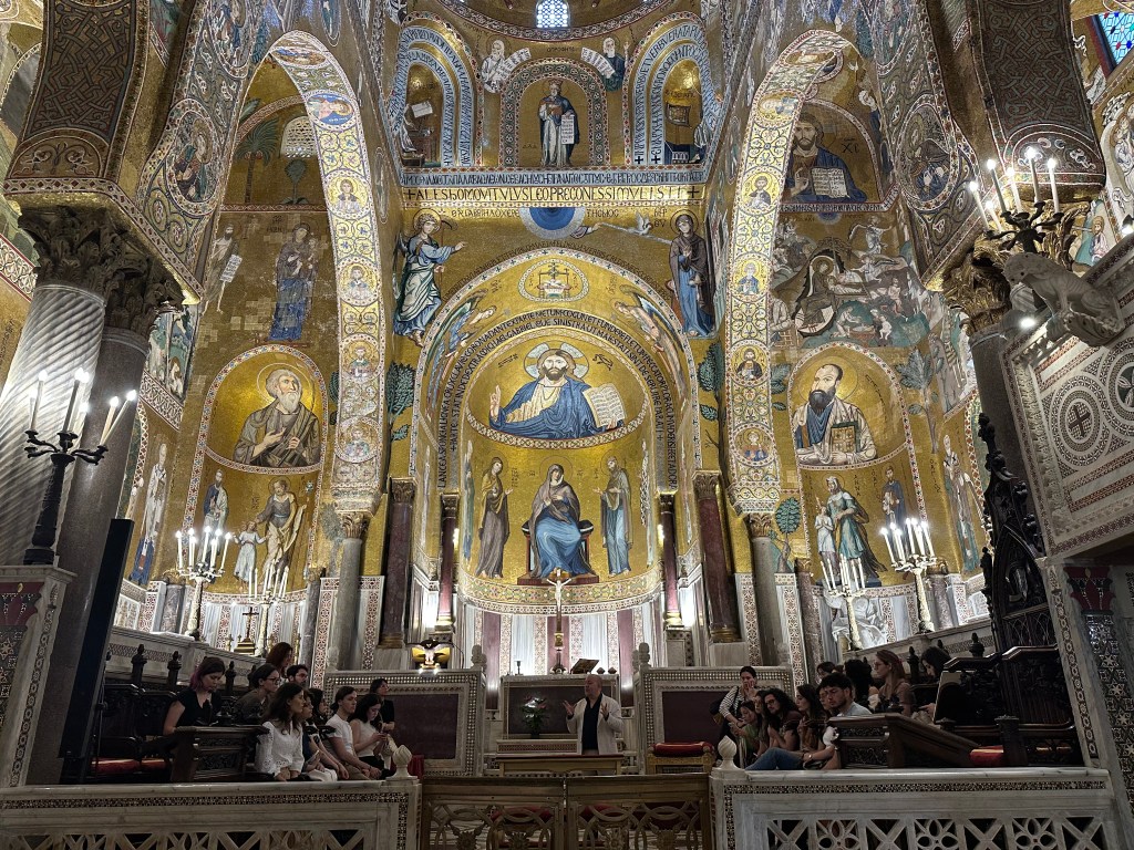
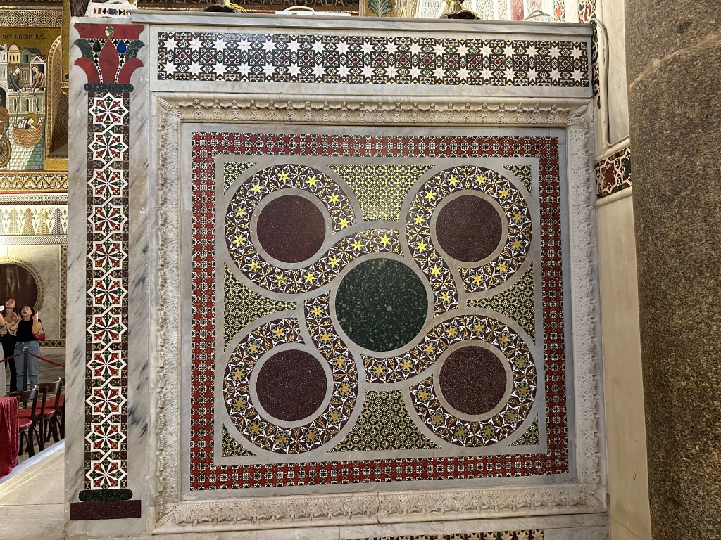
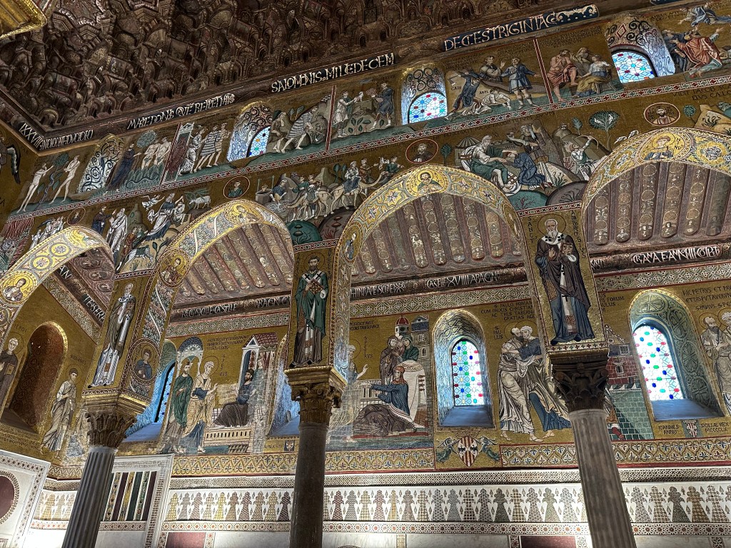
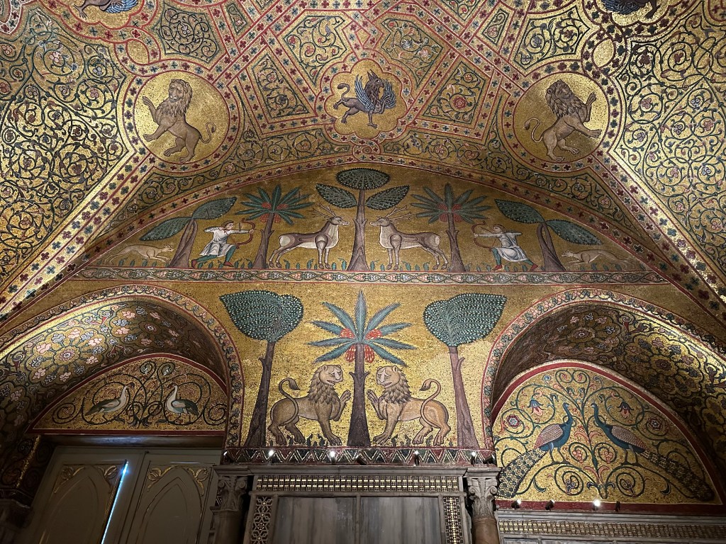
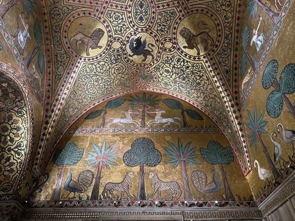
The palace’s extraordinary (and super Byzantine) Palatine Chapel:
Commissioned by Roger II of Sicily in 1132, the architecture represents a blend of Byzantine, Norman, and Fatimid styles that is unique to Sicily (we’d see another, even grander example right after we left Palermo).
To wit: a Norman church structure adorned with Byzantine-style mosaics and topped with a Fatimid-style muqarnas ceiling (identical in style to those we experienced at the Moorish Alhambra in Granada):
Byzantine-style mosaics dominate the walls of the ambulatory:
And geometric Fatimid Arab designs are evident along knee walls and other structures:
Although the mosaics covering the ceiling and dome date from the 1140s and were, indeed, created by Byzantine artists, others above the aisles were created in the 1160s and 1170s by local craftsman and are more Latin in style (including Latin inscriptions):
An abrupt transition to the 18th- and 19th-century Pompeian hall:
King Ruggaro (Roger II) Hall within The King’s Apartments, with its characteristic hunting scene mosaics:
Including its signature leopards, which now are not only the symbol of the palace, but, we found at a stay later, adorn a line of high-end Sicilian toiletries at hotels (the brand name itself is the urban island in Syracuse, which we’d visit later in the trip – this whole experience keeps folding in on itself).
Medieval painted wooden ceilings in King Ruggero’s Hall:
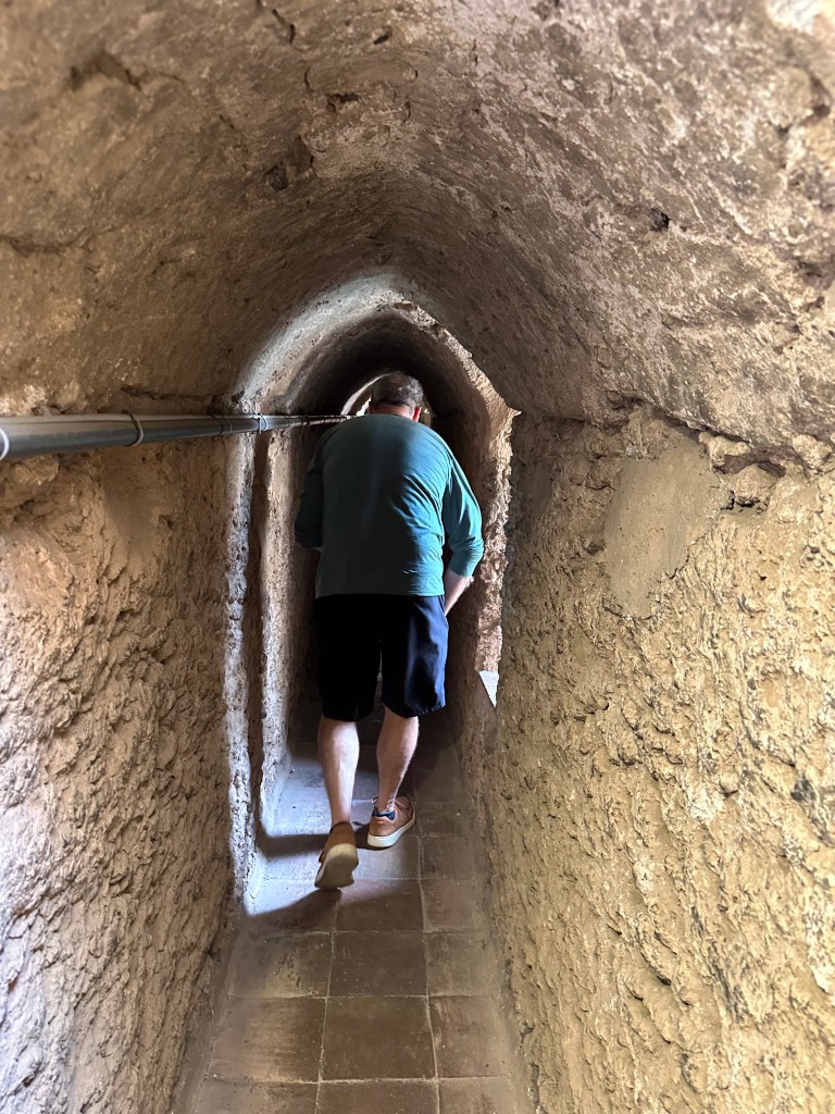
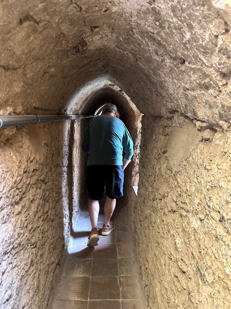
Climbing through one of the passageways in the fortified tower:
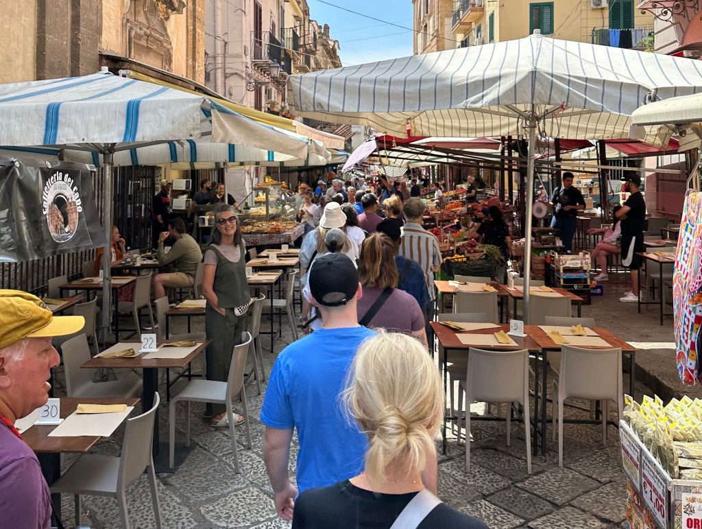
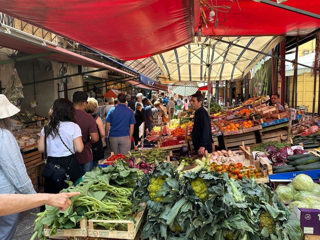
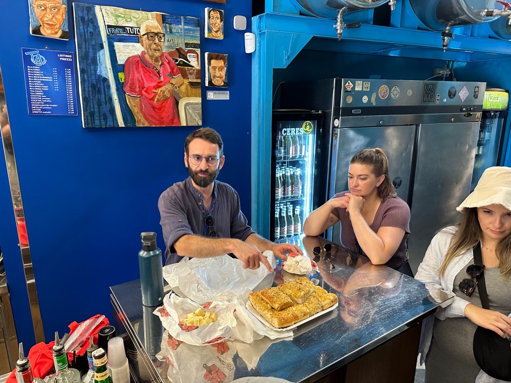
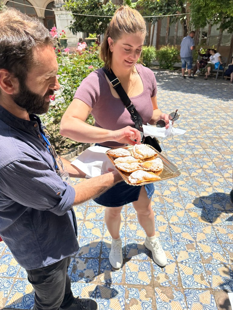
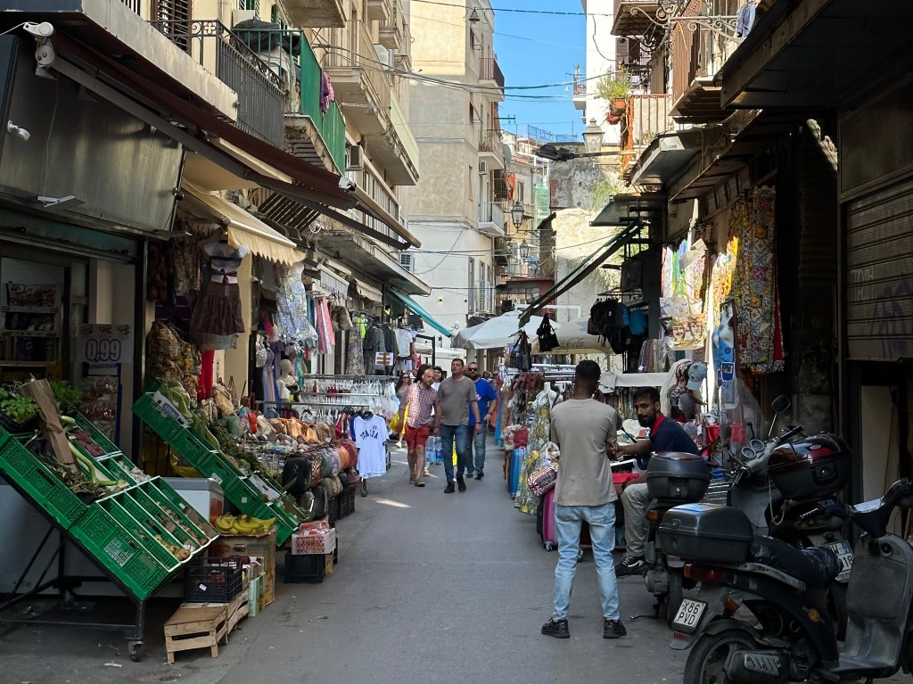
Back out on the street and in a street food tour!
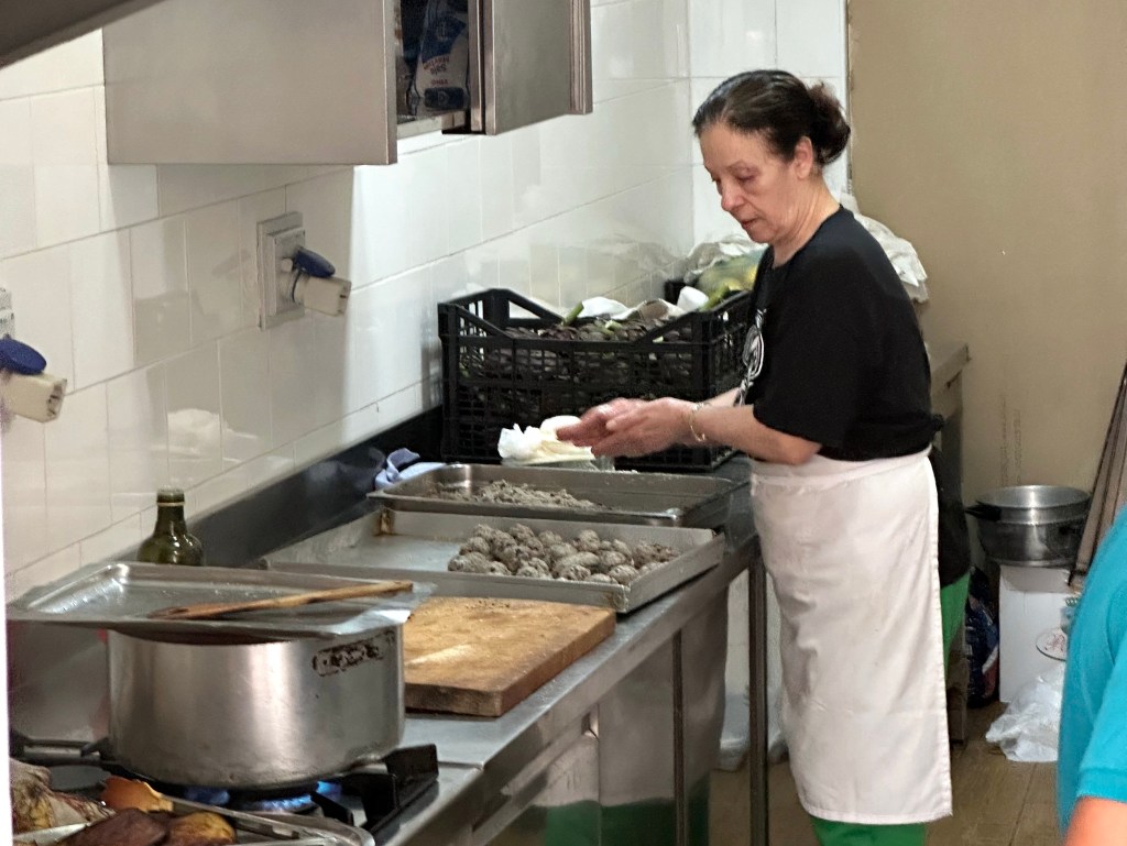
A little nona at work:
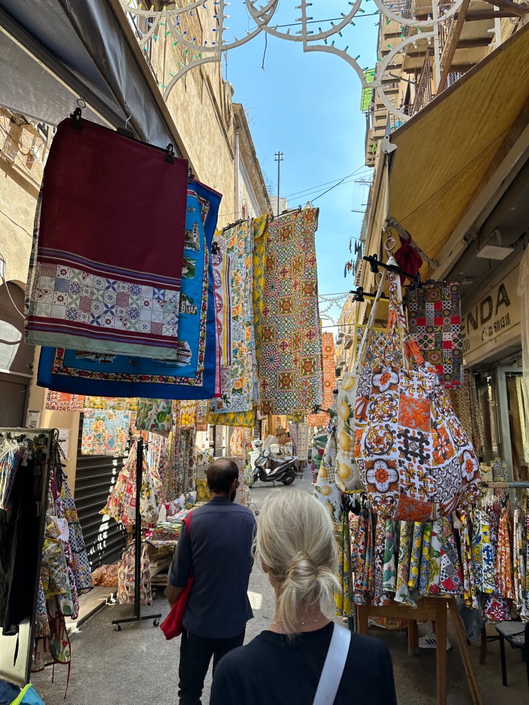
Parading through the fabric district:
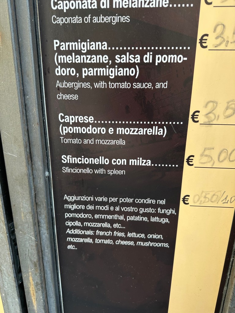
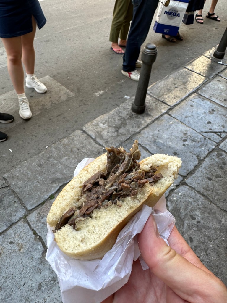
The highlight (lowlight?) of the tour? Spleen sandwich!
Would love (love!) to report that it’s splendid (hahahaha!), but 4/10 – would not recommend. And for context, we’ve had foal in Slovenia, brain in Hungary, and puffin in Iceland. (But our niece, Tara, who visited Sicily during her time in Italy, apparently digs it!):
In a sharp contrast, we stopped last at a local convent, where the nuns earn a little walkin’ around money by baking treats for sale:
The treats in question:
Nice setting in the convent’s cloister for our dessert round:
One evening on the way from aperitivos on Via Maqueda to dinner, we stumbled into this performance in one of the (many) churches on the street:
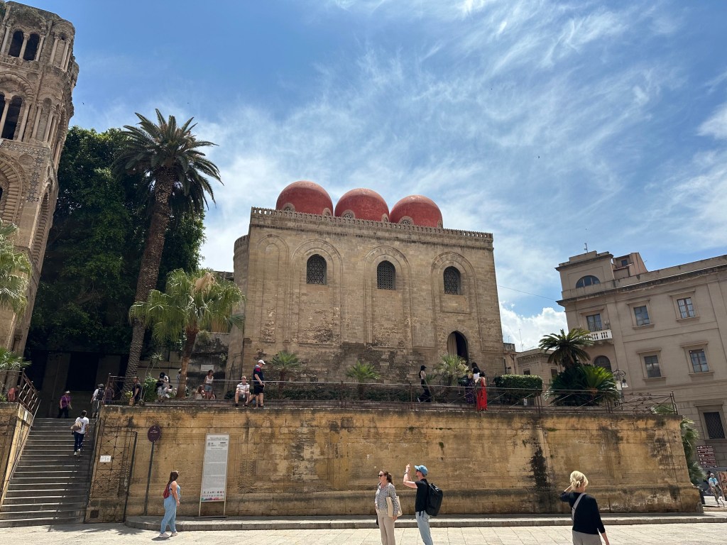
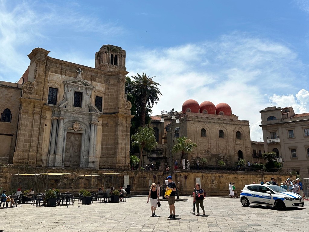
The next day, the star of Arabo-Norman architecture, San Cataldo:
Built in 1154 during Norman rule, the church not only embodies the melding of Arabic and Norman French architecture, it also serves as an example of the severe, militaristic, almost-fortified forms that even religious structures of the Normans exhibited.
An inside view of the three domes (balls, bulbs, inflamed cysts, whatever):
The church interior felt very compact and vertical to us – not a lot of breadth here:
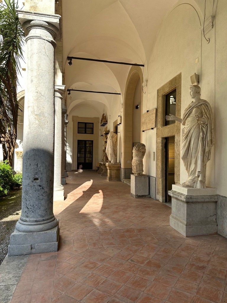
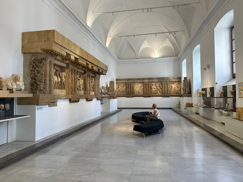
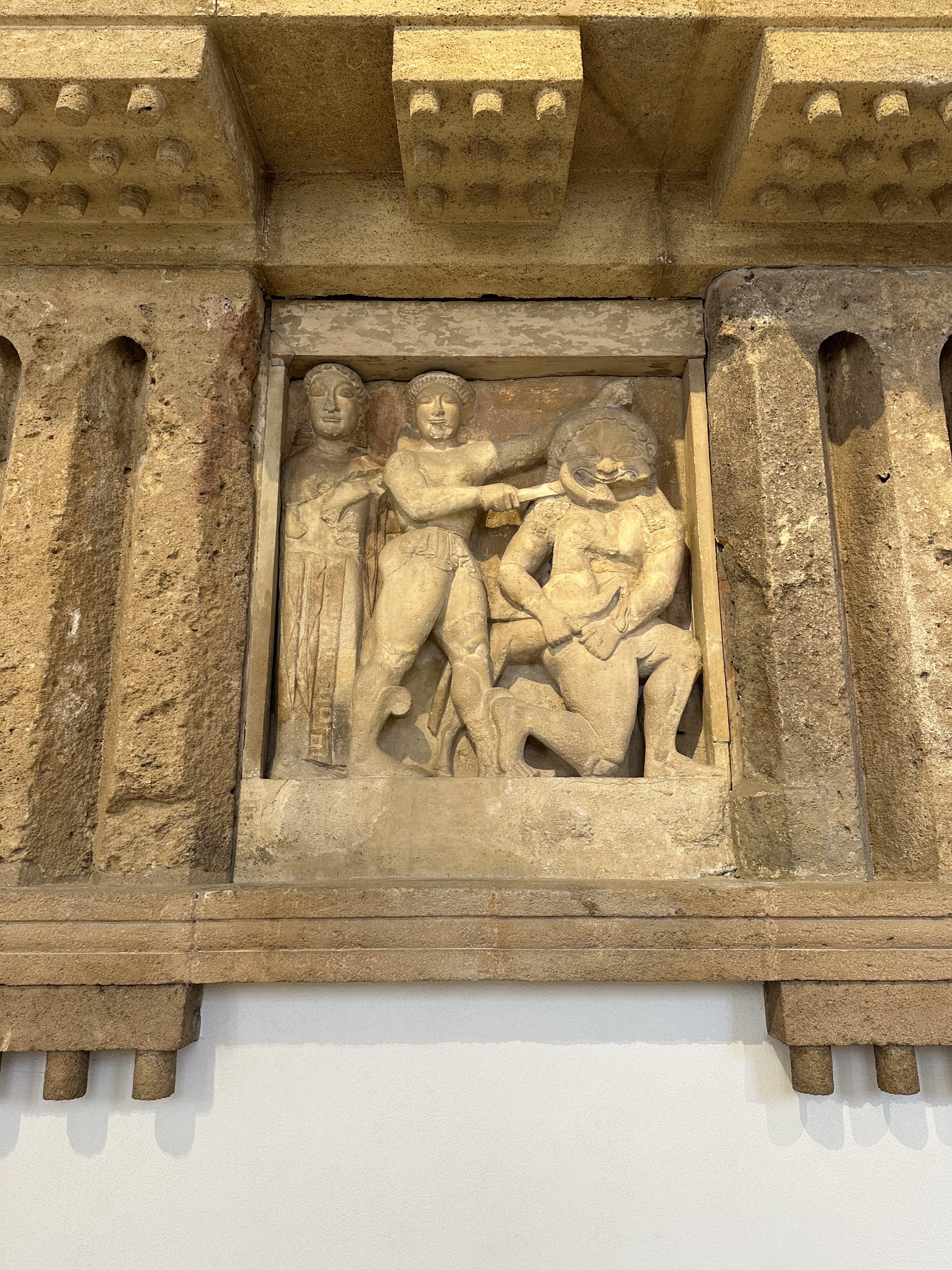
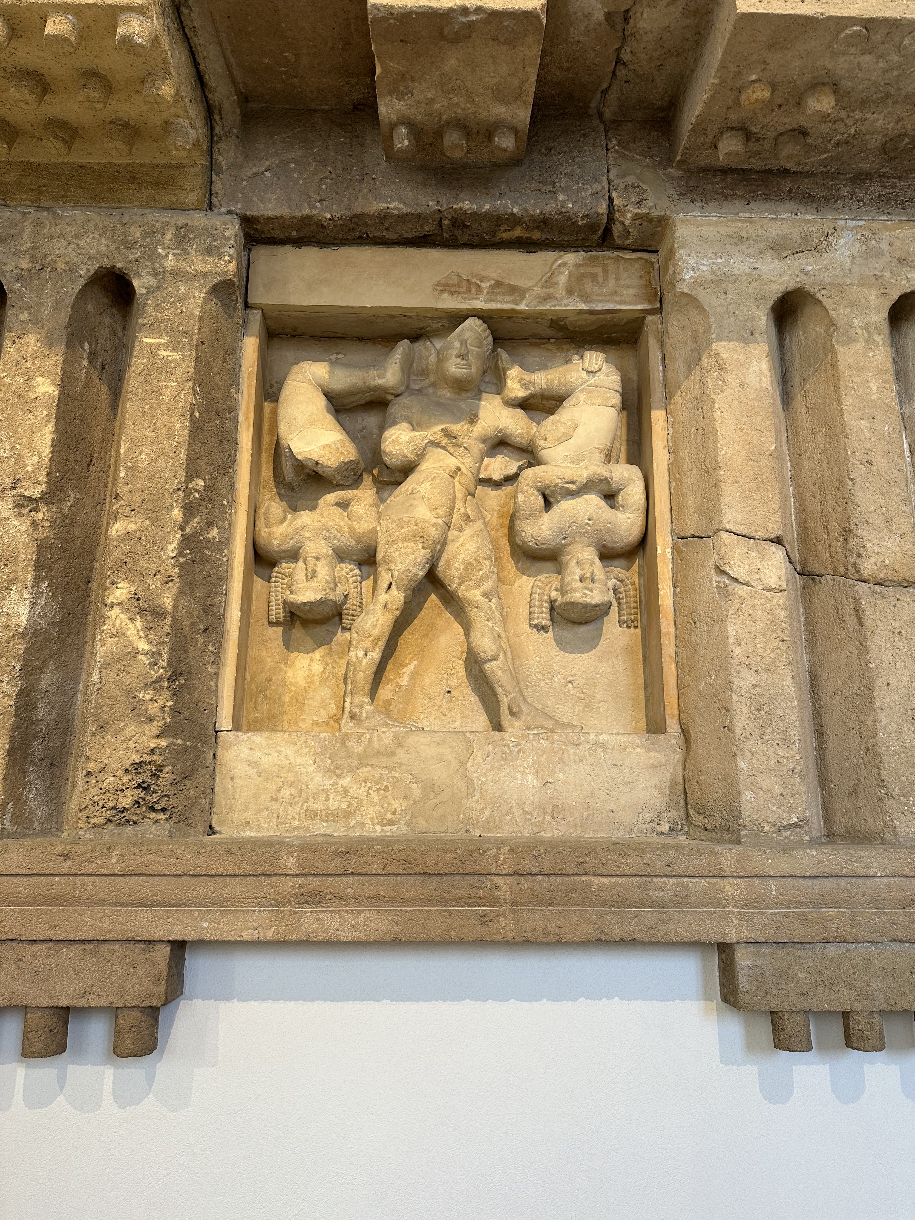
Down the street, Antonino Salinas Regional Archeological Museum:
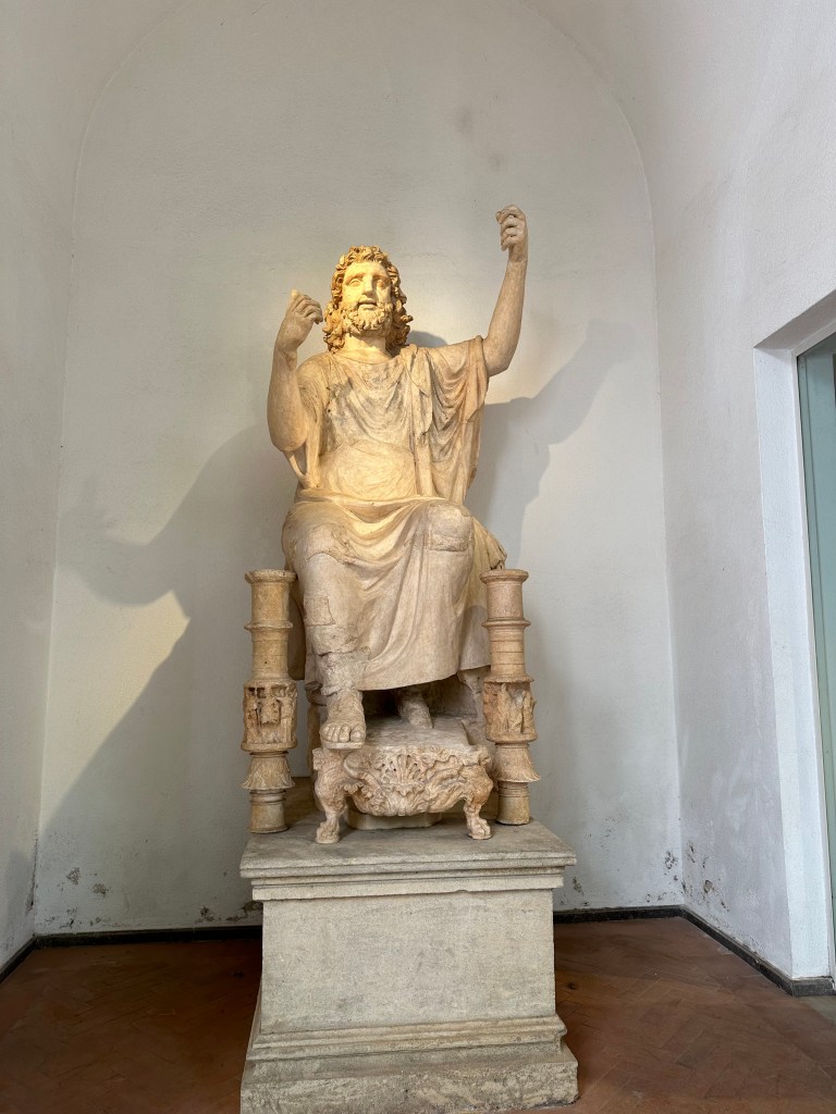
The museum is home to one of the richest collections of Punic and Ancient Greek art in Italy, including this 2nd- to 1st-century BC statue of Zeus:
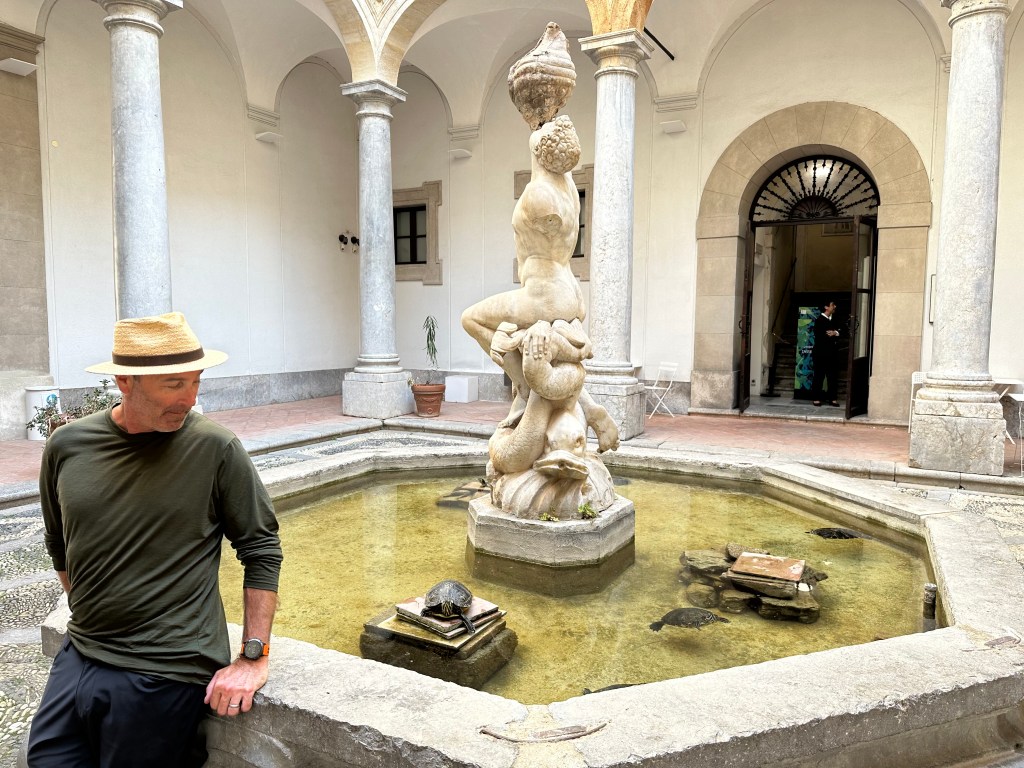
Oh, and turtles!
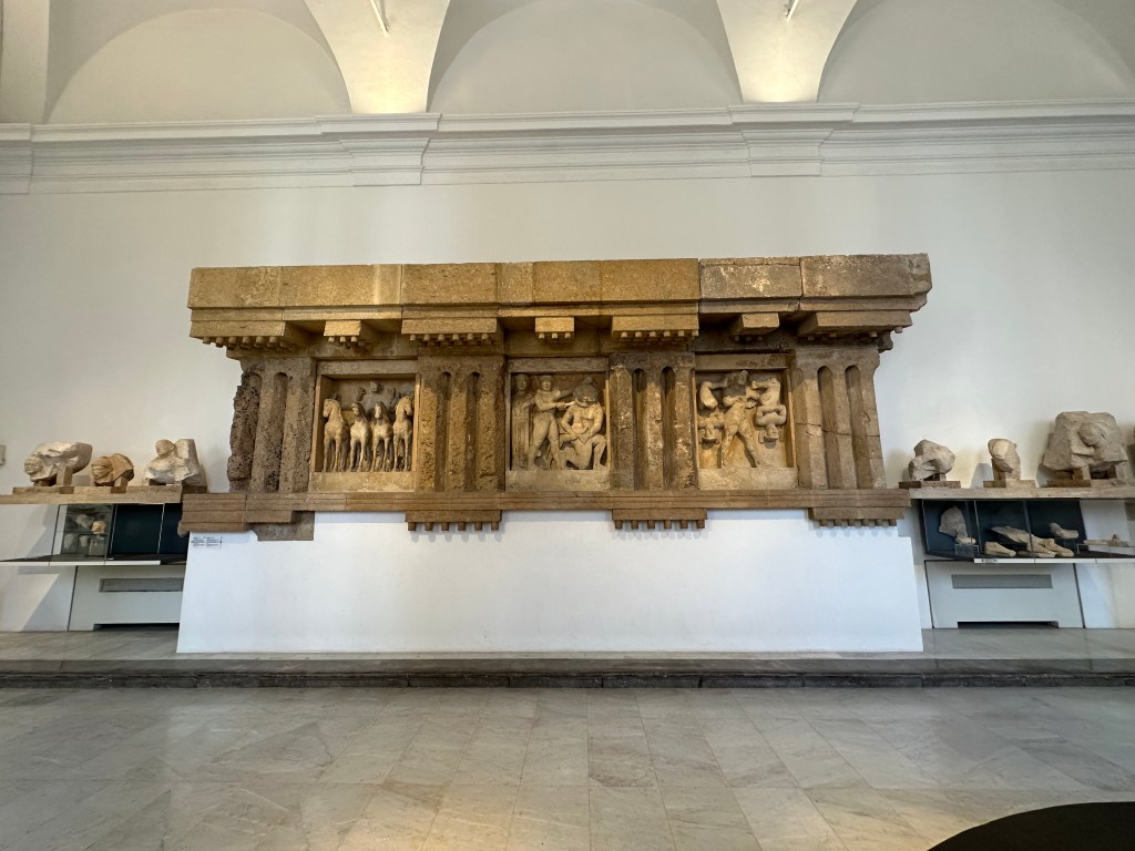
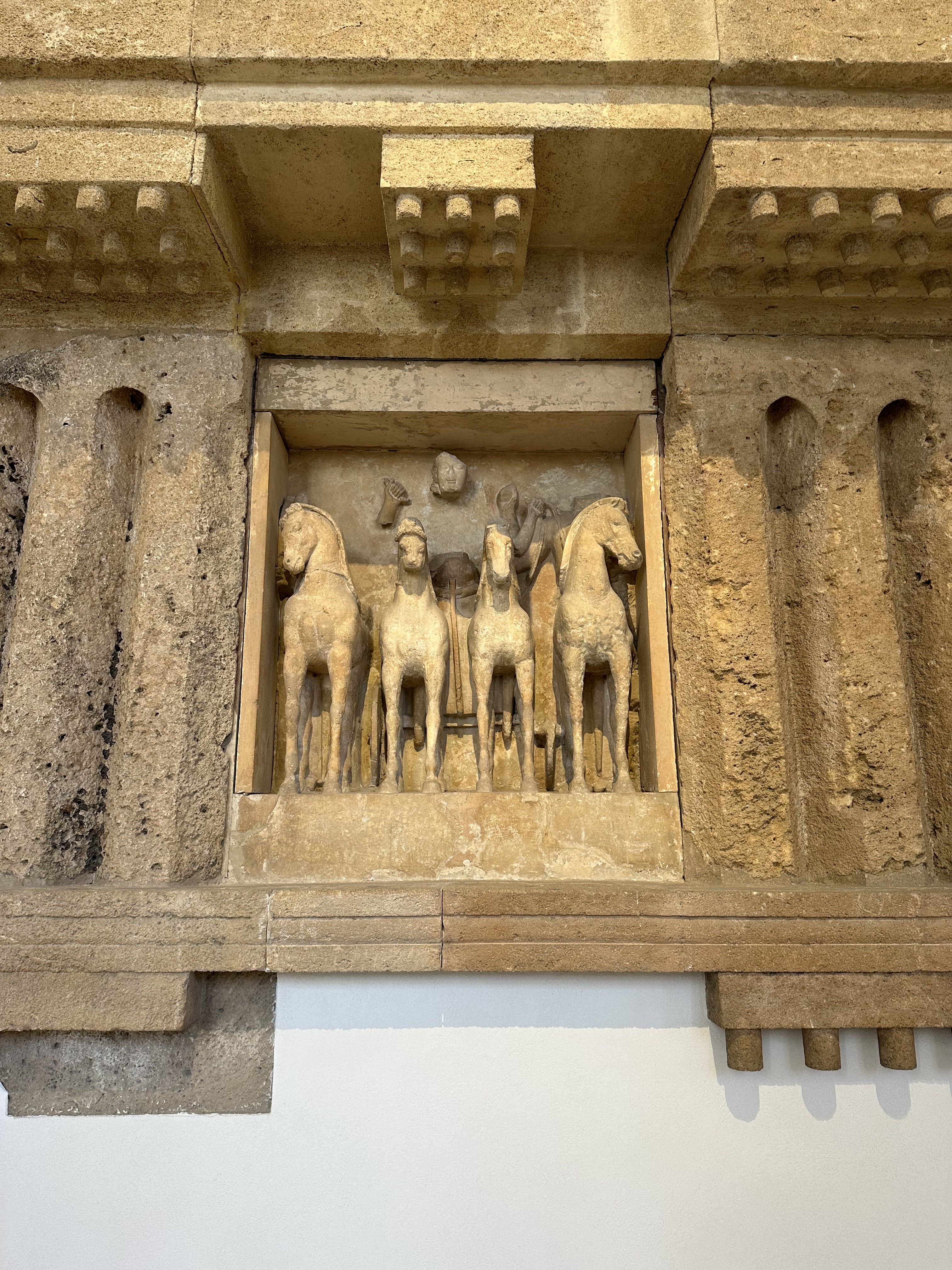
Taking in the frieze from a mid-6th-century BC temple from the ancient city of Selinunte:
Pretty awesome detail and workmanship from 7 millenia ago.
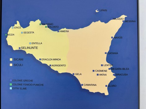
A helpful map of Punic (Carthaginian) and Ancient Greek cities from the period (Selinunte is in the west on the bottom of the island and was Greek, even though the Phoenicians and later Carthaginians occupied the same zone in the north):
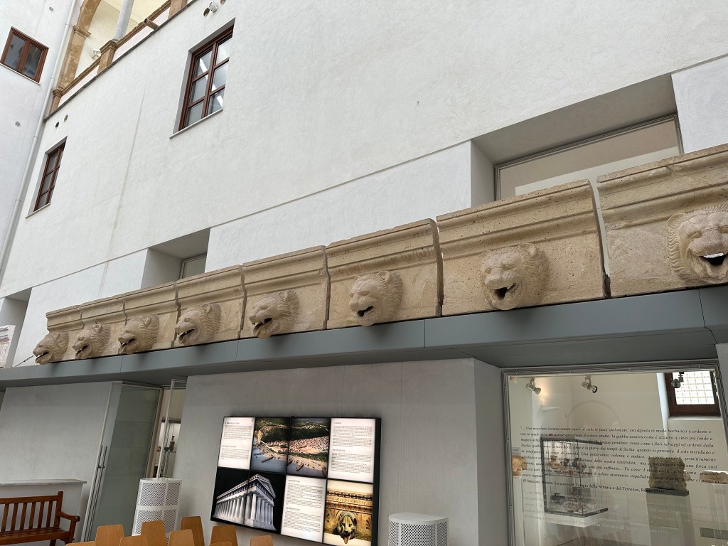
Roof-edge drip stones from moldings on classical temples – in this case, from Agrigento, which would be our next stop on the island:
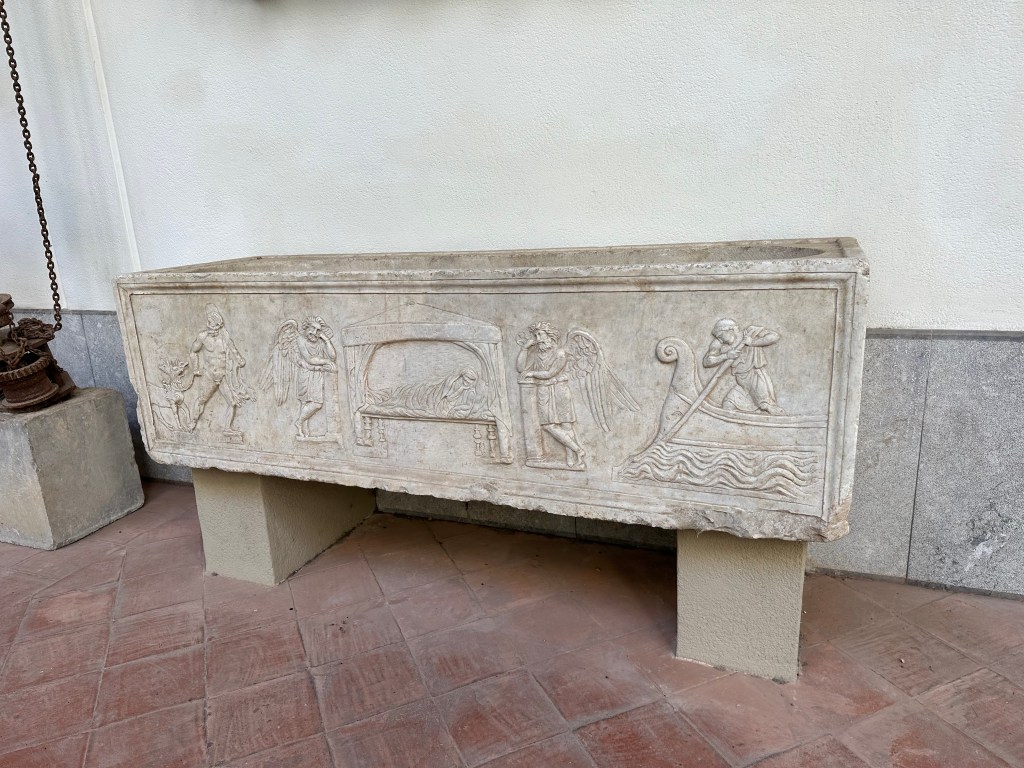
Very cool, later, Roman sarcophagus featuring Charon on the right and Hercules on the left:
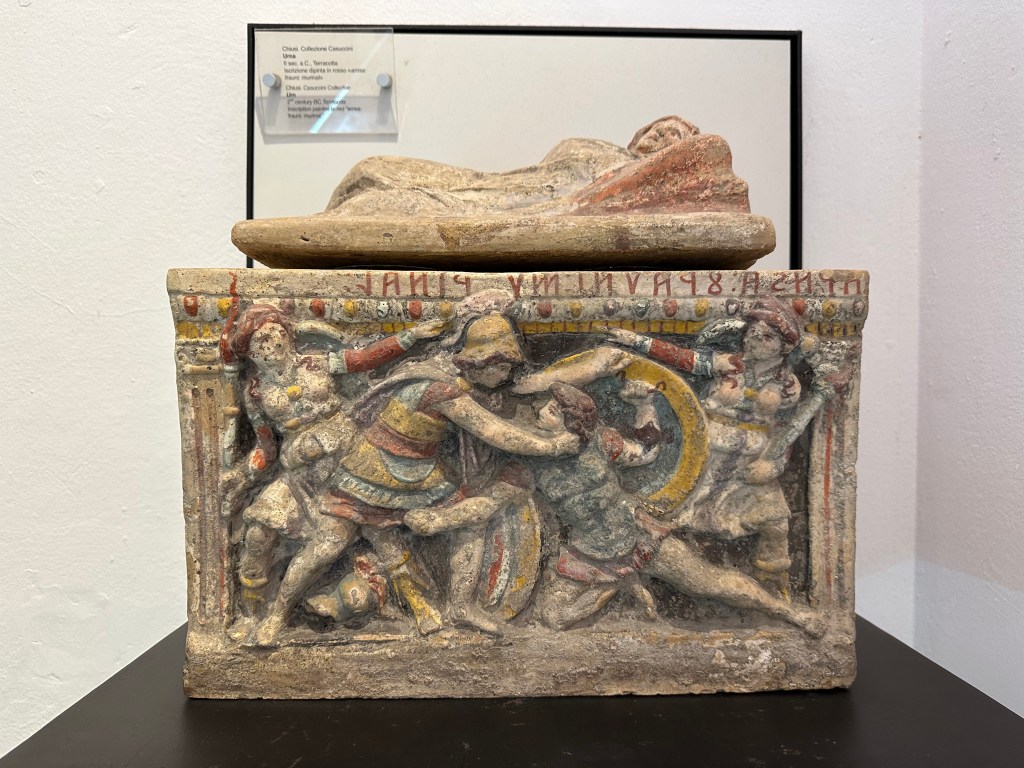
And a 2nd-century BC gladiator-themed, painted terra cotta, urn:
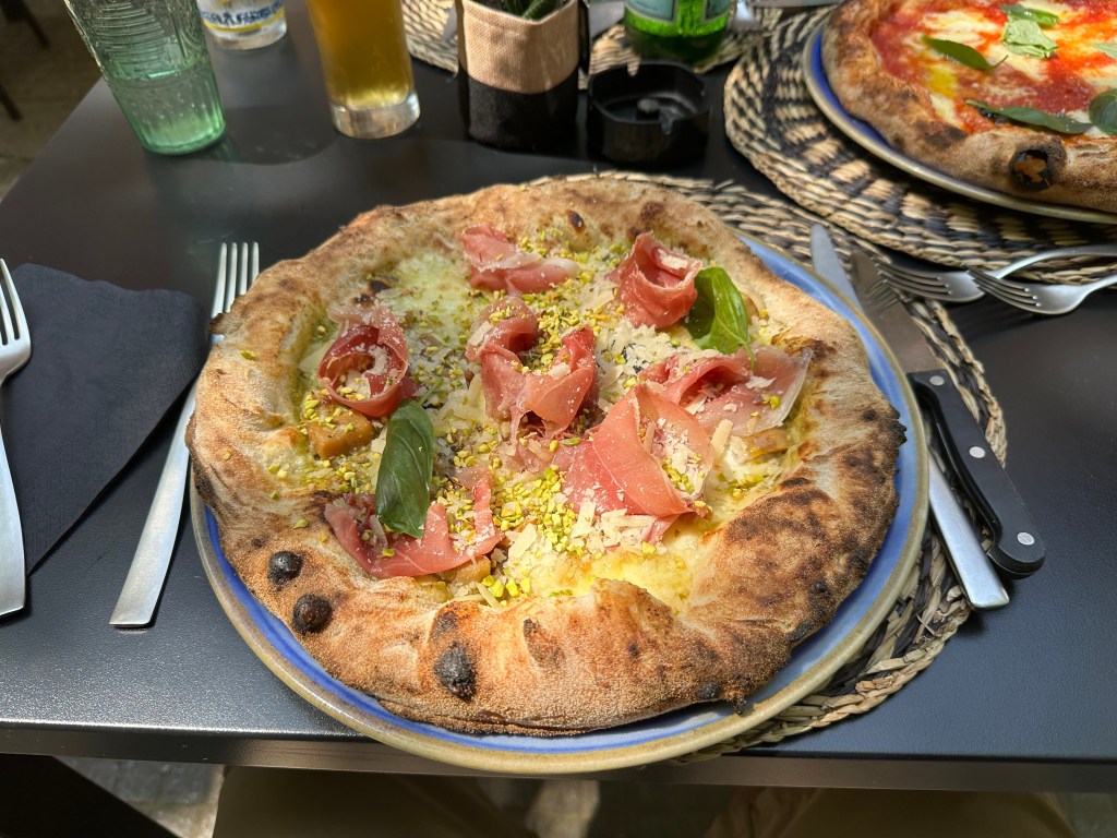
All of which made us hungry. Hungry for pizza with, um, pistachios? This would be a staple on the island – the Sicilians LOVE their pistacios:
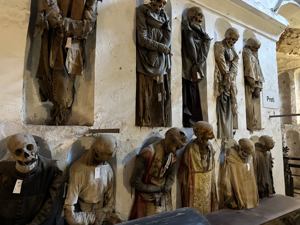
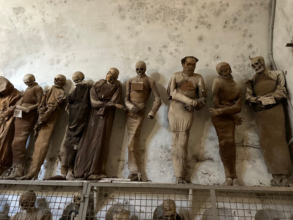
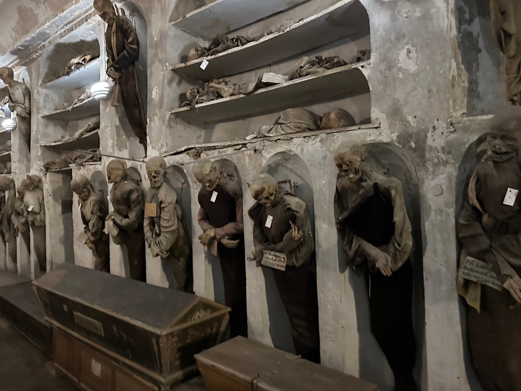
And with full bellies, and not a fear in the world of our lunch being returned to the outside world, we headed through town to the Capuchin Catacombs of Palermo, which contain around 8000 corpses and 1252 mummies; the last body was interred in 1939.
Aaaaah! There is a fear of the above occurring.
“Palermo’s Capuchin monastery outgrew its original cemetery in the 16th century and monks began to excavate crypts below it. In 1599 they mummified one of their number, the recently deceased brother Silvestro of Gubbio, and placed him in the catacombs.[citation needed]
Bodies were dehydrated on racks of ceramic pipes in the catacombs and sometimes later washed with vinegar. Some bodies were embalmed and others were enclosed in sealed glass cabinets. Friars were preserved with their everyday clothing and sometimes with ropes they had worn in penance.[citation needed]
Initially the catacombs were intended only for deceased friars. However, in later centuries it became a status symbol to be entombed in the Capuchin catacombs. In their wills, local luminaries would ask to be preserved in certain clothes, or even have their clothes changed at regular intervals. Priests wore their clerical vestments, while others were clothed according to contemporary fashion. Relatives would visit to pray for the deceased and to maintain the body in presentable condition.”
“The catacombs were maintained through donations from the relatives of the deceased. Each new body was placed in a temporary niche and later placed into a more permanent location. So long as contributions continued, the body remained in its proper place but if relatives stopped sending money, the body was put aside on a shelf until they resumed payments.” (All from here.)
The nudie fountain on our last evening in town:
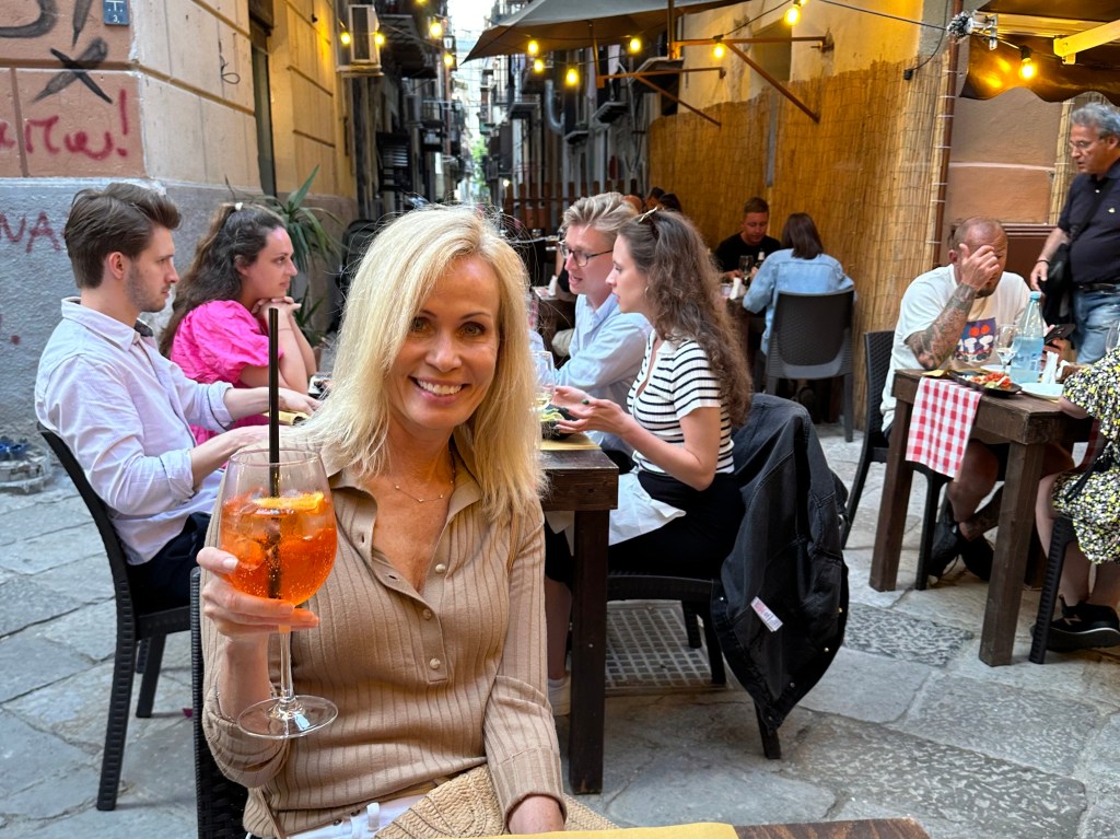
And a final Aperol spritz (in Palermo, not on the trip!):
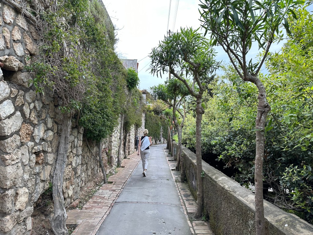
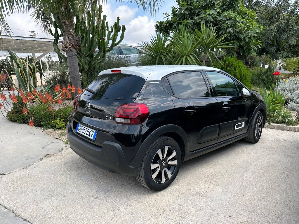
After exploring Palermo for a few days, we grabbed a cab to the train station and picked up our rental car for the next couple of weeks – another Citroen C3, with the weird rubber door inserts. Even though it looks like a sneaker, we truly dig these. We drove one throughout our 2-week slow roll around Languedoc and Provence and over to San Sebastian and really liked it. Although pretty compact, which you want when driving around medieval European villages, the C3 trunk (like those of our frequently rented rental class counterparts the Renault Clio and the VW Polo) accommodates our luggage exactly (another advantage of 24″ luggage, in addition to the ability to carry them on to our flights instead of checking them). Because we’ll stop places to hike or check out a town when driving from one destination to another, the ability to stow your luggage away from prying eyes looking to rob from dumb tourists provides significant piece of mind.
Case in point? Our destination for our first day of driving was Agrigento, in the middle of the southern coast of Sicily, but we wanted to stop in Monreale on the way to check out its celebrated Normano Arabic cathedral. Luggage hidden safely away in the C3’s trunk, we blithely parked illegally and hightailed it to the cathedral. (We couldn’t find legal parking and one of the WolfeStreetTravelers [the driver, natch] has zero patience for driving around to look for parking.)
Exterior of the Cathedral of Santa Maria Nuova in Monreale:
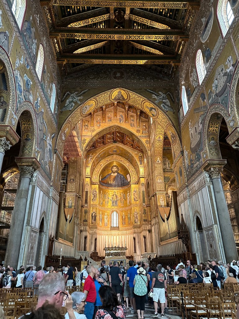
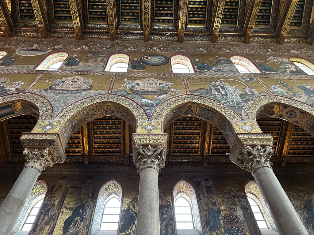
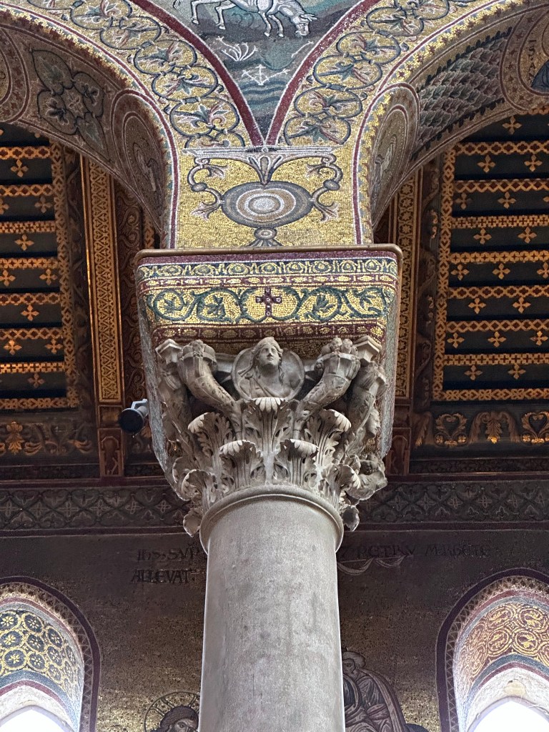
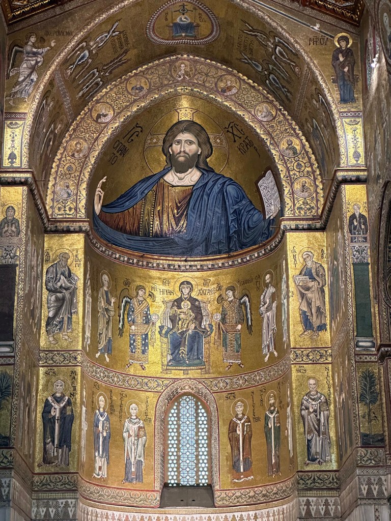
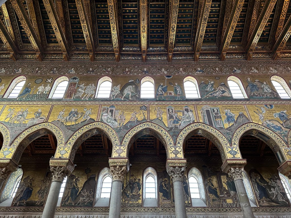
Begun in 1174 and completed in 1267, this place seems crazy Byzantine to us due to the gold mosaics, no matter how much historians characterize it as Normano Arabic. Freakin’ amazing to be in a space like this constructed and decorated by artisans in the 12th and 13th centuries.
Constructed by King William II of Sicily ( “William the Good”), the project was perhaps less about demonstrating his piety and more a political move: with the cathedral complex (which also included a royal palace and Benedictine monastery) William deliberately created a rival ecclesiastical power base outside the jurisdiction of the powerful Archbishop of Palermo, and by 1183 had successfully secured from Pope Lucius III the elevation of Monreale to an independent archbishopric, thereby cementing royal authority over the Church in Sicily. The cathedral became the seat of the metropolitan archbishop and a commanding symbol of Norman supremacy.
“The basilican nave is wide, with narrow aisles. On each side, monolithic columns of grey oriental granite (except one, which is of cipolin marble) support eight pointed arches much stilted. The capitals of these (mainly Corinthian) are also of the classical period.” (From here.)
“The execution of the mosaics was entrusted to Byzantine workers and the iconography is actually Greek. However, the relaxed attitudes of the characters, their softly draped robes and the rhythm of their movements reveal a clear evolution of the style compared to that of the Cappella Palatina and the Martorana, one which is typically Italian. In fact, at the end of the twelfth century, Italian artists were considered the best at iconographic art. The mosaic cycle develops the concept of the triumph of Christianity in three different moments, depicting: events prior to the Incarnation (Old Testament); episodes from the life of Jesus (Gospel); events subsequent to the death of Christ and the life of the Apostles (Gospel and Acts of the Apostles). The whole set is dominated by a gigantic Cristo Pantocratore (the right hand alone is two metres long) in the main apse, which represents the summary and purpose of the whole complex figuration.” (From here.)
The nave walls contain extensive Old Testament narratives starting with the Book of Genesis at the western end and progressing chronologically toward the apse.
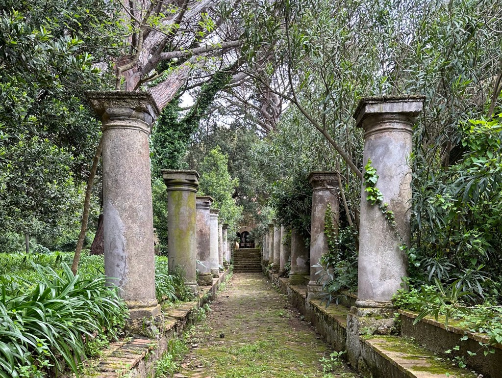
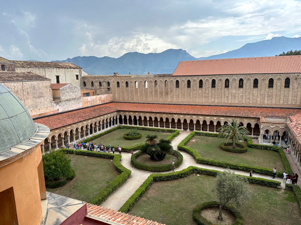
After climbing up through one of the towers to emerge outside, a view of the Benedictine cloister, with a fountain in the top right (south corner).
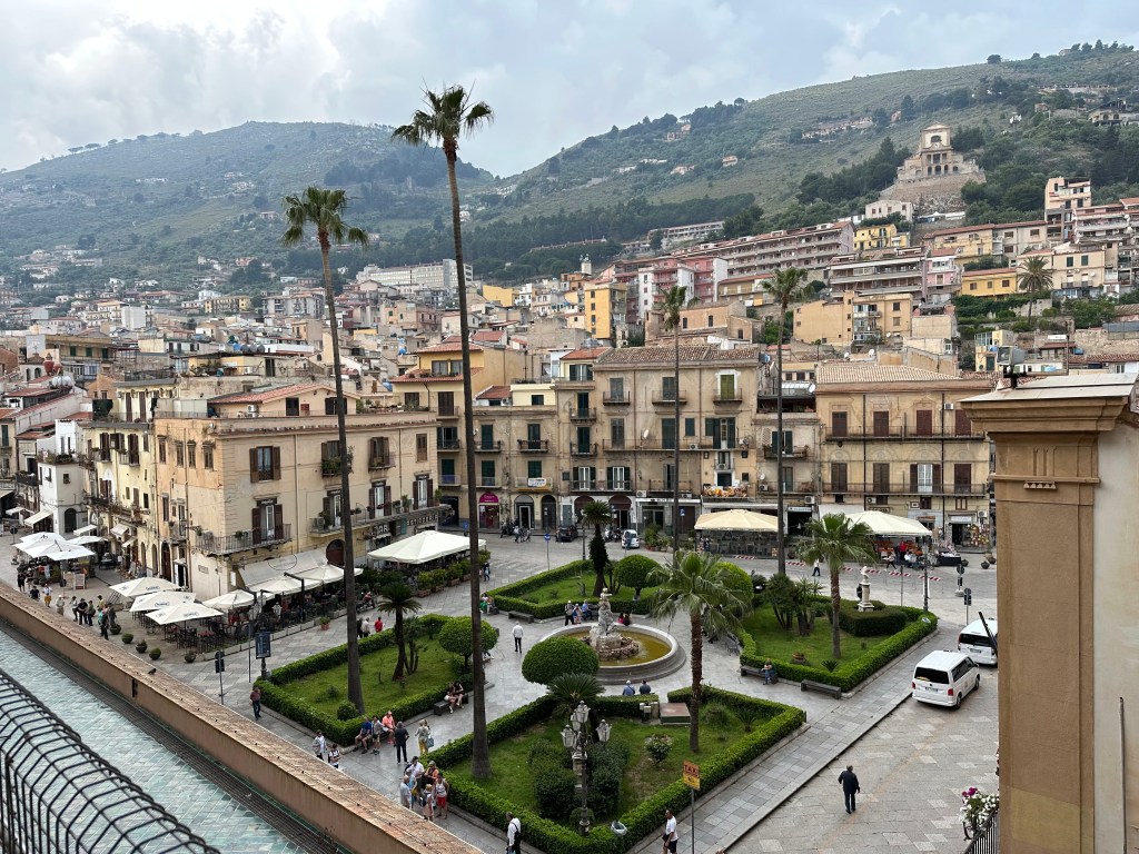
View of the town of Monreale from the cathedral:
Making our way through the highs . . .
and lows of cathedral passages as we explore its upper extremities.
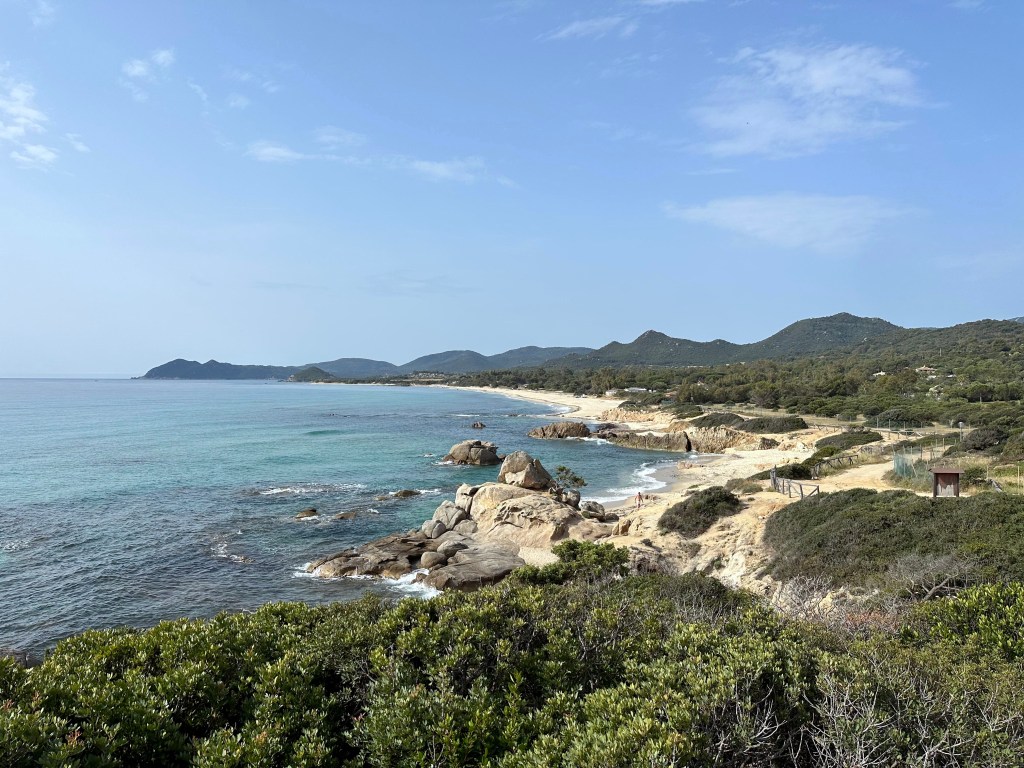
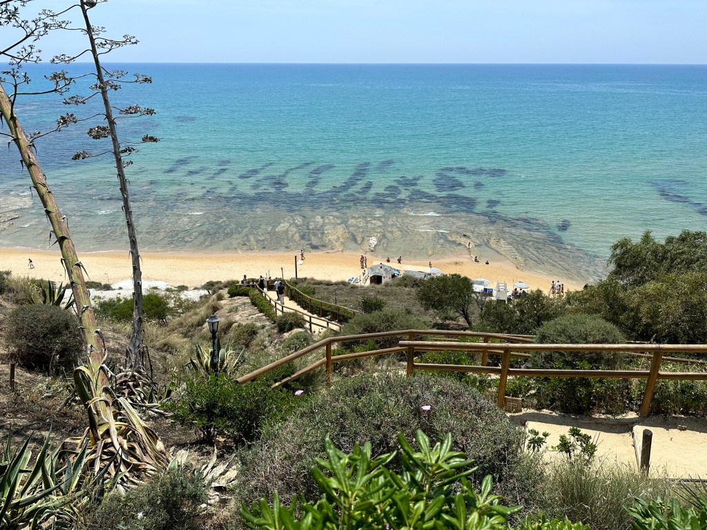
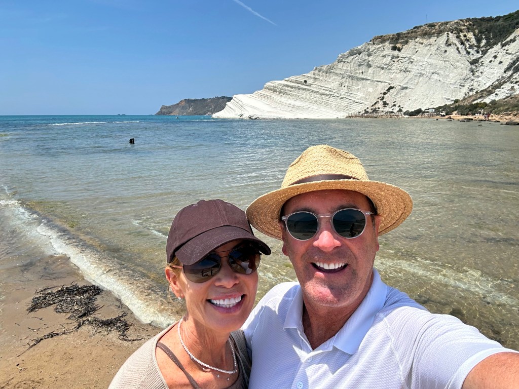
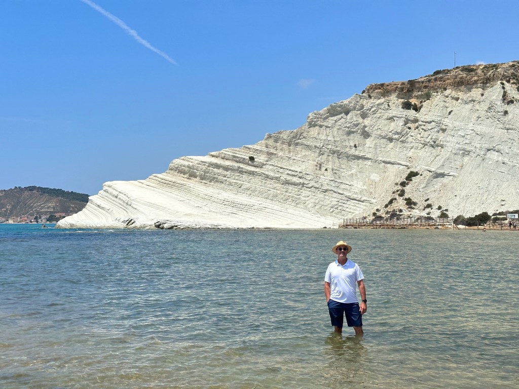
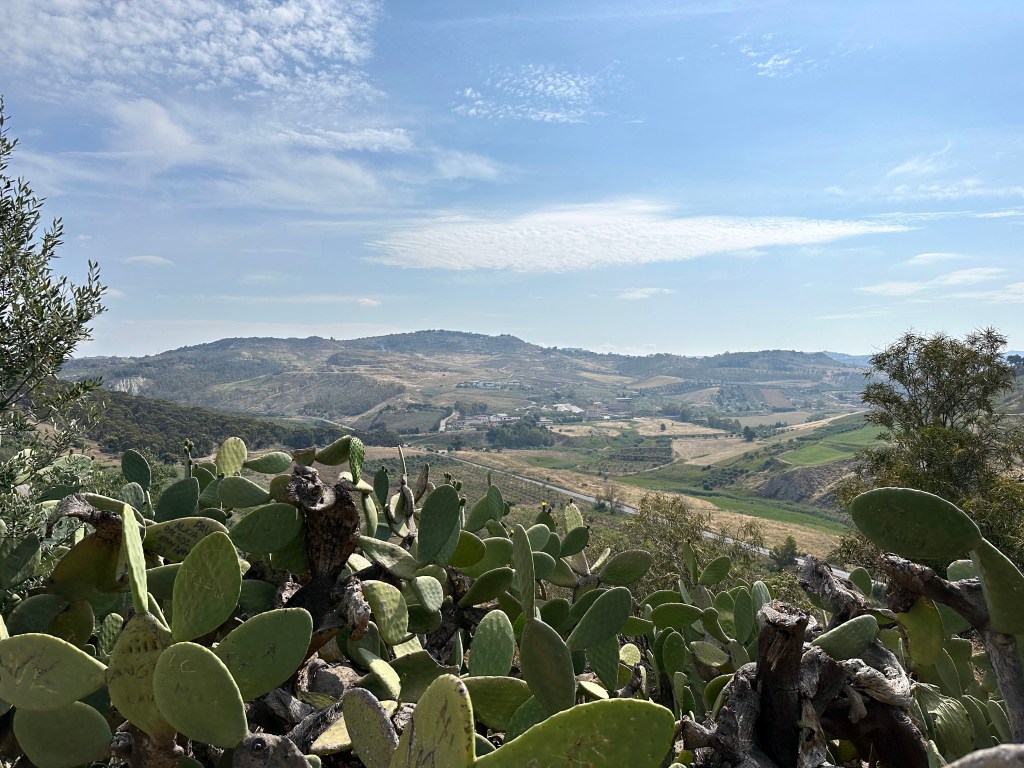
After our short adventure in Monreale, we headed to Agrigento, home to an incredible complex of Doric temples from Greece’s colonial days in Sicily. But since we’ve got a little space in this here post, we’ll add a little side trip from Agrigento after our foray to the temples: Scala dei Turchi.
Scala dei Turchi is Stair of the Turks in Italian – stair for obvious reasons and Turks because of the frequent Saracen raids in the area in the Middle Ages.
It was also hair of the dog during our visit, to our delight.
Lunch at a beach club . . .
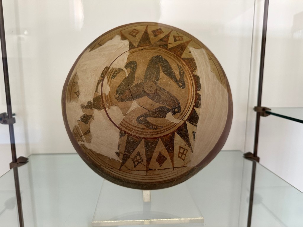
where we were confronted once again with the Sicilian triskelion, this time in a rather welcome context.
The triskelion symbol allegedly represents the three capes of the roughly triangle-shaped island. Although the emblem is found in antiquity, including on coins minted in Syracuse (where we’d be headed) in the 4th century BC, the symbol was revived and used in protest by Sicilians against the Aragonese in 1282 following the Vespers massacre. The bowl below we’d see the next day in the museum at the temple site.
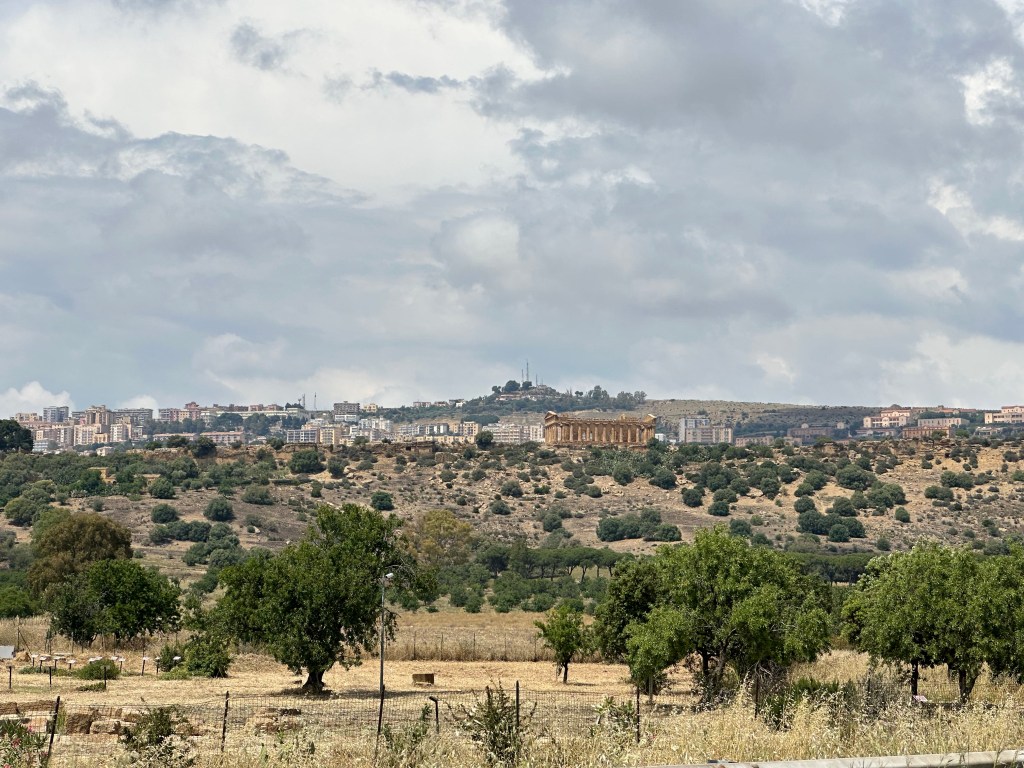
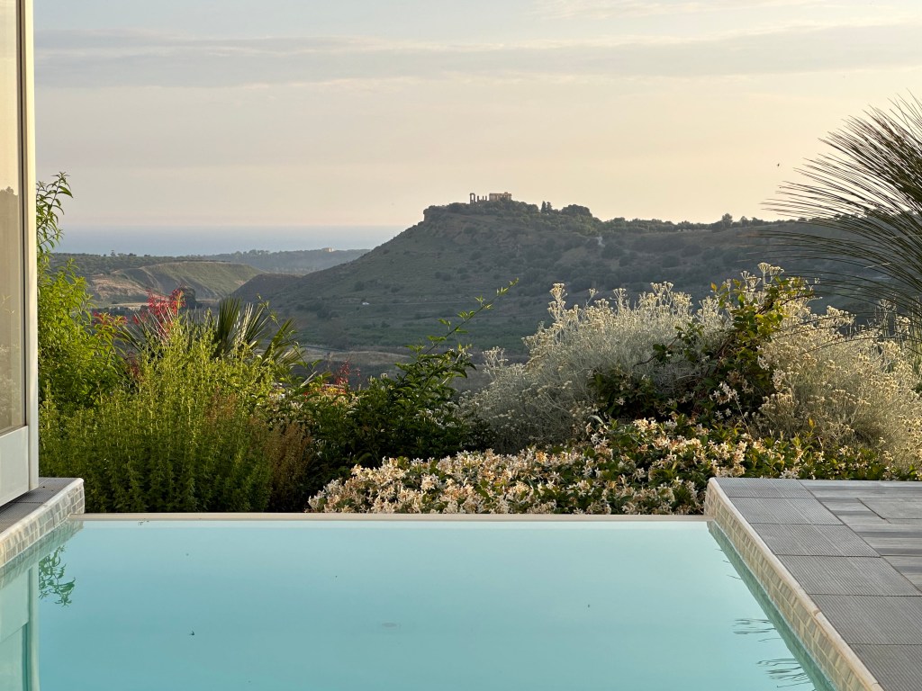
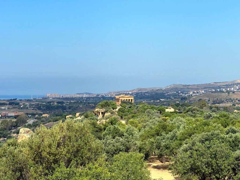
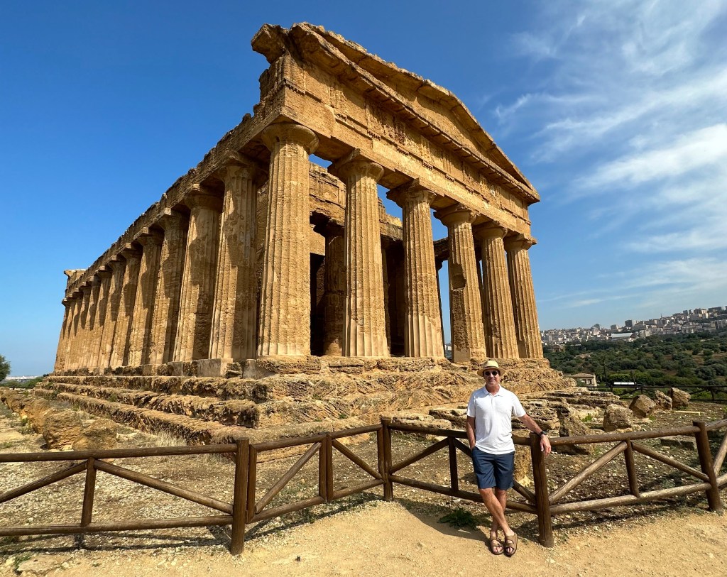
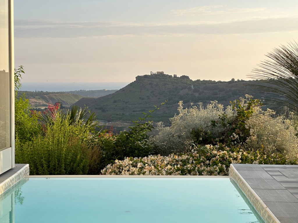
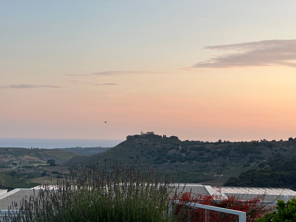
Speaking of which, a little view of the Temple of Concordia as we drive back from Scala dei Turchi to our hotel:
The evening Aperol aperitivo ritual has taken firm hold.
A prelude to our day at the temple complex with a view of the Temple of Concordia, this time from a more relaxing setting:
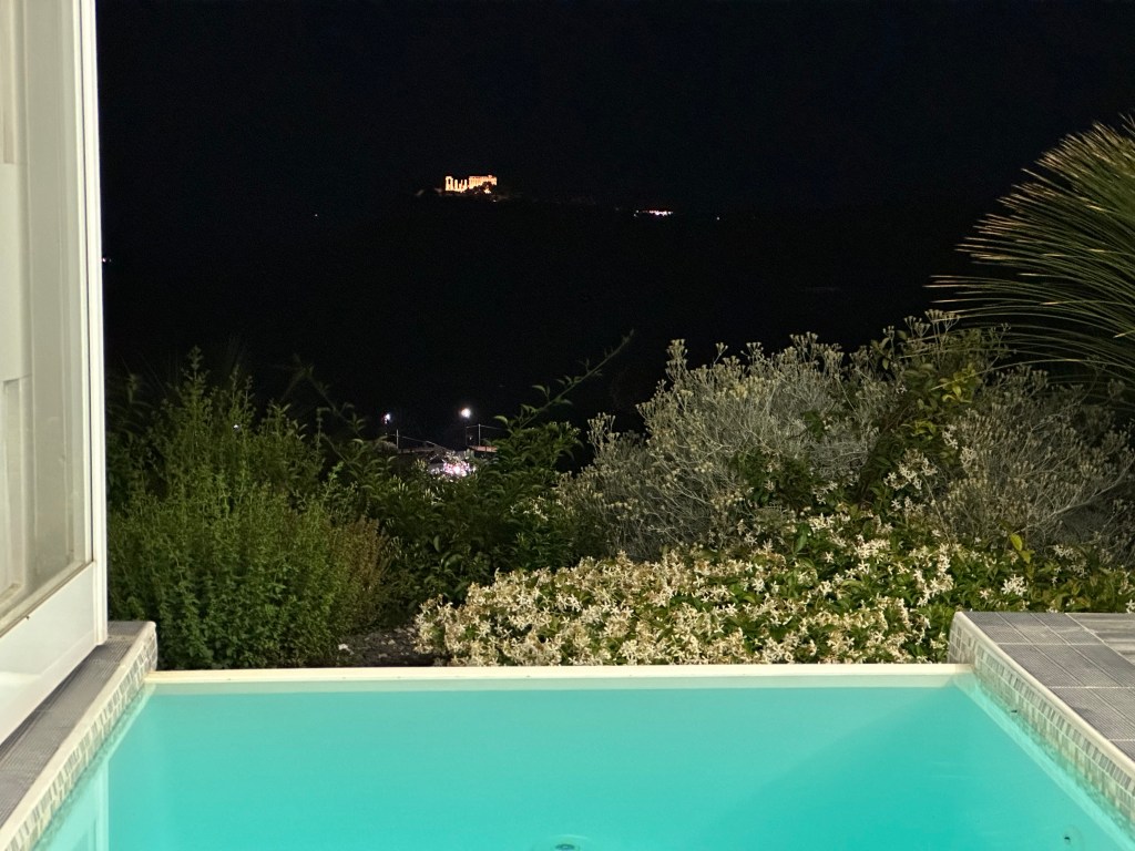
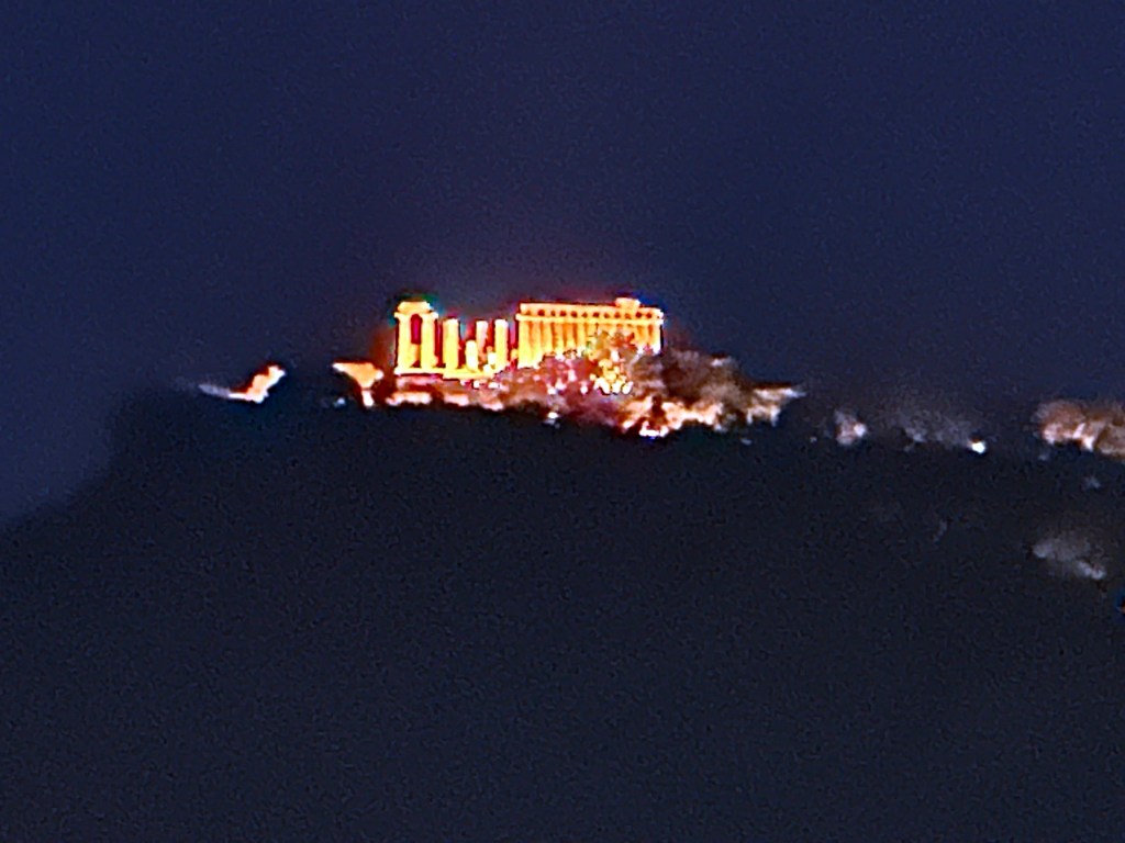
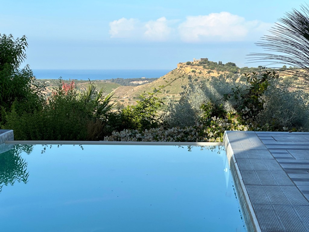
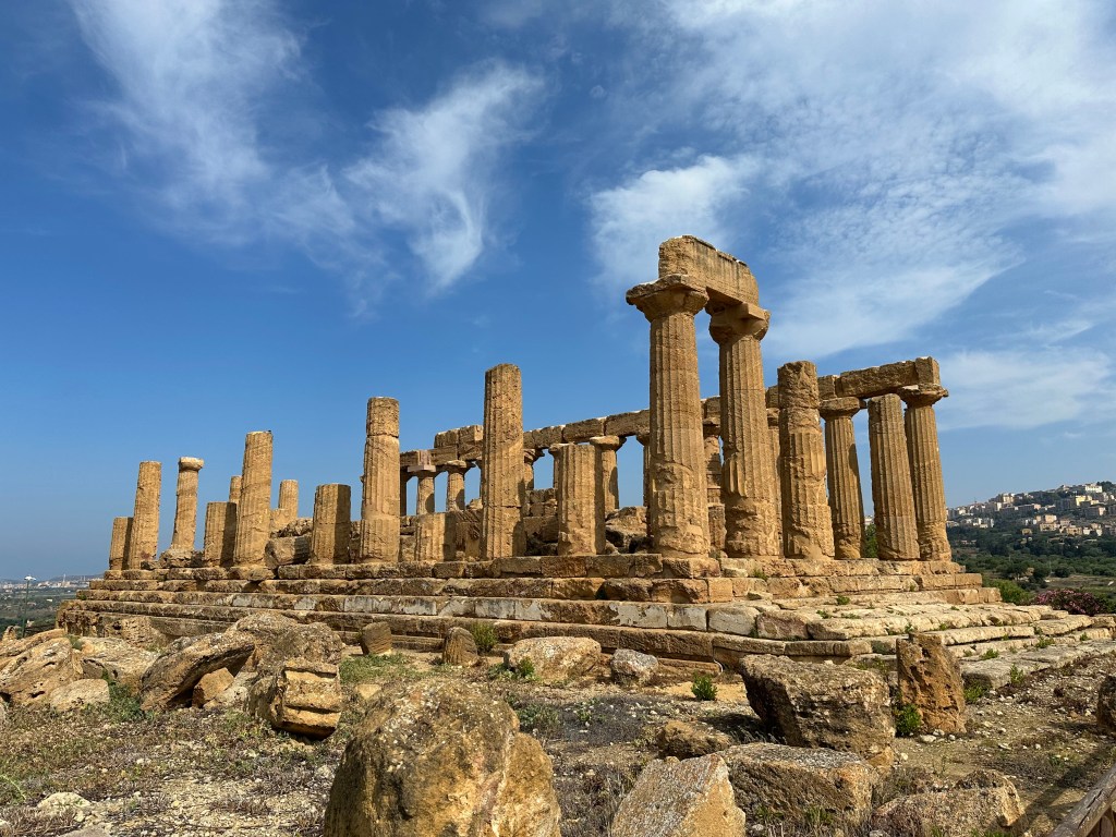
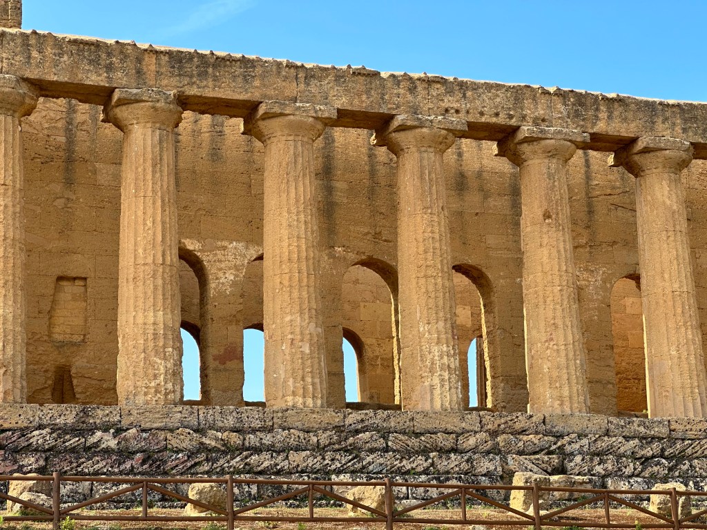
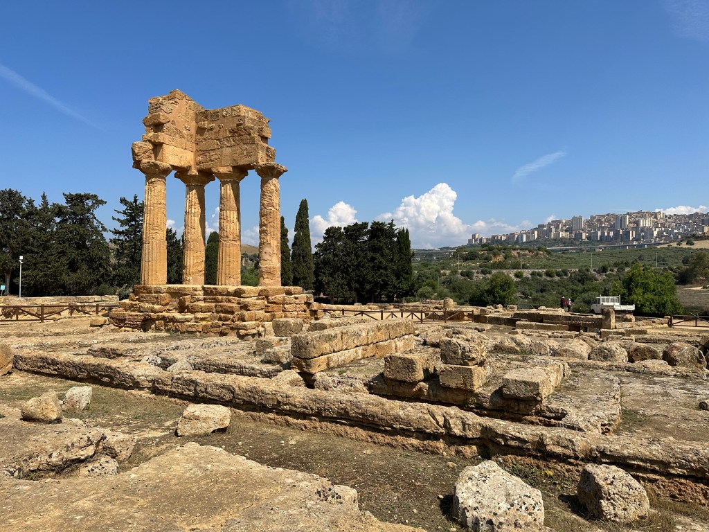
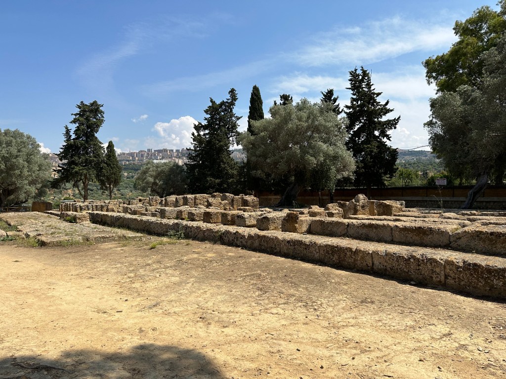
While our visit to Scala dei Turchi offered a little coastal sideshow during our stay in Agrigento, the Valley of the Temples (Valle dei Templi) provided the main event. We awoke to a pretty good view of our starting monument destination for the day: the Temple of Hera in the near distance.
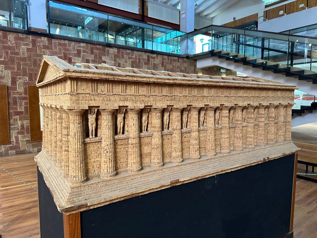
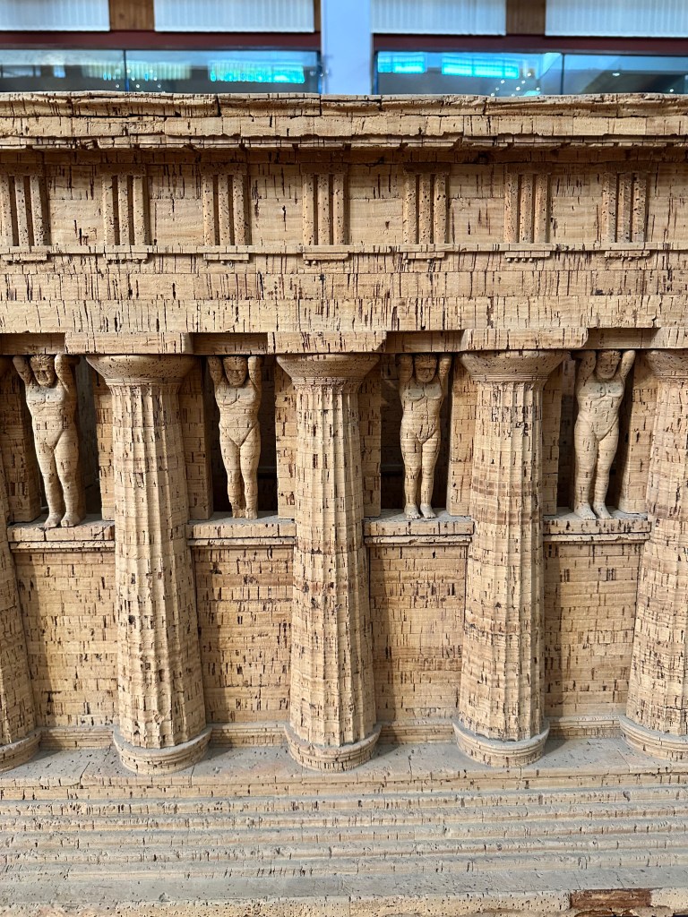
Valle dei Templi is the site of ancient Akragas (now modern day Agrigento), a Greek colony founded around 582 BC by settlers from Gela and Rhodes that grew to become one of the most prosperous and powerful cities in the ancient Mediterranean world, with a population at its peak that ancient sources suggest may have rivaled Athens itself. The complex preserves seven Doric temples built primarily during the fifth century BC. Designated a UNESCO World Heritage Site in 1997, the Valley of the Temples stands as one of the supreme monuments of Greek civilization outside of Greece itself, embodying the extraordinary cultural and artistic ambition of Magna Graecia — the network of Greek colonies across southern Italy and Sicily — and representing an irreplaceable testament to a moment when this corner of the ancient world was at the very center of Mediterranean civilization.
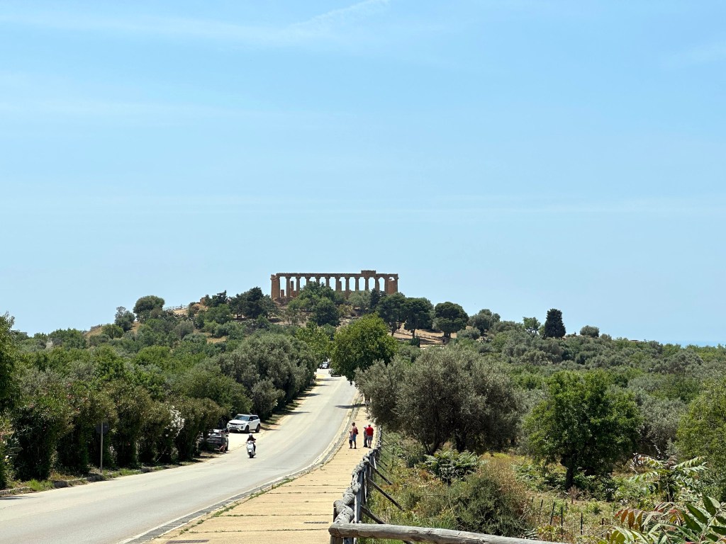
Getting closer. . .
Closer. . .
This is what we had been gazing at from afar.
The Temple of Hera (or Juno, if you prefer your gods Roman), is not actually a temple to Hera (or Juno). This attribution resulted from a misunderstanding of the location in a Greek text by Pliny the Elder during the much later Roman period.
No correction on the temple’s correct name was evident anywhere, though.
Regardless, the Greek colonists erected the temple in 450 BC, and was sacked and burned in 406 BC during a Carthaginian attack on the Greeks.
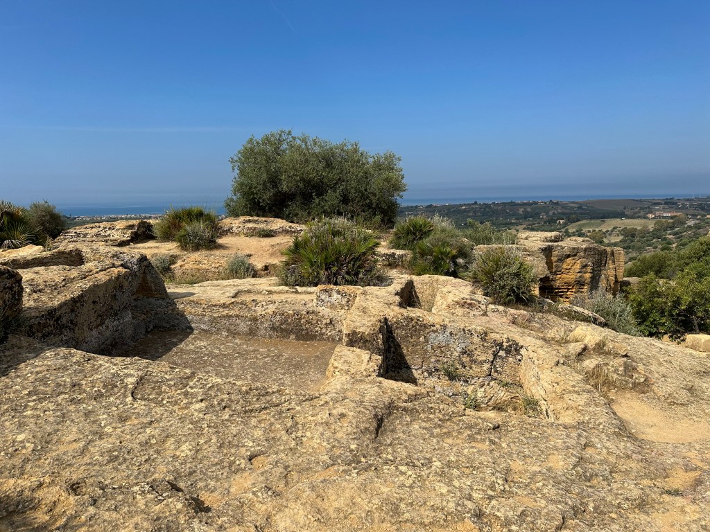
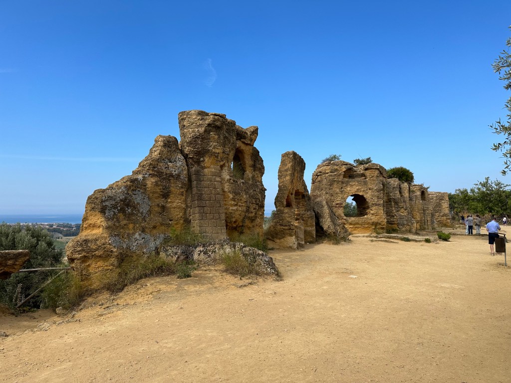
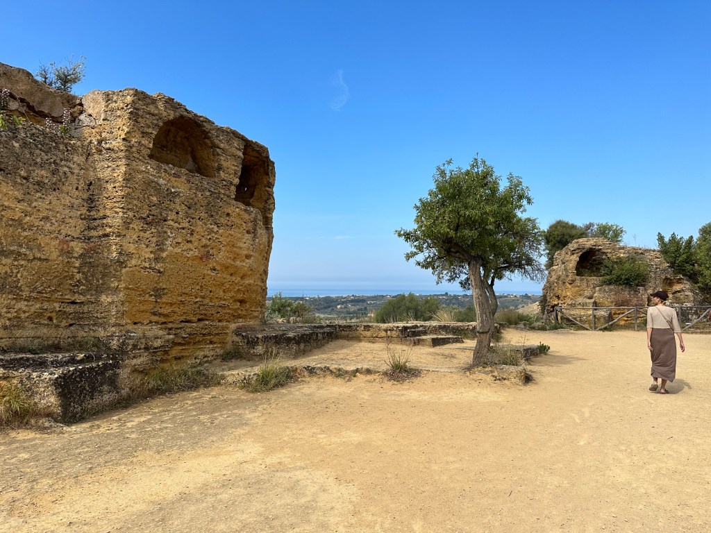
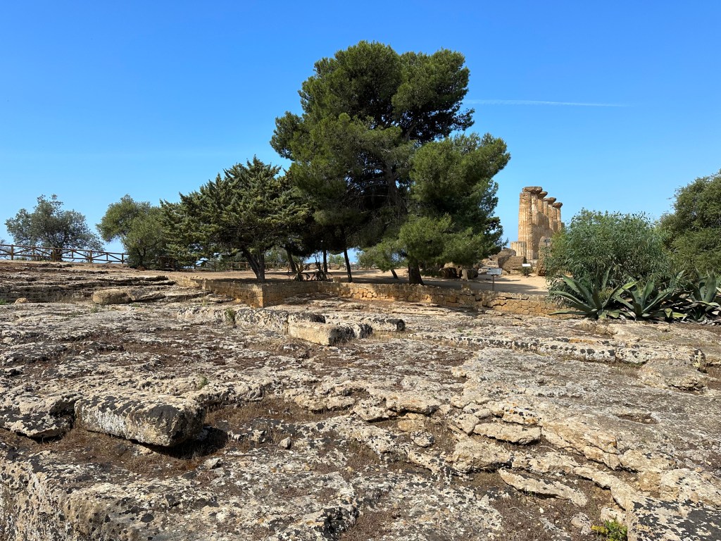
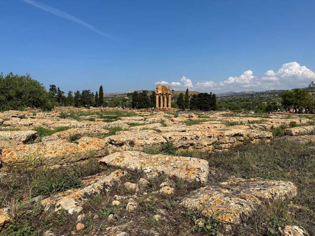
The Valley of the Temples is absolutely a misnomer: we’re actually on a ridge.
Partial remains of the city’s 6th-century-BC walls:
Which include early Christian, 2nd-century-AD arcosolium (arched, recessed) tombs carved directly into the walls themselves.
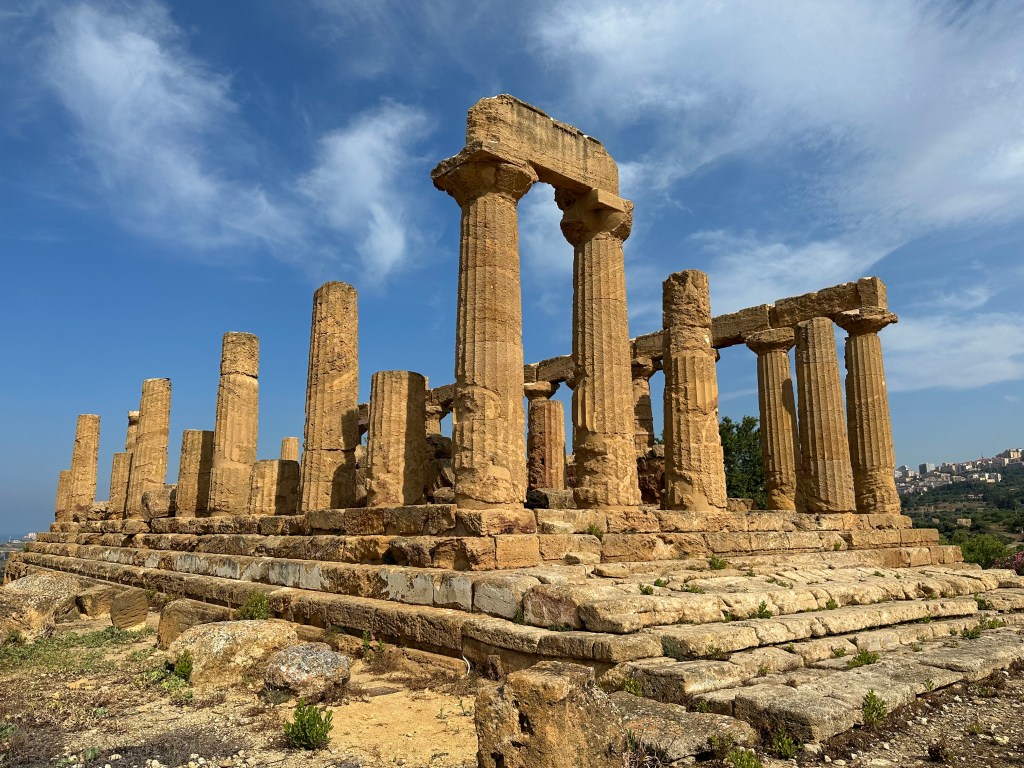
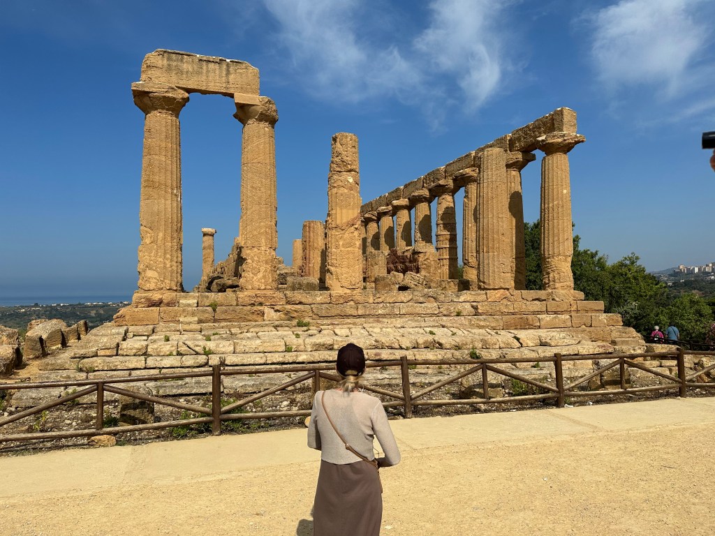
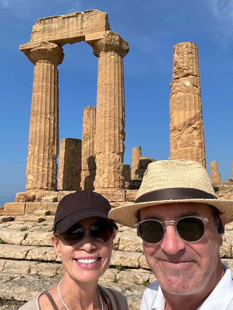
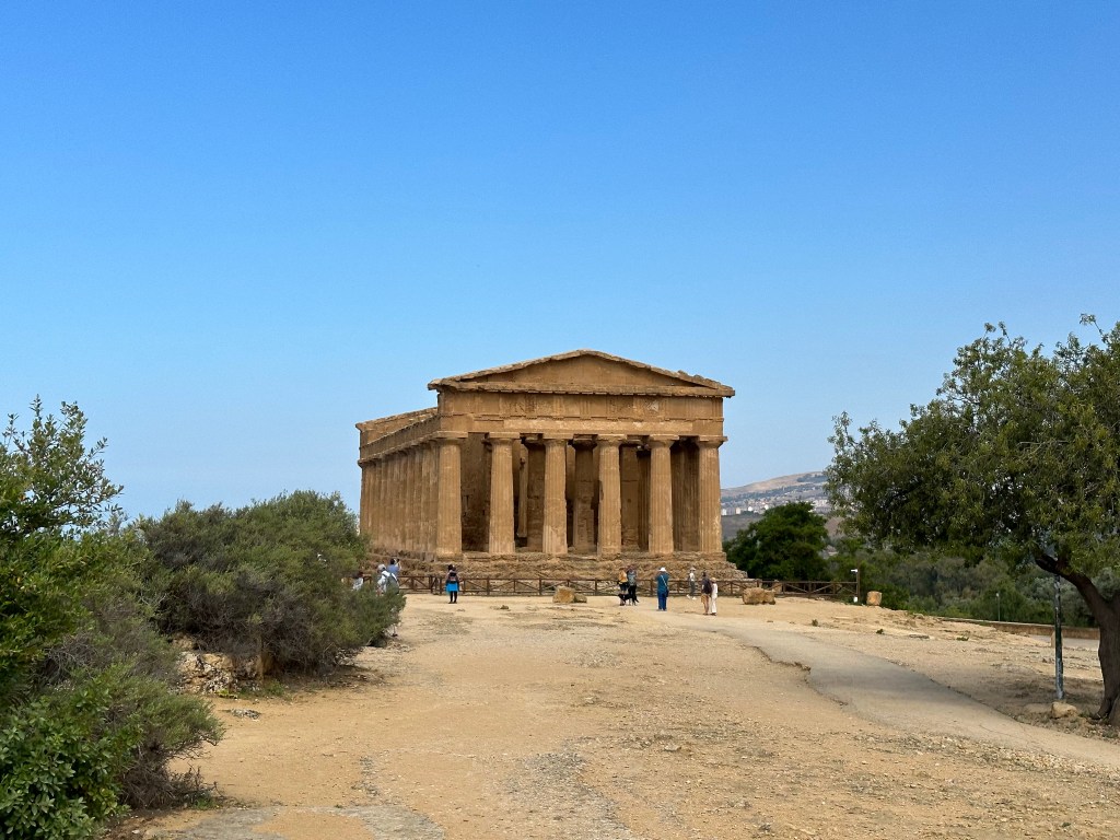
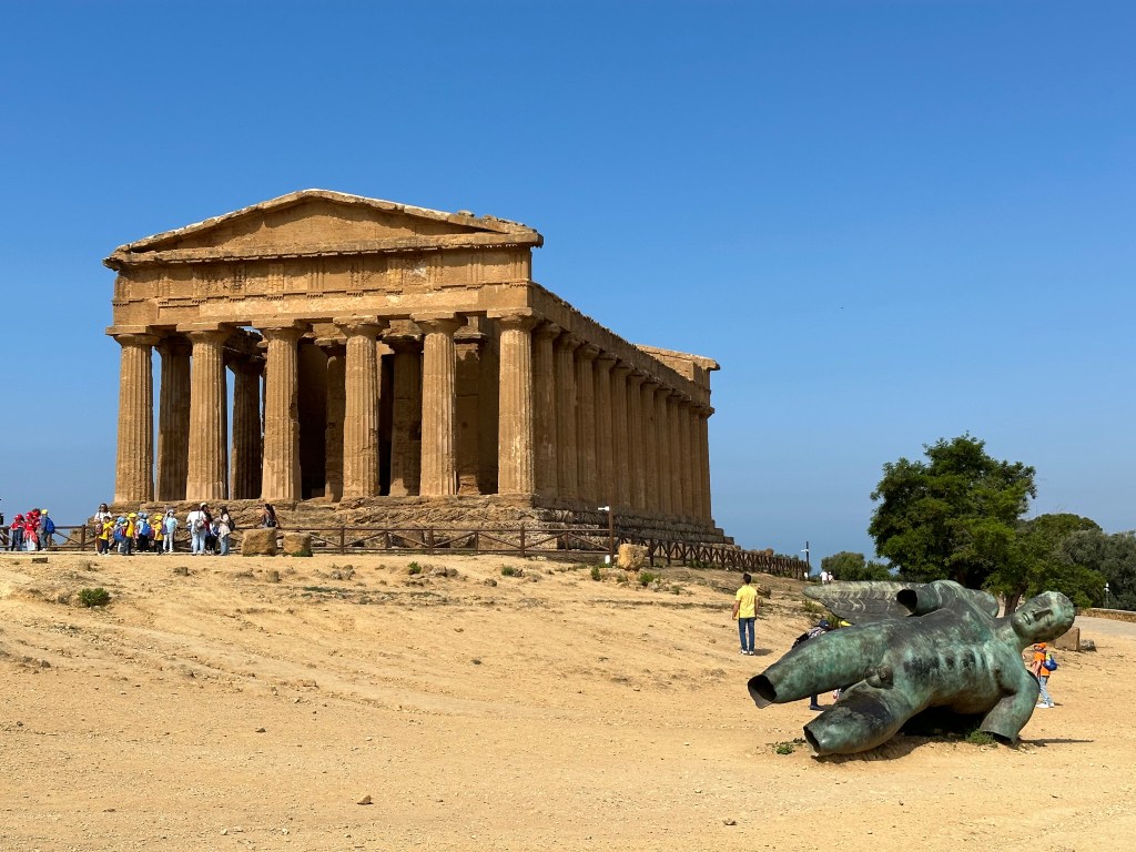
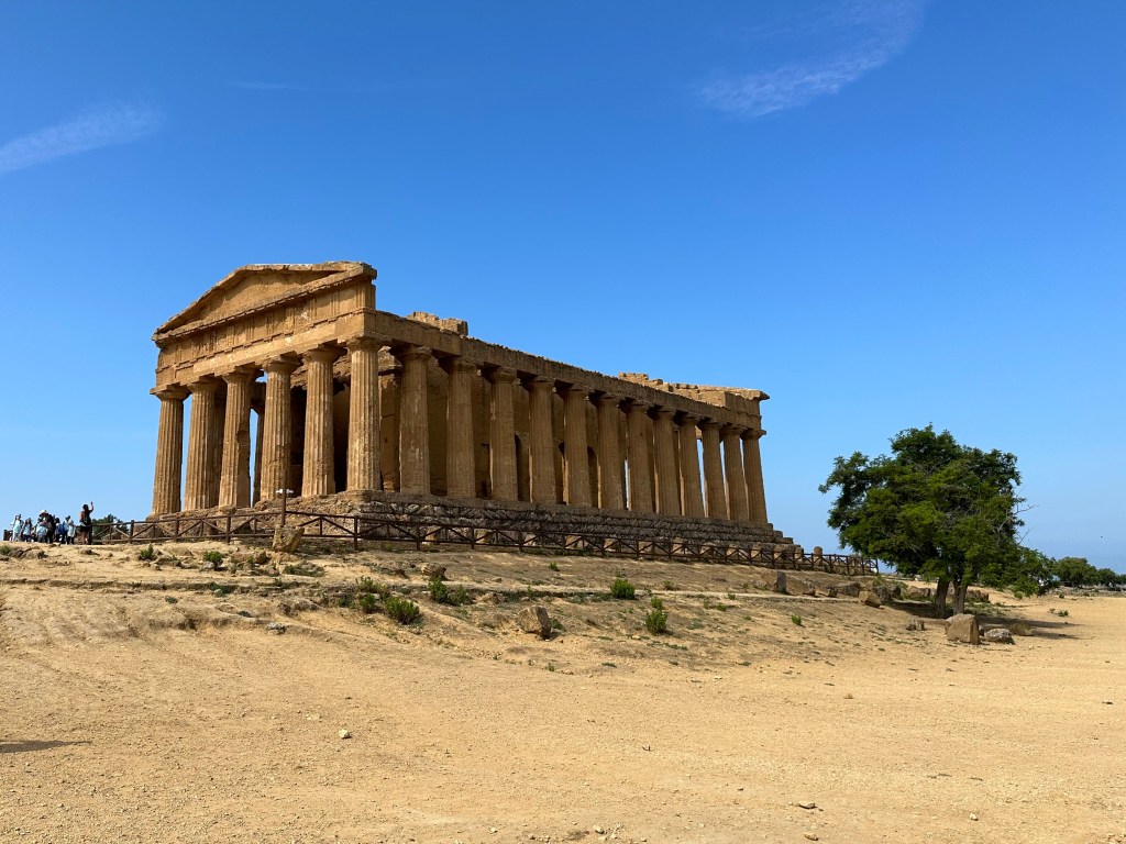
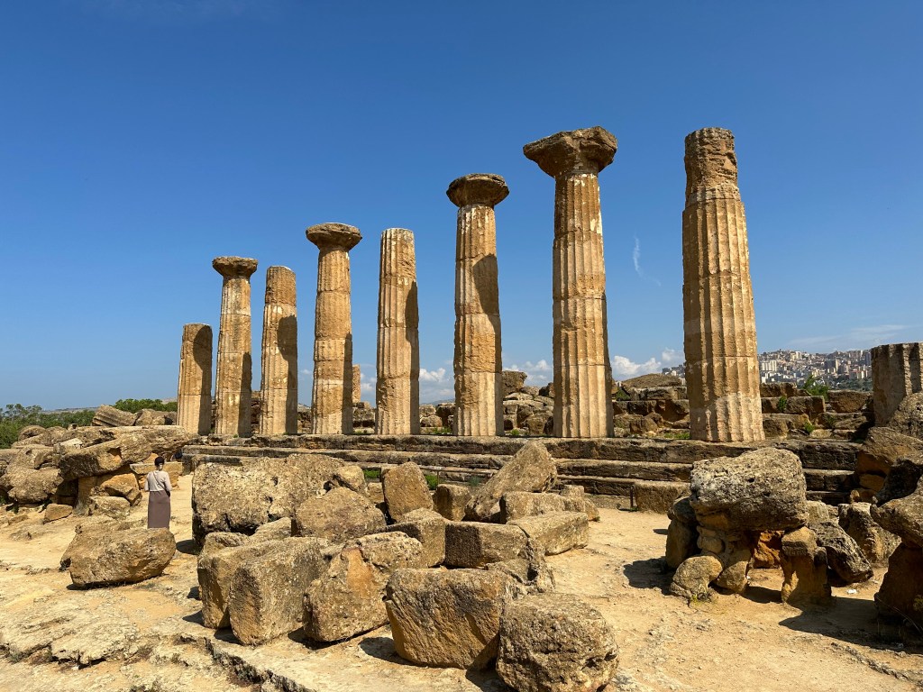
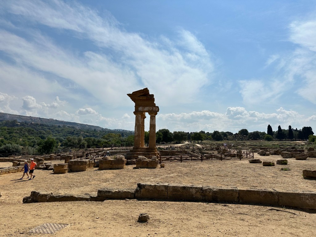
The star of the temple complex in the distance:
The Temple of Concordia is among the best-preserved Greek temples anywhere on earth — its remarkable survival owed largely to its conversion into a Christian church in the sixth century AD. “The temple was. . . dedicated to the apostles Peter and Paul by San Gregorio delle Rape, bishop of Agrigento and thus survived the destruction of pagan places of worship. The spaces between the columns were filled with walling, altering its Classical Greek form [we’d see the same thing in dramatic form when we hit Syracusa two stops later]. . . The Christian refurbishments were removed during the restoration of 1785.” (From here.)
But it was built 1100 years before that, between 440 and 430 BC.
Similar to the misnamed Temple of Juno, the temple was associated with Concordia, the Roman goddess of harmony, simply because a Roman-era Latin inscription that included Concordia was found nearby. It was unrelated to the temple, but this trend of blatantly misnaming the monuments here IS related to our growing sense of annoyance.
The Temple of Concordia is considered to be the best preserved Doric temple in the world, after the Parthenon.
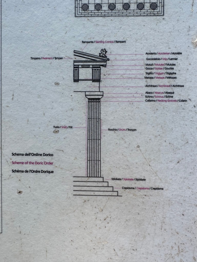
WHAT characterizes a Doric temple, you ask? Question answered by a historical marker at the temple:
Yup, no Ionic or Corinthian columns here. Just a delightful density of Dorics.
But the Doric department hasn’t yet departed. Just down the path lies yet another temple.
Behold, the remains of the Temple of Heracles (or Hercules, you Roman). And yet another BS misidentification. This one from another Cicero screed, mentioning a temple dedicated to Hercules not far from the Agrigento forum. But no one is sure that this is the one he was referencing. No worrries! In the apparent expediency of historo-archeology, researchers stuck the moniker on this half stack of columns and called it a day.
Not to content themselves with just misNAMING temples, they (we’re not sure who they is at this point), thought it would be a great idea to reconstruct a temple using pieces from various OTHER temples.
Behold, the Frankenstein Temple of the Dioscuri (Greek for “Sons of Zeus” – the twin deities Castor and Pollux). Luckily, they just contended themselves with building a corner out of mismatched, supersized Legos found on site.
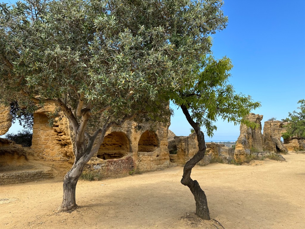
Lots of other pieces lying around, though.
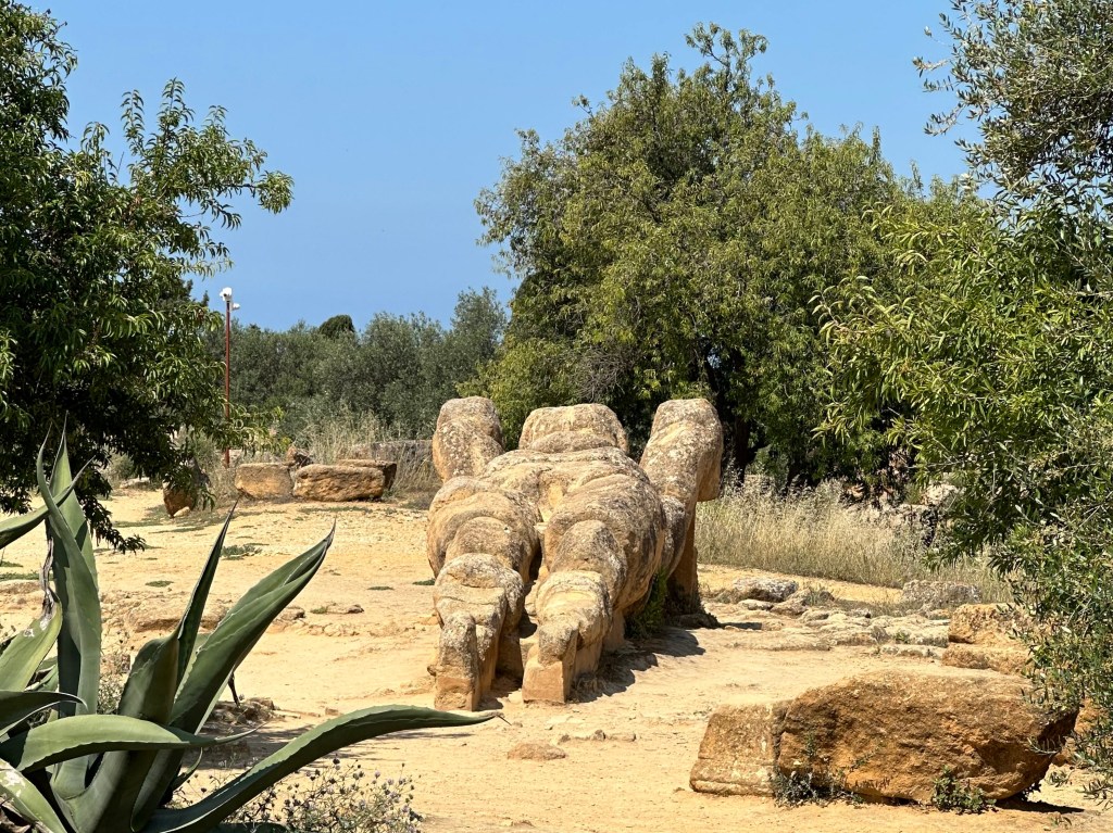
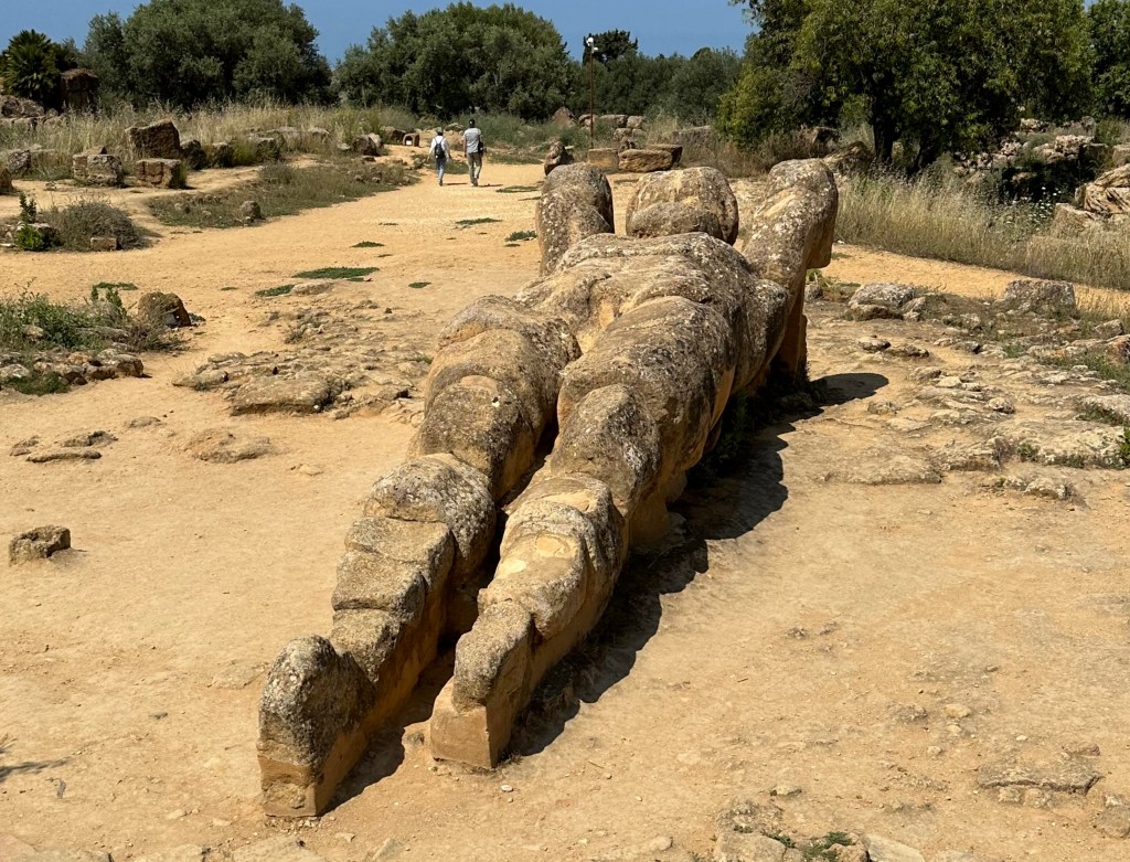
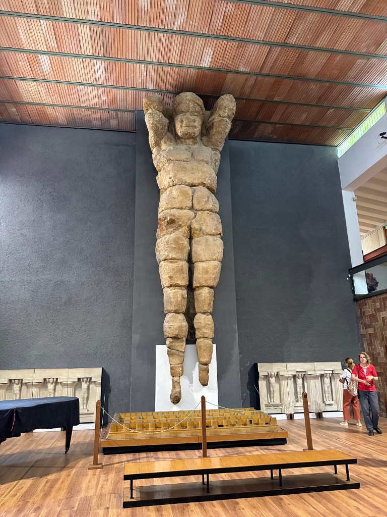
And finally, Atlas Shrugged (and then sat for a bit, and then just lay down for good). This is one of a few massive Atlas statues extant on site from an aborted attempt to build a massive (really massive) Temple of the Olympian Zeus.
In its reclining position, you can’t tell, but this thing is more than 25 feet tall (long in its current orientation).
Here’s another, upright in the Agrigento museum, with a passer by for scale:
Had the Temple of Olympian Zeus been completed, it would have been the largest Greek temple ever constructed, featuring the Atlas’ serving as telamones supporting its entablature:
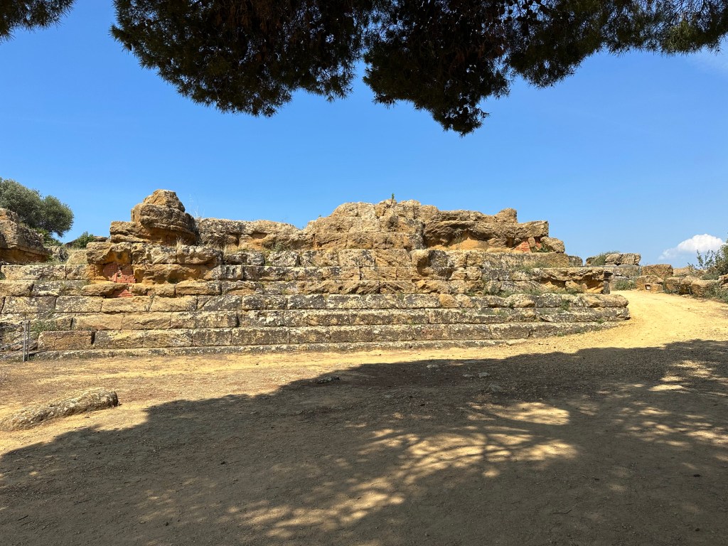
But, alas, the temple never really got off the ground. Construction commenced around 480 BCE (part of the base is below) after a major victory by Akragas Greeks over the Carthaginians at the Battle of Himera. At the time, Akragas was one of the richest Greek cities in the Mediterranean and the temple would be a statement of Akragas’s wealth and power.
But the Carthaginian invasion of Sicily in 406 BCE put an end to this. Akragas was besieged, many inhabitants fled, the economy collapsed, and monumental construction projects ceased. Leaving just this:
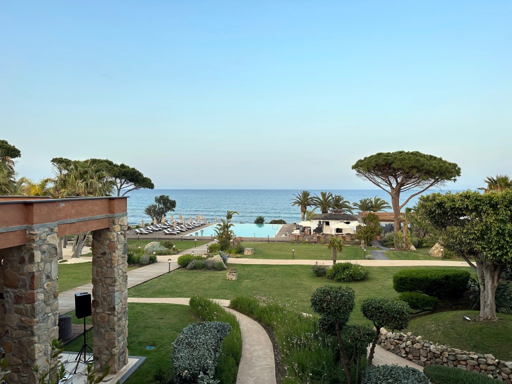
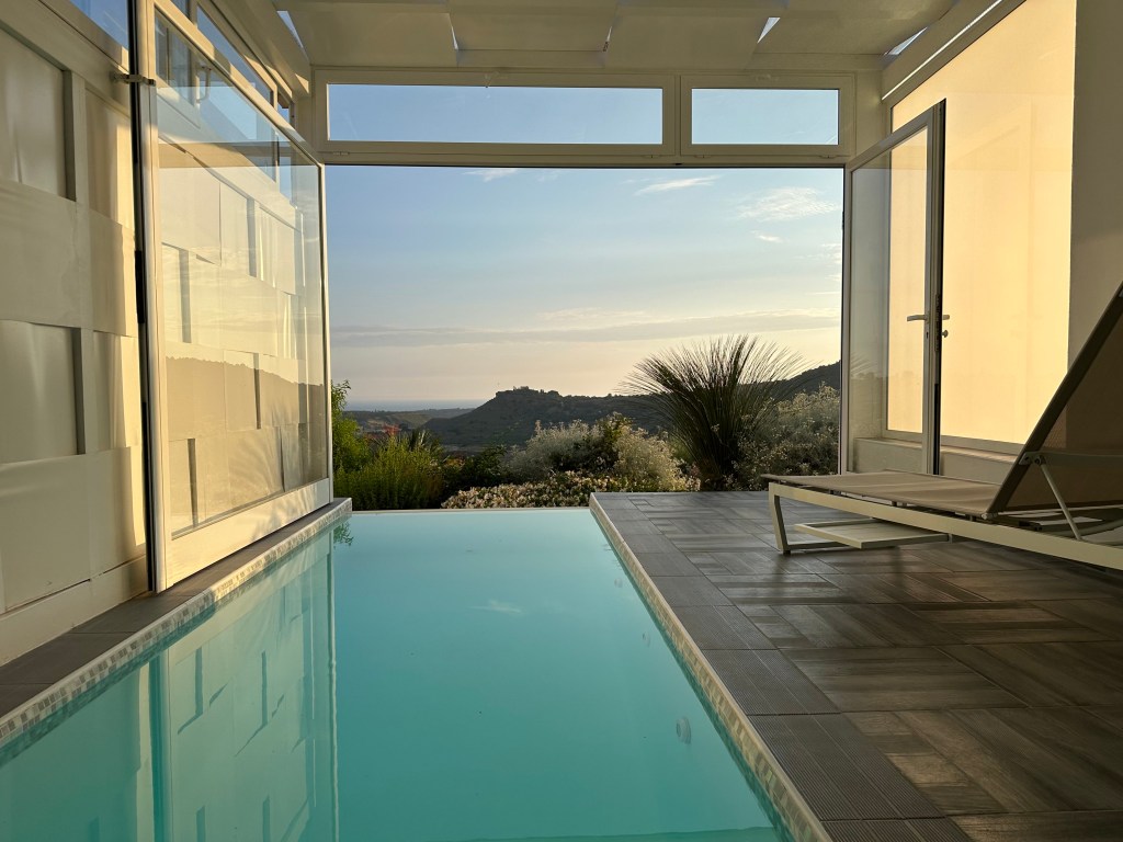
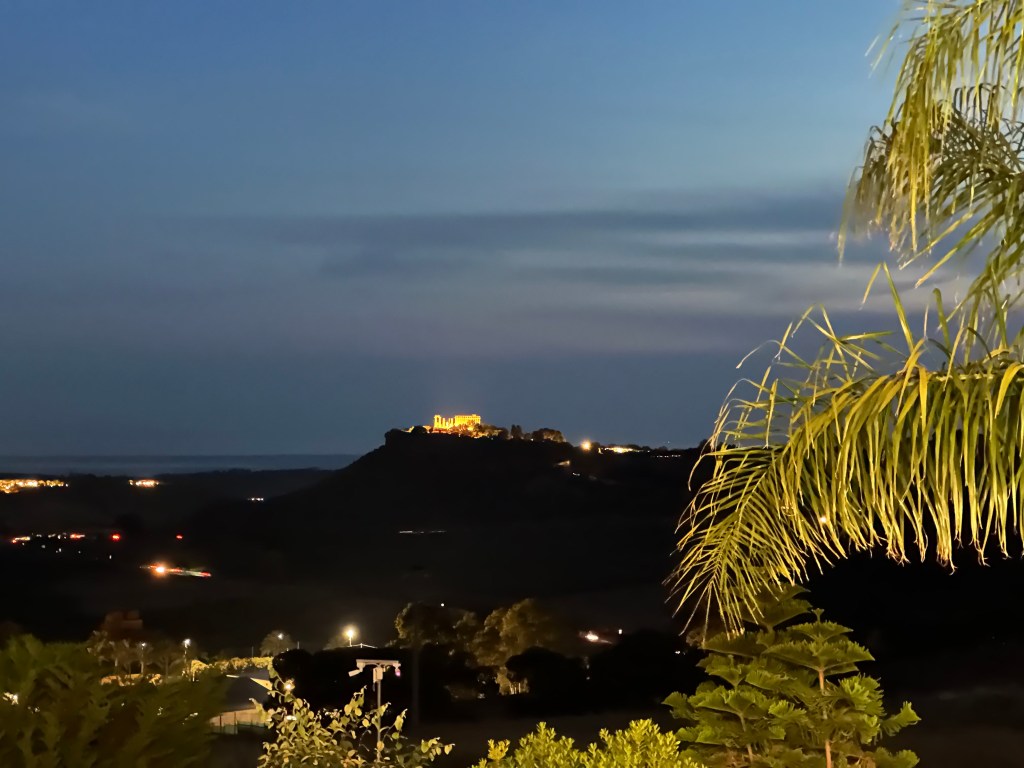
All of this is better viewed from a distance of both time and space from the comfort of our plunge pool at the end of a long day among ruins in the sun:
Our place was too inviting to venture out on either of the nights of our stay. Pretty good decision.
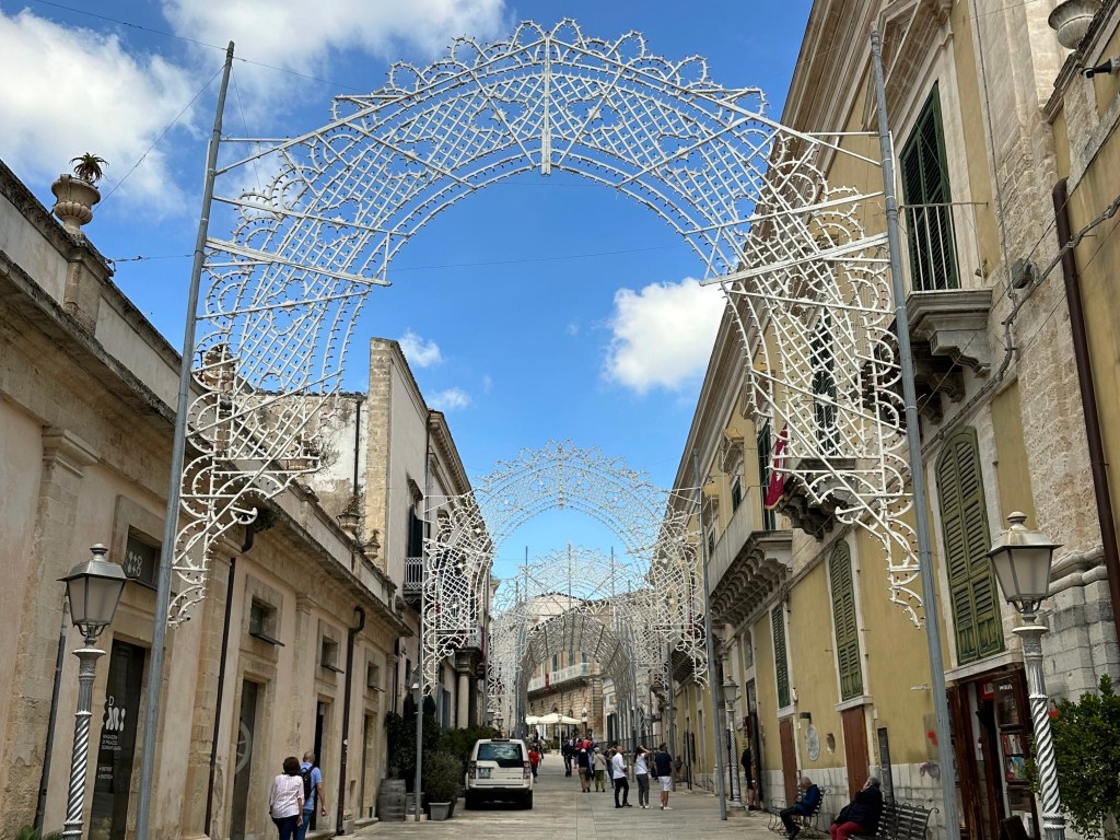
Next up: fast forwarding 2100 years and 90 miles from Agrigento to Modica and the first of our visits to the “Baroque Towns” of Sicily.
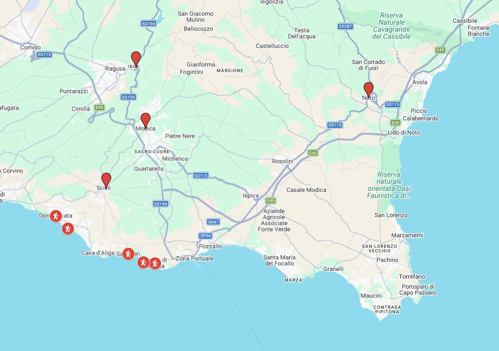
From Agrigento, we headed to Siracusa, in Sicily’s southeast corner. But first, we’d spend a few days in the island’s “Baroque towns.” These towns, including Modica, Ragusa, Scicli, and Noto, were all leveled during the region’s catastrophic earthquake in 1693. All of the towns were rebuilt in the same, exuberant, late-Baroque architecture – which was the style at the time – creating some of the most visually cohesive historic towns in Europe.
Each of the towns have the same characteristic Baroque, honey-colored stone architecture, dramatic staircases, and sun-drenched piazzas. But really, it’s the ornate churches that capture the essence of the Baroque towns – a prime example can be found in Chiesa di San Giovanni Evangelista in Scicli, but its siblings across the region all possess identical architectural DNA:
Of all of the towns to choose from, we decided to base ourselves in Modica for three reasons:
It was centrally located among the Baroque towns
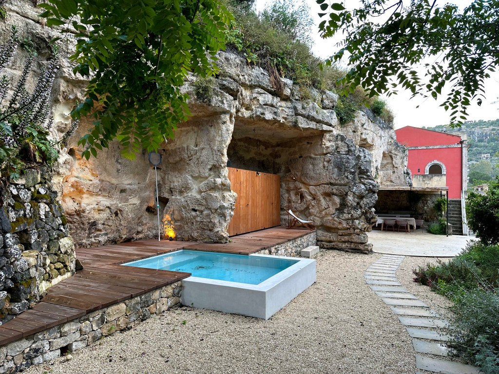
There was an AirBnB in town WITH A POOL, which is uncommon in town, and we were obsessed during planning with having access to a pool while traveling through Sicily’s (and Italy’s, and Malta’s, and Portugal’s) hot climate
Although the town looked small, it still hosted a Michelin-starred restaurant, seemingly an assurance that it would be a charming locale in which to base ourselves
We were wrong.
It was, indeed, centrally located:
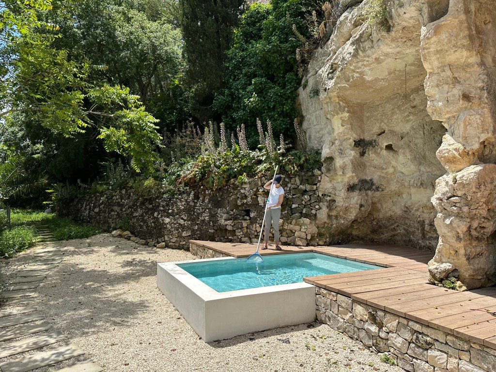
It did, indeed, have a cool AirBnB with a pool:
But, although the restaurant was on point,
the town lacked a pedestrian core and was not the most charming locale in which to base ourselves. After visiting Ragusa, we wished we had stayed there and had relegated Modica to day-trip status, a sentiment we passed on to our safari friends who had advised us on Capri and Praiano when they asked our advice when planning their trip to southern Sicily after our return.
Modica
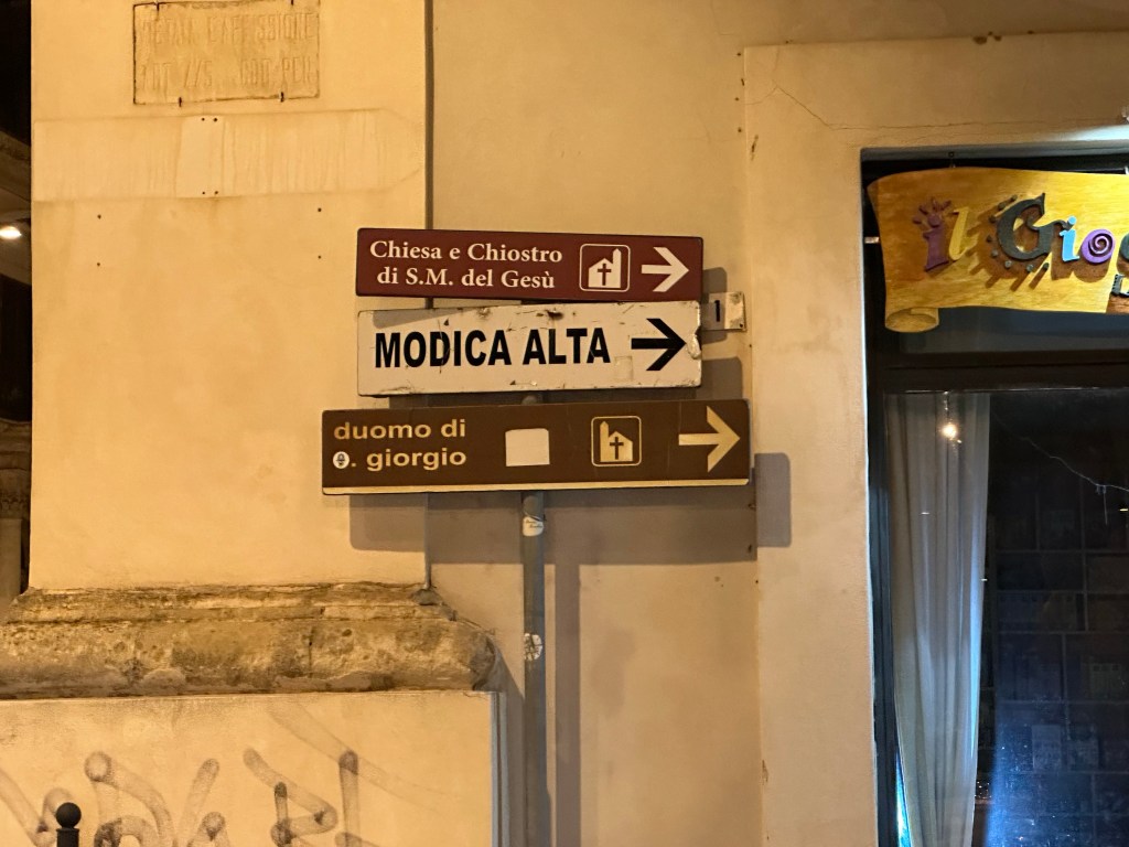
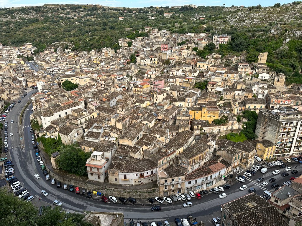
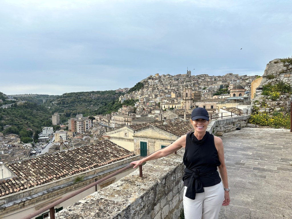
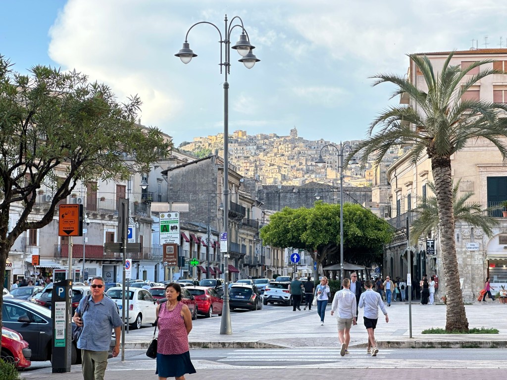
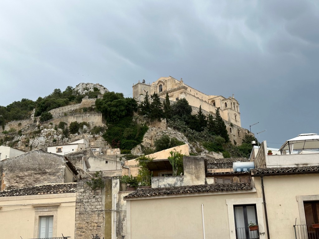
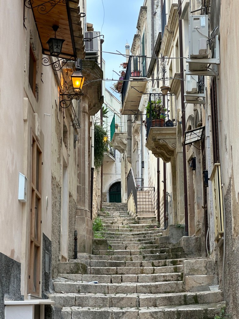
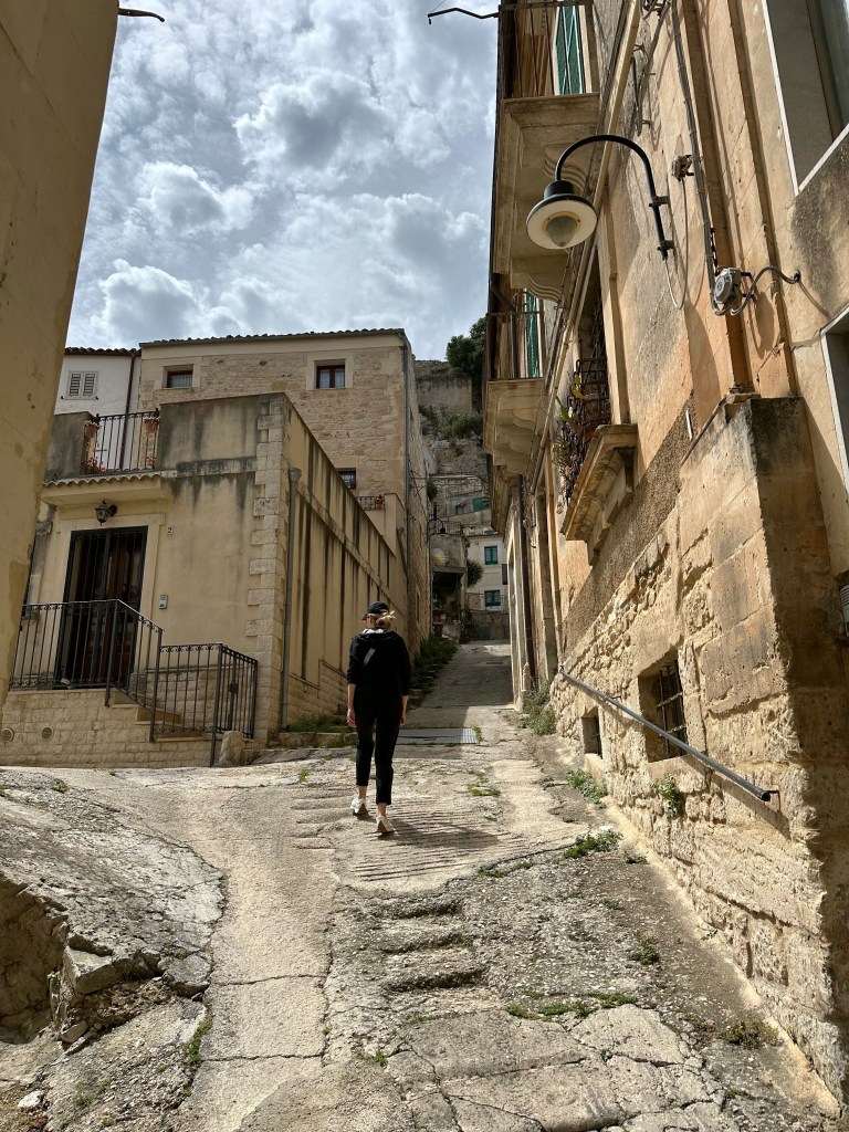
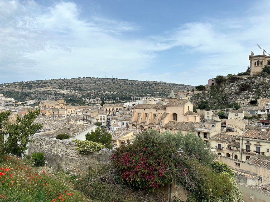
Modica is one of Sicily’s oldest continuously inhabited settlements, with roots stretching back to the Sicels and later the Greeks, Arabs, and Normans — each leaving layers of cultural imprint before the 1693 earthquake prompted its dramatic Baroque rebuilding across two hillsides joined by a central corso. One hillside is densely settled and comprises Modica alta, the high town:
At the bottom lies Modica basso, the low town:
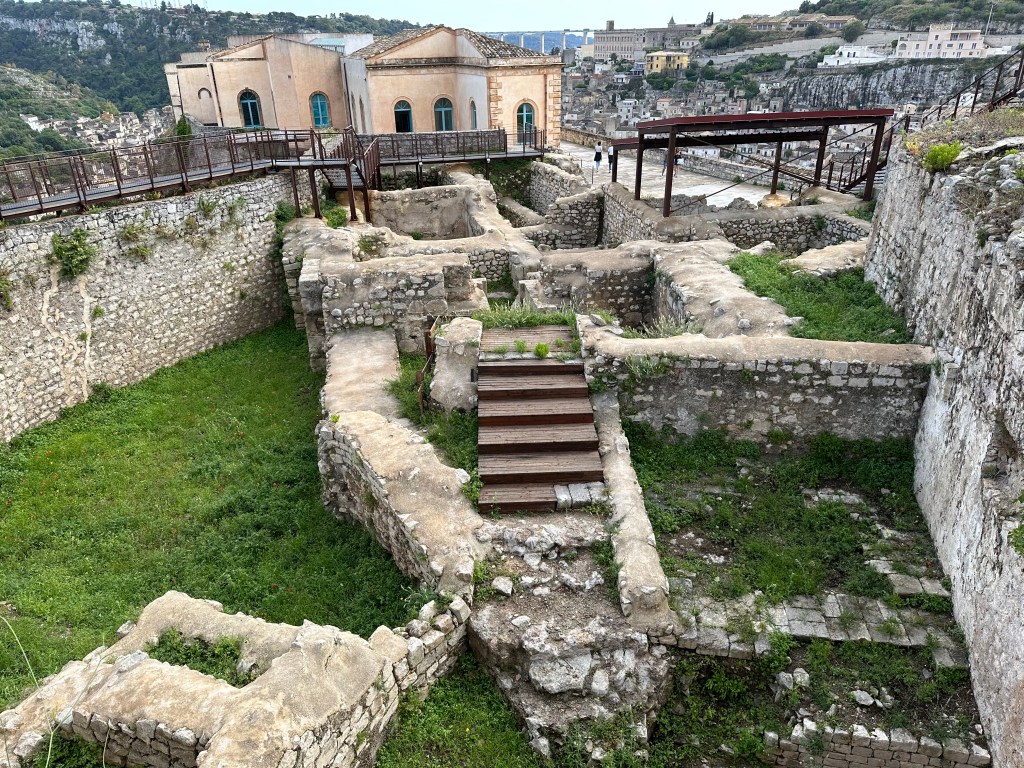
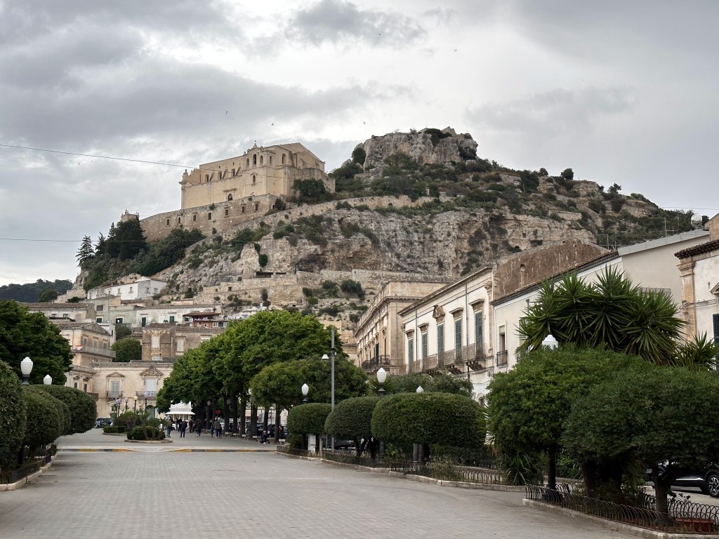
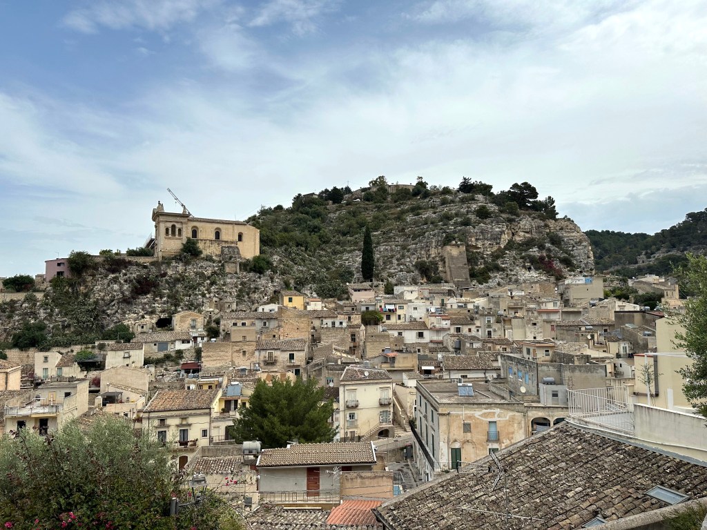
All of this viewed from Modica’s indominatable Castello dei Conti, a medieval fortress dating to 1272, perched on a rocky spur high above the town and reached via a long climb up steep steps.
A rather nice view of the castello from below, in Modica basso:
The town’s main drag:
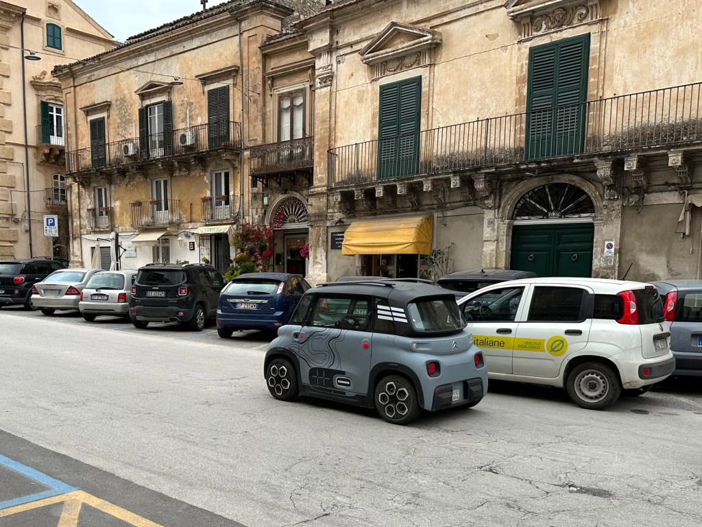
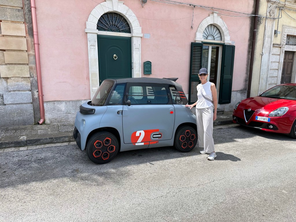
And the tiniest car we’ve ever seen. This little Citroen model would pop up in several of the Baroque towns. Hilarious.
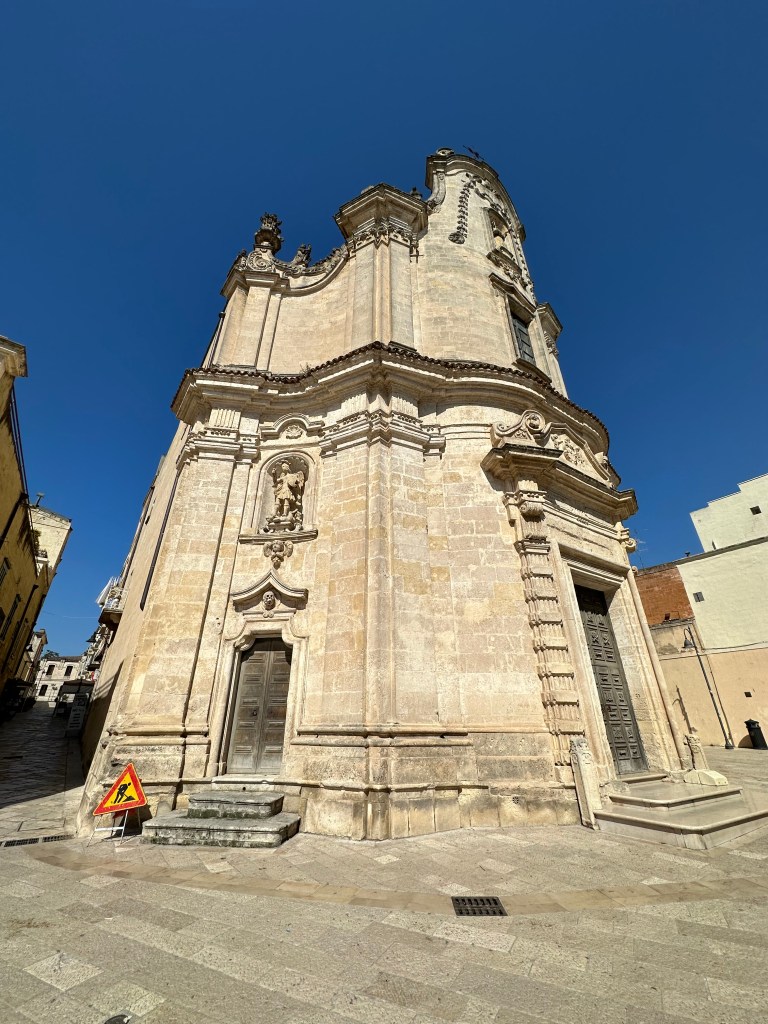
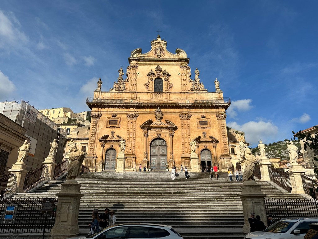
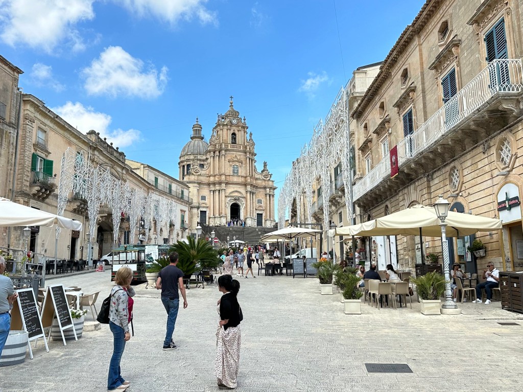
Our first (of way too many) Baroque churches. This one, a cathedral, the Duomo di San Pietro:
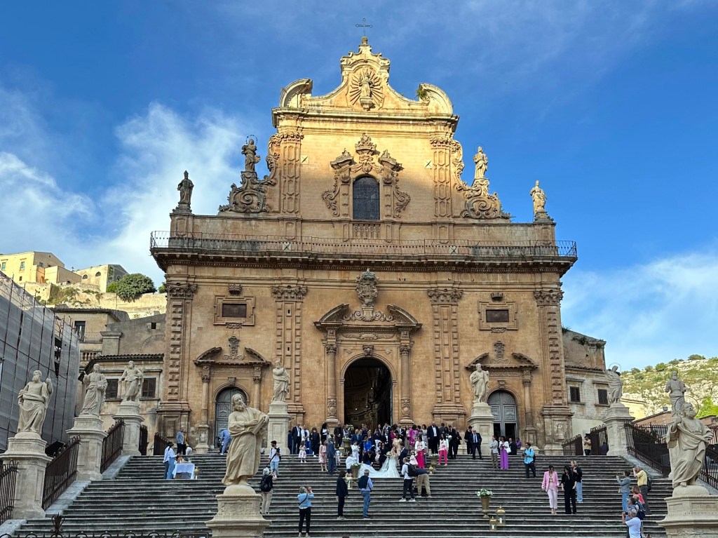
Put to good use hosting a wedding several days later:
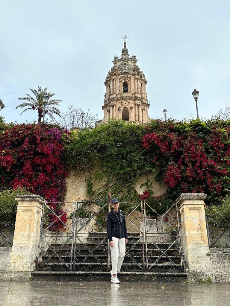
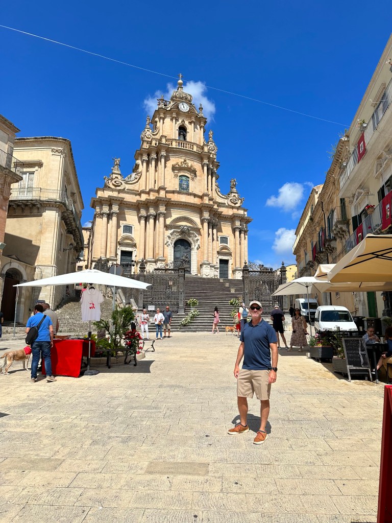
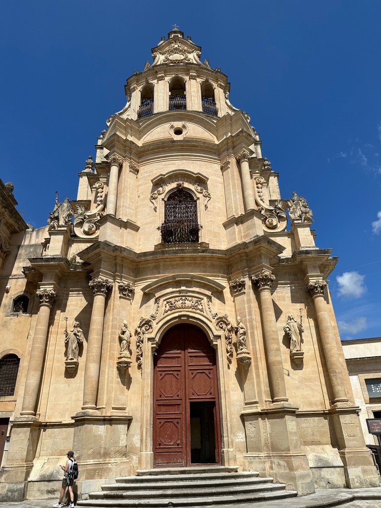
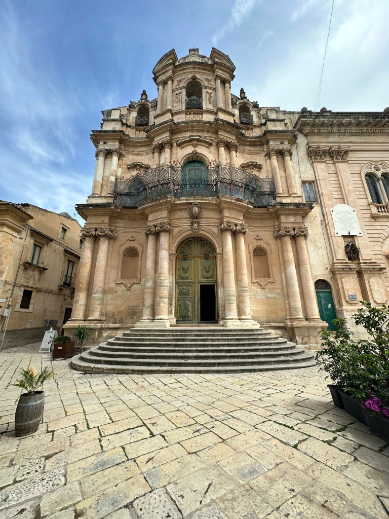
And yet another, ALSO a cathedral (which we totally do not get), the Duomo of San Giorgio:
Of all of the towns and all of the churches we’d visit, we thought this one singularly captured the Baroque style – highly ornamented and be-columned, all built with the honey-tan marble:
Oh, okay – another one, this time the Church of St. John the Evangelist:
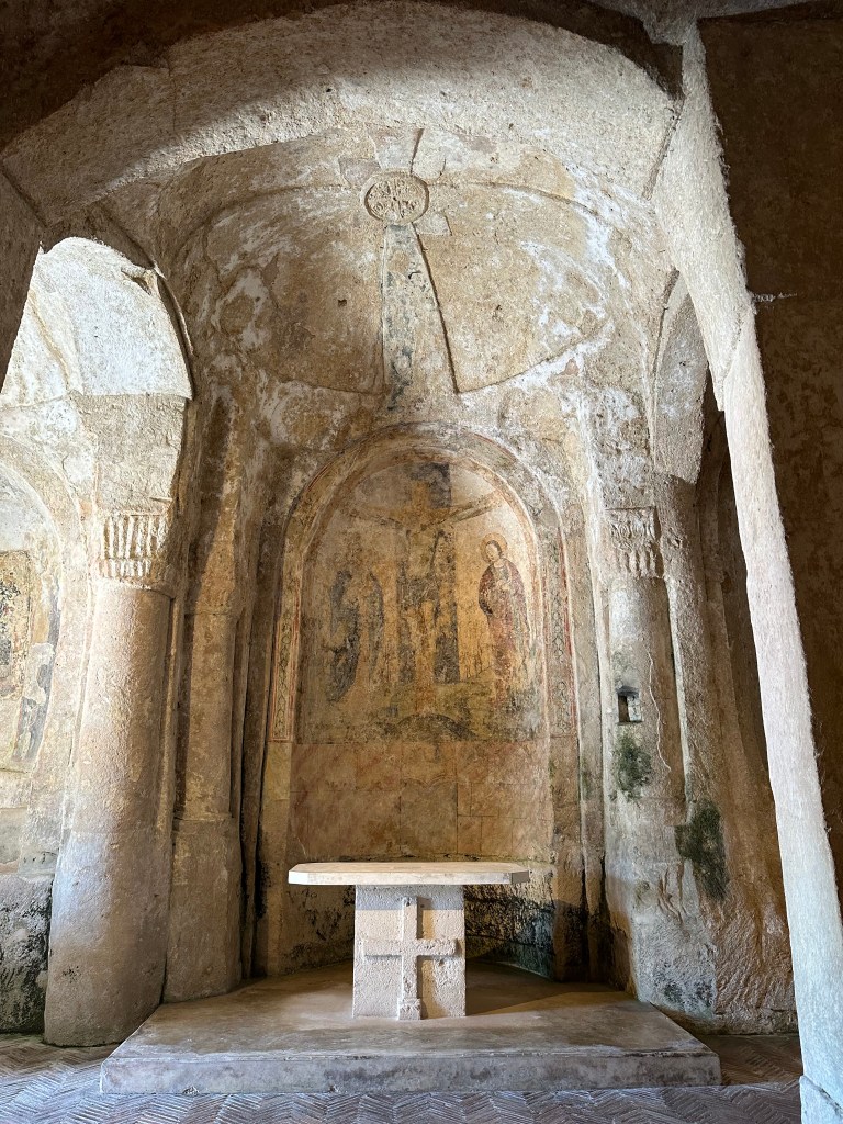
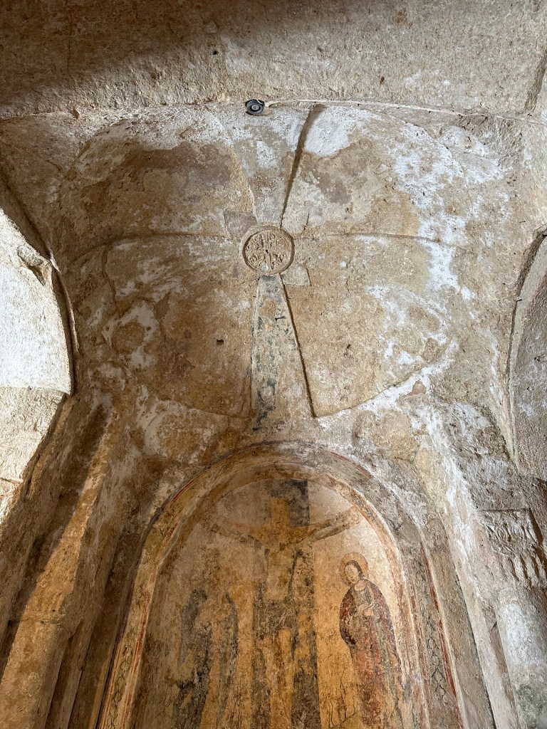
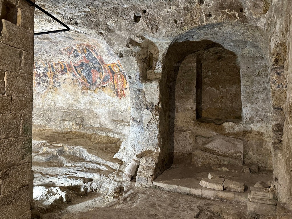
But they ain’t ALL baroque. To wit: the Rock Churrch of San Nicolo Inferiore. Discovered in 1987, the cave church dates to the 11th and 12th centuries and was abandoned following the Latinization of the island, when the Eastern (Byzantine/Greek) rite of Christianity was gradually replaced by the Western Roman (Latin) rite that followed the Norman conquest of Sicily in the 11th century .
This place was covered by the collapse of surrounding buildings during the 1693 earthquake. But check out what was preserved.
Cool carved apse:
Featuring yet another freakin’ Christ Pantocrator – clearly a fave of the Sicilians:
But we genuinely are engaged, entranced, and enthralled by troglodyte churches, with their openly exposed art applied a millennium ago and now just inches from you. Pretty incredible.
Five tombs are embedded in the center of the nave and likely date to the last phase of the building.
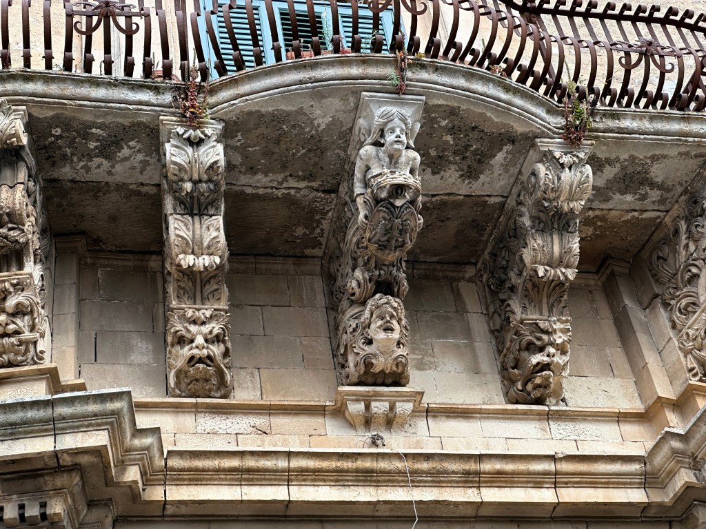
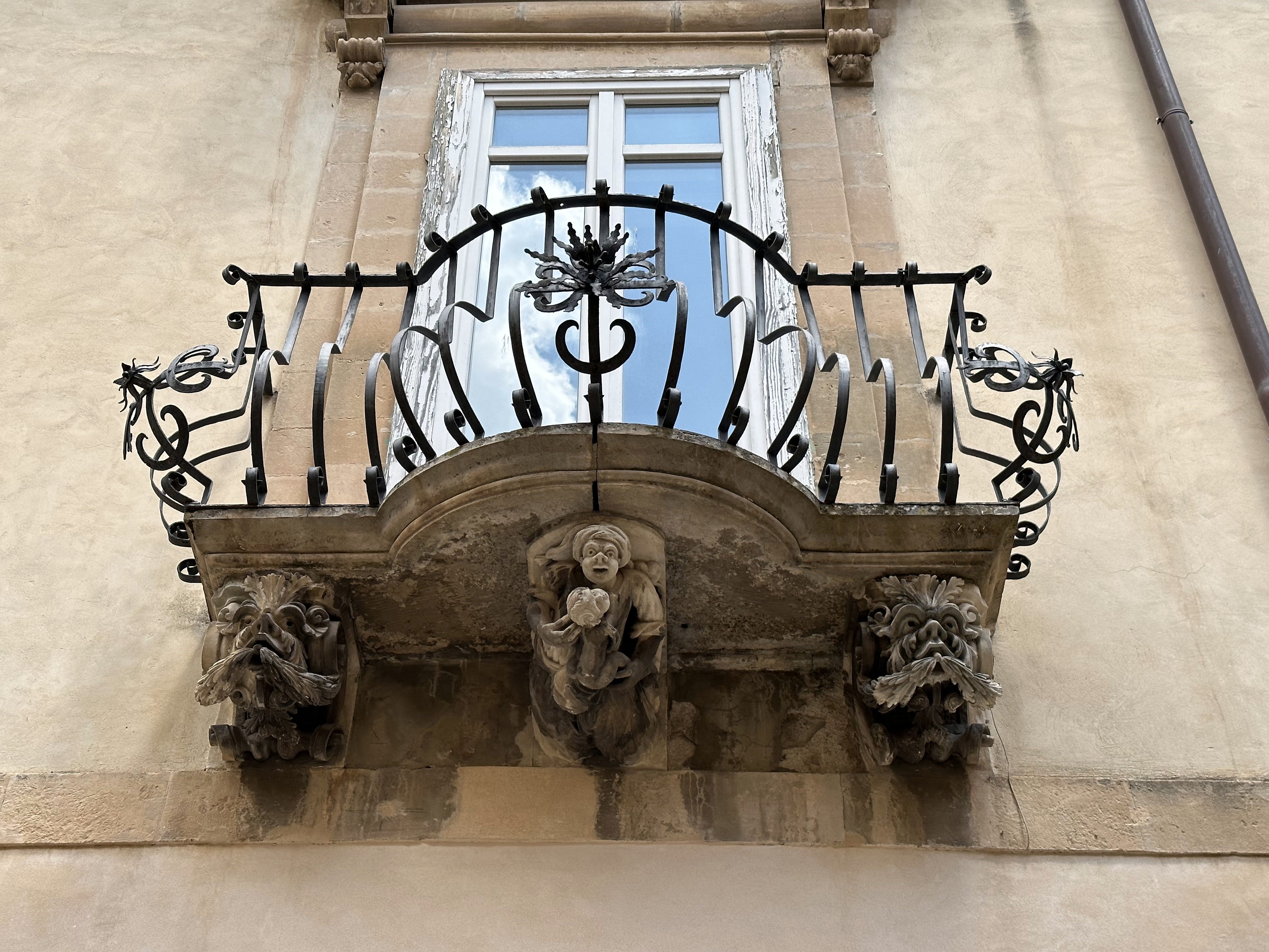
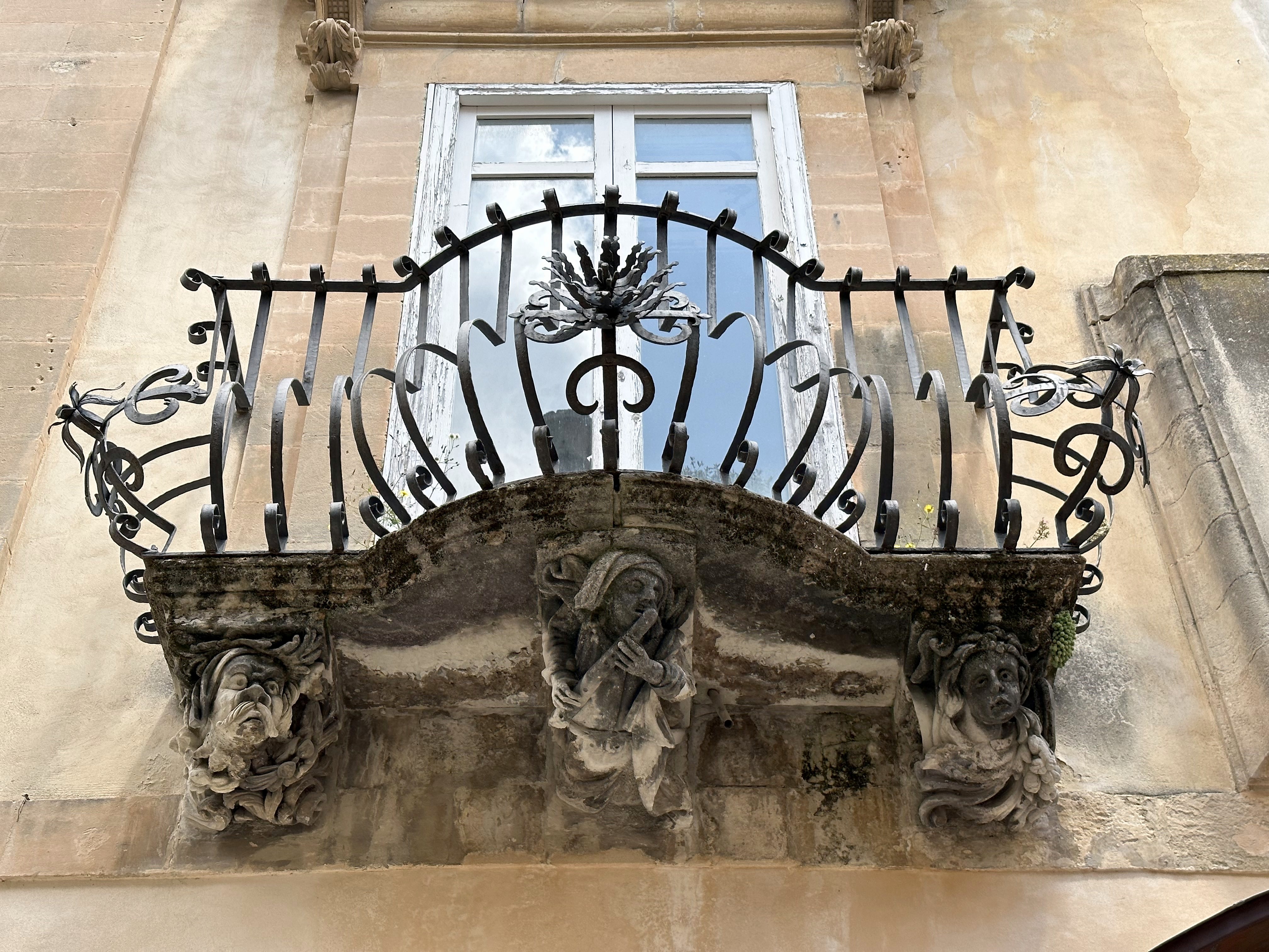
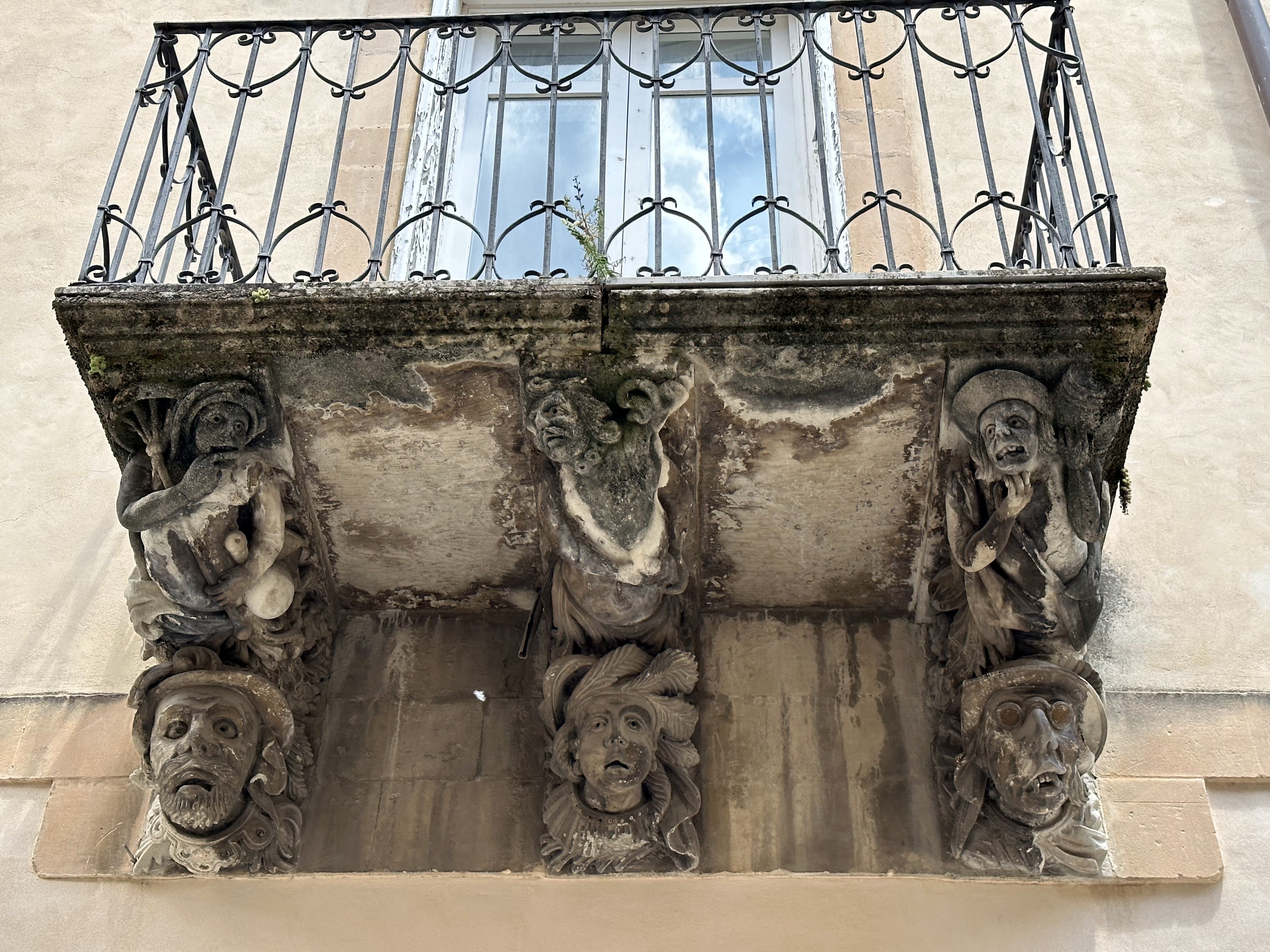
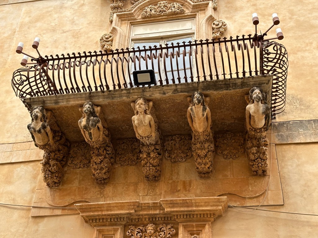
Outside on the streets of Modica, though, more Baroque elements – ornately carved balcony supports with lots of little characters (all of which we’d see in the other towns, too):
The town is perhaps most famous globally for its ancient chocolate-making tradition, inherited from the Aztecs via the Spanish and produced cold without cocoa butter, resulting in a grainy, intensely flavored bar that bears almost no resemblance to modern chocolate and is taken very seriously by locals. Modica’s chocolate is reputedly the closest thing one can get to the style of chocolate the Aztecs drank and ate. We tried some. Definitely an acquired taste. But we very much dug the provenance of chocolate and unique link to the Aragonese occupation of both central America and Sicily at the same time.
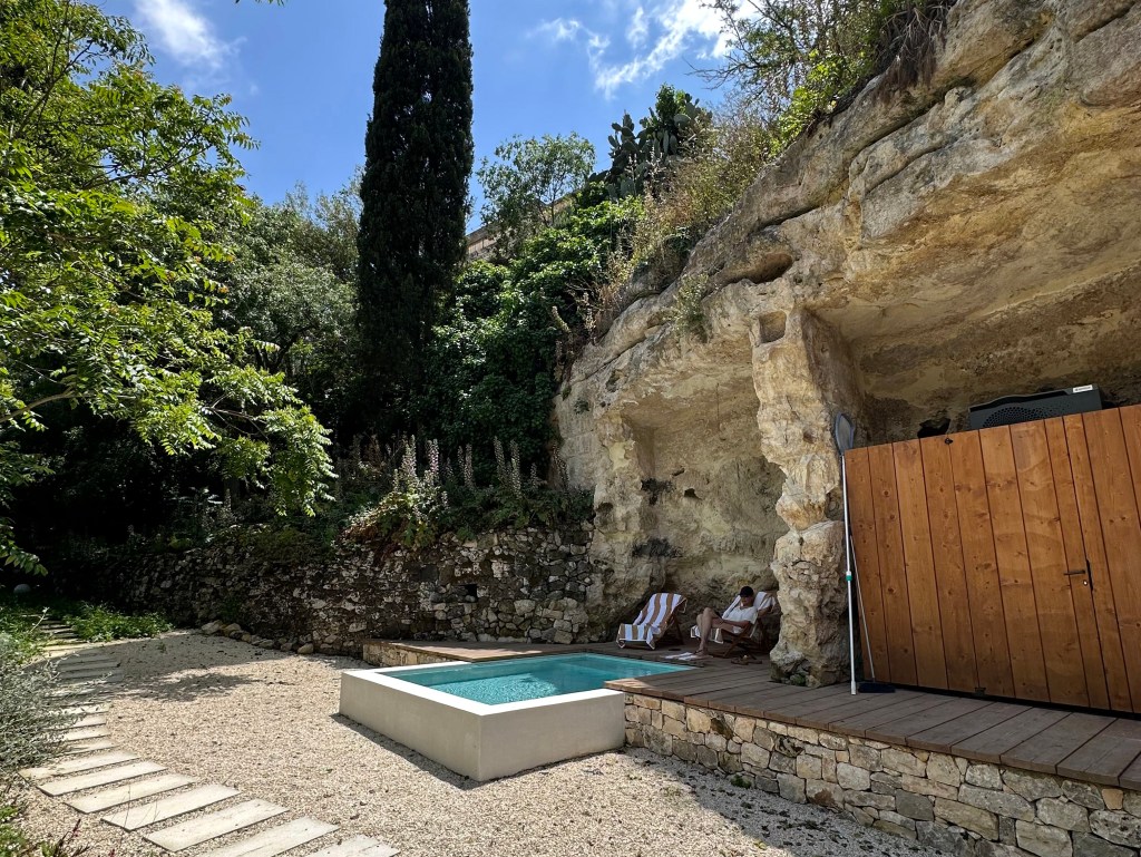
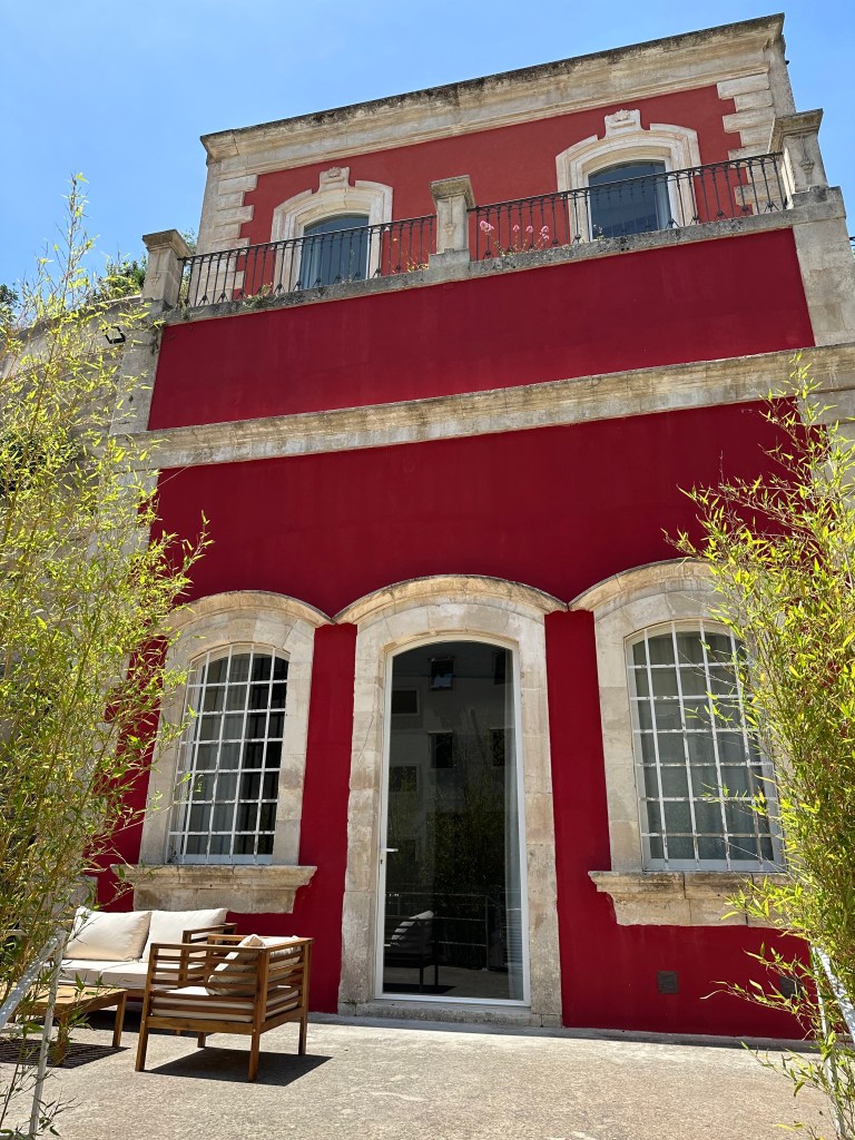
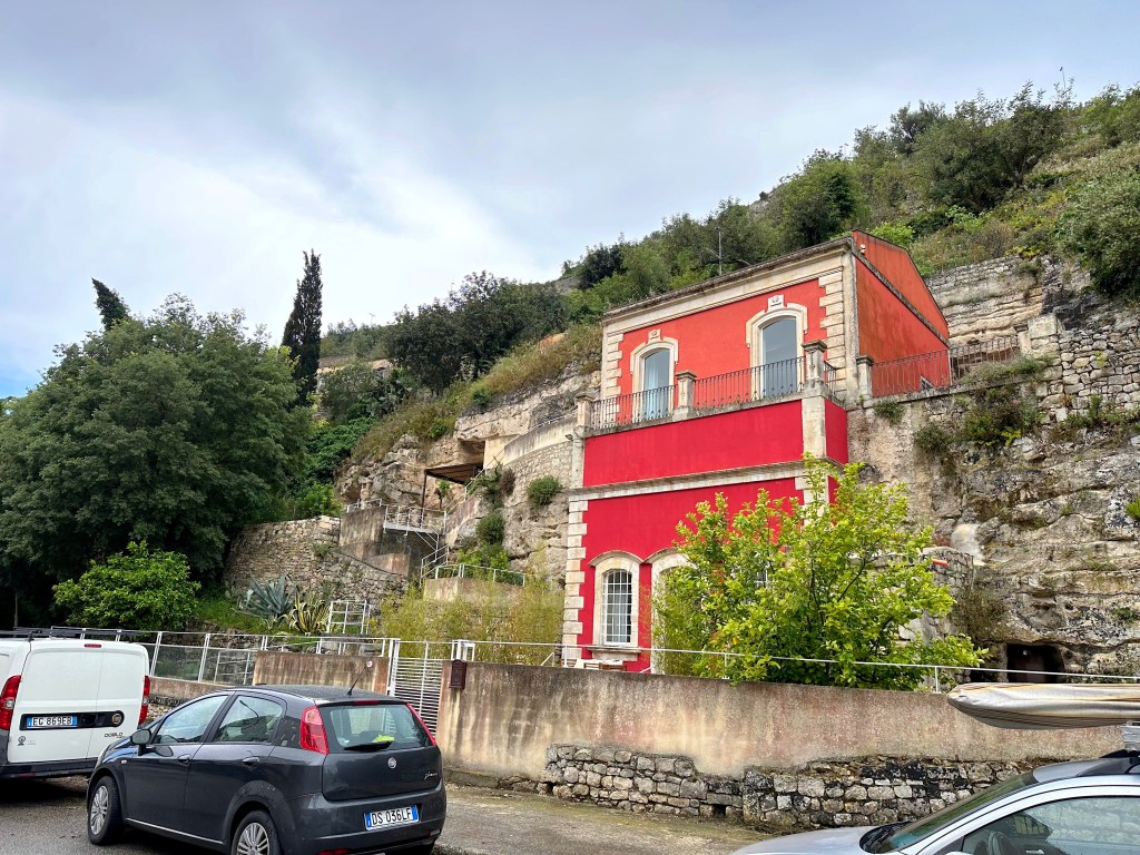
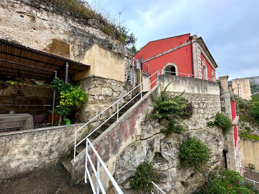
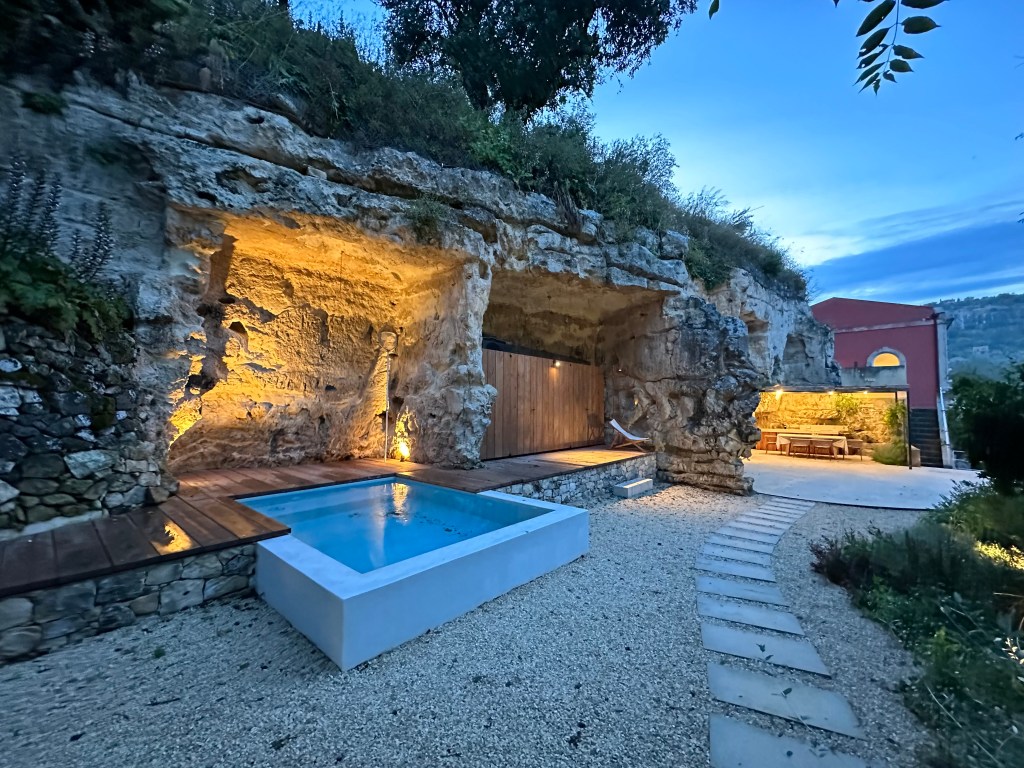
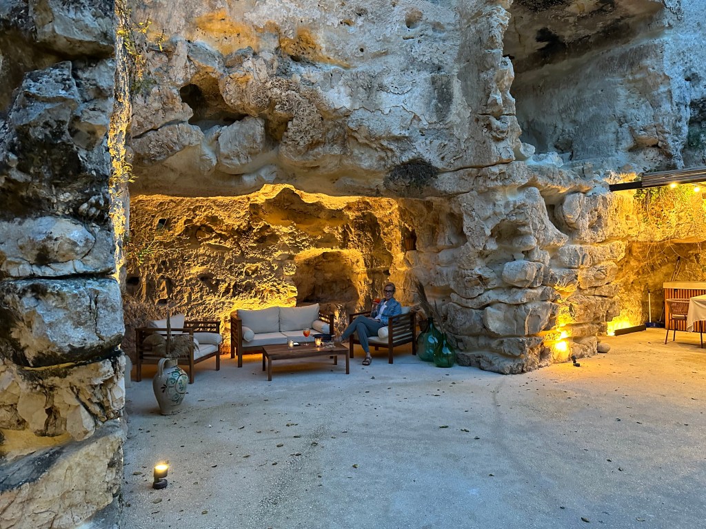
Our headquarters for Baroque barnstorming lay embedded in a cliff at the edge of town:
The place, both inside and out, offered LOTs of, well,
The place came with a pretty cute pool girl, which was nice:
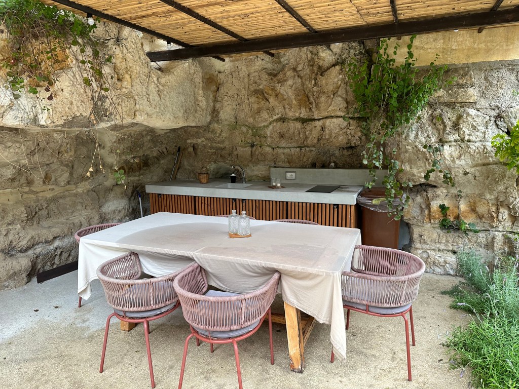
Our post-beach lunch area:
With pasta feasts prepared by the pool girl, who proved to possess multiple talents:
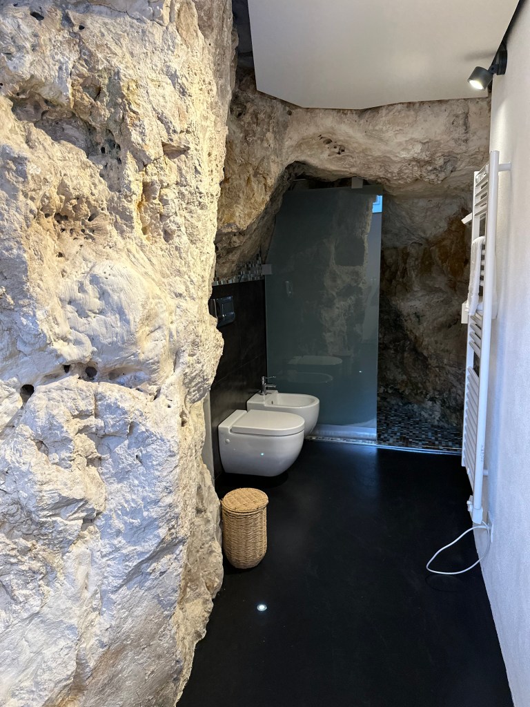
The cave action outside extended inside with a cave bathroom, perhaps to complement the cave church down the street:
Although Modica was cursed with the absence of a true pedestrian core, it nonetheless sported plenty of car-free lanes in both Modica alta and Modica basso:
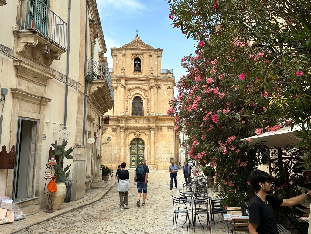
Ragusa
Our second Baroque town happened to be the one we SHOULD have stayed in: Ragusa. Much more charming and aligned with the WolfeStreetTravel style.
This is actually a view of Ragusa’s new town up on the hill; we did not visit.
Instead, we headed up to Ragusa Ibla – the burg’s Baroque old town.
And the passageways that typified this area of town:
Getting closer.
The heart of town:
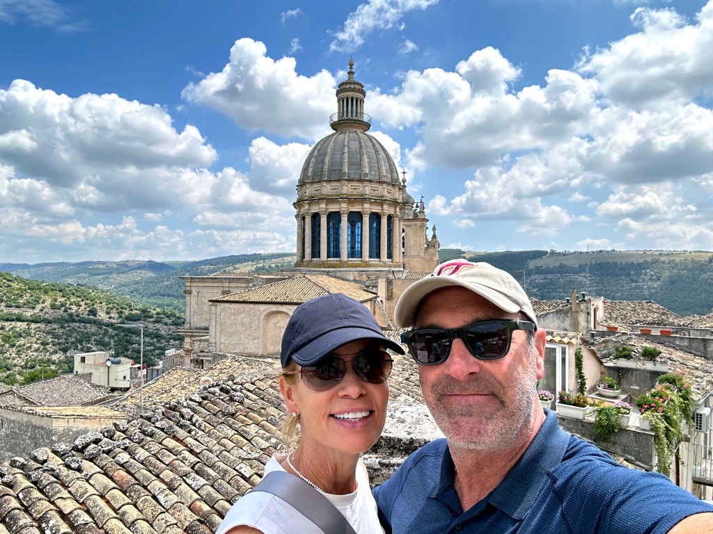
Ragusa Ibla is the ancient, labyrinthine lower town of Ragusa, a UNESCO World Heritage Site rebuilt in glorious Baroque style after the 1693 earthquake, its honey-colored stone churches and palazzos tumbling dramatically down a rocky promontory surrounded by deep ravines.
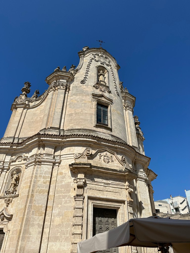
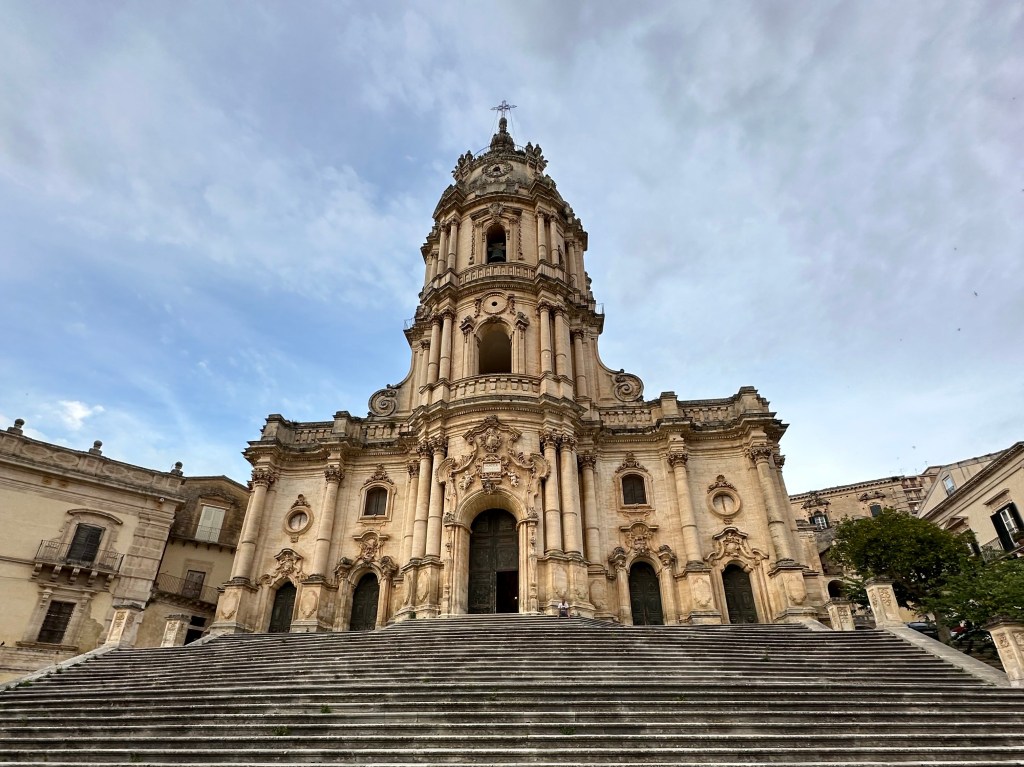
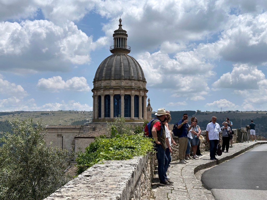
The undisputed highlight is the Cathedral of San Giorgio, one of the masterpieces of Sicilian Baroque attributed to Rosario Gagliardi, its magnificent facade rising above a sweeping staircase and presiding over a graceful piazza that ranks among the most beautiful in all of Italy.
Another Citroen breadbox!
Above and behind the Cathedral of San Giorgio:
At last, a non-Baroque church. The Church of San Giacomo Apostolo is one of Ragusa Ibla’s oldest sacred sites, dating to the 13th or 14th century and built under the Chiaramonte family, though rebuilt into a single-nave Baroque structure after the 1693 earthquake absorbed the ruins of the adjacent church of San Teodoro. Tucked inside the beautiful Giardino Ibleo public gardens at the eastern tip of Ibla.
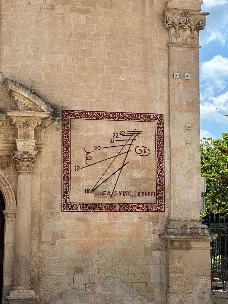
Dig the sundial:
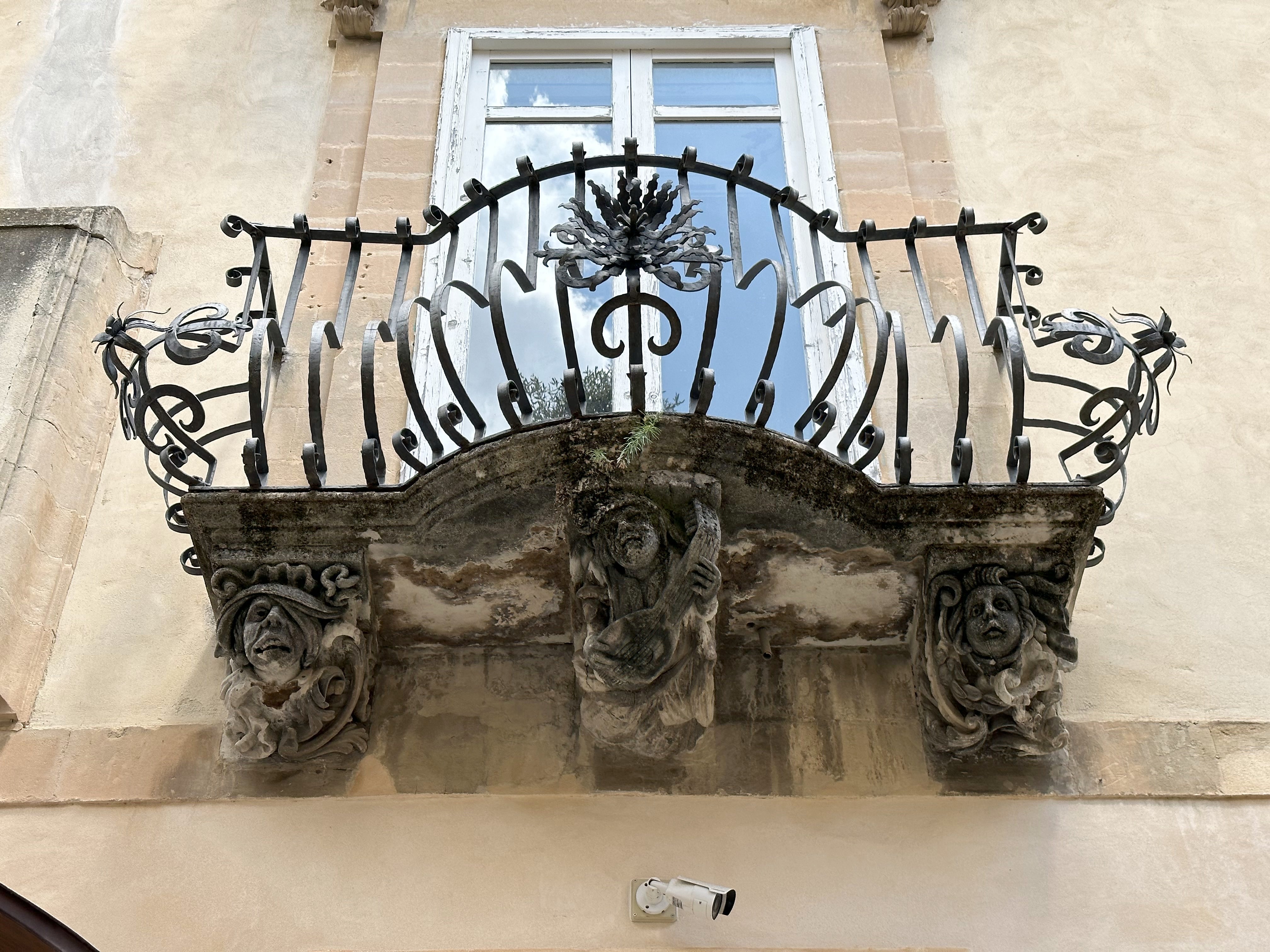
And more Baroque balcony ballustrades:
And a mishap spotted on the hilly, serpentine alleys of Ragusa:
Not happy:
Portale di San Giorgio — the Gothic portal of the ancient Church of San Giorgio, which was completely destroyed in the 1693 earthquake. The original church dedicated to St. George existed as far back as 1120. The 13th-century doorway depicts St. George slaying the dragon and is now a UNESCO-protected symbol of Ragusa’s resilience — a solitary medieval portal standing alone as the sole survivor of an entire church.
Chiesa di San Giacomo Apostolo – definitely not Baroque. The church dates to the 13th century, hence its more Romanesque appearance.
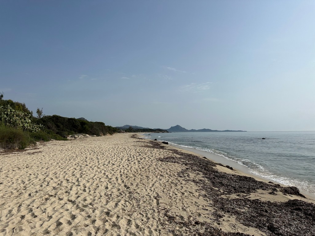
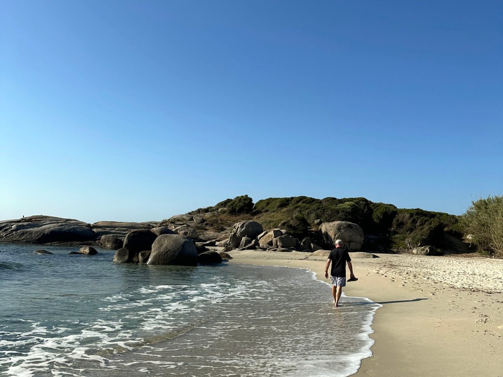
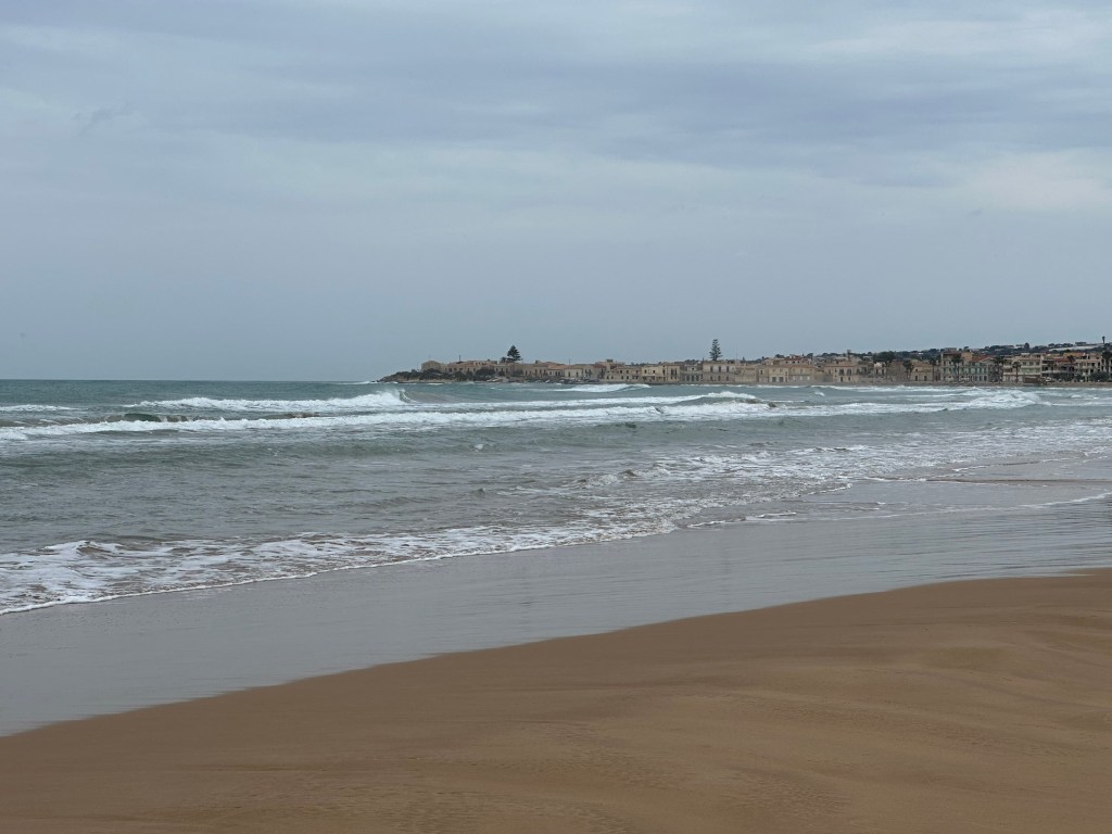
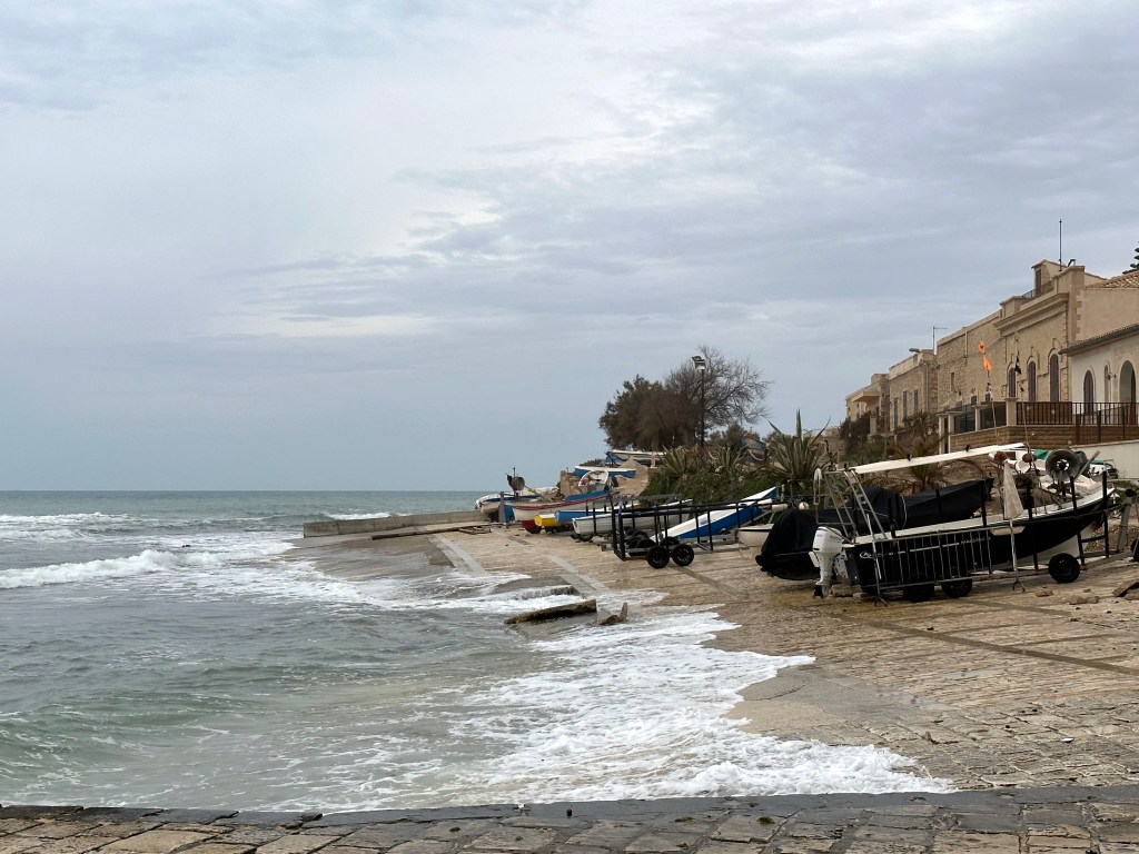
Unlike our 3-month New England and eastern Canada sojourn the next year, we couldn’t run every day here, but we could walk on the coast. So we headed a few mornings to beach towns just south of Modica. Which, frankly, provided some really nice hikes.
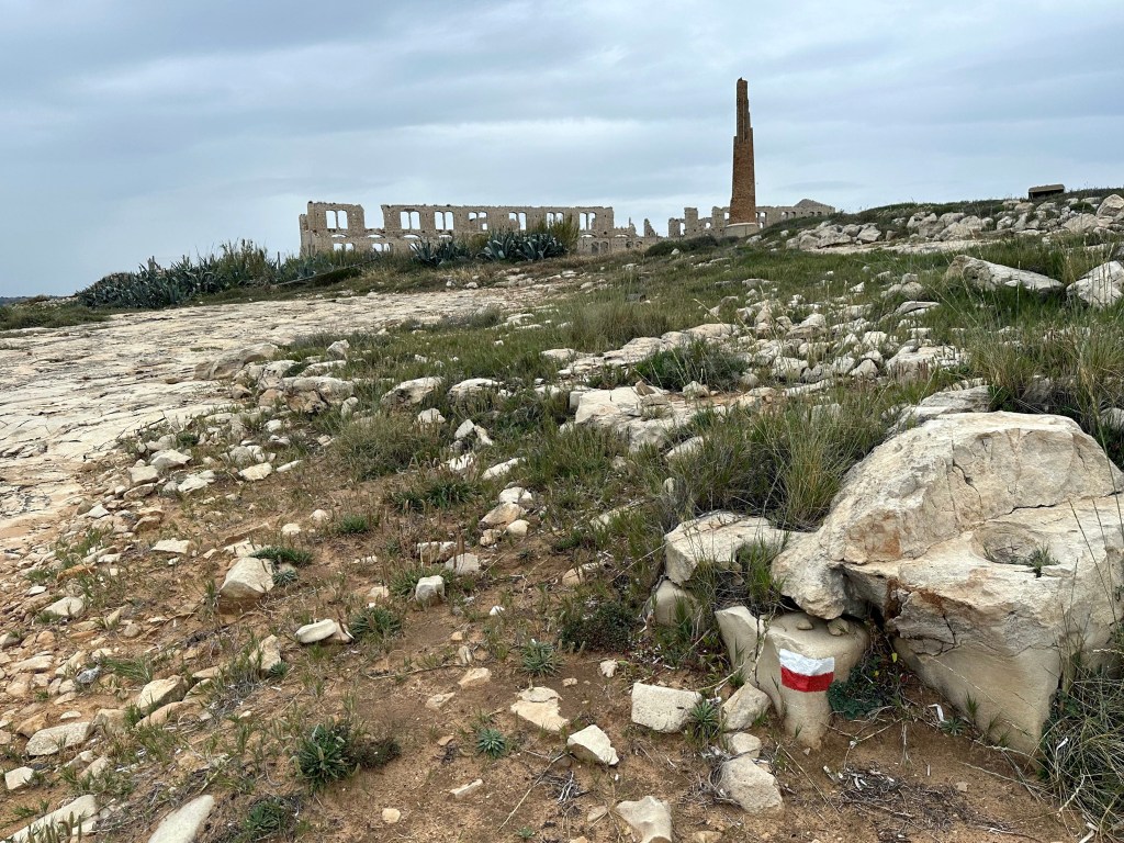
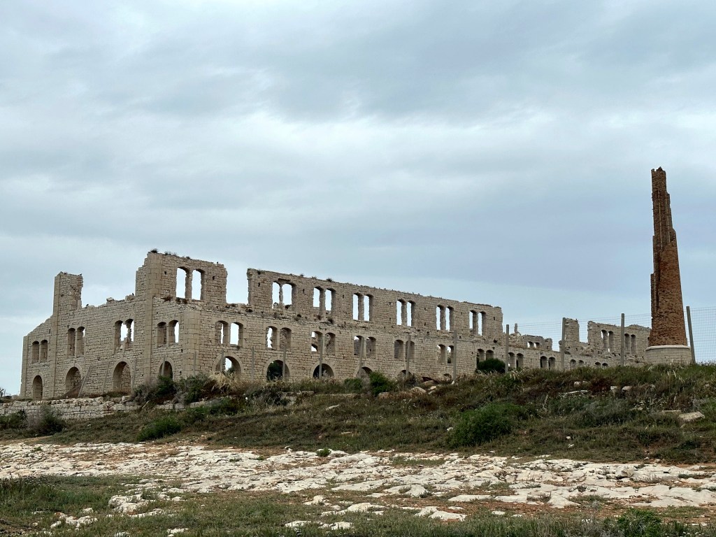
Our first hike took us past Fornace Penna, a hauntingly beautiful industrial ruin perched on a promontory just meters from the sea near the beach town of Sampieri. The kiln was built between 1909 and 1912 to produce bricks and construction materials.
After only 14 years of operation it was destroyed by arson in 1926, and the owner chose never to rebuild it — leaving behind one of Italy’s most photogenic industrial ruins.
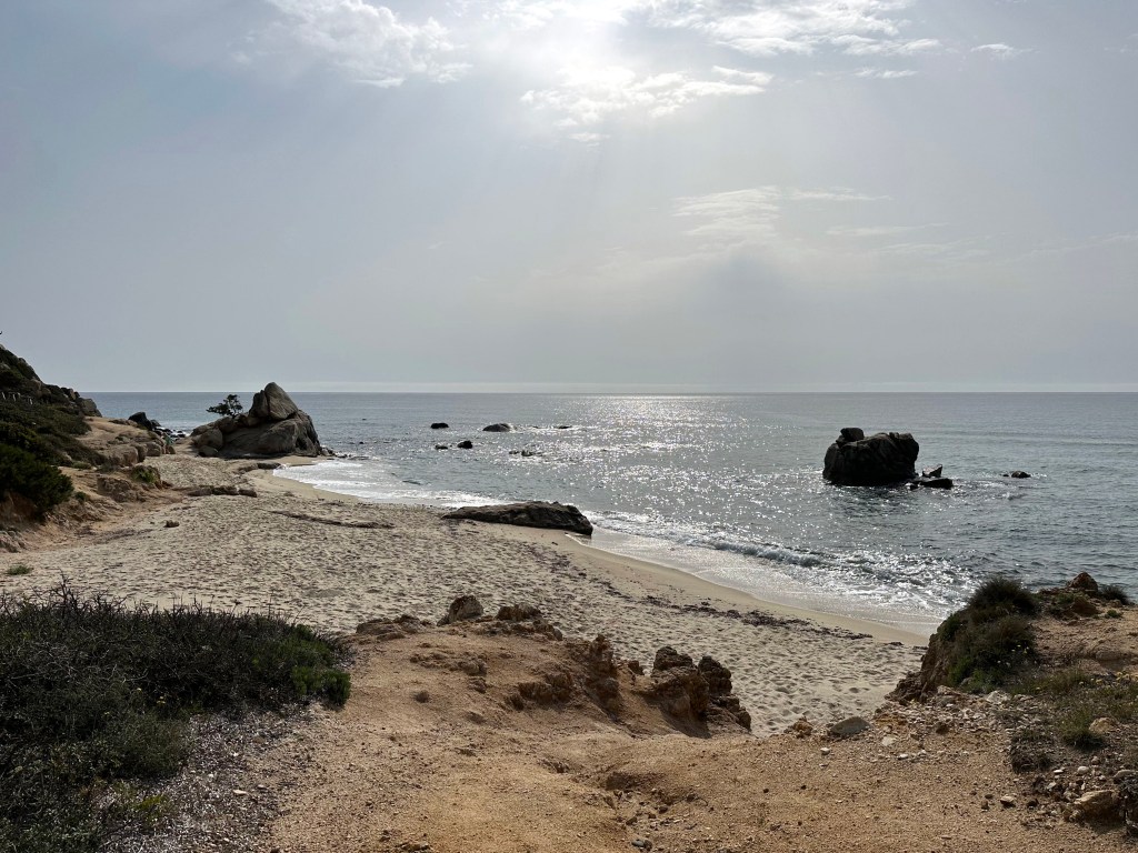
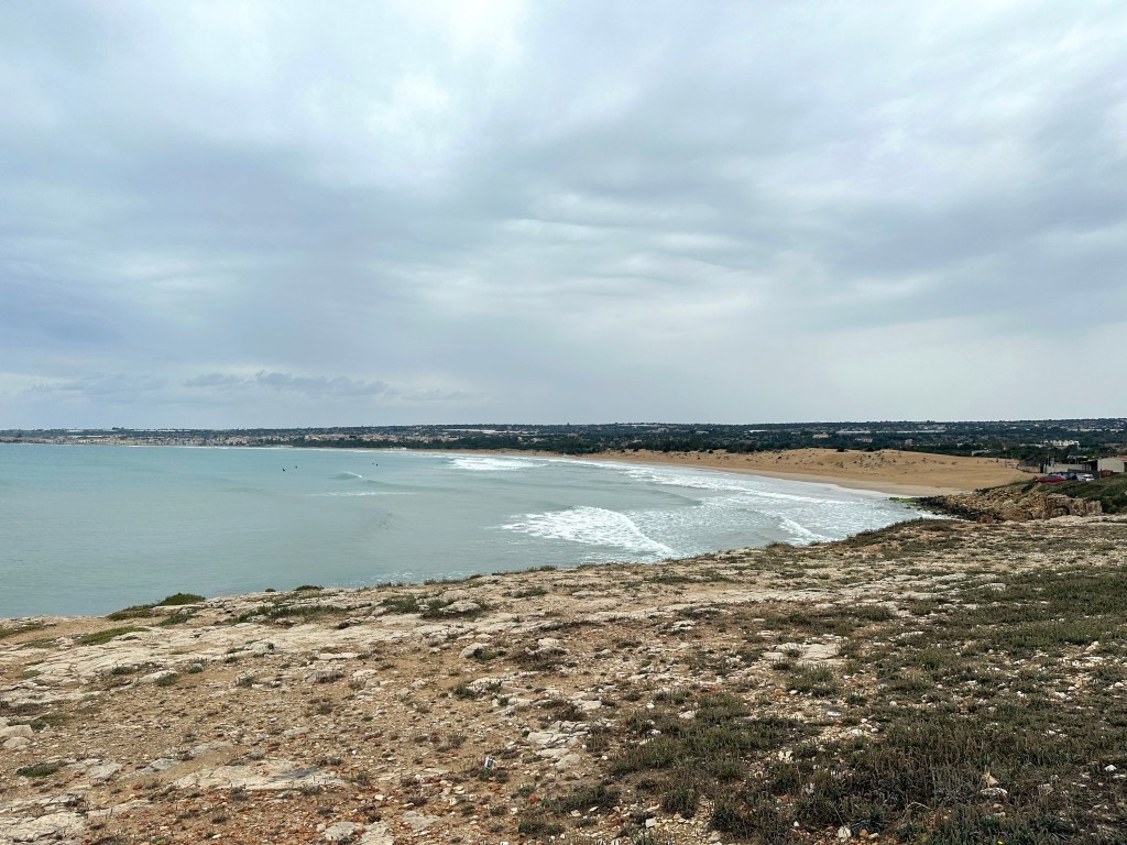
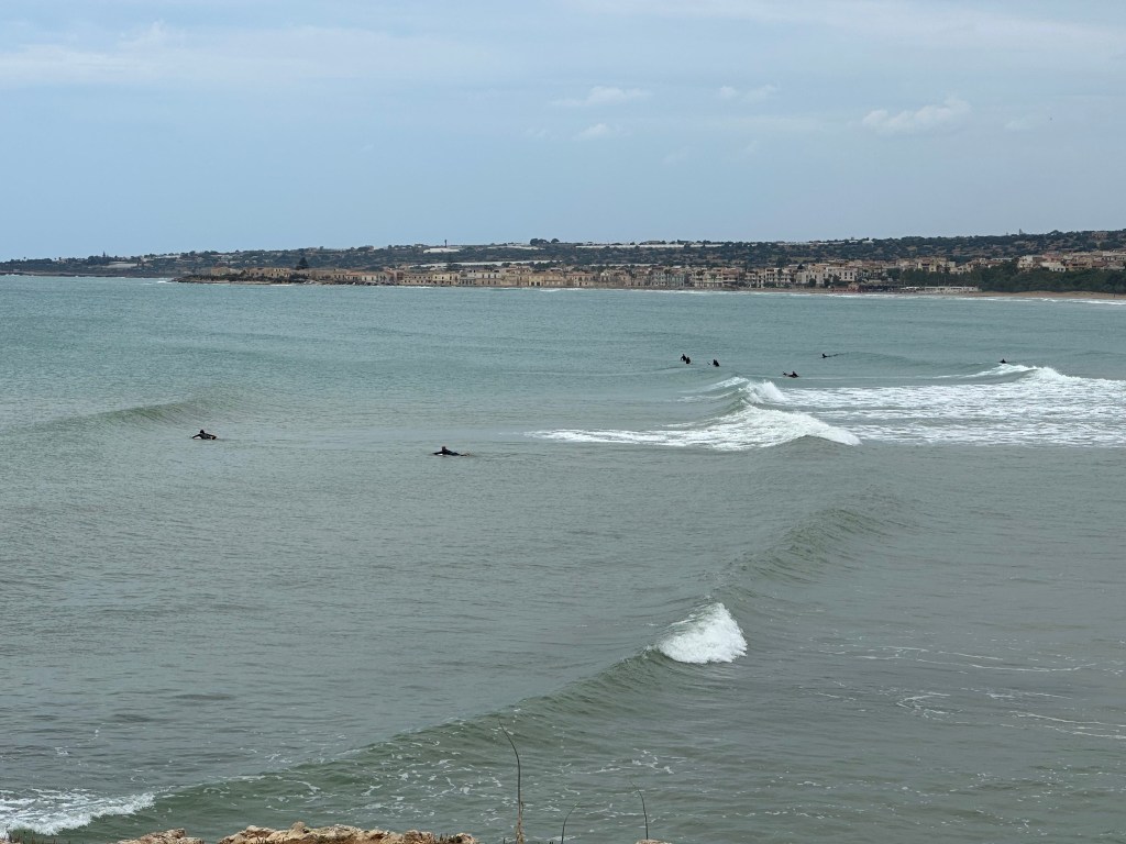
Little coastal view hiking into the beach town of Sampieri:
Not great.
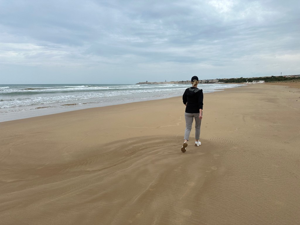
Bodi’s out there performing for Point Break, we think.
Scicli
Our penultimate Baroque town to visit lay between Modica and the beach: Scicli.
Scicli is a UNESCO-listed Baroque town tucked dramatically into the junction of three valleys in southeastern Sicily, rebuilt in golden stone after the catastrophic 1693 earthquake and flanked by a rocky hill crowned by the abandoned Church of San Matteo.
Smaller and less visited than its neighbors Ragusa, Modica, and Noto, Scicli still offered charm and – unlike Modica – a pedestrian core.
But just like Modica alta, Scicli had plenty of steps.
Leading to a pretty decent view.
Chiesa del Rosario perched on the cliff above town.
Chiesa di San Giovanni Evangelista from the top of the post, exemplifying the Baroque style:
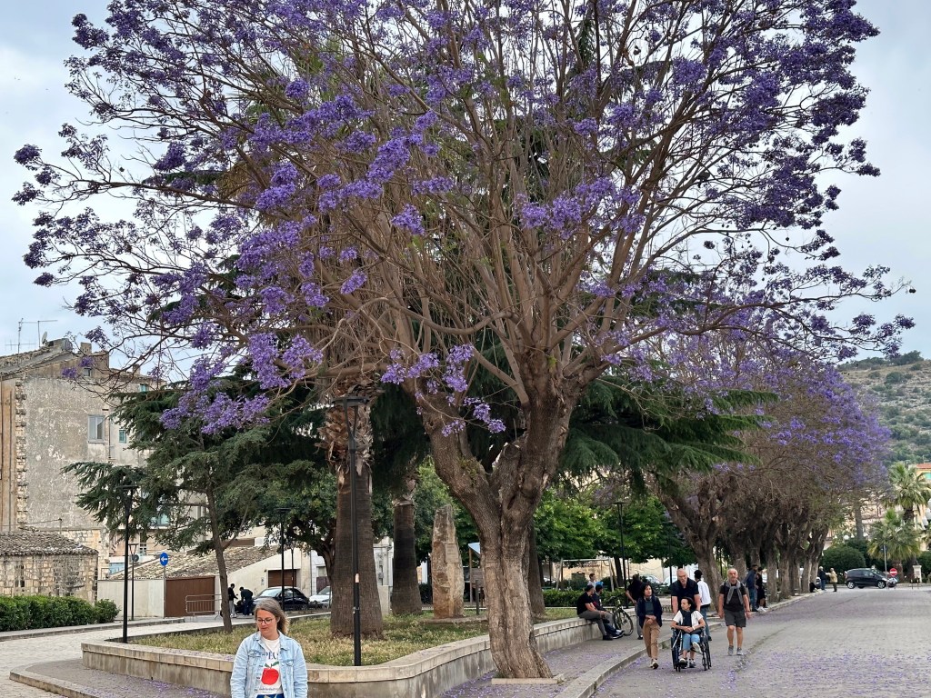
Jacaranda trees in Scicli, similar to those seen in another hilly town, Olvera, on our Catalonian bike trip.
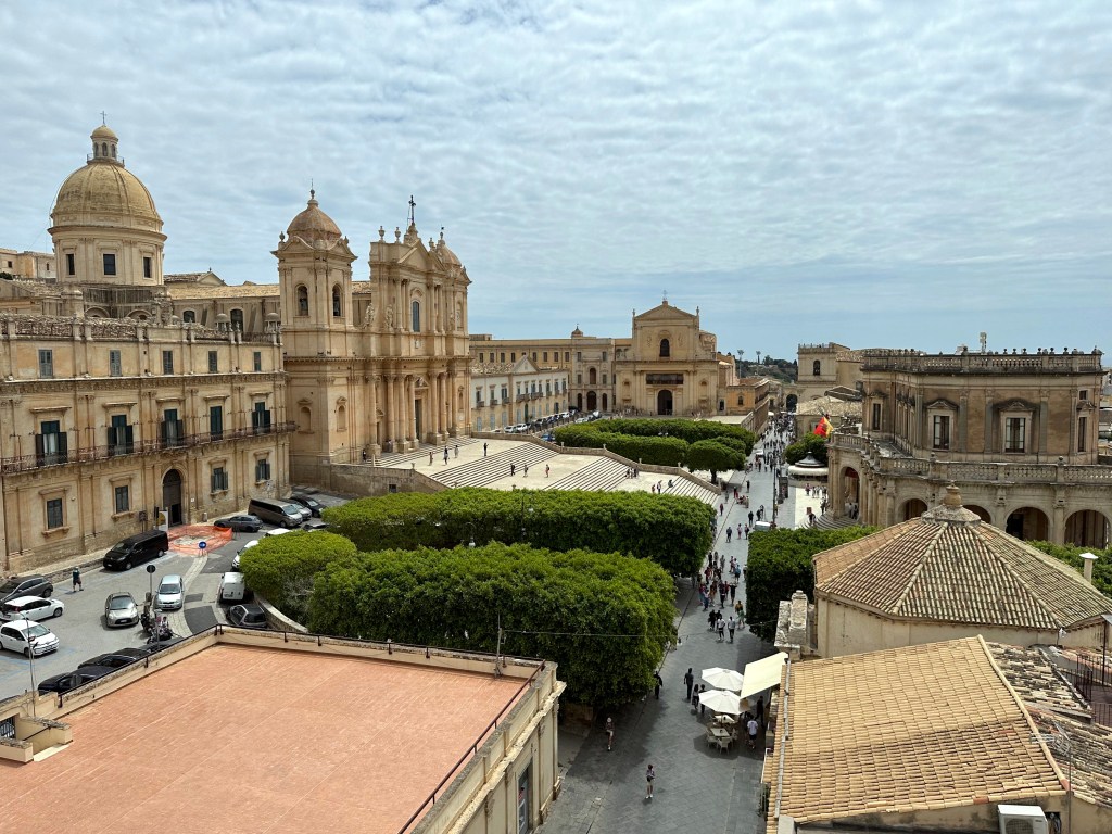
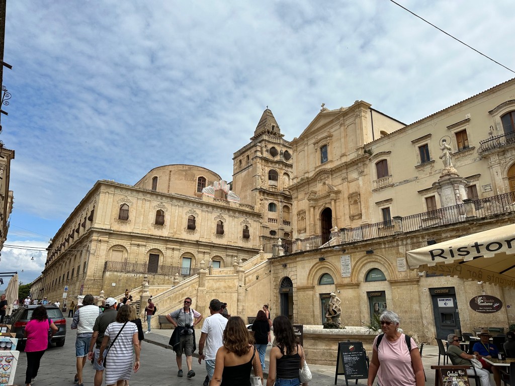
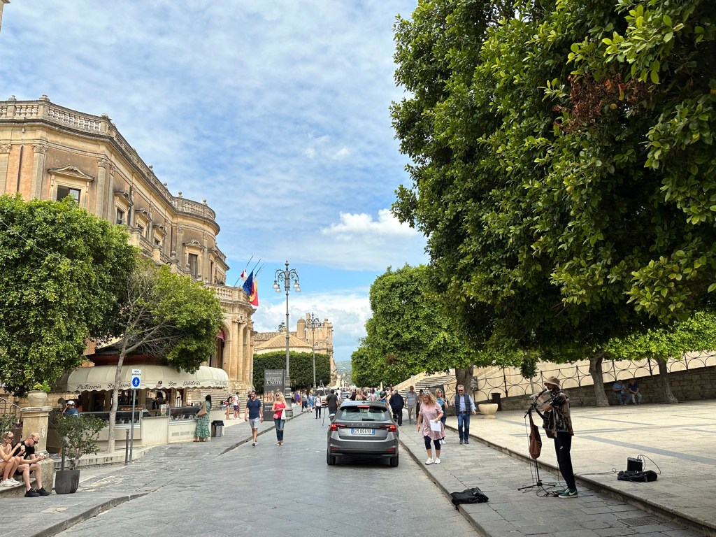
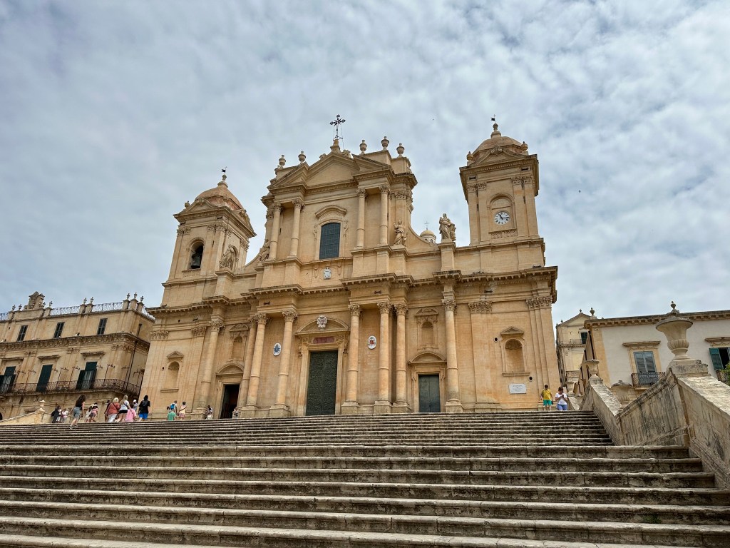
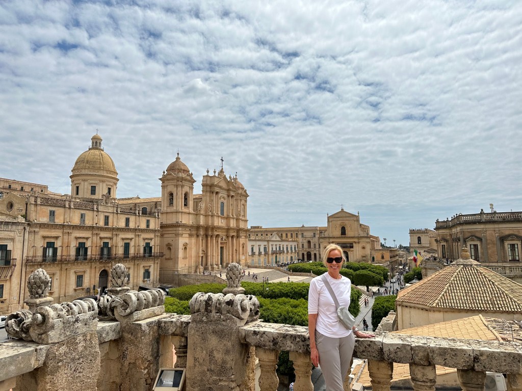
Noto
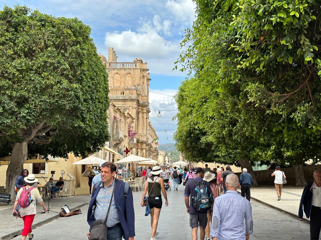
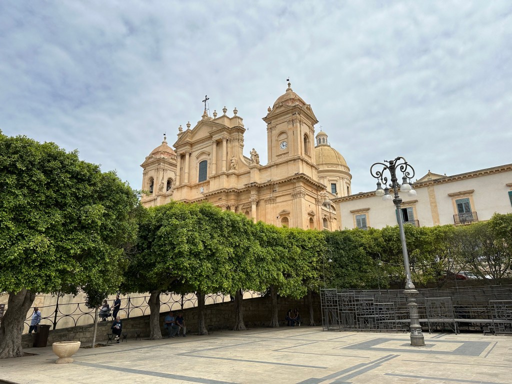
And finally, a stopover in Noto, on the drive from Modica to Siracusa.
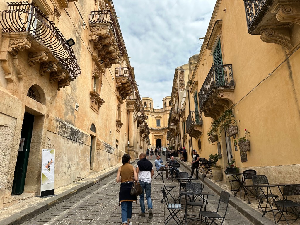
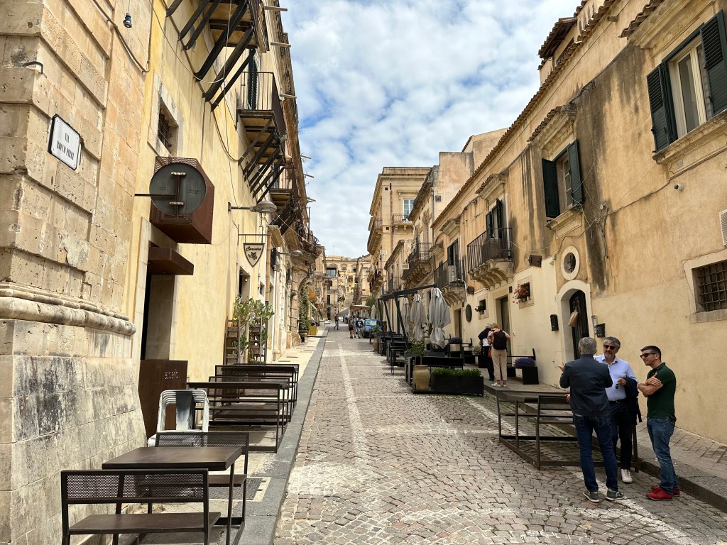
Noto is known as “the Capital of Baroque,” so our visits to its brethren apparently were just the warm up to the real deal. The main street, Corso Vittorio Emanuele, is, indeed lined with ornate churches and palaces that make the whole town feel like an open-air museum.
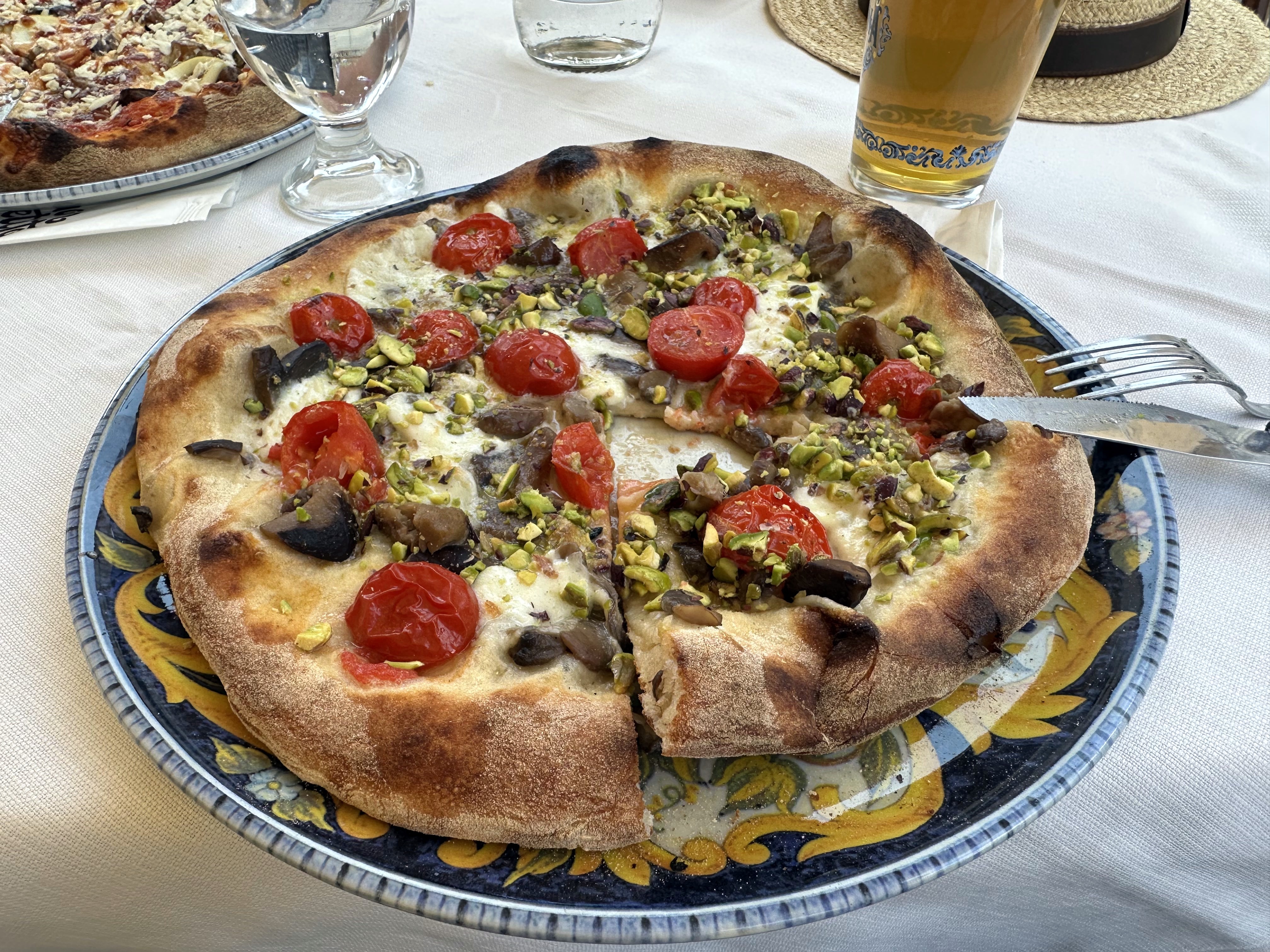
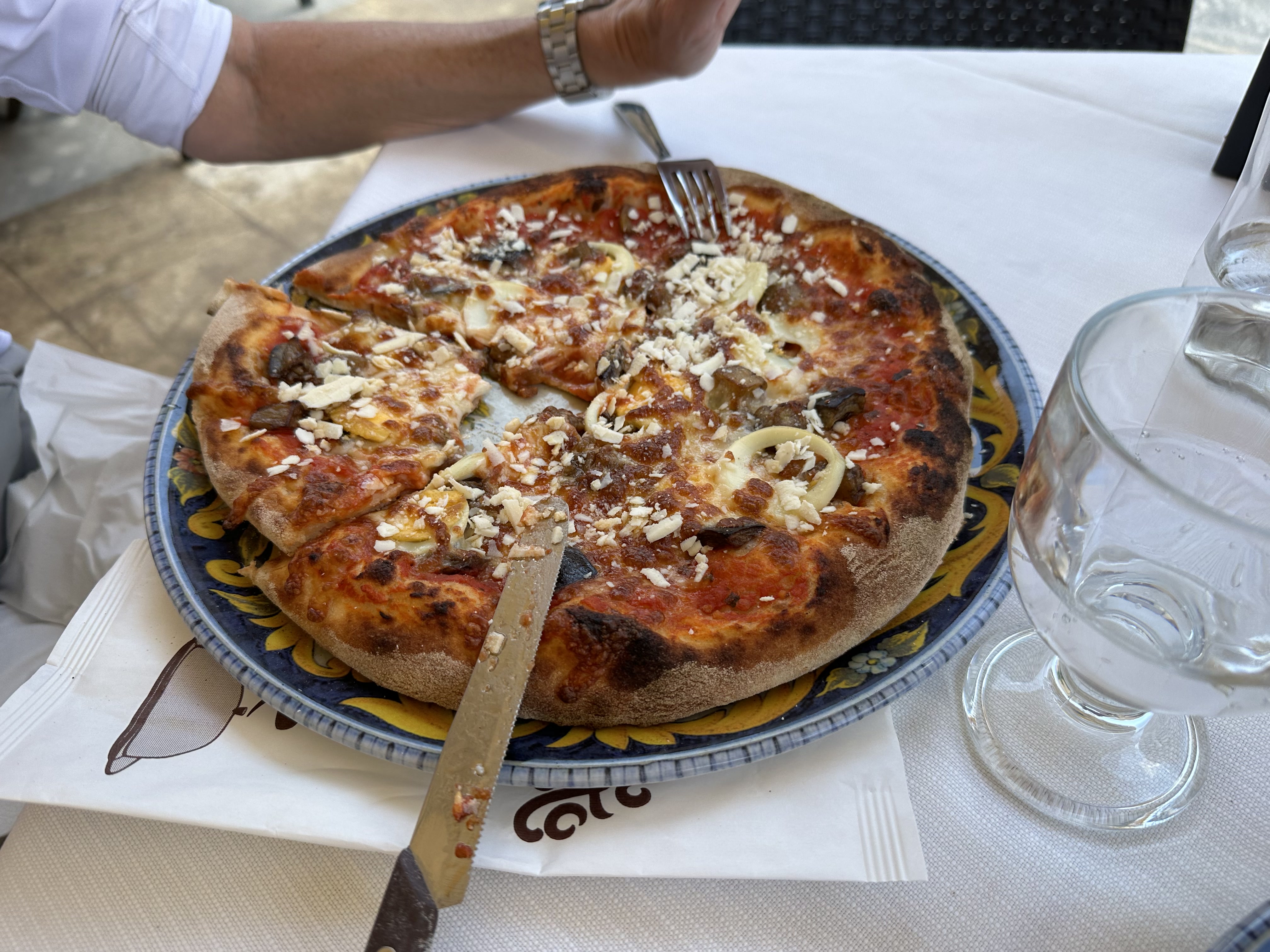
Little lunch in Noto, featuring both Neapolitan crusts and Sicilian pistachios.
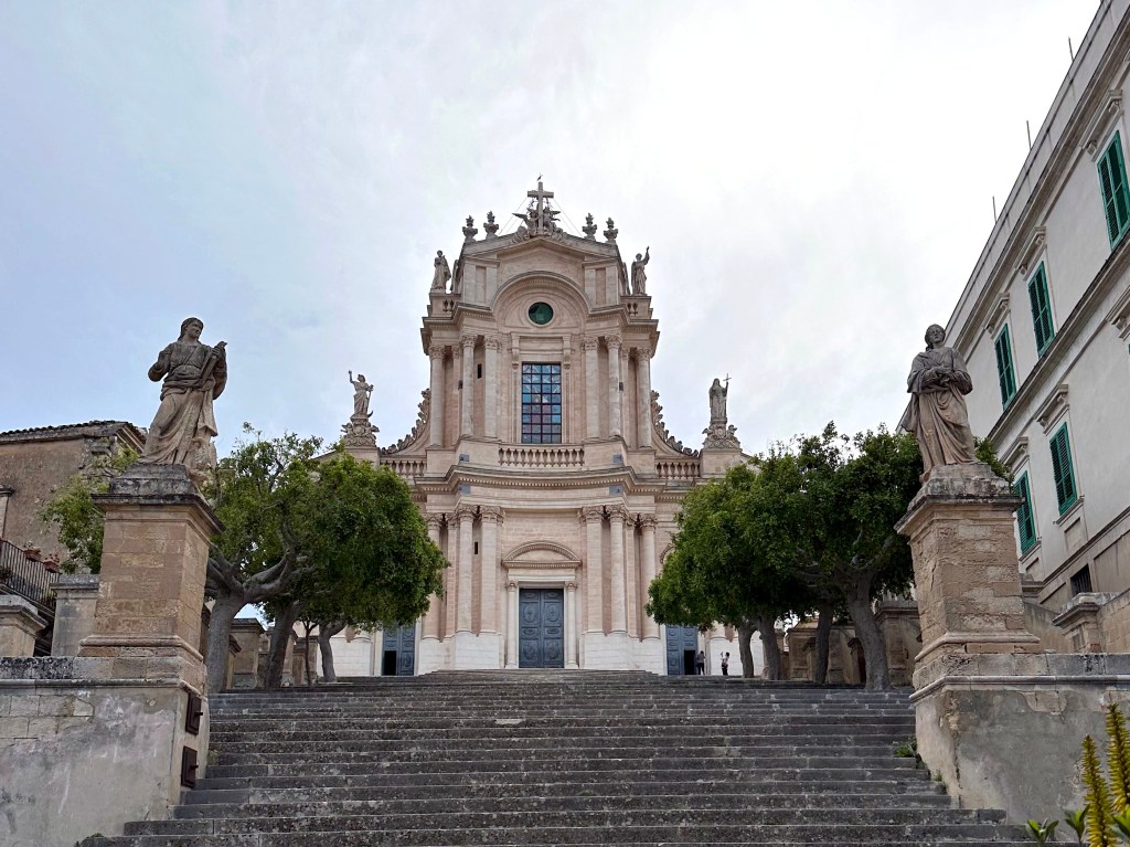
Noto’s cathedral:
And more Baroque balcony buddies:
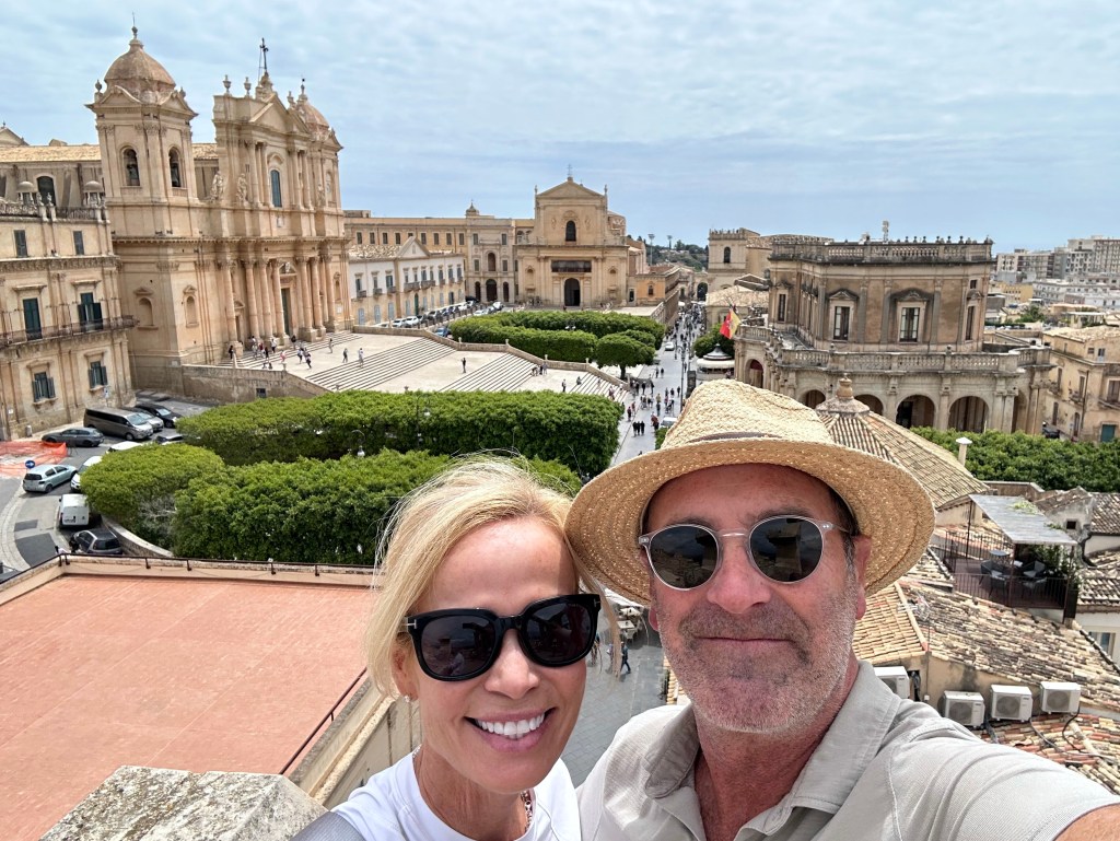
Pretty great view over town from the roof of the Church of St. Charles Borromeo:
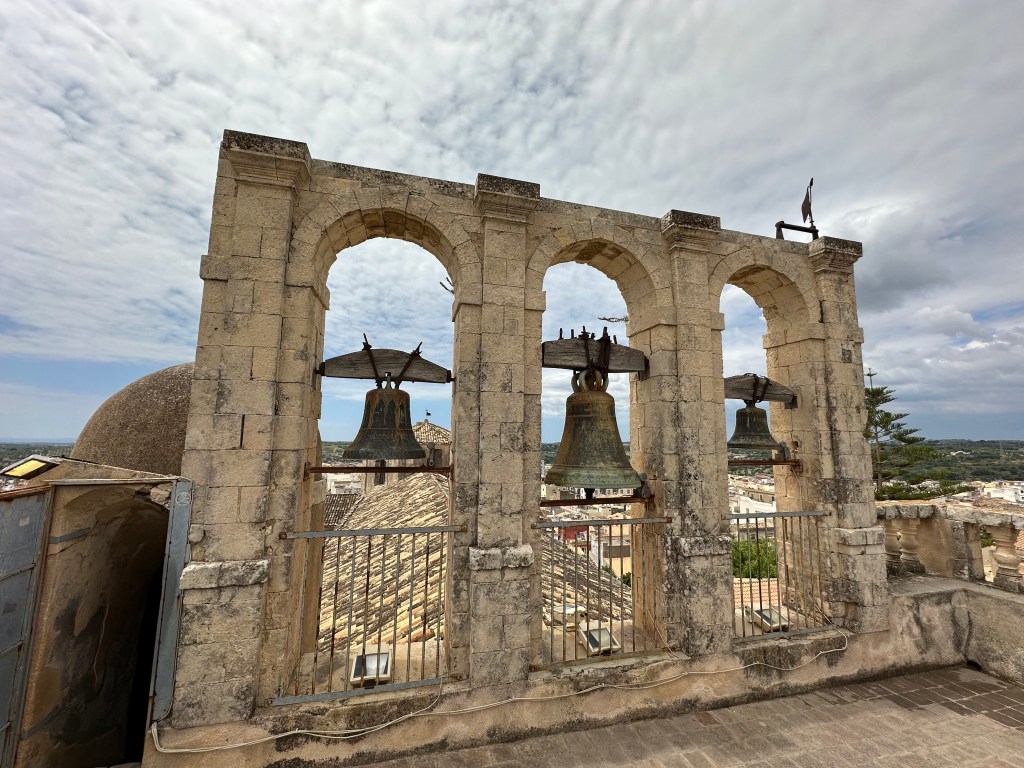
St. Mary’s bells in Old Town are better. . .
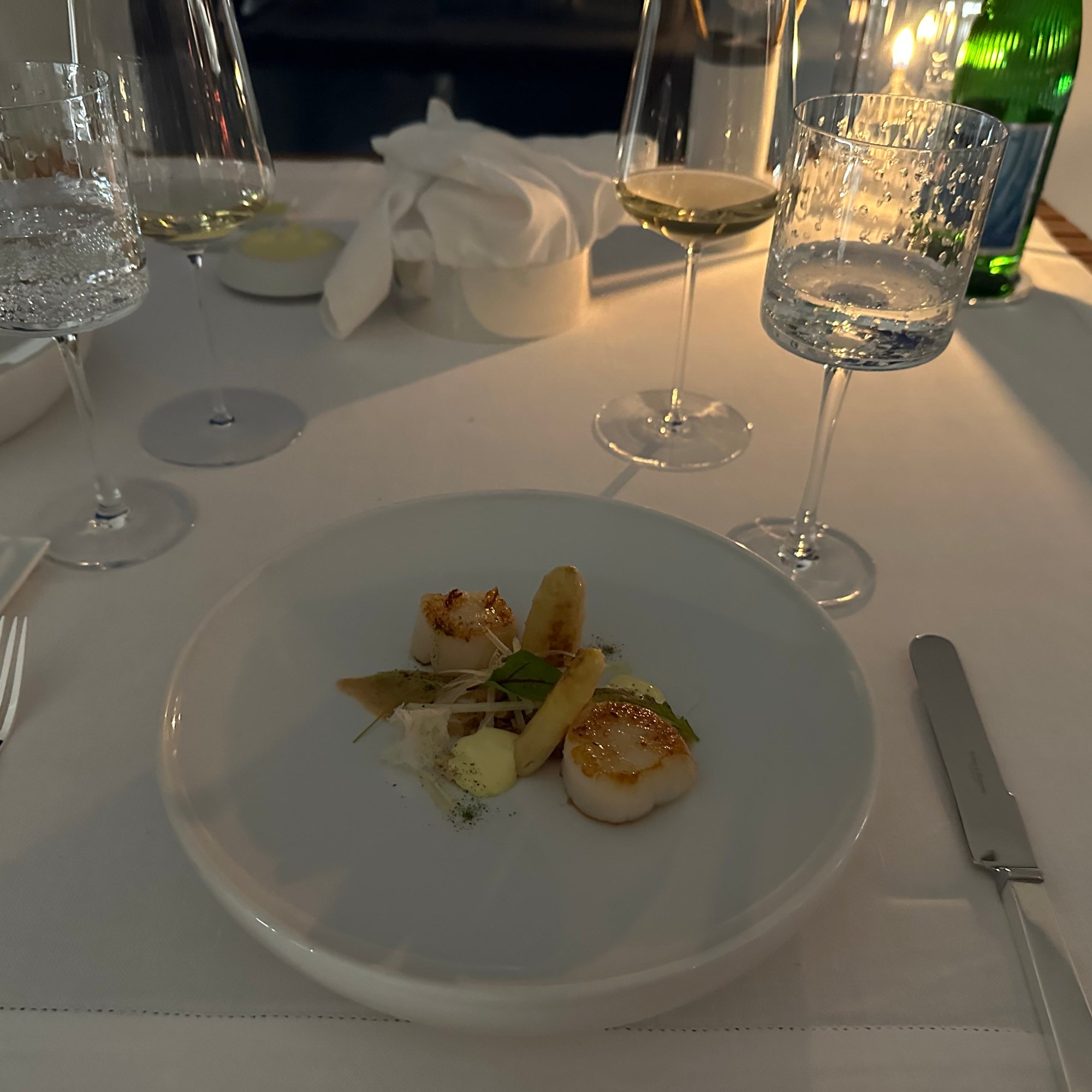
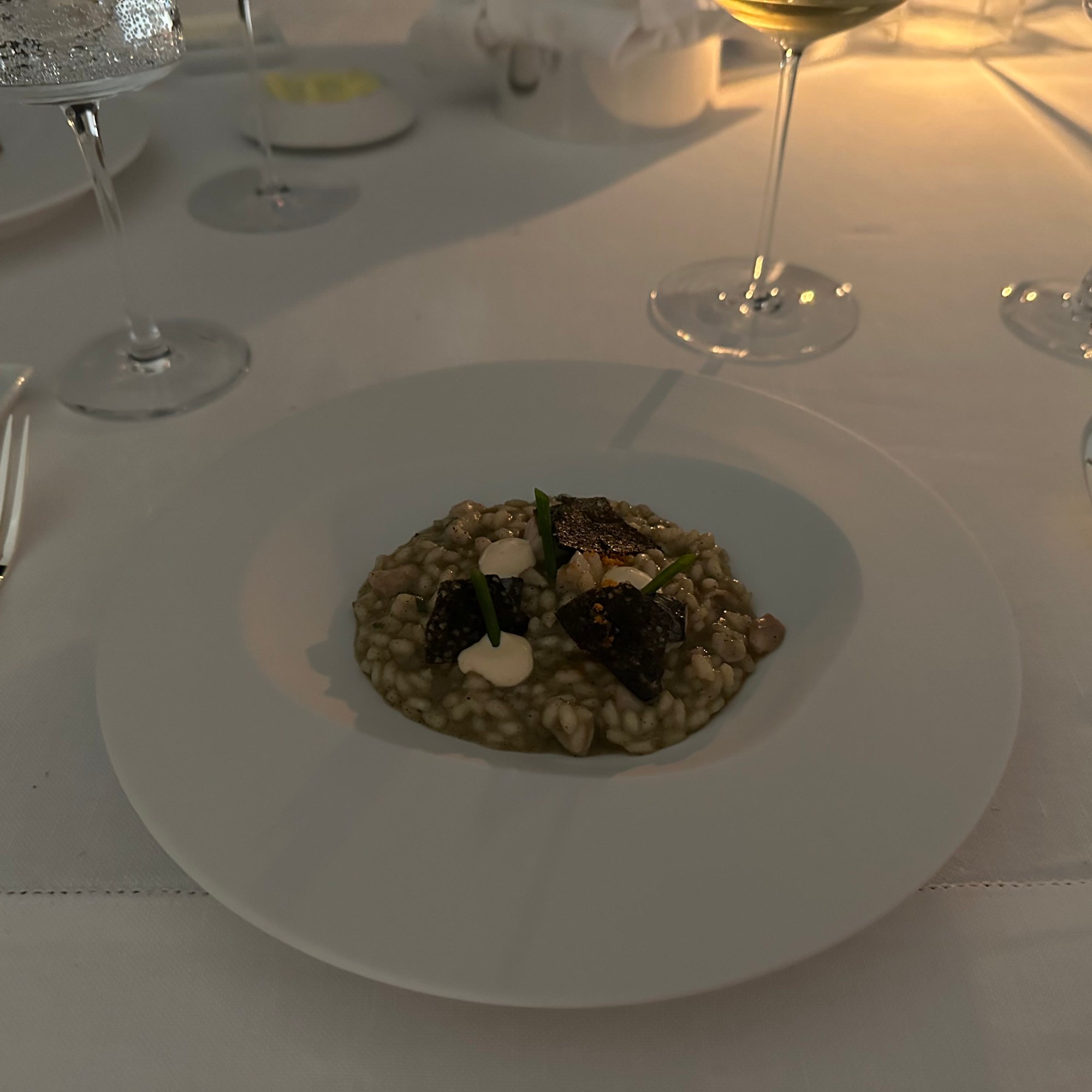
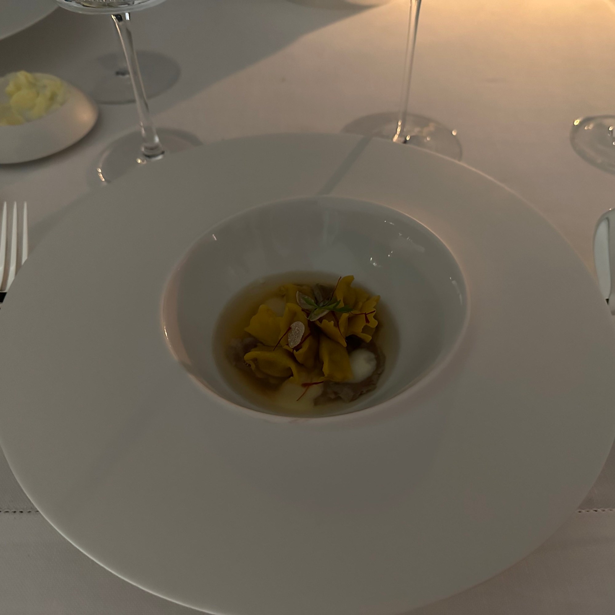
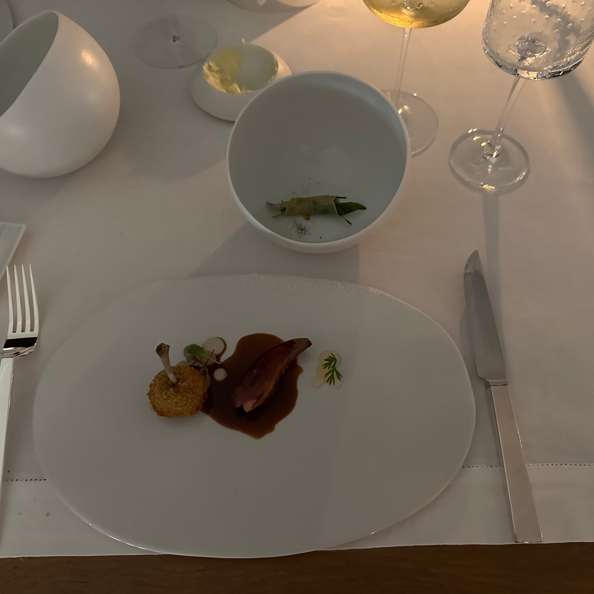
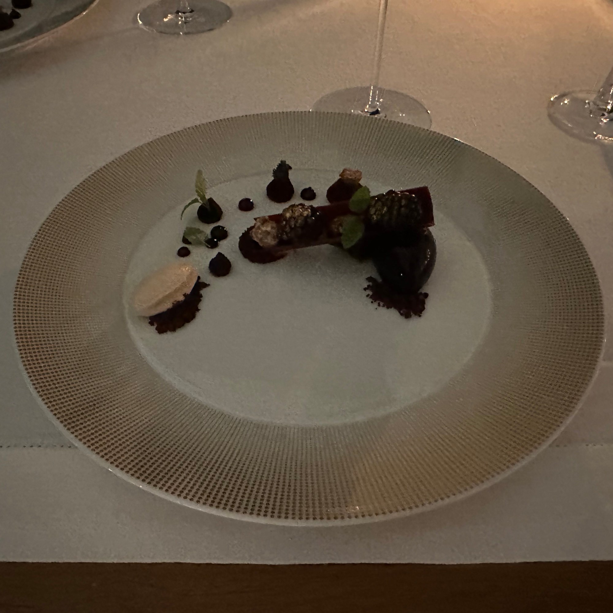
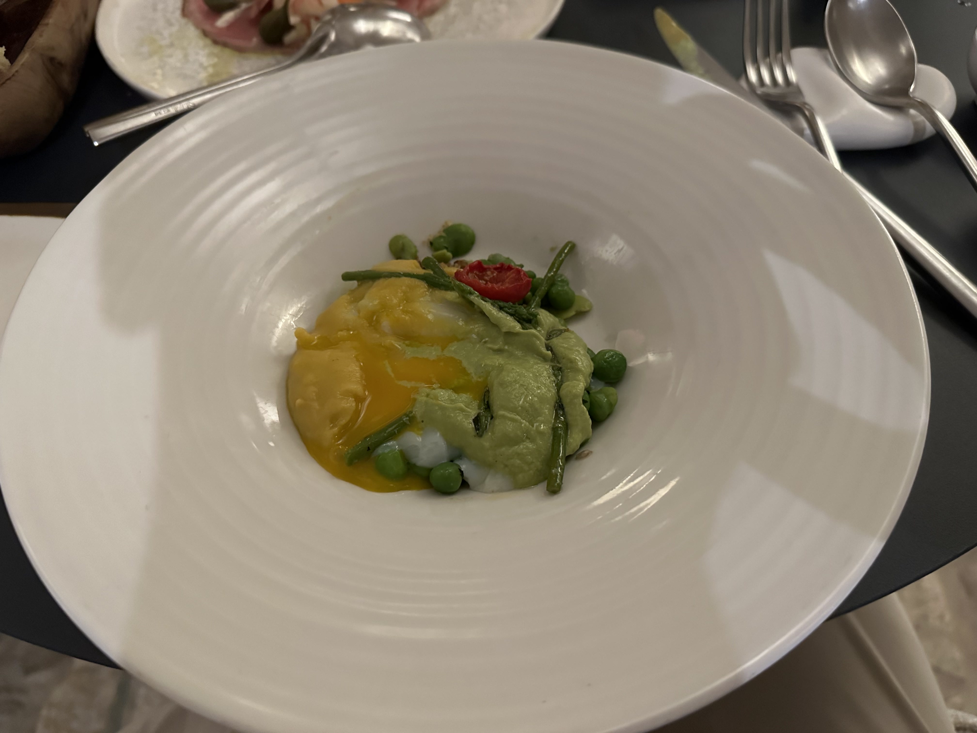
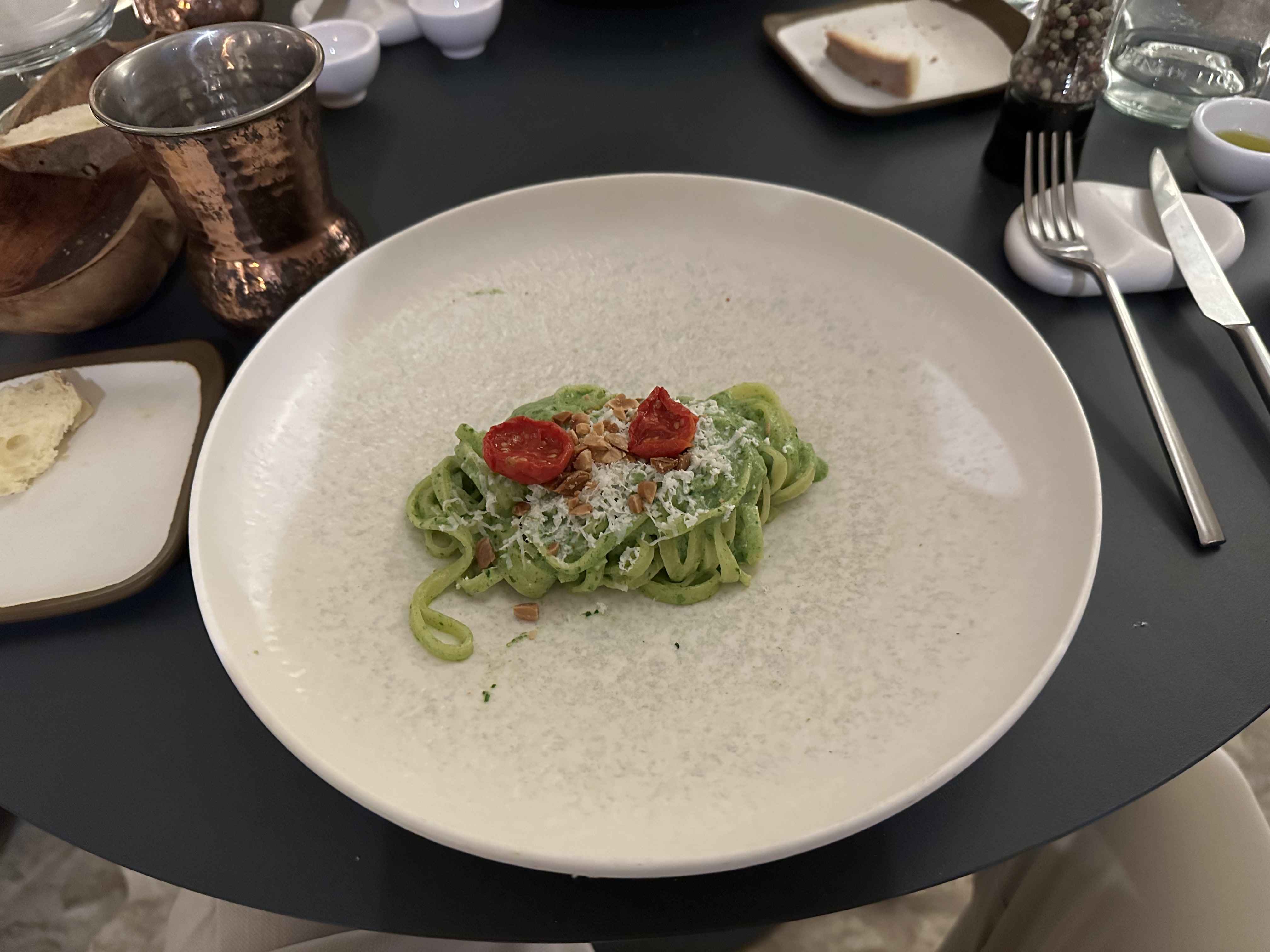
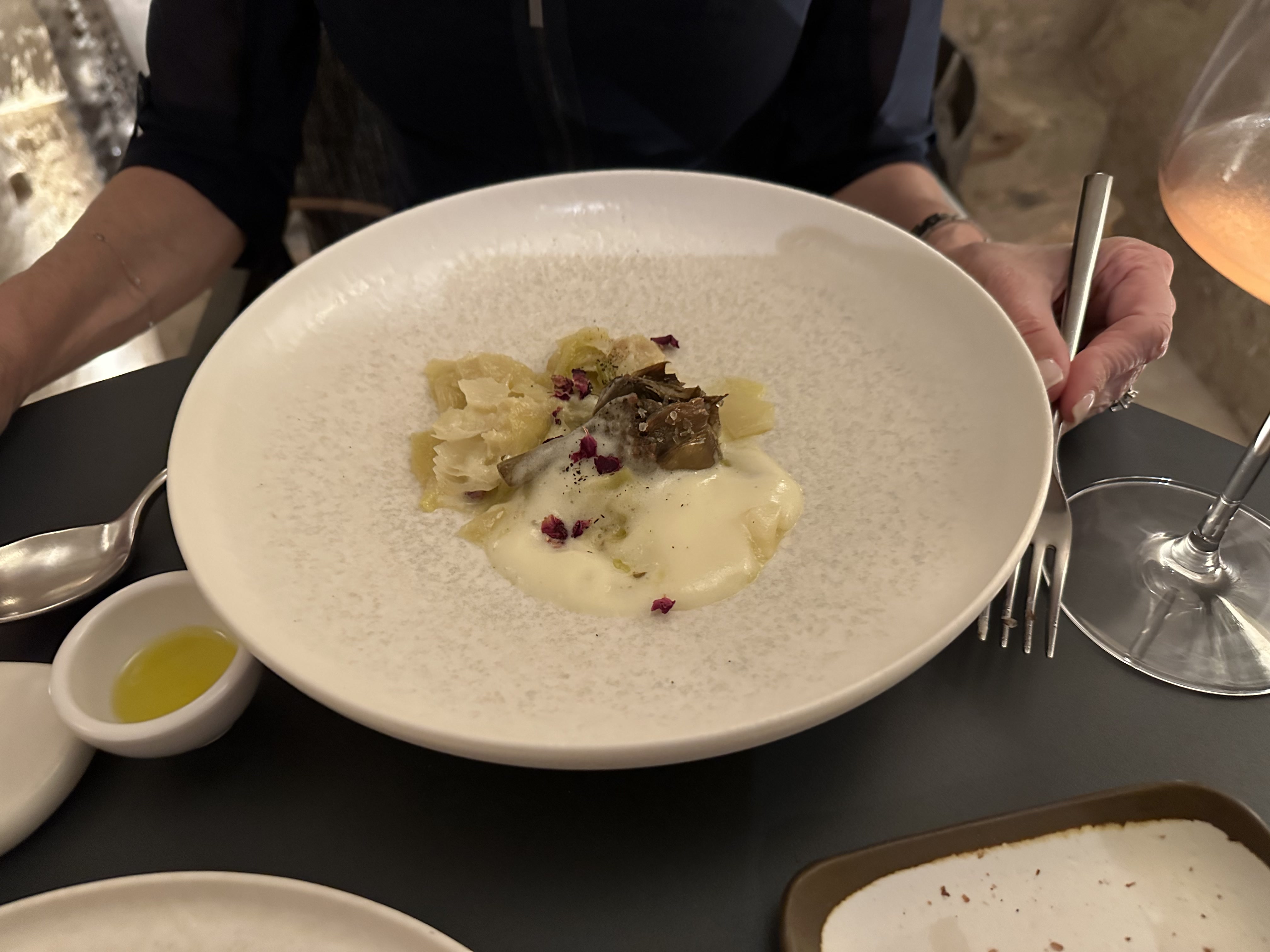
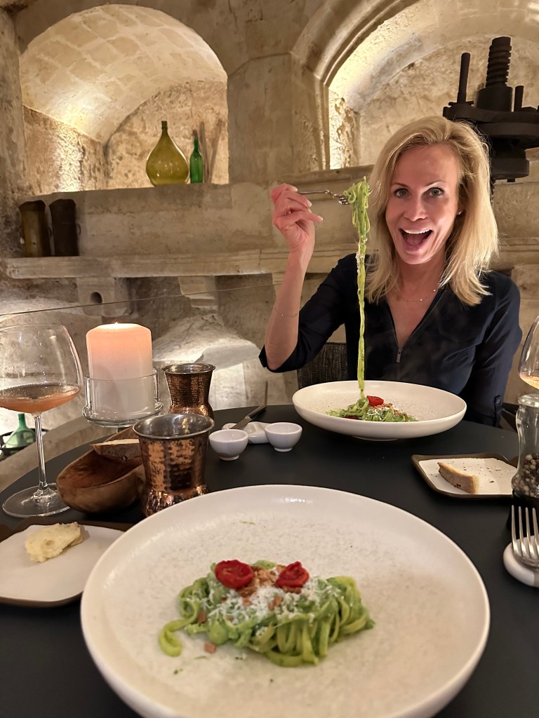
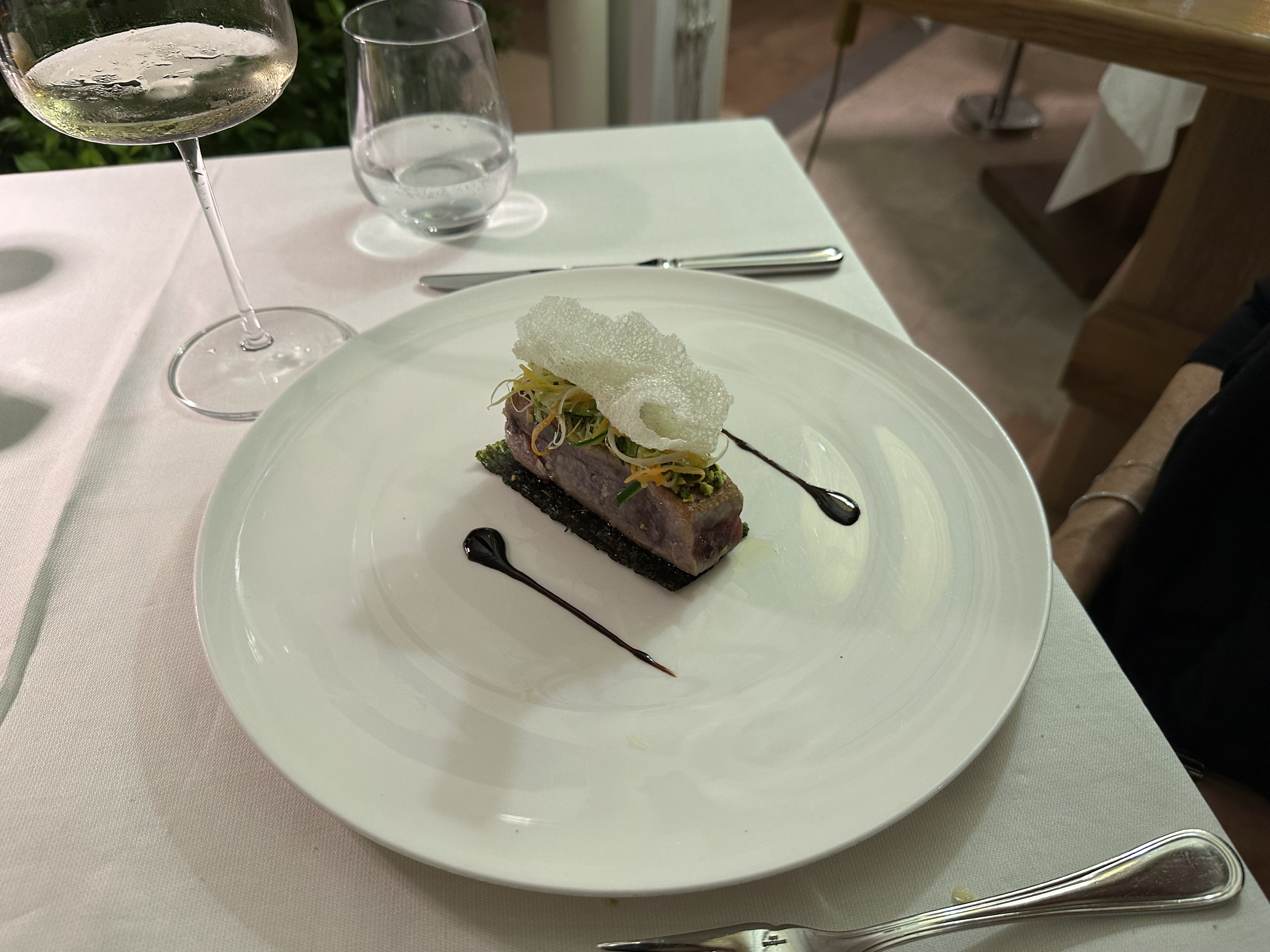
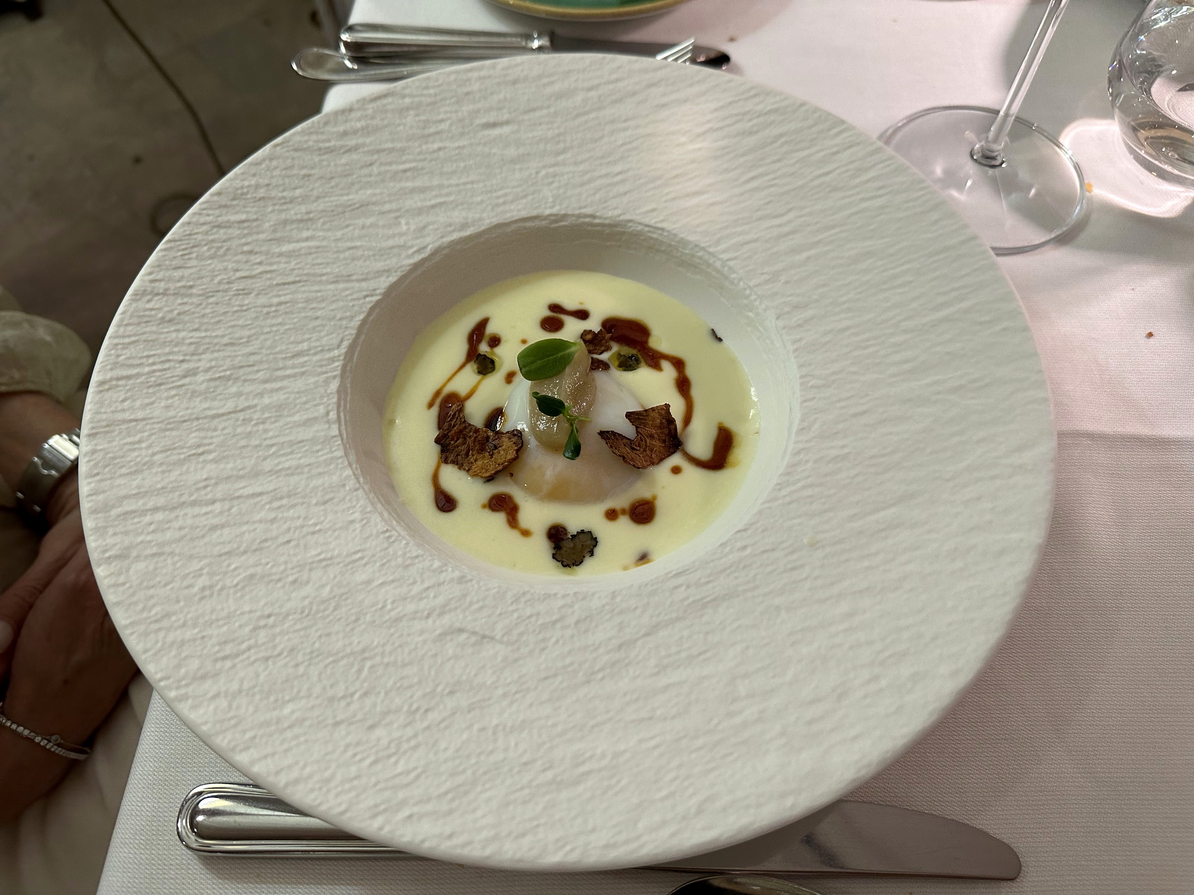
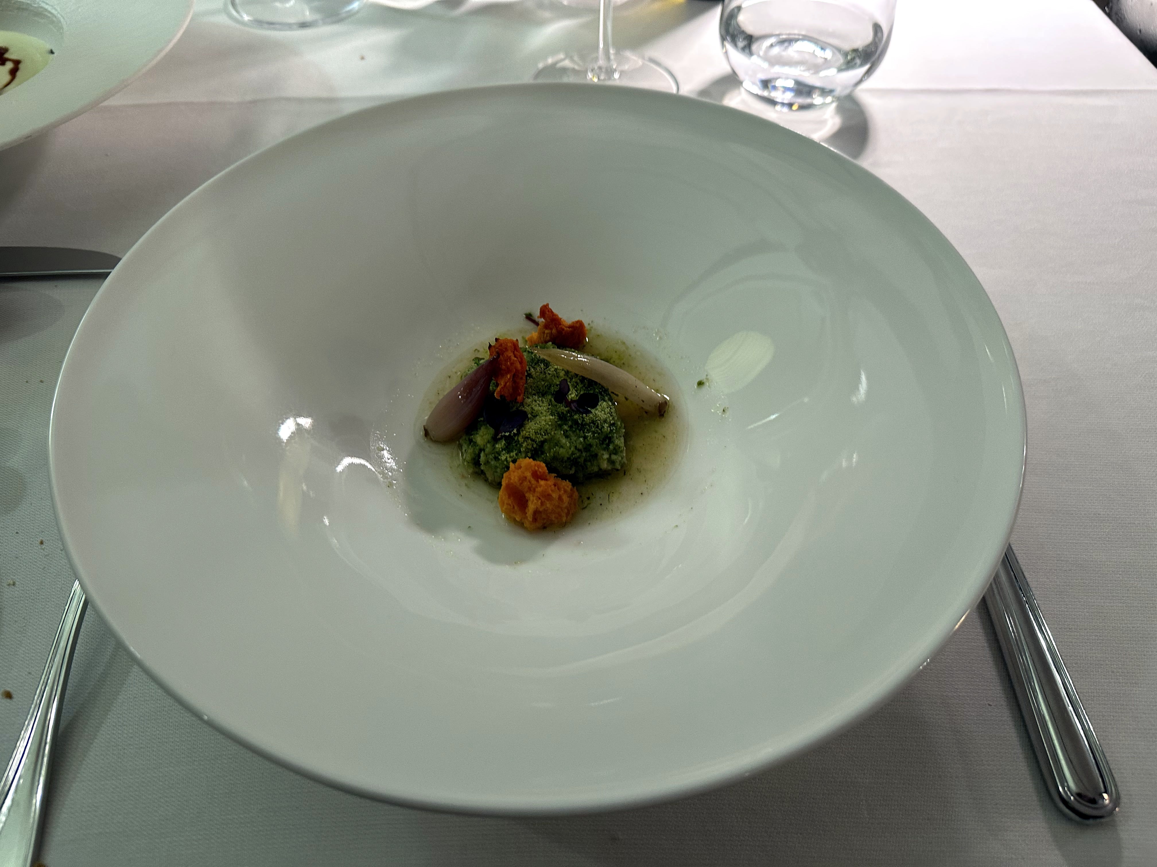
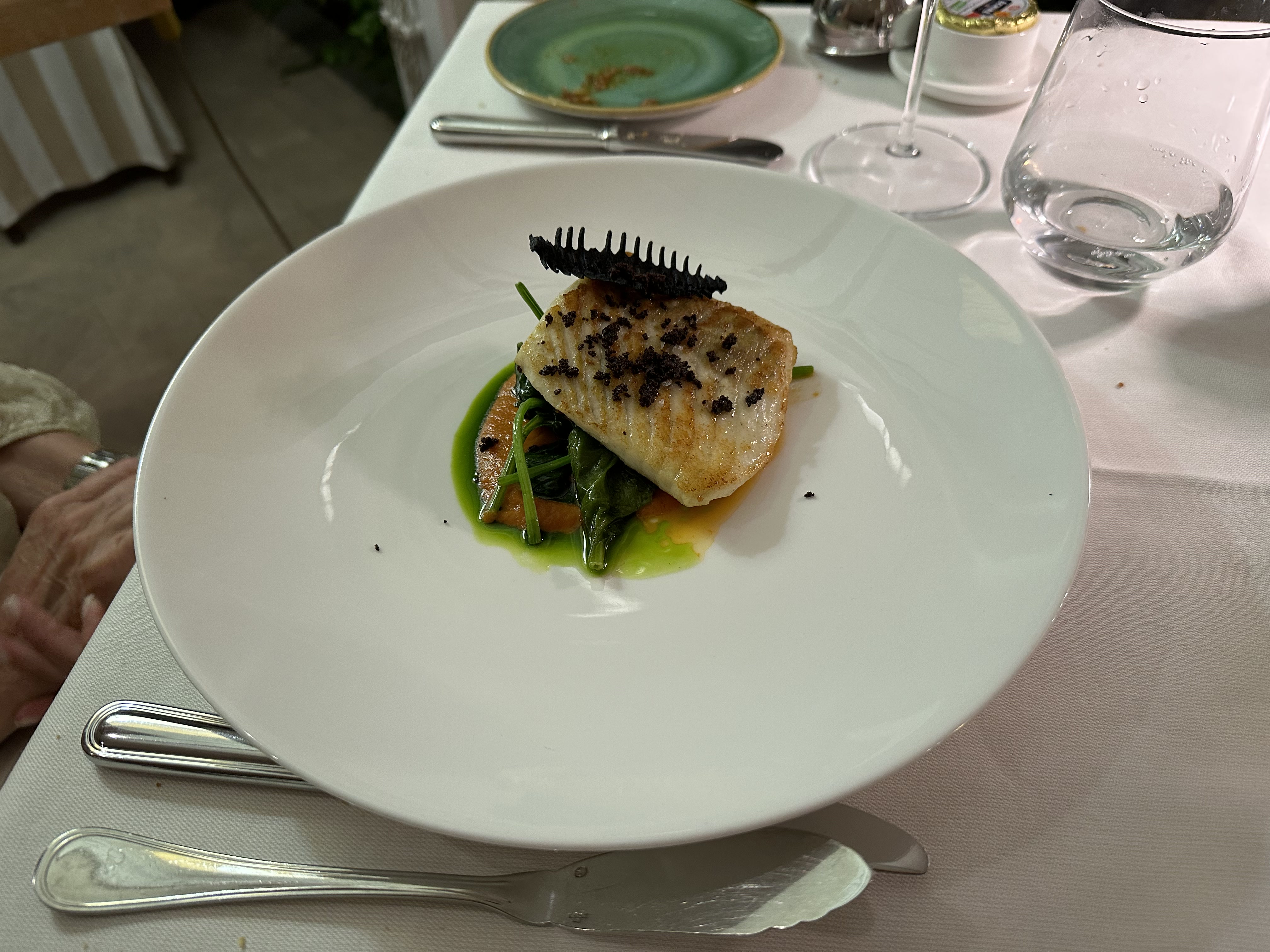
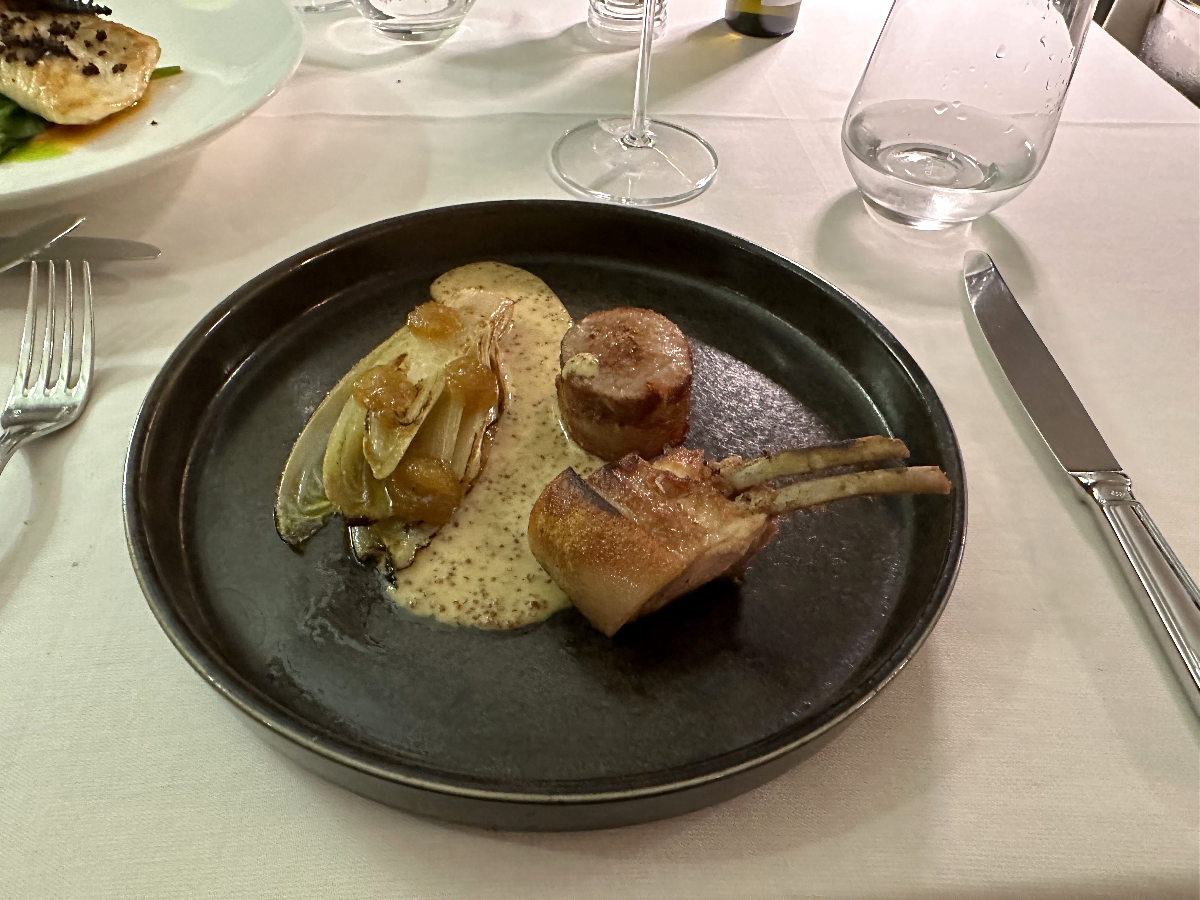
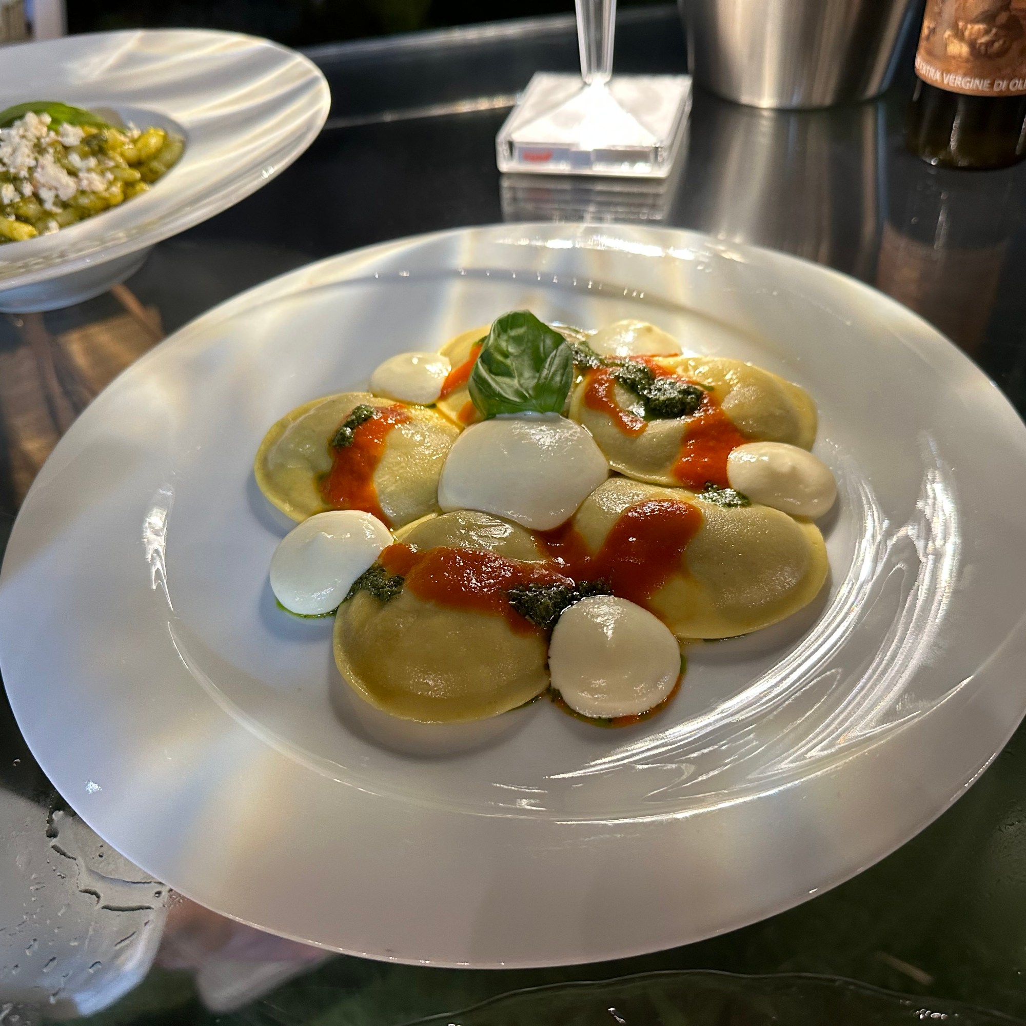
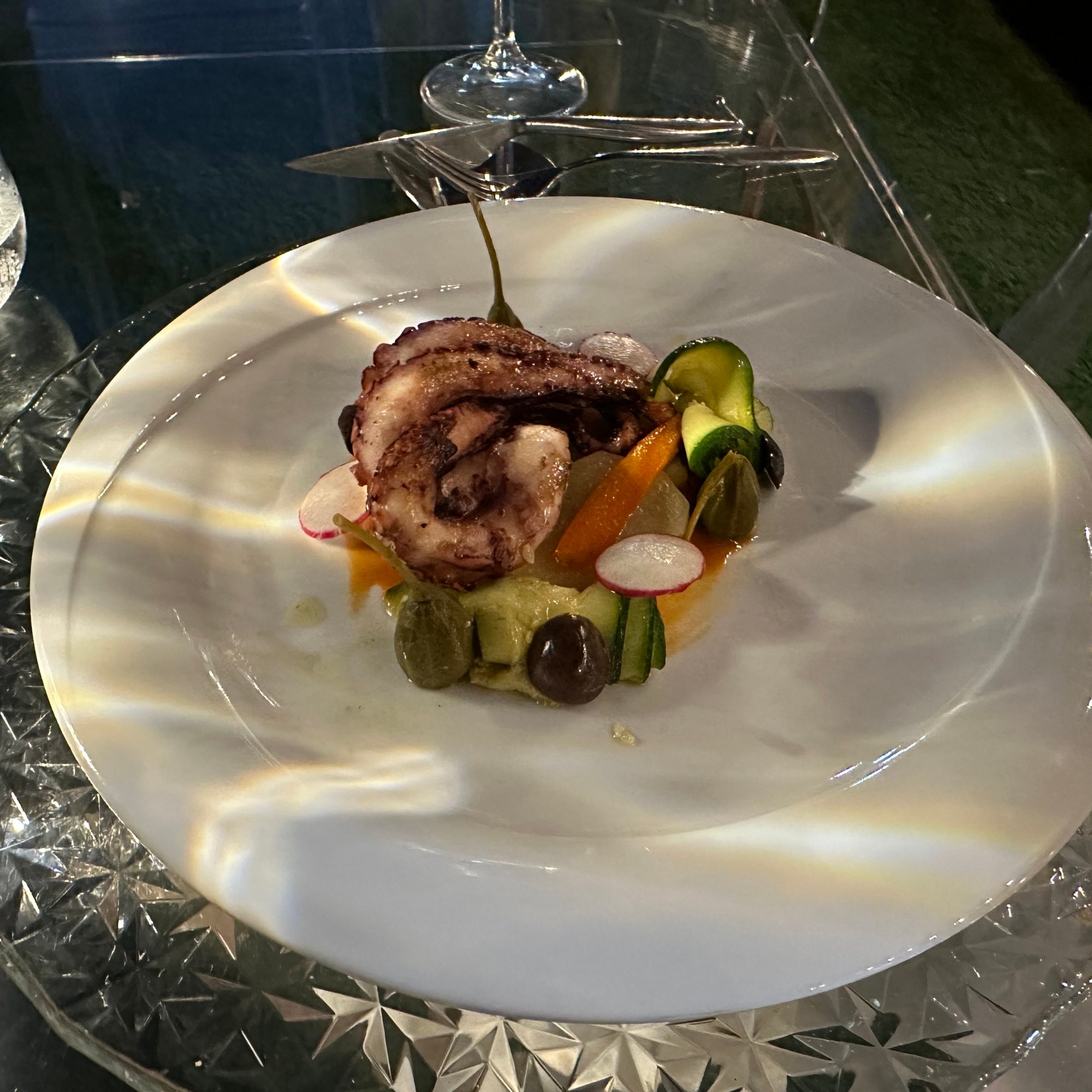
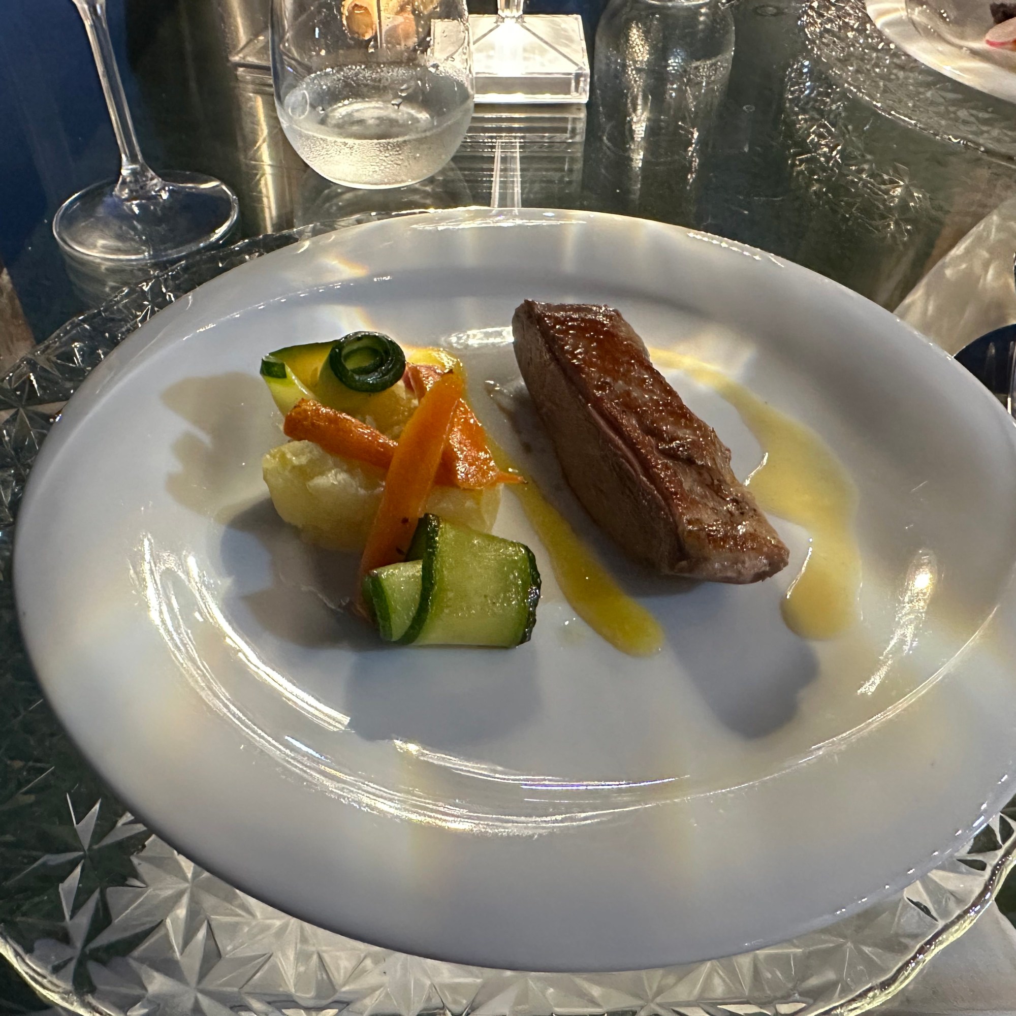
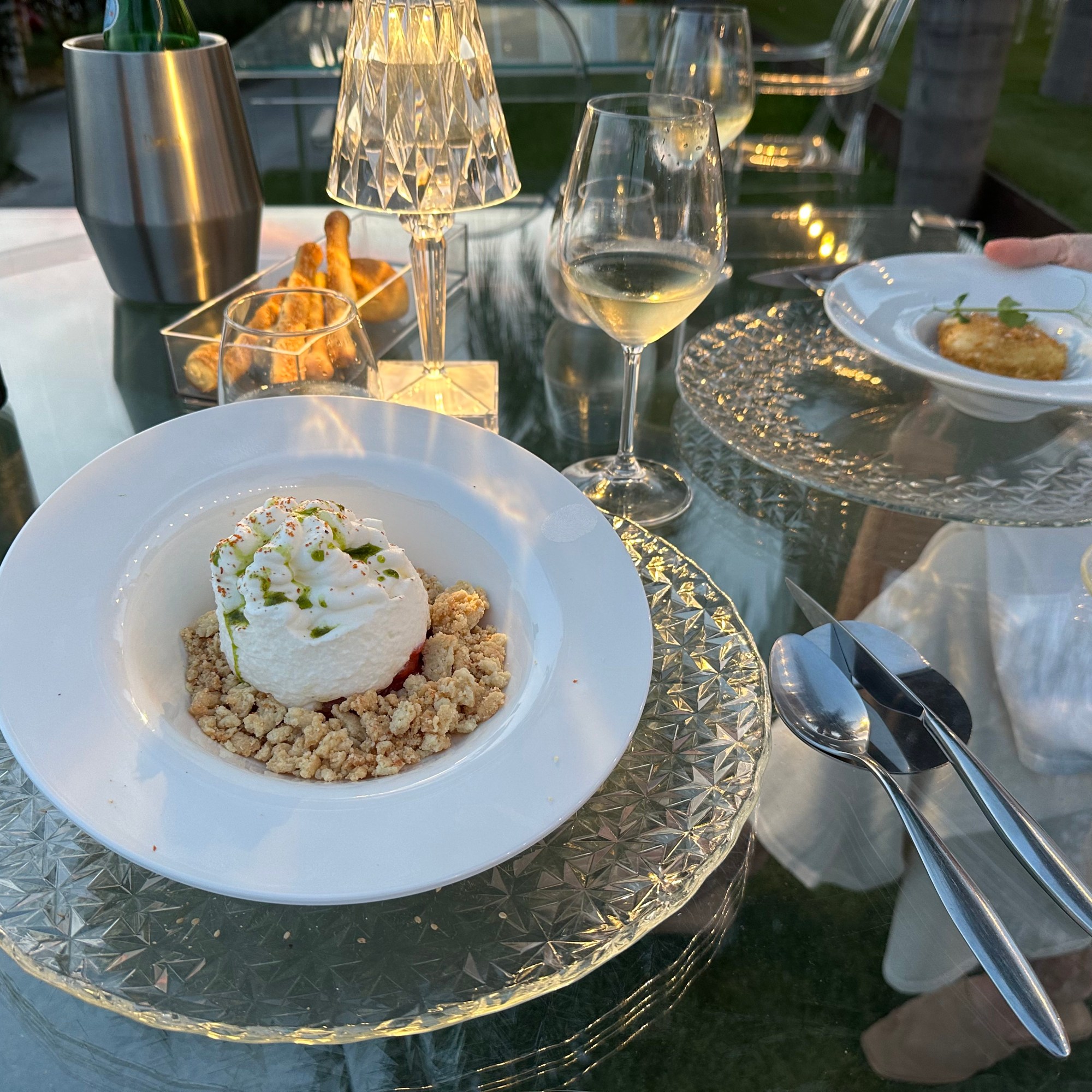
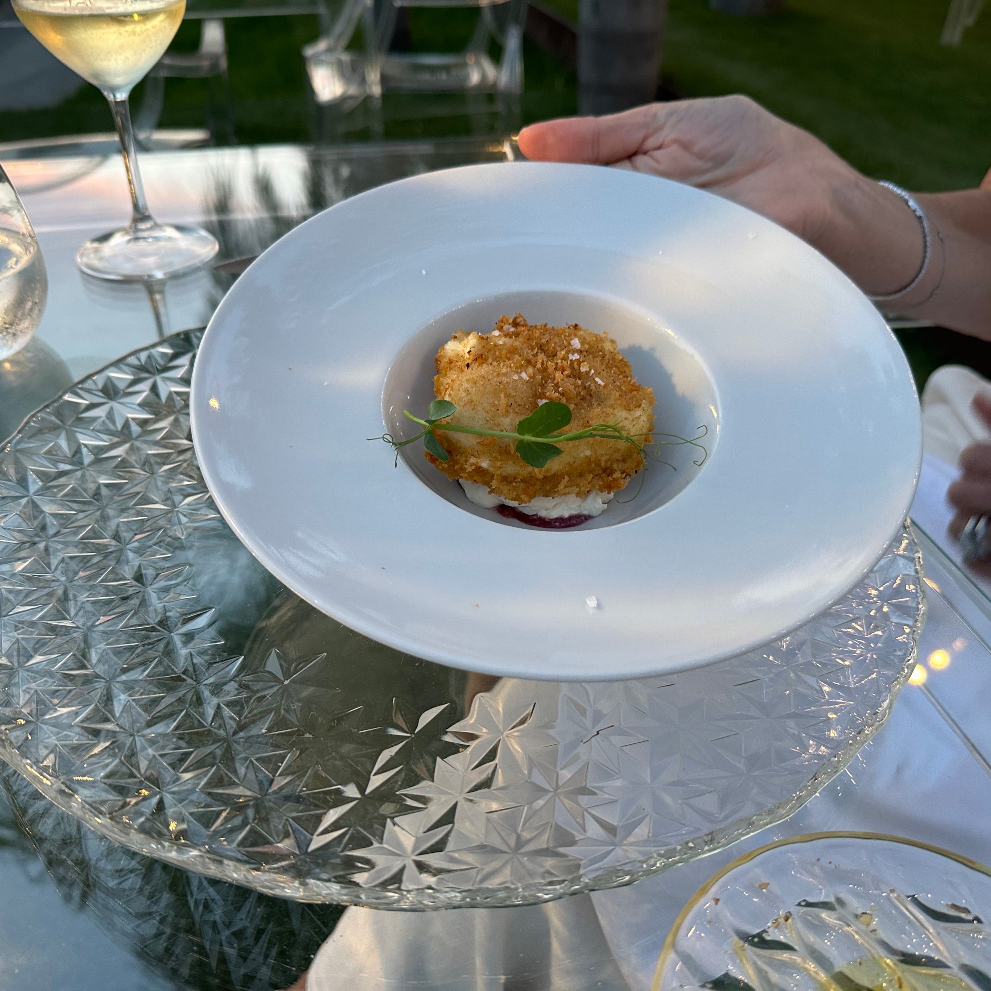
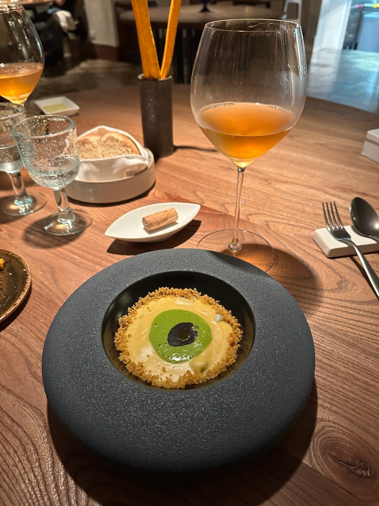
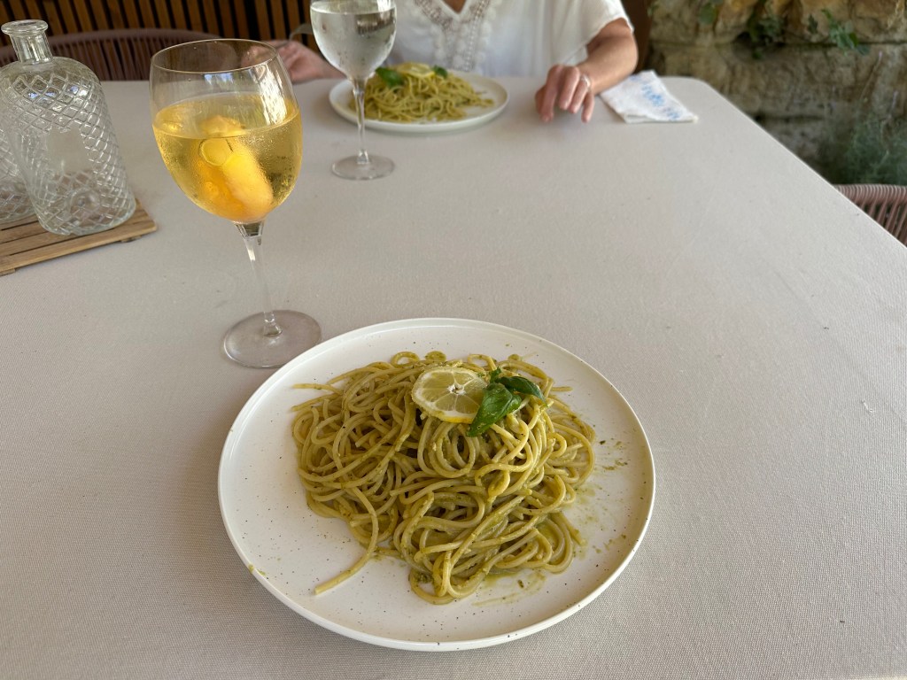
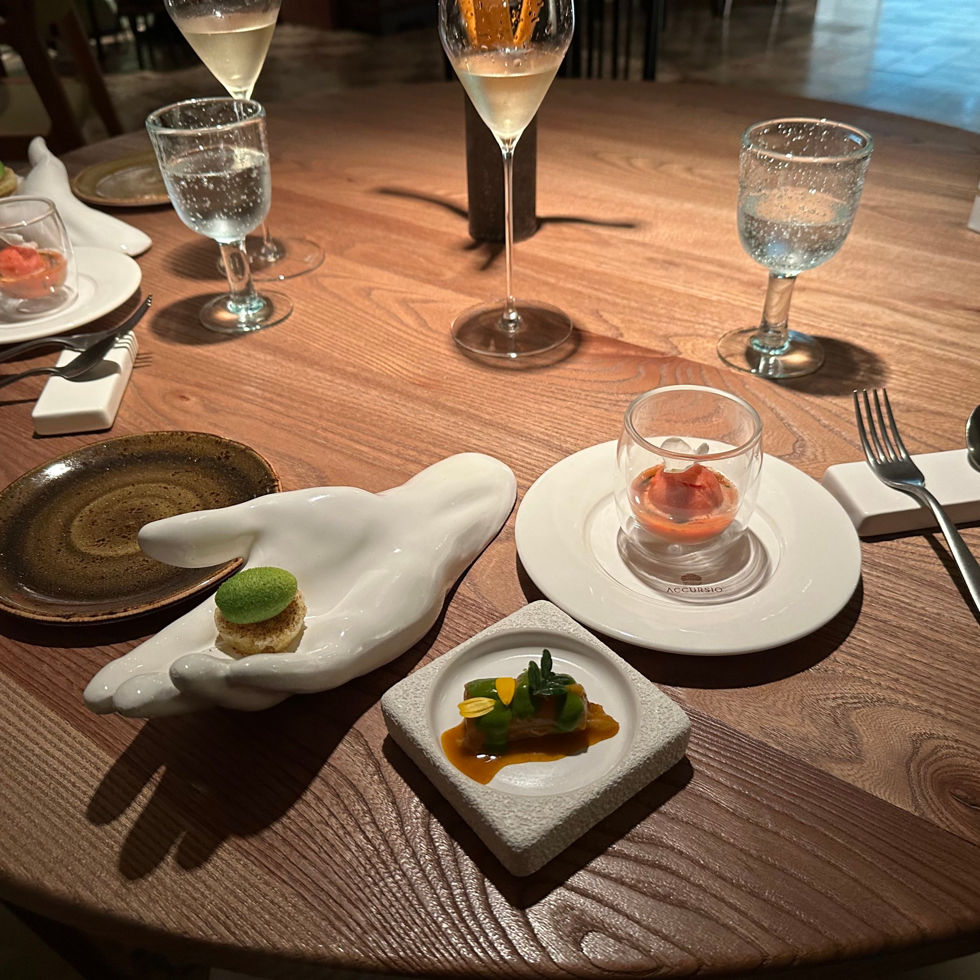
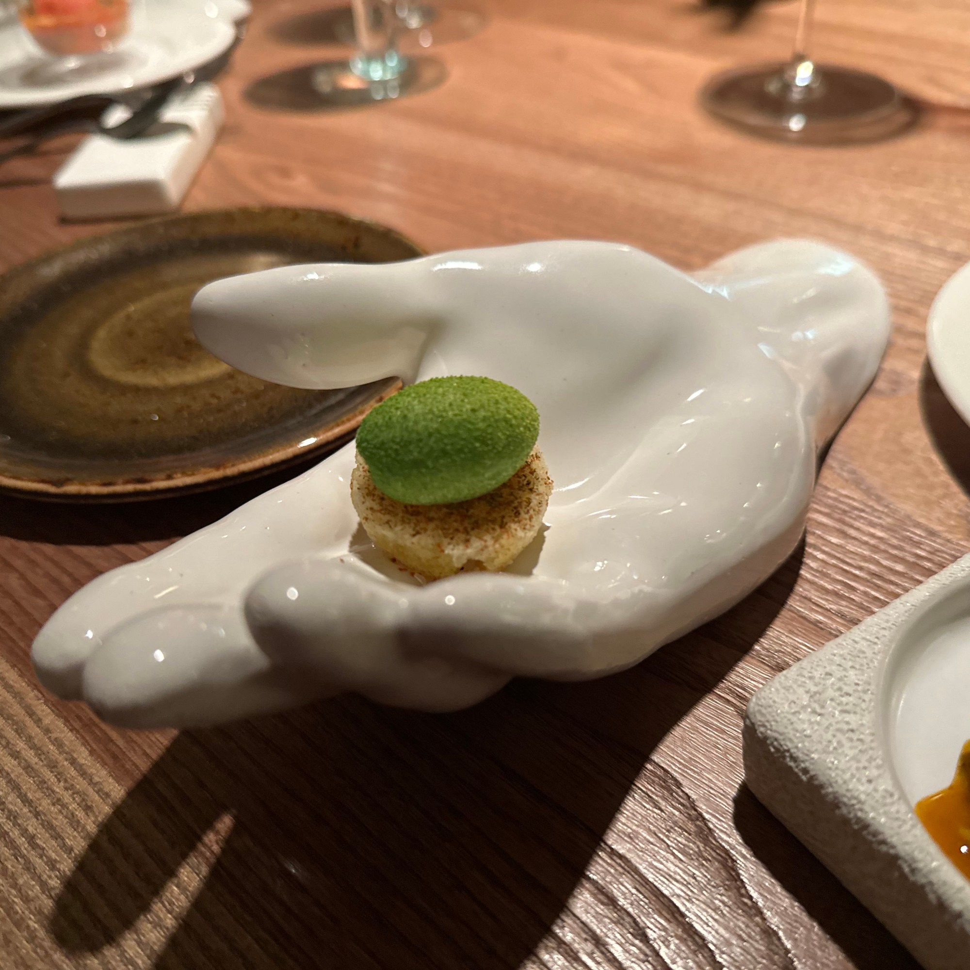
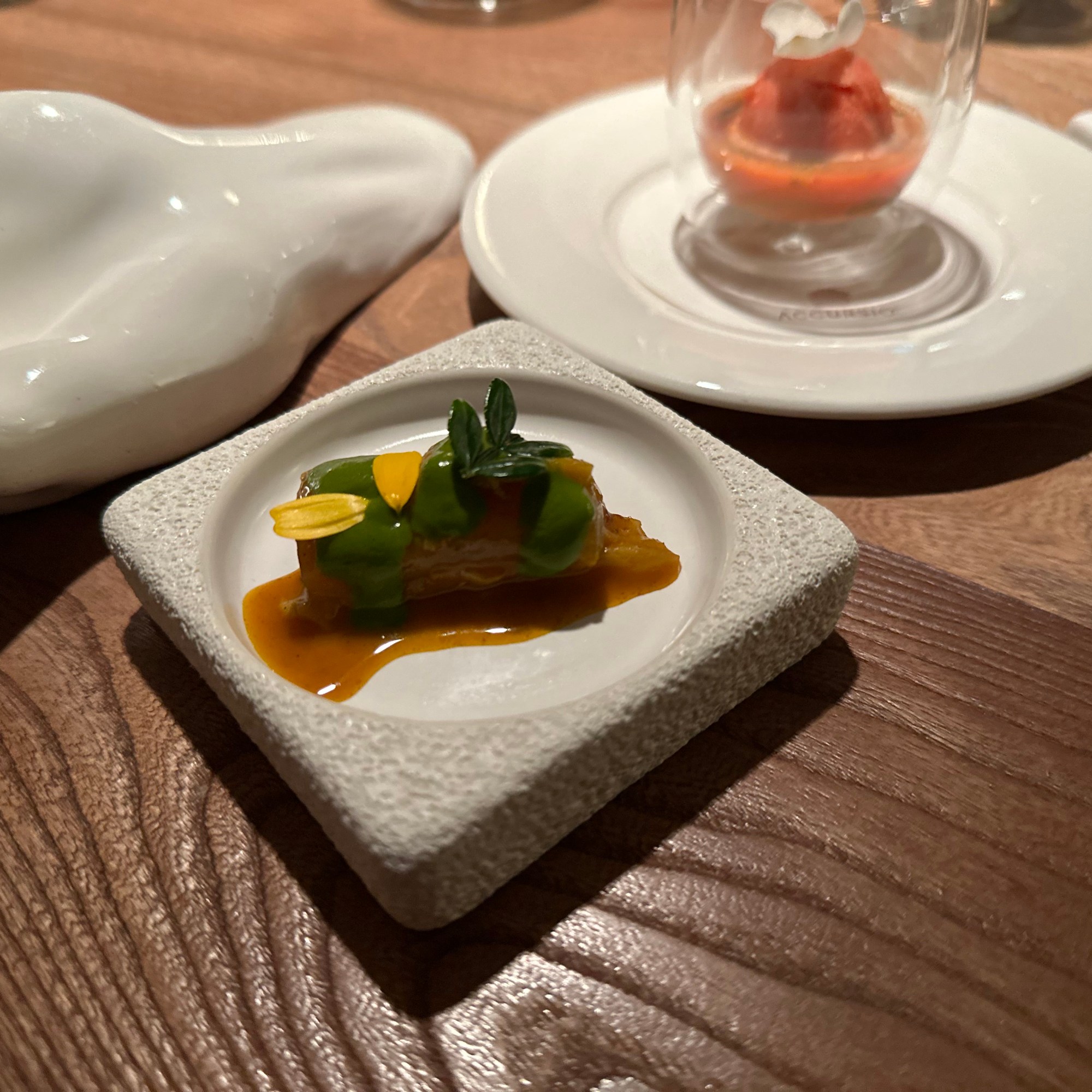
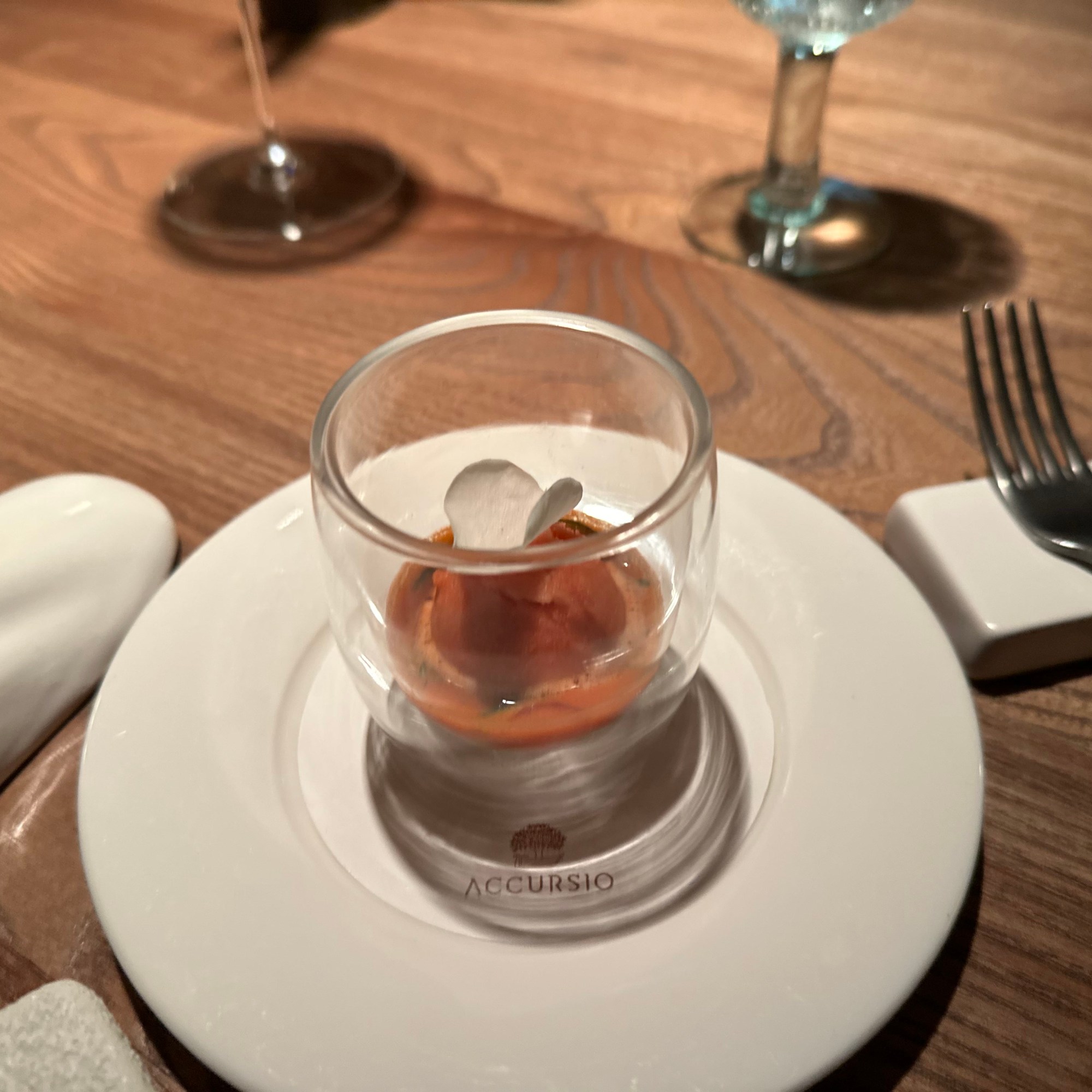
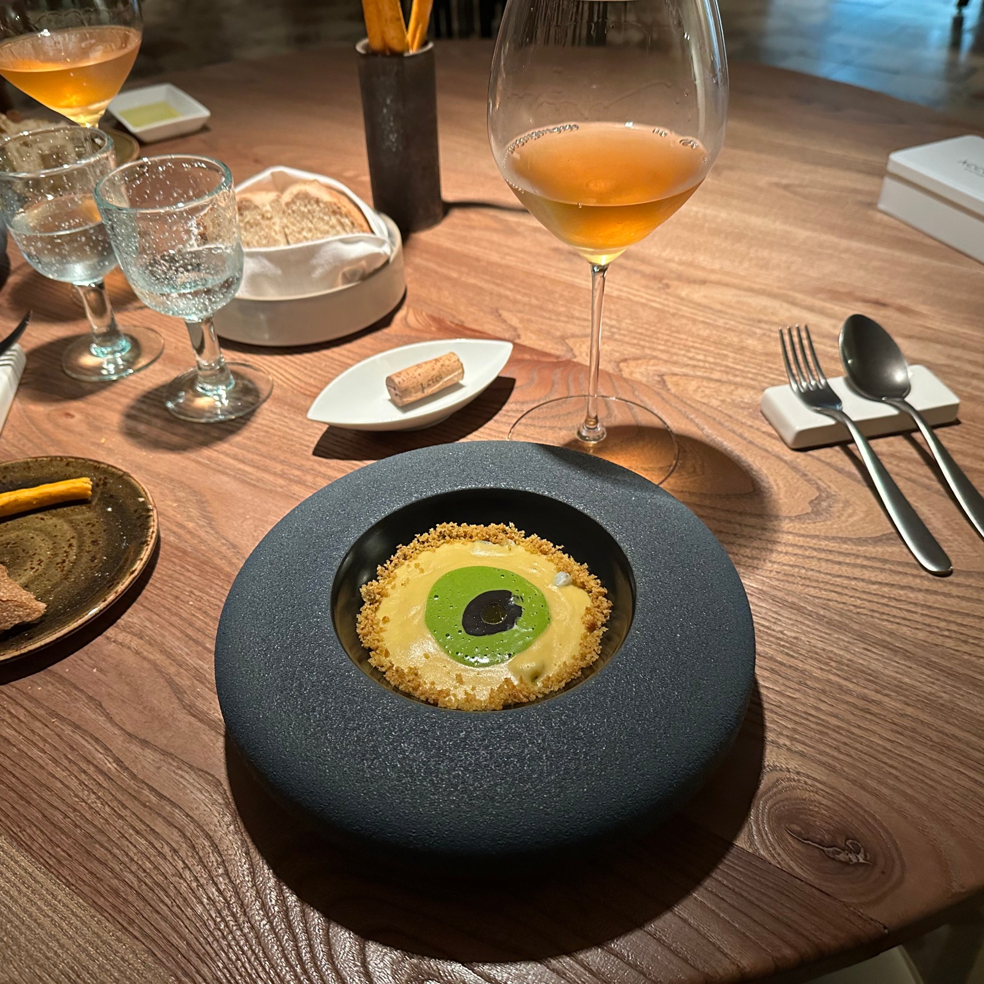
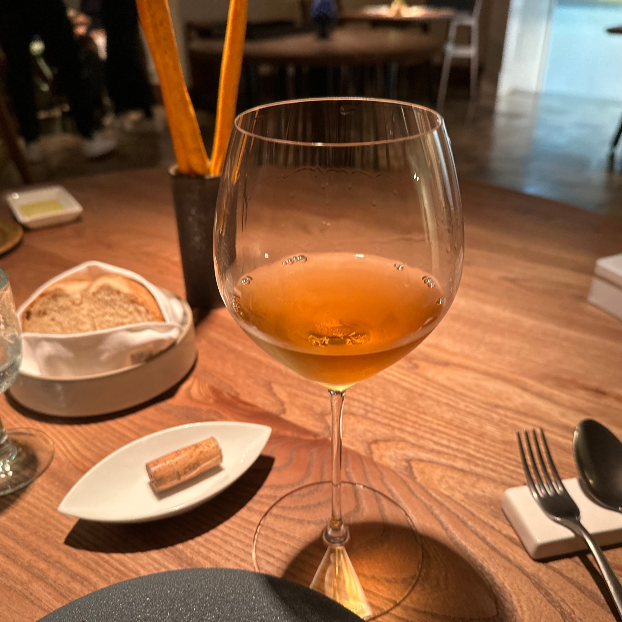
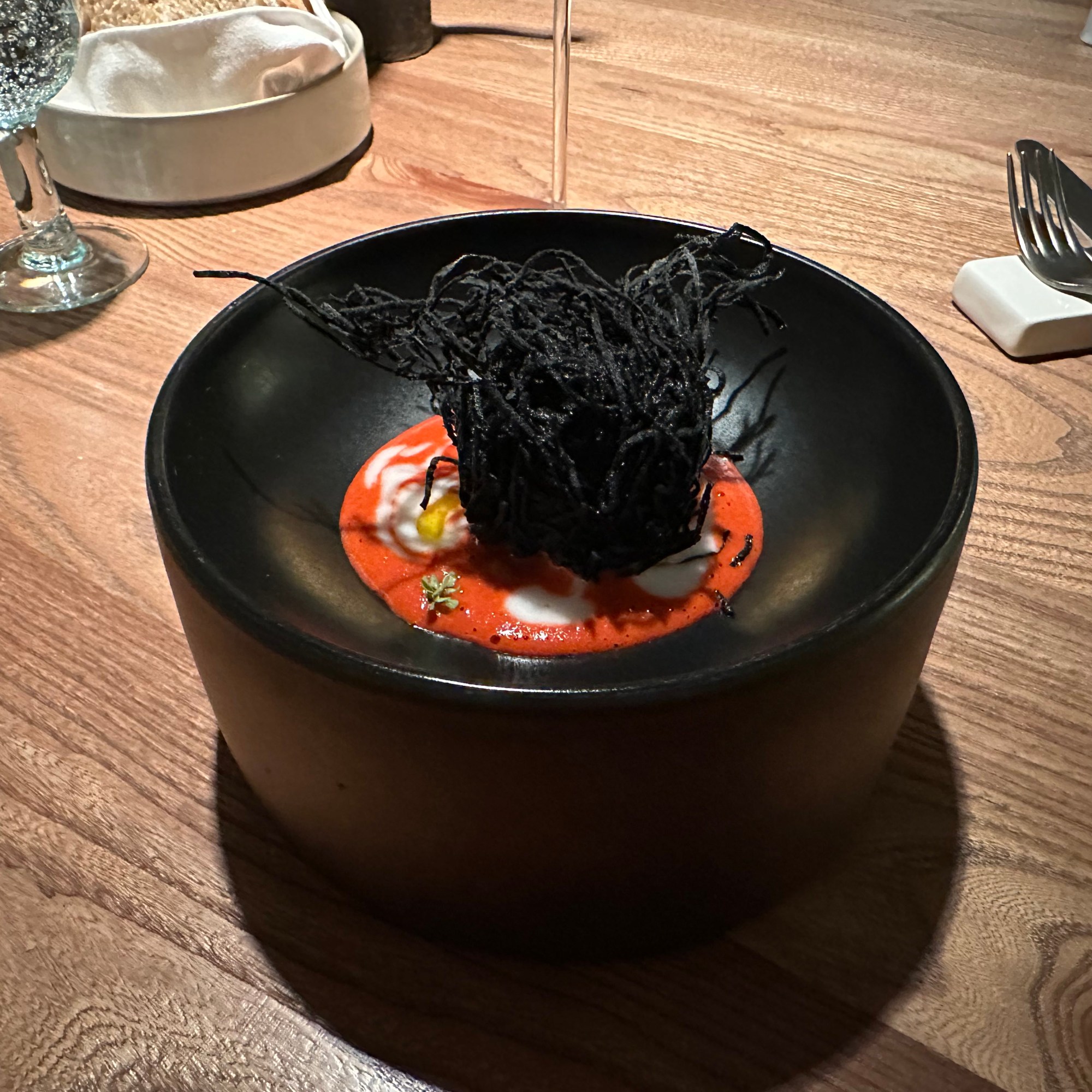
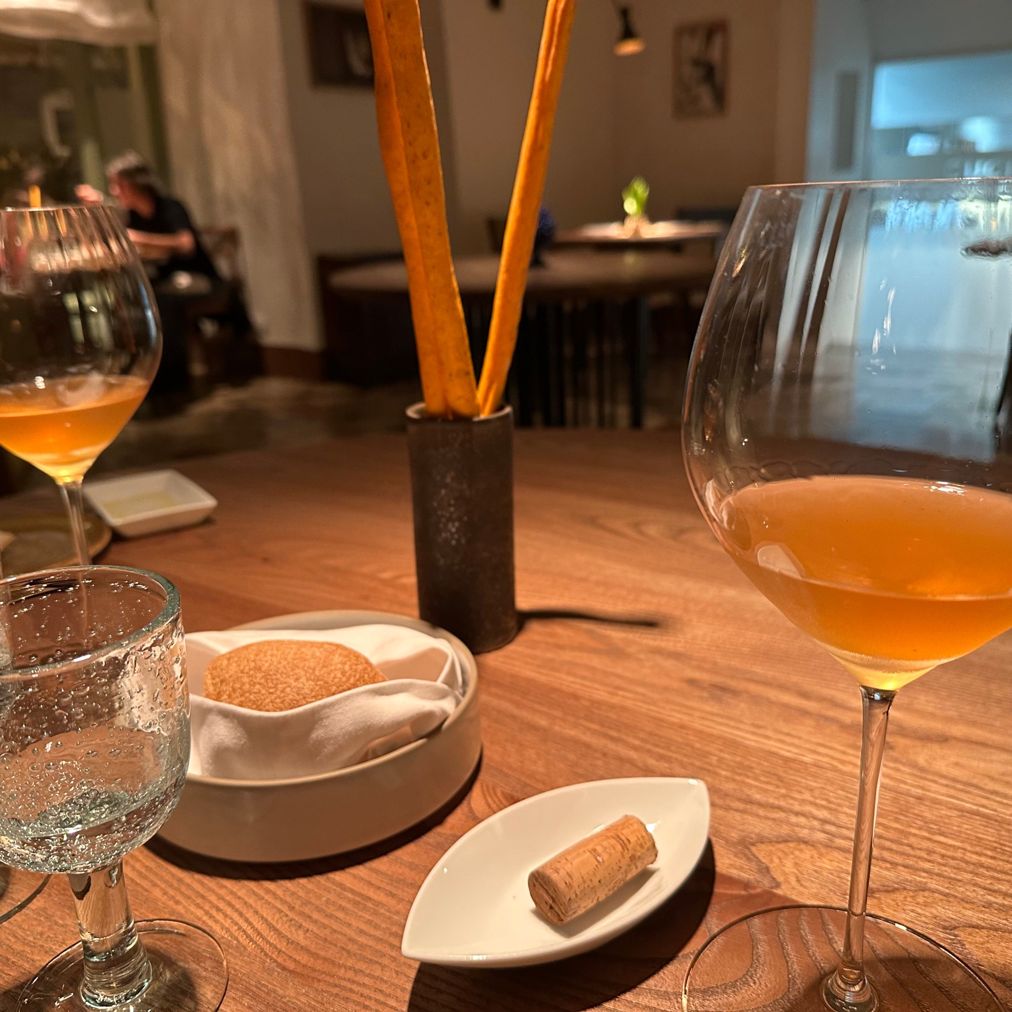
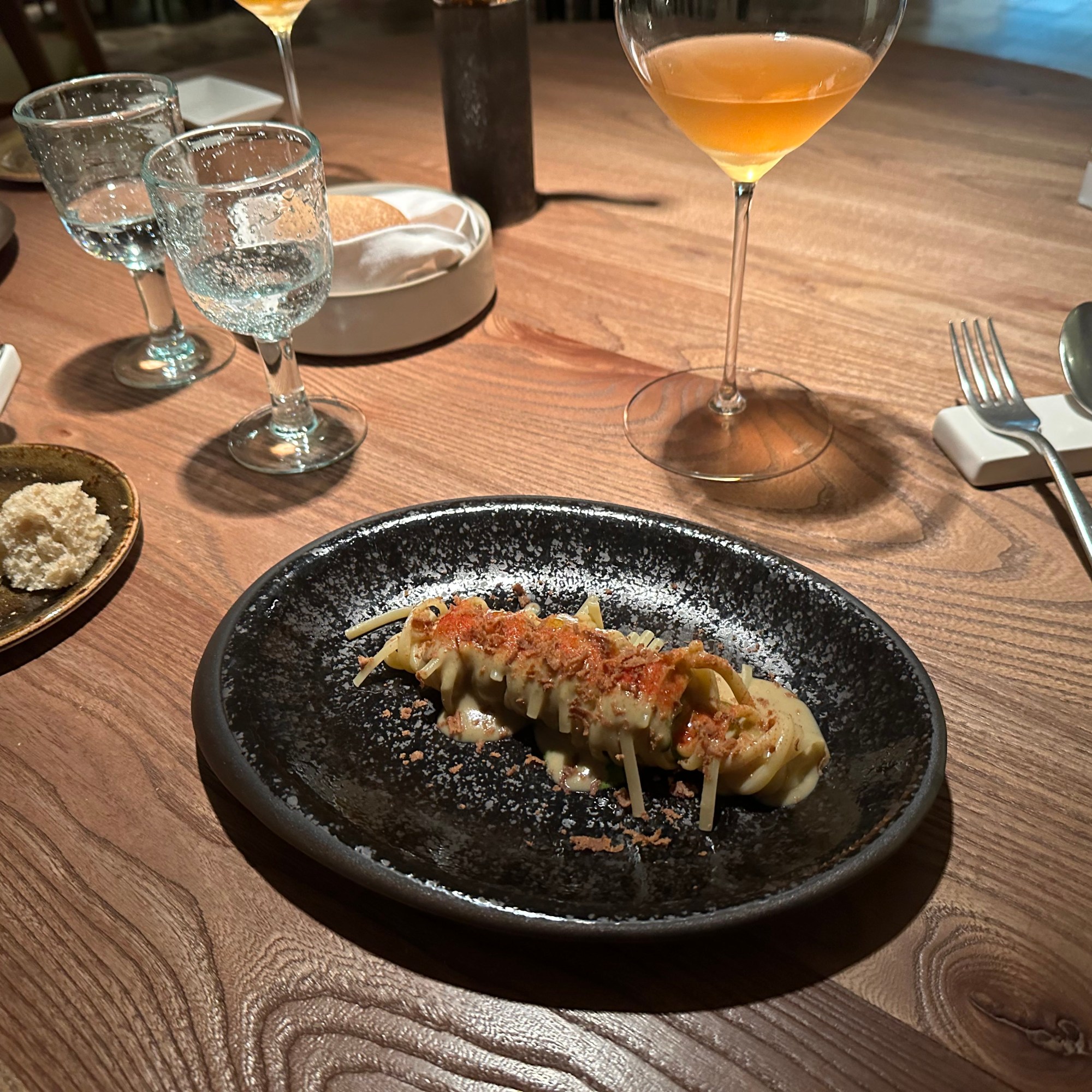
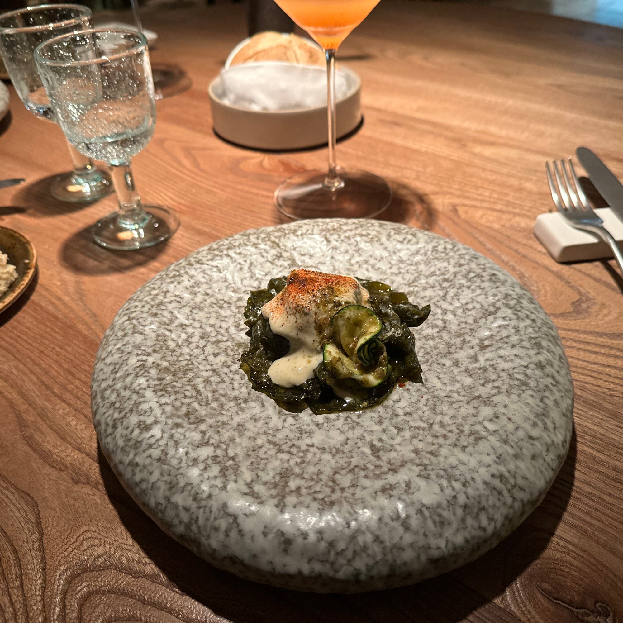
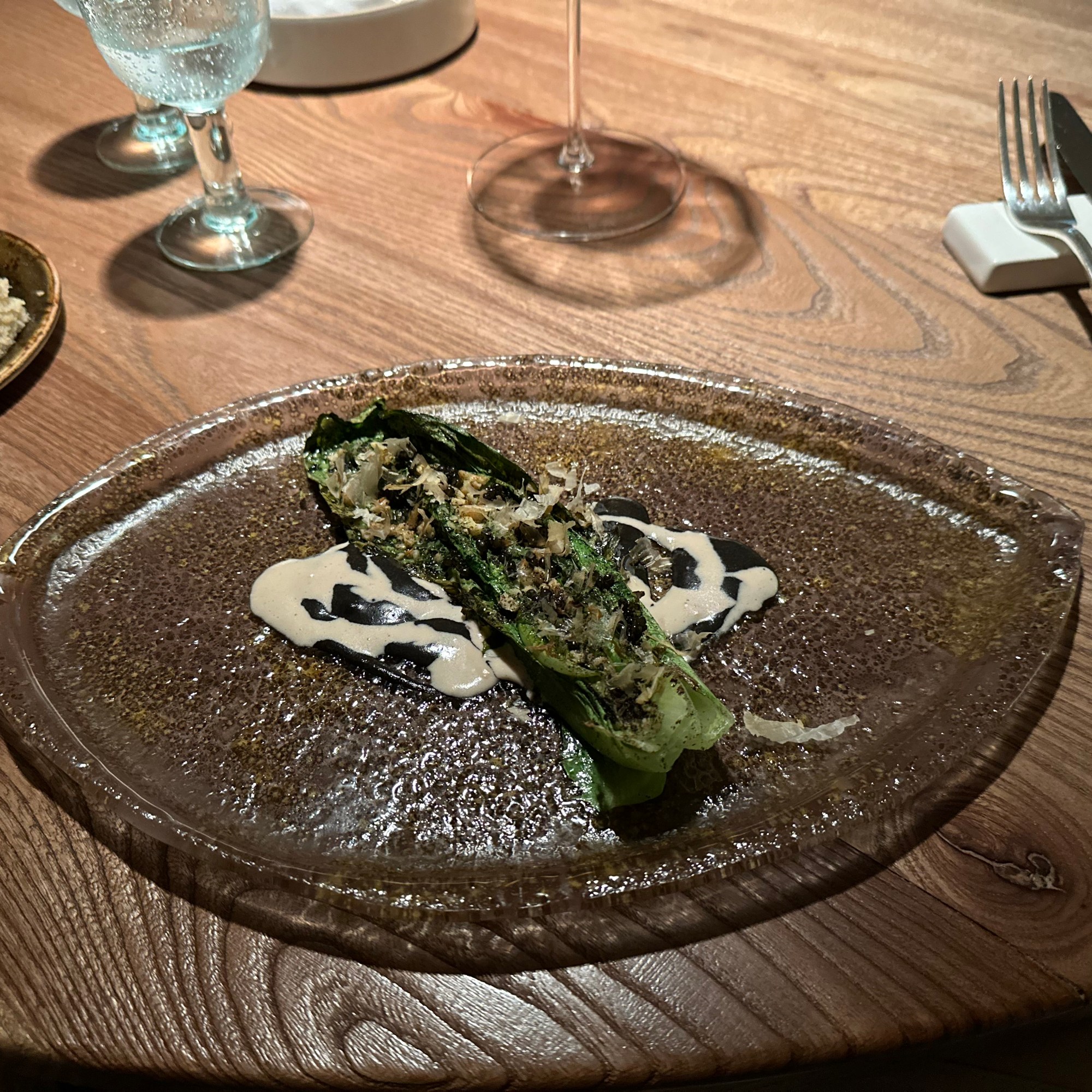
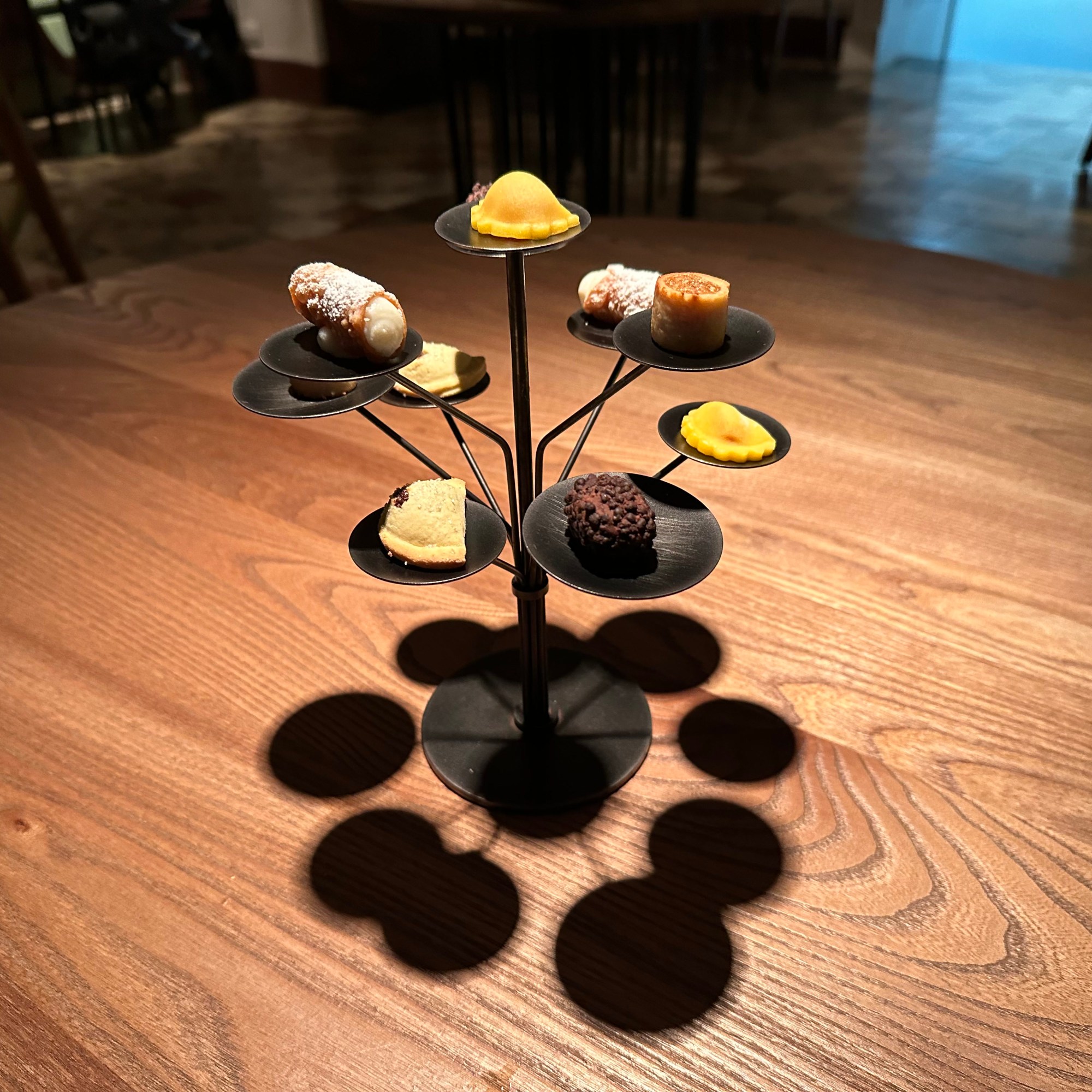
On our final night in the Baroque towns, we finally checked the Michelin-starred box for dinner in Modica at Accursio – one of the four best dining experiences of the trip, and our introduction to Sicily’s orange wine:
Wrapping up for the night before hitting the road the next morning: